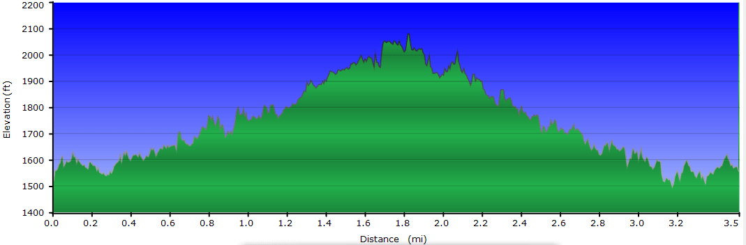
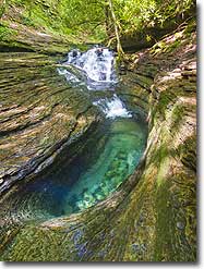
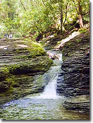
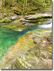
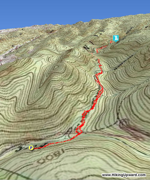
This 3.5 mile hike in southwest Virginia takes you across more than 15 water-crossings to see a series of small waterfalls and swimming holes. The main scenic draw of this hike is the visit to the Devils Bathtub – a beautiful sandstone formation in the streambed.
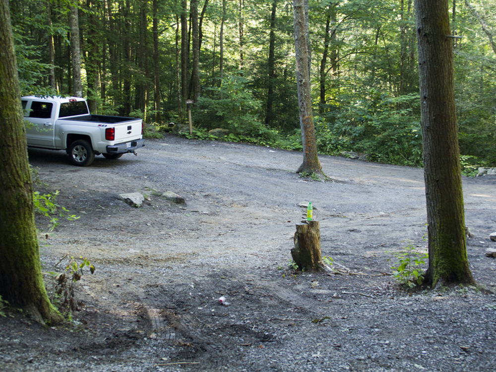
This hike is extremely popular and parking is very limited, so consider going on a quieter weekday. Also, this area is fragile, overused, and littered, so please consider bringing an empty trash bag and packing out garbage that other have left behind.
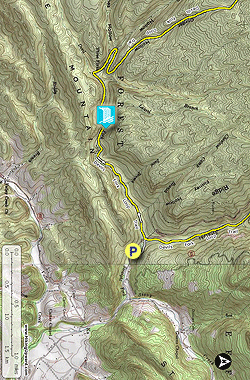
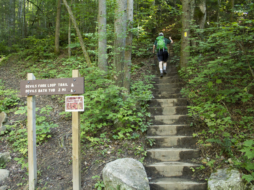
Mile 0.0 – From the top end of the parking lot, follow the stairway uphill to meet the trail. Take a left at the top of the stairs.
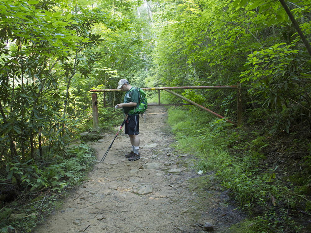
Mile 0.1 – Pass through a locked metal forestry gate. Descend slightly toward the stream.
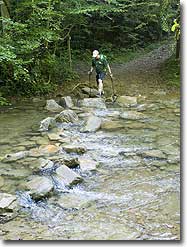
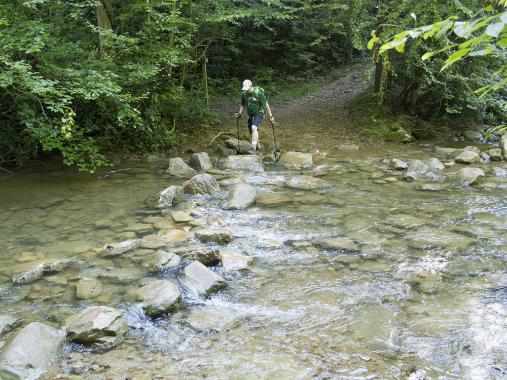
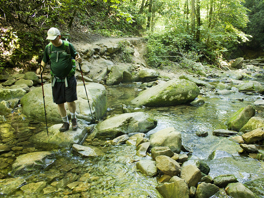
Mile 0.2 – Cross Devils Fork stream for the first of 12-18 times (depending on seasonal water levels)
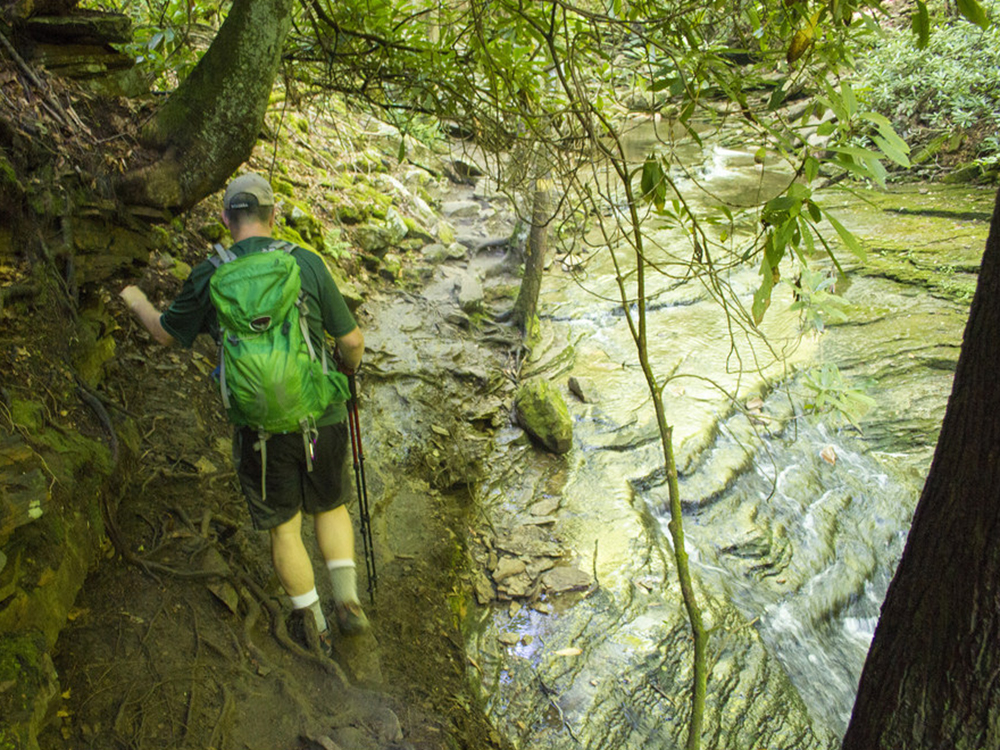
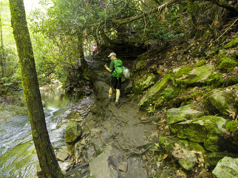
Mile .25 – Arrive at Devils Fork Loop Trail marker. Bear left, following the directional arrow toward the Devils Bathtub. The trail is blazed yellow. The trail will follow the streambed closely, crossing the water multiple times. Look closely for yellow blazes, as flooding has necessitated multiple reroutes.
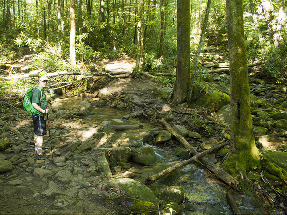
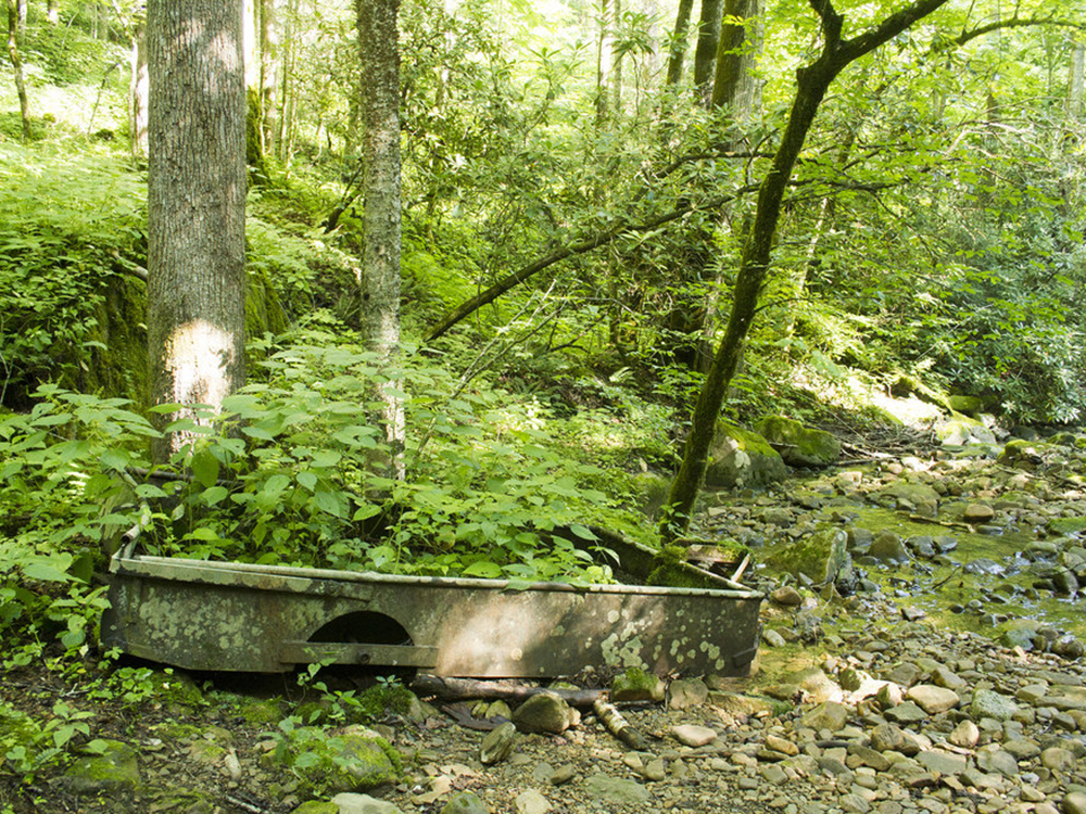
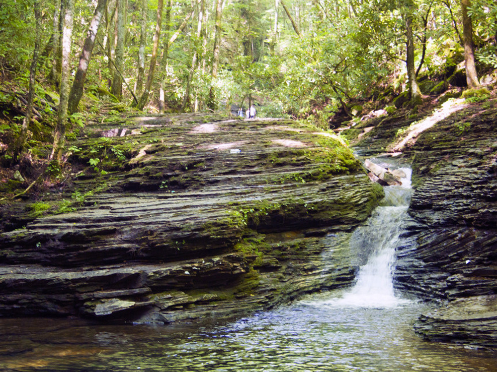
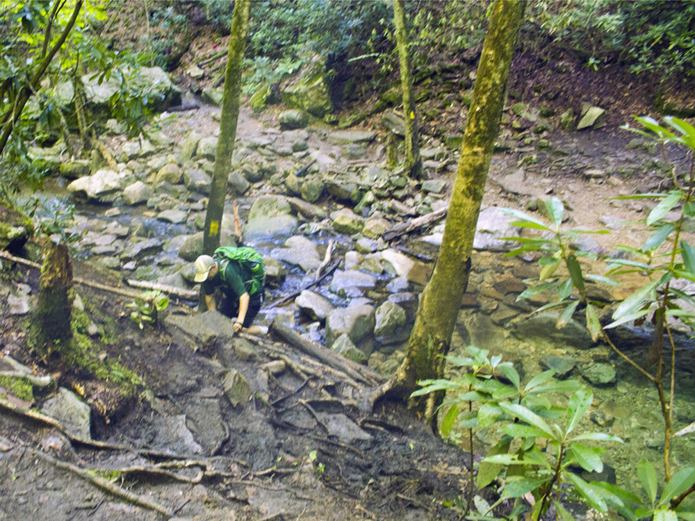
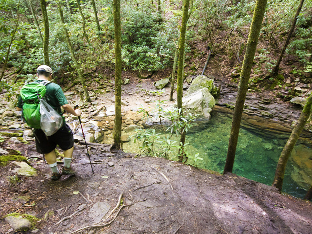
Mile .65 – Look for an old coal cart overgrown with vegetation. The railroad that used to run here was used to transport timber and coal. Continue to follow the yellow blazes and cross the stream numerous times. The fifth crossing is especially tricky to find the blaze as you must look down the stream about 75 yards to find the blaze and it requires you to rock-hop across the stream to get to the blaze.
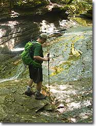
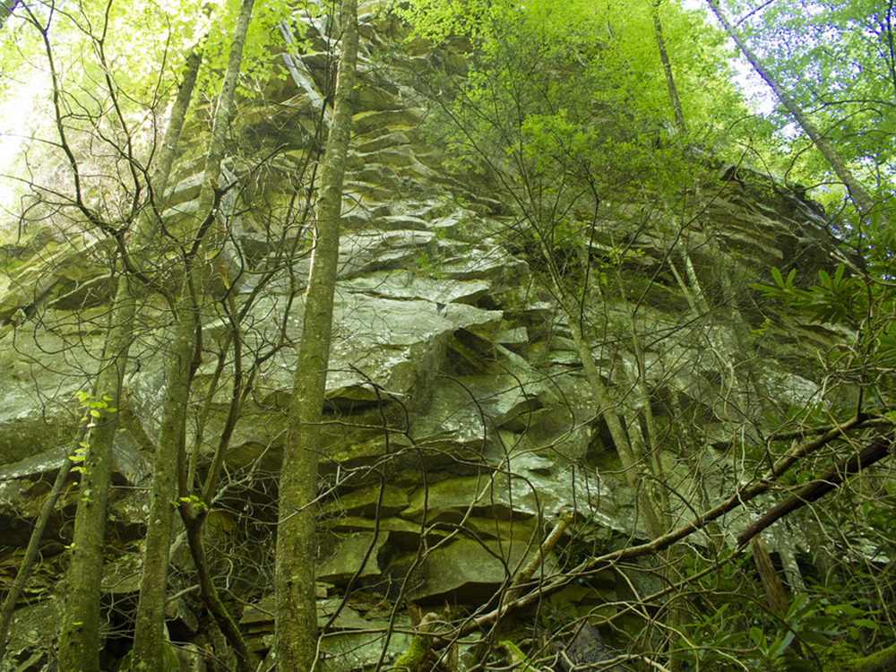
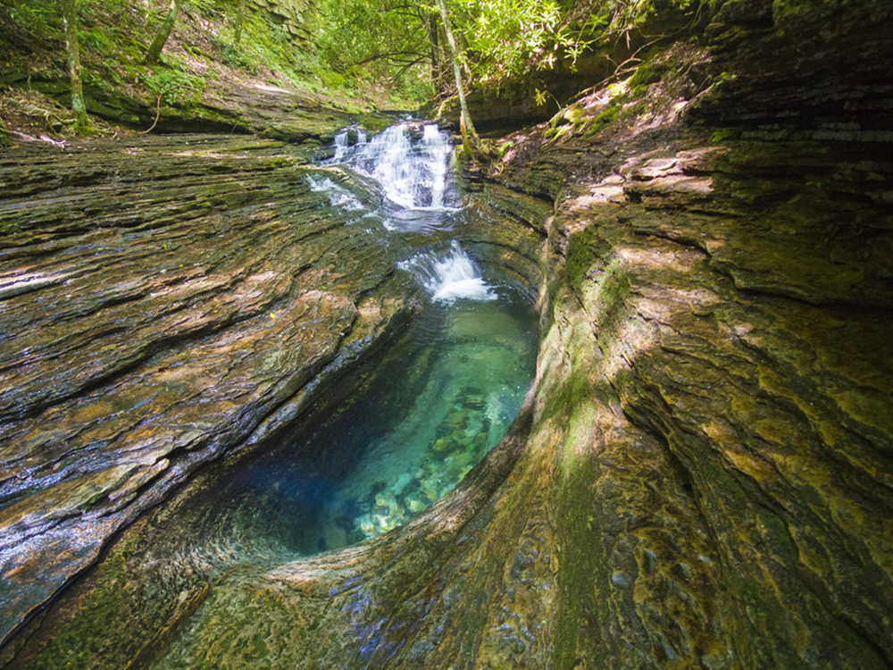
Mile 1.65 – Look through the woods and notice an interesting cliff-side rock formation. The rocks have almost a geometric pattern. At this point, the trail will descend rather steeply along the eroded stream bank. There should be a rope affixed to the uphill side of the trail to assist your descent.
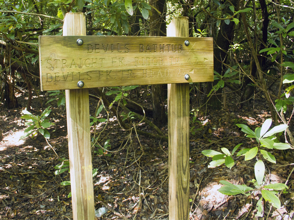
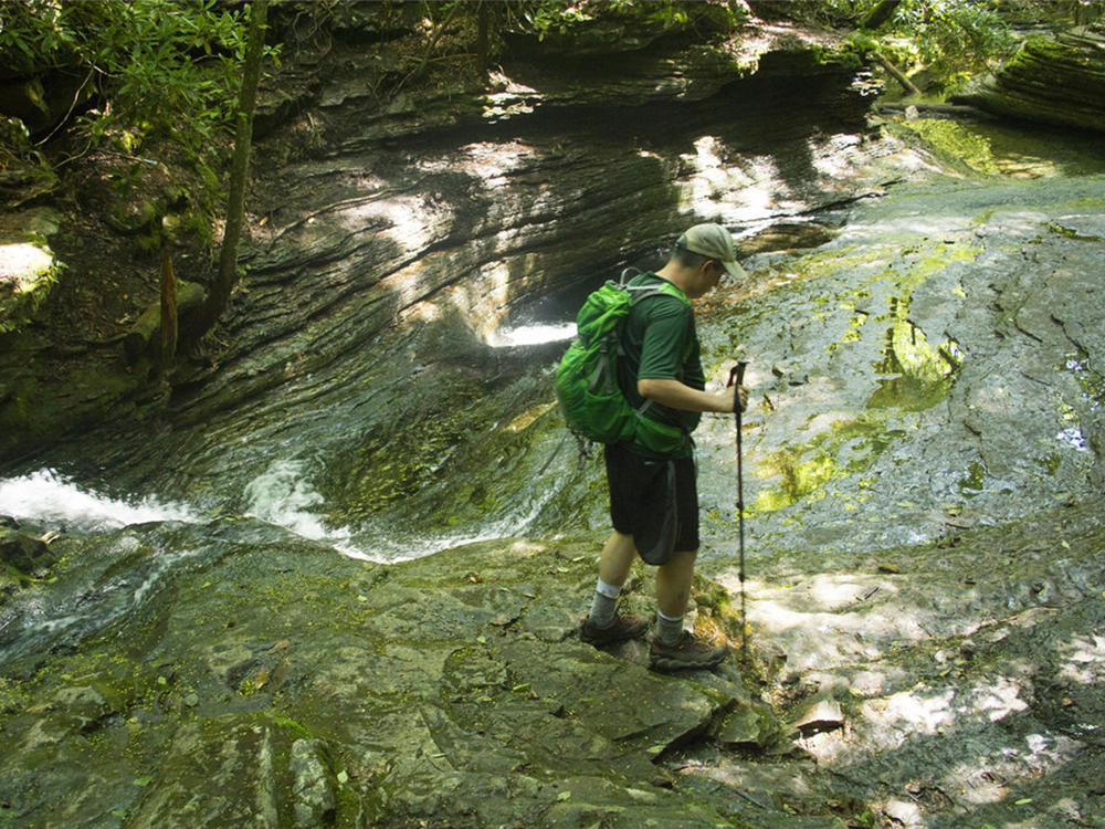
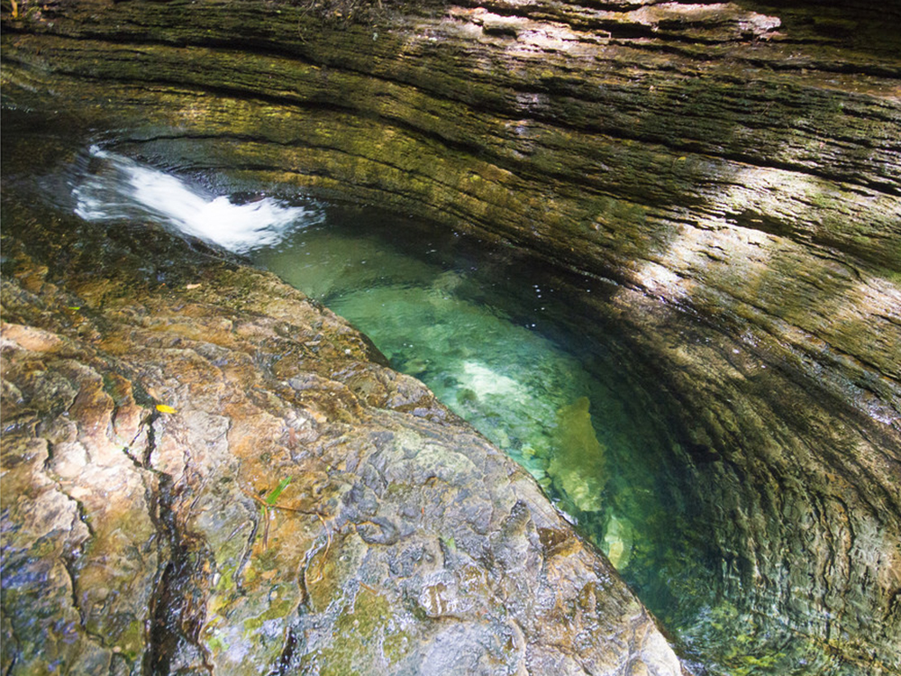
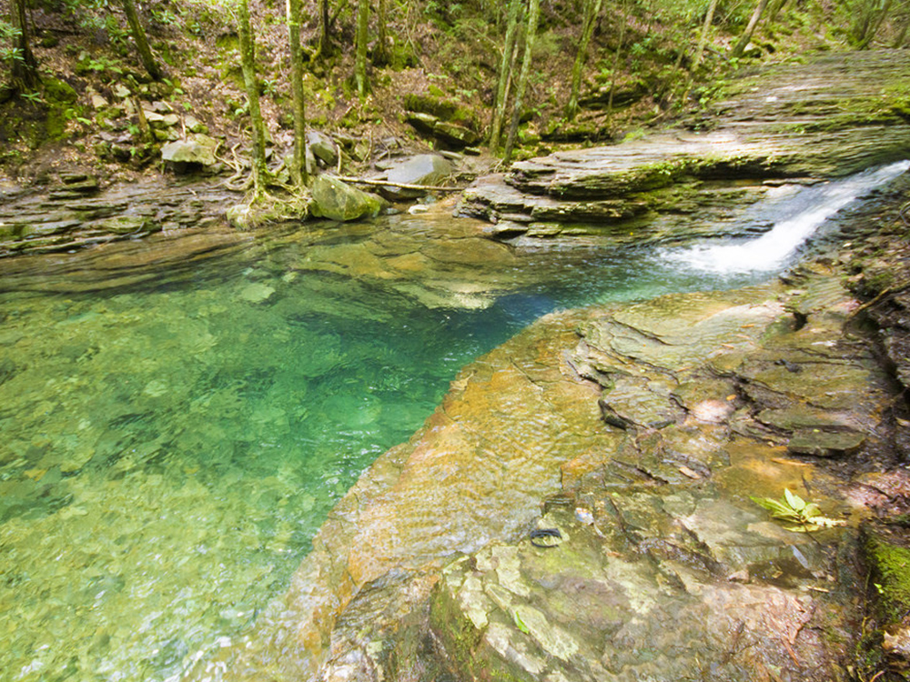
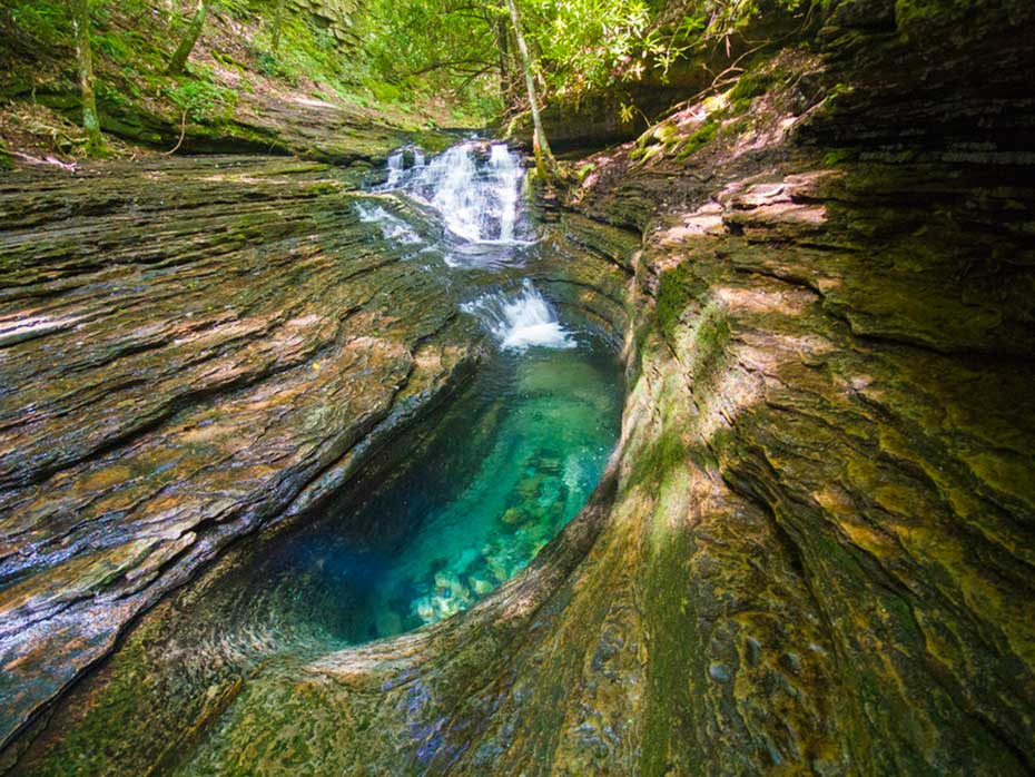
Mile 1.8 – Reach a wooden sign marking your arrival at the Devils Bathtub. There are numerous social trails and footpaths cut through the woods in this area. Follow an established trail to the water’s edge. Carefully climb the rocks down to explore the area. The sandstone sinkhole that creates the bathtub will be directly below you. The bathtub is fed by a small waterfall. After you’ve finished exploring, return to the wooden sign at the top of the basin and follow the marked trail back in the way you came.
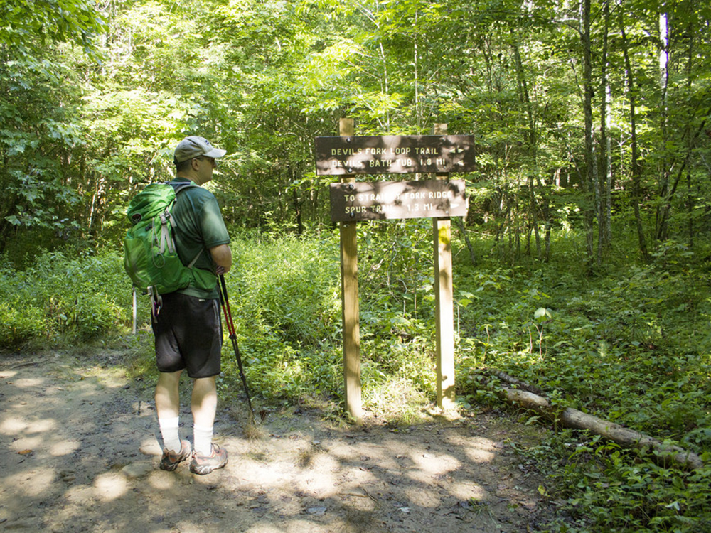
Mile 3.35 – Return to the sign marking the split in the Devils Fork Loop. Be careful to continue on the trail, bearing back toward the first stream crossing.
Mile 3.4 – Cross Devils Fork for the final time. Climb slightly uphill, passing once again through the locked forestry gate.
Mile 3.6 – Descend the stairs back down to the parking area.
Early August
Devils Bathtub
Devils Bathtub Hike Comments
Archived Comments
By:Brian S
Rating:
Date of Hike: Friday, June 29, 2018
Gorgeous on the walk in and rewarding finish to this hike.
First time ever visiting Devils Bathtub today.
We arrived around 11:30am after missing our turn onto 619. This is our fault for relying on GPS and smart phones. FYI- Neither work reliably out there. You will have no cell service and GPS satellites are hard for other devices to reach due to the terrain. Print out directions and as a second measure, screenshot them with your phone. I am carrying a road atlas just for these occasions . The parking area is down a gravel road approximately 1/4 mile that a typical two-wheel drive car will not make without damaging the underside of the vehicle. Jeeps, trucks, SUVs, crossovers and Subarus that have 8 to 10 inches of ground clearance is what you need to park at the trailhead. The road is narrow,muddy, steep and washed out in places. On the state road at the entrance to the trailhead parking atea there is no parking allowed. Youll see the no parking signs everywhere. If you get towed you can dial #77 on your phone that has no service to figure out where to get your car. I parked on 619 near the bridge, just before the intersection of High Knob and Green Chapel and had no issues. This was well past the no parking signs. It made the hike a little longer, but no big deal.
Two adults and a ten year old made this adventure. Like others have said already, you make several creek crossings along the way. We wore Keen sandals, two wore Keen Clearwaters and I wore Keen Newport H2s. I highly suggest wearing shoes like these for this hike as you will be in ankle and lnee deep water. Also bring your hiking poles or stick to help stability with the creek crossings. There os only one spot I was concerned with my child and it was a bit of a narrow ledge that had to be walked across near the end of the hike. Some kind soul tied a section of paracord between two trees you can hang onto to help yourself across. We made it across safely, but if she was any younger, I would have turned around and walked out. Im sure many, much younger kids have made it safely, but a fall here would be a terrible thing. No cell service and in the middle of nowhere with only the feet beneath you as the form of transportation available.
That is my one of two negative things to report. The second being trash left behind by others. I saw toilet tissue, socks, (lots of socks), styrofoam plates, water bottles, beer cans, Coke cans, two liter Pepsi bottles, Slim Jim wrappers, plastic along the trail. I even crossed the creek near the swimming hole and climbed the hill to check out the loop trail. I saw a fire ring with an extra large Hefty beg full of clothes, beer bottles, and who knows what else. Very disappointing and sad to see such a magical place be treated this way. I recommend doing what we will do next time, carry a few heavy duty garbage bags in and haul out some trash. I carried what I could, but it needs more help.
By:Suzanne
Rating:
Date of Hike: Wednesday, June 27, 2018
There has been quite a bit of rainfall in this area recently. The streams were high and plentiful. I counted 24! Rushing stream crossings out and back. They took some time navigating especially with my border collie. Unfortunately, we got duped into thinking we were at the devils bathtub, when we were only at the swimming hole. Keep going! Dont miss it, The pictures look amazing. The stream crossings definitely made this an adventure today. But I think I would enjoy more it with a little less water.
By:Angel BP
Rating:
Date of Hike: Tuesday, July 11, 2017
I used your info to navigate the hike on a hot, sunny July week-day with my daughter. We went early and we packed small plastic grocery bags to collect trash others may have left behind, per your suggestion. We passed 4 back-packers on their way out with 4 bags of trash and then we collected another 3 1/2 bags of plastic bottles, glass beer bottles, aluminum cans, snack wrappers and socks tossed out amongst the rocks/roots near the Devil's Bathtub and along the trail. This is a beautiful hike and natural swimming hole. The signs at the parking area clearly say "Pack it in-Pack it out!" but that information seems to be irrelevant to most day-hikers. I would encourage anyone who chooses to hike here to be responsible for your own litter and don't be afraid to pick up after others who were careless. If the trash continues to pile up, it destroys the ecosystem, the beauty of the location and could eventually cause state officials to close off all access. So let's keep Virginia beautiful and these natural wonders free for others to enjoy! Take only pictures, leave only footprints! Pack it in, Pack it out!


