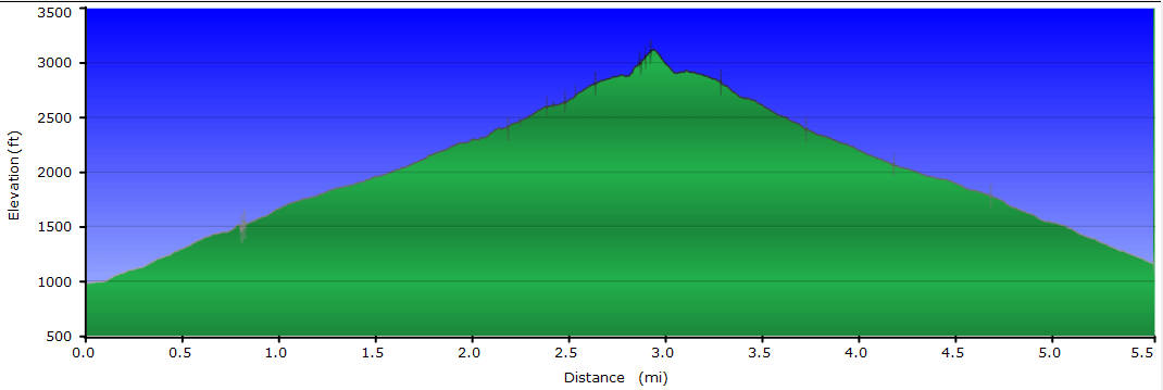
There are hikes where pictures don't come close to representing the true beauty of the views, and this is one of them. A more strenuous hike than you'd expect for a 5.4 mile 1,960 foot ascent, the hike has some unrelenting inclines and a steep final spur trail up to Chimney Top. You'll feel like you've hiked closer to 10 miles by the time you get back to the parking area. This hike is not nearly as popular as the views and camping deserve, so get out there soon before the word gets out!
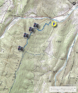
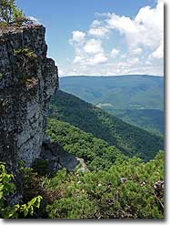
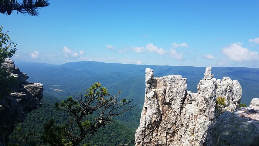
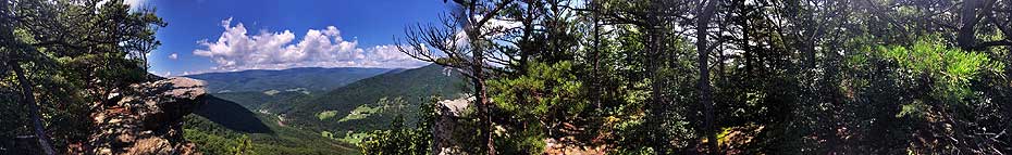
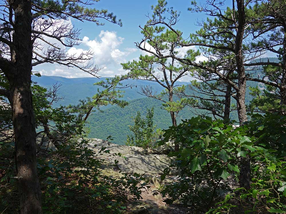
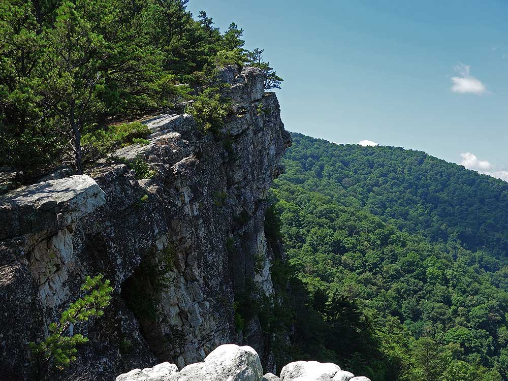
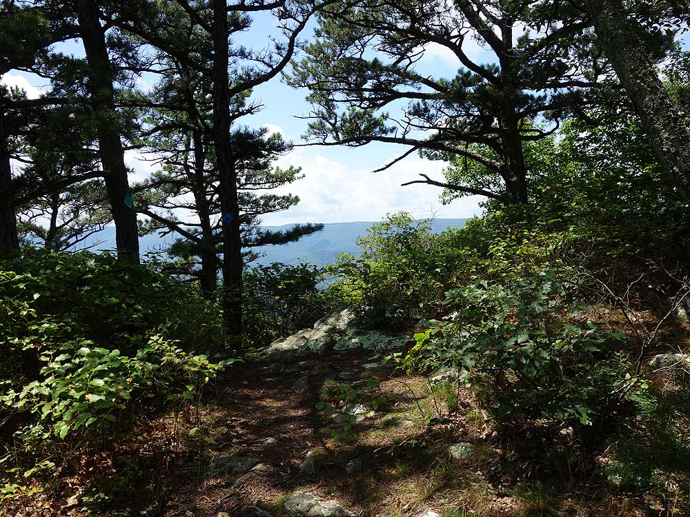
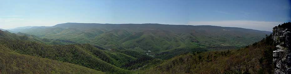
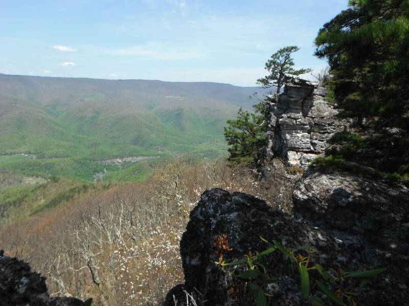
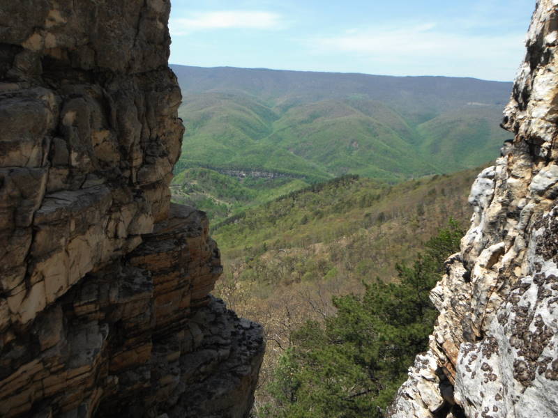
After passing through a forested area the hike enters more open pine stands, then arrives at the first overlook with a view down to the North Fork of the Potomac River. The rock wall here, visible from the valley, has overlook after overlook for nearly half a mile, so don't be concerned if you get to the parking area and see a lot of vehicles, you're still almost guaranteed to get an overlook to yourself.
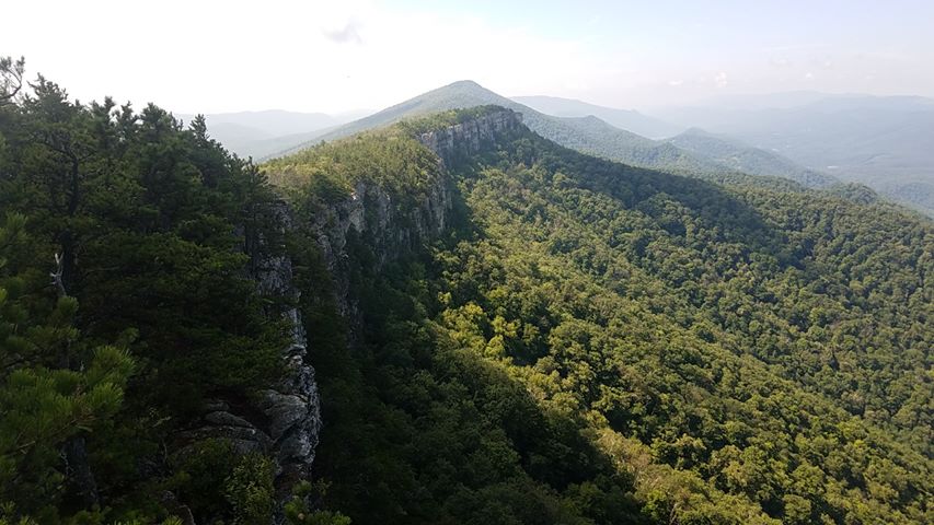
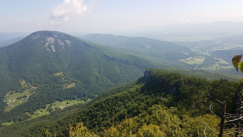
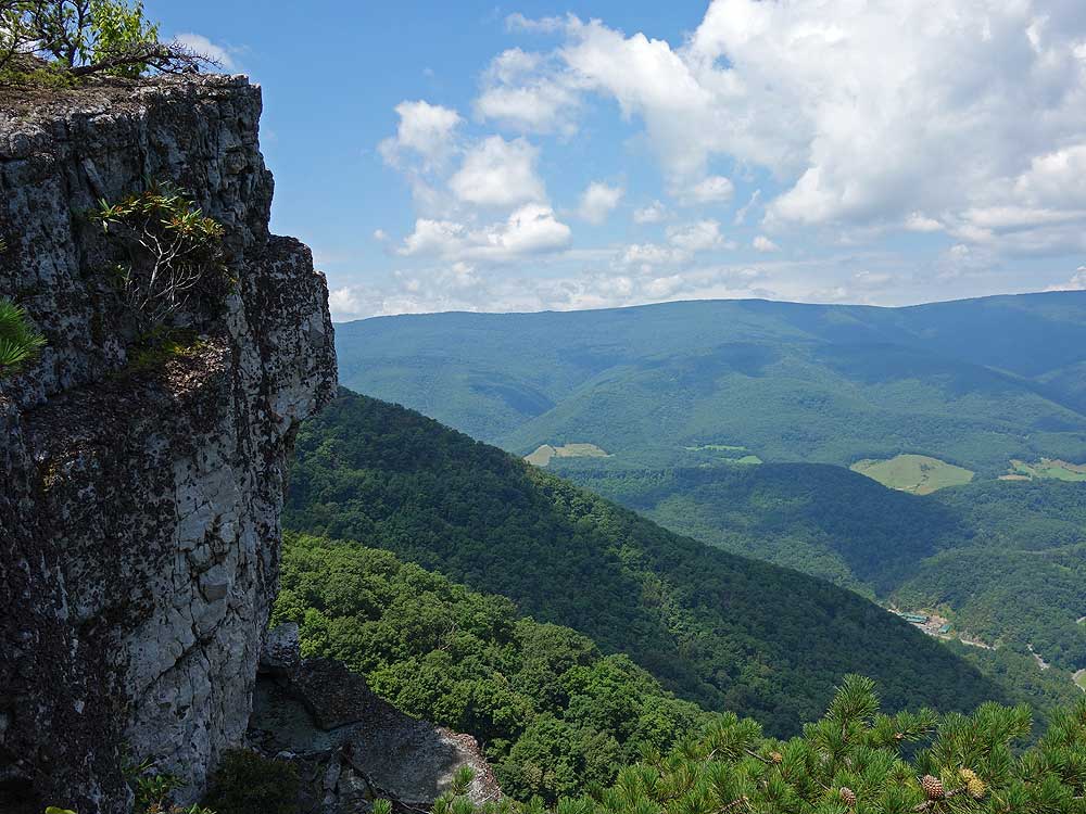
The Chimney Top hike is part of the northern section of the 24.7 mile North Fork Mountain Trail traverse hike with this area having the greatest density of overlooks. If you are considering doing the Chimney Top hike as an overnight backpack there are three good campsites. Two along the ridge wall, and the other at the Chimney Top summit. Keep in mind that there are no water sources on this 4.5 mile out/back route and you will need to carry water up with you.
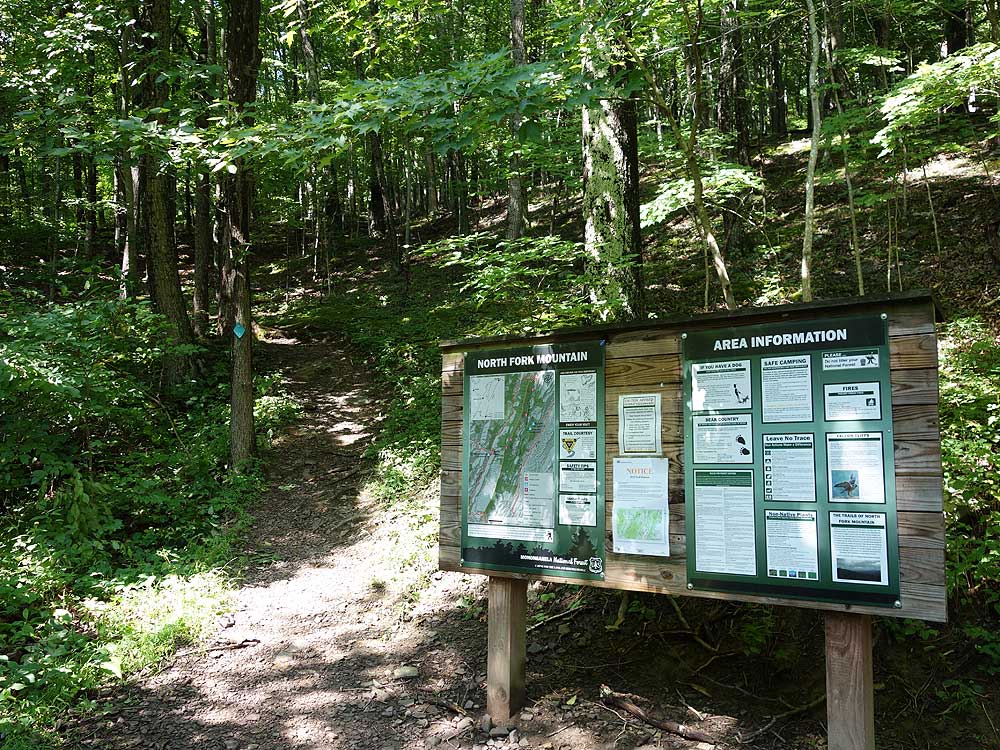
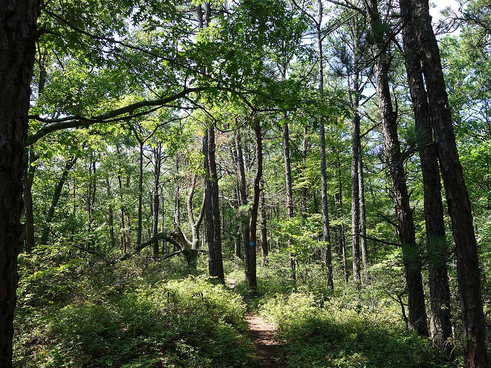
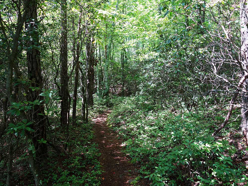
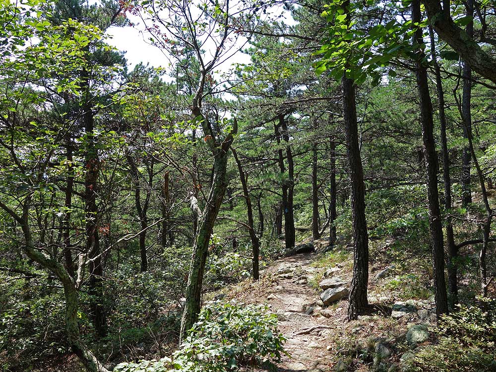
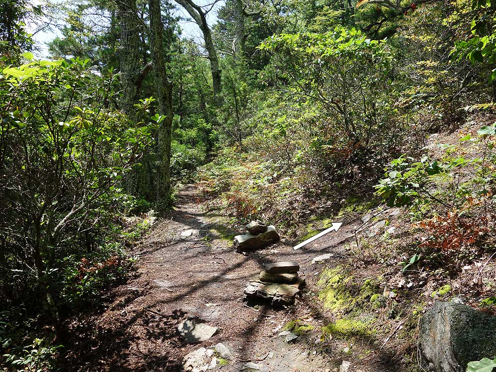
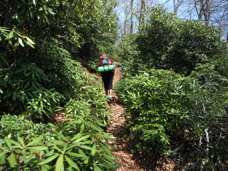
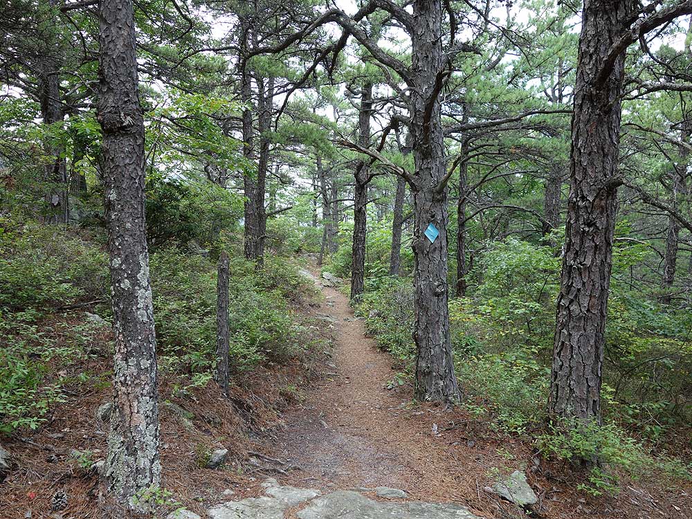
Mile 0.0 – From the parking area pass the information Kiosk and start up the blue triangle blazed North Fork Mountain Trail. The trail will wind upwards on the mountain through a forested area with good cover. Pine is also located along the trail which makes for a nice layer of needles to hike on. After climbing for 1.55 miles the trail makes its final switchback before the first overlook on the ridge wall. The trail will open up here with less cover.
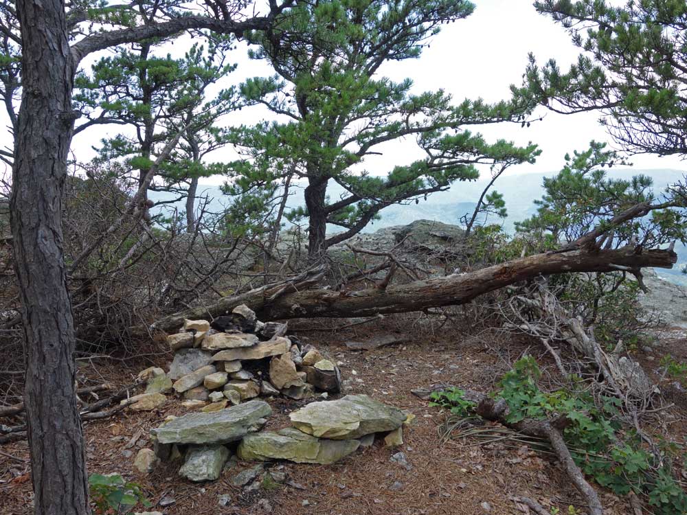
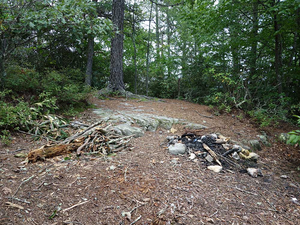
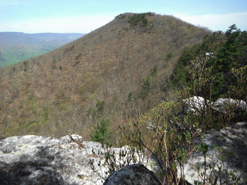
Mile 2.02 - Pass a second campsite on the wall. From this point the hike increases in steepness for the 0.4 miles to the Chimney Top spur trail intersection.
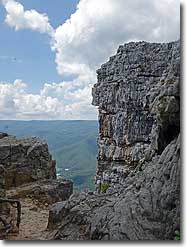
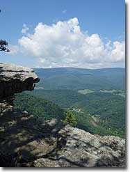
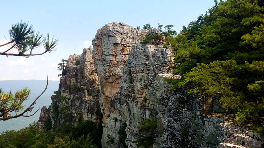
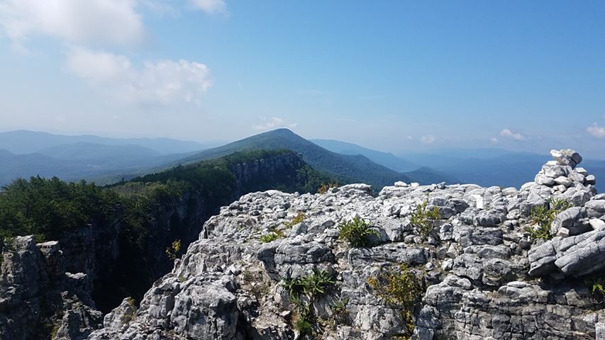
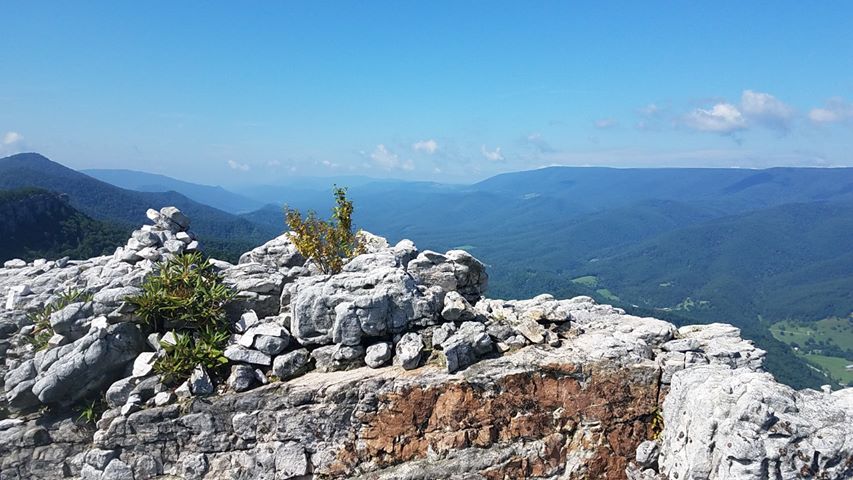
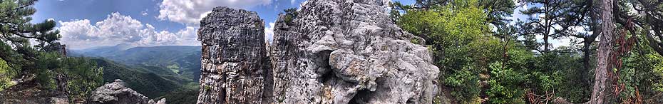
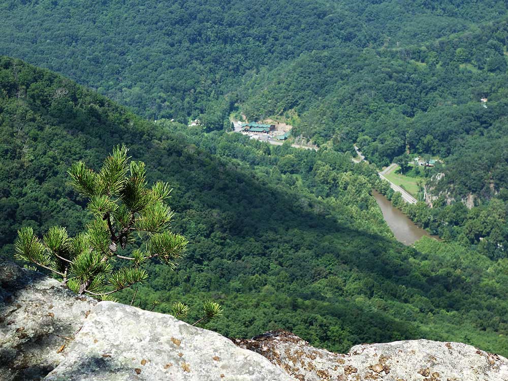
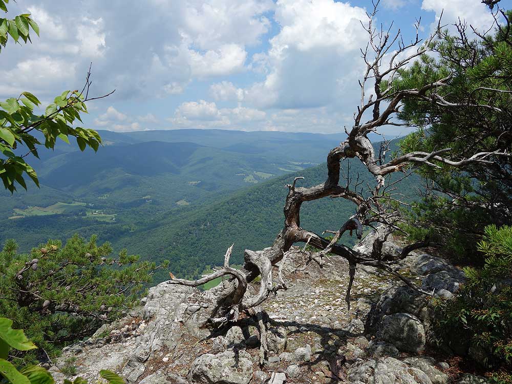
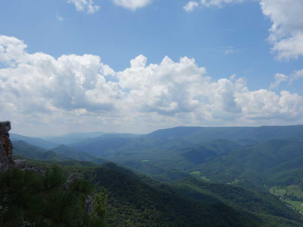
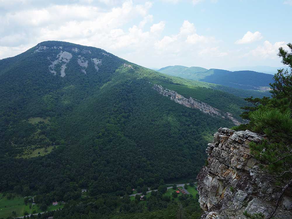
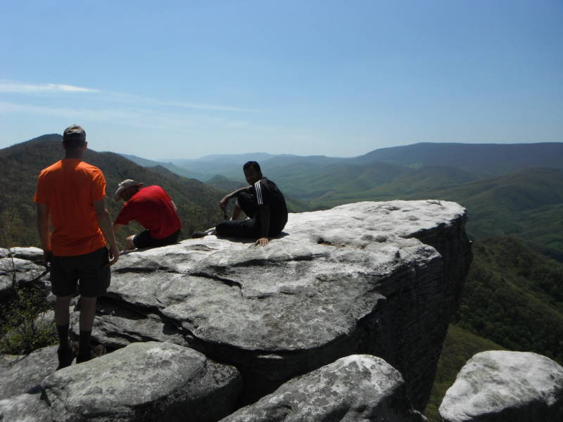
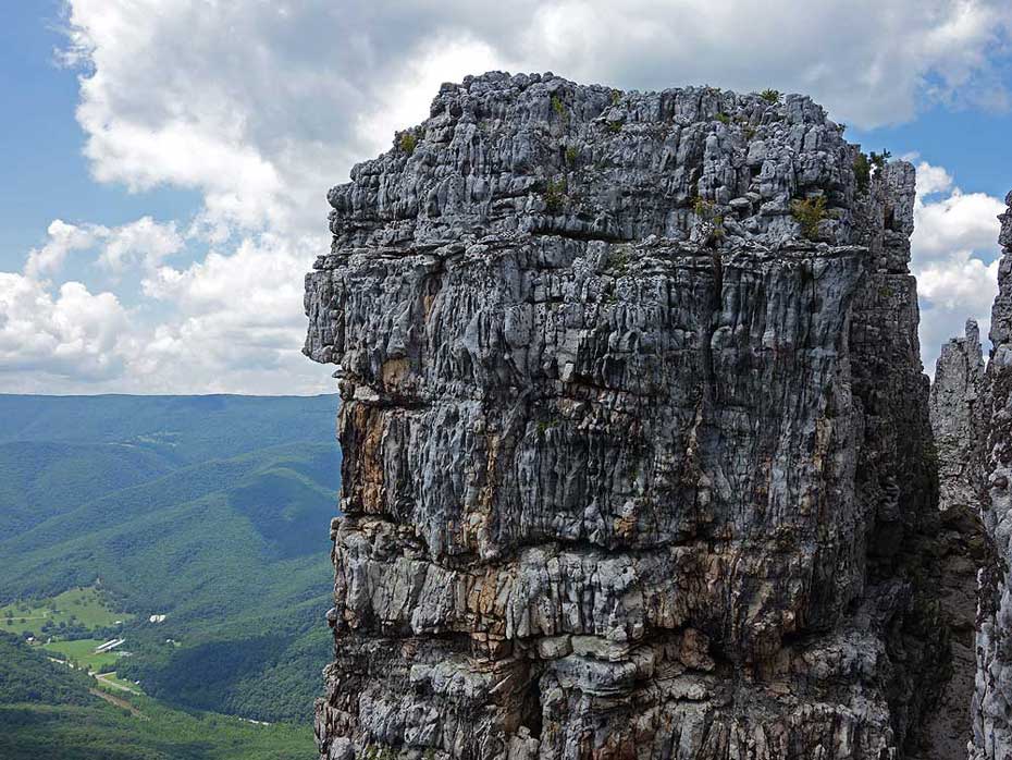
Mile 2.7 - Arrive at the Chimney Top summit campsite. Pass through the campsite to see Chimney Top with sweeping views of the valley. There are multiple viewpoints from the summit of the valley below. Use extreme care if you decide to climb around the rocks. A fall here will be fatal. Return down the steep spur trail and retrace your route back to the parking area.
Mile 5.4 - Arrive back at Smoke Hole Rd. and parking area.
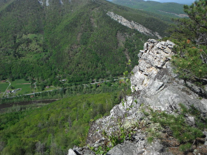
Chimney Top Summit - Courtesy of Peter Vladislav Uhlir
Early August
Mid May
Video - Fall Colors
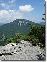
Chimney Top
Chimney Top Hike Comments
Archived Comments
By:John Smith
Rating:
Date of Hike: Saturday, October 5, 2019
I have hike this trail many times, I drive down from Columbus ,Ohio to take pictures. You have to made it up to the right overlook with the u.s. geological metal stamp in the rock for the best view of the whole valley. It is a simple down and up climb with rock hand holds. I have directed familys with kids up the right side . It is a great view.
By:Daniel McBride
Rating:
Date of Hike: Friday, September 13, 2019
My wife and I camped here on Friday night and to our knowledge we were the only ones up on the ridge! We loved the backcountry site (#1) and the views were as nice, if not better, than described. One tip: we really had to hustle to get up there before sunset as it is a tough climb...took us nearly an hour. We noticed on the way down the next morning that there was a nice, level site about 0.2 miles up from the trail head on your right, about 35 feet off the trail. Pretty good option if you're behind schedule as there are really no other options before getting up on the ridge. If coming from the DC area, I would consider this a great Friday night plan before heading deeper into the Monongahela.
By:Alison
Rating:
Date of Hike: Monday, August 5, 2019
We are in our 60s and have hiked across the US for many years and this was definitely one of the steepest hikes weve ever done! Hiked during the week so only saw one friendly group of three all day. But the views are soooo worth the climb! You will have the whole rock ridge line to explore with fantastic views everywhere. The day we went was hot, very humid, buggy and almost no breeze. We were soaked in sweat. No bugs at the top when we were there. If you like a challenge and are prepared this is one to put on your I hiked it list.
Hikers hint: to cool off, find boulder in shade that is cool/cold and lay as much of your body on it. The rock stays cold and cools you off. Reverse works in cold weather with boulder in sun.
By:Mo
Rating:
Date of Hike: Saturday, July 13, 2019
This Hike! Well words can't describe how difficult it is. You think the trail might eventually flatten out for a bit? But nah, it actually hits you with a surprise uppercut blow. The first mile is relatively steep, about 12-15% grade. There is also a lot of loose shale and rock. Once you hit the ridge line it becomes very rocky. There are abundant views of the surrounding valley. From the ridge line onward, the incline continues to increase until you slightly flatten out to probably the worse part of the hike. By making a right past the stacked rocks the trail now is at 60-70% grade. By the time you reach the top you are huffing and puffing! The views from the Chimney Rock are wonderful and definitely worth the effort. Be sure to bring lots of water and bug repellent. Also take your time hiking, take breaks often on this hike. I would give it a 5/6 for difficulty, there really aren't many hikes with 2000ft of elevation gain within 2.7 miles. You'd probably have to go North Carolina and hit the Black Mountain Crest Trail or Grandfather Mountain for similar elevation gain with 2.7 miles.
By:Arjun
Rating:
Date of Hike: Saturday, June 22, 2019
This was a great hike if you looking for solitude and great views. There are a bunch of overlooks on the way and the summit overlook offers great views. We encountered very few people on this hike. As others have mentioned , the last small stretch is steep but not bad. There is a cairn to mark where to make the right turn to the summit. I would do it again.
By:Richard W
Rating:
Date of Hike: Sunday, January 6, 2019
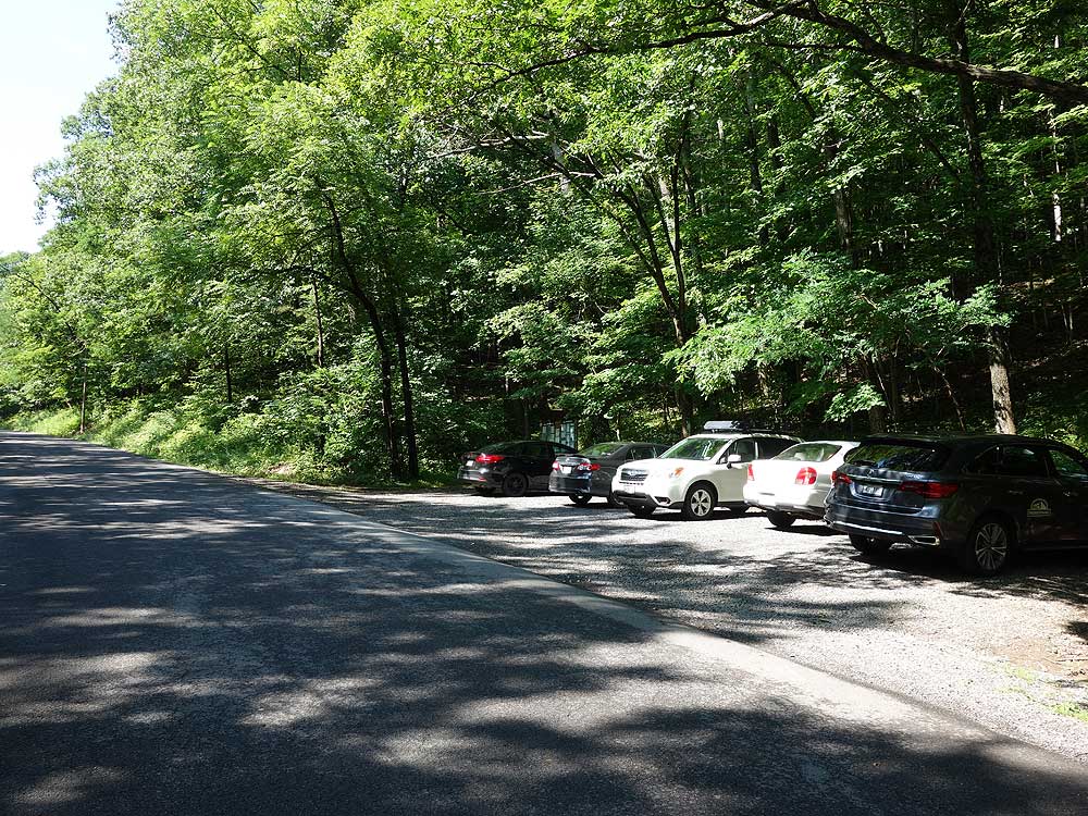
I completed this trail on a cold windy January morning. I was on a solo hike starting at 8 AM and saw 2 pairs of descending campers going up and a single ascending hiker with her dog on my way down so the solitude rating seems accurate. The parking lot for the trail head is tiny (maybe 6 cars max) so you may have to park further off road.
The bulk of the hike is very straightforward, easy to follow and marked with blue blazes. The spur trail near the peak is much more difficult and ran me out of breath. However, the view at the top is more than rewarding for the efforts you will have to put in to make it to the end. The winds at the top are strong and deafening the cliff face of the hike faces Westward so I recommend starting the hike around noon so that the sun shines against the cliff in the afternoon. Unfortunately, I went during the morning so the cliff face just appeared very dark and gloomy. A fair amount of prickly shrubs also obscure parts of the hike and lot of rocks are moss-covered so make sure to dress accordingly.
I was able to complete the hike in 3.5 hours total including breaks and picture taking. Overall a great hike with varying difficulty and a rewarding vista.
By:Phil
Rating:
Date of Hike: Sunday, October 14, 2018
Let me start off with the bad news. The rating for solitude was clearly before this hike was listed on hiking upward. I started on a freezing saturday in October and the mountain was packed with people all throughout the night and into our departure on sunday morning, including a rowdy crew enjoying a few adult beverages, some slackliners, a church group of more than 30 people and a few families with kids. Also, just being a bit of a stickler here, the difficulty should be higher. It has the same 4 stars that humpback rocks has and is far more difficult. I actually believe it is on par with the Priest hike in terms of difficulty.
But more importantly... Those views. Totally worth it. Every last bit of it. Made me want to invest in a better camera because I am sitting here looking at my pictures and they are amazing, but still can not even begin to do it justice.
By:Rob P.
Rating:
Date of Hike: Sunday, August 19, 2018
Did this on a cloudy day in August just as the directions read. Thoroughly enjoyed it - even with obscured views due to weather. Headed back tomorrow - plan on hiking further along the ridge and then back. Highly recommend this hike for any skill level.
By:Peter with Melinda and Liz
Rating:
Date of Hike: Saturday, August 4, 2018
Since I was hiking back from Chimney Top and passed Hiking Upward on their way up, I guess I'll be the first to review this hike.
This is my favorite hike. The views are great as soon as you hit the ridge about a mile from the overlook, and make it very tempting to conclude your hike there. Once you get to the Chimney Top area, the view is spectacular, only there is a trail in the bushes that takes an easy climb down and then up to get you to the top.
The view from the top is exceptional, an almost unobstructed 360°, set on bleached rocks that are more reminiscent of cave formations or a lunar landing. Make sure you check out the geo-marker, and the views to the north and south at this overlook. The way you'll know you're at the summit is if you see a huge cairn on a rock formation you can't climb to.
Chimney top's views are the best in West Virginia, mainly for their uniqueness. You have the 360° views Spruce Knob should have, a wall similar to the Endless Wall trail at New River Gorge, the valley views of Bear Rocks, all set in a terrain package that is to me unique in not only West Virginia, but also Virginia and Maryland.
This hike is not for someone out of shape. It may only be about 2000 feet in elevation, but it's the way the ascents are that make it harder than a hike of equivalent elevation. The last portion up to the chimney top area will leave anyone huffing and puffing.


