|
 By Trail Contributor: Jeff Monroe (Email Jeff) By Trail Contributor: Jeff Monroe (Email Jeff)
This is a loop day hike in a remote part of the Monongahela National Forest, ideally suited for those who don’t mind getting their feet wet while experiencing wide swaths of open meadows and bogs. This hike does not have vistas and, because this is West Virginia and fewer people maintain trails than locations closer to cities, summer growth in the open areas is sometimes pretty thick. Due to its overall wetness, it is not a great backpacking loop, but is a very convenient day hike for those camping at nearby Forest Service campgrounds like Spruce Knob Lake Campground and Gatewood Group Campground. This hike is one of the few in the area that can be done without any road walks or backtracking.
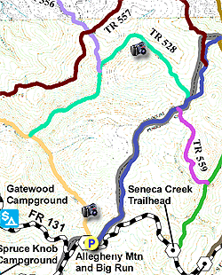
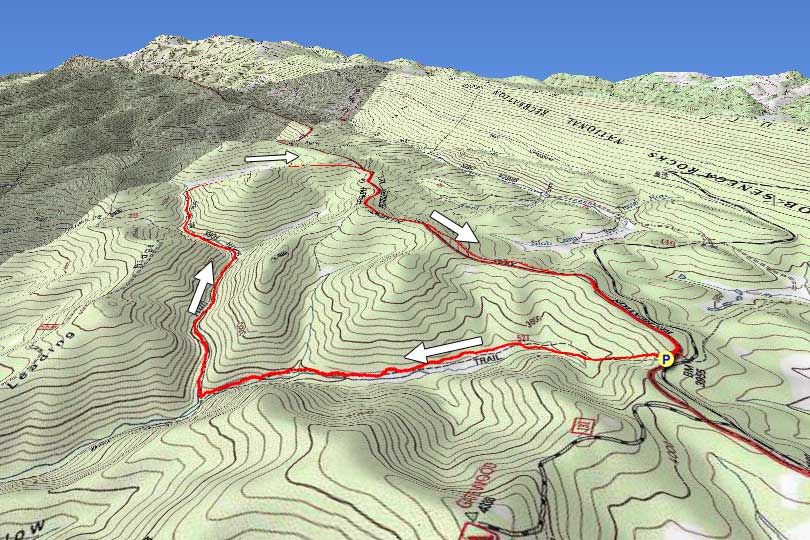
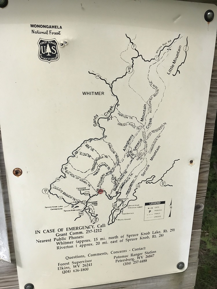
- Mile 0.0 – Park at a gravel lot on the north side of FR 112. This lot is marked by a large trailhead sign for Big Run on the road. As you enter the lot the closed gate at the end of the parking area is the return trail, the Allegheny Mountain Trail. Start out on the Big Run Trail (also called the “Big Run of Gandy Trail”), on the left next to the trail kiosk. Be sure to take a photo of the trail map if you did not bring one. Hiking the loop clockwise avoids an elevation gain at the very end of the hike, and is recommended as it places the less maintained trails early in the loop.
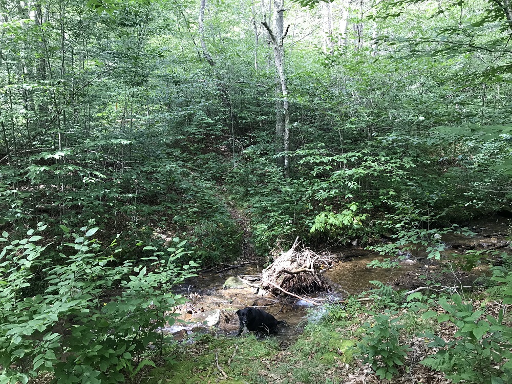
- Mile 0.3 – The blue blazed Big Run Trail drops from the parking lot almost immediately, and begins a series of stream crossings soon after leaving the parking lot.
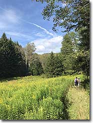
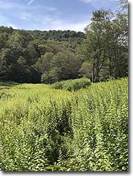
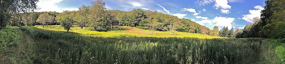
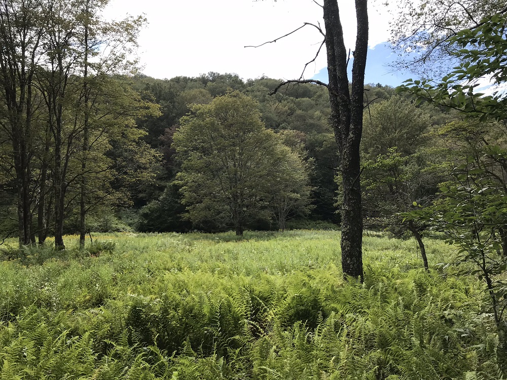
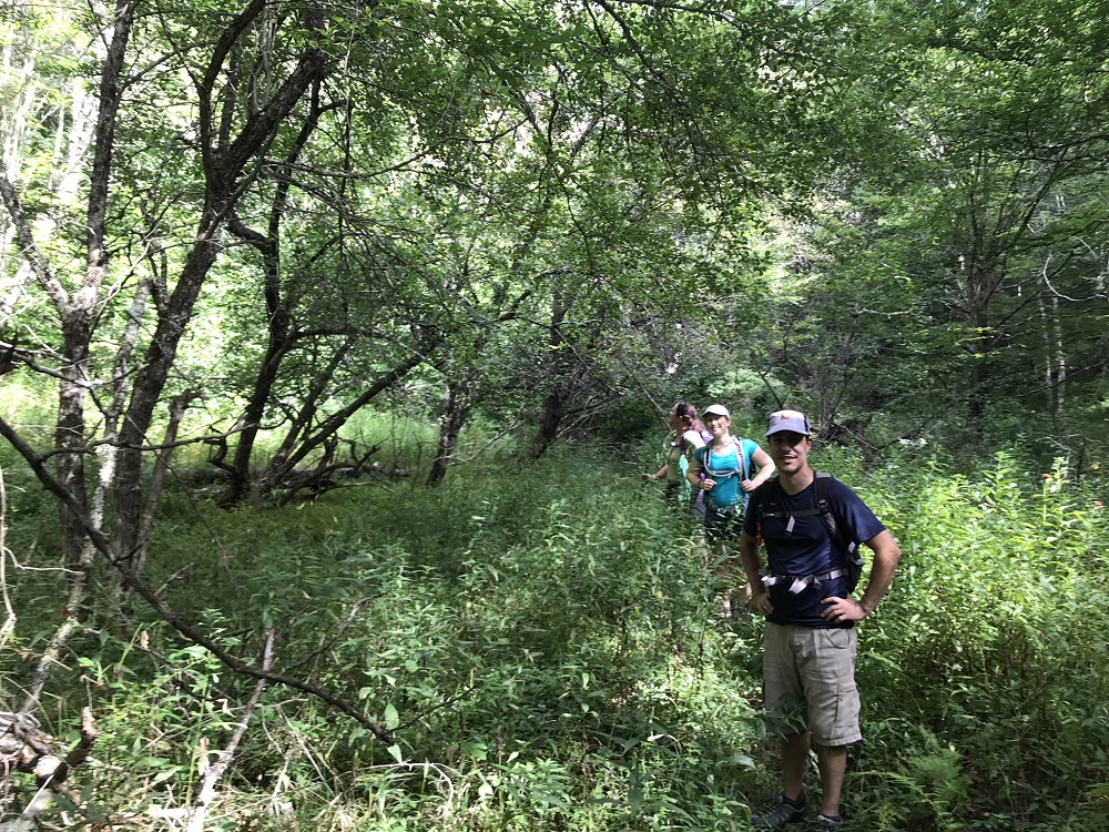
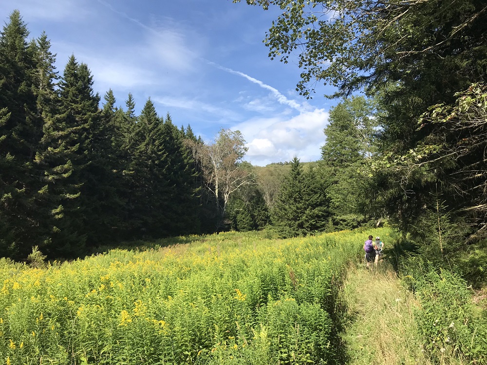
- Mile 0.6 – The trail winds in and out of the edge of the woods, with a large open area covered in ferns on your left. This area is very wet, and the wetness often bleeds into the trail, so you can count on wet feet and mud along this part of the hike. During summer months, the trail may be overgrown, but it is well blazed and relatively easy to follow.
- Mile 1.2 – Stream crossing. After this, the trail becomes drier and the meadows recede. The trail follows a stream.
- Mile 1.5 – Pass through an old apple orchard and make note that you should come back to this trail in mid-September to pick fruit.
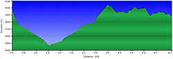
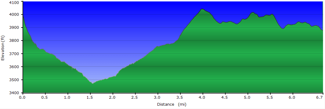
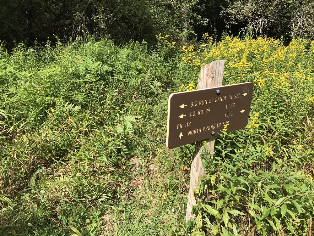
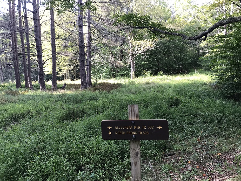
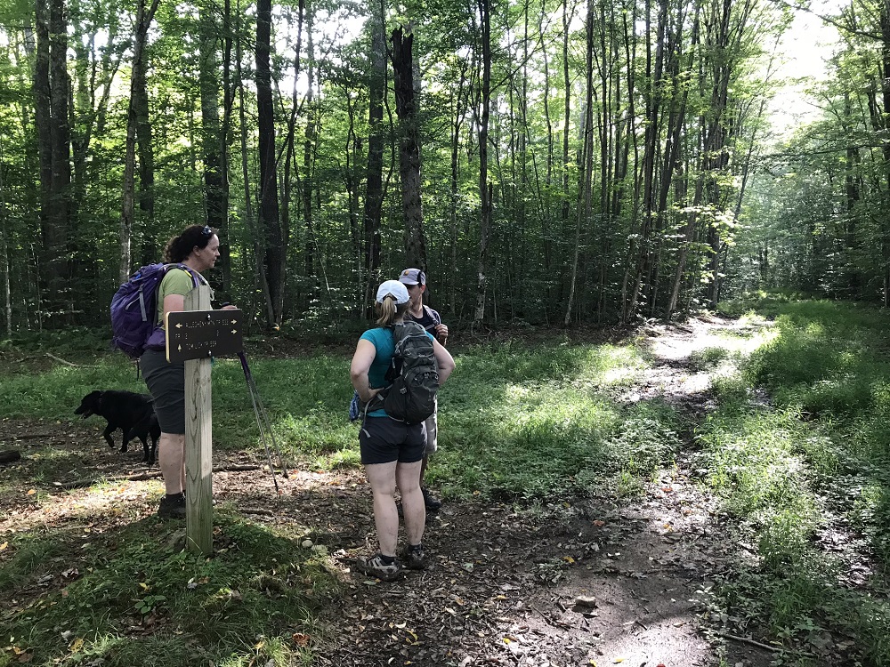
- Mile 1.4 – The trail intersects with the North Prong Trail, also marked with blue diamonds. Leave the Big Run Trail and take a right onto the North Prong Trail, following another branch of the same stream. You are at the low point of the hike now, and the next 2.5 miles will climb to the hike’s high point, ascending from 3470 feet elevation to just over 4000 feet.
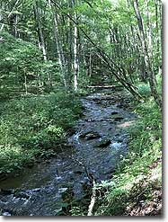
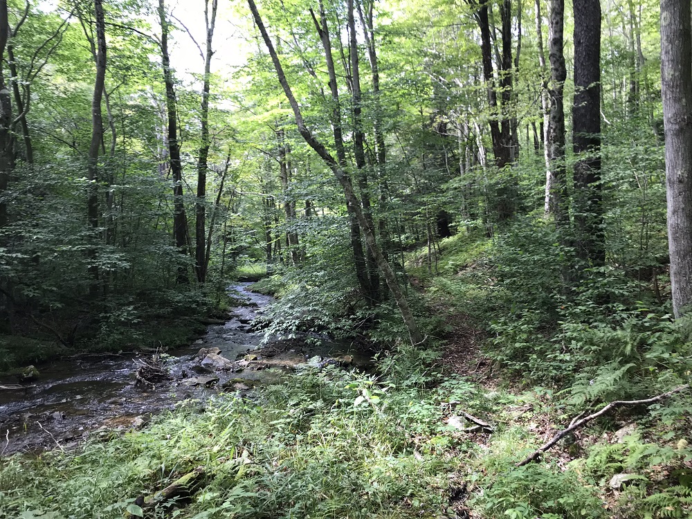
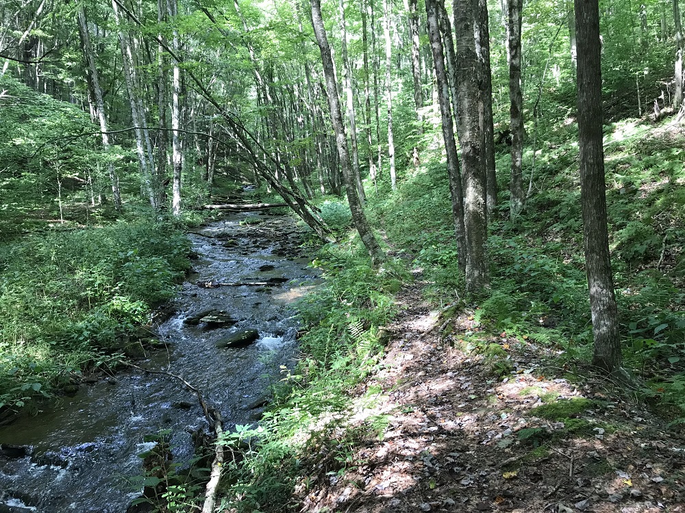
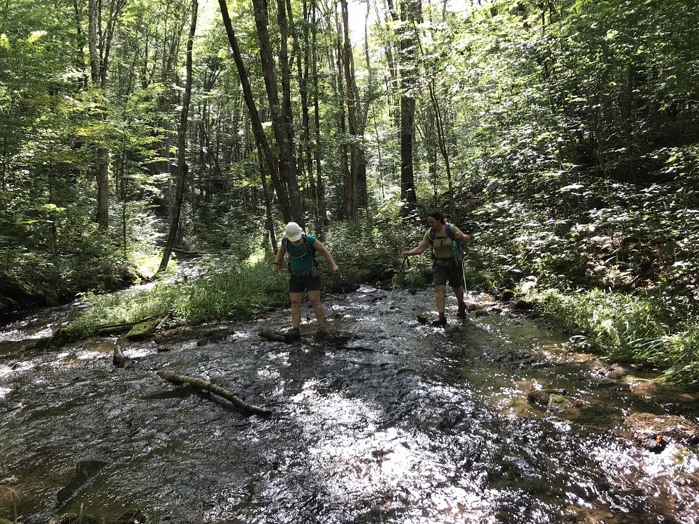
- Mile 2.0 – The trail crosses the stream for the first of 5 crossings over the next 0.8 miles. It will be tough to keep your feet dry, as there are no bridges and few large rocks to hop as you cross and re-cross the stream.
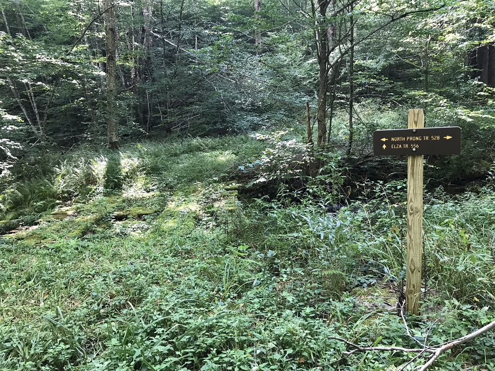
- Mile 2.8 – The North Prong Trail meets the end of the Elza Trail. Marvel here at a unique feature: an actual bridge! Alas, it is for users of the Elza Trail and not for us North Prong folks. Continue on the North Prong Trail. After this intersection, however, the North Prong Trail becomes much less overgrown with summer growth and the term “superhighway” may pop into your head as you are on an old road bed.
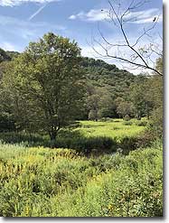
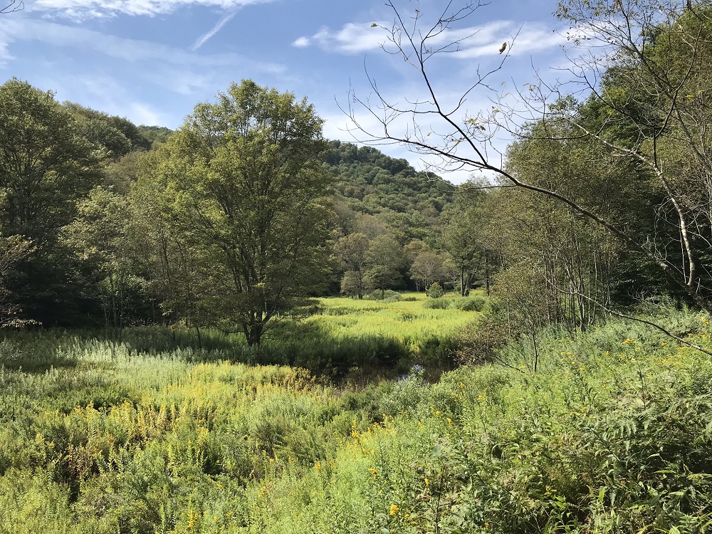
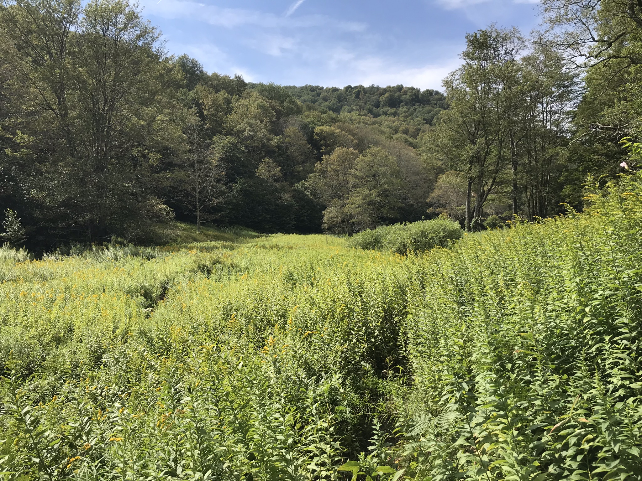
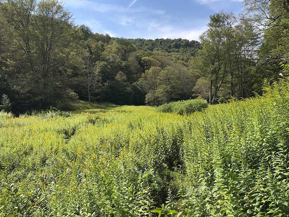
- Mile 3.3 – Pass alongside some exceptionally large and beautiful meadows before the trail turns away from Big Run.
- Mile 4.4 – The North Prong Trail ends when it meets the blue blazed Allegheny Mountain Trail. Take a right here, onto the Allegheny Mountain Trail, which follows an old road bed.
- Mile 4.5 – The Tom Lick Trail meets the Allegheny Mountain Trail. The Tom Lick Trail is described in Hiking Upward’s Allegheny/Seneca Creek description. Continue on the Allegheny Mountain Trail through woods for the last miles of this loop.
- Mile 7.1 – The Allegheny Mountain Trail ends at a closed gate which blocks access from the trailhead parking lot.
|


