Pilot Mountain
The Most Unique Mountain In NC
Great North Carolina Hiking Books!

Bearwallow Mountain/Blue Ridge Pastures, North Carolina


Topo Hike Trails Map
   All Hikes Map
   Click for location shots
   Click for Parking/Start location
   Hike trail blazed colors
   Other trail

  • Flash_FP1
  • Flash_FP2
  • Flash_FP3
  • Flash_FP4
  • Flash_FP5

Length Difficulty Streams Views Solitude Camping
2.4 mls N/A N/A

Hiking Time:
Elev. Gain:

Bearwallow Mountain
1 hour with 15 minutes of breaks
740 ft

4.9 mls N/A N/A

Hiking Time:
Elev. Gain:

Trombatore Trail to Blue Ridge Pastures
2.5 hours with 30 minutes of breaks
1,410 ft

7.3 mls N/A N/A

Hiking Time:
Elev. Gain:

Combined Hikes
3.5 hours with 45 minutes of breaks
2,150 ft

Links:
Resources:
Carolina Mountain Land Conservancy
Topo Hike Trails Map (PDF)
Bearwallow Mtn NC Weather Forecast
Current Weather Radar
Garmin (GDB), Gaia/Trails App (GPX) (What's this?)
From:

Park on either side of Bearwallow Mountan Rd. 35.46042, -82.36845
 

By Trail Contributor: Zach Robbins (Contact Zach)

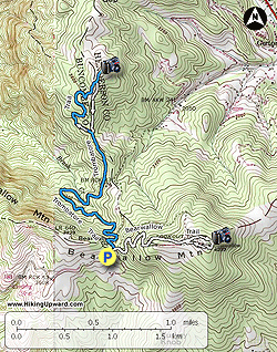
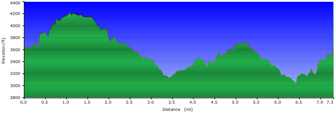
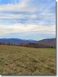
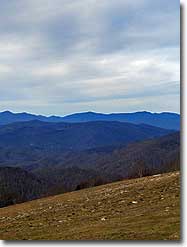
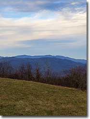
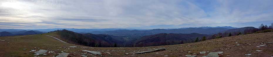
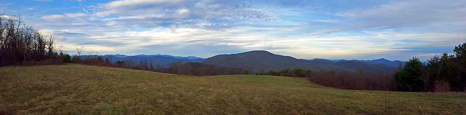
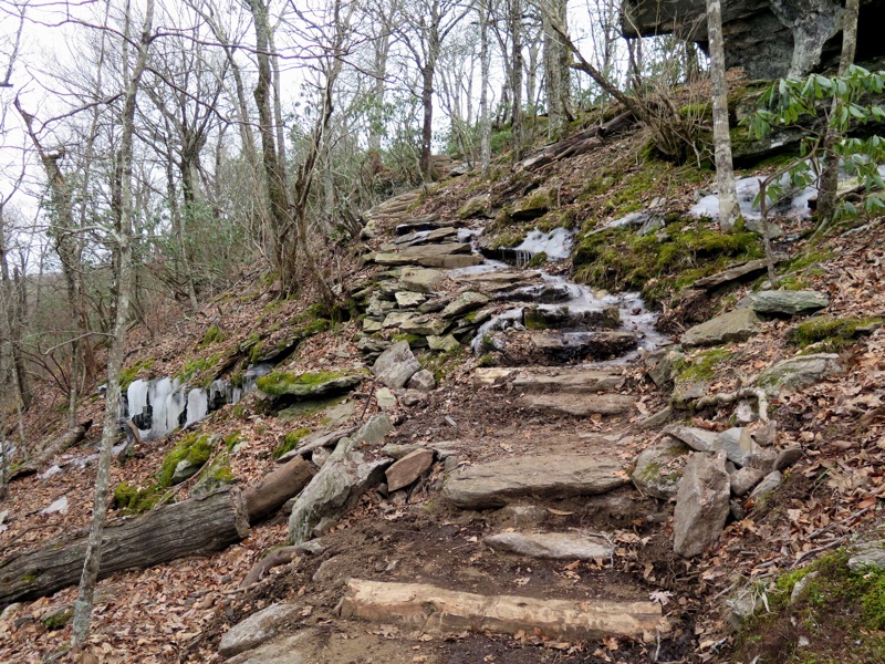
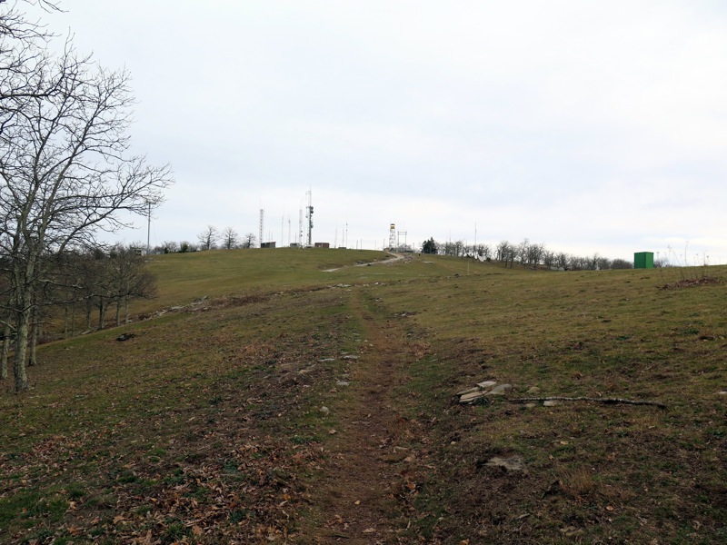
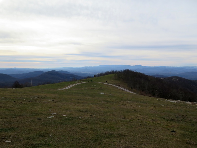
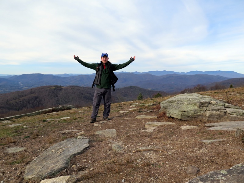
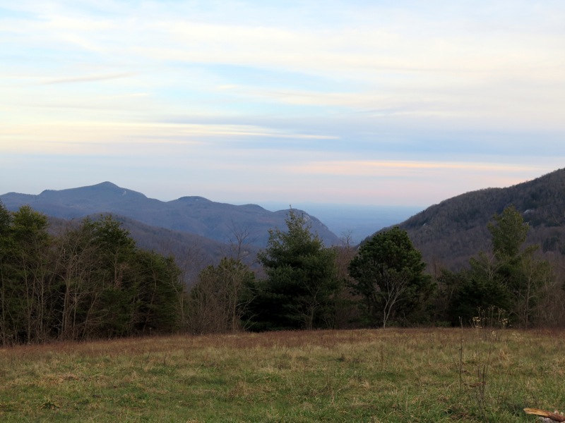
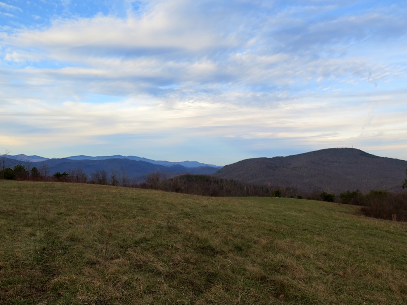
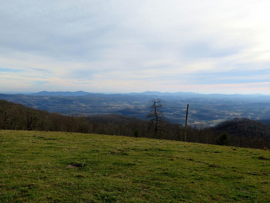
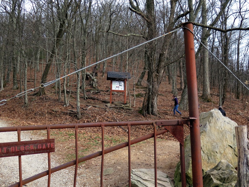
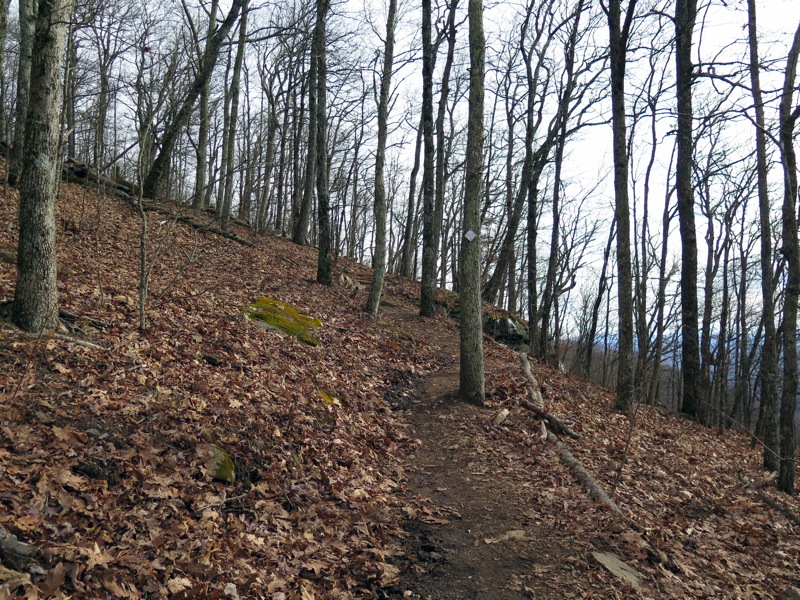
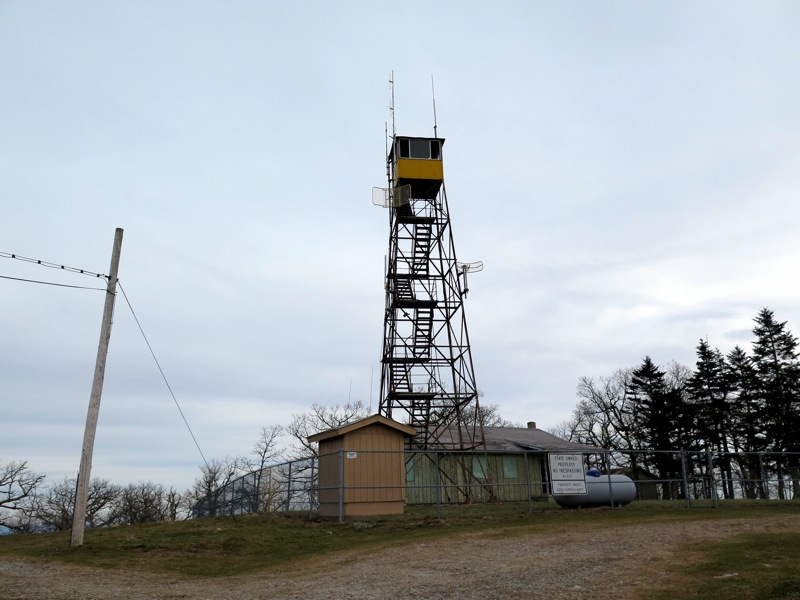
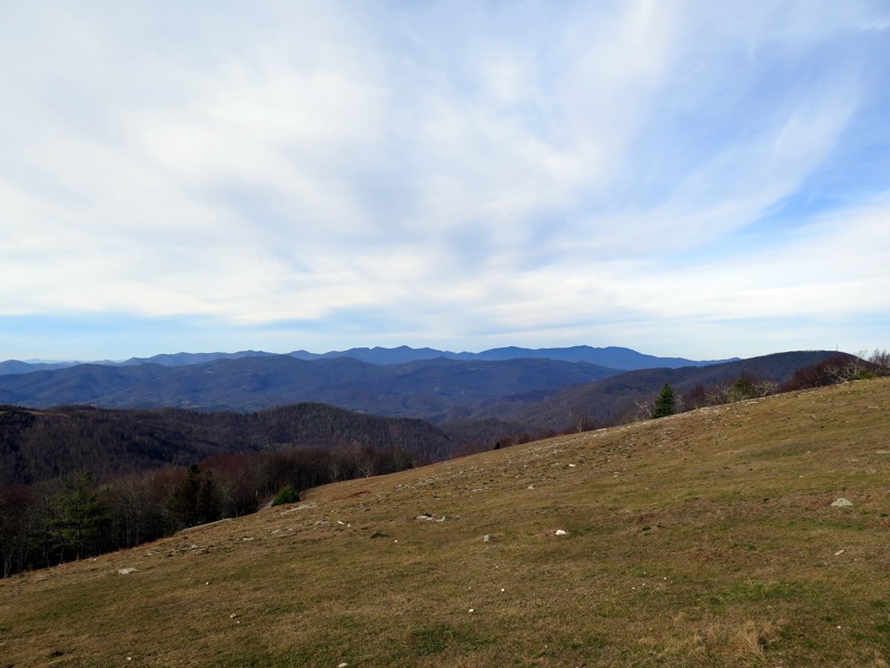
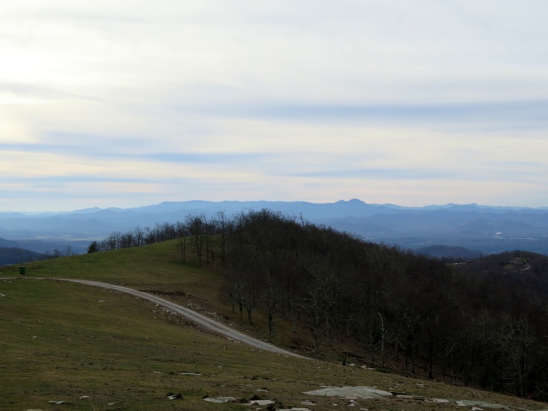
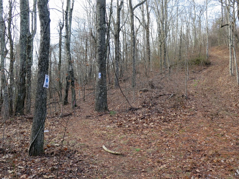
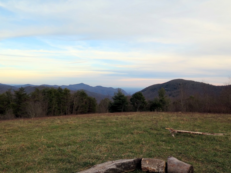
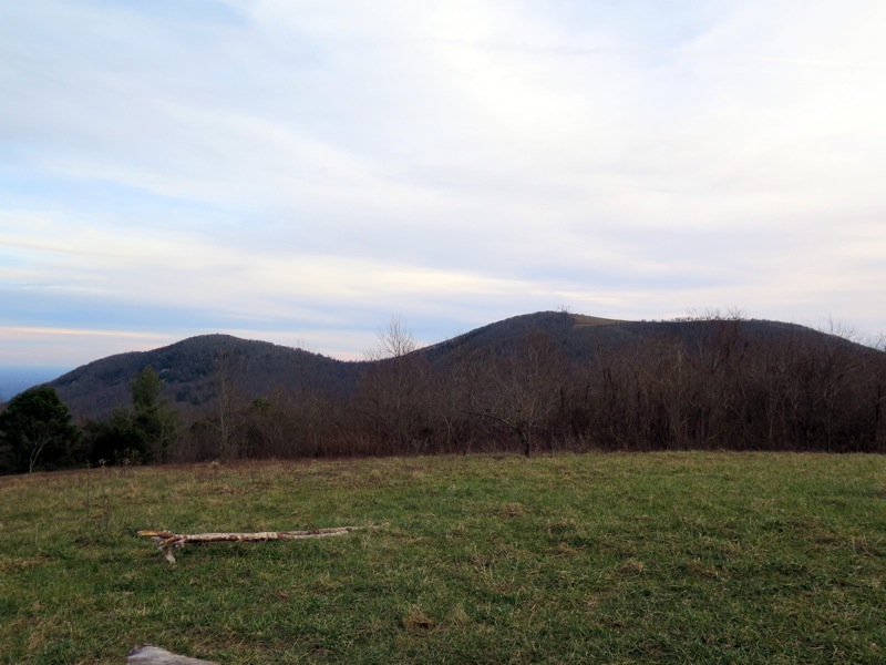
Two of the newest trails in the Hickory Nut Gorge region provide stunning views with minimal effort. From lofty Bearwallow Gap on the Eastern Continental Divide you can choose the short hike to the popular bald summit of Bearwallow Mountain or the longer hike along the Trombatore Trail to a small bald known as Blue Ridge Pastures.

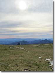
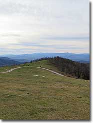
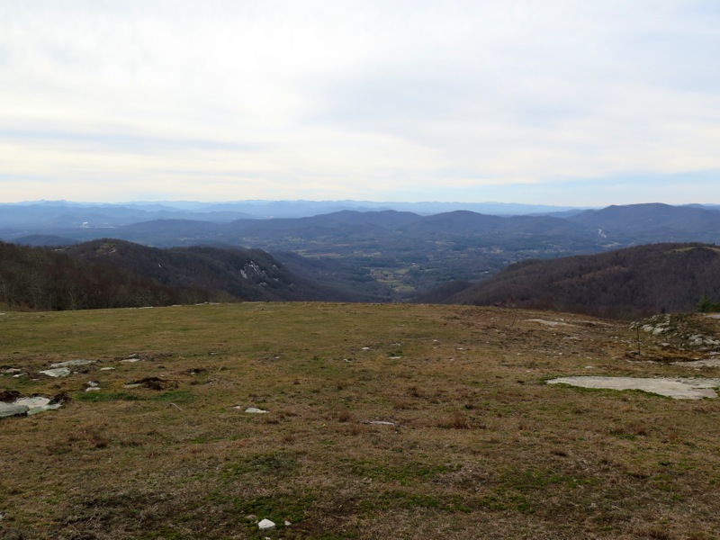
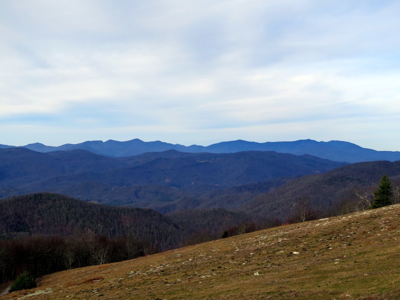
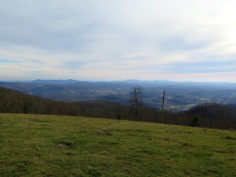
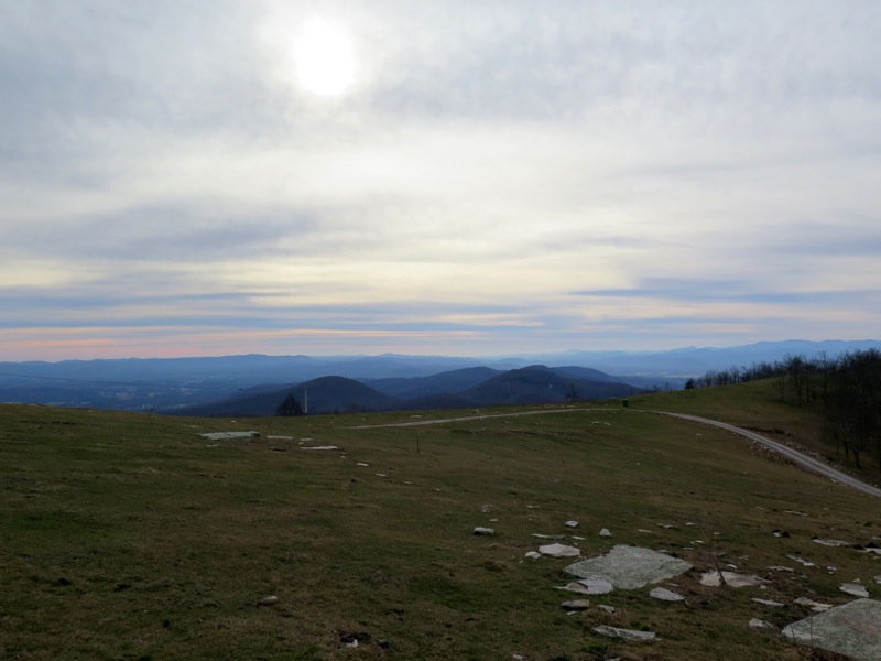
From Bearwallow Mountain you’ll be treated to sweeping views of Western North Carolina while Blue Ridge Pastures offers a unique view down the rugged Hickory Nut Gorge. Both mountains provide excellent northern views of the Swannanoa Mountains, Black Mountains and Great Craggy Mountains. This page describes both hikes which make an excellent half day excursion or choose one for a picnic on a sunny day.

  • Mile 0.0 – There is ample parking on both sides of Bearwallow Mountain Road after the road crests Bearwallow Gap and turns to pavement. At the gap the Bearwallow Trail begins on the east side while the Trombatore Trail begins on the west side. This hike begins with the Bearwallow Trail (white blaze). The new Bearwallow Trail climbs gently on many switchbacks up the west side of the mountain through hardwood forests. The alternative route to the summit follows the forest road to the left and they are roughly the same length.
  • Mile 0.9 – Trail leaves the forest traversing the immense bald summit of Bearwallow Mountain. As you approach the communications towers you will have constant views south of the Green River Game Lands region and the Kings Mountain Range on a clear day.
  • Mile 1.1 – Summit of Bearwallow Mountain (4,232 feet) adorned with communications structures and an old fire tower. The steel Aermotor tower was constructed in 1934 but is normally closed to access. From the mountain top you’ll have outstanding views in every direction except east, which is blocked by gnarled trees. Due north is Little Pisgah Mountain, the tallest peak in the Hickory Nut Gorge area. On the left are the Swannanoa Mountains followed by the Great Craggy Mountains and Black Mountains dominating the region. The Brush Creek Valley lies to the northwest with Asheville out of sight. You can spot the Great Balsam Mountains to the west on a clear day. The easiest peak to spot in this range is the TV tower adorned Mt. Pisgah, the pyramidal mountain on the right side of the high ridge.    
  • Mile 2.4 – Bearwallow Mountain hike ends at Bearwallow Gap. For the second part of the hike find the Trombatore Trail (no blaze) on the opposite side of the street. You will see a wood sign board with no information beyond a small gap in the fencing. The trail moderately descends on switchbacks towards Brush Creek.
  • Mile 3.6Trail crosses over Brush Creek. Beyond this point many forest roads crisscross the trail since it mostly borders private property. At almost all intersections are temporary plastic signs indicating the direction of the Trombatore Trail.
  • Mile 4.2 – At a confusing 5-way intersection veer slightly left on the Trombatore Trail. The trail actually makes a loop around the summit. The wide road bed heading straight and uphill is the shortest version but it is steep. This hike takes the hiker’s path and returns along the forest road.
  • Mile 5.0 – Climb over a cow stile and enter the vast grassy bald of Blue Ridge Pastures. Go left towards the end of the bald for the best views.
  • Mile 5.1 – On the north side of Blue Ridge Pastures is a fire ring in a beautiful spot with views north and east. This tract is part of a conservation easement purchased by the Southern Appalachian Highlands Conservancy and will be part of a larger trail system around the Hickory Nut Gorge. Unlike Bearwallow Mountain you have a direct view of the Hickory Nut Gorge. Shumont Mountain rises high above the cliffs of Round Top Mountain and Rumbling Bald marking the eastern end of the gorge where the Broad River flows into Lake Lure. To the southeast the double-humped massif of Little Bearwallow Mountain and Bearwallow Mountain rises high above the landscape. It is easy to pick out your starting spot at Bearwallow Gap. Perhaps the most dramatic view is north of Little Pisgah Mountain with the Great Craggy and Black mountain ranges in the distance.
  • Mile 5.3 – Instead of going back over the cow stile, continue south along the loop following the forest road down the mountain.
  • Mile 5.4 – Descend through grassy fields dotted with large trees. Good winter views of Bearwallow Mountain through this section.
  • Mile 5.6 – Forest road levels out at the loop trail intersection. Follow the Trombatore Trail back to the parking area.
  • Mile 7.3 – Hike ends at Bearwallow Gap.
Video
Mid December
Bearwallow Mountain/Blue Ridge Pastures
Bearwallow Mountain/Blue Ridge Pastures Hike Comments
Archived Comments


By: Zachary Robbins Rating: Date of Hike: Sunday, September 2, 2018
Did a quick stop to Bearwallow while in the area, weather wasn't perfect but it was still a nice day up top. A lot of people exploring the summit. There were also a lot of cows up top, far more than my last visit. I'd say at least 25. There is no barrier between you and the grazing cows, so be mindful and try not to block mothers from their younguns. I definitely recommend this year-round, but winter is better. You'll have less people and much better visibility.

about us | contact us | terms of use | © 2000 - 2024