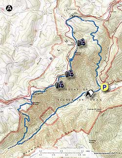
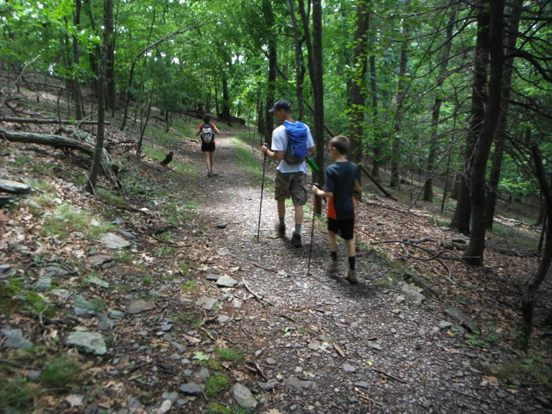
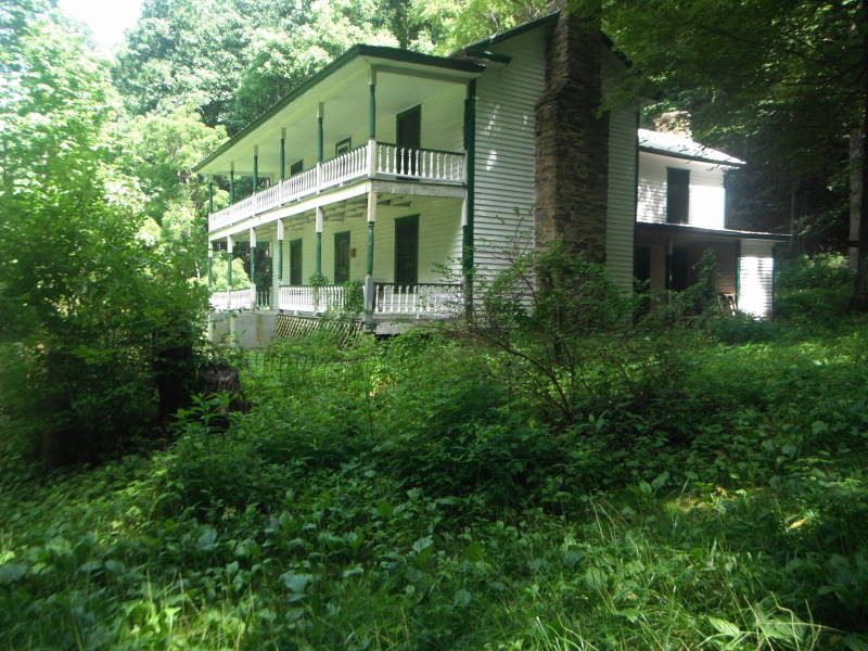
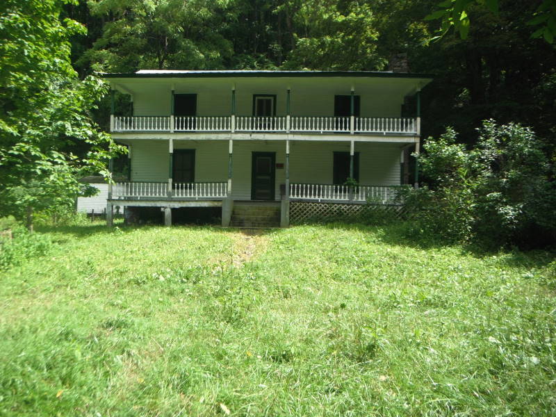
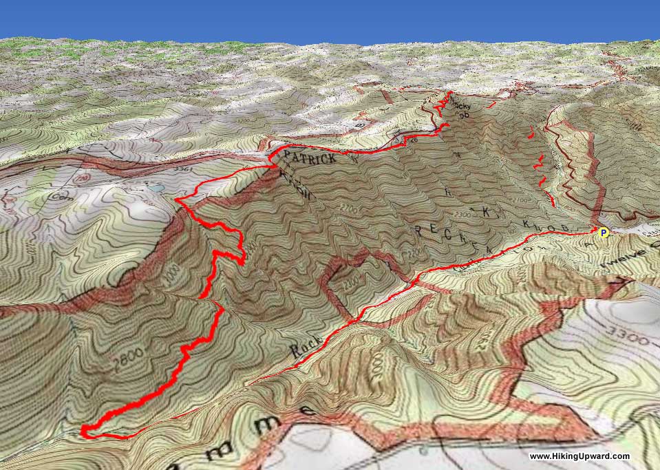
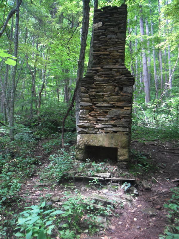
If you are ever near Floyd, VA, be sure to put this hike on your to do list. There is a heart pounding climb at the beginning of the hike, some gentle hiking through meadows on top of the ridge and then mostly down for the last 4.0 miles. You will see an old Appalachian Trail shelter, chimney of an old homestead and then the Austin House beside Rock Castle Creek.
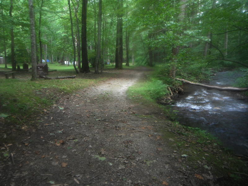
There are multiple places to start this hike along the Blue Ridge Parkway, but we recommend starting at the convergence of Rock Castle Creek and Little Rock Castle Creek in the gorge. Basecamp at the primitive camping area 0.25 miles upstream on Rock Castle Creek on fire road, and do it as a day hike.
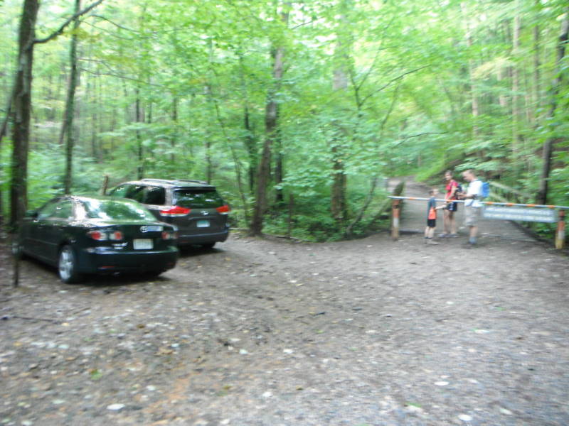
Mile 0.0 – From the parking area cross barrier and bridge, continue straight on fire road and in 0.10 miles make a sharp turn to the right on to the green-blazed Rock Castle Gorge Trail.
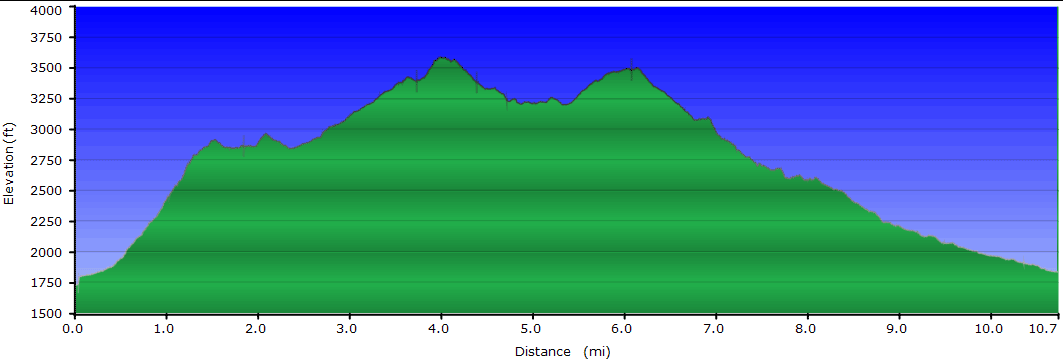
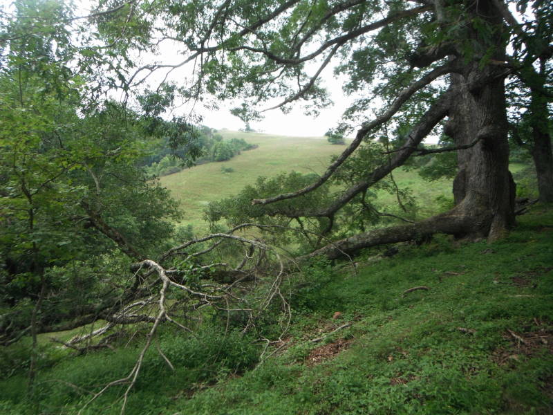
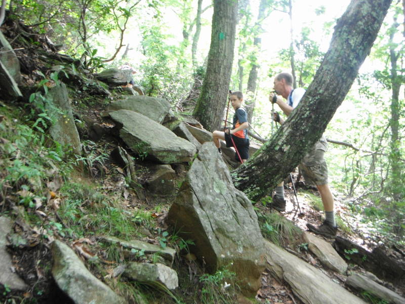
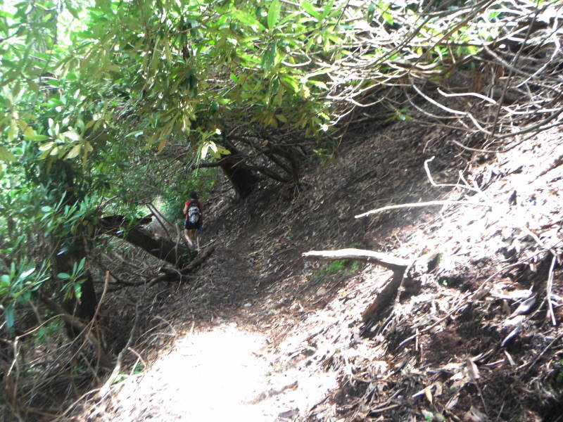
Mile 0.5 – The trail starts to become much steeper, gaining almost 1100’ in 1.0 miles.
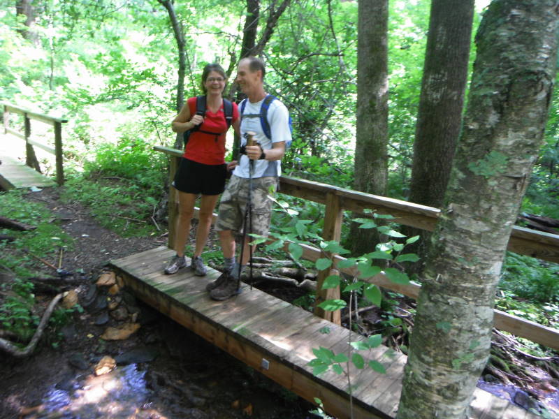
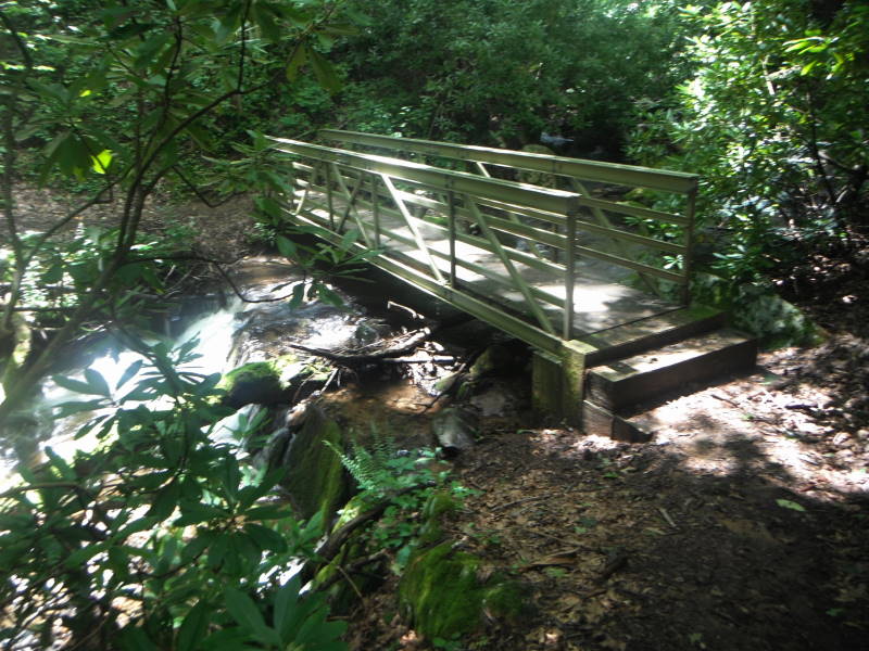
Mile 1.5 – The tough part of the trail is over, in 0.3 miles cross two bridges.
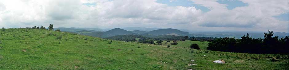
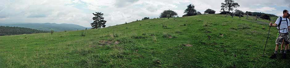
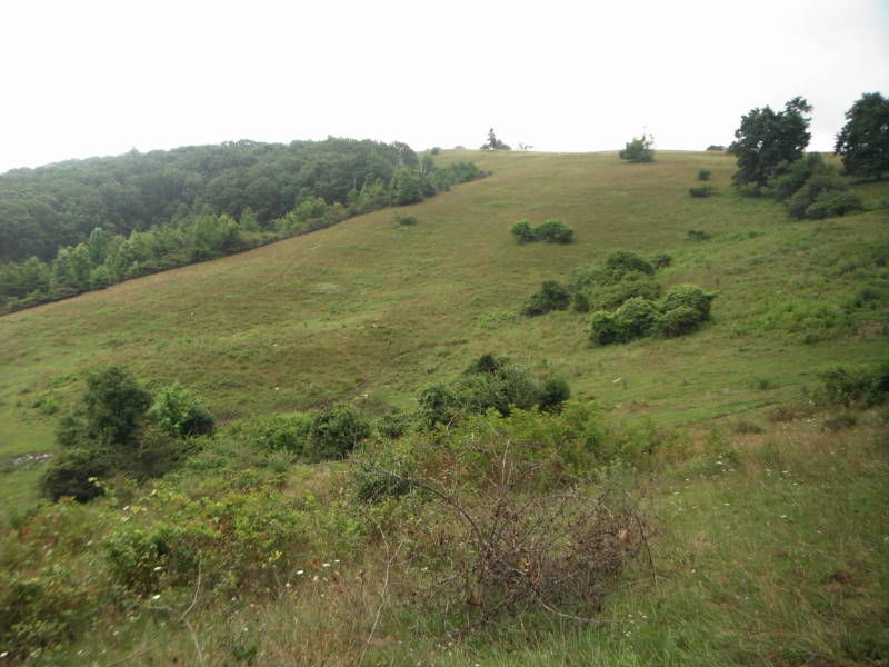
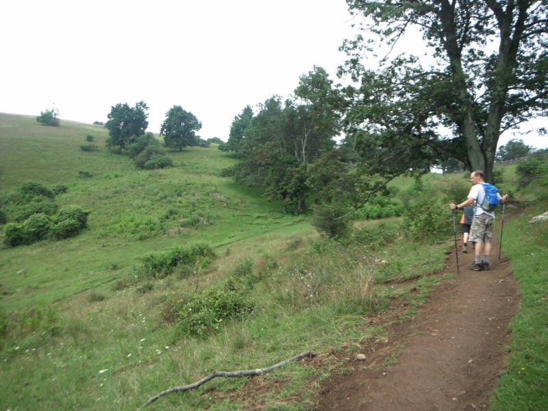
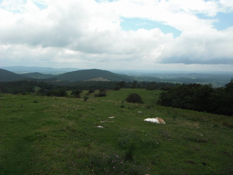
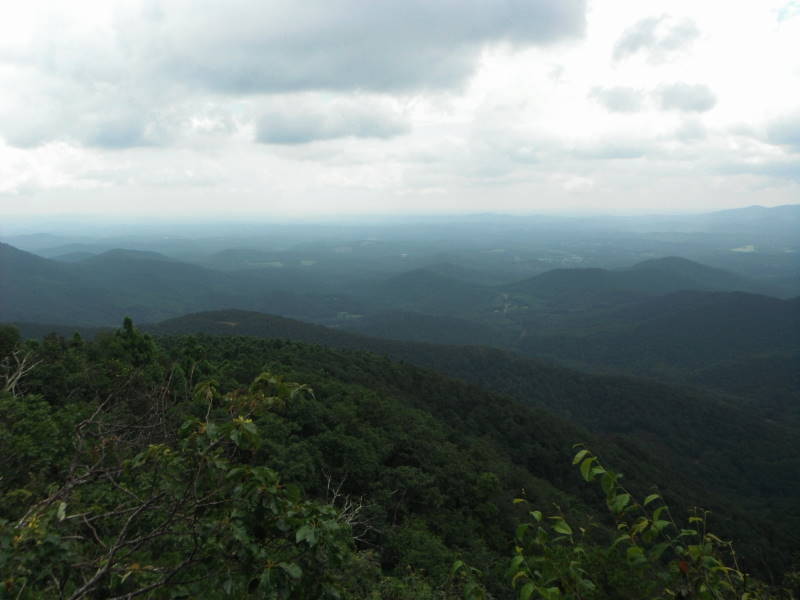
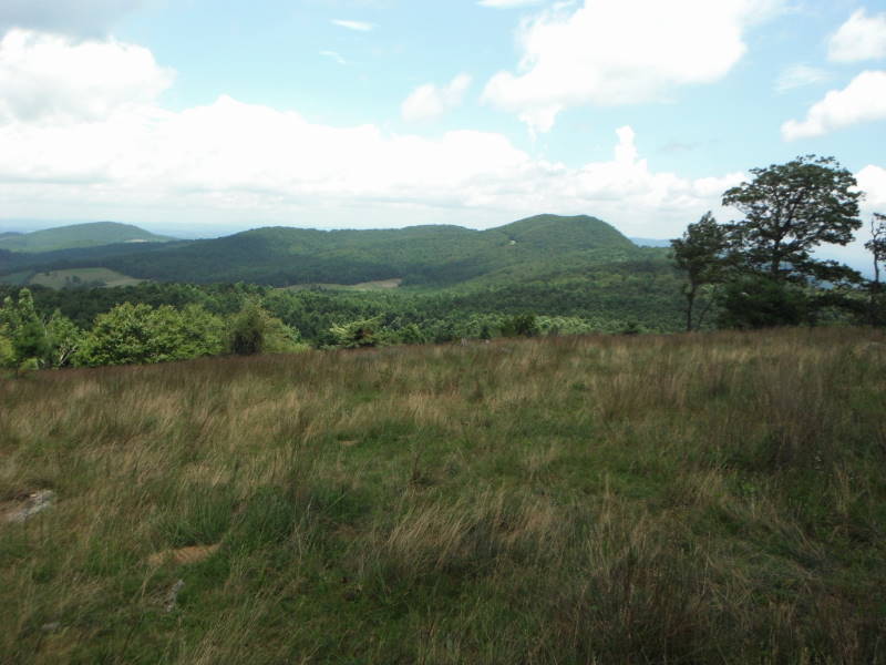
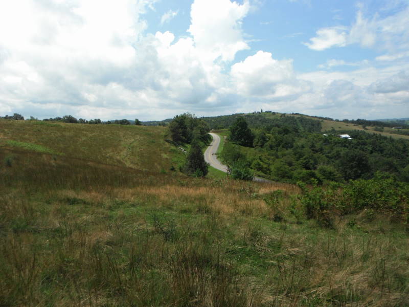
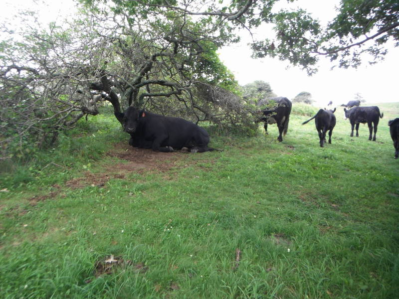
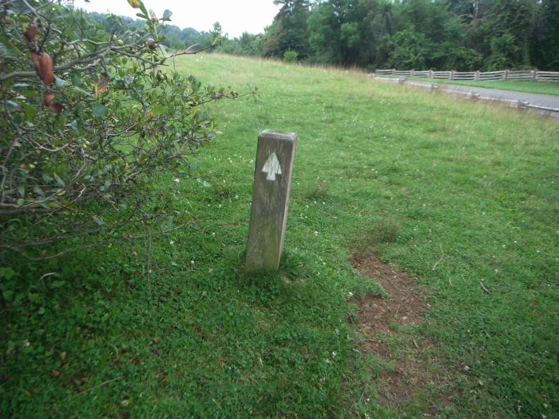
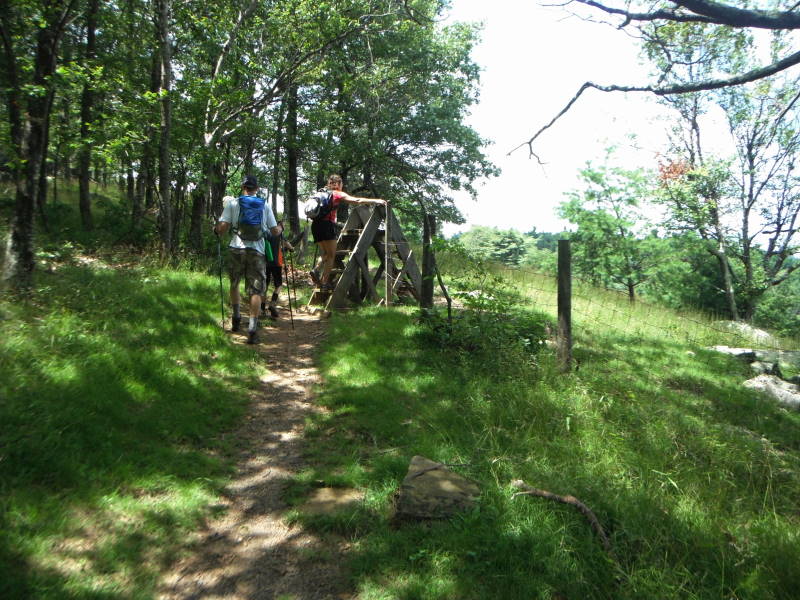
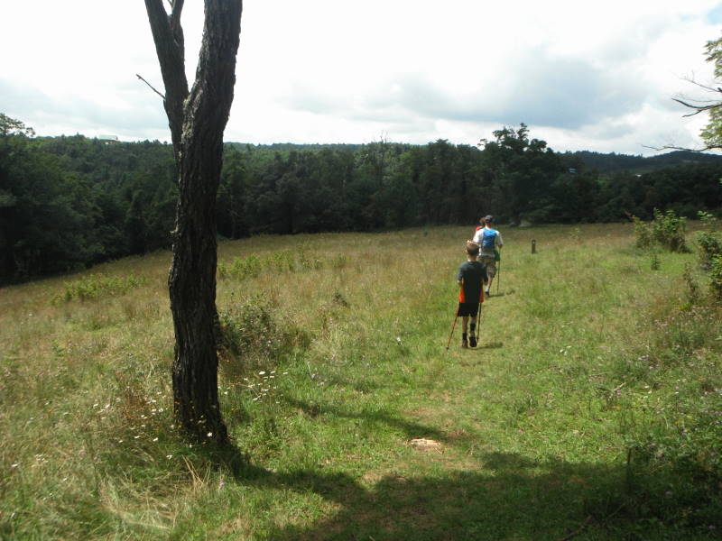
Mile 2.8 – You will climb the first of four fence stiles and into a pasture. The last stile will be around the 7.0 mile mark. Be prepared to dodge some cows, a huge bull and of course their cow patties over the next mile. As the Blue Ridge Parkway becomes visible, you will see the entrance to the Rocky Knob Campground and Visitor Center on your right. Follow short trail posts with arrows through the pasture, the trail hugs the pasture close to the Blue Ridge Parkway for the most part. There are great views over the next 4 miles.
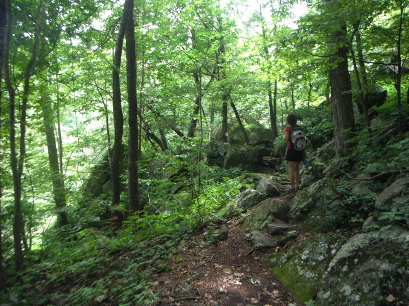
Mile 3.7 – Reach Saddle Overlook, in 0.1 miles bear left at fork intersection. The trail is evident but there are no blazes as you go over Rocky Knob.
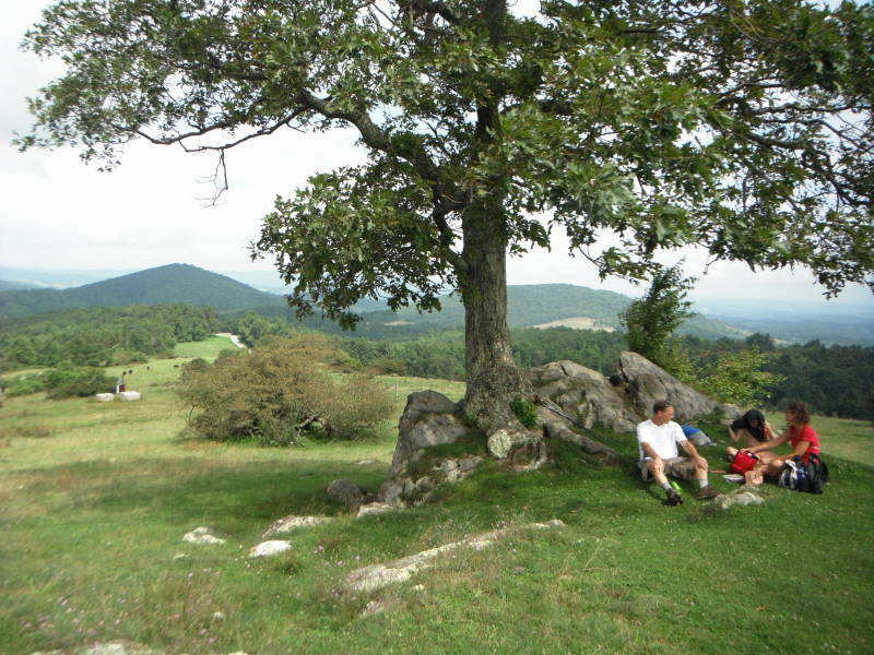
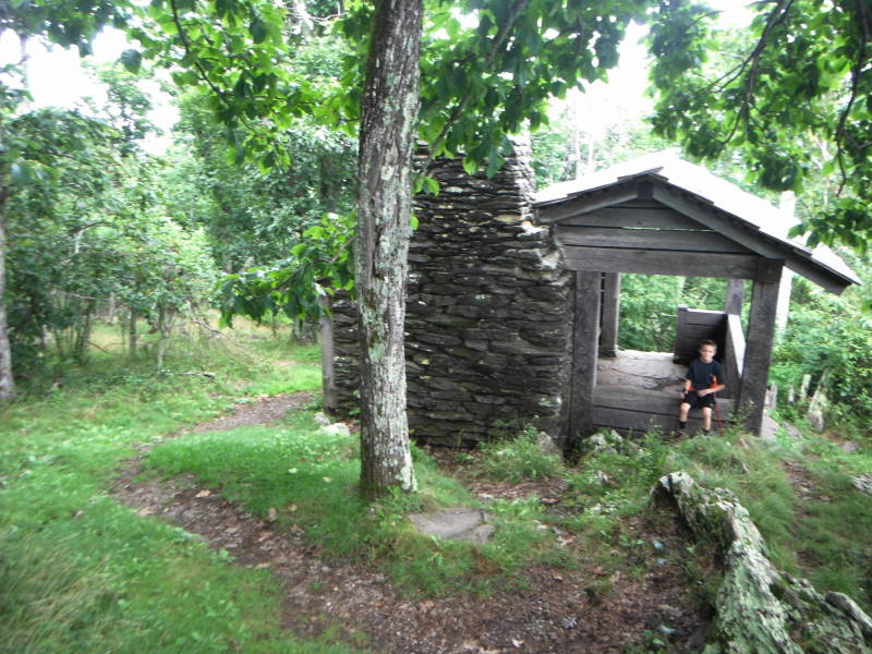
Mile 4.0 – Former Appalachian Trail Shelter, the AT was relocated to the west in the 1950’s. Continue on other side of shelter by the chimney following ridge line as other unmarked trails go right towards the parkway. There are a couple of other good viewing areas just after the shelter on your left. The top of the incline is Rocky Knob. Green blazes will start again in about a 0.5 miles.
Mile 4.4 – T-intersection, bear left onto Rocky Knob Trail.
Mile 4.8 – Rock Castle Gorge Overlook.
Mile 5.1 – 12 O'clock Knob Overlook. Comfort Station, Picnic Area and bathroom is just across the Parkway. Trail is now blazed Green and Blue. Trails over the next mile will come in from the right, stay left.
Mile 5.7 – Cross a fence stile into another meadow and bolder field.
Mile 6.1 – Black Ridge Trail intersection, stay left on Green-blazed Rock Castle Gorge Trail. You are now in Grassy Knoll.
Mile 6.6 – Leave Grassy Knoll, go through a fence stile/gate. What goes up must go down, and you will be going down the rest of the way, and the first few miles will be steep.
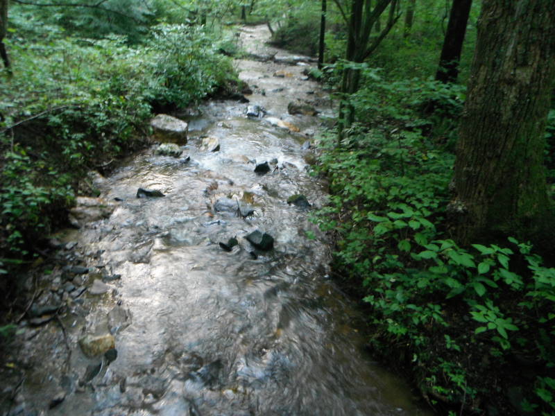
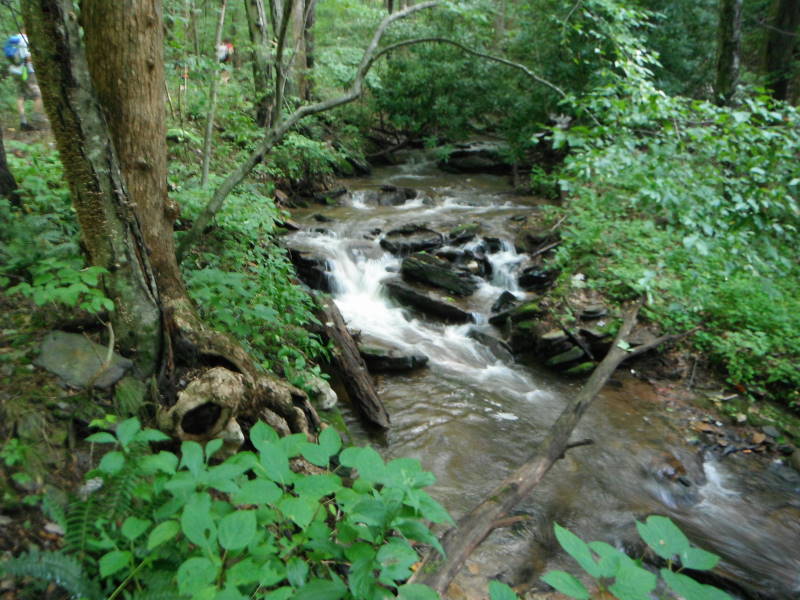
Mile 8.0 – Old homestead chimney ruins on left. Just after the chimney you will cross the first of four metal bridges.
Mile 8.1 – Intersection with fire road, bear left and follow Rock Castle Creek downstream.
Mile 8.9 – 2nd Metal Bridge
Mile 9.0 – 3rd Metal Bridge
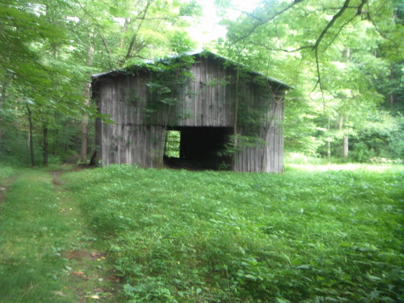
Mile 9.2 – Austin House, privately owned, built 1916. Also there is an old barn just past the house.
Mile 9.5 – 4th Metal Bridge
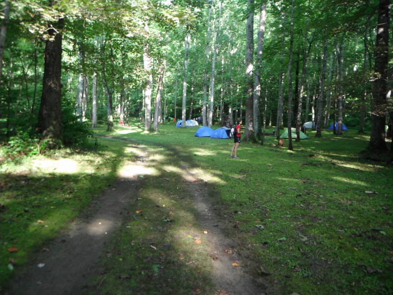
Mile 10.4 – Primitive camp site. Permit required from Visitor Center or Rocky Knob Campground on the Parkway. You are not allowed to camp anywhere else on this trail besides this primitive camp site.
Mile 10.7 – Return to the parking area.
Mid August
Rock Castle Gorge Hike Comments
Archived Comments
By:Judith L Ratcliffe
Rating:
Date of Hike: Sunday, July 14, 2019
This is the second-most strenuous hike I've ever done! My friend and I are both strong, fast hikers and this took us eight hours (we stopped more than usual to re-soak our neck towels, but still). Lots of beauty, amazing vistas and varied scenery, (and so much time next to water!) but this trail needs serious maintenance. We lost time to navigating multiple downed trees and there were several stretches with thigh-high weeds nearly obscuring the trail. But definitely glad we did it! Feel like we earned a badge of some sort!
By:Jeanne
Rating:
Date of Hike: Monday, October 1, 2018
This was one of the most strenuous hikes we have ever completed (and we've hiked in deserts, canyons, and more). Mileage is off - it's well past 10.9 miles as stated on the map and probably closer to 15 miles, total. Took us about 8 hours with plenty of rests along the way. Gorgeous waterfalls, varying terrain, meadows, and more made it enjoyable. Pack plenty of water and leave a lot of time.
By:Tkh9758
Rating:
Date of Hike: Sunday, July 29, 2018
Awesome hike!
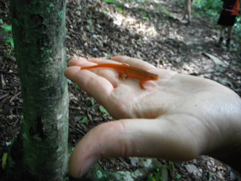
Arrived to start the hike later than anticipated around 2:45pm from the twelve o'clock knob overlook and started the hike clockwise... great start considering everyone recommends the opposite direction. The first mile was spent taking in some seriously spectacular views as we passed rock castle gorge overlook, rocky knob, and saddle overlook and even from the first cow pasture! After that you get a feeling of being deeply alone in the woods which is just incredible and exactly what a long, hard hike like this should deliver. There's about a mile of traversing a rocky descent before you arrive at the bottom and meet up with the creek. Then, you're on the fire road. This serves as an excellent place to make up some time which may have been lost enjoying the sights at the overlooks. These 2.8 miles have a slow and steady incline and are wide and easy to traverse-- also another treat! Along this part I did see a black bear and various prints, so beware.
After the fire road we began our ascent once again out of the gorge. this was moderate at worst and to me what made it difficult was just the sheer distance preceding it, but it was definitely manageable. At the top of the 1.5 mile 900' ev section you will arrive at another cow pasture. If you have a dog with you please use caution because me and my dog almost got mauled by some angry cows as we interrupted their feeding along the trail. They were not fans of us stepping on their grass before they got to eat it :( from there its easy and your only about 1.5 miles from the twelve o'clock knob parking area again!
All in all this was a great hike with excellent views and a challenging but rewarding and manageable terrain. Great for training for an AT thru hike. Make sure to bring plenty of water. Me and my dog went through almost 5 liters on a 80 degree day. There is the creek so you don't have to bring it all with you as long as you have a water treatment system with you (yay for Sawyer filters!) I loved this hike and its a rare gem. :)
Hike on friends!!!!
By:CURTIS COOK
Rating:
Date of Hike: Saturday, June 30, 2018
Great Hike and even better workout! We started around 8am to beat the heat, did the hike counterclockwise as recommended and made it in just a little over 5 hours. Remember to take plenty of water and have that extra bottle. Most of the hike was in the wooded area and provided good shade for the hike. the creeks provided ice cold water to dip the hat in to cool off. Stopped a little over half way for lunch. Hiking stick or poles are a must due to the steep areas and slick rocks. Remember its a gorge so if you hike down, you have to hike back up, be prepared for some tough but rewarding hiking with some awesome views. Planning on doing this again in the fall or Winter.
By:Jfo
Rating:
Date of Hike: Monday, May 14, 2018
Saw a black bear at mile 8 ish - it was scared of ya and ran away. This is one of my fav hikes and is quite strenuous
By:cimindv
Rating:
Date of Hike: Sunday, February 18, 2018
The Rock Castle Gorge was a great hike. My wife and I arrived around 9:45AM at the Twelve O'Clock Knob Overlook. We left from there and followed the loop in the South direction.
I was a great hike and it had everything, we enjoyed the Rock Castle Creek at the bottom of the gorge. The climb up to the Rock Castle Overlook is tough. Water and food should be considered.
The hike is 12.9 miles and we made it in 4:15. We used Strava to map the hike.
By:Robert Tuckwiller
Rating:
Date of Hike: Monday, October 2, 2017
My friend and I both hiked the 11 mile trail. We are both in our sixties and not frequent hikers. We found the trail strenuous and steep with our aging knees, but a very beautiful and well laid out path. If you don't think you are up to the physical hiking I would suggest a moderate alternative. The timber was beautiful and Rock Castle Creek was perfect. In fact we returned later to fish and caught several very small native trout. Only artificial lures are allowed so we used dry flies and single hook spinners. We returned all that we caught.
We also camped at Rocky Knob Campground on the Blue Ridge Parkway. It is close and convenient, but provides no electricity. Flush toilets and water, but no showers or hot water.
By:Ron Riquelmy
Rating:
Date of Hike: Saturday, July 22, 2017
I have hiked this trail I believe 5 times now. I recommend starting at the bottom. The trail head is located on route 605 which is off route 8, in Woolwine, VA. After you cross the bridge leaving the parking area take the right and follow the trail counter-clockwise up the steep ascent. That way you get the hardest work done at the beginning of the hike when you are freshest. Trekking poles are helpful. Especially on the steep descent. They will take some of the load experienced by your knees. Take lots of water and energy snacks.
In the first mile+ every time I hike this trail I wonder how I am ever going to finish. But after cresting that first steep ascent the trail is kind and allows you to recover before encountering the climb up to Rocky Knob. From the Knob most, but not all, of the work has been done.
It's important to be both physically and mentally prepared for this hike. For me it was more enjoyable the 2nd time when I knew what to expect from the steeper sections and knew how to pace the hike.
By:BSA Troop 76
Rating:
Date of Hike: Saturday, April 29, 2017
Terrific hike! We completed this as a first backpacking outing with our Scout troop. We took a couple of meetings to prep the troop preceding the outing which paid dividends on the trail. 12 total hiked the entire loop with only one blister!
The above info is slightly incorrect in actual practice. For starters, the mile markers are all slightly off throughout as the total loop, according to our GPS, is closer to 15 miles, not 10.7. Also the designation at the 6.6 mile mark as being downhill from there is, well, wrong. Really wrong. There is still a fair amount of up remaining, which the Scouts reminded me of each time they were encountered. Also additional metal bridges have been added in the year 2016 causing some confusion for us as we neared the end of the loop.
The campsite is in what we assumed is an old homestead location with a couple of foundations remaining and washed out bridge with some flag stones from the old driveway. It is a large area with room to spread out and hammock camp if desired. There is a porta-john as well that was well maintained. The river is only feet away and during our stay it was roaring.
Camping does require a permit and this proved the most difficult part of preparing for the trek. I finally got an answer when I called this number for the 6th time, (540) 745-9660. Other numbers I found online were not correct.
Happy hiking!
By:Bruckner8
Rating:
Date of Hike: Monday, April 10, 2017
I'm 6', 230 lbs, and I managed this hike in 5 hours and 15 minutes, including 3 ten-minute breaks. I followed the instructions on the main page to the letter, and they worked very well! I will refer to their mileage points in this review.
Right after mile 3.4, it's clear where the next "Short trail post" marker is, but the NEXT one caused a small amount of uncertainty. It seems one can veer right, or go straight. I decided that the I'd go straight in the direction of the marker, and I found the next marker at the top of the hill (grass had grown up). Moral of the story: Just follow the parallel direction of the arrows, and you'll be OK.
The trail between 6.6 and 7.7 is amazingly beautiful, with two gully/stream crossings out of this world! In fact, I'm not sure why this hike isn't rated 6 for streams!!! There must be 10-12 crossings (no bridges), not to mention the bridges and the fact that you see and hear streams/creeks/gullies for most of this hike!
Between mile 8.1 and 8.9, two new "metal bridges" have been installed. Maybe the original author didn't mention them because they are large enough for vehicles (on fire road, after all), whereas the other 4 "metal bridges" are purely for foot traffic. At any rate, I was a little confused as I was counting bridges (and the distances weren't making sense), but I figured it out after I saw the metal foot bridges. :)
From 8.0 to 9.2 is a treat if you're into lots of cascades/mini-waterfalls, as Rock Castle Creek roars down to the valley floor. Both you and the creek need to descend from 2600' to 1700' but the creek does it a lot more abruptly, until it mellows out near Austin House. By then you're at the same elevation for the rest of the hike.


