|
| Length |
Difficulty |
Streams |
Views |
Solitude |
Camping |
| 8.7 mls |
 |
 |
|
 |
|
Hiking
Time:
Elev. Gain:
Resources: |
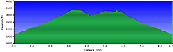
4.5 hours with half hour for lunch
2,400 ft
 Topo Hike Trails Map (PDF) Topo Hike Trails Map (PDF)
Ewing, VA Weather Forecast
Garmin (GDB), Gaia/Trails App (GPX) (What's
this?)
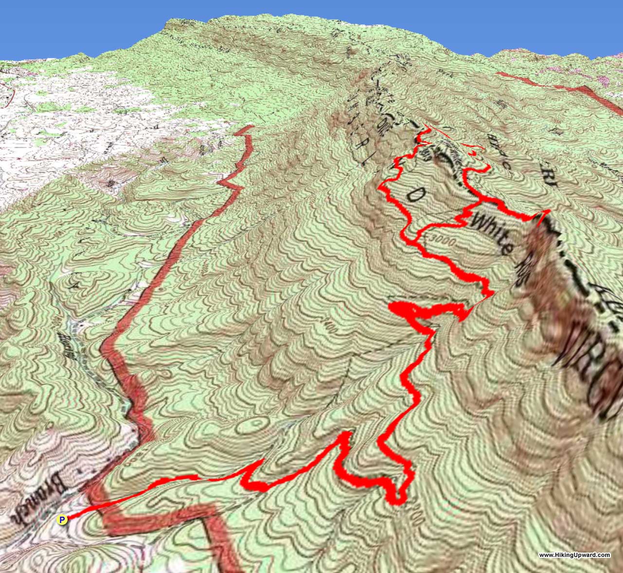
3D
View of Route |
 By Trail Contributor: Jeff Monroe (Email Jeff) By Trail Contributor: Jeff Monroe (Email Jeff)
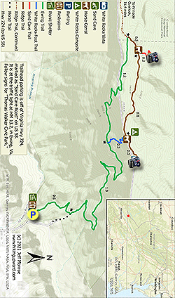
The Cumberland Gap National Historical Park is located at the far southwestern point of the Commonwealth of Virginia, where three states meet: the southwestern tip of Virginia, the southeastern corner of Kentucky, and northeastern Tennessee. This area is a long way from much of the rest of Virginia, and is further west than Detroit, Michigan. Although most of the park is centered near the Gap where the state boundaries intersect, this hike is located on the opposite side of the park. If you decide to make this hike an overnight backpack, you will need to drive to the Visitor’s Center in Kentucky to obtain a free permit. There is also a wonderful and inexpensive car campground about five miles west of the trailhead on U.S. 58.
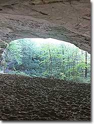
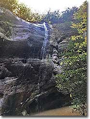
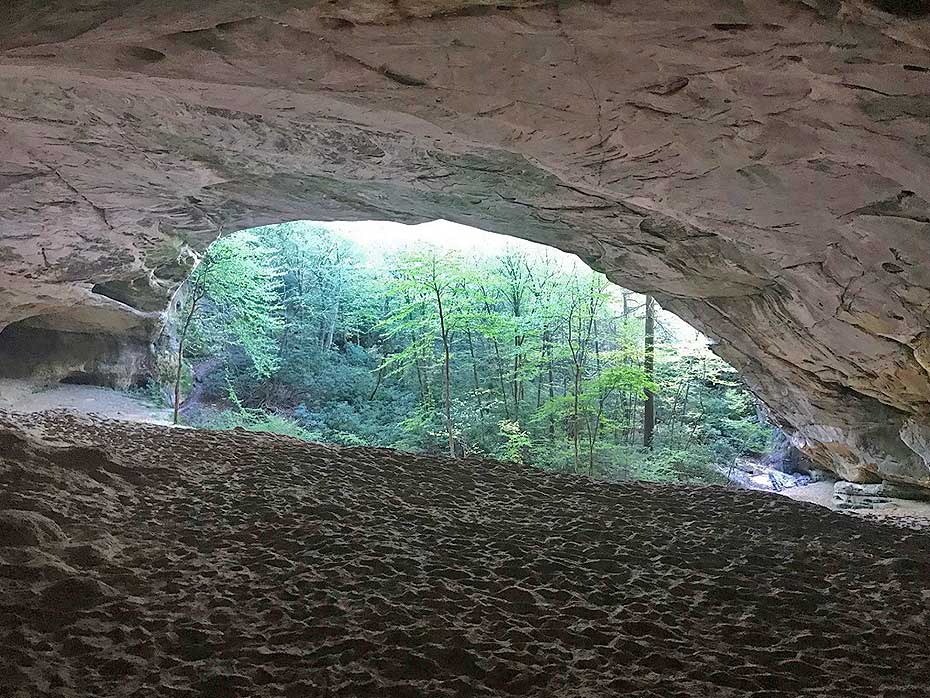
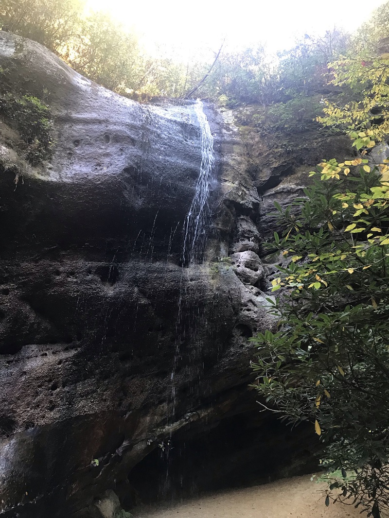
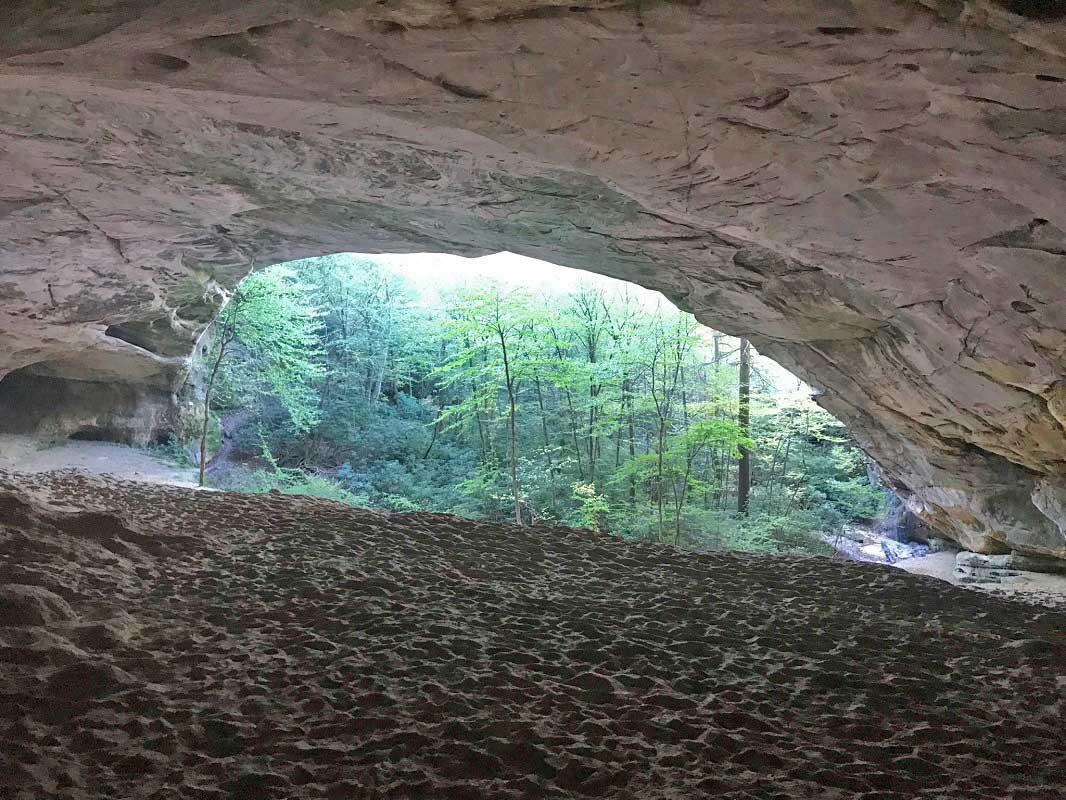
The hike described here is primarily located in Virginia, however one of the attractions is located over the Kentucky border – Sand Cave. Water did not create Sand Cave - it is a wind cave, which means that wind sculpting the sandstone formed the cave. Even so, it is an impressive landmark and you should not pass it up. A high, thin waterfall next to the cave adds to the experience.
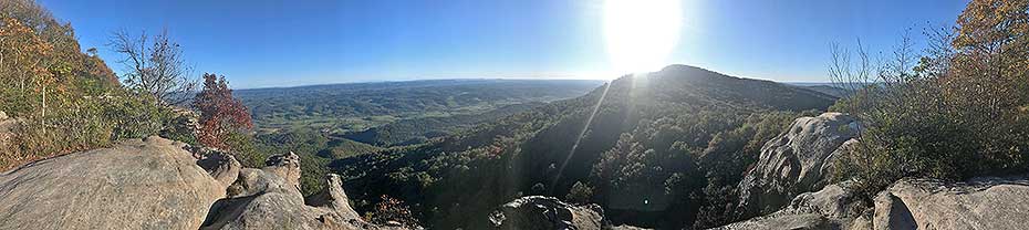
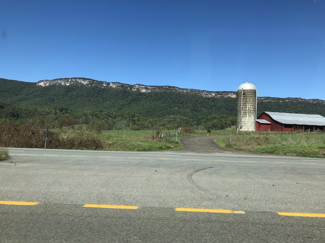
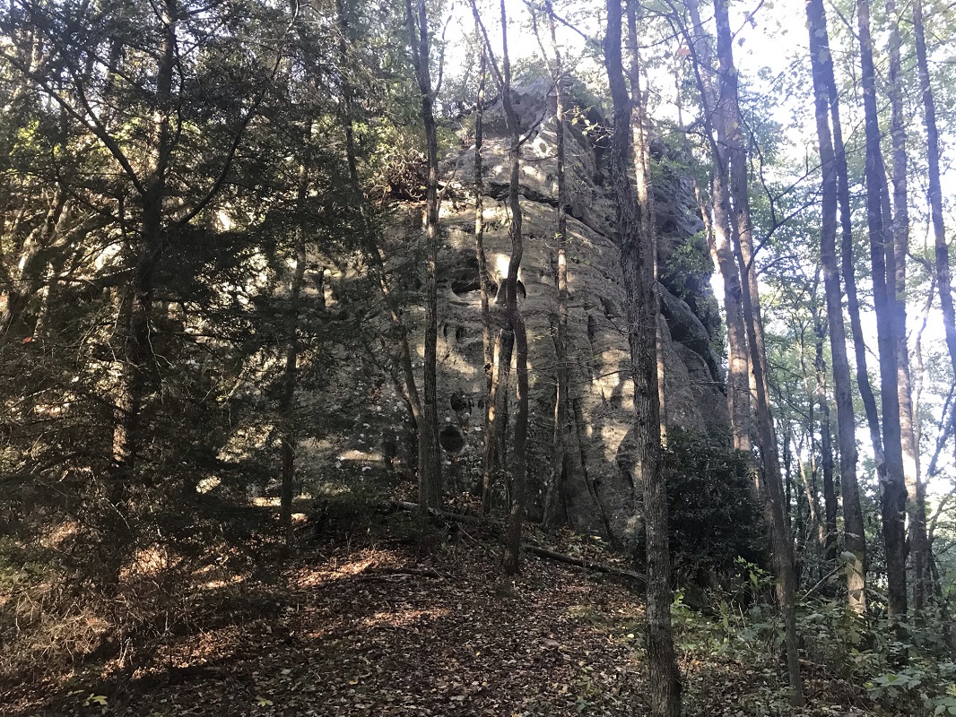
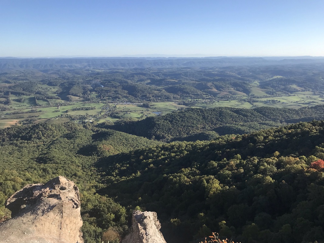
This hike also features spectacular views from the summit of White Rocks, about a mile away from Sand Cave. The White Rocks formation is a very visible landmark as you drive U.S. 58, and the views from the summit are breathtaking. Visiting both Sand Cave and the vistas from White Rocks in a hike that is less than nine miles long makes this one of the most outstanding hikes in Virginia, even if parts are in Kentucky!
-
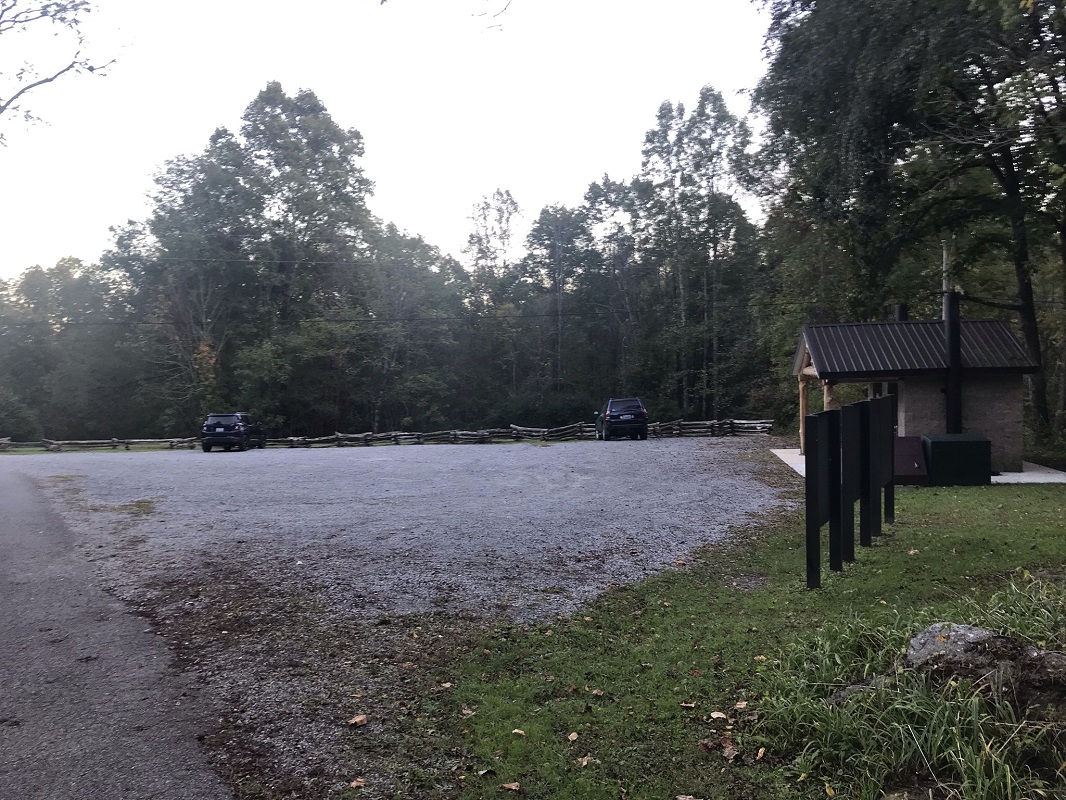
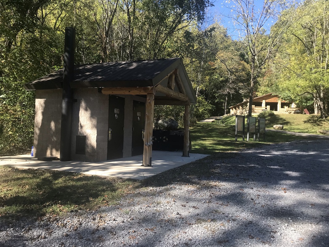
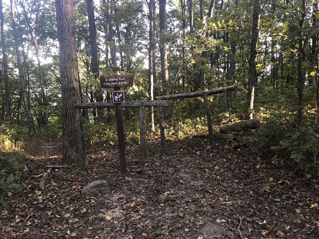
Mile 0.0 – Start the hike at the Thomas Walker Civic Park Area. There is a sign for the park on U.S. 58, along with the Ewing Trail. The hike starts at the Civic Park, and the drive from U.S. 58 features some colorful views– the National Park Service cannot be happy! There is space for about 15 cars in the parking lot, and facilities there include privies and a picnic pavilion next to the parking area. Start up the trail by walking between the picnic pavilion and the privies. Just behind the pavilion is the trail with a trail sign, and just beyond that, a sign indicating that the trail briefly travels though designated wilderness.
-
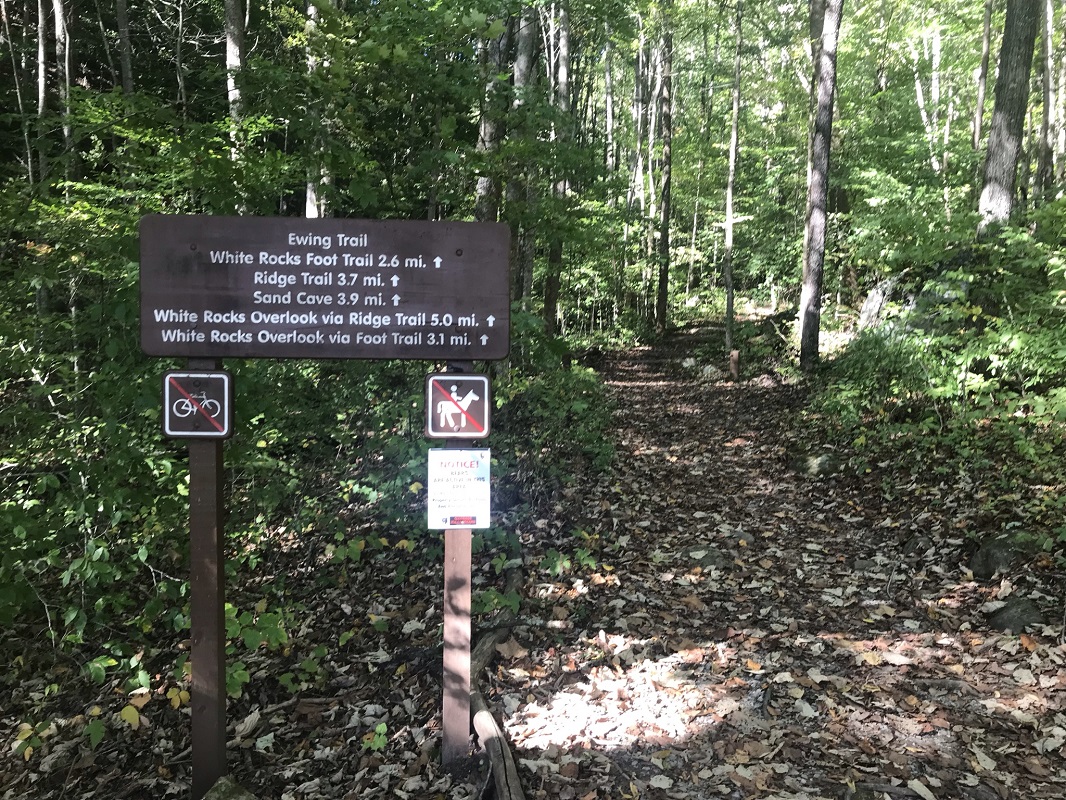
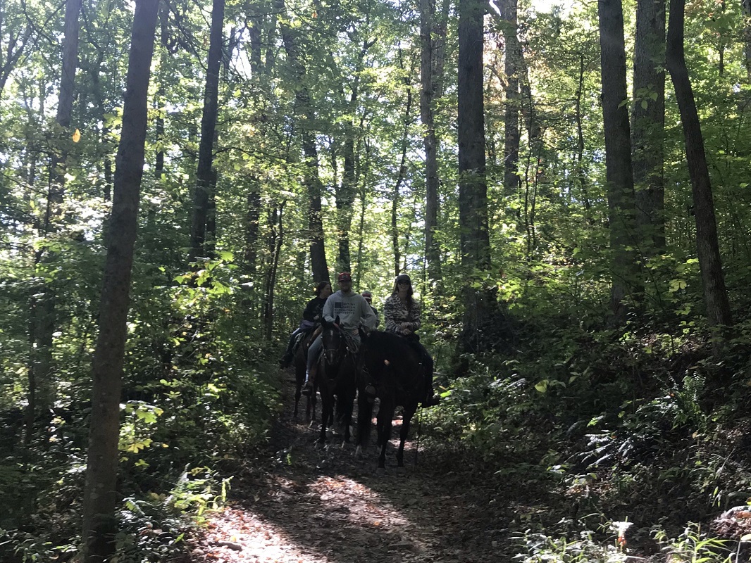
Mile 0.6 – The trail comes to a T intersection at the Ewing Trail, marked by a trail sign. Take a left onto the Ewing Trail - an equestrian trail - heading uphill. The hike up to this point had prohibited horses and bikes. To the right, the trail descends to the horse trailhead, which is near the civic park where this hike started. The Ewing Trail ascends through woods over the next 2.7 miles at a very consistent grade – about 11% - ascending from 1875 feet at this intersection to 3400 feet when it reaches the ridge. Because this is a horse trail, parts of the trail are very rocky.
-
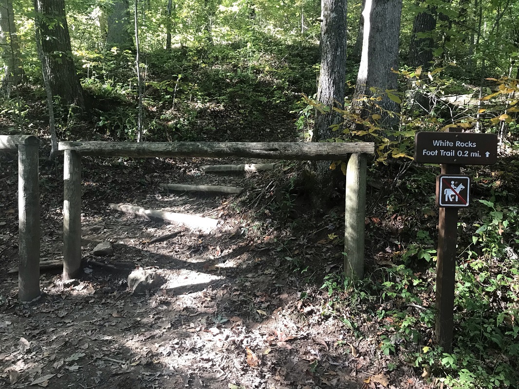
Mile 2.5 – A trail sign signals the intersection between the Ewing Trail and the lower end of the White Rocks Foot Trail. Use this if you wish to skip the Wind Cave portion of this hike, but this description continues straight on the Ewing Trail and later descends via the White Rocks Foot Trail. Because the White Rocks Foot Trail prohibits horses, there is a gate keeping horse traffic off that trail.
-
Mile 3.2 – After a series of switchbacks, reach the top of the ridge. At 3400 feet, this is actually the high point of this hike, as the trail drops nearly 500 feet to reach Sand Cave, and then does not make up all of that loss when it climbs to White Rocks at 3380 feet.
-
Mile 3.6 – Pass another wilderness boundary sign.
-
Mile 3.7 – The Ewing Trail ends at the Ridge Trail. Go right on the Ridge Trail toward Sand Cave. To the left, the Ridge Trail continues 15.4 miles to the Pinnacle Overlook, just above Cumberland Gap.
-
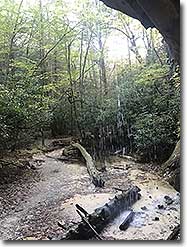
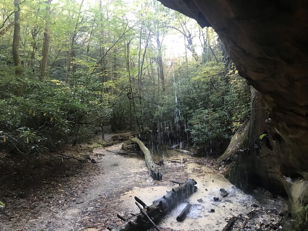
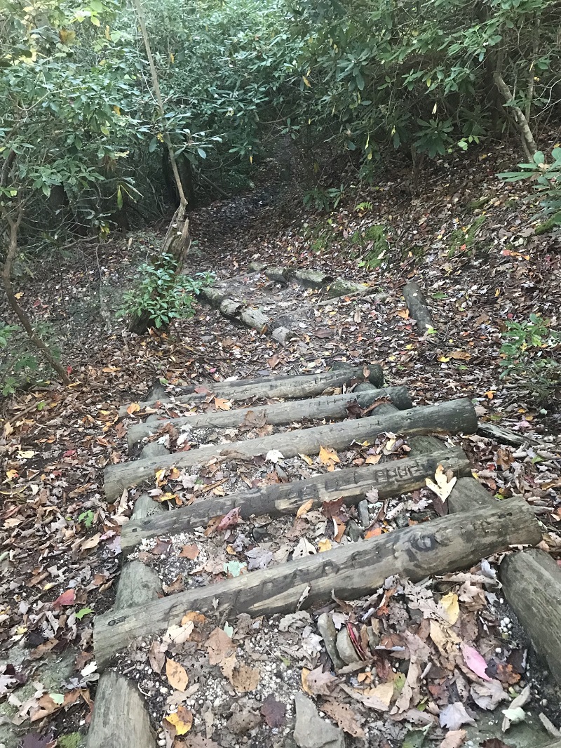
Mile 3.9 – The Sand Cave trail cuts left, marked by a sign and posts to tie up horses, which are not allowed further on the trail to Sand Cave. From this intersection, the trail to Sand Cave drops steeply. There is an unsigned fork after about a tenth of a mile, and, while either fork will reach Sand Cave, the fork to the left is the better option when hiking toward the cave as it takes you past a waterfall on your way to the cave. Descend via slippery-when-wet log steps.
-
Mile 4.1 – Descend past a small stream, cross, and come to the waterfall. During dry times, the waterfall may be nearly nonexistent, but if conditions have been wet recently, this waterfall is an amazing sight. You can even walk behind it.
-
Mile 4.2 – Behind the waterfall is the Sand Cave, which involves climbing a sand dune in order to get to the back. The area under the ledge forming the cave is football field-sized big! Be sure to go to the very back and let out a yell. To return to the Ridge Trail via a loop, head left as you look out from the back of the cave, and follow the cliff line along the sand until you come to a trail in the trees. This trail reconnects with the trail to the Ridge Trail, heading uphill.
|
-
Mile 4.5 – Return to the Ridge Trail and take a left, which takes you through the woods past some interesting rock formations.
-
Mile 5.3 – The upper end of the White Rocks Foot Trail is on your right, and to the left is a trail that leads 0.2 miles to the White Rocks Campsite. I did not hike to the campsite, but the National Park Service website indicates it has a capacity of 12 campers and is located at Lat: 36.668766, Long: -83.447508. The NPS requires a free permit to camp.
-
Mile 5.4 – Pass an area to tie up horses, which are not permitted beyond this point. Follow a much smaller trail by continuing in the same direction. The trail cuts to the left of some rocky bluffs, and then climbs steeply between rocks.
-
Mile 5.6 – Reach the summit of the area known as White Rocks. From here, there is an unimpeded view to the east and south with views to North Carolina and the Great Smokies, including Clingmans Dome, the second highest peak east of the Mississippi – over 75 miles away.
-
Mile 5.9 – Return via the trail you ascended to White Rocks, pass the horse corral, then take a left onto the White Rocks Foot Trail, past a fence blocking horses.
-
Mile 6.2– The White Rocks Foot Trail ends at the Ewing Trail. Take a left on the Ewing Trail and descend off Cumberland Mountain.
-
Mile 8.1– Leave the Ewing Trail onto the foot trail back to your vehicle. Although marked with a trail sign, as of this hike the sign only faced in the other direction. Be aware and look for the trail and sign to your right as you descend.
-
Mile 8.7 – Return to the trailhead parking lot.
|


