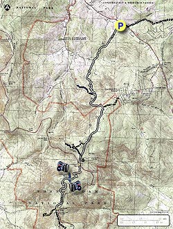
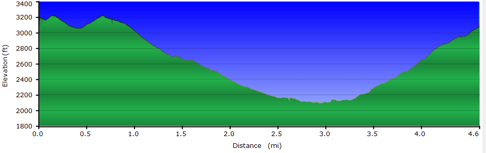
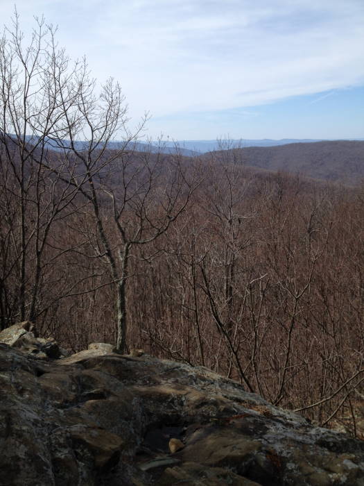
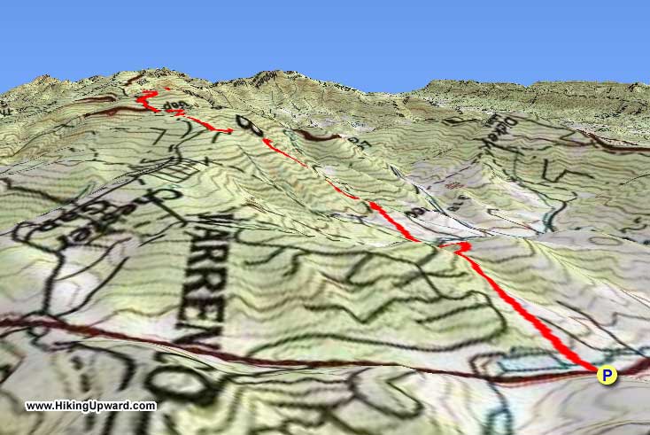
Chester Gap to Jenkins Gap completes the last section of the Appalachian Trail in the Northern Section of Shenandoah National Park. This is a tough climb up from Route 522, gaining about 2900' but there are some great views at Possum Rest, Compton Peak and an awesome Basalt Column Rock formation on the east overlook of Compton Peak.
We did this as a shuttle hike but with a twist, one group started from Jenkins Gap, one from Route 522, and then we traded keys when we met on the trail. If you have a big enough group (we had 8), this is a cool way to get in a point-to-point hike. Park at Compton Gap for a short version to Compton Peak and the Basalt Columns.
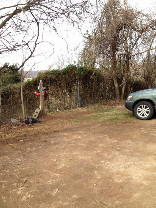
Our group of 4 did the hike from Route 522 (Chester Gap) to Jenkins Gap (MP 12.5) so that is how we will describe the hike. The White-Blazed AT heading South begins directly at the rear of the Route 522 parking area.
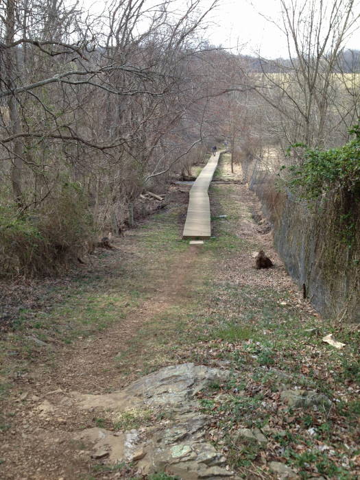
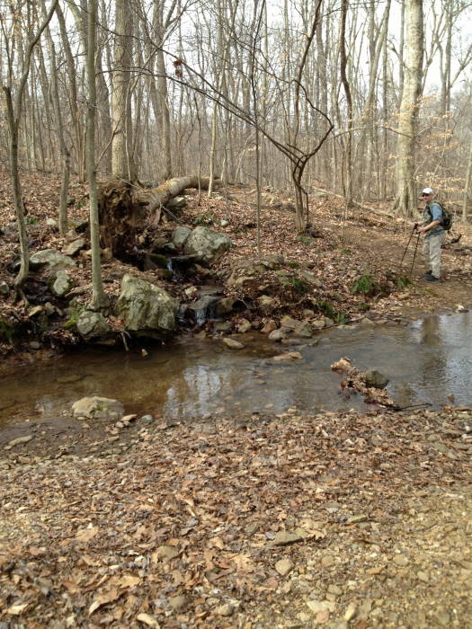
Mile 1.4 – Head south from the Parking area to Joy Spring Rd. There will be a tall metal fence for about the first mile. Just after crossing the road you will cross a small creek.
Mile 2.0 – Intersection to 4H Center will be on the right.
Mile 2.6 – Intersection to Route 601 Harmony Hollow, blue blazed trail.
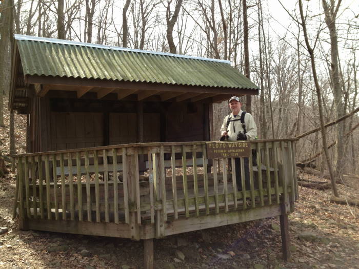
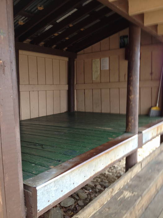
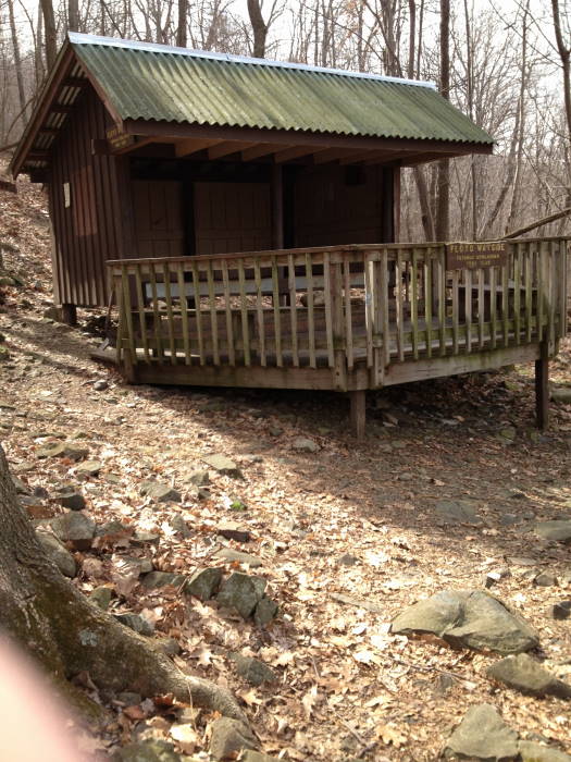
Mile 2.9 – Spur Trail to Tom Floyd Wayside Shelter. From Route 601 to the shelter are 2 seperate trails leading to the same Spring and to a small campsite at the first sign.
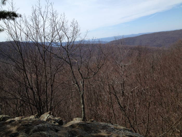
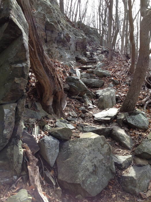
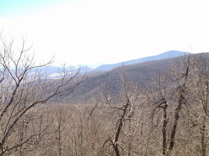
Mile 3.6 – Possums Rest Overlook. Lots of work on this section of the trail up to the overlook, thanks PATC trail maintainers. This is a nice overlook, worth a stop just prior to entering the boundary to SNP.
Mile 3.8 – Intersection with Compton Gap Trail, Trail is both Yellow and White-Blazed. You can make good time on this section through to Compton Gap Parking as it is pretty level and wide.
Mile 5.0 – Intersection with Spring House Road on the right, yellow blazed trail bears to the right onto this.
Mile 5.3 – Intersection with Dickey Ridge Trail. Fort Windham Rocks are just up the trail a little ways on Dickey Ridge Trail, supposed to be nice, we did not go due to time.
Mile 5.5 – Compton Gap Parking - MP 10.5, cross Skyline Drive to head to Compton Peak on the AT.
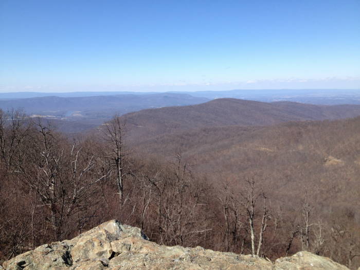
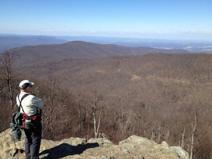
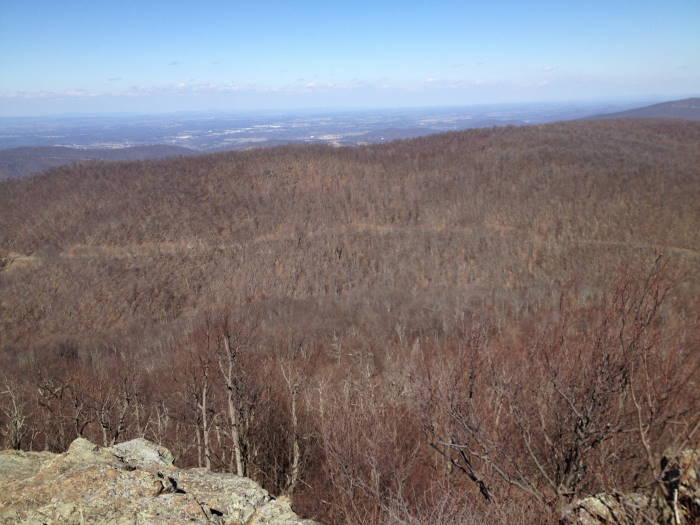
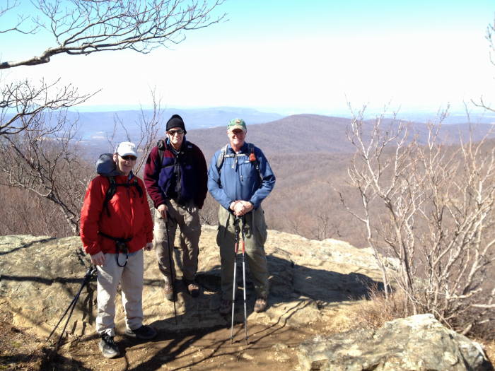
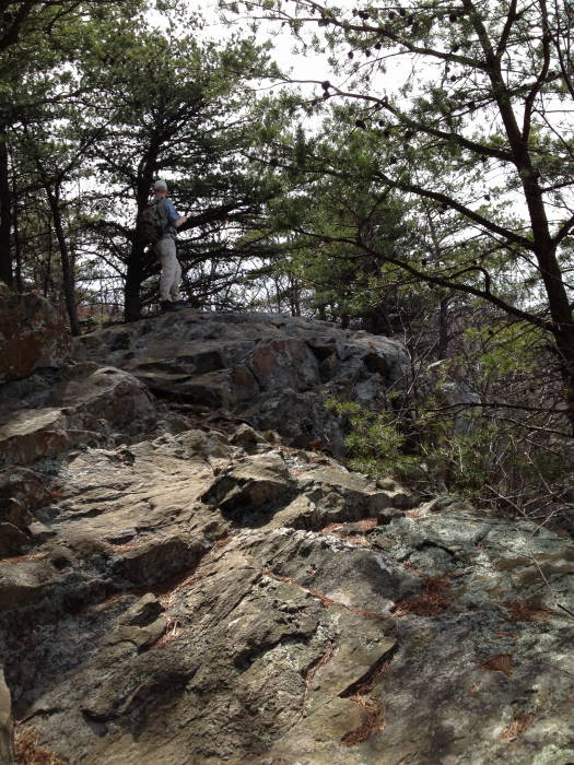
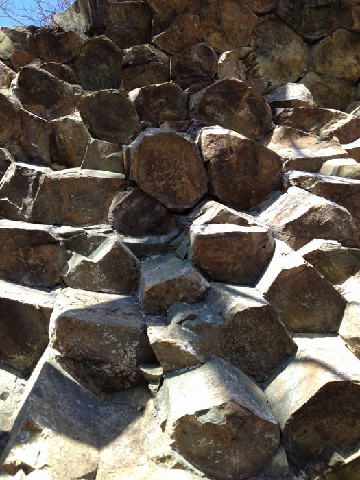
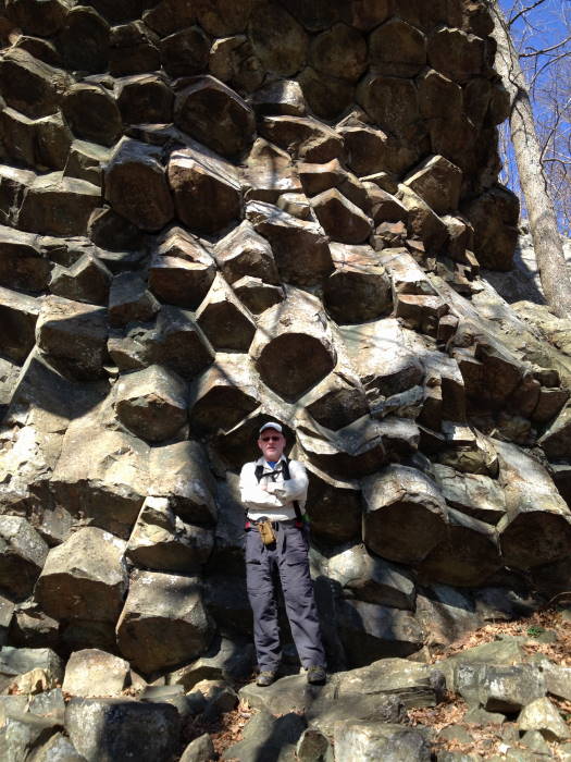
Mile 6.4 – Compton Peak intersection, blue blazes. To the right is an overlook to the west, to the left is an overlook to the east with the Basalt Columns. These are out and back trails.
Mile 7.0 – East Overlook and Basalt Columns, really wild rock formation. Search for “Giant's Causeway” in N. Ireland for a grander display of this same type of formation. Return to Intersection and bear left onto the AT
Mile 8.4 – Intersection to Jenkins Gap Parking spur trail, bear left.
Mile 8.5 – Jenkins Gap Parking
Mid
March
Chester Gap/Jenkins Gap Hike Comments
Archived Comments
By:Suzanne
Rating:
Date of Hike: Sunday, July 9, 2017
Got a late start and because didn't want get caught by darkness just went to the intersection with the Compton Trail. Possum Rest Overlook pretty much obscured by trees this time of year. I'm sure it's spectacular in the Fall/Winter. Saw 2 bear cubs right after Possum Rest, and a through hiker saw a cub in the area from Spring Road to Possum Rest.
I'll do this hike again, probably in the Fall.
By:KYboy
Rating:
Date of Hike: Saturday, July 1, 2017
Nice hike. Basalt Columns are great. The 8.5 miles is one way. I "only" did out and back to Compton peak. Lots of AT through hikers. They are so friendly. Many had a story to share.
By:Jimmy
Rating:
Date of Hike: Saturday, June 13, 2015
Did this as an out and back hike, turning around at mile 7 after going out and doing the west overlook and basalt columns. This hike was much more challenging than I originally anticipated and the 90+ degree heat and high humidity didn't help. I disagree with the original rating of 4 for views and would give this somewhere between a 2 and 3 instead. I think that it might be more of a 4 in the fall/winter when leaves have fallen but there are not many views aside from the overlooks at mile 7 and Possums Rest Overlook.
After crossing Joy Spring Rd. at mile 1.4 the trail is gradual up hill and starts getting much steeper with switchbacks as you hit mile 2 all the way to mile 3.6. You can definitely make great time on the Compton Gap Trail and then it is uphill once again after you cross Skyline and head up Compton Peak.
Bring plenty of water if you're doing this in the summer! Overall it was a nice hike but I was hoping for some better views. I can definitely see how this would make for great training if you're planning on transitioning to longer hikes.
By:Bonefixer
Rating:
Date of Hike: Saturday, March 14, 2015
I am going to leave a review here but we went Chester north to Manassas Gap. This takes you over High Knob, on the AT through the protect scenic corridor. Lovely day as the rain held off. There are some grassy balds, similar to Cold Moutain/ Mt Pleasant area with old apple trees. Parkiing on Rt 522 and Rt 55 are easily recognized and plentiful. We saw our first through hiker "flip flopping" from Harper's Ferry to Georgia. Several sources of water and the Denton shelter was quite nice with picnic table and rocking chair. Distance was about 8.5 miles of relatively easy hiking. Enjoy.
By:Kellygirl
Rating:
Date of Hike: Saturday, September 27, 2014
I completed this hike as an out and back, starting from 522 and ending at Compton Peak. The two side on Compton Peak were really cool. It was a beautiful day outside and enjoyed the hike. I didn't find the hike that strenuous but I do believe it was around 14 miles round trip. This is a good hike for people who want to transition to longer hikes.
http://www.meetup.com/hiking-162/photos/12088162/ We started at Compton Gap Parking lot, hit Fort Windham Rocks and then Dickey Ridge. Thought you might enjoy some pictures from Fort Windham Rocks. Great for little kid scramble. We lucked out to see a bear standing in the road on this 70 degreee December day along with hang gliders--ok the hang gliders were not standing in the road, but you'll see that when you check out our pictures.<
By:M. Greene & BMW
Rating:
Date of Hike: Saturday, April 28, 2012
We did this hike as an out and back hike. By the time we were done, the GPS gave us 16.75 miles in 7 hrs 28 min. We started out on route 522 parking and hiked the entire trail all the way to Jenkins Gap following the map. We also went a little further on Skyline Drive to the Jenkins Gap Overlook to take some pictures, which is where our turnaround point was. We then headed back down the trail, to the Route 522 parking lot. We did not do the east and west overlook again but did add the 4H Center hike on way back that was just over ½ mile out and back. When we got back to the parking lot we also kept going just a little past the parking area crossing the street and heading north on the AT just to give us the 16.75 mile finish. We started at 10:15 and the parking area was just about full we had to squeeze in a small grassy area that most likely was not meant for parking. This was an enjoyable Spring hike with a wide variety of wildflowers everywhere, the few waterfalls were nice, and the shelter and 4H Center were very welcoming and well taken care of. We rate this hike as a 5 star only because we did it as an out and back which made it more of a challenge.


