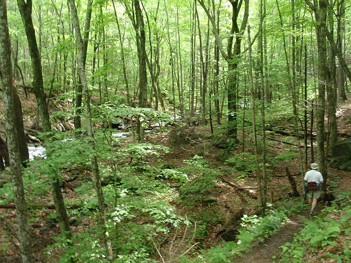
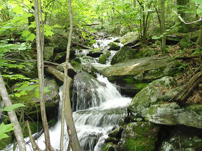
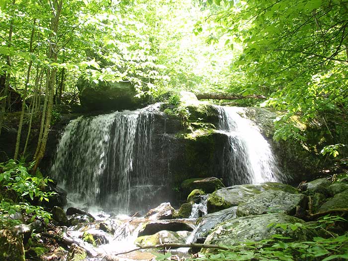
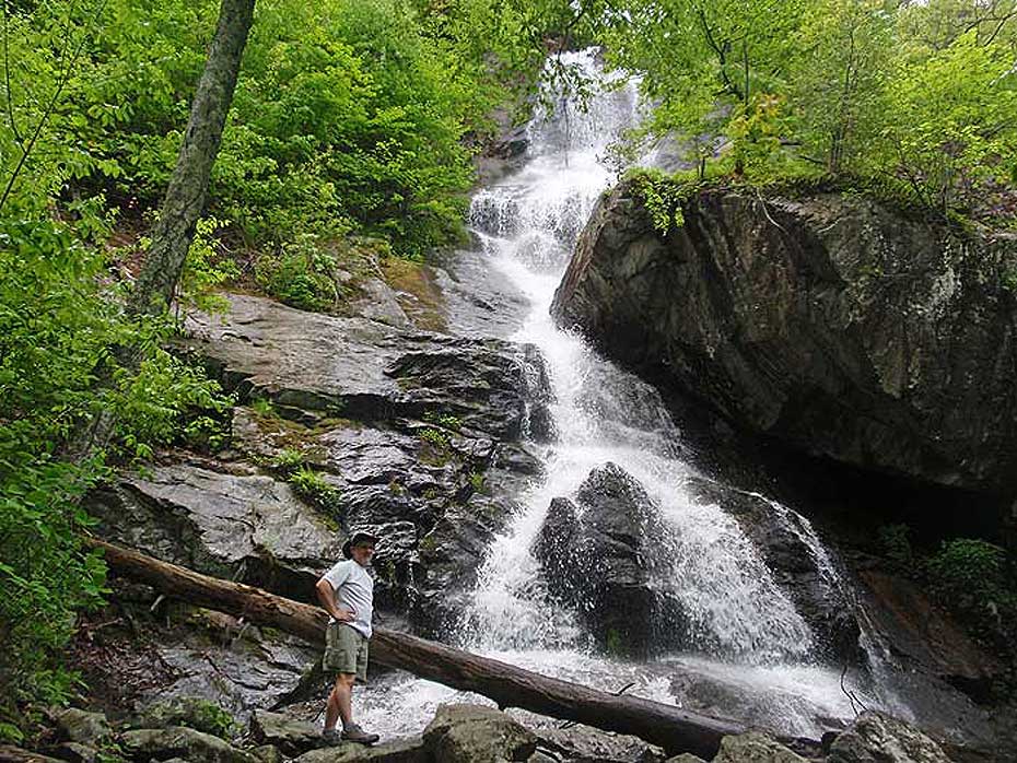
Are you looking for a hike with lots of streams? If so, this is a hike you should do, and is one of the most popular hikes in the Jefferson N.F. You will either be right next to streams or within sight of a stream for about 90% of this hike. The highlight of the trail is the 200’ Apple Orchard Falls with a very nice viewing area constructed by the Forest Service in 2000. Shane “The Mountain Lab” joined us on this hike and true to Lab nature, he was wet most of the trip!!
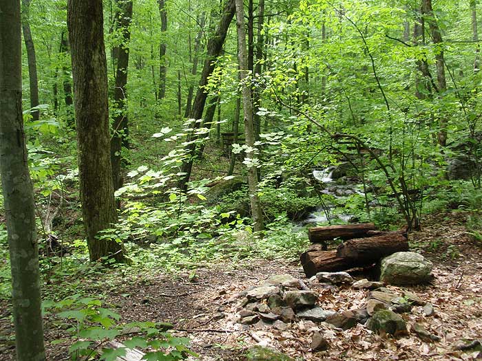
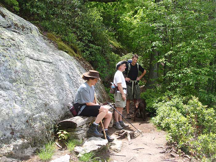
There are some great camping spots within the first mile of the trail and a really good one near the end of the Cornelius Creek Trail just prior to the parking area. For such a short hike it has some of the best stream views of any hikes we have done in Virginia.
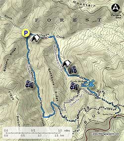
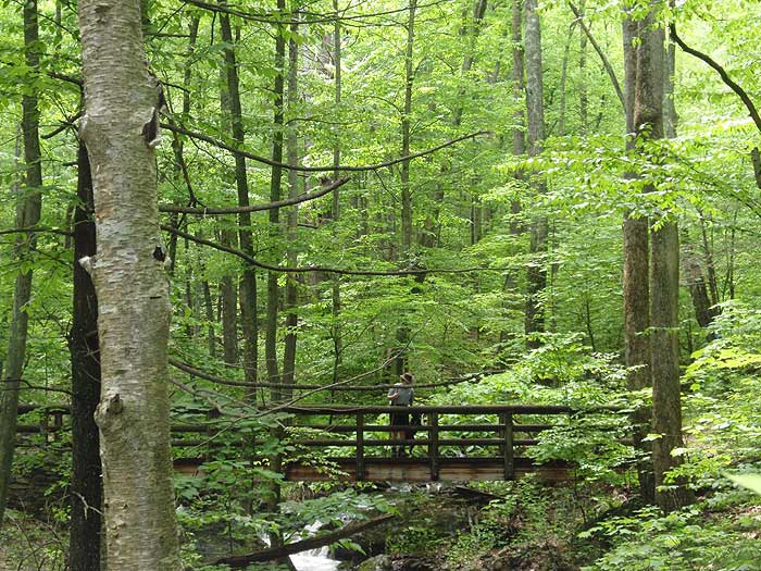
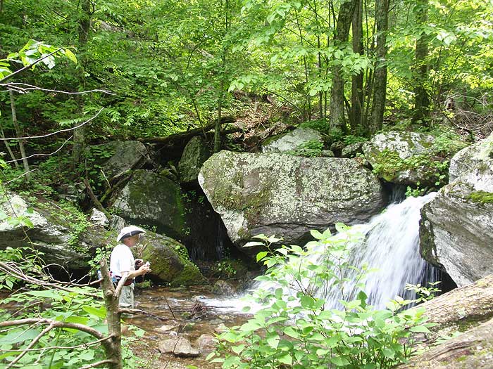
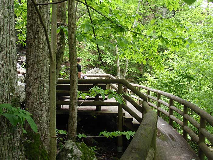
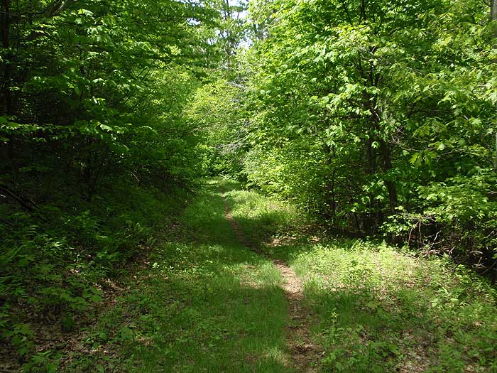
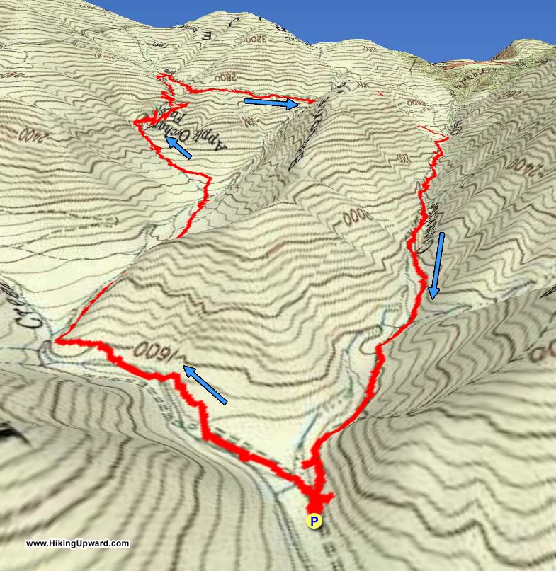
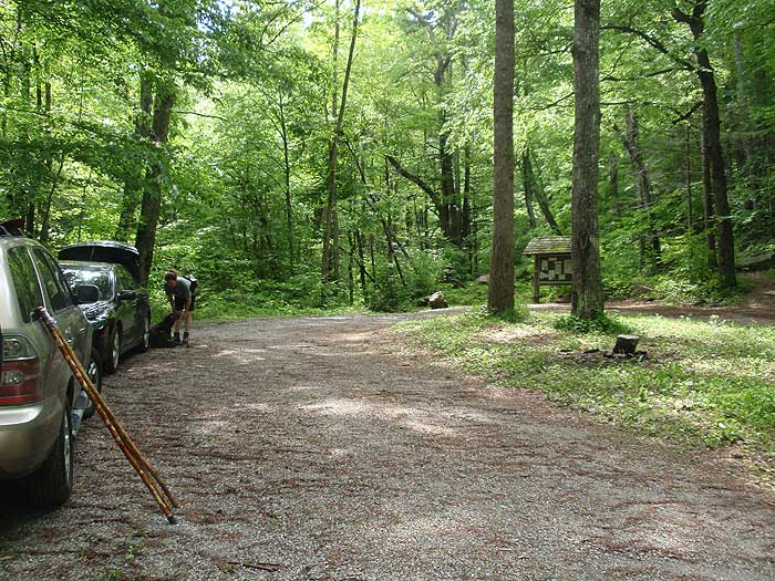
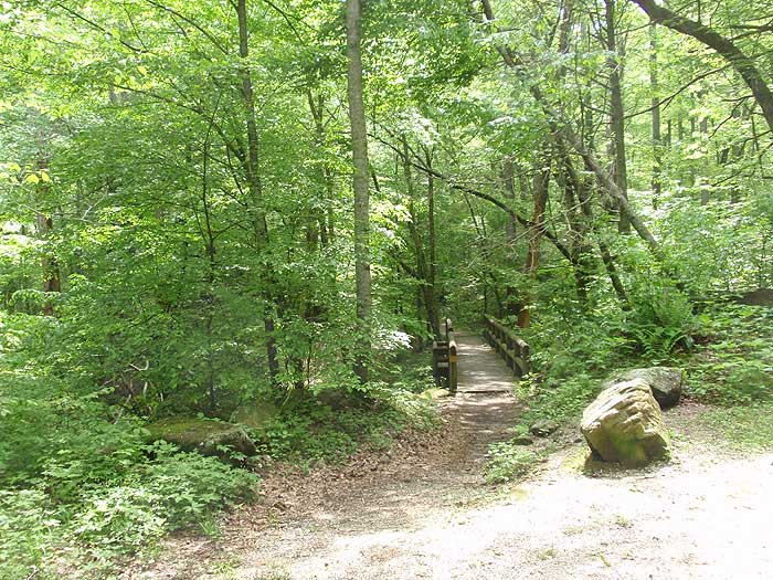
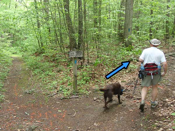
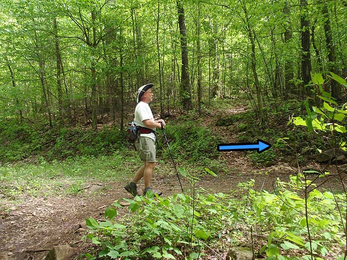
From the parking area take the bridge to the left of the kiosk to begin the hike on the blue blazed Apple Orchard Falls (AOF) Trail. In 0.2 miles you will come to an intersection, bear right and stay on the AOF Trail. About 1.0 mile later you will arrive at two bridges and another campsite, take the 2nd one over the creek continuing up on the AOF trail. The next 0.75 miles starts climbing more steeply until you reach Apple Orchard Falls. You will want to stop here and have lunch and get some good photos of the Falls.
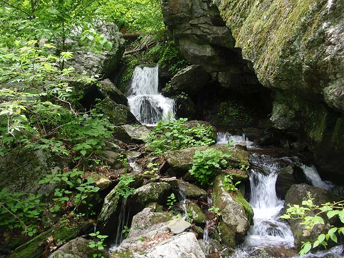
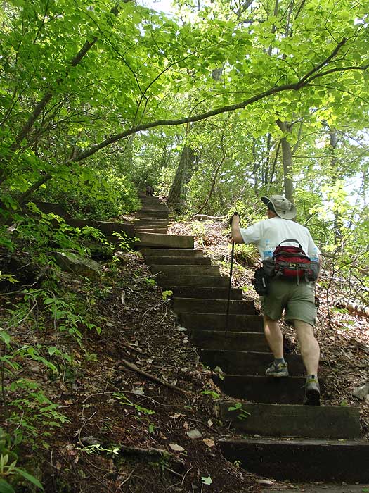
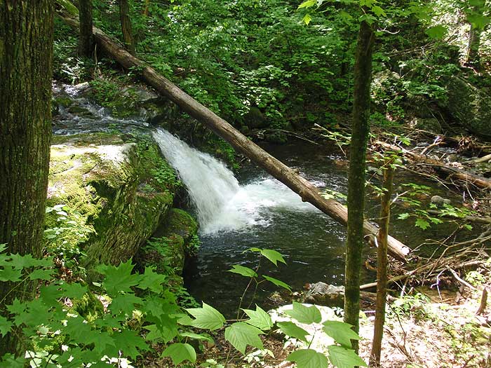
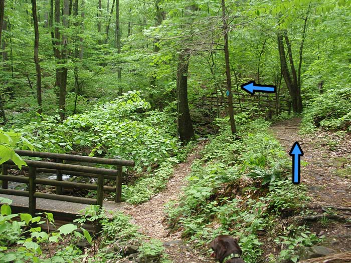
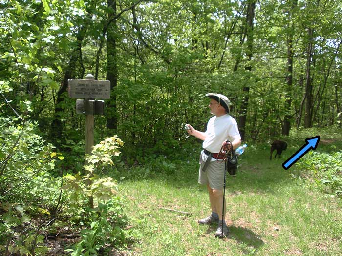
Beyond the Falls you will start to climb a series of wooden stairs coming very quickly to the only overlook with a wooden bench of the whole circuit, and just beyond that another small waterfall. Go another 0.3 miles to the intersection of the Apple Orchard Falls Road (a seeded fire road) and take a right. Follow it 1.0 mile to the blue blazed Cornelius Creek Trail. The Fire Road bears to the right but stay straight to go on the Cornelius Creek Trail.
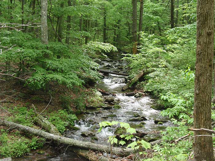
Follow the Cornelius Creek Trail for 2.2 miles to the parking area. The trail follows Cornelius Creek and will include two crossings. The creek was flowing well on our trip and made for difficult crossings and some wet feet. There are also some very good swimming holes on the way down. There are multiple places you will want to stop and take photos of the creek flowing over the rocks.
Warning: Be careful of the plentiful stinging nettles near the creeks and ticks on the fire road.
Note: An alternative parking area if all you only want to see the Falls is at Sunset Field, near Milepost 78.4 on the Blue Ridge Parkway. It is approximately 1.5 miles down to the Falls from Sunset Field.
Mid May
Apple Orchard Falls
Apple Orchard Falls Hike Comments
Archived Comments
By:Stephanie
Rating:
Date of Hike: Saturday, October 28, 2017
My husband, myself and our 2 dogs hiked this trail. We had a great time although the elevation was pretty tough at some points. We did see some snakes along the trail. The falls were beautiful and if you go further up there's a beautiful view of the mountains. We were on the trail mostly by ourselves until we got closer to the falls.
By:Jeff
Rating:
Date of Hike: Wednesday, August 24, 2016
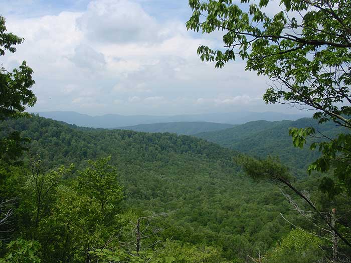
This hike punches above its weight in difficulty, but is worth the work! We set out from the upper trailhead (Sunset Field, on the BRP) around 8:30 intending to hike this loop clockwise, with a small detour. From the intersection of the AT and Cornelius Creek Trail, we continued Southbound on the AT for just over a half mile, up a modest hill, to the Black Rock Overlook. I think it offers a better view of the valley than anything you'll see on the loop itself, and is absolutely worth the sidetrip.
Continuing back along the trail, we found the descent along Cornelius Creek Trail to be a leg-burner (this would be a theme for the day) as it was pretty steep, prolonged, and had plenty of cobble-sized stones to mess up your footing. Hiking along Cornelius Creek was lovely, with an abundance of swimming holes, shelfs, cascades, etc. There were a few large-ish trees down across the trail here, but nothing we or the dog couldn't navigate.
Heading up Apple Orchard Falls Trail was less remarkable both in views and character until we got closer to the falls. The trail steepens considerably below the falls, so we took a long break for water and snacks at the platform there. Following this, it was 1.5 miles back uphill to the trailhead. We'd hiked down the falls and back before without any complaint, but doing the same trail after 7 miles is a much harder story. A very worthwhile hike, but not as easy as you may think looking at the mileage and elevation if you're hiking from the top.
By:Shawn R.
Rating:
Date of Hike: Saturday, January 9, 2016
This is a wonderful hike which is alongside of a creek a majority of the way. We went on a day which was very foggy and cool which meant two things: no other people and no view(s). Although we weren't able to see anything where the overlook was, this was still a phenomenal hike. There were a couple of areas which could be used as swimming holes during much warmer weather. Also, there were two areas with creek crossings that almost guaranteed some wet feet.
It's important to note that it is fairly easy to get "lost." We had to retrace our steps a couple of times. The blazes were spread out far too much and at one point misleading. There was a blue blaze on a tree on what looked like where the trail could go, but it turned out the trail kept going a different direction which had no blazes. This trail then led to fire road. From there it was fairly straightforward. Just keep walking on that road until you reach a sign which will lead you in the right direction.
Despite needing to backtrack a few times the hike only took a little more than 4 hours with several small breaks to enjoy the falls.
By:Lostgypsy
Rating:
Date of Hike: Saturday, August 22, 2015
Great hike even if I took a wrong turn, which led me covering some of the same trail twice. The falls are beautiful and the walk on Cornelius was quite relaxing with all the solitude.
By:Sterling
Rating:
Date of Hike: Saturday, August 22, 2015
I'm a 61 year old photographer and a moderate hiker. This was a great hike with water everywhere. So many great photo opportunities. A steady uphill trek to the Falls with many photo spots of the stream. The hike down the mountain on the Cornelius Creek Trail was very rocky and dry. Upon arriving at Cornelius Creek for the rest of the hike out was awesome with many falling water scenes and several nice pools. Review said swimming holes but water is mountain stream cold and just right for soaking your feet and splashing your face. I will be returning just to do the Cornelius Creek Trail again. Great photos ! I'll add for people with pets that a hikers dog took a 20 foot fall near the small fall above the big falls. It was not on leash and actually seemed ok, hard to believe. The owner put it back on leash and continued on. Great solitude and peaceful hike with lots of water.
By:Adrienne
Rating:
Date of Hike: Wednesday, August 12, 2015
I hiked down to the falls from the Blue Ridge Parkway. We enjoyed the crispness and coolness of the air. It was 85 F in Roanoke that day but it was crisp and cool on the mountain. The trail is completely enclosed in a shade canopy, which is especially good for my heavy coated dog. It was a Wednesday and we saw only four couples on the train during our down and back. I'll be back during the autumn colors!
By:Rob B
Rating:
Date of Hike: Saturday, July 11, 2015
This was a great hike and we hiked the exact path that the map followed. From the parking lot up to the falls, then using the connector road, and down Cornelius trail is actually ~7.5 miles. It's a great hike but be ready for the extra mileage!
By:Mike Quinn
Rating:
Date of Hike: Sunday, May 24, 2015
We started at the Sunset Field Overlook (MP 78.4). Our group: Amy and I our three sons (ages 10, 8, and 6) and our black Lab. The trail is in reasonably good shape. Rocks and roots in spots, but generally good with just one small, narrow, mucky stream crossing with rocks to hop across. If you are reasonably-observant and careful, you can do this trail in running or trail shoes. If you're not, you can trip or tweak an ankle.
A stream parallels the trail for a while, and you'll descend a set of wooden stairs and a wooden bridge and see what shall forever be known to me as "Little Apple Orchard Falls." (More on that later.)
The small waterfall area offers places to sit on big rocks, enjoy the scenery, and take a break. From here, the trail starts to descend quickly and constantly through big stands of rhododendron, intermittent views, and multiple sets of wooden stairs. At some point, the voice in your head will say, "Uh oh. We have to go back *up,* but ignore it because at the base of the falls, there's a very nice wooden platform with benches that offers a great view of the 200' falls.
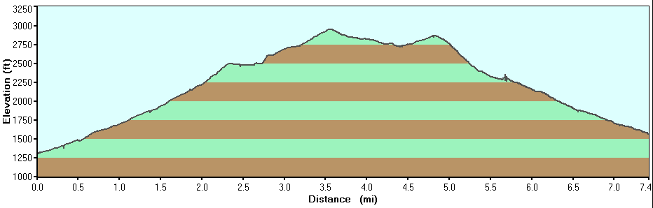
Did I mention that the elevation change from the parking area to the wooden platform at the base of the falls is 1000'? On your return to the parking area, you'll do the wooden stairs, pass the small falls, hit another set of stairs, and then begin a nearly-constant climb back up to the parking area. There are plenty of spots to rest along the way. (Watch for a big rock that looks like it has a bench built into it. On your way back up, the trail veers sharply to the right at that spot and isn't marked very clearly.) If you're hiking with kids, plan on taking a few breaks.
The trail didn't feel crowded, even on Sunday of Memorial Day weekend. It's possible that some folks hit the AT (about .25 from the trailhead) to summit Apple Orchard Mountain. You'll probably see AT thru- or section-hikers taking a side trip to see the falls.
Summary: An easy trail because of its condition, but a tough trail because of the elevation change. Definitely worth the time to see the falls.
Ok, more on "Little Apple Orchard Falls." This was our *second* visit to this trail. On our first trip a week earlier, we got to the stairs and wooden bridge, saw the small falls and a thru-hiker, and just *assumed* that we'd arrived at the falls. After all, if a thru-hiker was stopping to eat and purify some water, this had to be the end of the side trail, right? We took some pictures, marveled at the beauty of it all--and then a couple days later found photos of the *real* Apple Orchard Falls on Google. The decision to go back and do it right came swiftly and with little discussion. It was worth the return trip.
By:Zack
Rating:
Date of Hike: Sunday, April 12, 2015
Note: The fire road is closed to vehicle traffic 2 miles before the normal parking area, so add 4mi to your total hiking distance/time.
By:S.Zanatakos
Rating:
Date of Hike: Sunday, November 9, 2014
I did not enjoy this hike. I found the trail to be very poorly marked in areas. A few markings where misleading and or missing. The ground was fully covered by leaves making it difficult in areas to determine where the trail continues and made it difficult to not twist an ankle. The terrain is very inconstant. The falls where disappointing compared to other VA waterfalls. The Cornelius Creek trail is not scenic at all.. Went through some Bear territory getting back to the parking lot... Took 3.15 hours to do the hike roundtrip and stopping a few times. The series of wooden steps where the highlight of the trail. Wouldn't recommend this hike, at least this part of the year in early Nov. Limited on daylight and easy to get lost, even with the typography map offered here. The trail is clean of trash overall which is always a plus. but the parking lot is down a ways from the campsite. It may have a different aspect in the spring but regardless I Won't be doing this hike again.


