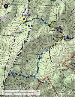
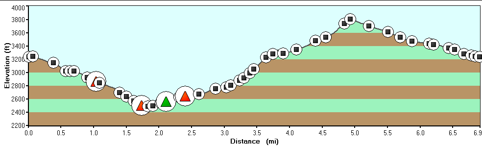
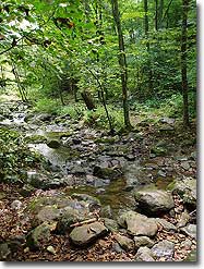
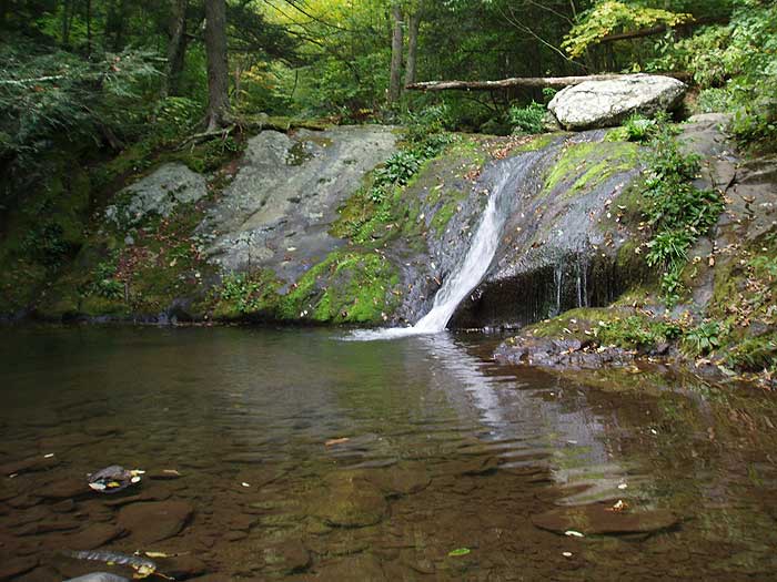
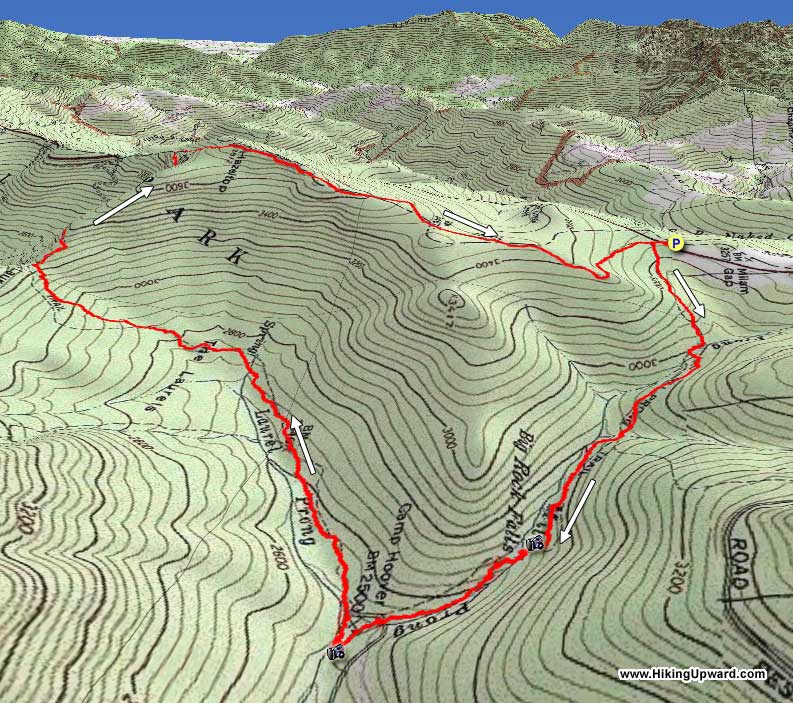
Camp Hoover, also known as Rapidan Camp, is a scenic and historic hike that passes the retreat of former President Herbert Hoover, and First Lady Lou Henry Hoover. The circuit is a moderate hike and passes Big Rock Falls, which is a small pool and stream cascade where the trail crosses Mill Prong.
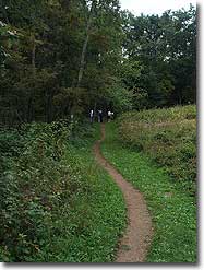
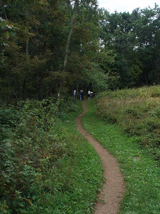
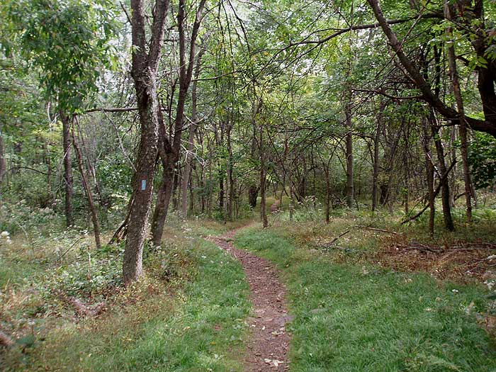
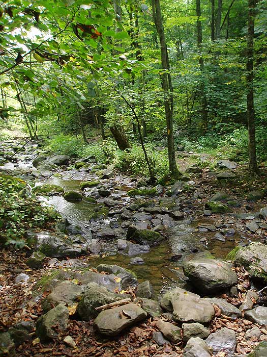
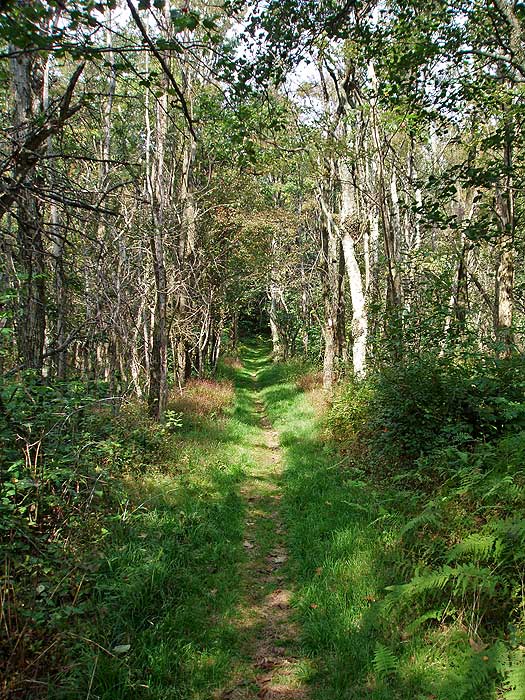
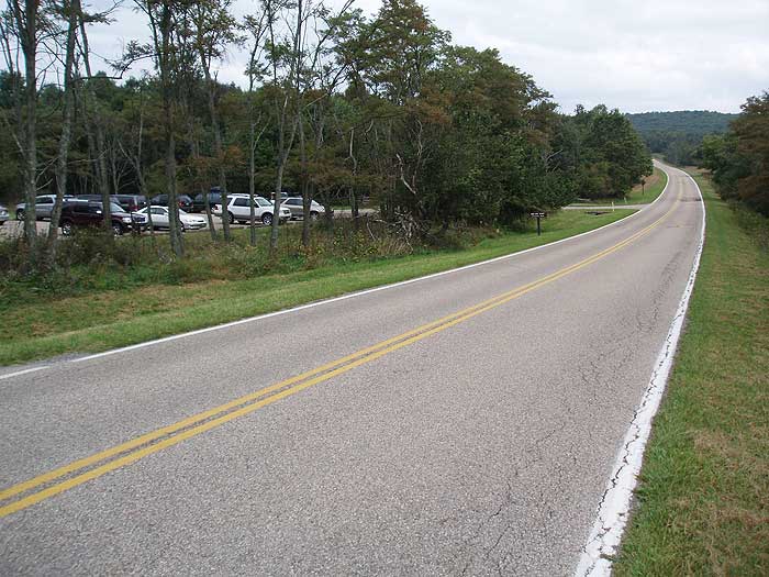
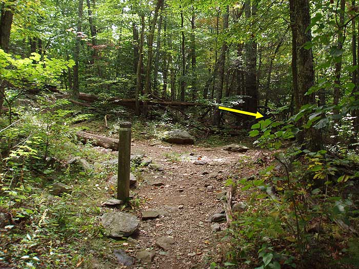
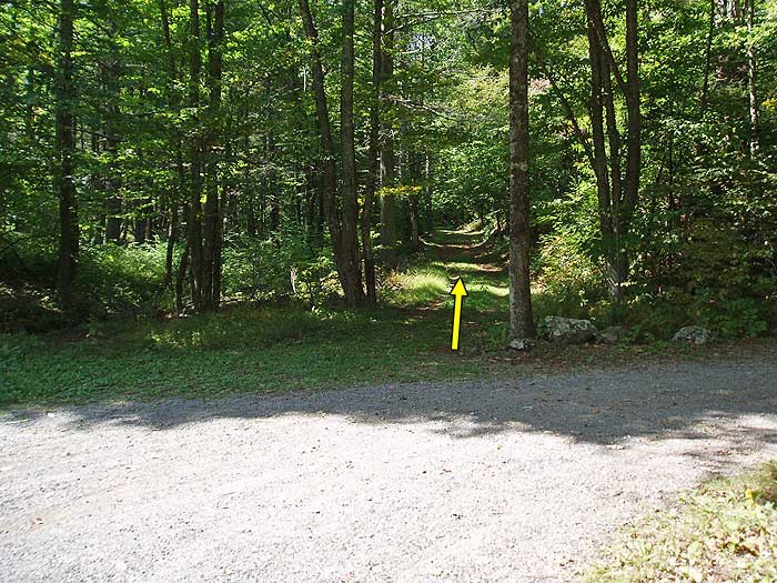
From the parking area at Milam Gap, cross Skyline Drive and follow the white blazed Appalachian Trail (AT) for 100 yards to the intersection of the blue blazed Mill Prong Trail. Turn left downhill on the blue blazed trail as it descends into the valley, then in 0.5 miles crosses Mill Prong for the first time. Continue to follow the trail for another 0.4 miles where it crosses another small creek that feeds Mill Prong, and in 100 yards arrive at the intersection of a horse trail that leads to the Rapidan Fire Road.
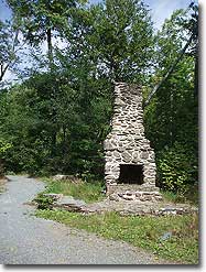
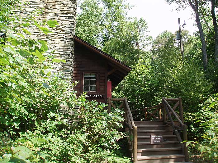
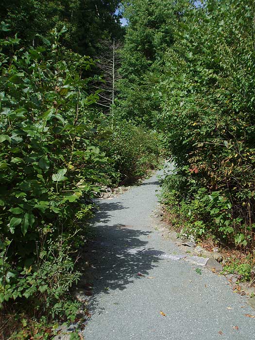
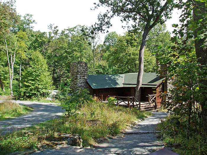
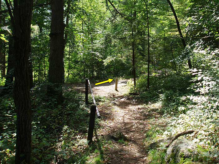
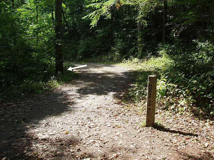
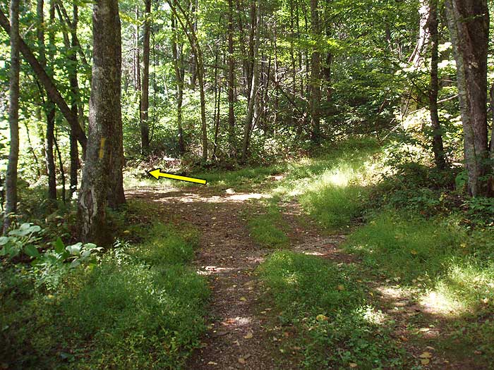
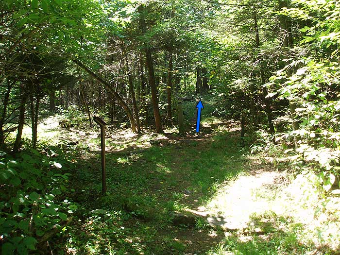
Turn right downhill on the now yellow blazed Mill Prong Trail, from this point to Camp Hoover, backcountry camping is not allowed. In 0.3 miles from the previous intersection, the yellow blazed Mill Prong Trail will cross Mill Prong and pass Big Rock Falls. Continue downward on the trail for another 0.4 miles where the Mill Prong Trail ends at Camp Hoover. Turn right on the access road, then immediately left down the footpath passing "The Creel" house. "The Creel" was occupied by two of President Hoover's chief aids. Larry Richey, a former F.B.I. agent assigned to guard the President who also acted as his personal secretary; and Joel T. Boone Jr., the Presidents personal physician.
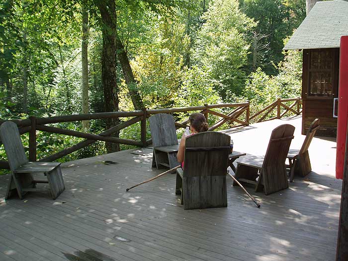
60 yards past "The Creel" house is the presidential main quarters known as the "Brown House". The rear deck on the "Brown House" is a great place to enjoy the same view former President Hoover and world dignitaries enjoyed back in the 1920's. When he left office, Herbert Hoover, and his wife Lou Henry Hoover, donated the land to the government to become part of the newly created Shenandoah National Park.
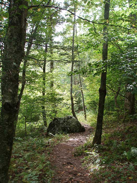
From the "Brown House" continue on the yellow blazed Laurel Prong Trail, that starts at the Camp Hoover turn around. The yellow blazed trail will initially follow an old forestry road for the first 0.4 miles, then the forestry road veers right uphill. Remain left on the narrower yellow blazed trail for another 0.5 miles to the intersection of the yellow blazed Fork Mountain Trail. Stay straight on the now blue blazed Laurel Prong Trail for 0.4 miles, then pass a spring and only good camp site on the hike. Follow the trail uphill for another 0.8 miles to the saddle, and junction of the Cat Knob Trail.
Turn right on on the blue blazed Cat Knob Trail as it continues uphill for 1.1 miles to the intersection of the white blazed Appalachian Trail (AT). Turn right uphill on the AT crossing over the hike high point, and Hazeltop Mountain, in 0.4 miles. From the high point, the AT now heads downward for the remaining 2.3 miles back to Skyline Drive, and the Milam Gap parking area.
Mid September
Camp Hoover Hike Comments
Archived Comments
By:Bret
Rating:
Date of Hike: Tuesday, August 22, 2017
I had hiked to Camp Hoover from Milam Gap as an out & back in June but wanted to do the full loop. The hike down Mill Prong is enjoyable with the stream close he majority of the decent. The first stream crossing is my favorite with water flowing around a tree surround by moss covered rocks. It has a surreal feel and I expect gnomes to peak out around the rocks. Big Rock falls while not large is a relaxing place to take a short break before continuing to Camp Hoover. The day I stopped at the camp the gentleman at he camp was very knowledgable about the history of the camp I stayed longer then planned but was worth the time. After the camp I headed up Laurel Prong which is a lovely hike crossing many streams and springs. Continuing on to the AT I came across and overlook just past the summit of Hazeltop Mtn. The view was reminded why I enjoy the hike and was the perfect place to recharge while enjoying a snack. I only encountered a few hikers, mostly on the AT. Overall great solitude, some nice streams and a new favorite in Shenandoah.
By:Steve
Rating:
Date of Hike: Tuesday, October 25, 2016
This is one of the more picturesque hikes on this web site. A volunteer was at Camp Hoover giving an interesting presentation. The other reviews cover main points well. My main point in this review is to note that, in the description, I think the fifth paragraph, starting From the Brown House may be incorrect, confusing the yellow and blue blazed trails. I think this can be verified from the map. I suggest a rewritten version as follows (if I am wrong please correct me): From the Brown House continue on the yellow blazed Laurel Prong Trail, that starts at the Camp Hoover turn around. The yellow blazed trail will initially follow an old forestry road for the first 0.4 miles to an intersection where the forestry road veers left downhill. Turn right on the narrower blue blazed Laurel Prong Trail for 0.4 miles, then pass a spring and only good camp site on the hike. Follow the trail uphill for another 0.8 miles to the saddle, and junction of the Cat Knob Trail.
By:EllieMierz
Rating:
Date of Hike: Saturday, September 19, 2015
This was my first overnight backcountry camping experience and it was a great loop to do it on! We started on Saturday at 9:30 am from Milam Gap parking, and went the Laurel Prong trail first instead of the Mill Prong. I would recommend this route. The AT stretch was not strenuous with a lovely lookout. It was not busy.
We set up camp at about 1pm on the Fork Mountain Trail next to the stream where there was a perfect spot for a small tent and good places to hang our bear bag. Once we set up camp, we headed the .5 miles to Camp Hoover at 4 pm, and were able to speak with the rangers and get a tour of Hoovers getaway. It was a lovely and informative tour that changed my mind about Herbert Hoover altogether! Seemed like a very kind man. It was nice exploring the camp in the dwindling daylight.
We awoke on Sunday morning and set off at 9 am. We allowed ourselves 2 hours to get back to Milam Gap via Mill Prong (2.8 miles) since it was entirely all steep uphill. About .2 miles from Big Rock Falls, we spotted a very large black bear 20 ft. to the left of the trail staring at us on its hind legs. We made lots of noise and blew our whistles and eventually it turned and ran away. Needless to say, we were back at the parking lot by 10 am, practically running the rest of the uphill.
All in all, it was an extremely enjoyable trip. I loved the solitude of the camp, and the quietness of the entire hike. I would definitely do it again as an overnight or a day hike!!!
By:Paul
Rating:
Date of Hike: Thursday, July 16, 2015
Five stars for historical significance and work out...Five stars also to the weather...a glorious day...
Must say that I came across a lazy Rattlesnake on the AT at Hazeltop...waited and waited for it to go...finally it crossed the trail...did not go far at all...must've been full from a meal...ran past him and no more trouble...
There is a side trail to a nice view as you begin your descent back to Milam Gap...only 50 yards so do it.... Especially after the work you had to do to get there...
All together a pleasant hike but understand the climb from Camp Hoover to Laurel Gap is not a walk in the woods...and subsequently up the AT to Hazeltop...
By:Ken D
Rating:
Date of Hike: Wednesday, April 15, 2015
This is a nice hike. It's pretty easy to Camp Hoover and it was nice to have lunch on the deck of the Brown House and stroll around the camp. The Laurel Prong trail was okay with not much to see until it intersects with the Cat Knob Trail. The last half mile or so before the intersection are the toughest of the hike since you gain ~500 feet. After that it's some ups and downs, and the trail is much more fun to walk until the AT. The climb up Hazeltop isn't steep, just constant, and then it's very easy downhill the rest of the way. Putting this on the list for a family hike.
By:doobie
Rating:
Date of Hike: Tuesday, April 7, 2015
going to hike it tomorrow with son and a couple of his friends.. been wanting to do this one for a a while. to answer question about trees. Sounds like there was a burn in that area a some point. Used to fight wildland fires and lots of times you can see burn marks on the base of old dead trees on the downhill side.
By:D&G
Rating:
Date of Hike: Friday, July 4, 2014
We loved this hike - Wratboyz's description is pretty accurate, especially the part about it being more strenuous than expected. This hike has a little bit of everything: streams/waterfalls, history at the Rapidan camp (with a nice deck for eating lunch), different types of (mostly hardwood) forest on the way back up, hiking the rocky ridge with huge boulders/rock faces and amazing views through the trees, and a few miles of the AT as the "recovery" leg. At one point on the uphill from Rapidan, there was so much water across the trail that we though we had lost it we had to look behind us for the blazes to confirm we were on the right path, since the ones in the uphill direction were few and far between. There was even a tree that looked like it had been down for a while we had to scramble over that obstacle to keep on going. It was a fairly windy day, and watching the trees sway in the wind was magical. If you do this hike, don't miss the short side trail off to the left once you're on the AT there's a rock outcropping with wonderful views.
Question for other readers: There was one part of the forest on the way up the Laurel Prong trail which was quite different from the rest all of the trees looked quite young and thin, and they had a lighter, smoother bark than the rest of the forest. The few trees that had any width to them were dead. Does anyone know why that part of the forest is so different than the rest?
By:D&G
Rating:
Date of Hike: Friday, July 4, 2014
Addendum to our previous review: If you turn left at the bottom of the horse trail before heading into the camp and cross the bridge, there's a toilet on the left hand side (more than a port-a-john, less then plumbing).
By:Wratboyz
Rating:
Date of Hike: Sunday, April 27, 2014
I did this as a circuit, starting with Mill Prong at Milan Camp to Camp Hoover, and then back on Laurel Prong to the AT to Milam Gap. The hike on Mill Prong to Camp H is mostly downhill (which should warn you about the hike back). The way down is very nice, you go by the creek, nice relaxing water noise, quiet, peaceful. The camp itself is well documented and interesting, great place to hang and eat lunch or something. If you go back on the Mill Prong, it will be mostly uphill. If you do the circuit, the Laurel Prong trail is muddy in some spots for the first mile or so, then opens to a moderate uphill climb through a forest meadow. But after that, you start straight uphill through mtn laurel. IMHOP, this is fairly brutal until you reach the junction with Cat's Knob trail. Cat's Knob takes you uphill a bit more until you junction with the AT north. More uphill uphill until you reach the crest of Hazeltop. After that it's thankfully all downhill. All in all a good hike if more exerting that I suspected.
By:JamesO
Rating:
Date of Hike: Monday, December 30, 2013
The Camp Hoover has been the favorite of four hikes my sons and I have taken so far for their hiking merit badge. We followed the path described here. The hike had a nice mix of features. We enjoyed hiking along the stream for the beginning two or so miles of the hike. There was a small cascade on the stream that we enjoyed. Camp Hoover provided a nice historical aspect to the hike. We very much enjoyed the section of the Laurel Prong trail from the Cat Knob trail intersection to the intersection with the AT. There were some very nice views along the trail. We also enjoyed a nice viewpoint on the AT just after starting on the down slope, about 2 miles from the parking area. The viewing area was to the left, from a rock outcrop. We completed the hike in four hours including a lunch break. We also headed down the AT a bit further to get our required distance in and visited the Tanner Ridge Cemetery. All in all this was fun hike.


