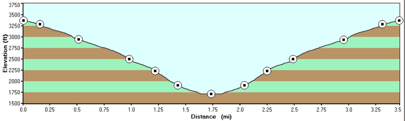
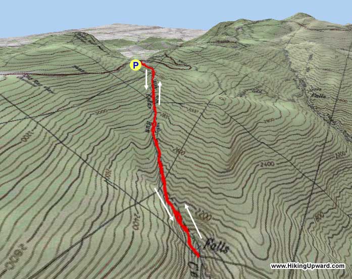
Not
very long, this down and back hike can still be somewhat of
a workout as you gain 1,500 ft on the way back in only 1.7
miles. If you make the hike in the early spring, Cedar Run
should be flowing with several beautiful ponds and small waterfalls.
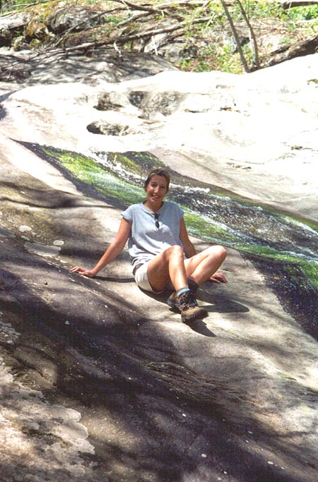
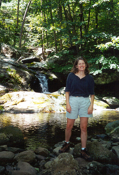
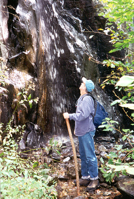
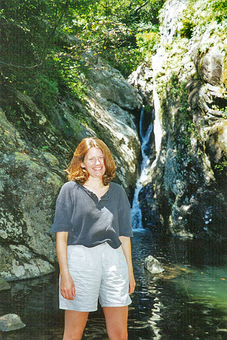
The main falls at the base of the hike have a great natural
water slide and there is a small swimming hole about 40 yards
beyond it.
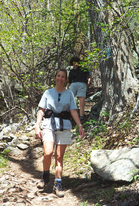
Start the hike by heading down Cedar Run Trail. Pass the Big
Meadows Trail that comes in from the left after just 20 yards,
continue downward on the Cedar Run Trail where the grade will
gradually increase. In about 0.8 miles, Cedar Run will become
visible on your right with several small ponds along the way.
At 1.5 miles cross Cedar
Run
and climb the opposite bank. 0.2 miles further you arrive
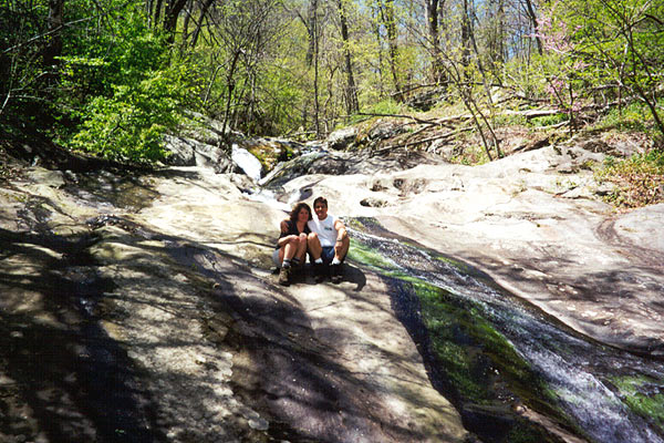
at the Cedar Run natural water slide, with a small pond at
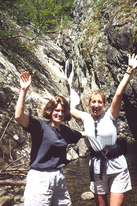
its base. In 50 more yards, reach your destination, the
tallest falls on the hike with Half Mile Cliffs visible on
the opposite site of the run. Leave the trail and have lunch
at the small pond at the bottom
of the falls.
To return just retrace your steps up the trail to the parking
area.
Late June
Early July
Cedar Run Hike Comments
Archived Comments
By:Peggy Pavell
Rating:
Date of Hike: Saturday, August 8, 2015
This was an uphill, rocky hike but very enjoyable.Ā On the way to the park, we saw a mama bear at the base of a tree and 3 baby cubs in the tree above her.Ā Also a lovely doe and her fawns.Ā The smaller water falls' slide was great fun .. the larger water falls' slide dangerous.Ā Of course, in the Spring thaw there would be more water in the falls and maybe not so dangerous.Ā AĀgreat escape from DC for a good part of the day. I'd hike this again but not slide down the falls.
ps.Ā I am 64 years old.
By:Hans ( und Heidi )
Rating:
Date of Hike: Sunday, June 15, 2014
We do a circuit here that starts at the bottom and goes around Hawksbill Mountain to the Summit. Several times we went up White Oak Canyon, took the short and steep trail from Skyline drive up to Hawksbill Summit then the gradual long way around by the AT finishing with the steep decent down Cedar Run. This time we did the reverse hike and got the steep climb up Cedar Run first, then the more gradual ascent up the AT to Hawksbill. This actually is my preferred route now. About 9 miles and quite rugged on the 3 mile Cedar Run trail. Makes for a great long day hike. Started at 10am and got back to the car at 7. Met a 96 year old man at the summit who was quite the inspiration!
By:Joanne
Rating:
Date of Hike: Wednesday, August 15, 2012
My 28 y.o. daughter took my 11 y.o.grand-daughter and myself(57y.o.not in great shape and had a cold!)and our 2 yo lab mix on this trail. Took us about 5 1/2 hrs. Weather was mid 60's and we encountered a rain shower. Only saw a few chipmunks along the way. I picked up a walking stick along the steep way down which helped a lot. The dog helped pull me back up! The rock slide was refreshing and we didnt get cold till we got back to the parking lot, so have some warm clothes ready. I cant swim so dumping off over my head was a little scarey but the slide itself was fun and not painful like I imagined. The dog is still sleeping! I'm a bit sore but not bad. Didnt bother my grand-daughter in the least. Nice girl-time together!
By:CapinWinky
Rating:
Date of Hike: Wednesday, June 10, 2009
This hike was great and the slides are awesome! While the hike down is easy, the hike back up is not keep that in mind and leave yourself enough daylight to make it back up (will probably take twice as long as it took to get down).
Notice I said slides, not many people know this, but the second waterfall is slidable. The key is cross your fingers at the base of your head and keep it up off the rock while also keeping your legs and back straight in line with each other. Go down straight and tuck in your elbows to minimize contacts with the side of the shoot area you will leave contact with the rock half way down and recontact smoothly, so don't worry. The landing into the pool is also nice and deep. In my opinion, that hump right before the pool on the first slide is more painful than anything the second has to offer. Keep in mind me and my friends were all mid twenties and didn't mind a scrape or two. However, we all did it several times with no injuries and only stopped because the water was so darn cold!
By:AKA_MLE
Rating:
Date of Hike: Tuesday, September 2, 2008
I went with my 4 yr old son. We had a blast. He enjoyed playing in the water and the rock slide. I had to carry him for the last mile or so, We swam for 2 hours and he was way too tired. It overall was a fun hike and I would recommend it to just about anybody. The trail was a bit rocky, but nothing that a child couldn't do. This wasn't his first hike either, He can handle about 3-4 miles usually, but this one was a little harder for him because of the elevation. Ā


