
|
| Length |
Difficulty |
Streams |
Views |
Solitude |
Camping |
| 8.2
mls |
 |
 |
|
 |
N/A |
Hiking
Time:
Elev. Gain:
Resources: |
4.5 hours, including a stop for lunch and stops to look at exhibits
750 ft
 Topo Hike Trails Map (PDF) Topo Hike Trails Map (PDF)
Appomattox VA Weather Forecast
Garmin (GDB), Gaia/Trails App (GPX) (What's
this?) |
 By Trail Contributor: Jeff Monroe (Email Jeff) By Trail Contributor: Jeff Monroe (Email Jeff)
The Appomattox History Trail is located entirely within the Appomattox Court House National Historical Park, administered by the National Park Service (NPS). This the scene of Confederate General Robert E. Lee’s surrender to Union General Ulysses S. Grant signaling the end of the Civil War. The National Park Service’s presentation at the Historic Village is not to be missed, as it wonderfully explains how the unique features of the landscape in this area worked to force a surrender at this spot.
If you have time after exploring the Historic Village and taking a tour with a National Park Ranger, the NPS has developed the Appomattox History Trail, located on NPS land across Virginia Route 24 from the Historic Village. Overall, the trail is pretty tame, with a couple of short, steep sections. This is probably not a good trail to take after rains, however, as trail sections may be muddy or flooded during wet periods.
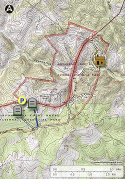
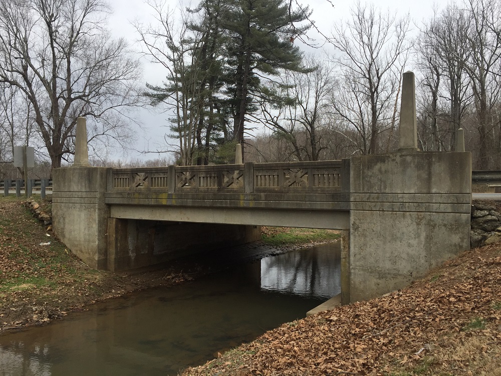
This trail involves an out-and-back hike with a couple of loops on either end. If short on time, just do one of the loops. The better of the two loops starts from the north end of the park, starting at Lee’s Headquarter Parking on Virginia Route 24. Also be sure to check out the highway bridge where Route 24 crosses the Appomattox River, which features Confederate and Union battle flags. There is a picnic area here.
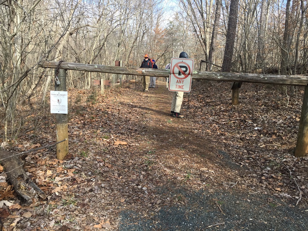
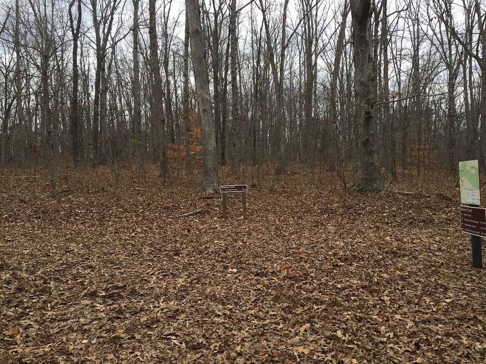
- Mile 0.0 – Parking for this hike is located just off of Virginia Route 24 as it enters or leaves the Historic Village area, at a lot marked for the North Carolina Monument. You can also park and hike starting at the parking lot for Lee’s Headquarters, but this description will start and end at the North Carolina Monument Parking, which is located between the Historic Village and the present day town of Appomattox.
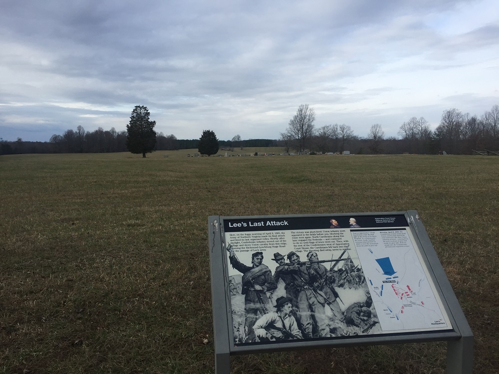
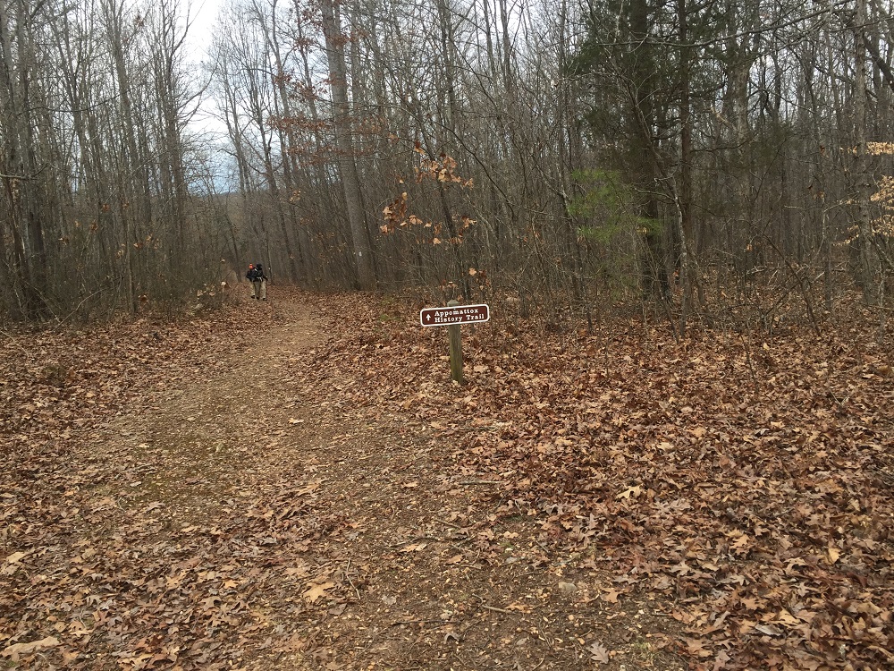
- Mile 0.1 – From the parking lot, take a right and pass through some woods to reach a sign describing the last assault of Lee’s army on April 9, 1865, and another sign describing one of the war’s last casualties, wounded near this point.
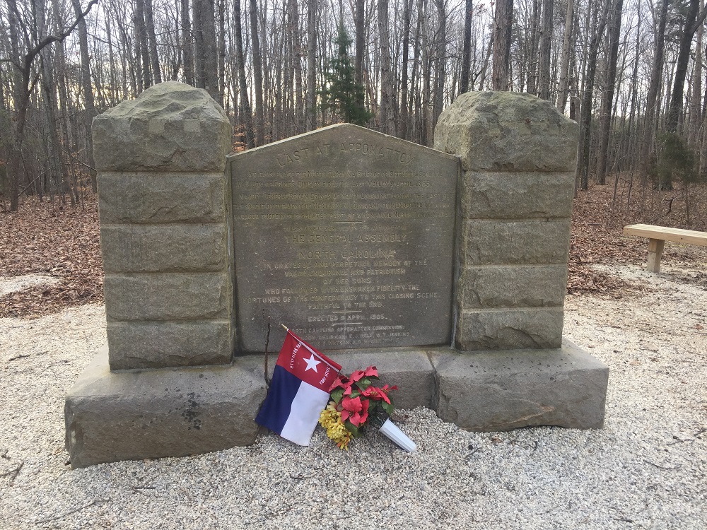
- Mile 0.3 – Follow white blazes down a gravel path along the edge of an open field to the North Carolina Monument, placed by that state’s General Assembly to commemorate the actions of North Carolina troops in battle. Be sure to note the numbers listed on the side of the monument: the number of residents of the state at that time, the number of war casualties, and the number who died of disease during the war. These numbers should surely give you pause!
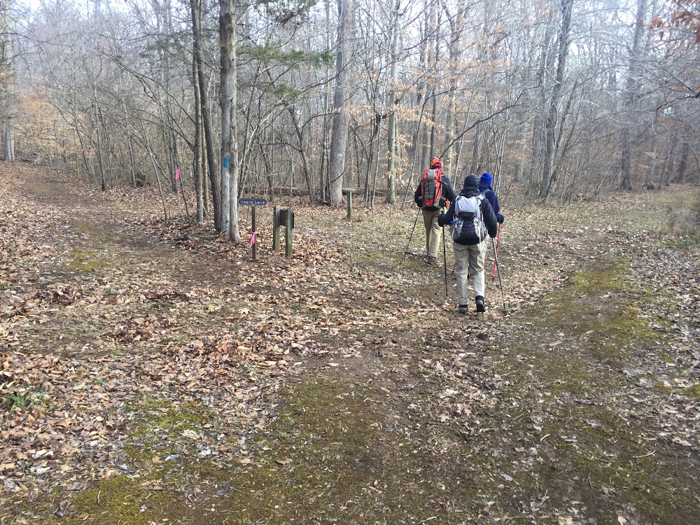
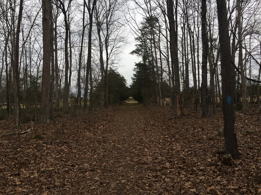
- Mile 0.9 – The trail continues after the North Carolina Monument and is well marked. It enters woods and proceeds in a straight line for nearly a half mile. After almost a mile there is a fork in the trail and a small sign for the Sears Lane Trail to the left. Going left can take you back to your vehicle for a short loop hike of 1.5 miles. This trail will be described later in this account. Stay right if continuing the hike.
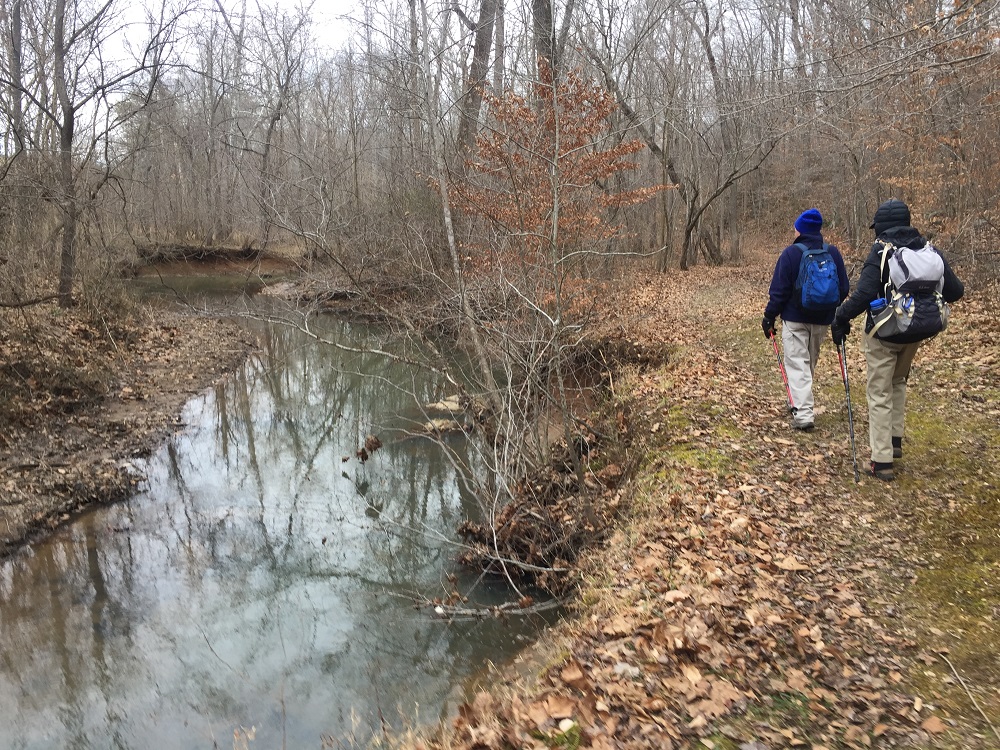
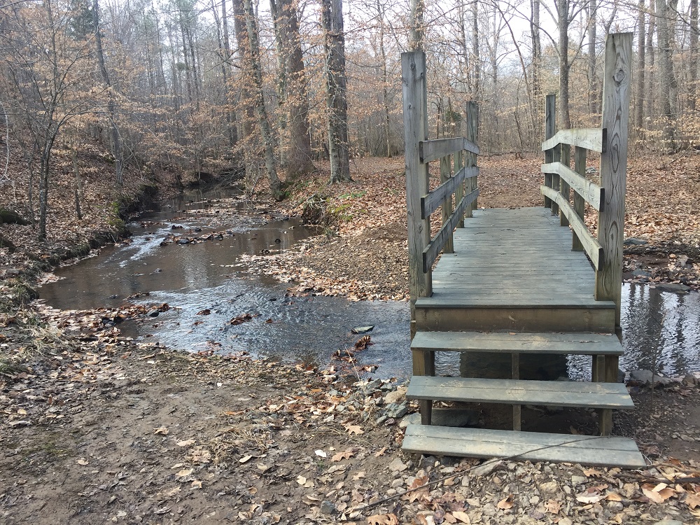
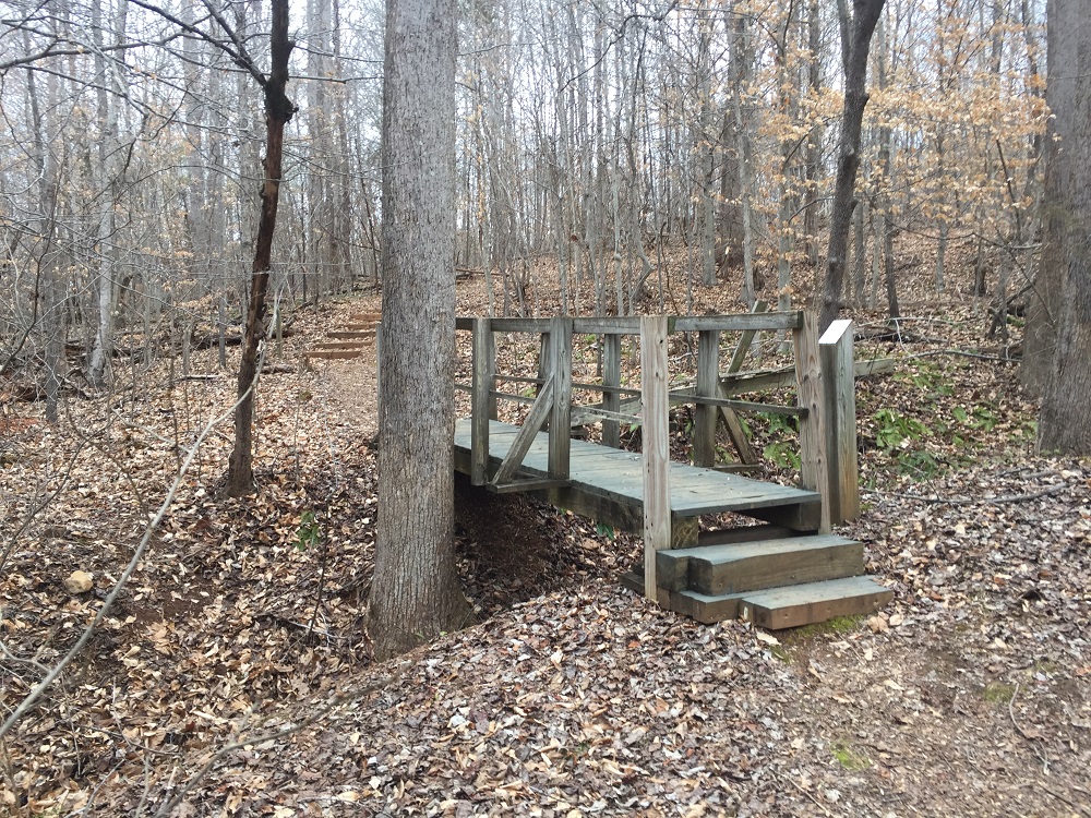
- Mile 1.0 – Cross the Plan Run Branch on a wooden bridge. For the next half mile, you will walk on a straight trail that parallels the edge of the NPS property as it slowly gains elevation.
- Mile 1.5 – The trail takes a left turn and slowly drops in elevation. Turn around here, and a sign tells you that you are on the History Trail, so you know where you have been! Strangely, several trail signs only point the other way. Following the trail in either direction is very easy and well-marked with white blazes.
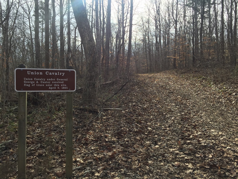
- Mile 2.0 – Just before crossing the River Ridge Road, pass the Flag of Truce Marker. The sign indicates that truce was sought near here the morning of April 9, 1865, when the truce flag was received by General George Custer. Cross the road and pass a gate on the other side. To the left, traffic may be seen on Virginia Rt. 24, which could take you back to your car by turning left at Route 24 and walking in the grass off the side of the road.
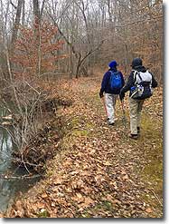
- Mile 2.3 – The trail climbs for about four-tenths of a mile, then loses all the gain quickly, in half the distance, as it approaches the edge of the stream called Plain Run Branch – the same stream crossed by bridge earlier in the hike.
- Mile 2.5 – Pass through some swampy areas – the Park Service reportedly plans to build up this part of the trail in the future, but for now this section of trail will likely be muddy and may be temporarily flooded after a good rain.
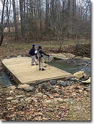
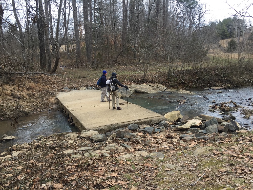
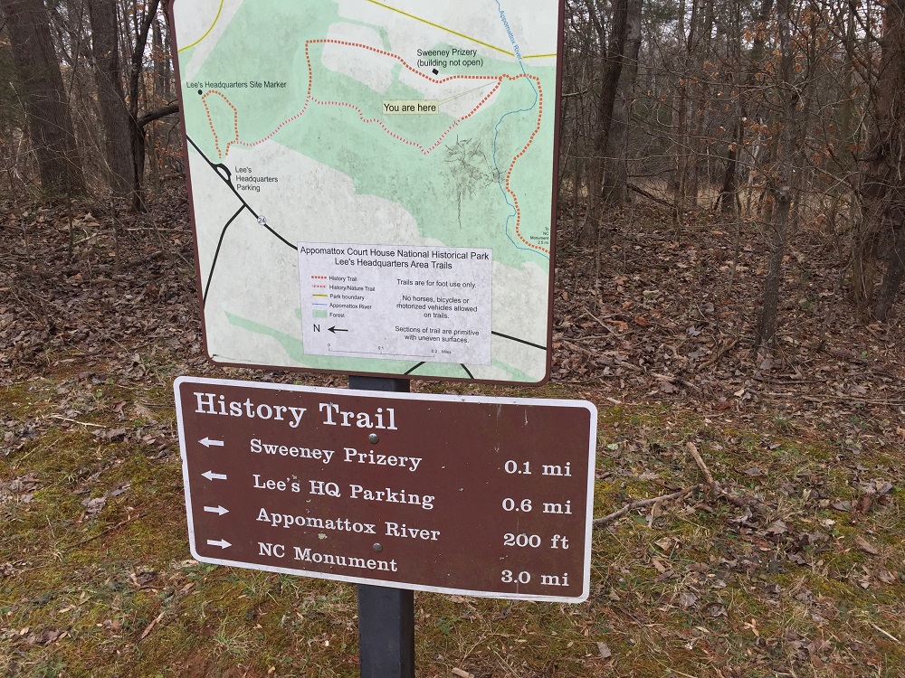
- Mile 3.4 – Cross the stream on a concrete bridge near the site of a mill that operated along the stream in the late 1800s, following the Civil War. The trail then takes you out of the woods and into an open field, 250 feet later. At this point, there are two choices. This description goes left and returns via the other trail. Take the orange blazed nature trail. There is a map at this crossroads.
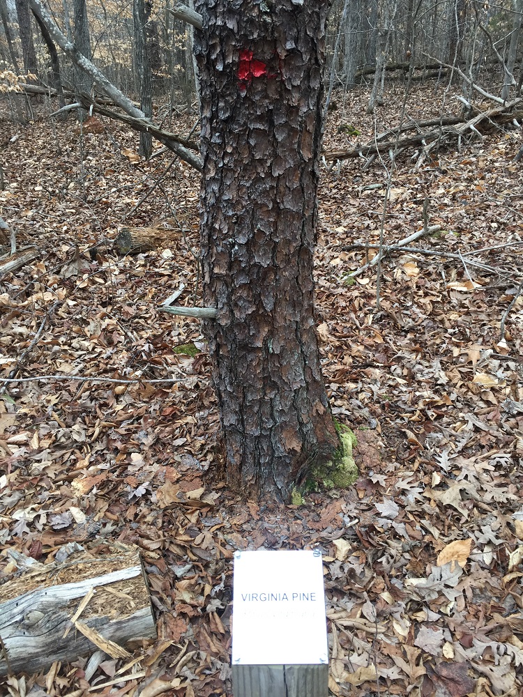
- Mile 3.6 – Cross another wooden bridge, which crosses a gully. Enter into an area where many trees have been labeled, thanks to the local chapter of the Society of American Foresters. This is a wonderful area to walk through and test yourself on your tree identification skills. Included in the examples are several trees that are not common in Virginia.
- Mile 3.9 – The trail returns to the Appomattox History Trail. There is another map. Take a left here continue towards the Lee Headquarters parking lot.
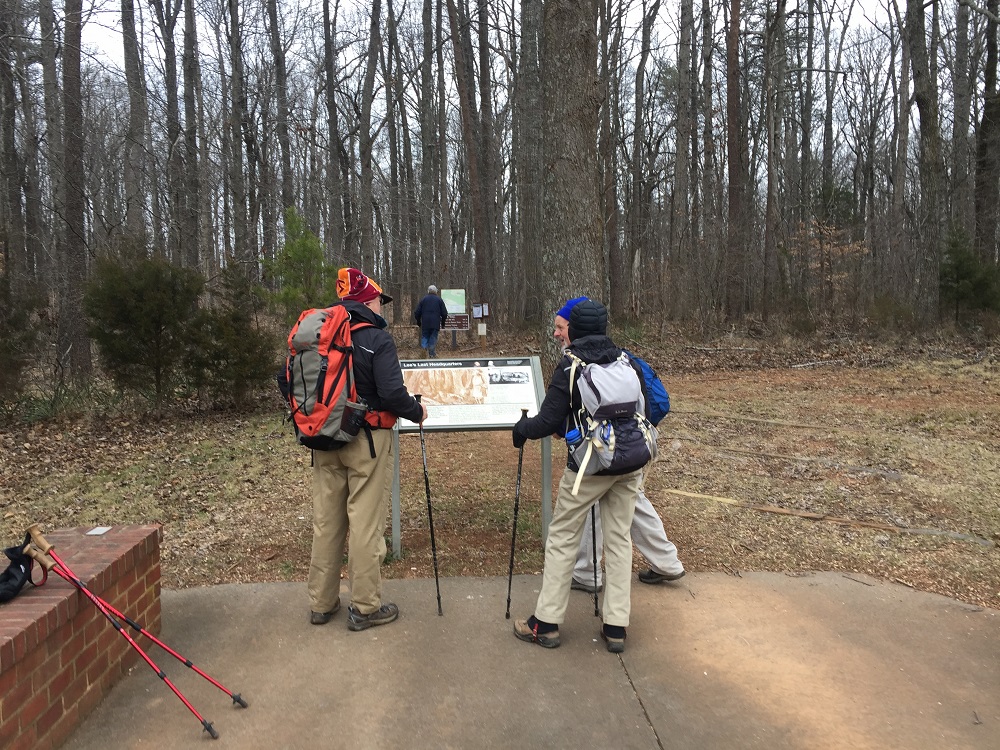
- Mile 4.1 – The Appomattox History Trail ends at the Lee Headquarters parking lot. Check out the sign here, then take a right back into the woods and walk towards the headquarters site after passing another map.
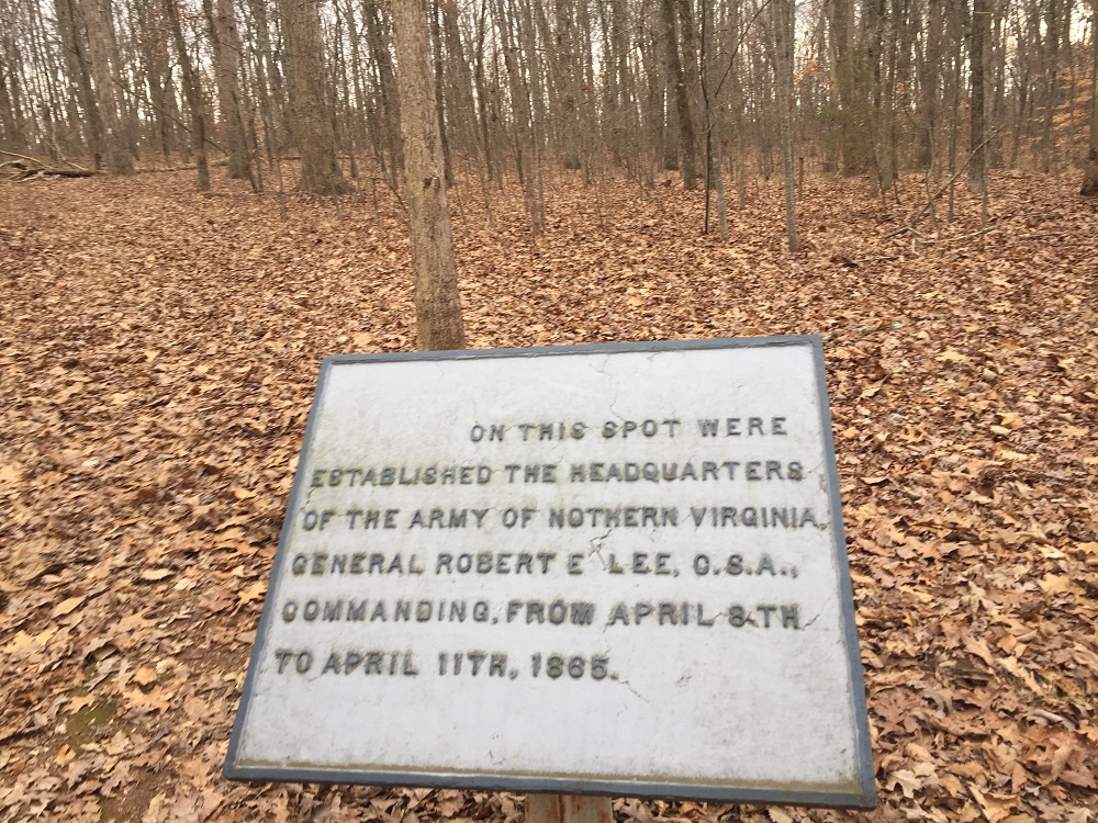
- Mile 4.2 – Lee’s Headquarters does not exist anymore, but a plaque is here commemorating the location. From this point, continue on the trail as it loops around and back to a point where you had been a few minutes prior. Take a left and reach the intersection of the Appomattox History Trail and the Nature Trail. Go straight.
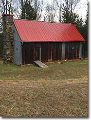
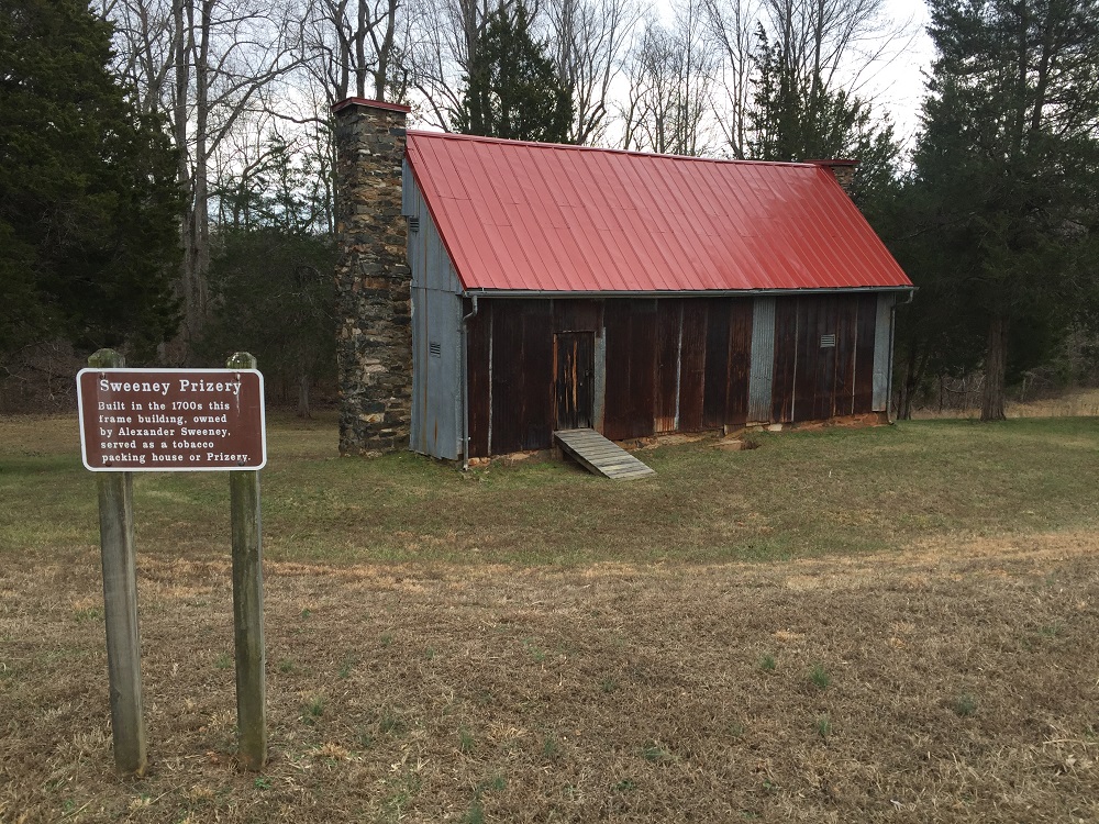
- Mile 4.5 – The trail passes the Sweeney Prizery Building. The Prizery is the oldest building on the NPS grounds and was used as a tobacco-packing house. It is not open.
- Mile 5.0 – Reach the trail split and map that you passed at the 3.4 mile mark. From here, return via the way you came over the next 2.4 miles, crossing the dam, taking a right, and walking along the stream’s edge. The hardest part of the entire hike is leaving the flood plain of Plain Run as you climb to cross River Run Road again.
- Mile 7.4 - Shortly after again crossing the bridge over Plain Run, come to the turnoff for the blue blazed Sears Lane Trail. Take a right here. The Sears Lane Trail is an old roadway that General Grant used to bypass confederate troops on his way to Appomattox Court House to discuss the Confederate surrender with General Lee. At the time of Grant’s journey, the area was open fields of tobacco and grain. Now it is hardwood forest.
- Mile 7.9 – The trail passes through a grove of pine trees before taking a left into an open field and reaching the Raine Family Cemetery. From the cemetery, you can see your vehicle.
- Mile 8.2 – Return to the parking area.
|


