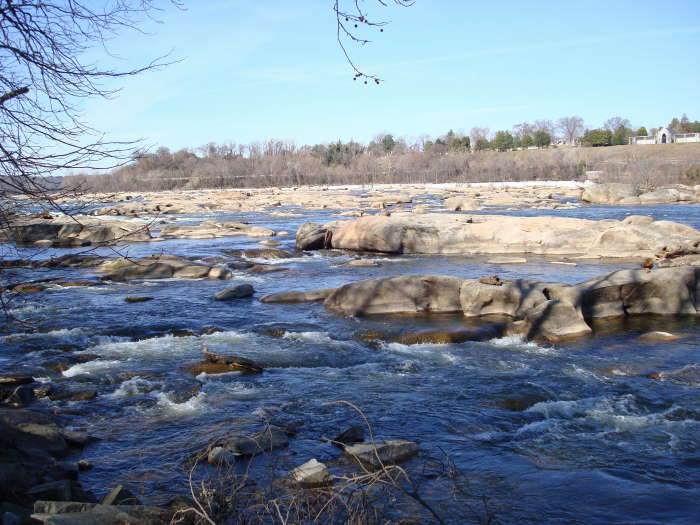
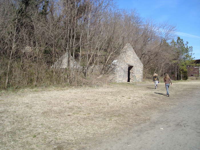
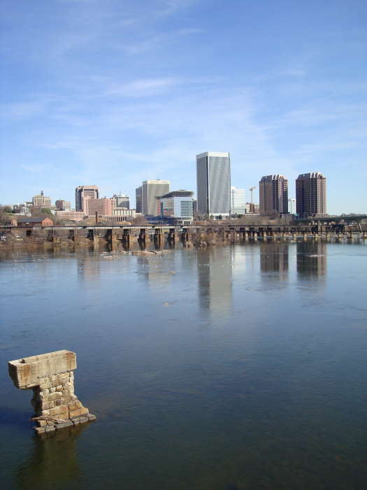
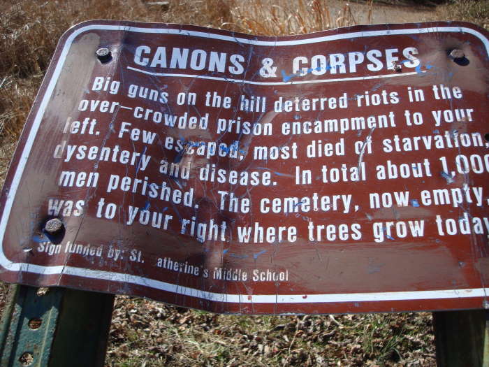
Belle Isle is a deceptively named, family friendly, wheelchair accessible hike in the middle of the James River with the downtown skyline of Richmond, VA visible in the background. If you just walked around and looked only at the river, the trees, the birds, the climbing cliffs, etc, you would certainly agree that it is a “Belle Isle”. On the other hand if you read some of the posted signs and looked around at the evidence of its prior use, you might be transported back to a time when it was not a Belle Isle: a granite quarry pit, a power plant, an iron milling factory, an iron foundry, and the most haunting of all – A Civil War prison camp where over 1,000 Union soldiers diedfrom deprivation.
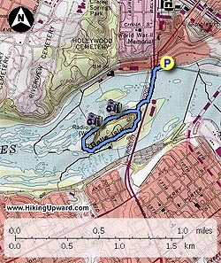
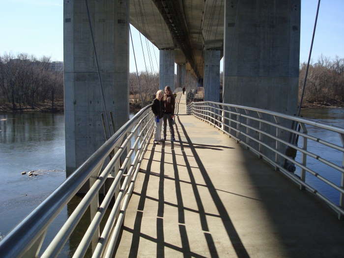
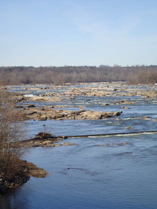
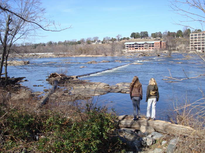
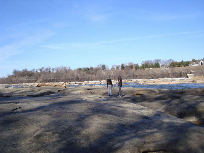
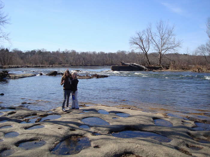
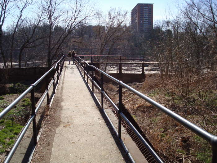
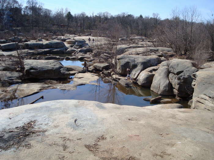
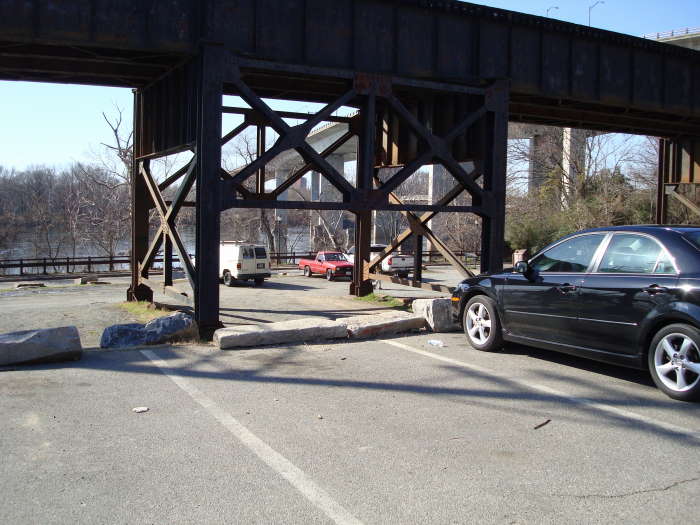
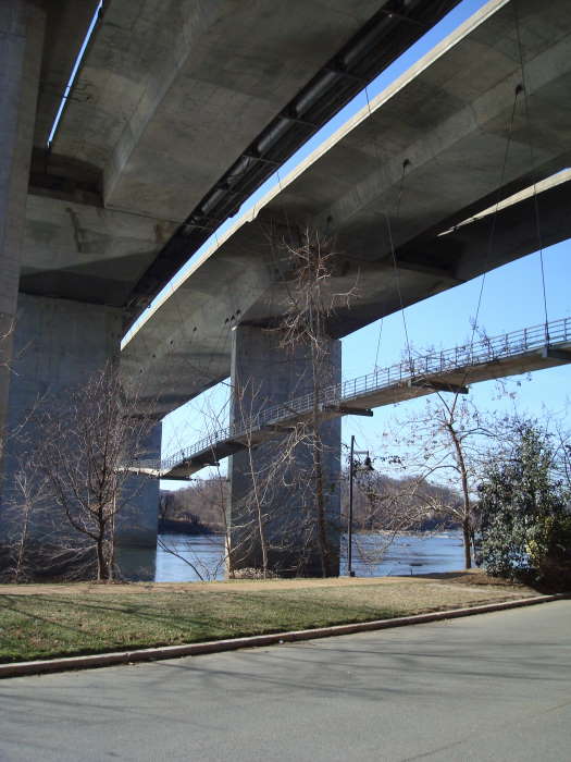
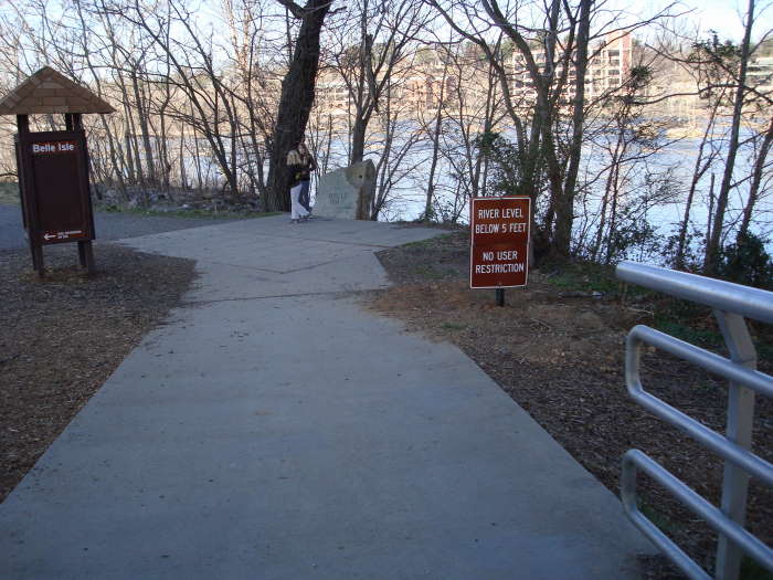
From the parking lot, head under the train trestle to the sidewalk and take a right heading to the hanging bridgeunderneath the Lee Bridge (Route 1/301). It is about 0.5 miles to the other side of the bridge from the parking area. Stay straight as you come off the foot bridge and go about 100 yards and bear to the right following the river. The area to the right at this intersection was the Civil War Prison Camp cemetery (bodies since removed). Continue following the trail along the river with many side paths leading to rocks on the river that have great photo opportunities. Caution: during times when the river is highit is not advisable to go rock hopping. The summer sees many people out here for the day relaxing on the rocks getting their feet wet.
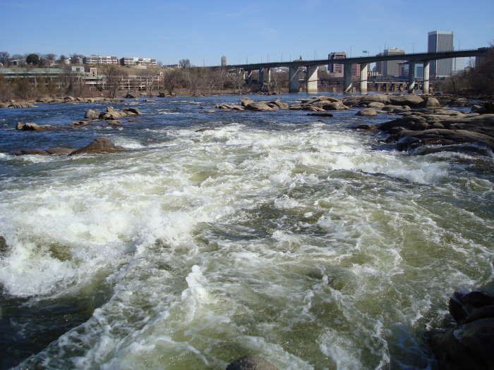
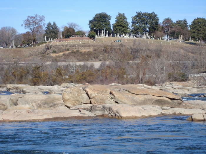
The cemeteryvisible on the opposite bank is the Hollywood Cemetery where Presidents Monroe and Tyler are buried along with President of the Confederacy Jefferson Davis, Confederate General JEB Stuart and thousands of civil war soldiers.
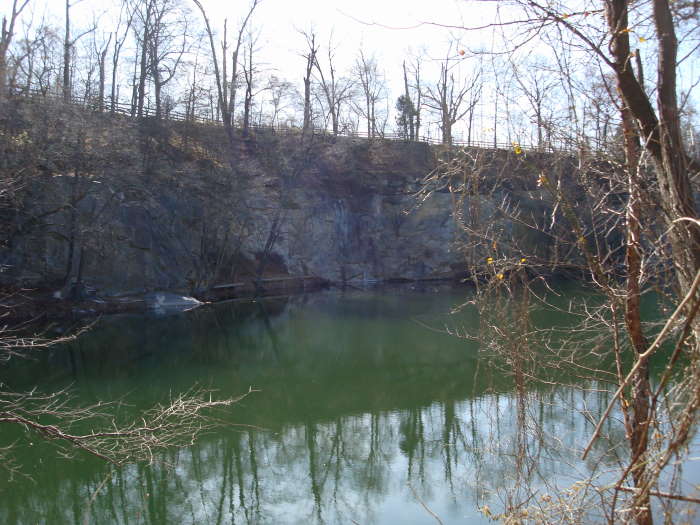
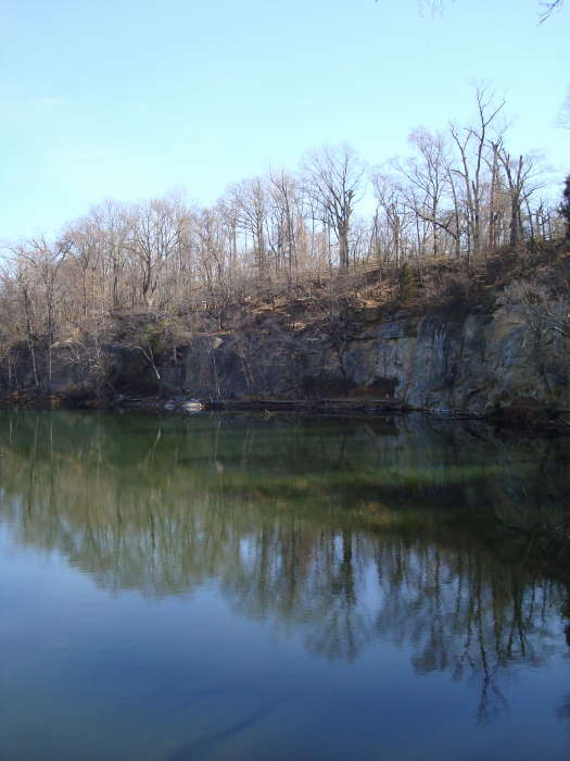
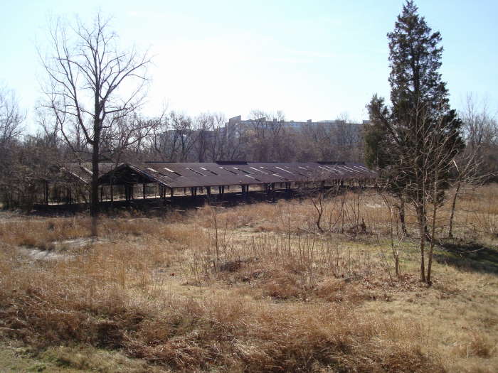
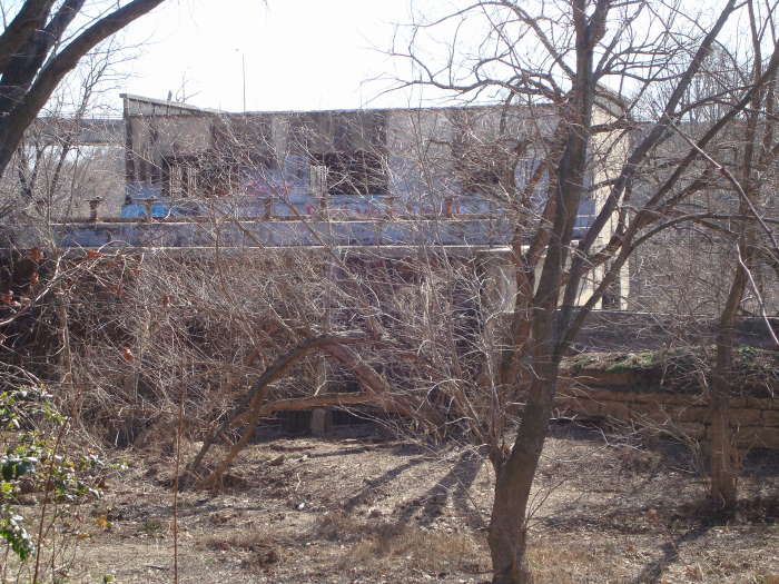
About 0.4 miles from the first intersection you will see the rock quarry and pond on the left. Rock climbing is allowed in the quarry but at your own risk. 200 yards beyond the quarry is a picnic area with some more opportunities for exploring the rocks on the river. 150 yards beyond the picnic area is a side trail to see some of the remnants of the power plant dam and more rock exploring. Continuing on the main loop trail, keep an eye out for the power plantand iron mill (made nails, wire, horseshoes, etc) and take a left in about 0.4 miles to head back to the foot bridge. From this point it is about 0.6 miles back to the parking area. The steel framed building on the right just before the bridge is the old iron foundry.
It may take you more than 1 hour to hike this trail if you stop and look at the many interesting views of the riverand the remnants of Belle Isle’s past.
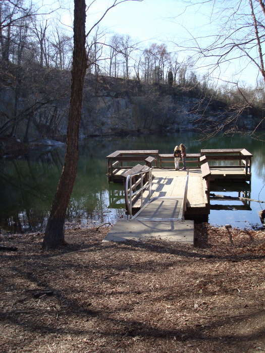
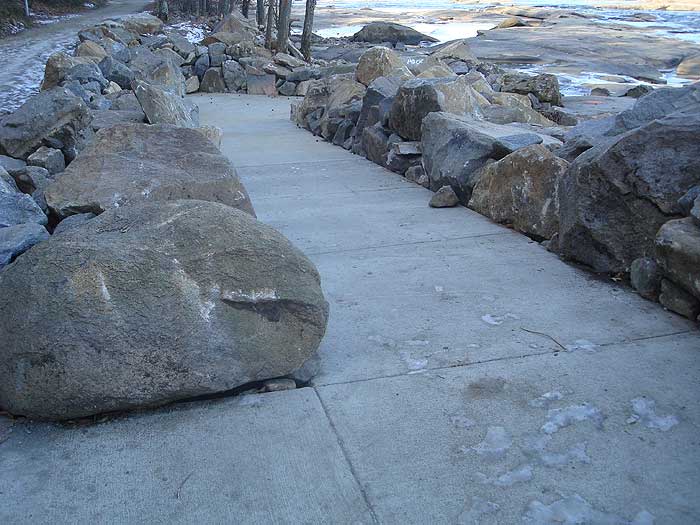
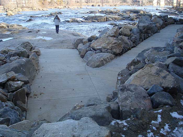
Note: As of 2010 a new accessible ramp to the rocks was completed in Dec 2010. The ramp is approximately 0.5 miles after getting off the bridge. Be aware, there is only 1 dedicated Handicapped Parking Spot at the Belle Isle parking area, it is the last spot prior to the sidewalk leading to the bridge.
Late
February
Belle Isle Hike Comments
Archived Comments
By:Jessie R.
Rating:
Date of Hike: Tuesday, September 1, 2015
I used to live within walking distance and hiked here all the time. If you want a longer/more challenging hike you can combine it with a lot of nearby places, like Manchester climbing wall, Reedys Creek, or take the Buttermilk Trail down to Byrd Park to see Pump House. There's a lot to explore at Belle's and the surrounding area. The only thing I don't like about this park is there are a lot of people who take their dog off leash here, which is fine if they have good recall or can leash their dog for me to pass with my dog, but I've had too many encounters where that was not the case. It also is pretty crowded there, even on really rainy or snowy days there are always people there.
By:Jeb
Rating:
Date of Hike: Monday, October 17, 2011
I routinely hike/power walk from the VA War Memorial down to Belle Isle & back during lunch hours. You can do this whole circuit in about 45 minutes with decent pace. During warm weather, sometimes the rocks can be overcrowded with VCU students pretending they're at the beach, but it's really fascinating to go when it's cooler & there aren't so many people there. The water views are spectacular and for me, it's not uncommon to sense the presence of other walkers following behind who aren't actually there.
There are bathroom facilities, pet relief stations, and I think there might be a water fountain or two, as well as at least one covered picnic area, so it's definitely family-friendly. A great location for history-minded hikers, fitness buffs, and casual walkers alike.
By:HikingUpward
Rating:
Date of Hike: Saturday, January 15, 2011
We went back here to check out a new accessible ramp down onto the rocks. What a great job the City of Richmond did with the ramp. It is on the right less than 1/2 mile after coming off the foot-bridge. New photo will be added soon. This is a great little hike and the last 2 times we have been, we have seen a Bald Eagle and 2 Hawks, so keep your eyes open.
By:Billy McBride
Rating:
Date of Hike: Friday, January 15, 2010
I love this place. Me and my frends have been going here regularly for the past three years. It is amazing to me that such a beautiful nature retreat is right smack in the middle of all the hustle and bustle of the city. If you want to get to the island in a more adventurous way, you can park on the other side of the island on one of the side streets, and take the spiral staircase to a trail that leads to the island. There are points where you can walk off the trail and onto the giant river rocks, and you can hop accross these rocks to access the island. There is a ladder on the other side of the rocks that takes u right up to the main trail. The ladder doesnt look too strong, but it has been supporting the weight of me, my frends, and who knows how many other people for all these years, so i trust it.
By:Robyn
Rating:
Date of Hike: Saturday, September 5, 2009
My cousin and I are just getting started with hiking and wanted to work ourselves up to the bigger hikes so we chose Belle Isle which is only 30 minutes away from home. It was the best yet! So much history! It was also a little challenging for the two of us who aren't used to that much activity! We chose not to follow every gravel walk way and instead did some of our own exploring. We went down on the rocks and did some climbing and jumping, walked along the edges of the rock climbing walls and explored the old power plant. I definitely insist that everyone take the chance to go to Belle Isle! Very historical!


