|
| Length |
Difficulty |
Streams |
Views |
Solitude |
Camping |
| 4.3 mls |
 |
 |
 |
|
N/A |
Hiking
Time:
Elev. Gain:
Resources: |
3.5 hours with half hour for lunch
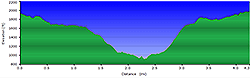
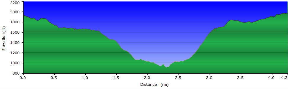
1,350 ft
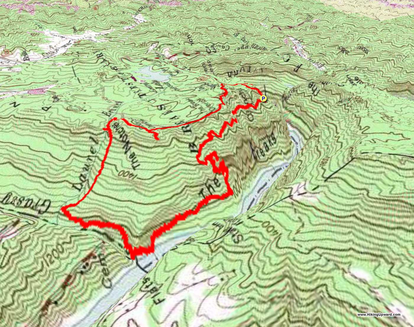
 Topo Hike Trails Map (PDF) Topo Hike Trails Map (PDF)
Elkhorn City, KY Weather Forecast
Garmin (GDB), Gaia/Trails App (GPX) (What's
this?)
3D
View of Route |
 By Trail Contributor: Jeff Monroe (Email Jeff) By Trail Contributor: Jeff Monroe (Email Jeff)
Have you ever taken a hike that, when you were done, you looked at your distance with disbelief because it took such a long time to complete a relatively short hike? On paper, this loop does not seem like it is a challenge, but much of the time the trail is actually very rocky and steep. My slow pace – about half of my normal speed - had me worried about completing this short loop before sunset for much of its length. And I hiked it when dry! Others say this trail is downright treacherous after rains or when the leaves are falling. Heed the park’s warning sign and attempt this one only if you are an experienced hiker outfitted with good boots.
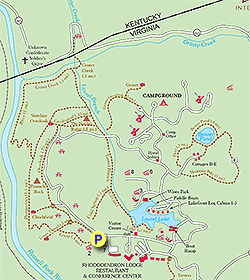
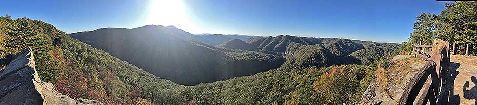
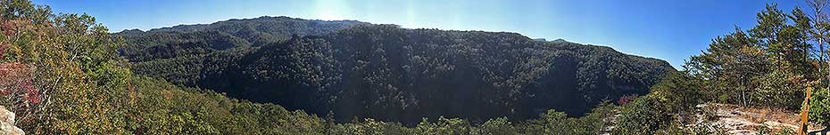
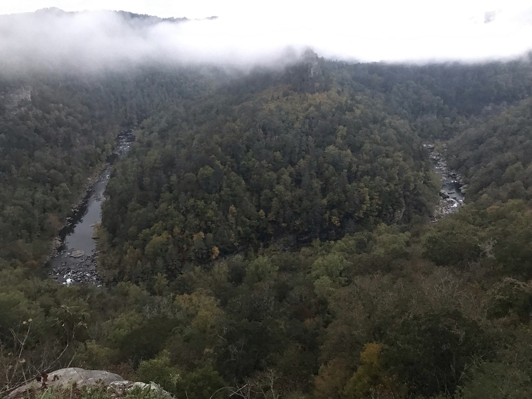
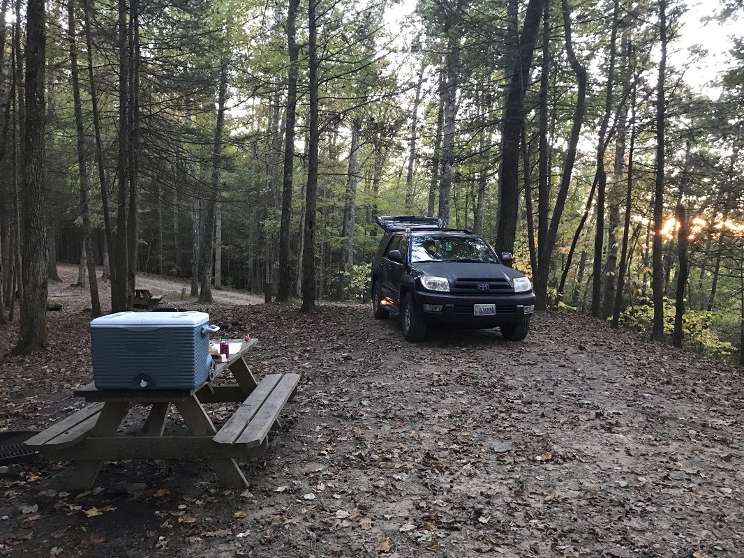
Although this hike never leaves Virginia, Breaks Interstate Park is located in both Virginia and Kentucky. Each state jointly operates the park. It does not require a Virginia State Parks pass to enter, but instead is a separate charge. The highlight of the park is the varied views of a canyon created by the Russell Fork River, said to be the deepest canyon east of the Mississippi. When fully open in the Summer, there are a great variety of recreation options in this park. There are lodge rooms and a restaurant, mountain bike trails, boat rentals, cabins and cottages, and a large pool. The campground has sites with electricity and water, and sites for tents without upgrades. The campground restrooms have hot showers – no need for quarters. (Note: even walk ups who first check in at the park will have to reserve a site through reserveamerica.com. There are no sites held back from online reservations, so you will get dinged for the online fee whether you reserve at home before leaving or with the help of park personnel after you arrive.) It is a large campground, and it is the only camping option in the park, as there is no backcountry camping here.
The beauty of this place makes it worth the long drive it takes most folks to get here. The prolific trail guide writer Leonard Adkins states in his 50 Hikes in Southern Virginia of Breaks Interstate Park, “if your time in this region is limited, you should bypass everything else and spend your days here. If I had my way, I would spend my whole summer here.” His guide does not describe this loop, and I do not believe many visitors explore the described trails because most do not stray from the rim. This is the only access to the Russell Fork River, however, and having hiked the real Grand Canyon earlier in the year, I wanted to compare my previous experience with this park’s “Grand Canyon of the South.” (Spoiler: the trail to the river at Breaks is a lot shorter, but mile-for-mile is harder than its Arizona namesake.)
-
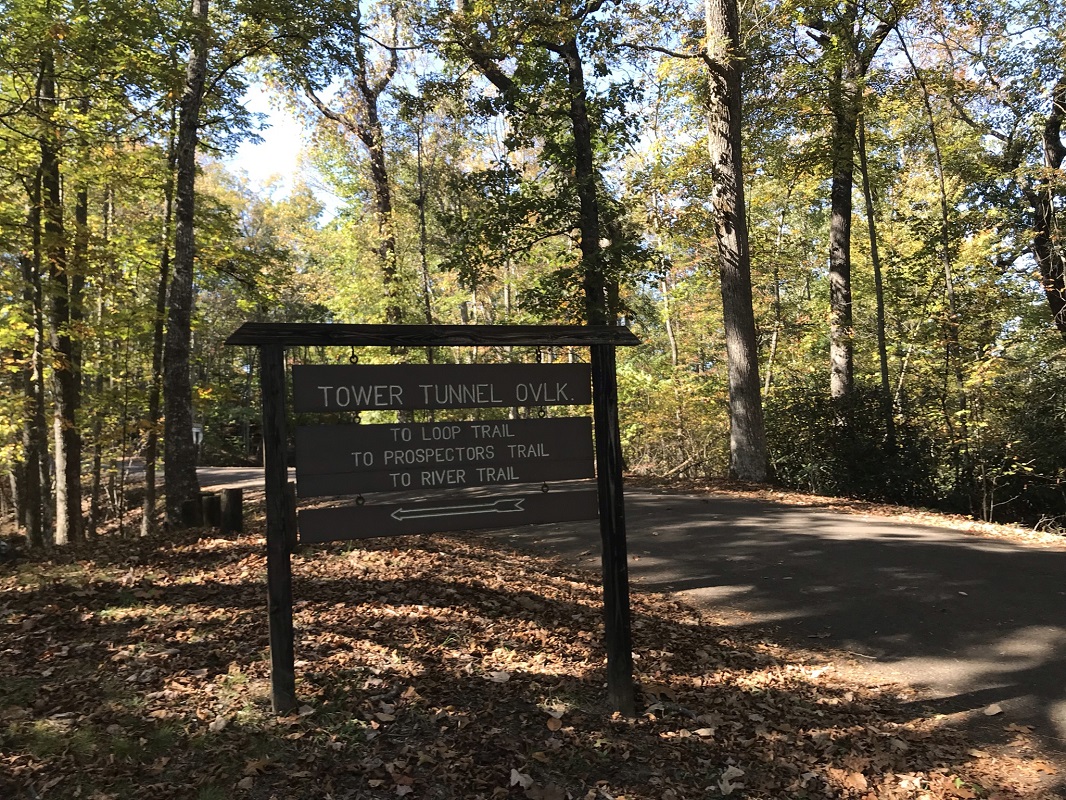
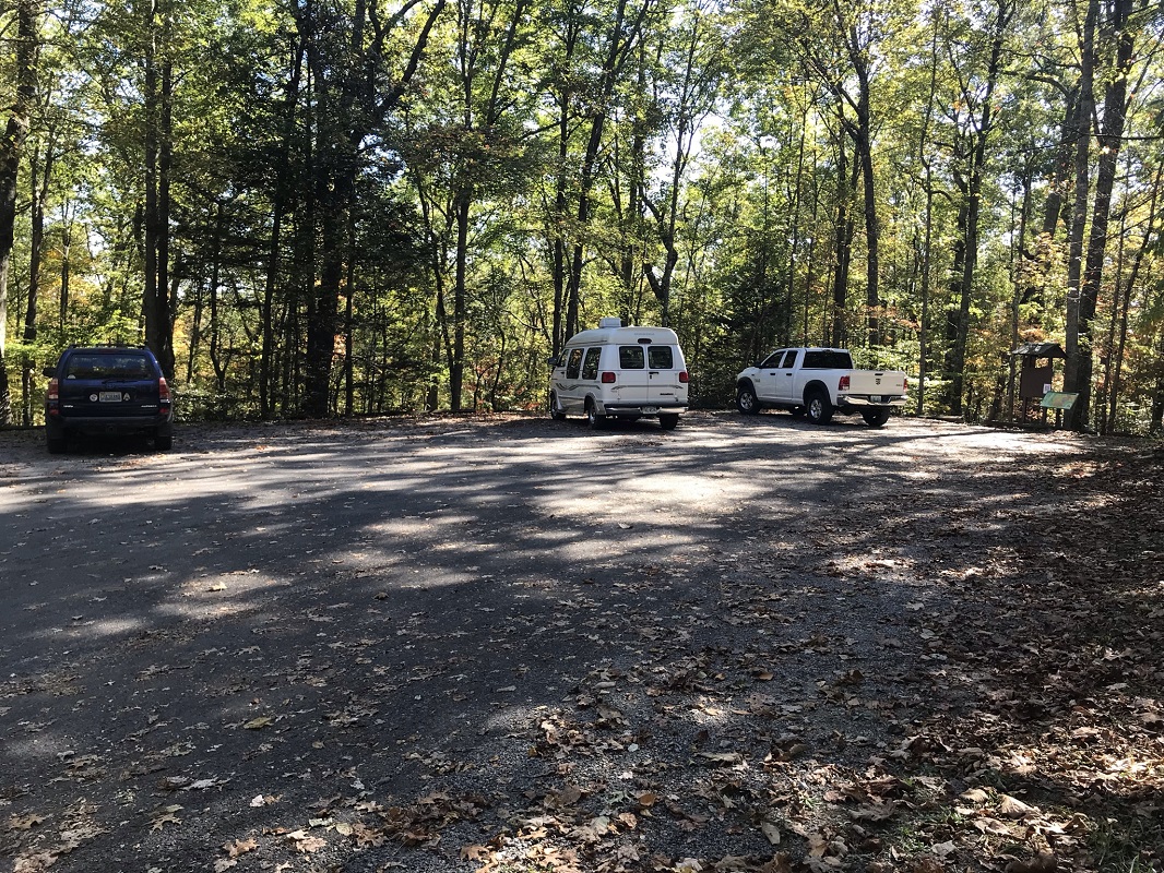
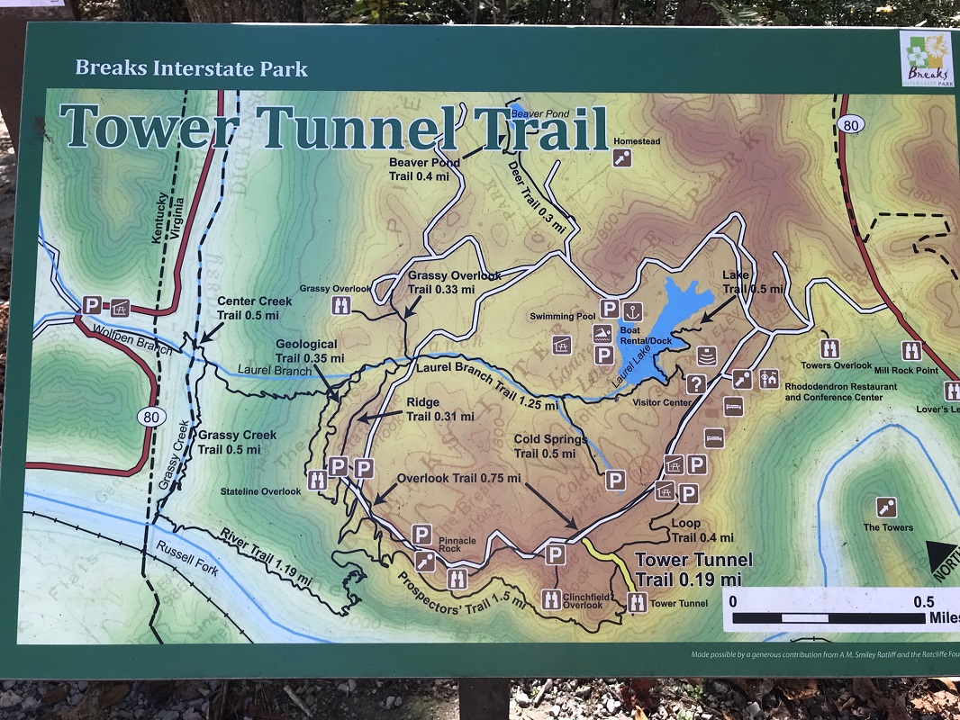
Mile 0.0 – After driving past the lodge and the park’s visitor center, start the hike from one of the parking areas giving access to canyon overlooks. This description starts at the Tower Tunnel Overlook parking area. The lot has room for a dozen cars, but if there are no spaces you can start this loop at the next parking area. Start the hike next to the kiosk at the end of the lot, and take a photo of the trail map if you do not have one with you.
-
Mile 0.1 – Take the yellow blazed trail past a trail intersection and head a short distance out to the overlook before starting the real hike.
-
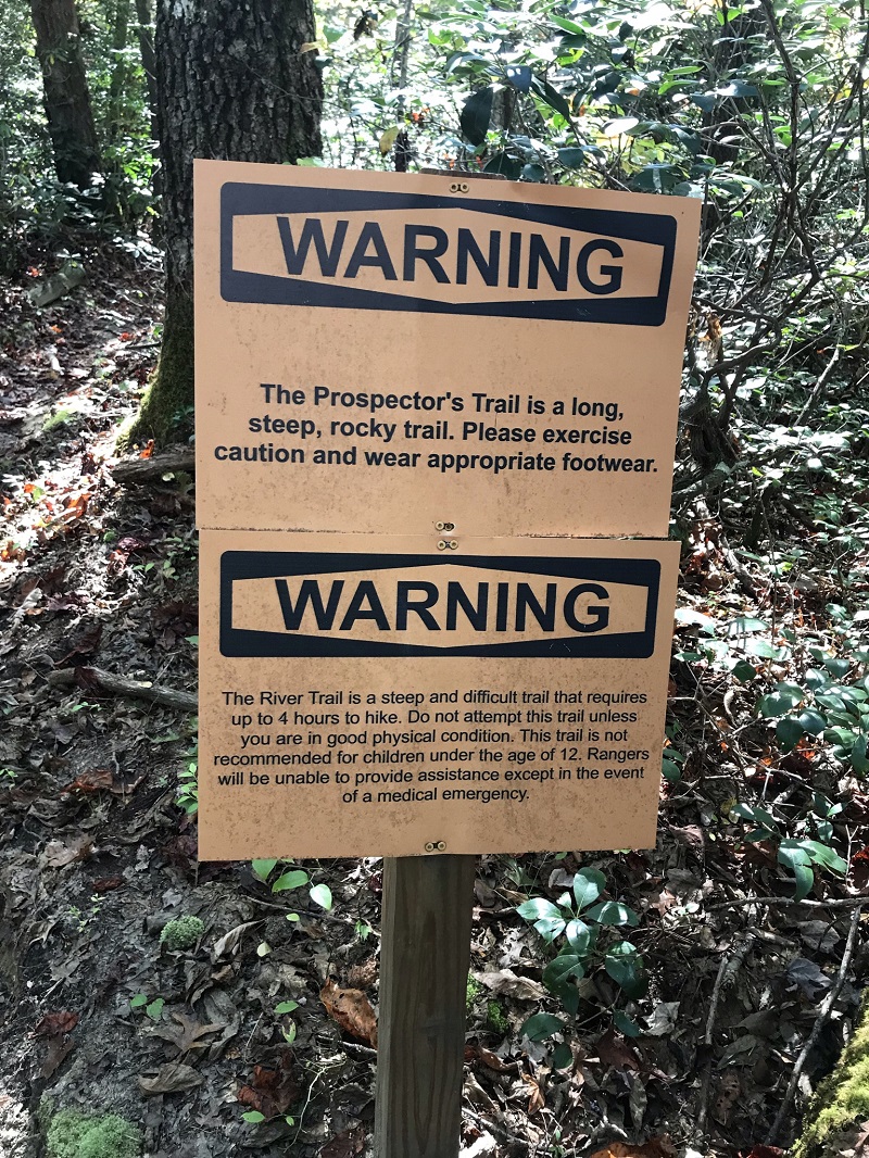
Mile 0.2 - After soaking in the vista, return to the trail intersection you passed on your way to the overlook. Before you again reach the parking lot, take a left onto the orange blazed Prospector’s Trail, heading toward the River Trail. The park’s trails are very well signed here. Shortly after starting down the Prospector’s Trail, pass a couple of stern warning signs telling you to be in shape and well equipped to complete the trails described here.
-
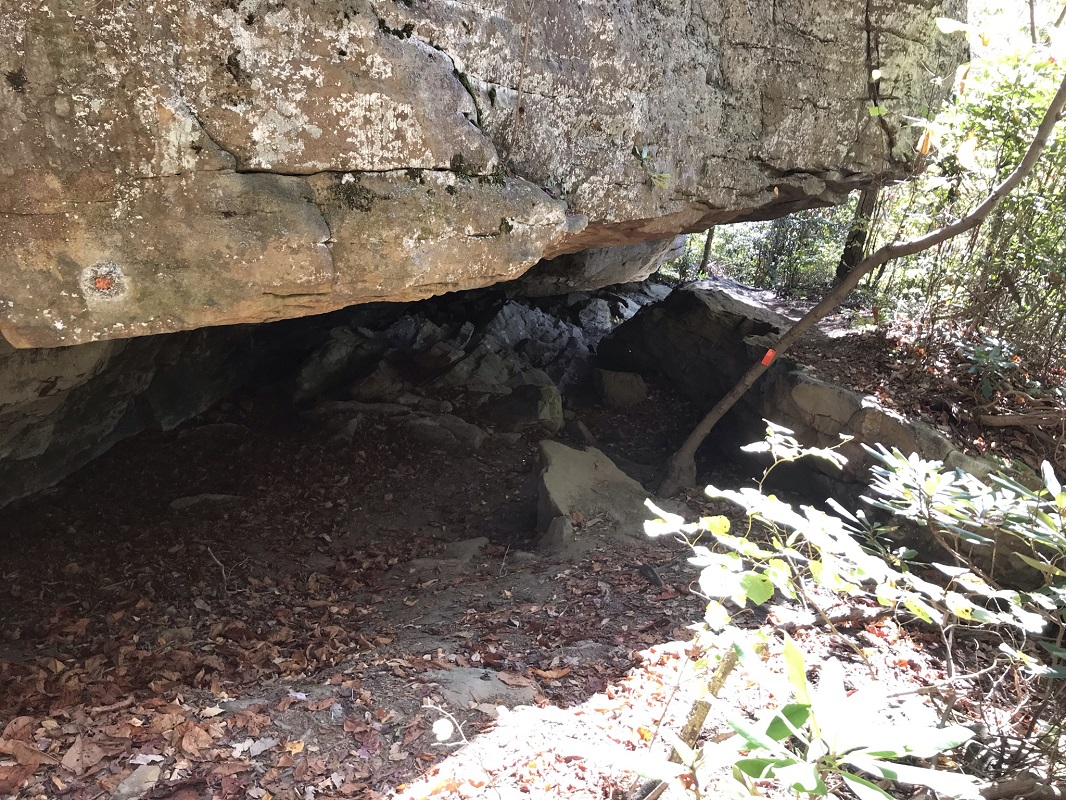
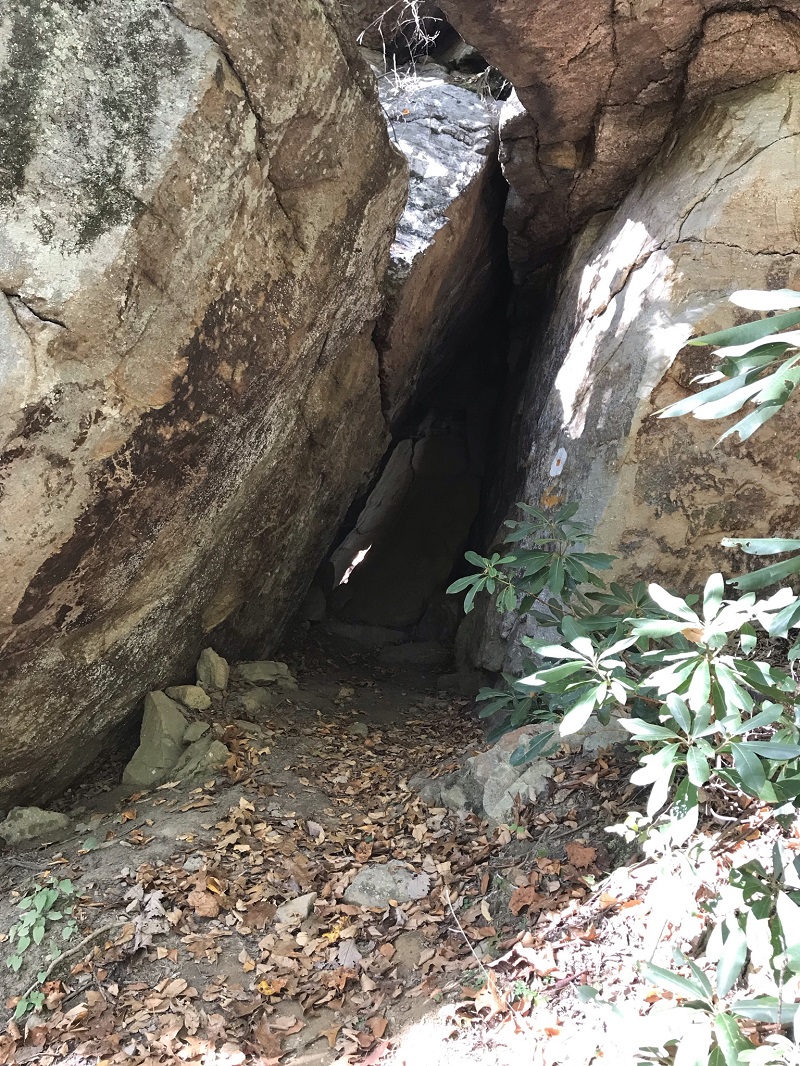
Mile 0.5 – The Prospector Trail begins to lose elevation and heads underneath a huge rock boulder. This trail’s path follows the canyon rim, but along a lower elevation than the rim.
-
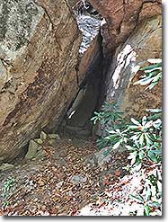
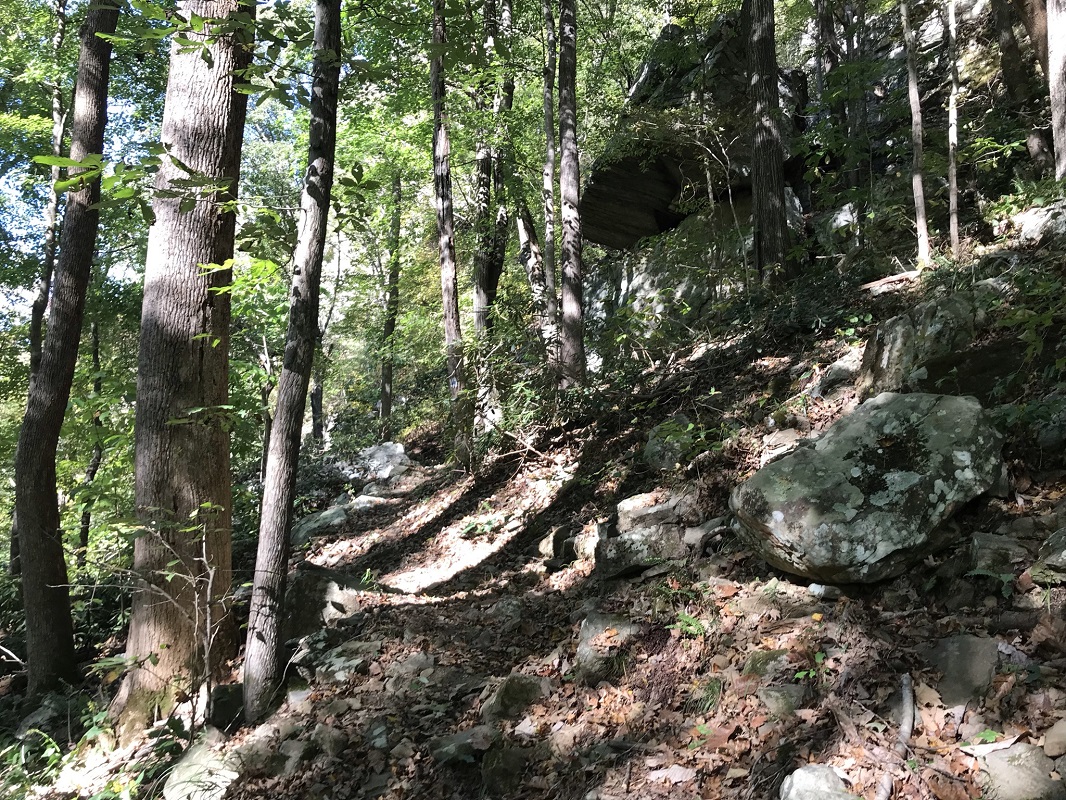
Mile 0.6 – The trail makes a couple of switchbacks and passes a “Rock Climbing Access Trail” before it cuts into and through a series of large boulders. Very cool!
-
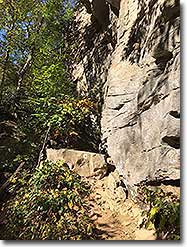
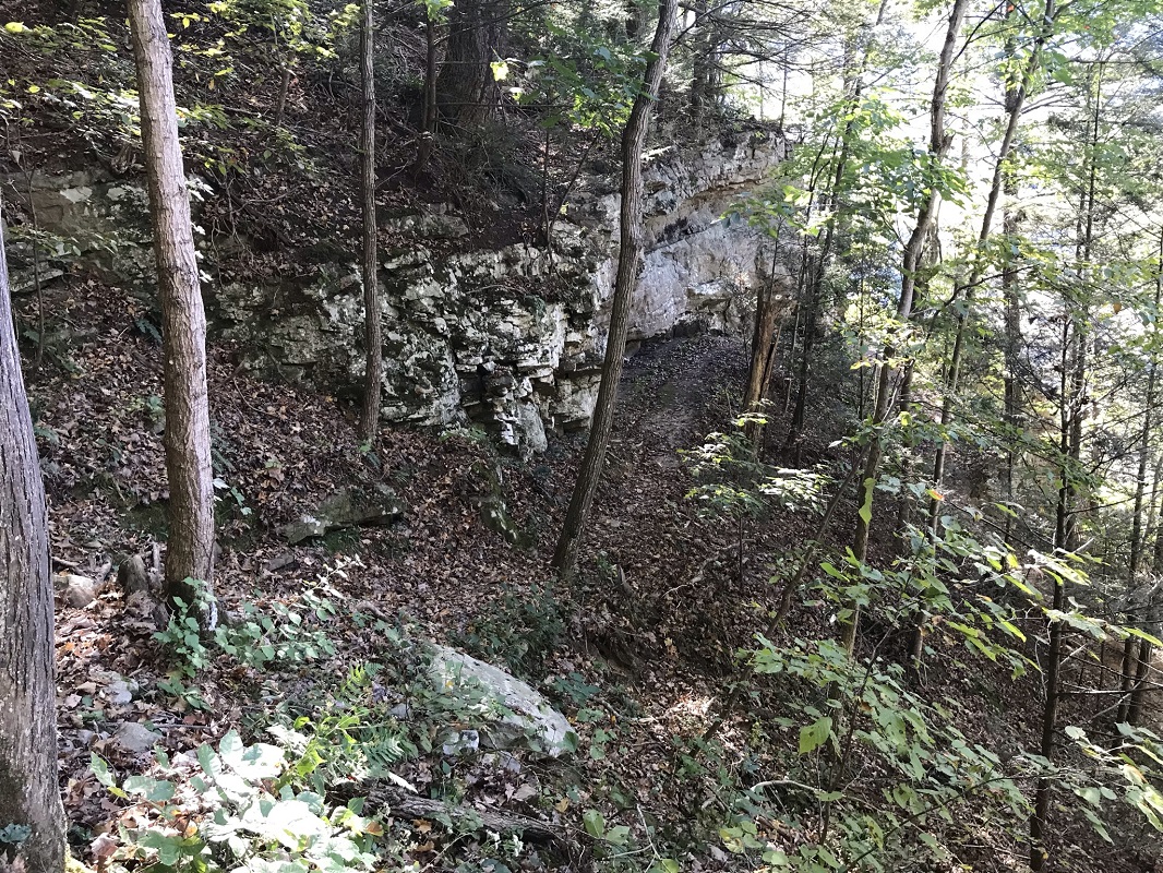
Mile 1.2 – Come to an intersection with the start of the River Trail. Leave the Prospector’s Trail and head down the blue blazed River Trail. The route really drops elevation fast over the next half mile, dropping 560 feet over the next 0.6 mile. During this section, the trail passes next to a series of small cliffs. Although the trail is rocky and there are few views during this section, the nearby rock formations make for a pleasant hike.
-
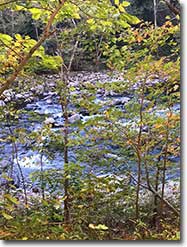
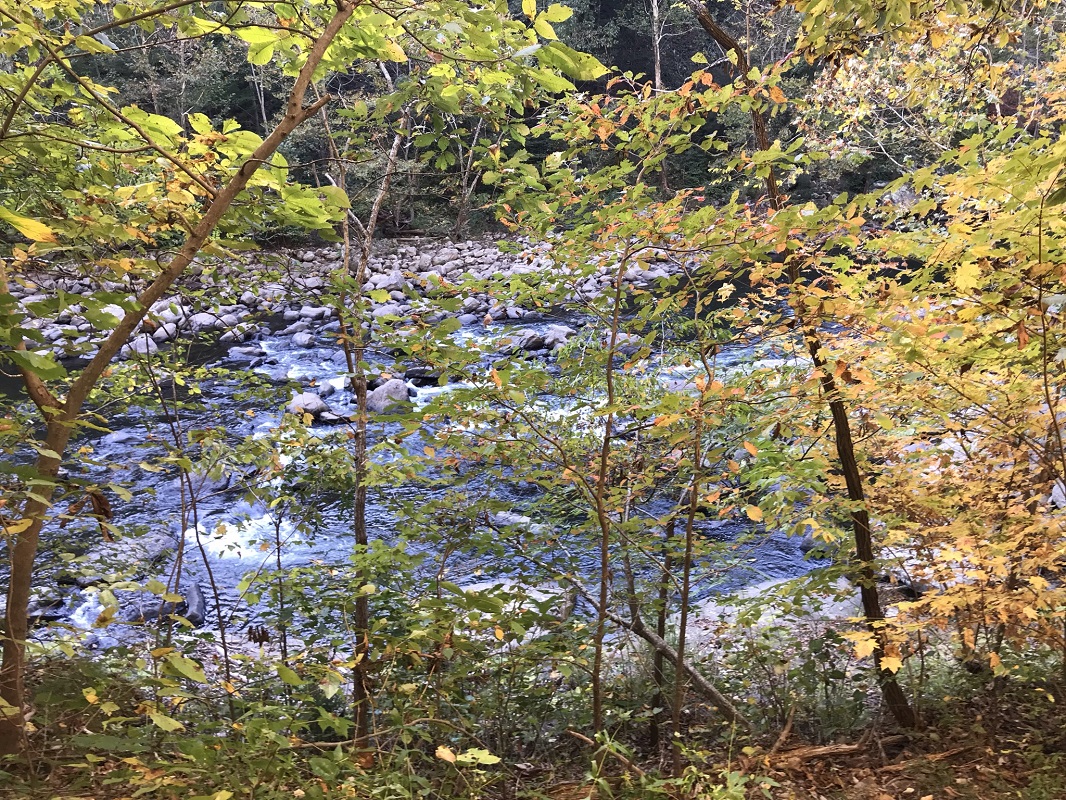
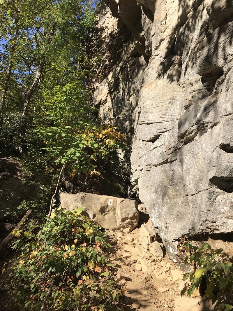
Mile 2.2 – The River Trail drops to close contact with its namesake river, with views between the trees. It never reaches water’s edge, but you can easily bushwhack to the river. I headed on using the trail, passing very close to more cliffs.
-
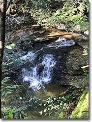
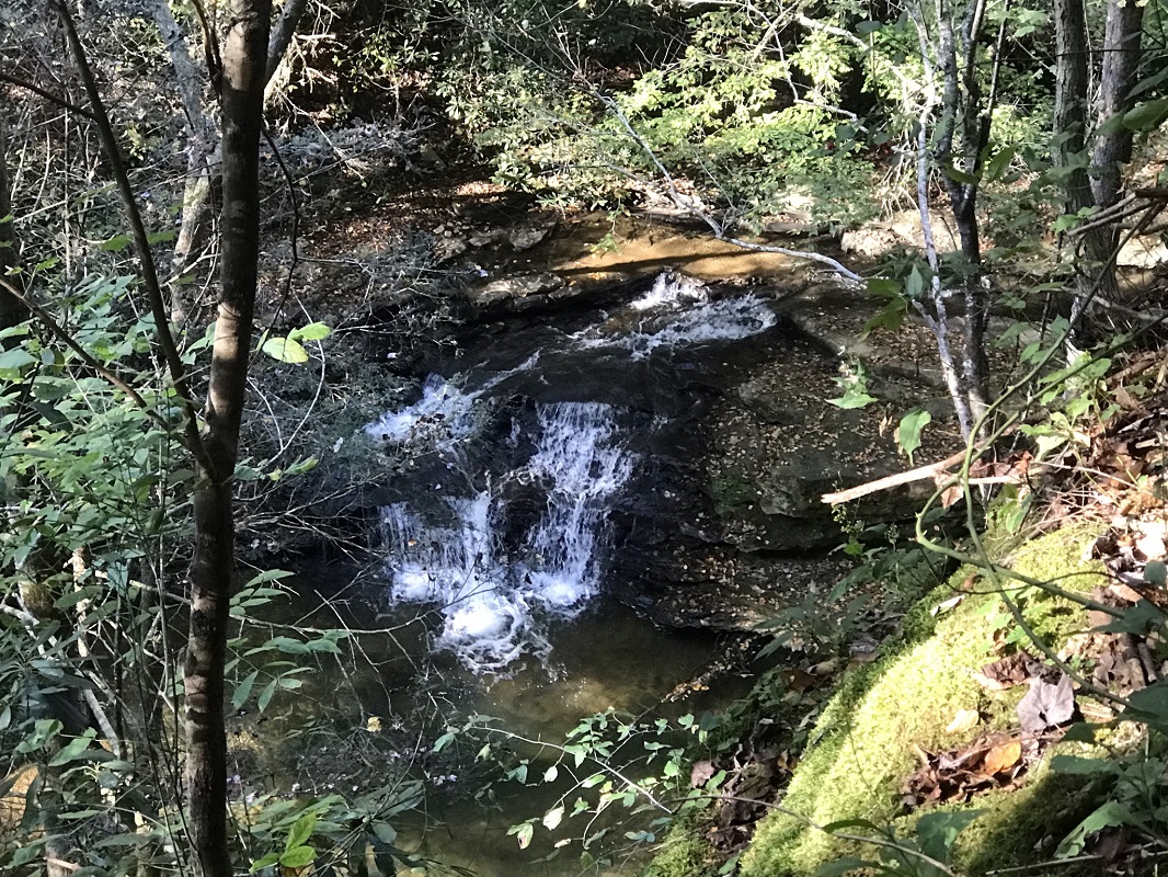
Mile 2.3 – The River Trail ends at a right turn and becomes the Grassy Creek Trail near where Grassy Creek enters into the Russell Fork River. There was no trail sign here, but the Grassy Creek Trail is yellow blazed, not blue like the River Trail. Just after the turn, ascend about 50 feet, and look down on a small waterfall on Grassy Creek.
-
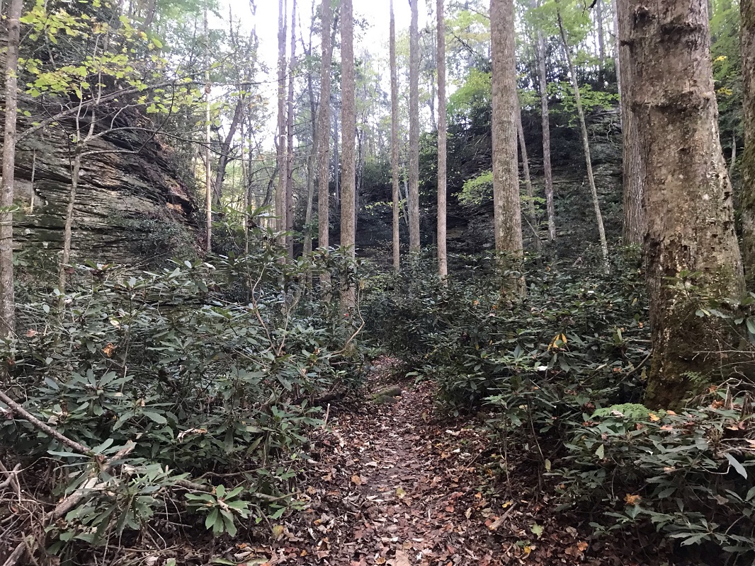
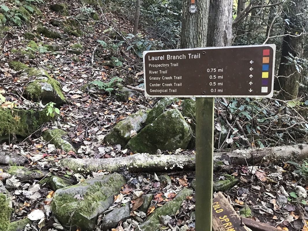
Mile 2.7 – Turn right onto the Laurel Branch Trail. If you find yourself crossing a somewhat slick streambed on the Grassy Creek Trail, you have gone too far. I missed this intersection at first, even though it is signed. The Laurel Branch Trail parallels the Laurel Branch stream and climbs straight upslope at a steep pitch, averaging nearly a 30% grade for over 3/10 of a mile.
|
-
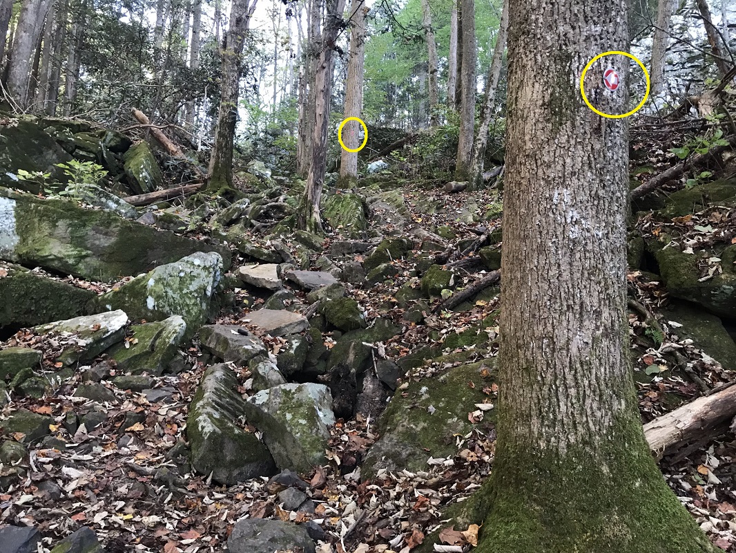
Mile 3.0 – A trail sign signals an intersection with the end of the Prospectors Trail and your return to the rim top trail system, with arrows pointing in every direction, signaling multiple choices. Although you could take the Prospectors Trail back, it seemed more interesting to stay on the red blazed Laurel Branch Trail, which ascends in a zigzag a trail marked with a series of metal arrows on trees. Shortly afterward, take the Laurel Branch Trail through a rock formation known as The Notches.
-
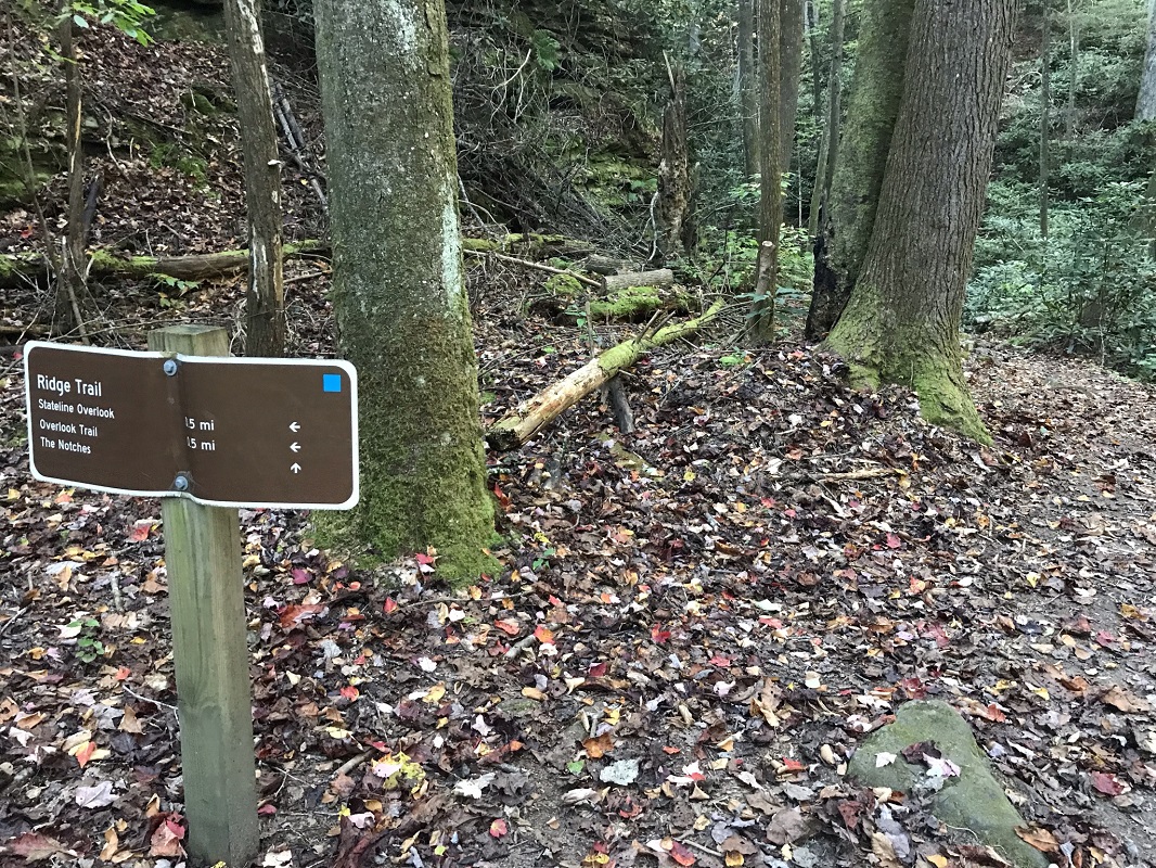
Mile 3.2 – After passing through The Notches, arrive at an intersection with the blue blazed Ridge Trail, marked by a sign. Take the Ridge Trail towards Stateline Overlook. After an initial, brief climb, the Ridge Trail is relatively flat. The rest of the hike is easy.
-
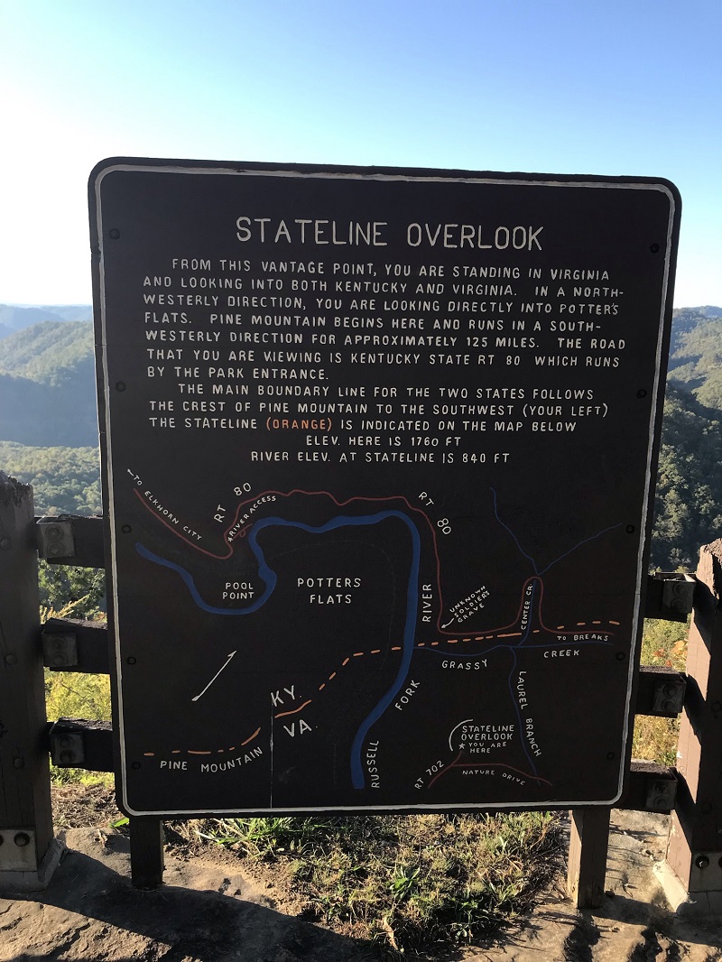
Mile 3.6 – Reach the parking lot for the Stateline Overlook. Be sure to detour slightly to check out the views at the overlook! There is a signboard at this overlook explaining the boundary and Pine Mountain. Continuing on the hike, I found trail signs lacking and the route confusing here. My map told me that the Overlook Trail would take me back to my vehicle. Returning from the overlook to the parking area, the Overlook Trail is on the right. But the trail was so much smaller than other trails I had experienced in the park, I thought it was a social trail and did not take it at first. I started out following the park road back then switched to the Overlook Trail as it paralleled the park road just to the right, passing several picnic areas and the Clinchfield Overlook parking area/trailhead. The park road was empty.
-
Mile 4.3 – Arrive back at the trailhead parking lot.
|

