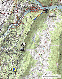
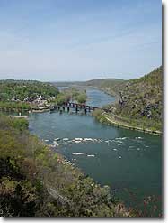
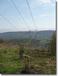
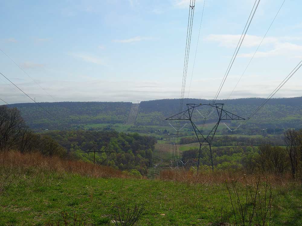
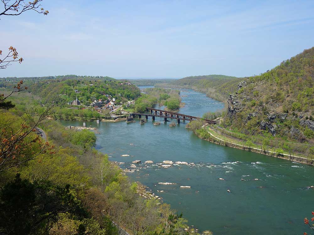
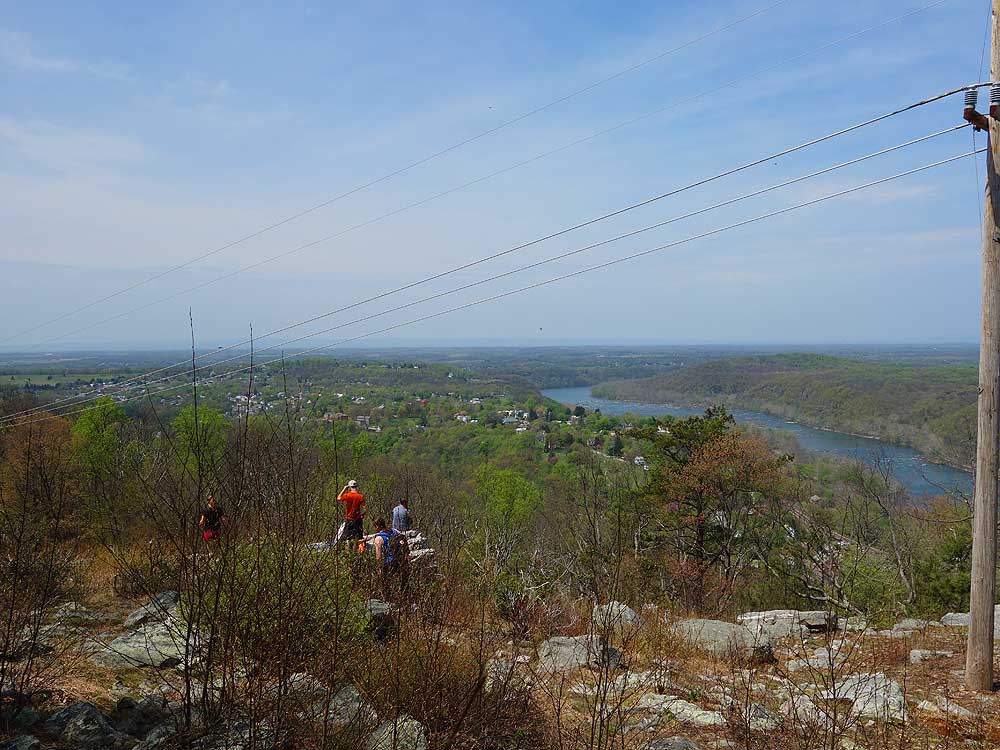
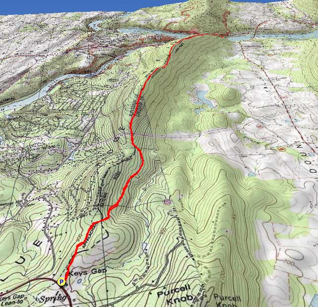
Following the Appalachian Trail north from Keys Gap this hike features the beautiful Loudoun Heights overlook of Harpers Ferry and Potomac River. There is also a nice vista from a utility clear-cut with Virginia to the east and West Virginia to the west. For those making this a backpack, there are two good campsites between the clear-cut and Harpers Ferry National Historical Park. The one downside to this ridge walk is the extremely rocky section of Appalachian Trail just south of Harpers Ferry National Park.
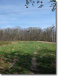
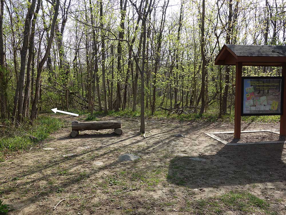
Mile 0.4 - The trail splits with an old section of the A.T. going left. Stay right on the white blazed A.T. descending and traversing the eastern side of the ridge. Pass 3 campsites on the right side of the trail from this point to the utility clear-cut. These campsites should not be used, as there is no camping allowed between the parking area at Keys Gap and the utility clear-cut at mile 1.4.
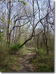
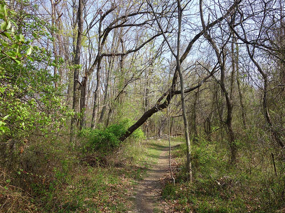
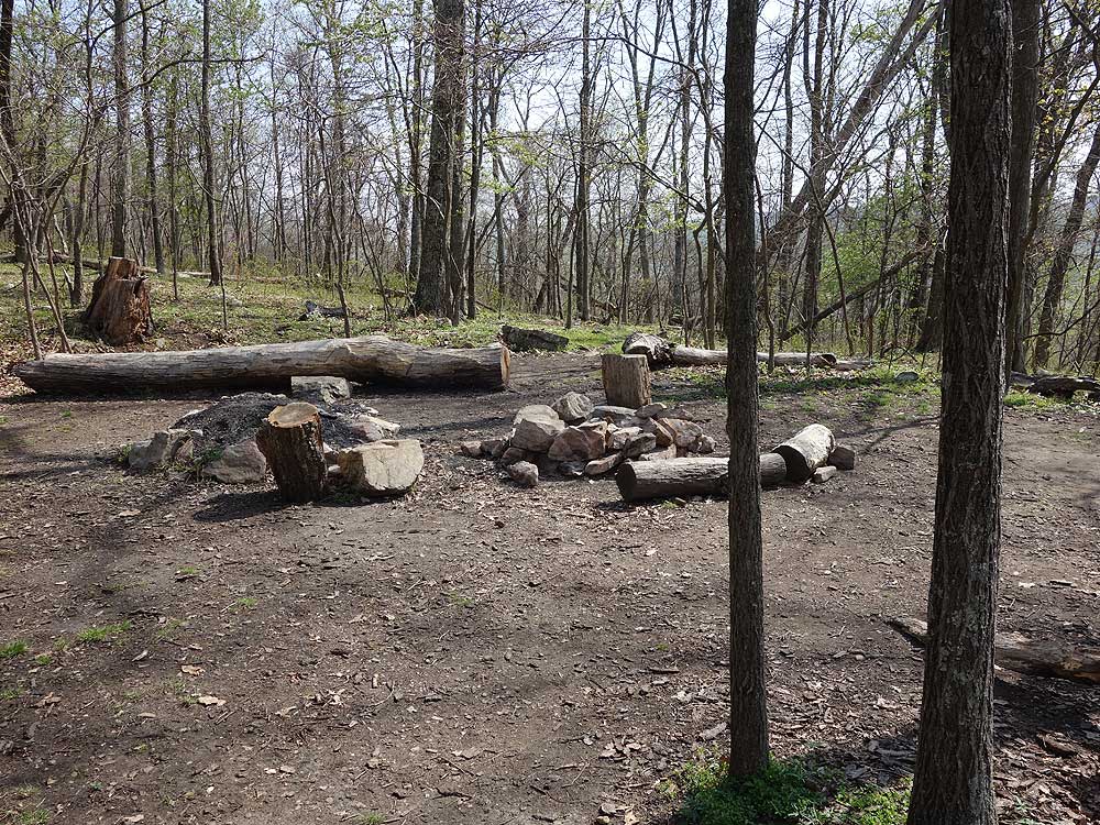
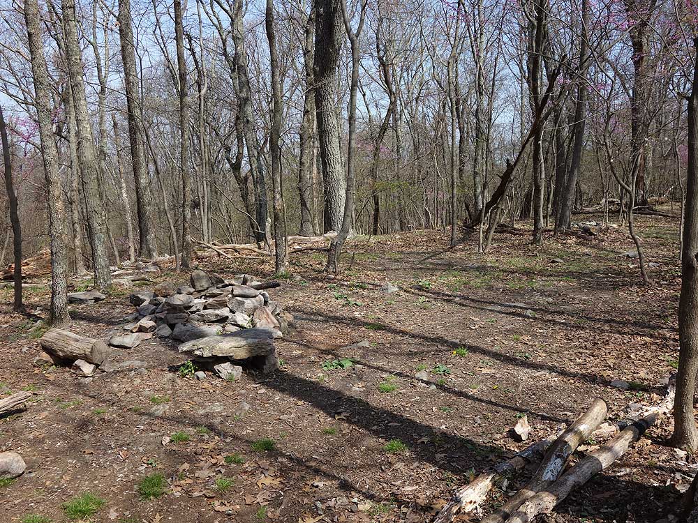
Mile 2.0 - Pass the first of two good campsites. This is the largest campsite with a fire ring and can accommodate 3 tents. From this point the trail becomes significantly more rocky.
Mile 2.9 - Arrive at a second campsite just before the A.T. passes through a small saddle.
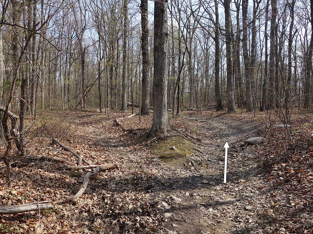
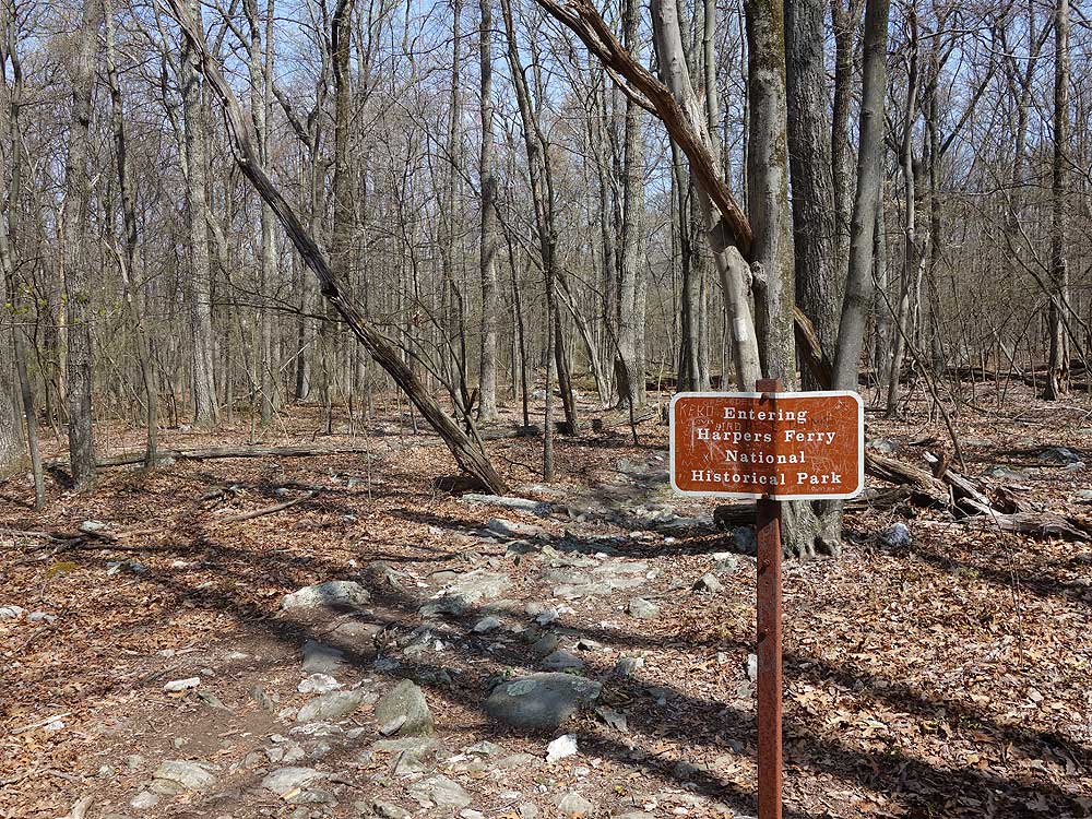
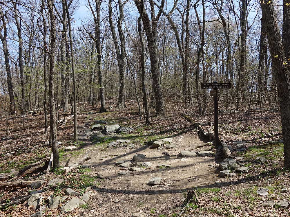
Mile 4.0 - At the intersection the white blazed A.T. turns left/west downhill towards the ATC Visitors Center. Turn left downhill. This section of the blue blazed trail is closed as of 2018.
Mile 4.25 - Turn right on the orange blazed trail as it climbs to the ridge and intersection with the blue blazed trail
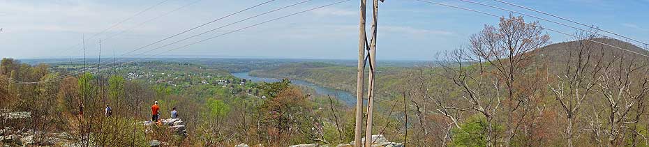
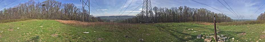
Mile 5.25 - Turn left on the blue blazed Loudoun Heights Trail north passing a view of the Potomac River at a power line clear-cut. The trail then descends to the right and passes around the mountain.
I hiked this on 10/4/19 and apparently some changes have been made recently. The blue trail from the AT to the orange trail is blocked off with branches and the AT has been rerouted to the west of where it originally was from where it crosses from VA into WV to a little before the orange trail. I did go through the branches and take the blue trail back to the AT after heading back from the overlook. At this time it is still clear and blazed. Strange that it appears they are doing away with that section. I could find nothing wrong with it and it is definitely a much easier route than orange.
By:Alan
Rating:
Date of Hike: Saturday, November 10, 2018
Not a regular hiker, but figured NPS would have a nice hike for visitors. Was wrong. Am in shape, could have finished hike. Dropped leaves completely obliterated trail. Had to rely on markers. These markers are woefully inadequate! Found trees with white blazes toppled over. Mid way up we found orange ribbons around trees, was this the orange trail? No it wasnt. Lost time there. Why were they there? White blazes ran out about mid way up mountain. My wife and I stood for 30 minutes in vain trying to find next white blaze. Was thinking couldnt a park service employee walk the trail twice a year with 3 cans of orange, white and blue spray paint to mark the trail so that visitors can EASILY see the path? I would pay for the paint! Returned to the hotel with thought that a little foresight and work by NPS, a lot more people can enjoy this mountain. Poorly marked trail ruined it for casual hiker tourists. Dont recommend the hike till they do the necessary markings. You will become lost.
By:Peter
Rating:
Date of Hike: Saturday, November 10, 2018
Alan's review is woefully bad. I hiked Loudoun heights on Saturday as well, from Harpers Cemetery. There is nothing difficult about navigating this hike: you can hike the white blazed AT halfway up the mountain, and take the orange trail to the blue trail after going up a huge hill at the end of the orange trail. Or you can hike the white blaze to the top and turn left on the blue trail off of the white trail, which is easier in the long run because the grade lessens greatly after the orange trail and once you get to the blue it's flat or going downhill.
I saw a lot of people struggling with this trail today. If you can't hike the upper Maryland heights trail, you wont be able to hike this one. As for the condition of this trail, it was fine and navigable. Trees were knocked down because the wind was blowing 40-45 mph at times. If you hike, you will find fallen trees. Its common.
It was hard to stay at the overlook on Saturday with that big wind. Anyway, long story short, this is an easy hike to do if you are fit and observe your surroundings. Ive helped several people get back on the trail, after getting off because the simply were talking and not paying attention to whats going on around them. Lastly, it's fall and there are leaves everywhere. These are trails. They arent vaccumed by Harpers Ferry NPS.
By:Hobo Hiker
Rating:
Date of Hike: Wednesday, February 21, 2018
FYI- I hike from the Keys Gap parking lot all the time and there seems to be a lot of car break-ins at this lot. Especially if cars are left overnight. Make sure you do not leave ANYTHING valuable in your car. I suspect the nearby trailer park. Blackburn Trail Center also use to be broken into a lot before the care taker took over. Also, after a rain, the first mile of the AT towards Harper's Ferry is a swamp. The first mile of AT trail is in ridge bowl and the water has now where to go. I mean shoe deep mud.
By:Solo
Rating:
Date of Hike: Monday, February 19, 2018
Trail is mostly small to midsize rocks and poles were helpful. I did a modified version of this hike by starting at the Route 9 lot and then at mile 4 taking the left turn down to Harpers Ferry. The turn and everything else on this trail are very well marked. The hike down to Harpers Ferry was smooth and the return offered a great vertical workout. Harper's Ferry is a cool little place to stop for lunch or a snack and turn around to retrace your route. Someone did a great job of designing the highway bridge to accommodate hikers as they built a nice stairwell under the bridge and added a concrete barrier between the cars and hikers. Well done and much appreciated. In total I did about 14 miles in about 5 hours. You could easily add mileage after Harpers Ferry as the AT and C&O Canal trail continue together in parallel to railroad tracks
By:Steve
Rating:
Date of Hike: Thursday, June 1, 2017
I'd give it three stars but the Loudon Heights Overlook bumps it up to four. The best overlook I've seen on any hike in this area, and the only one I wanted to stay at for an extended time. As the description notes, the hike is rocky along most of its length. It's not much worse than the rockiest hikes I've encountered in George Washington National Forest (Signal Knob, Three Top Mountain). I did fine wearing trail runners. I had two hiking poles in my backpack in case it got too tough but didn't use them. Definitely the rockiest stretch of the Appalachian Trail I've run into in hiking 50 miles or so of pieces of it. In a couple very rocky patches I lost the trail and trail blazes but following the rocks shortly brought be back to the trail. About 20 other hikers on the AT, one other on the blue-blazed portion down to the overlook. Seemed busy for a weekday but didn't feel crowded. It was quite muddy for parts of the first mile, like 2-3 inches deep, but I was able to walk around the worst parts. A longer hike but the relatively low elevation change made it a bit easier than I expected. No streams or springs so bring enough water. This parking area is shared with the Keys Gap/Buzzard Rocks hike going south (which I also recommend). If you look at the reviews of that hike a couple note some odd characters hanging out in the parking area. There is a notice posted at the trail head to stow your belongings and lock your car. A panhandler at the trailhead asked me for spare change. I didn't feel unsafe but it's odd because I don't see such activity at any other trailhead. Please be alert.


