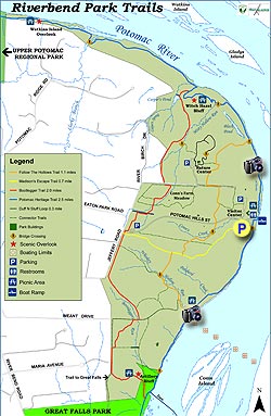
With Scott's Run Nature Preserve and Difficult Run, Riverbend Park along the banks of the Potomac River and just outside the beltway, is the least well known of the three. With only a small amount total elevation gain, the interconnecting trails are suitable for just about any skill and fitness level.
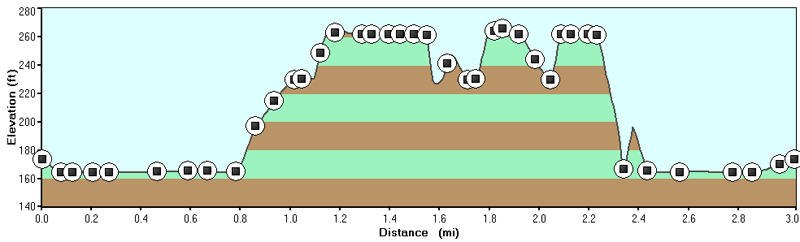
The hiking trails at Riverbend Park can be done in a number of different combinations to suit the abilities of any hiker. Here we have marked out the longest possible circuit route of 4.5 miles.
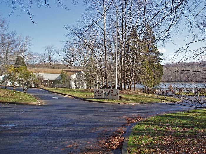
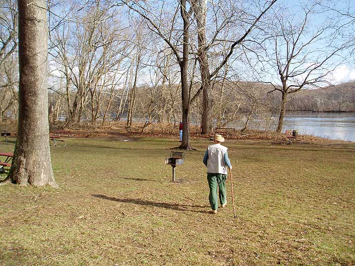
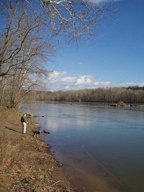
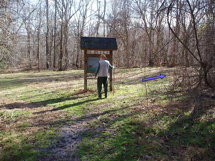
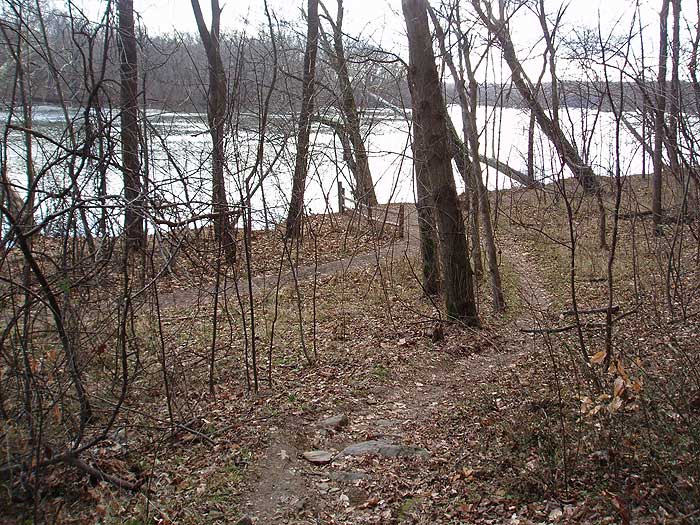
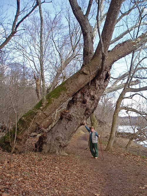
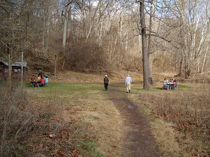
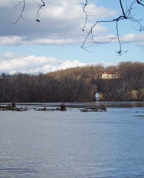
From the parking area, directly behind the main visitors center, walk through the picnic area, and head upstream on the Potomac Heritage Trail that follows the banks of the Potomac River.
In 0.5 miles pass the Follow The Hollows Trail, and in another 0.2 miles cross another small footbridge then arrive at the intersection of the Bootleger Trail.
Continue uphill for 0.2 miles where the Bootlegger Trail passes a connector trail that heads over to the Duff N Stuff loop trail.
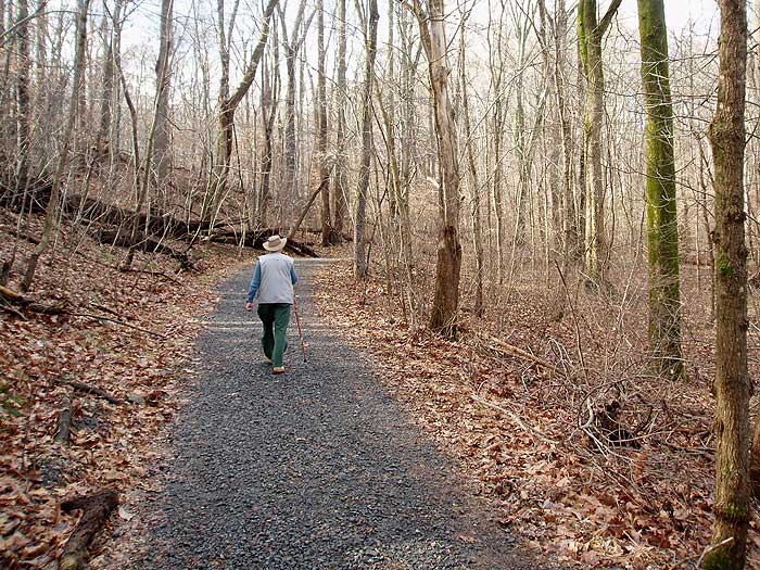
Continue on the Bootlegger Trail for another 0.2 miles where the trail passes through the Conn's Farm Meadow area. From this point the trail runs along the western edge of the park.
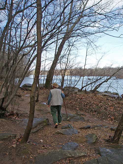
1.4 miles after passing through the Conn's Meadow Farm area on the Bootlegger Trail, the Bootlegger Trail will turn left downhill at the intersection of the Great Falls Park connector trail.
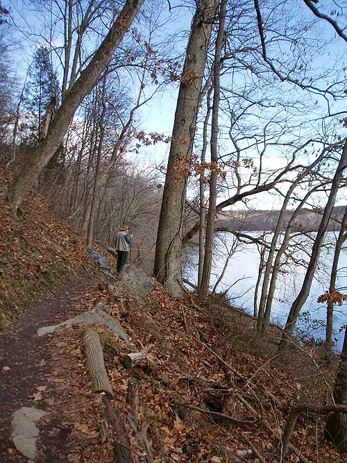
Turn left downhill for 0.2 miles passing the Artillery Bluff overlook and arrive at the Potomac Heritage Trail and Potomac River.
At the banks of the Potomac River turn left upstream on the Potomac Heritage Trail. In 0.6 miles pass the Follow The Hollows Trail, then pass through a picnic area in 0.2 miles.
From this point the Potomac Heritage Trail will become wider, and arriving back at the Riverbend Park Center, and lower parking area, in another 0.7 miles.
Early January
Riverbend Hike Comments
Archived Comments
By:Mark
Rating:
Date of Hike: Sunday, July 9, 2017
Was a beautiful Sunday out and tried to get into Great Falls Park with some nephews to go hiking there, but at 9:45 the line to get in was nearly 1/2 mile long and not moving so we drove to Riverbend Park with the idea to hike down the riverside trail to Great Falls. About 1/2 down the trail we ran into many groups that warned us about yellow jacket nests in various trees that had fallen with about 80% of the people having been stung (as well as some dogs). With two younger boys we did a detour on some of the trails in the woods to get to Great Falls which would have OK (pretty boring, but quick to traverse), but then as we got back to the riverside trail near the damn just before Great Falls there were some nests in the rocks there and myself and one of the boys was stung as were some other people. We had been in the visitors center talking to the nice lady there and not one warning about the nests from anyone with the park until we ran into a ranger from Great Falls preparing to put some signs up.
Certainly not a quiet place on a summer Sunday, but definitely less crowded than Great Falls. Probably would rate it a four if not for the yellow jackets.
By:Bryan
Rating:
Date of Hike: Thursday, May 4, 2017
Nice hike with a good mix of terrain. Easy for beginners, but not challenging. Trails are well marked throughout the park if you follow the markers. The area is beautiful, but there's no spectacular vistas along the trail.
By:Thea
Rating:
Date of Hike: Friday, May 15, 2015
The map here is not showing the exact track, so I had difficulties when trying to follow the printout of the HU map that I used for reference (I have been using this method for all of my hikes which follows HU directions, and so far succeed). Other than that this trail is pretty nice for a nearby walk/hike. Basically, follow green sign on the east side, and red sign on the west side. I finished in 1 hour and 45 minutes, total distance as per my gps is 4.02 miles - this includes several back and forth walk in an attempt to find the red sign after crossing the Conn's Meadow Farm area.
By:TravelMad
Rating:
Date of Hike: Monday, January 20, 2014
Pleasant - we did it in a little under 2 hours.Ā But - you need to keep your eyes peeled for the red blazes of the bootlegger trail and not solely rely on these directions.Ā (Although a few more landmarks in these directions would be appreciated...)Ā This was our first time in Riverbend, and it gave us a nice survey of the park.Ā I also do not think it would be particularly suitable for families with young children around Artillery Hill - it is a steep hill down - but there are plenty of connector trails to avoid that last bit.Ā Thanks for posting the hike!Ā We will do more off this website.
By:Athryn
Rating:
Date of Hike: Friday, January 18, 2013
The directions are sorely in need of updating, it's been 2 or 3 years since the trail names have changed, and I unfortunately didn't pay close attention to the comments before setting out. I spent more time being frustrated with my map and less time actually enjoying the hike. :\
HikingUpward Note: Athryn, thanks for the notes about the new trail names. The map has been updated as well as the hike directions to now include the longer loop hike on the Bootlegger Trail.
By:JV
Rating:
Date of Hike: Sunday, January 29, 2012
My two boys, 9 and 12, the dog and I hiked from River Bend down into Great Falls and back again. They could scramble up and down the cliffs and rocks while I strolled along. The path is straight and usually dry (although when the river floods it gets muddy) and not at all strenuous.Ā The Great Falls section is crowed with people while the River Rend section isn't.Ā Nice views as well.Ā Overall a great way to spend a Sunday afternoon with kids.
By:M. Greene & BWM
Rating:
Date of Hike: Saturday, January 21, 2012
We hiked this on a Saturday with about an inch of snow on the ground. The visitor center is very well maintained with friendly and helpful staff. They were shoveling all the sidewalks when we arrived at 11:20. The visitor center had some really cool items that you should stop in and take a look at. About this hike, well it took us 3 hours and 30 minutes to complete adding 5.36 miles to this hike. Before we got to Carpers pond we kept going straight along the Potomac passing some really cool stuff a bridge, a huge house, Watkins Island Overlook and a washed out road that has a make shift waterfall. After the washed out road we kept going straight for a little longer. Adding this really adds some excitement to this trail and also a great workout. So in the end we did 3.5 hrs of hiking covering 8.36 miles of trails running into about 6 other people in an inch of snow it was a great day for a hike.
By:Kackeroo
Rating:
Date of Hike: Sunday, August 14, 2011
The trails in Riverbend have been re-named and re-blazed. The former "Paw Paw Trail" is now part of the "Bootlegger Trail". The "Upland Trail" is now blazed gold and is called the "Follows the Hollows Trail". There are still some posts marked as "Upland", but I'm guessing they will be removed or re-branded at some point. Here is a link to the latest trail names and blazes: http://www.fairfaxcounty.gov/parks/riverbend/trails.htm
By:Adam Peat
Rating:
Date of Hike: Wednesday, July 20, 2011
We did this hike early in the morning during the weekday and were the only ones on the trail.Ā The trails were generally narrow and there were many cross trail spider webs (every few feet) so we eventually used a stick to clear the the path.Ā A hiking hazard, I know, but this was excessive.Ā The hike itself was not too scenic (although we did enjoy the meadow) and all of the other potomac river hikes we've done have had much better river views.Ā A nice, easy hike, but our least favorite that we have done.
By:Rich and Nick Davis
Rating:
Date of Hike: Saturday, July 2, 2011
Great Hike!Ā Beautiful views of the Potomac.Ā Started in Great Falls Park and then into Riverbend with my son.Ā We started about 7am and it there were no people.Ā By 1130 am it was much busier.Ā A great 7.5 mile hike.


