Mt. Mitchell is the tallest peak in the Appalachian Mountains and the Eastern U.S. which makes it a worthwhile destination for any hiker. Tourists can access the mountain during the warmer months when the Blue Ridge Parkway and state park are open to vehicle traffic. The state park offers many exhibits, amenities, and trails, and the namesake mountain has a paved walkway leading to the observation tower just a few hundred yards from the parking lot. However, the true way to experience the mountain is to hike it, all the way from the bottom.
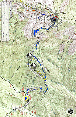
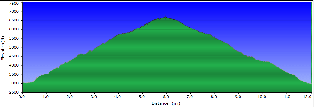
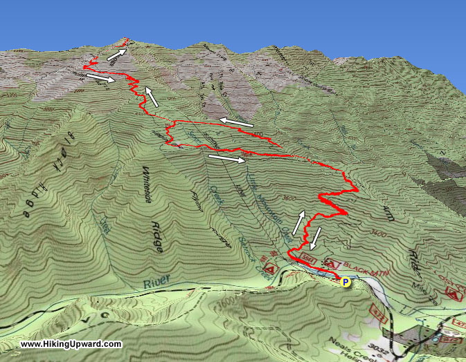
The classic route is the Mt. Mitchell Trail which starts over 3,000 feet below the summit deep in the South Toe River Valley. For nearly 6 miles the trail climbs steadily through multiple forest ecosystems as you leave the comforts of the valley and enter the southern Appalachian spruce-fir forests only found at the highest elevations in the southeast. Along the way you’ll find views, microburst damage, beautiful forests, and ice if it’s the winter. Your reward is the incredible 360° view from the Mt. Mitchell observation tower where you can spot seemingly every mountain range in North Carolina.
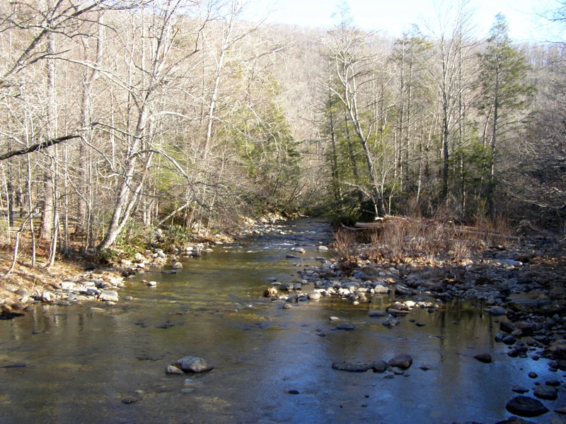
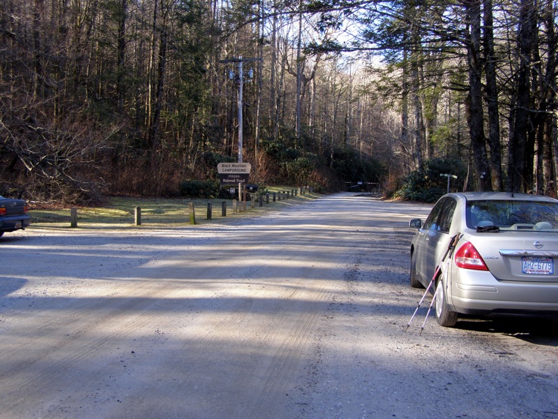
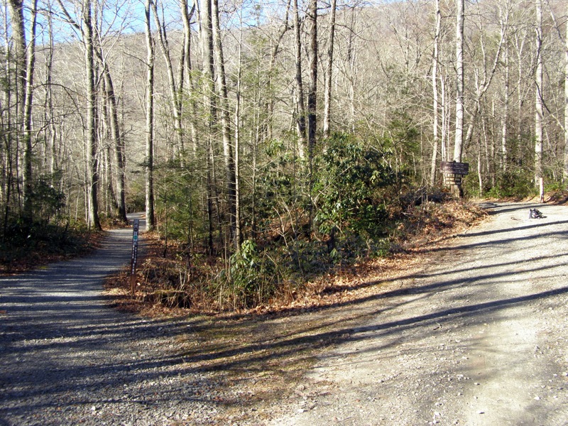
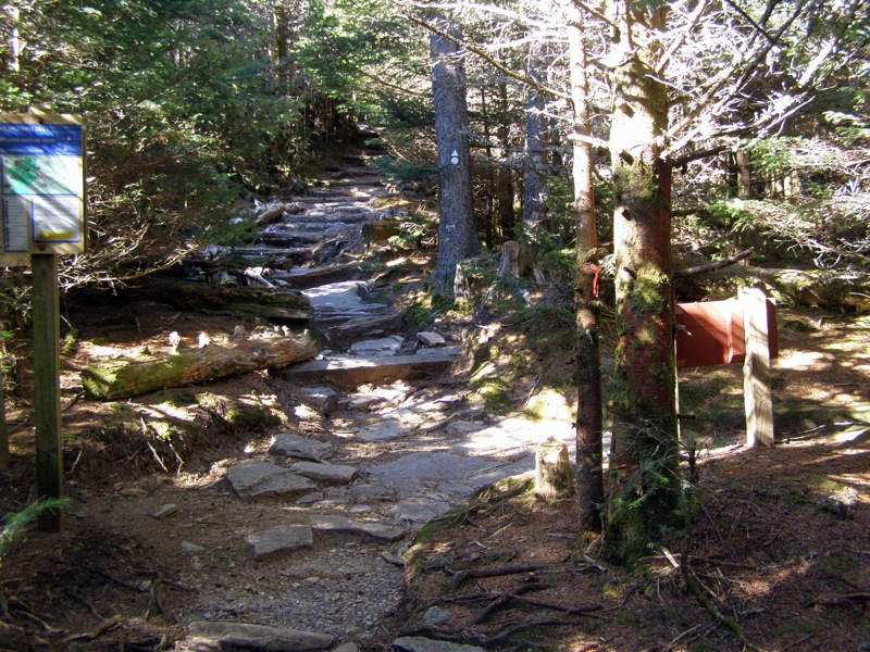
The trail head is located in the Black Mountain Campground, managed by the Appalachian Ranger District of Pisgah National Forest. From the small community of Busick, turn on the South Toe River Road off highway NC-80. Follow this gravel road for 2.8 miles to the entrance of the Black Mountain Campground. At the entrance is a parking area beside an information board, just before a road bridge over South Toe River. This is the designated hiker’s parking lot, parking in the campground is for registered campers.
Mile 0.0 – Hike begins at the hiker’s parking area at the Black Mountain Campground. Start your hike crossing the bridge on the right over South Toe River.
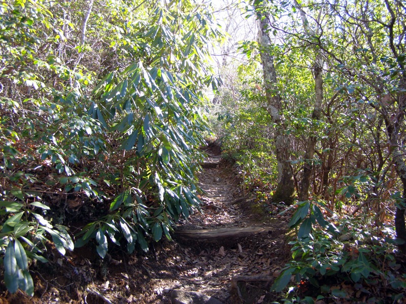
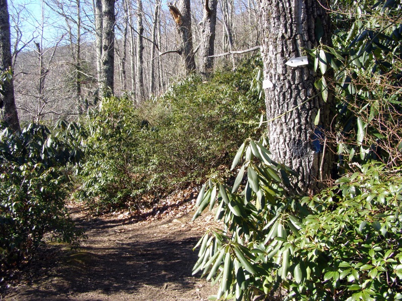
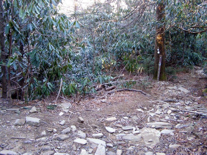
Mile 0.3 – The Mt. Mitchell Trail (blue blaze) begins on the right side of the road. This trail is 5.5 miles one-way to the summit of Mt. Mitchell, the tallest mountain in the Eastern United States. The Mountains-to-Sea Trail (white blaze) follows the Mt. Mitchell trail for the majority of the journey. For 1.6 miles the trail switchbacks through hardwood forest then thick rhododendron and mountain laurel.
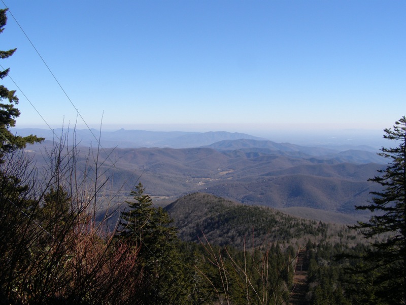
Mile 1.9 – Junction with the unmarked spur trail to overlook of South Toe River Valley.
Mile 2.0 – Junction with the Higgins Bald Trail. Unlike what is listed on topographic maps the Mountains-to-Sea Trail (white blaze) follows the Higgins Bald Trail (yellow blaze). Go right on the Mt. Mitchell Trail.
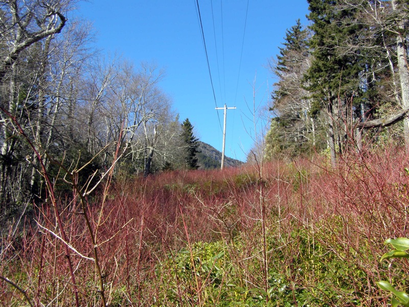
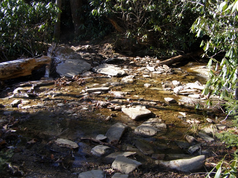
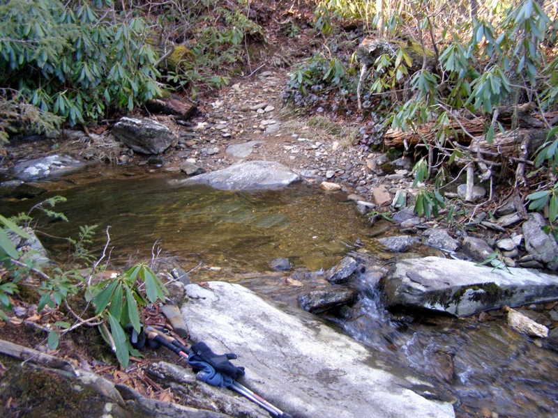
Mile 2.9 – After passing through a power line clearance, rock hop over Setrock Creek and then reach the junction with the Higgins Bald Trail (yellow and white blaze). The MST rejoins the Mt. Mitchell Trail at this junction.
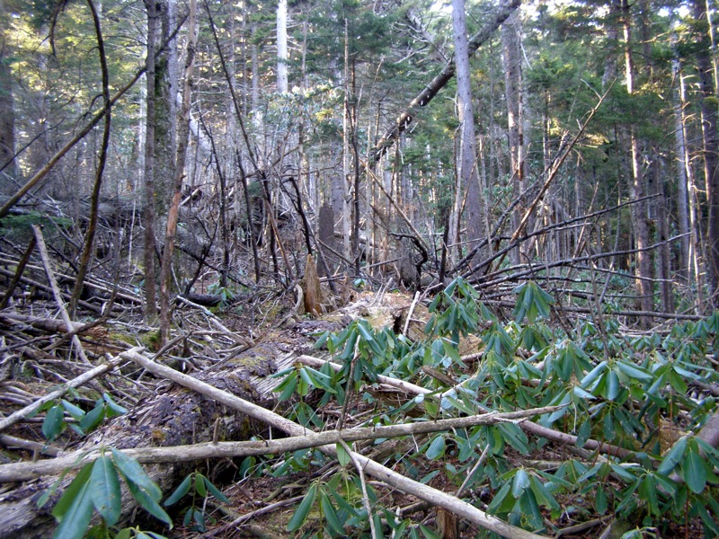
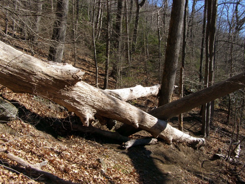
Mile 3.1 – Pass through an area with campsites below large pine and spruce. In this area you’ll pass extensive damage beside the trail as a result of a microburst.
Mile 4.2 – Junction with Buncombe Horse Range Trail. The Mt. Mitchell Trail turns left following the horse trail briefly.
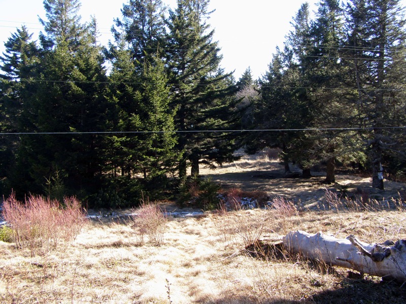
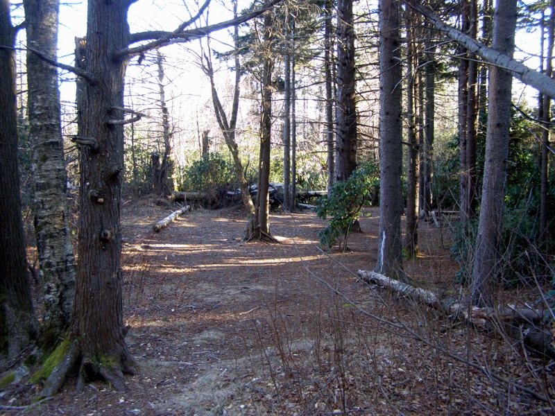
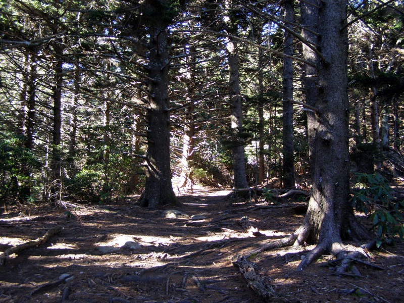
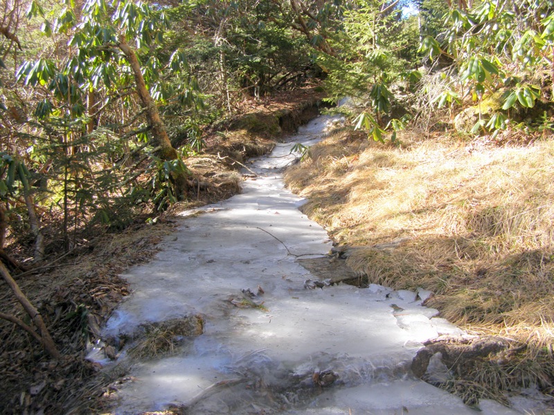
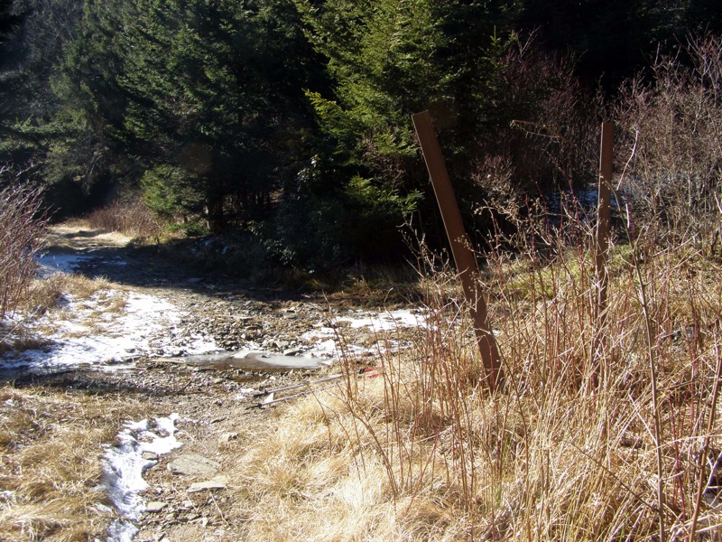
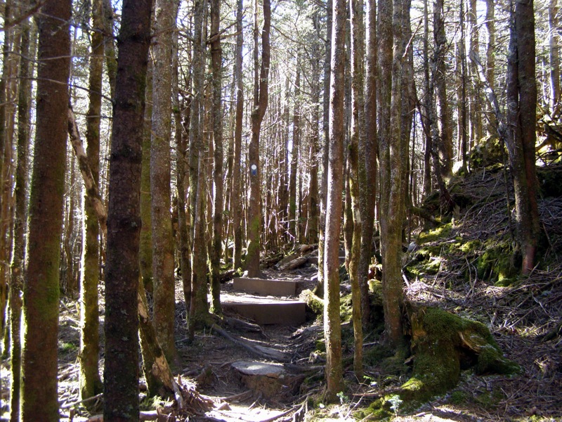
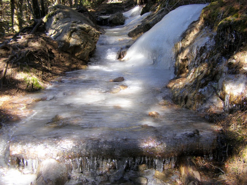
Mile 4.3 – Mt. Mitchell Trail turns right leaving horse trail at Commissary Hill (great campsites). From here the Mt. Mitchell Trail leaves the national forest entering the Mt. Mitchell State Park boundary. For the next 1.6 miles the trail follows a narrow, heavily eroded path over roots and rocks. As you near 6,000 feet you will enter southern Appalachian spruce-fir forest that is unique to the Southeast. The forest is dominated by red spruce and Fraser fir. During the winter this section has long sections of ice.
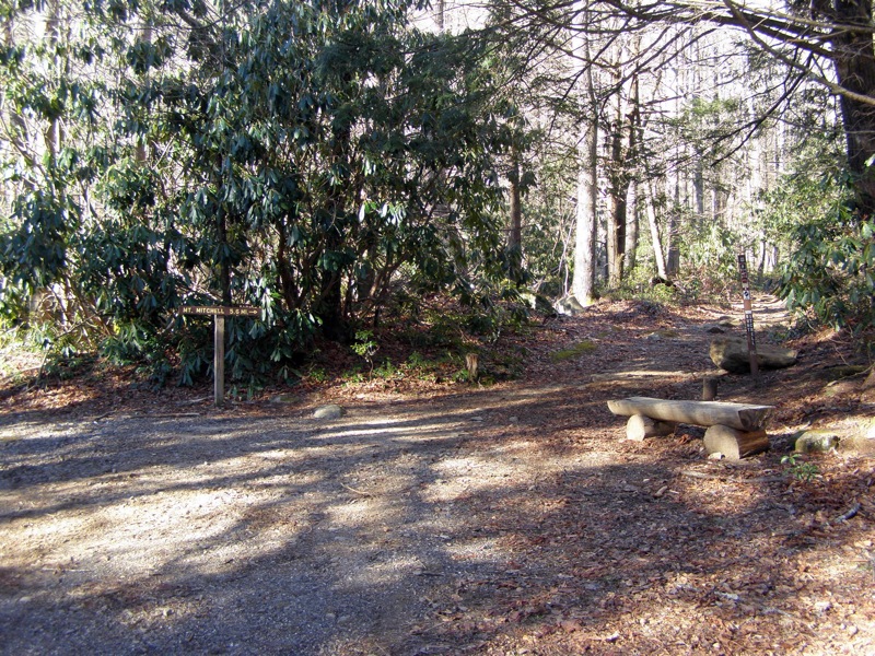
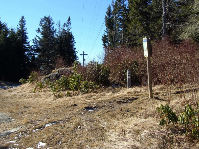
Mile 5.6 – Junction with Balsam Nature Trail. Stay left on the Mt. Mitchell Trail-Balsam Nature Trail. The right fork of the Balsam Nature Trail is a short loop and also ends at the summit.
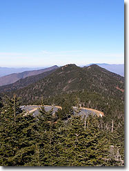
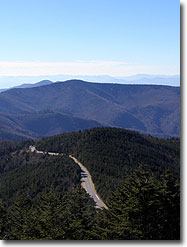
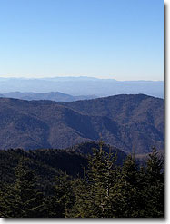
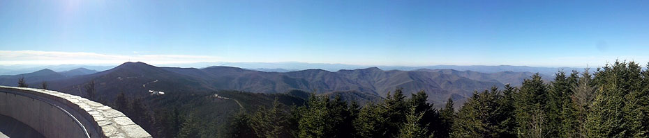
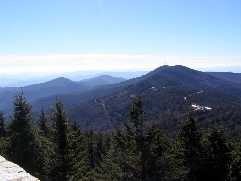
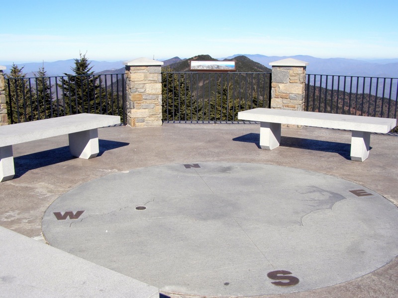
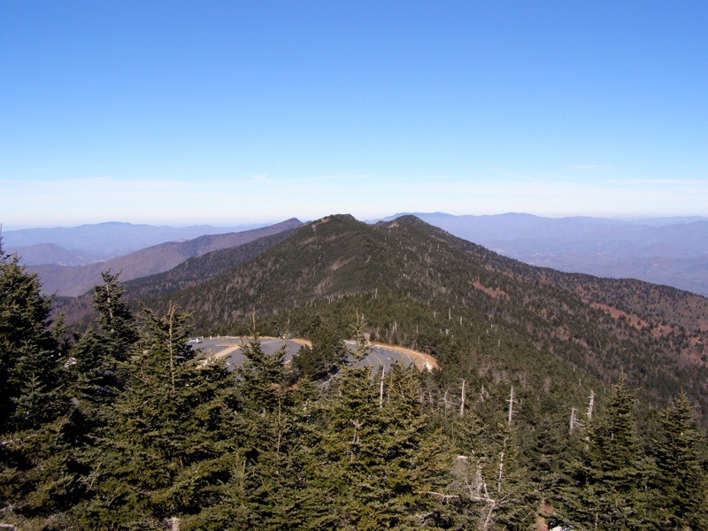
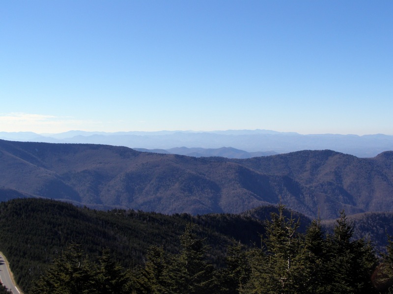
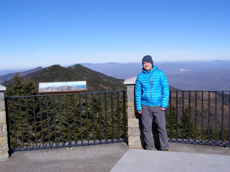
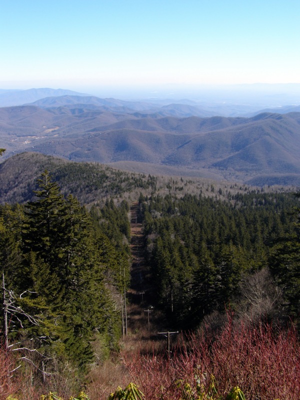
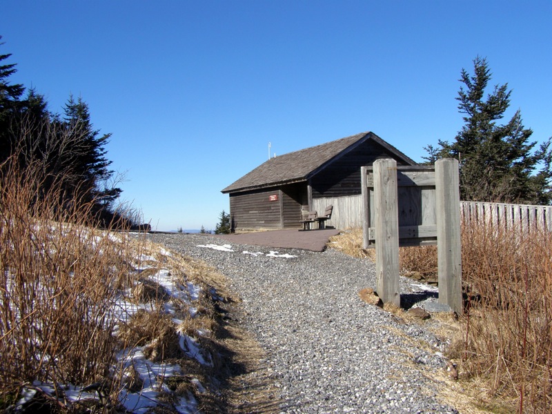
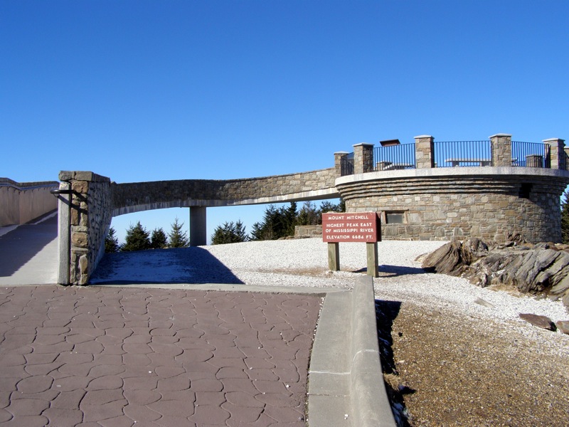
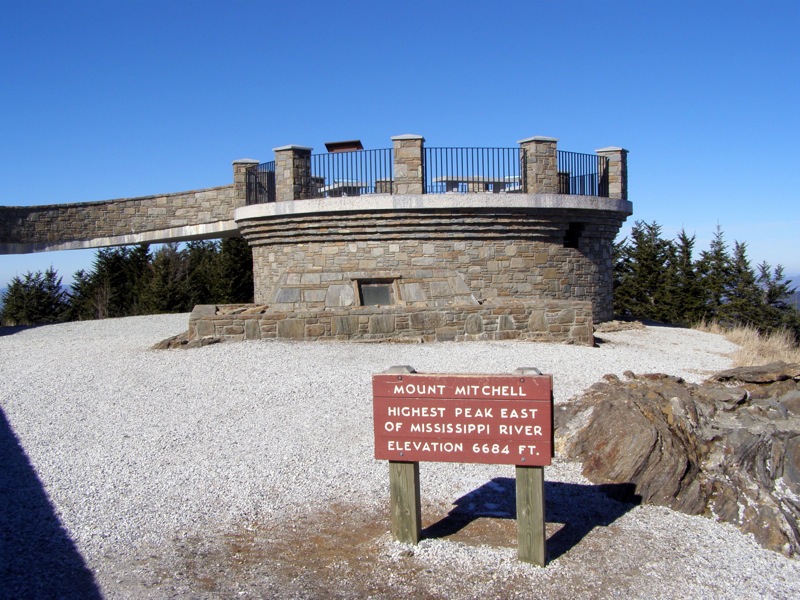
Mile 5.9 – Reach the summit of Mt. Mitchell, the highest mountain in the east at 6,684 feet. The grave site of Dr. Elisha Mitchell is below the observation tower. The observation tower was remodeled in 2008 and provides 360° views complete with interpretive signs in each direction that help you identify all the mountains and land features in view.
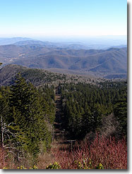
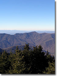
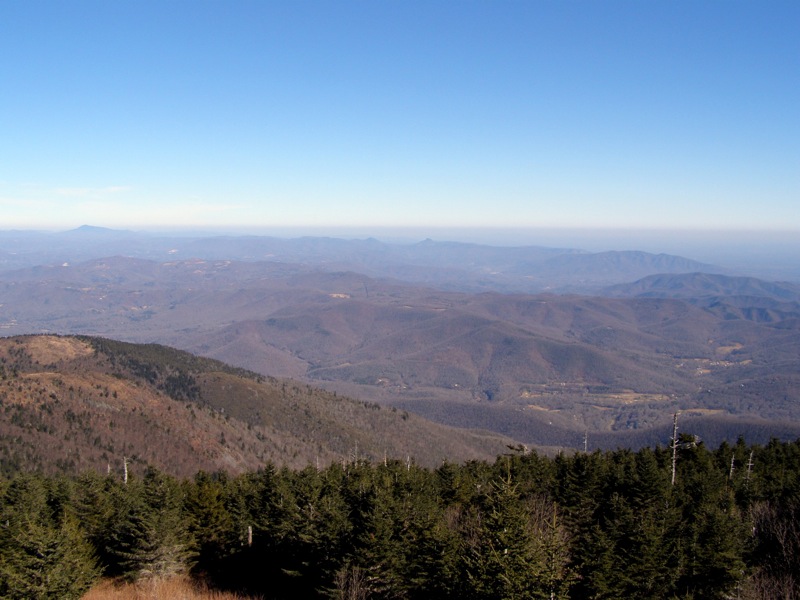
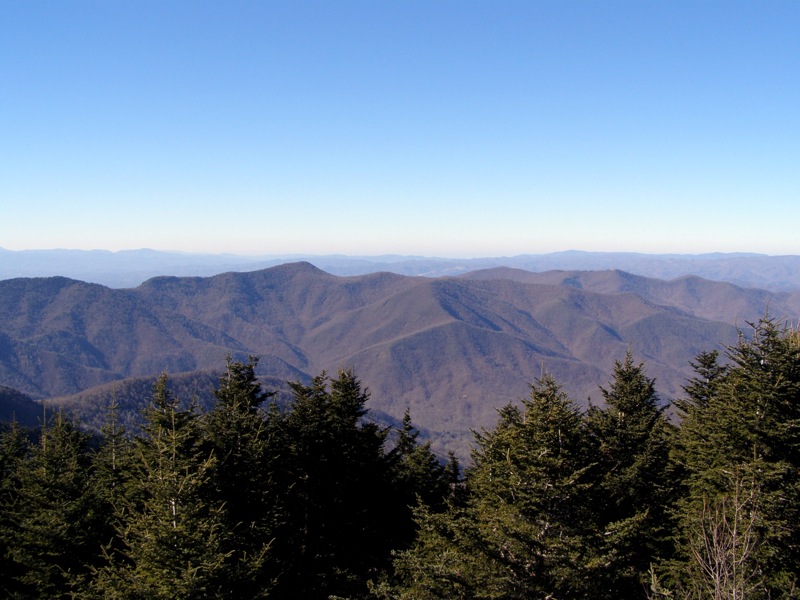
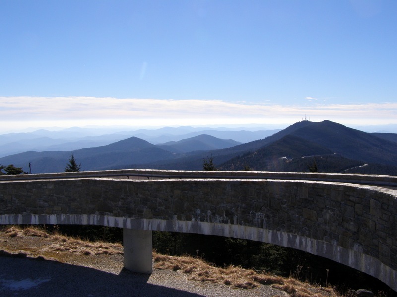
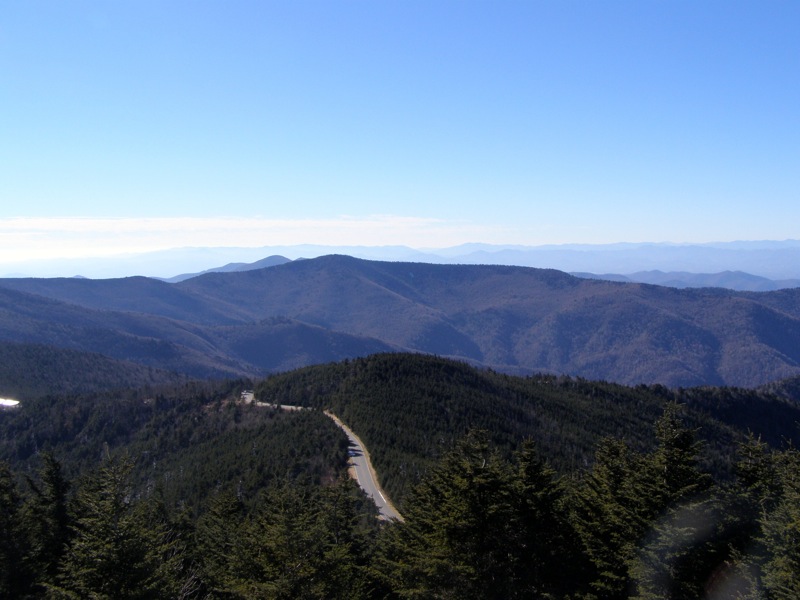
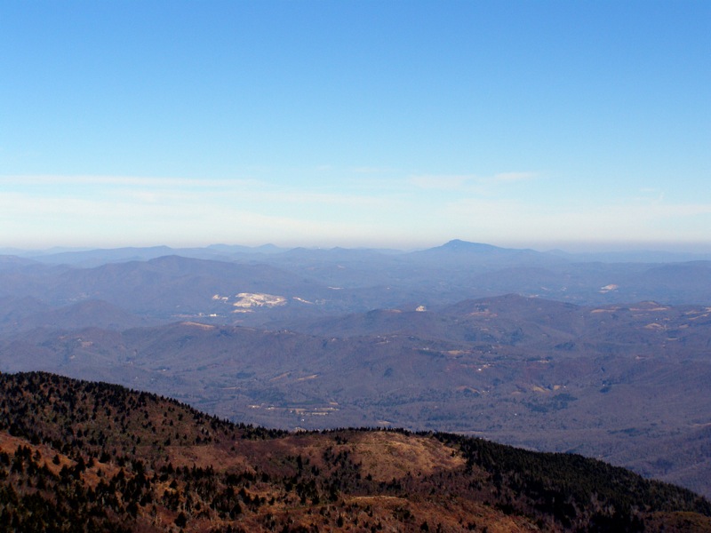
Immediately north Mt. Craig, the 2nd tallest mountain in the east, is the closest peak. The northern Black Mountains dominate the skyline as they undulate for miles ending at the conical Celo Knob. Farther north you can see the tall, gently sloped mountains of the Roan Highlands. In the northeast Grandfather Mountain sticks out as the tallest peak in its immediate area. Linville Gorge and the iconic Table Rock Mountain and Hawksbill Mountain are visible in the east. Due south you can spot Highway 128 curving along the southern Black Mountains, with the radio towers of Clingmans Peak rising beside Mt. Gibbes. Pinnacle is the conical peak to the left of Clingmans Peak. Graybeard Mountain is in between Pinnacle and Clingmans Peak but smaller and more rounded. The Black Mountains are shaped like a J and this readily apparent than atop Mt. Mitchell. The southwestern Black Mountains curve around the Cane River Valley. Immediately to the west Point Misery, Little Butt, and Big Butt are the closest peaks. Towards the southwest Blackstock Knob is the highest peak with a small, rounded summit. Immediately behind and to the left is the distinctive summit of Craggy Dome, the tallest peak in the Great Craggy Mountains. Most of the Great Craggy Mountains are obscured from view by the Black Mountains. If you summit on a clear day, you will be able to see tall ridgelines of the Great Balsam Mountains and Great Smoky Mountains running southwest to west.
Turn around and head back down the Mt. Mitchell Trail towards the campground.
Mile 8.9 – Junction with Higgins Bald Trail, go right following Higgins Bald Trail/Mountains-to-Sea Trail (yellow and white blazes). If you decide to continue down the Mt. Mitchell Trail you will reduce the total distance by 0.4-mi.
Mile 9.4 – Campsites on the right side of the Higgins Bald Trail.
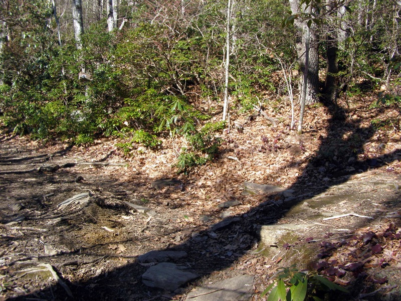
Mile 9.5 – Higgins Bald Trail crosses over Setrock Creek. There is a waterfall below this crossing but no side trails were visible.Mile 10.2 – Higgins Bald Trail ends at the Mt. Mitchell Trail. Continue following the Mt. Mitchell Trail down to the parking area.
Mile 12.0 – Hike ends at Black Mountain Campground.
Early January
Video
Mount Mitchell Trail Hike Comments
Archived Comments
By:Lisa
Rating:
Date of Hike: Saturday, May 25, 2019
Definitely a challenging hike for me, mentally and physically. I hiked the full out and back from Black Mountain Campground. The dirt/gravel road was in good condition on the day I hiked, but the new parking lot wasnt open yet resulting in a long line of parked cars along the road. As an older woman with weak feet and ankles, I always use trekking poles and my typical hike is moderate/rough, maximum 5-7 miles. The weather was sunny and 60-70 degrees. I loved the varied plant life along the trail, the wildflowers were beautiful, with Rhododendron and Azaleas starting to bloom. My favorite is the smell and beauty of the fir trees near the summit. There were several areas along the trail with gorgeous views looking out toward Table Rock and showed the typical layered beauty of the Blue Ridge mountains sweeping north. Several dispersed campers scattered throughout the lower and upper portions of the trail, many with dogs.
The trail has many steep sections with high steps, and washed out sections of trail. Much of it is very rooty with a few large rocks and granite and lots of loose rocks. Foot placement took much of my focus. The trail seemed to go on forever, both ways. I crossed 2 or 3 small streams with a tiny waterfall, good water sources for those who filter. I brought a few liters of water, which was not enough for me. I was definitely feeling dehydrated when I finally reached the summit. Fortunately the concession at the summit had plenty of water for purchase, cash only on the day I hiked.
The hike down was much more difficult for me than the hike up. In all, I averaged 45/Mile, (4 hrs up, 4 hrs down)with lots of hikers young and old easily passing me. A few hikers were meeting shuttles or friends at the summit, for a 1-way hike.
By:Zachary Robbins
Rating:
Date of Hike: Sunday, January 6, 2019
After 4 years I returned to the Mt. Mitchell Trail with some small variations at the top adding more trail miles. This was mainly in spite of the NC High Peaks Black Mountains Challenge, but it also was nice to revisit this great hike. Some of the trail near the bottom has improved with new log steps and the small bridge has been finished. Otherwise it felt like the same trail as before. This was probably the best visibility I've ever had on Mt. Mitchell. I could see peaks and city skylines 100 miles away, including Charlotte, Crowders Mountain, Moores Knob, and even the Uwharrie Mountains. Ice was not as big of a deal this time due to warmer temperatures, but the trails above 6,300 feet were still covered in solid ice and lingering snow. If you hike this in the winter you really should bring ice traction just in case. I kind of wish I had it for about an hour there. On the way down I took the Higgins Bald Ground Trail which had significant blowdowns in 2 sections. Surprised that hasn't been cleared yet, must have been recent.
By:george r
Rating:
Date of Hike: Tuesday, August 21, 2018
My brother and I (ages 61 and 68) did only the ascent from the Black Mtn. Campground to the summit, and used the shuttle back to the car. It took us a little over three hours and both of us felt it was physically challenging. The trail is heavily eroded with rocks and exposed roots the predominant feature. There are places where we had to step up a foot to a foot and a half. I had to watch every step. We were both glad that we booked the shuttle because I think that hiking back down would have taken longer and could easily have resulted in some kind of injury.
We met three people on the way up and saw no wildlife, but the backcountry camping area near the summit was closed due to bear activity. There are some places where there are views but it was foggy and cloudy when we did it so I can't really comment on that.
We were on the summit for about 20 minutes when the temperature dropped, the wind came up and it started raining. No matter what the weather is like at the start, be sure to carry extra clothing to keep you dry and warm at the top as the weather can change drastically and suddenly from pleasant to life-threatening.
I rated this a 3 mainly for the physical challenge involved, solitude, and the views if you're lucky enough to have clear skies at the top. If you decide to book the shuttle, it's the Yancey County Hiker Transport (828) 682-6144 Cost $21.00 and they need 48 hours notice. Worth every penny.
By:MarshMudMan
Rating:
Date of Hike: Thursday, August 11, 2016
I did this hike last week with my brother during a family vacation to NC. I do most of my hiking in Shenandoah NP which I love but I was looking forward to tackling the higher summit elevation and greater elevation gain of Mt. Mitchell. And, I was looking forward to the "incredible 360° view" from the summit. The trail was just as described by the previous reviewers: a steady uphill that is challenging only because of its length, not the steepness per se. And, the trail is in bad shape in spots. There has been lots of erosion since the Mt. Mitchell trail was built (but the Higgins Bald Trail was much better). It didn't rain on our hike but had rained for several days beforehand there were long sections of the trail that were nearly indistinguishable from a stream. But, the hiking wasn't all bad. It was neat watching the ecology change as we ascended from the parking lot through 3500+ feet of elevation change to the summit. And, there were loads of ripe blackberries and blueberries lining the trail - yum! And, we saw a couple of bright orange eastern newt efts. It was a pleasant and satisfying hike. But that view from the summit I had been looking forward to: 360° of clouds (oh well, maybe next time). We didn't see anybody else on our hike up the mountain but ran into about 15 people on the way back down (plus another 20 or so who had driven to the summit). It took us ~ 2 hours 40 minutes each way. Overall verdict: I would definitely do this hike again if I was reasonably sure that the summit wouldn't be covered in clouds.
By:Jennifer
Rating:
Date of Hike: Monday, July 4, 2016
This trail needs A LOT of work. The entire trail seems washed out due to erosion. Every step must be watched to avoid a turned ankle or worse on exposed rocks/roots. The summit is great and other than the condition of the trail, it would have been a tough, but nice hike.
By:Jimmy
Rating:
Date of Hike: Wednesday, November 25, 2015
The hikes in NC always blow me away, and I've done a fair amount of hiking in VA/WV/MD. Mt. Mitchell was definitely a very challenging hike. The grade is consistent over the 5.6 miles from the campground to the summit, and you feel every bit of the 3,684 ft. elevation gain. This hike is not nearly as challenging as Grandfather Mt. and the difficulty rating of 5 is accurate. There was plenty of ice on the trail starting at the 3.5 mile mark, just over 5,000 ft. Coming down though, a lot of the ice had melted as it was warming up. Took just over 5 hours to finish, started at approximately noon. You can't beat the views from the summit, however these are really the only views you will have aside from the power line sections.


