
|
 By Trail Contributor: Zach Robbins (Contact Zach) By Trail Contributor: Zach Robbins (Contact Zach)
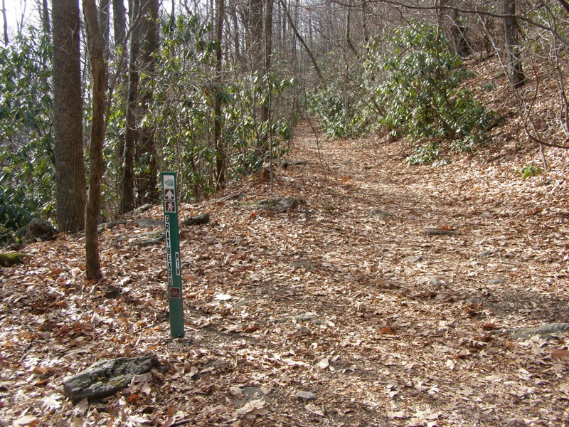
Montreat is a small community in the Swannanoa Valley that contains a college, well-known conference center, and most importantly a wealth of trails. Most people flock to Montreat to hike Lookout Mountain or Graybeard Mountain. The Montreat Conference Center maintains more than 25 miles of trails in the 2,500+ acres of the Montreat Wilderness. These trails also connect to Pisgah National Forest and the Ridgecrest Conference Center.
Two outstanding, little-known peaks in the Grandfather Ranger District can be accessed by a long hike from Montreat connecting trails in the Montreat Wilderness to the Old Mitchell Toll Road. The Old Mitchell Toll Road was a railroad used for logging and tourists in the 1910s that was turned into an automobile toll road after World War I. Tourists could drive from Black Mountain to Mt. Mitchell. When the Blue Ridge Parkway opened in 1938 the toll road lost popularity and soon ceased operations.
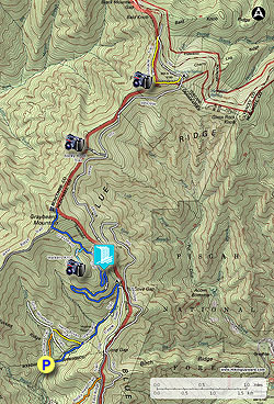
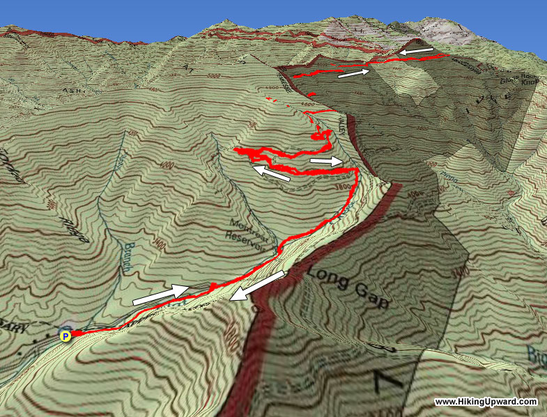
This hike starts in Montreat using the popular Graybeard Trail but then leaves the Montreat Wilderness to connect to the Old Mitchell Toll Road. The toll road heads north through Pisgah National Forest by the two rocky summits of Pinnacle and Rocky Knob with outstanding views of the Great Craggy and Black Mountains. Unless you park on the Blue Ridge Parkway, access to these mountains requires a long trek. This lengthy hike is an option during the winter season when the parkway is closed. On the return route we included a quick stop at Walker’s Knob, the additional 1.4 miles to Graybeard Mountain are excluded.
When you enter Montreat stop by the Montreat Store on the 2nd floor of the Moore Center Building. This is at the intersection of Lookout Road and Assembly Drive beside Lake Susan. They have a free paper map and you can also purchase a color topographic map for $8.99. The free map is good enough for the Montreat trails but will not be helpful for the area north of Rocky Knob. In addition to our free topo map, the National Geographic #779 map of Linville Gorge/Mt. Mitchell displays all hiking trails for the area.
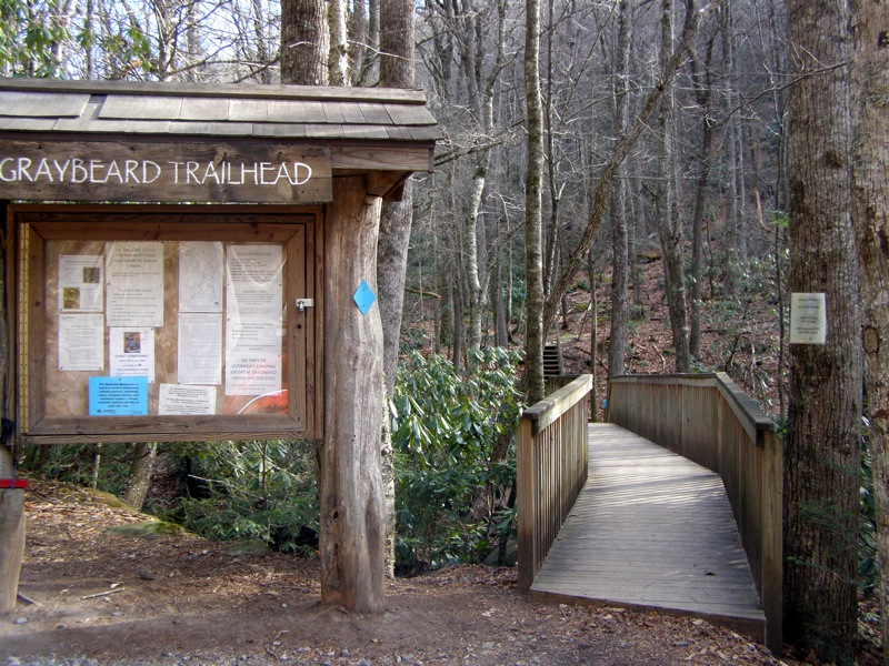
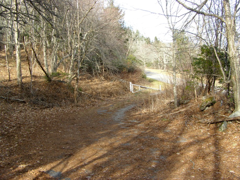
Continue driving up Assembly Drive where you will spot a large pullout on the right side of the road for the Graybeard Trail.
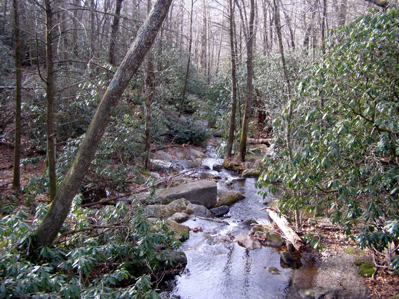
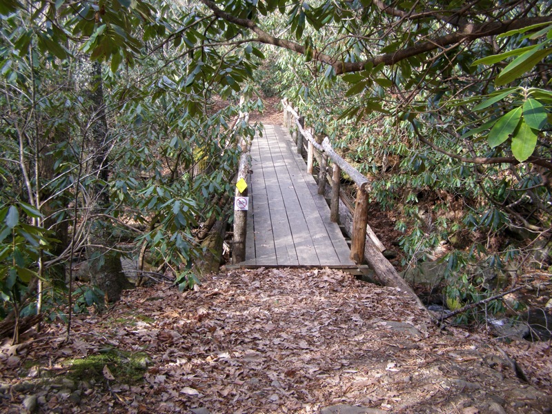
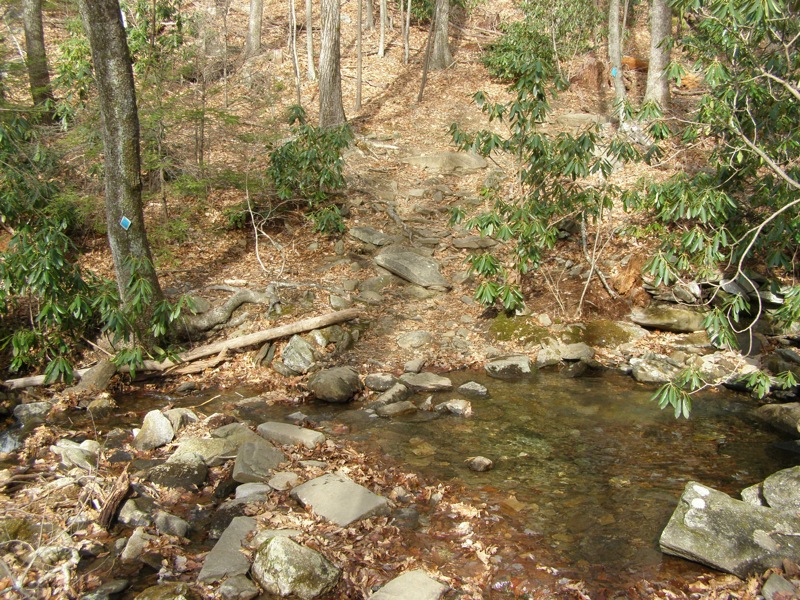
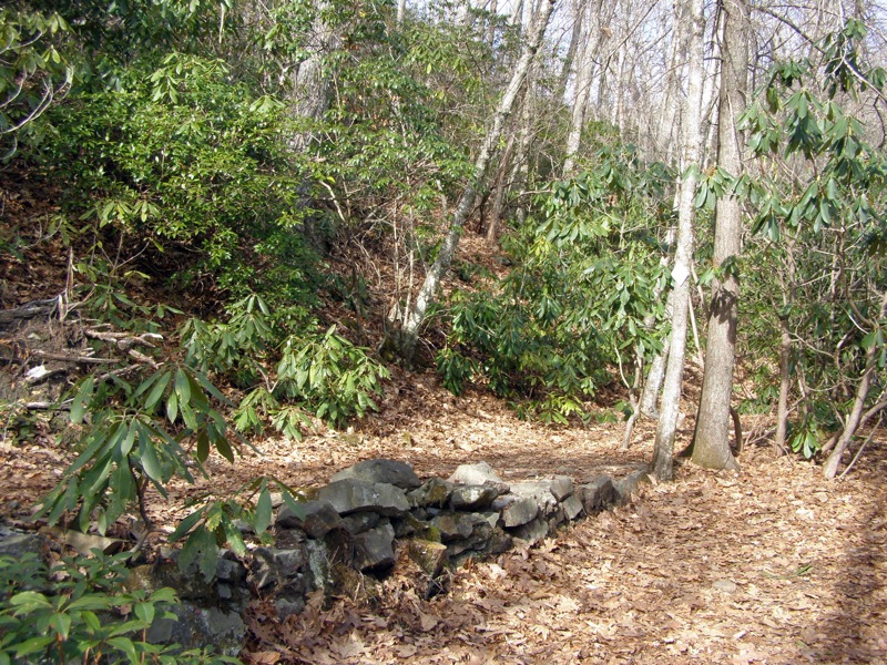
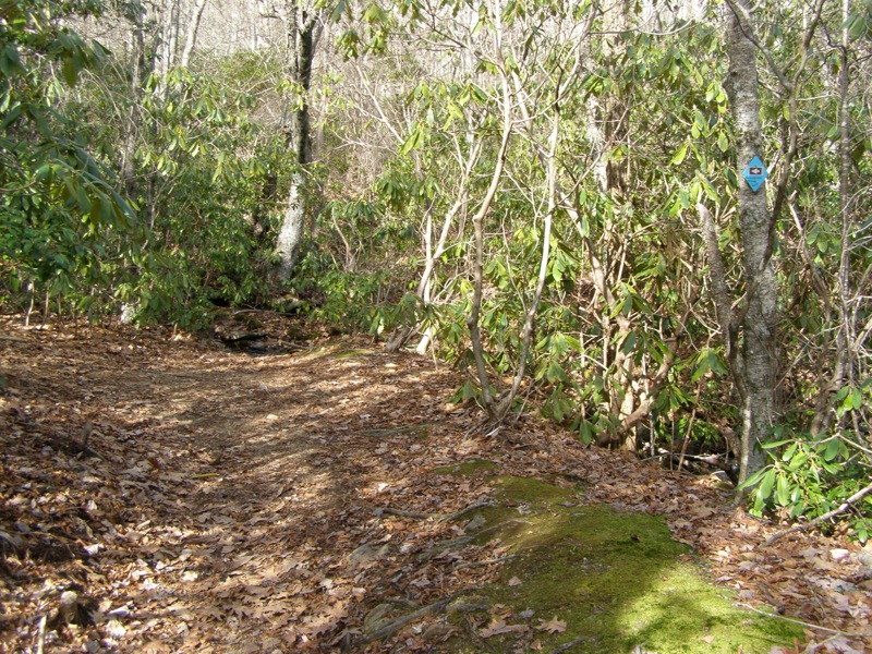
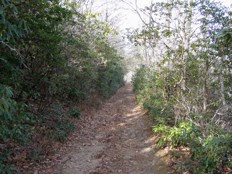
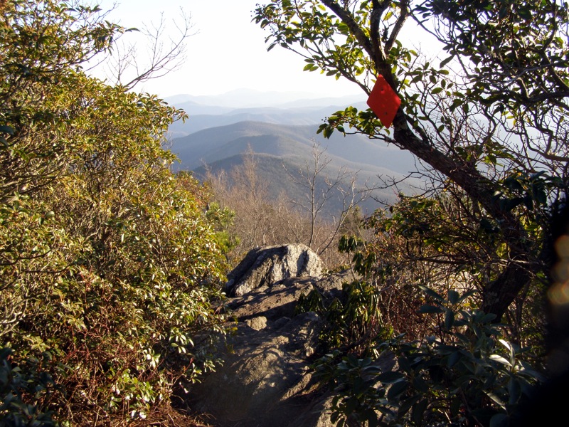
- Mile 0.0 – Start at Graybeard Trail (blue diamond blaze) cross a wood bridge over Flat Creek. The trail hugs the creek on the east side through a tunnel of Rosebay rhododendron.
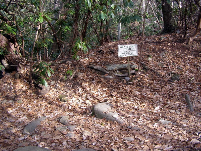
- Mile 0.5 – Junction with the Harry Bryan Trail (yellow diamond blaze), stay right on Graybeard Trail. The trail gets steeper beyond this point and leaves the rhododendron emerging into a sparsely forested valley.
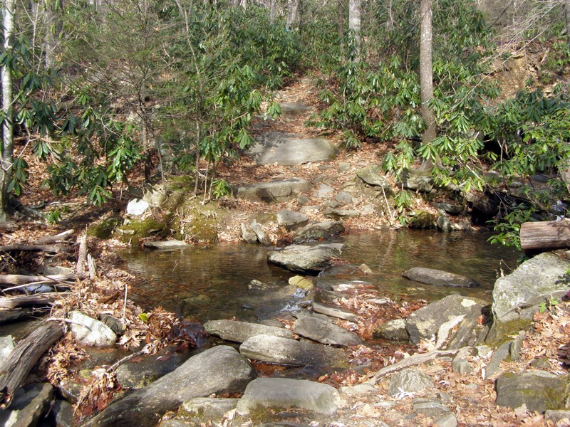
- Mile 0.8 – 1st rock crossing over Flat Creek.
- Mile 1.0 – 2nd rock crossing over Flat Creek.
- Mile 1.2 – 3rd rock crossing over Flat Creek and begin the final steep approach to Pot Cove Gap.
- Mile 1.4 – Reach a trail intersection east of Pot Cove Gap. The Old Trestle Road (white diamond blaze) comes in from the east crossing Flat Creek (there’s a campsite across the creek). Turn left on the Graybeard Trail where you will begin a section called the switchbacks for the next 2.1 miles. This section is some of the nicest, easiest trail around because the switchbacks are very long with minimal elevation gain.
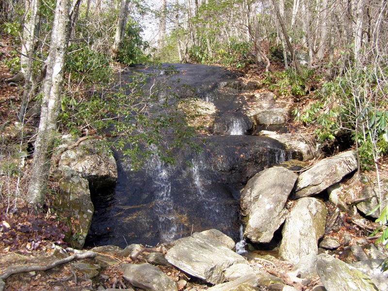
- Mile 2.8 – Junction with a short 200-foot spur trail on the right to Graybeard Falls. Graybeard Falls is a 20-foot slide waterfall. There is a large campsite beside the creek. Turn around and continue up the Graybeard Trail.
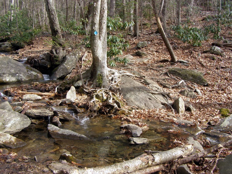
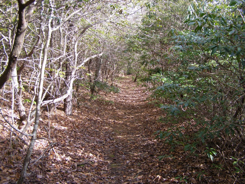
- Mile 3.5 – The switchback section ends where Old Trestle Road (white diamond blaze) leaves Graybeard Trail crossing over Flat Creek heading east. The Graybeard Trail turns left at the intersection and climbs on the west side of the creek. Cross the creek to an obvious campsite and forest road. Old Trestle Road is flat and is covered by the forest canopy.
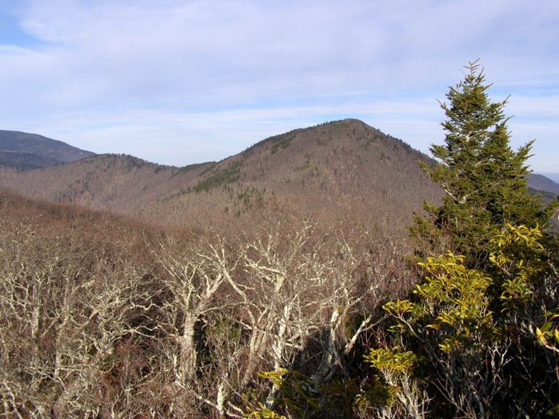
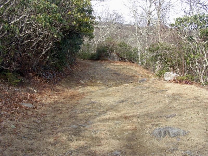
- Mile 3.7 – Old Trestle Road ends at the Old Mitchell Toll Road. You will see Pinnacle straight ahead beckoning you from miles away. Go left on the Old Mitchell Toll Road, a well-maintained forest road used primarily by bear hunters. Make sure to wear orange or bright colors on this road as this section of the national forest is part of the Mt. Mitchell Bear Sanctuary. The hike along the toll road is a long stretch but is almost flat. The roadbed alternates between dirt and very rocky sections. During the winter you will have continuous views through the trees of Pinnacle and the rugged ridges to the east.
- Mile 5.2 – Walk straight through a four-way intersection. An unmarked forest road will drop away to the east. The Rocky Knob Trail (white diamond blaze) is on the left.
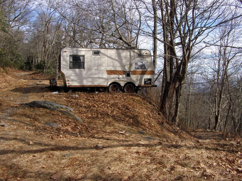
- Mile 6.5 – Intersection with an unmarked forest road dropping to the east before 2 run-down trailers likely used by hunters. This road leads to the Heartbreak Ridge Trail. Stay straight on the Old Mitchell Toll Road and you will pass by a 3rd trailer on the left and then a small cabin on the right.
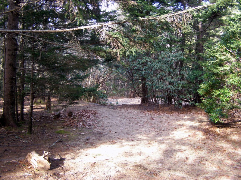
- Mile 6.8 – Pass by campsites on the left and right of the road. The return trail from Pinnacle exits to the left campsite.
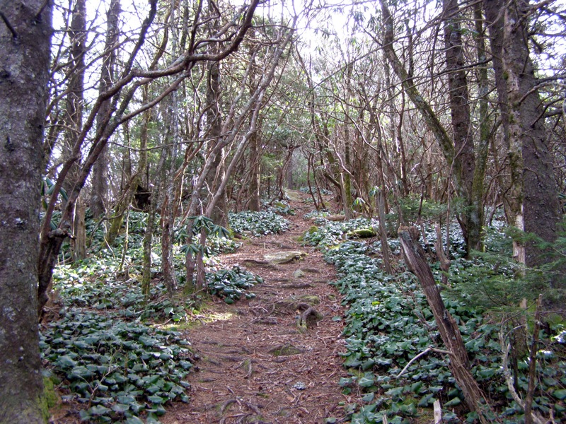
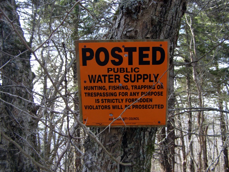
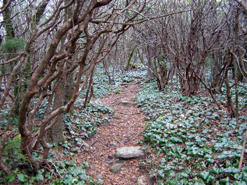
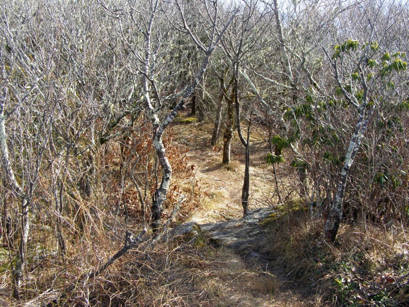
- Mile 7.4 – The Old Mitchell Toll Road crosses the Blue Ridge Parkway near Black Mountain Gap. Just before the parkway look for an unmarked small trail climbing up the embankment towards an orange warning sign. This is the Pinnacle Trail (white or yellow blazes). This short and steep trail is periodically blazed but used infrequently. When in doubt follow the ridge uphill and south. Your west side will be frequently marked with No Trespassing signs or barbed wire because you are walking the border of the North Fork Watershed Natural Area. The trail goes through a wonderful variety of forest as it passes through tunnels of rhododendron, mountain laurel, and spruce/fir.
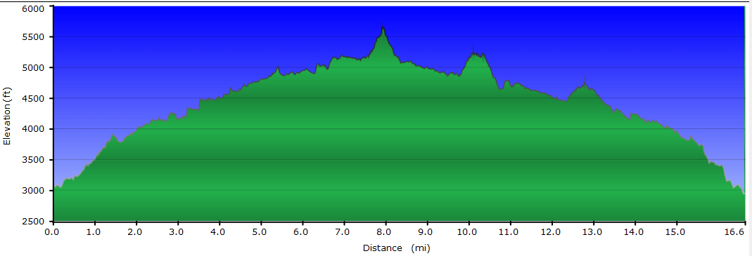
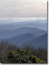
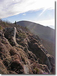
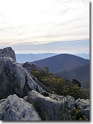
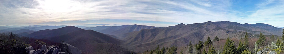
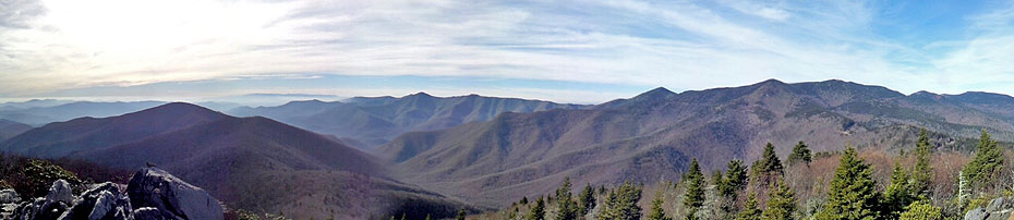
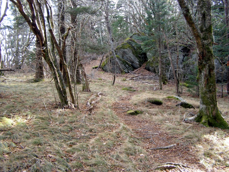
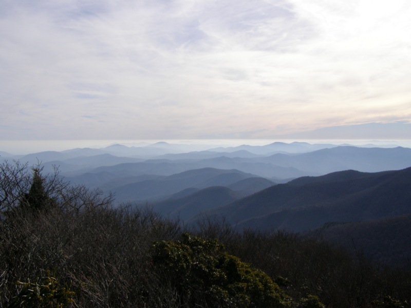
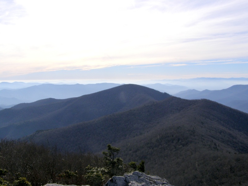
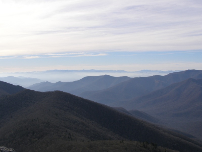
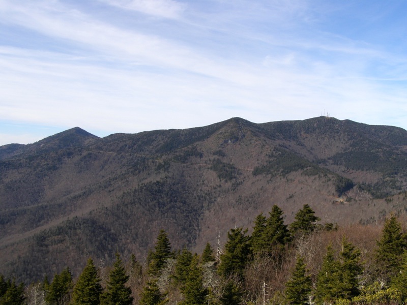
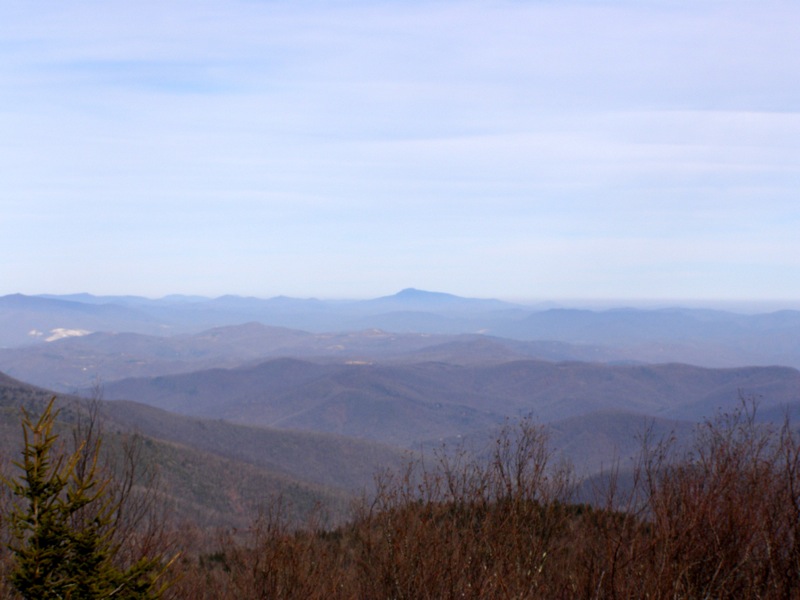
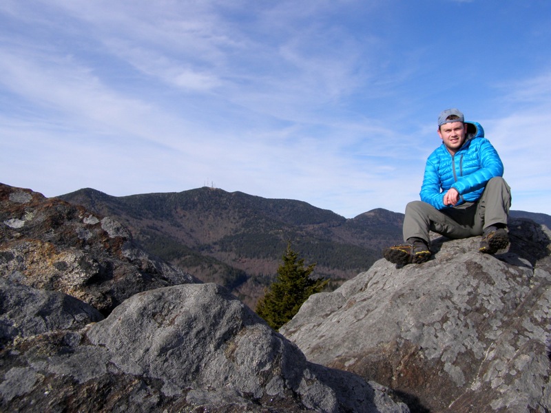
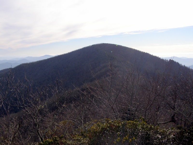
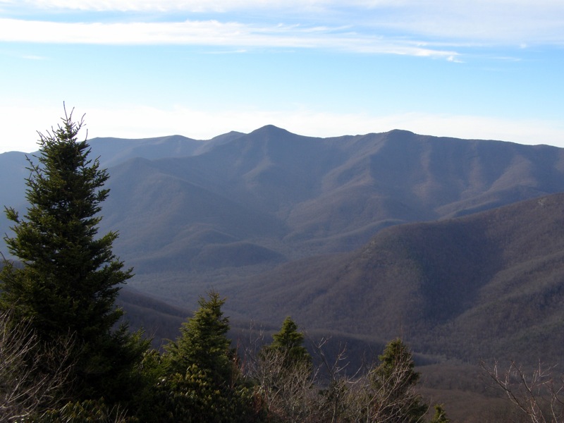
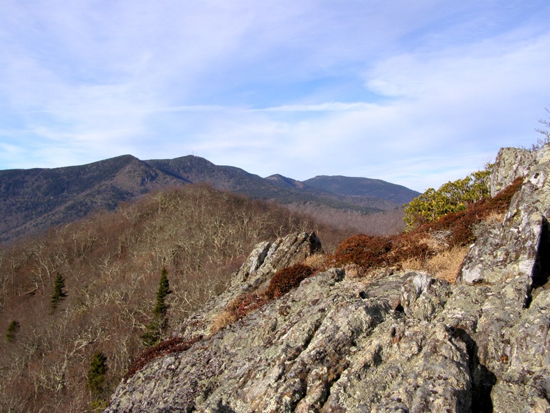
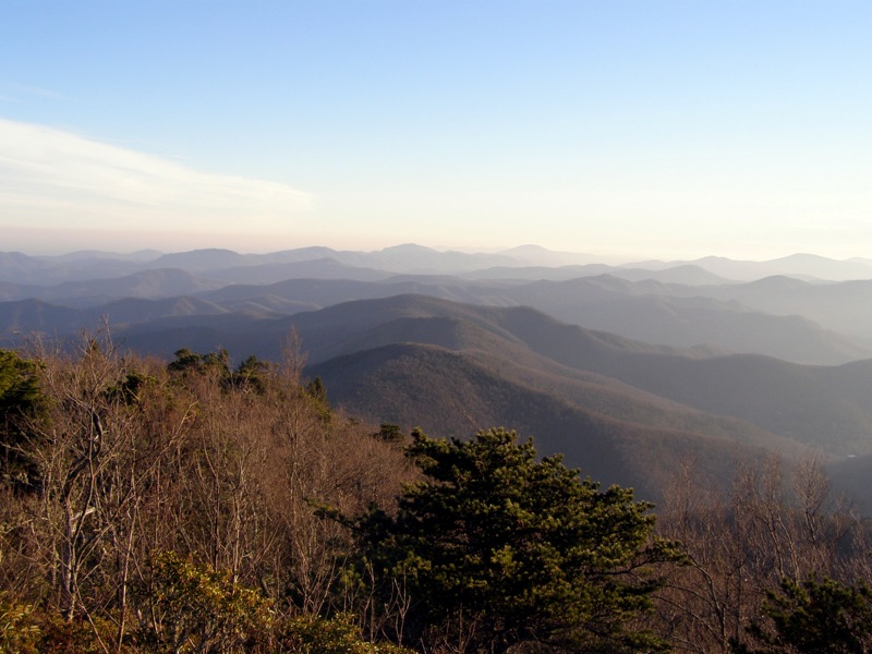
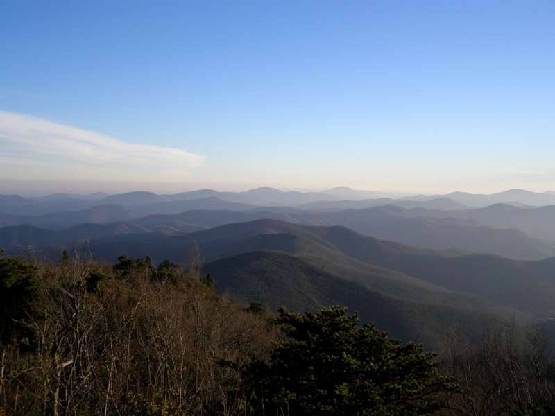
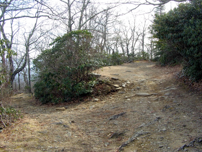
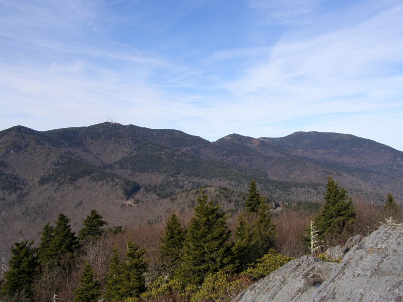
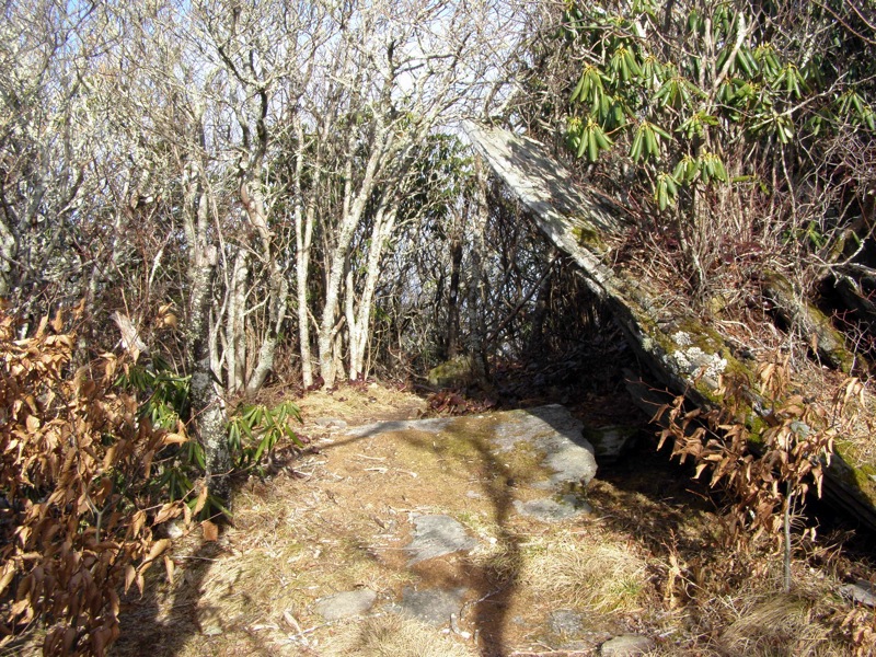
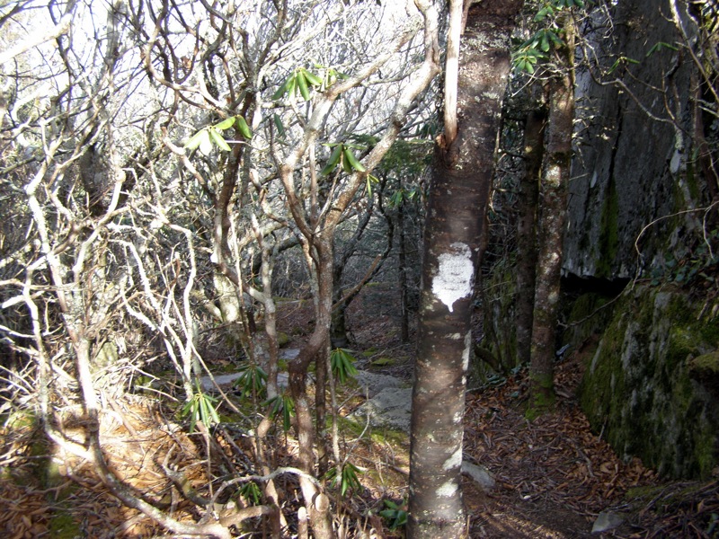
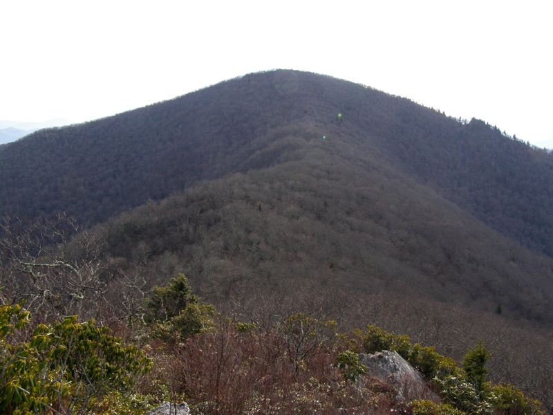
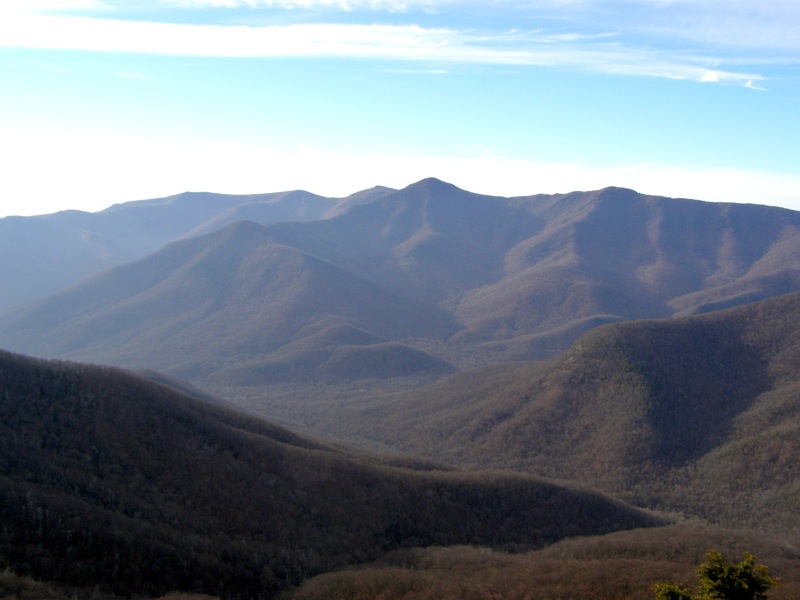
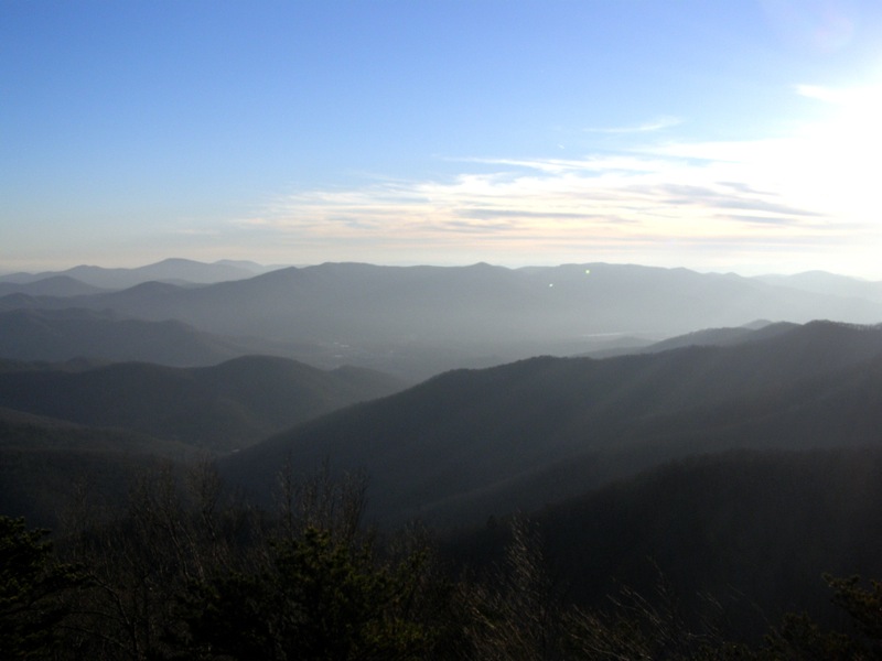
- Mile 7.9 – Reach the rocky, exposed summit of Pinnacle (5,665 feet). You will be treated to 270° views on this isolated summit. To the south you can see the ridge leading to Rocky Knob and Graybeard Mountain with the Swannanoa and Hickory Nut Mountains rising in the distance. The best vista is the Great Craggy and Black Mountains dominating your immediate west/north image. It is easy to spot the communications towers on Clingman’s Peak. The Blue Ridge Parkway snakes below these mountains. Mt. Mitchell is slightly harder to pick out since the massive sloped peak masks the summit tower. You can also spot Grandfather Mountain and Linville Gorge to the north ast. There is another trail on the east side of the rocks. Take this trail to reduce mileage. When you duck into the trees the trail splits, go left heading northeast at first down very steep slopes. Then the trail will turn east. This trail is frequently blazed with yellow or white paint.
- Mile 8.3 – Emerge into a large campsite with the Old Mitchell Toll Road in front of you. Go right heading south towards the Rocky Knob Trail.
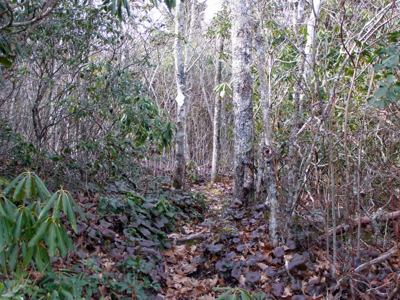
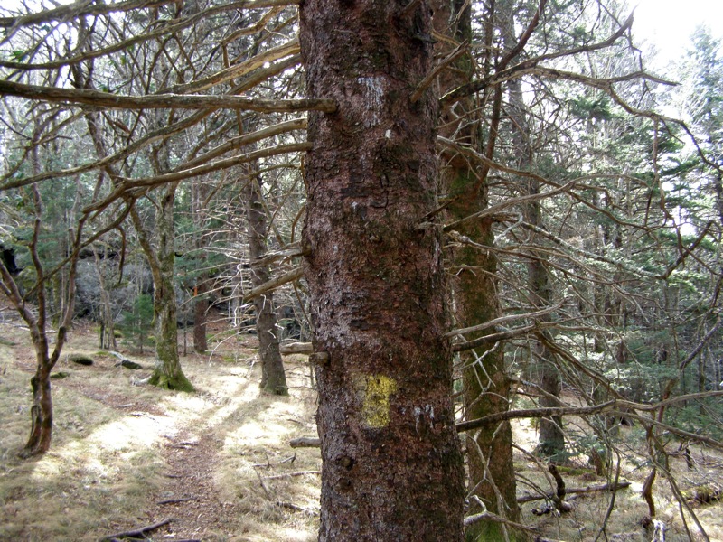
- Mile 9.8 – Reach the four-way intersection. The Rocky Knob Trail (white diamond blaze) will leave the road on the right. There is a plastic diamond blaze nailed to the tree. This trail is very narrow and tight but easy to follow because the surrounding forest is thick.
- Mile 10.0 – Pass by an intersection with an unmarked side trail coming in from the left. This is the only other spot on the trail with a blaze marker. Stay straight heading uphill and west.
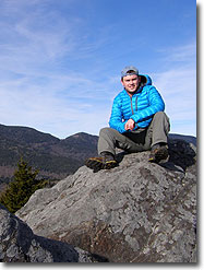
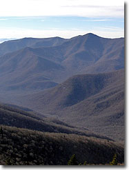
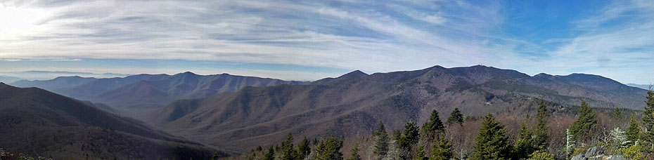
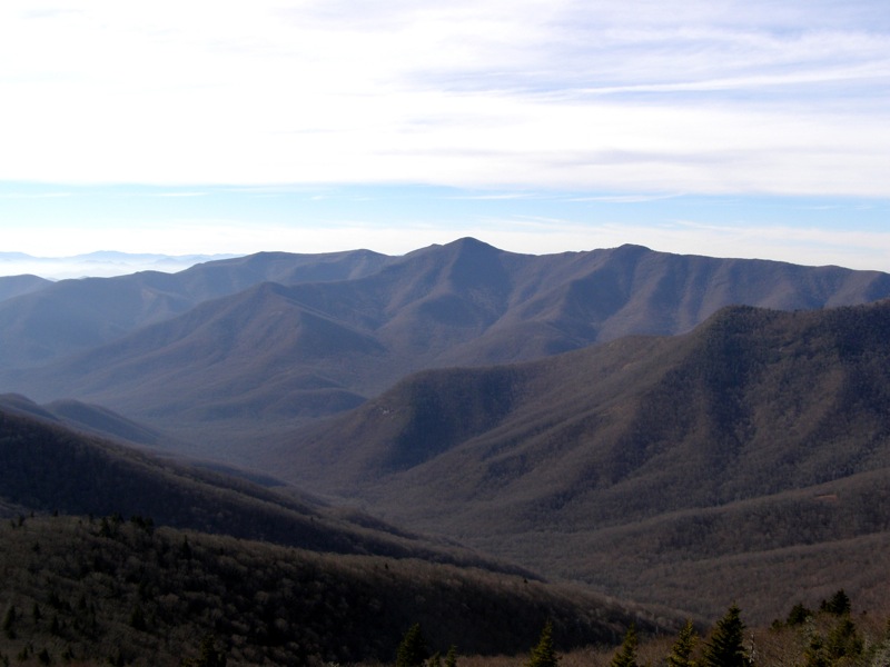
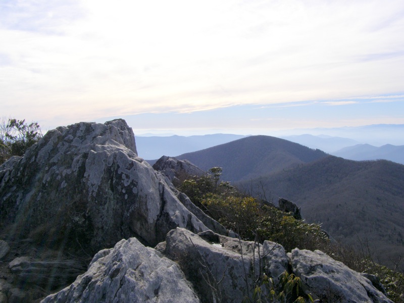
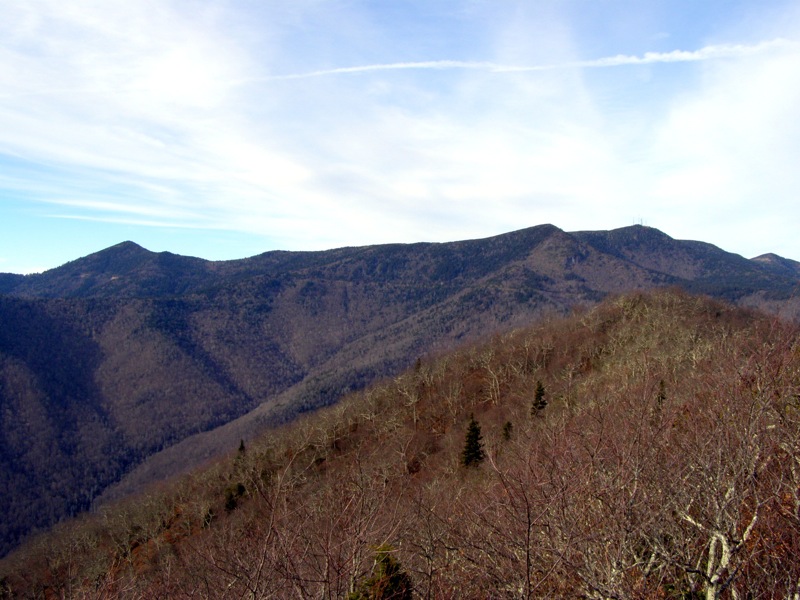
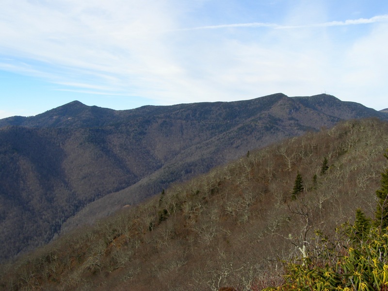
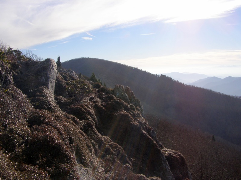
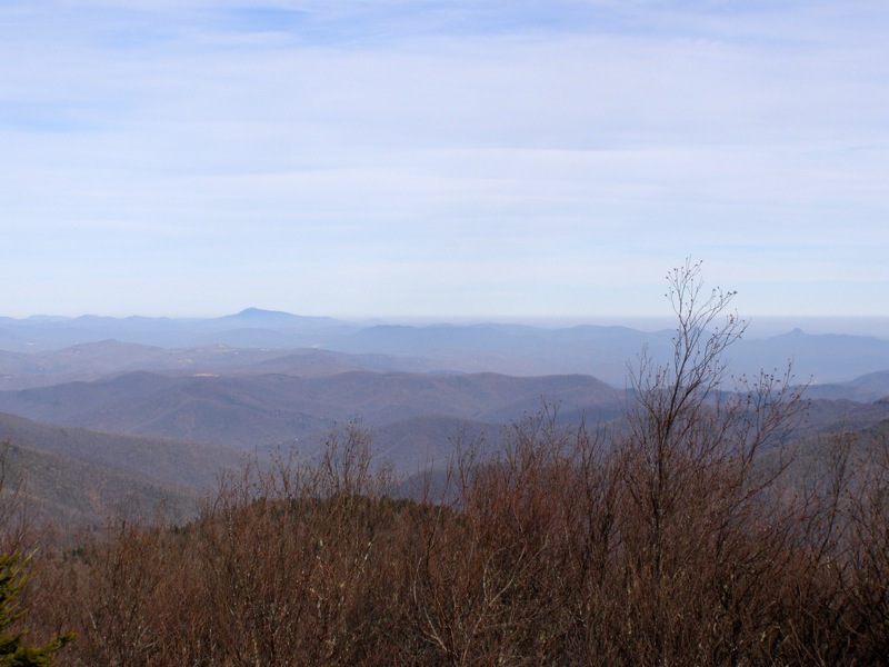
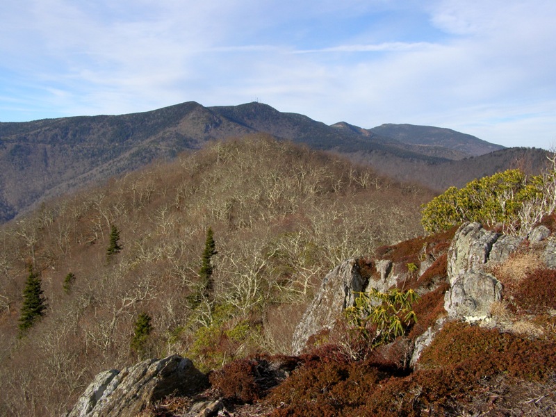
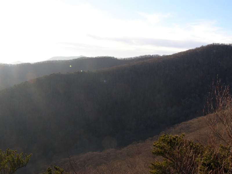
- Mile 10.1 – Reach the summit of Rocky Knob (5,240 feet). The true summit is thin and exposed but doesn’t offer the best views on the mountain. There are 2 prominent cliffs on the north and south side of the summit. Walking south you will see a trail ducking down below the summit. This trail leads to one outcrop in 50 feet, and then below this outcrop the trail is less-defined but leads in 50 feet to a huge cliff facing southwest. From this cliff you will have great views of Graybeard Mountain and the Great Craggies. Turn around and head back to the summit to find the cliffs on the north side. You can see these rocks from the southern view.
- Mile 10.2 – North of the summit a faint trail splits north/right away from the Rocky Knob Trail just below the ridge. If you keep walking this it will continue to follow the ridge down beside the watershed boundary and you will be able to see the northern cliffs above you. Look for an easy slope to scramble up and soon you will be atop the cliffs. The views of the Black Mountains are fantastic and you can also get a good view of Pinnacle. Turn around and head back towards the main trail to descend the mountain.
- Mile 10.4 – Head down the mountain on the Rocky Knob Trail and avoid the unmarked trail on the right.
- Mile 10.6 – Trail ends at Old Mitchell Toll Road, go right to head back towards Montreat.
- Mile 12.1 – Go right on Old Trestle Road.
- Mile 12.3 – Go right on the Graybeard Trail towards Walker’s Knob.
**Note - Hiking to Walker’s Knob from this intersection and back is 0.9-miles. You can skip this summit if you wish for a total hike of 15.7 miles.
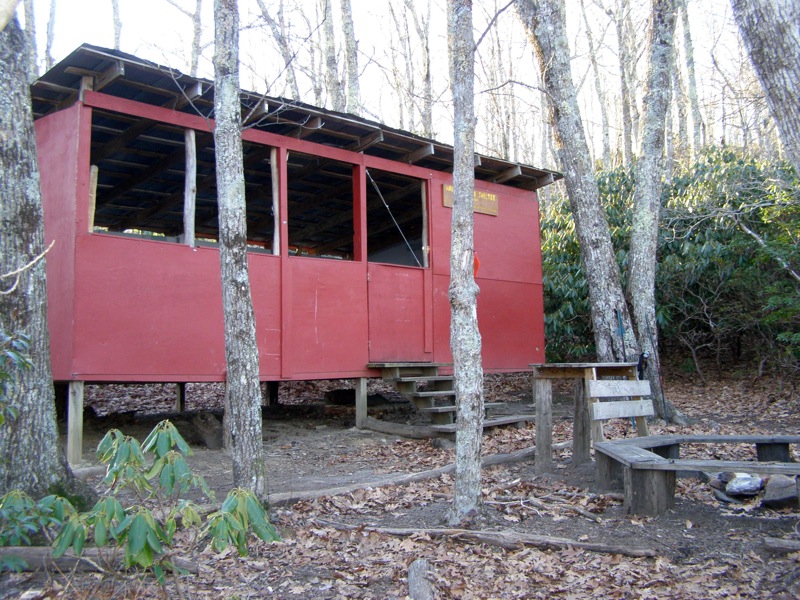
- Mile 12.6 – Trail intersection at the Walker’s Knob Shelter (orange diamond blaze) Go left on the Walker’s Knob Trail.
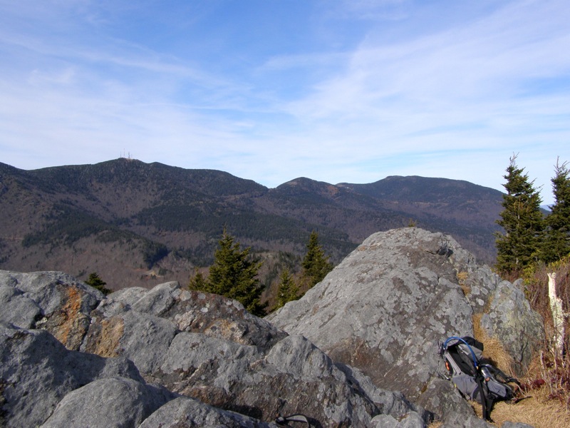
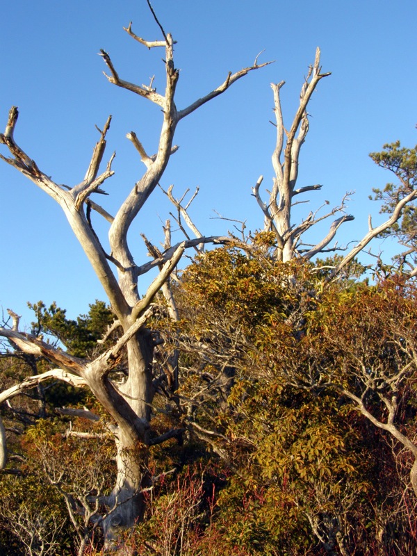
- Mile 12.8 – Reach the outcrops of Walker’s Knob (4,780 feet) with great views south of Lookout Mountain and the Swannanoa Mountains rising high above the valley. The knob looms over the smaller peaks to the east. You should be able to see the slopes of Bearwallow Mountain and other prominent peaks in the Hickory Nut Mountains in the far south. The Seven Sisters Ridge is on your immediate right and is part of the amazing trail system at Montreat. Walker’s Knob also contains an excellent variety of dead trees. This summit is best hiked before noon since the sun will be facing you in the afternoon hours.
- Mile 12.9 – Go right at the shelter on Graybeard Trail heading towards the car.
**Note - If you are really pushing your limits or making this part of a backpacking trip, go left to summit Graybeard Mountain for an extra 1.4 miles round trip.
- Mile 16.6 – Hike ends at the Graybeard Trail parking area.
|
