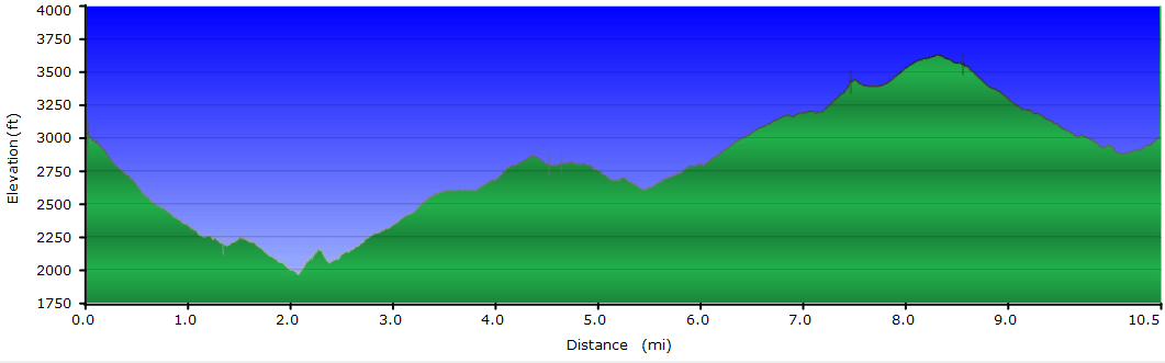
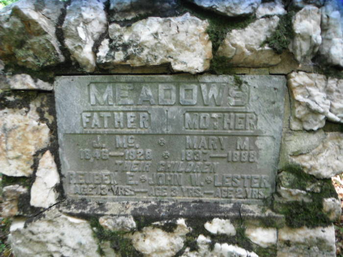
This hike can be done as a nice short 4.8 mile loop hike to see the Falls or a longer 10.6 mile circuit hike to see the Falls, 2 cemeteries, the Upper Pocosin Mission ruins, and the PATC Pocosin Cabin.
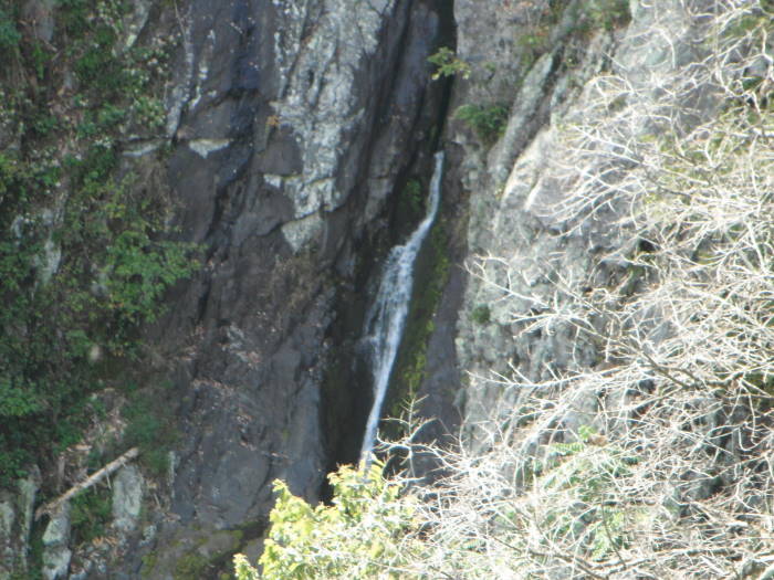
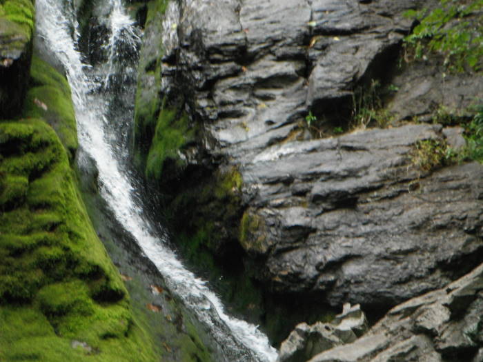
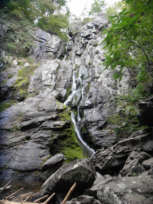
The 83' Falls, 3rd largest in SNP, are easily accessed via the South River Picnic Area (MP63). There is a walled overlook at mile 1.3 to view the Falls and for a great view of the Falls, a further walk down to the base of the Falls is encouraged.
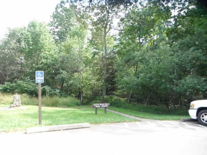
Mile 0.0 – The trail begins near the restrooms about ¾ of the way around the South River Picnic Area.
Mile 0.2 – Intersection with the Appalachian Trail, stay straight on the Blue-blazed South River Falls Trail.
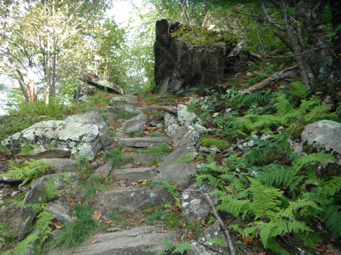
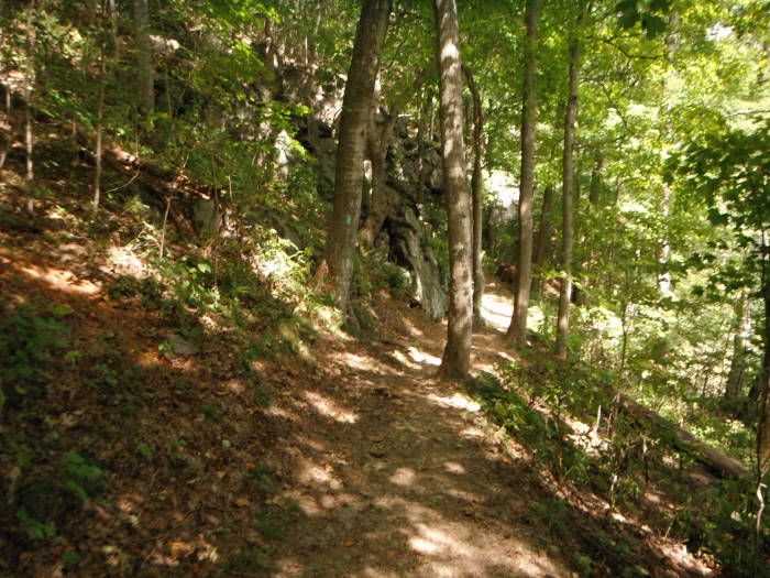
Mile 1.3 – After a steep descent and a couple of creek crossings you will arrive at the South River Falls walled overlook for view of Falls. Continue on the trail to the Fire Road Intersection.
Mile 1.5 – Fire Road Intersection, take right to go to base of Falls, highly recommend doing this, a little tough coming up but worth it.
Mile 2.2 – Continue down fire road until it ends and then follow narrow/rocky path to the base. When the water is flowing the pool at the bottom would feel good to take a swim.
Mile 2.9 – Return back to Intersection at Mile 1.5, tough little climb out of the Gorge, continue past intersection, staying on fire road, trail is yellow-blazed at this point
Mile 3.3 – Reach South River Fire Road. Decision point:
For short 4.8 mile loop stay straight and in 0.8 miles reach the Appalachian Trail, take a left onto the AT and in 0.5 miles reach the South River Falls Trail, take a right to reach South River Falls Picnic Area to complete hike.
For longer 10.5 circuit hike continue following the directions below.
Note: Over the next 1.2 miles you will cross into the Rapidan Wildlife Management Area and various Private Properties, stay on the trail and you will be fine, you will even cross a yellow road barrier. The blazes are sketchy at best on this section.
Mile 3.3 - Bear hard right onto the South River Falls Fire Road.
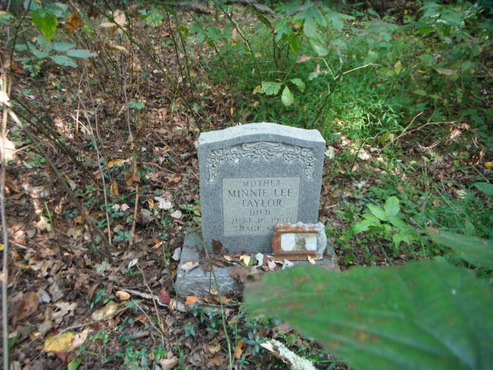
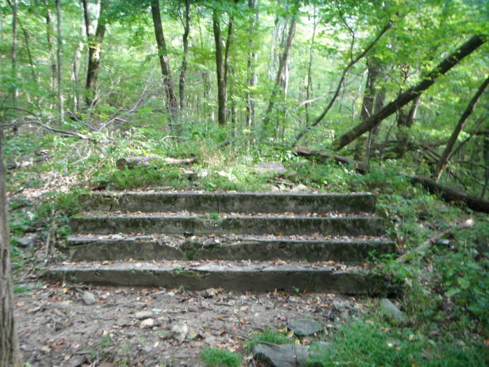
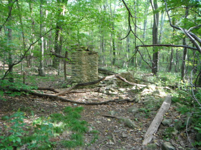
Mile 6.0 – Return to previous intersection and bear right continuing on the Pocosin Horse Trail, reaching the Upper Pososin Mission ruins. The Upper Pocosin Mission cemetery is to the left and the Mission to the right. The trail bears to the left and becomes the Pocosin Fire Road at this point.
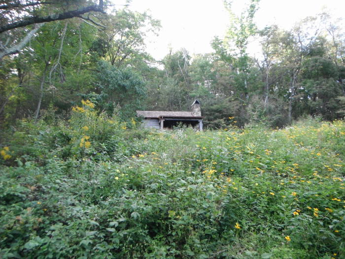
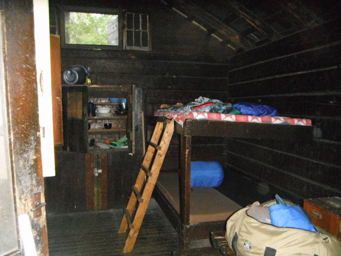
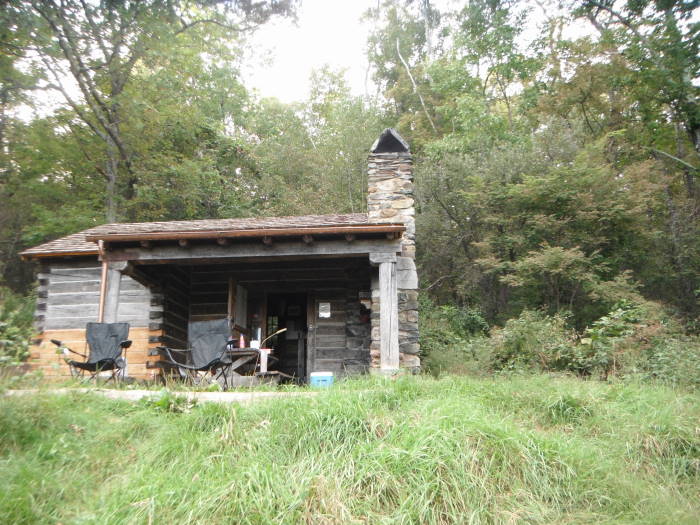
Mile 6.8 – Pocosin Cabin on the left. This can be rented from PATC. Great view from the front of the cabin looking east. Return to fire road, bear left.
Mile 7.0 – Appalachian Trail Intersection, bear left heading South on the AT.
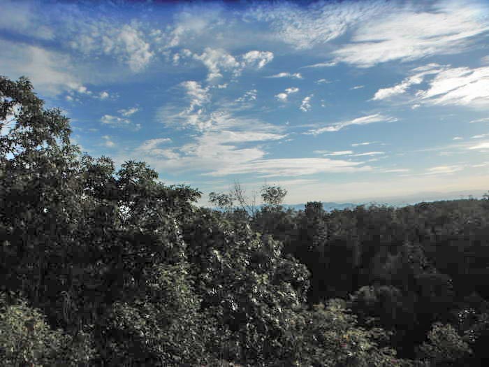
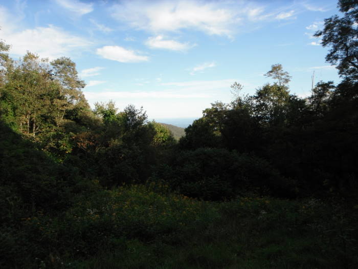
Mile 7.5 – After a couple of breath catching switchbacks reach a vista with views northward, probably best when the leaves are off the trees.
Mile 8.6 – Summit of Bald Face Mtn with a vista to the west, once again probably better when the leaves are off.
Mile 9.9 – Intersection with South River Fire Road, go through intersection, staying on the AT.
Mile 10.4 – Intersection with South River Falls Trail, take right to head back to Parking Area.
Mile 10.5 - Parking Area.
Early September
South River Falls Hike Comments
Archived Comments
By:Adventuregirlatheart
Rating:
Date of Hike: Friday, June 14, 2019
Today was a beautiful day to be out and, despite previous reviews, I decided to do the longer 10.5 mile loop of this trail. I had done it last year and I was interested to see if the trail was in as rough shape as described by other hikers. It's not! I do agree that the second half of the loop is overgrown, but nothing I needed to bush wack through. I would wear pants or socks to the knees to protect your legs from the grass and potential of ticks. When you start up on the overgrown fire road, you will come to a chain link barrier. It's two posts low to the ground with a chain connecting the two. Soon after you will pass the signs that tell you that the SNP boundary is ending and you are on private property for the wilderness preserve. A road or trail comes in from the left, but you don't take that one. Keep going! It might feel weird with everything overgrown, but soon after you see a very clear sign for the horse trail. Take an immediate left and you will have clear yellow blazes to follow. I am going to upload a picture if I'm able so you can see what it looks like. Check out the trail photos! The cemetery and ruins are somewhat overgrown but still visible. This hike is not one for large views but there is so much greenery. Definitely recommend doing this hike on a cool fall day as well. All the leaves should be beautiful colors. I'd also recommend this hike for an intermediate or experienced hiker. This loop would not be my first choice for a novice hiker.
By:C Lewis
Rating:
Date of Hike: Saturday, May 25, 2019
Please read this review before you try to hike the circuit (10 mile route)! I am from Charlottesville and hike a lot of the SNP trails in the south and central sections. I've gone out twice in recent months trying to do this route. The first time when there was snow on the ground we missed the right hand turn that starts you going east for the larger route. Determined to do it again and complete the circuit, I tried it again yesterday. Got to the parking lot at 8:30am and didn't see anyone on the hike (it's Memorial Day Saturday!) except for campers until the couple who I now call my angels.
After the hike along the stream and the overlook, I skipped the descent to the bottom (did it a month ago) and followed the South River Falls Fire Road again. I found the missed right hand turn but as the review by Em said below, the fire road was way overgrown (this is the fire road going east, not west that is part of the shorter 4 mile circuit). But I persevered thinking, we've had a very wet spring and these weeds show it. I even found the left turn (per your directions) to the Pocosin Horse Trail. Again, very overgrown. I didn't keep track of the distance but I would say that after at least a mile the Horse Trail narrowed down to a foot trail and then became faint to say the least. So I backtracked and thought to see if I had lost the trail. Thank goodness I ran into a couple whom I had seen in the South River Falls parking lot. They confirmed they were trying to make the same route up to Pocosin Mission. He had an All Trails app with cell service that showed that we were on the Horse Trail. So, we forged ahead. But soon the trail disappeared completely. Middle of thick woods with brush underfoot, fallen trees, and plants as high as our waists. With no choice, we bushwacked through deep brush trying to get out. This part was the worst hiking experience I have ever had and they (who were from British Columbia with this their first camping venture into the SNP!) agreed it was their lifetime worst. If I had been out there alone, I think I would have made an emergency call.
Sean's review from two months ago says he made the circuit, so perhaps it was the overgrown weeds. But this is NOT a trail that is maintained by the Park Service or a local AT trail club, as so many are. In fact, the part where we got lost is not on SNP land but is in the "Rapidan Wildlife Management Area," as the directions note. I just want to warn any potential hikers. I had good insect repellent on, but choose to wear shorts as it was to be in the 90's. We all three were itching badly as we bushwacked. My legs and arms were rubbed thoroughly with Technu (poison ivy/oak treatment) with two showers when I got home. I am surprised we did not encounter a snake because we could not see any of the forest floor as we bushwacked our way out uphill. We kept monitoring our phones that told us we were heading north towards the AT/Skyline Drive and finally did. The last portion was very uphill and pretty exhausting.
After I departed the couple/angels, and was hiking west on the AT back to the parking lot, I ran into a group who had tried the route the evening before. They said they could not even find the Horse Trail turn off to the left from the Fire Road.
Obviously this trail has vexed a lot of people.
IF you want to try this, I would suggest doing the route clockwise: from the SRF parking lot, take a LEFT on the AT and hike up to the Pocosin Cabin, then finding the Pocosin Horse/Pocosin Fire Road and hike south, hopefully completing the loop, linking up with the South River Trail and do the Falls last, then hike up to the parking lot after enjoying the water.
I'll keep looking for reviews here, hoping for an explanation.
Don't know how to score a circuit that I couldn't complete. I enjoy the Falls area and this time even the remote parts of this trail.
But I do note the history of this land and the fact that the mission and the natives were evicted from it to build the SNP. I also note the reviewer below who felt this part of the trail was haunted. I feel like I might have to agree that, at least for our hike, there was mischief afoot.
By:Sean
Rating:
Date of Hike: Friday, March 29, 2019
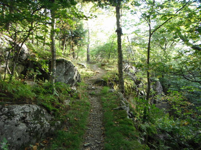
I hiked this as described including the walk down to the base of the falls for the full 10.5 miles. I relied mostly on my GPS device and not so much the hike description. Including breaks to catch my breath and for lunch, and for off-trail exploring and hanging out at the falls, I took 6 hours total. I'm not in the best shape and it was my first long hike of the season, but since I took my time it wasn't too much. (I was really feeling that last few hundred feet of climb before the maximum elevation point.) Even without leaves on the trees, there was not much in the way of long-distance views -- with leaves in the summer you are not missing much. Many springs along much of the route -- I'd pack less water next time. The route is generally in good condition and not very rocky.
By:Ileana
Rating:
Date of Hike: Sunday, November 4, 2018
Your directions were good until the end. I did the 10.5 circuit hike and after a very hard rain a couple of days ago, the falls were gushing water. Spectacular! When I arrived at the fire road at the end, your directions say to stay on the AT and the South River Falls trail is .5 miles away. In fact, the South River Falls trail is a steep 1.5 miles down the fire road to the left and then you have to hike up 1.5 miles to the parking lot. The other alternative is Skyline Drive at .2 miles going right but it doesn't take you to the parking lot. You have to walk a little bit on Skyline Drive to reach the parking lot. Go left when you reach the top of the fire road to the South River parking lot.
By:Em
Rating:
Date of Hike: Sunday, August 19, 2018
I went out early in the morning fully intending to do the 10 mile loop! Welp, the views of the waterfall were mostly covered by foliage and the fire trail was too overgrown to hike! Had to do the short loop which I found boring. Ill go back in November to try out the full loop but overall I dont think this is a good choice for summertimeunless youre super keen on a shorter hike and a swim.
By:Alyssa
Rating:
Date of Hike: Thursday, January 25, 2018
This hike was great! Except...it's haunted! I legit felt like that section through Rapidan and until you're back onto the AT had a haunted feel to it. Then sure enough I got home and there are a couple unsolved mysteries from out that way! Very scary, maybe you need to add that into your ratings!!
By:Medic-G
Rating:
Date of Hike: Monday, January 15, 2018
My wife and I did the "extra short" version of this hike. We took advantage of the NPS fee free day on MLK day and did a portion of this hike. We hiked to the base of the falls and back returning on the South River Trail making an approximate 4.4 mile hike.
With the exception of the falls, I would agree with the views being a 2. Since we did this in winter, the views were better since there were no leaves on the trees. Also, since the temperatures were below freezing and had been below freezing we had some good ice formations on several of the rock faces and the South River and falls also had ice formations. We were glad there was ice on the falls because the possibility of ice on the falls is the reason we chose this hike.
I would have to give it a lower solitude score. I know this was a fee free day however, it was a cold winter day and there were quite a few people on the trail. We luckily timed our hike and had the base of the falls to ourselves. I would give it a 2 for solitude on the day we hiked and I could see where the solitude on this trail/hike would be a 1 in the summer/warmer months.
Just a reminder for those with dogs who would like to do this hike, dogs are to be kept on a leash. We ran into one dog off the leash which could have been a problem since we were hiking with our dog. So, just a friendly reminder.
By:TAG
Rating:
Date of Hike: Saturday, January 13, 2018
We only hiked the short version of the hike but it far exceeded our expectations. The waterfall was stunning, especially from the base. Today's weather was frigid and super windy but we escaped much of the wind by hiking down to the falls only. View of the falls were excellent with the bare trees. Our watches logged 1400' of elevation but it wasn't technical at all except right at the base of the falls which was a short rock scramble. The falls were gushing today. I highly recommend this hike!
By:Threehikers
Rating:
Date of Hike: Wednesday, May 10, 2017
Hiked clockwise on a beautiful spring day. The only downside was having to go up the South River road at the end of the hike....it really made it a challenge for us old men. The part from the picnic area on the AT to Pocosin Road was a nice walk with enough climbs to know you're hiking and beautiful spring flowers were everywhere. The Pocosin Road to the upper mission was gentle down hill and the ruins are interesting and a good spot to stop for lunch. The trail across to the cemetery and South River Road was a bit wet in places due to all the rain but a beautiful area to hike through. The cemetery is interesting and then the hike up the South River Road made sure we were tired but feeling good about a nice hike on a beautiful day.
By:Steve
Rating:
Date of Hike: Monday, February 20, 2017
The best waterfall on Skyline Drive. I started the hike from the picnic area. Easy to the find the trail by the bathrooms. The trail was smooth and looked well traveled. It must be very popular in warm weather. When I arrived at 9am there were only two other cars in the parking lot. Granted it was February and the day started out at 38 degrees. For the most part the trail is easy. Around the falls overlook there are several cliff drop offs beside the trail, you should keep track of the kids. Past the overlook the trail widens back out and winds easily down to the base of the creek. You then climb back up for a slight bit on some rock stairs to the base of falls. The rock stairs are on a rather tame area. Well worth it. I didn't find any "steep" sections.


