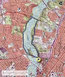
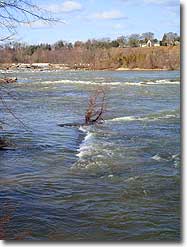
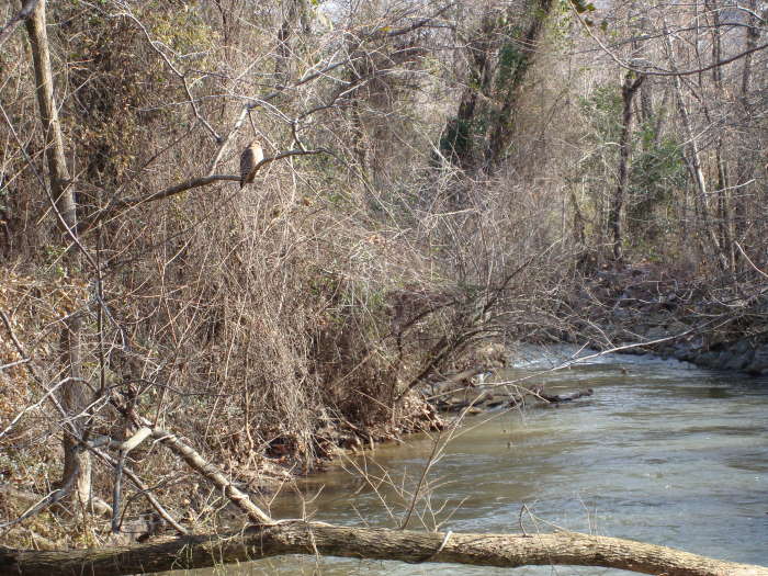
This was a great hike to do without having to go to the mountains and if you like water, you’ll love this hike located mostly within the City of Richmond James River Park System. For an urban hike, there was a little bit of everything. There was nature with the geese, hawks, ducks, trees, and of course, the James River seen throughout most of the hike. There were also the urban distractions: traffic, people, trains, and something that we have not walked by on any other hikes on this site – 3 cemeteries. Surprisingly enough, even with all the distractions, this is a worthwhile hike. Look around as you hike and you will see some beautiful things.
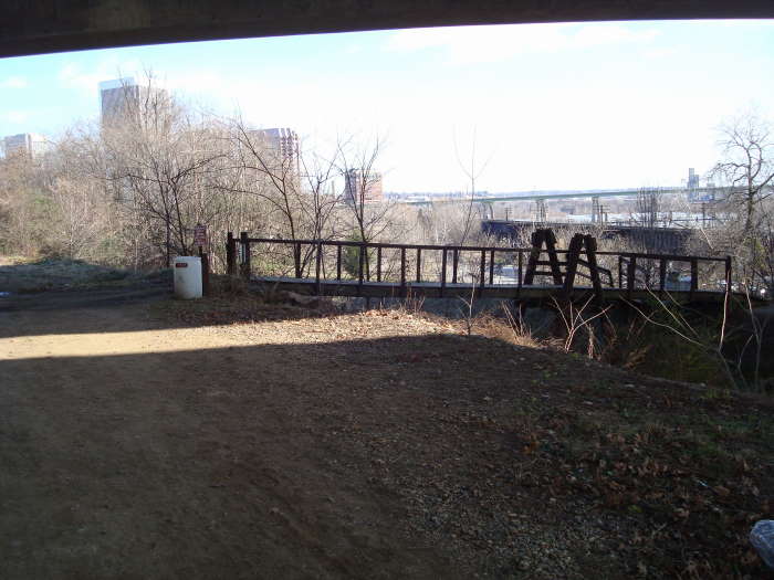
The trail starts at the same parking lotas the Belle Isle hike, head under the train trestle to the sidewalk and take a right heading to the hanging bridge underneath the Lee Bridge (Route 1/301) Note: Do not park under the trestle as you may get train grease on your car. It is about 0.5 miles to the other side of the bridge from the parking area. Stay straight as you come off the foot bridge passing an intersection on the right in about 100 yards, bear to the left past the Call Box, paralleling the Lee Bridge. You will pass another intersection in about 150 yards, stay straight and then cross the South Side pedestrian bridge.
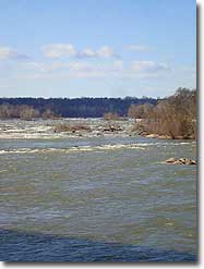
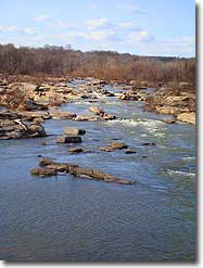
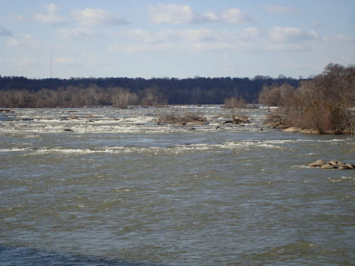
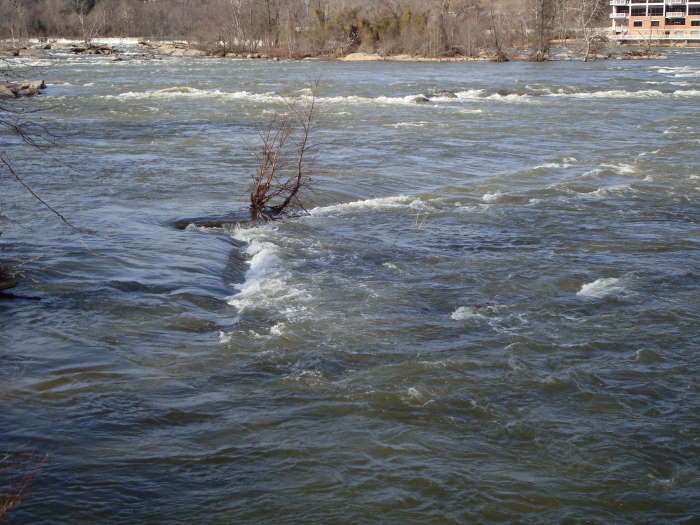
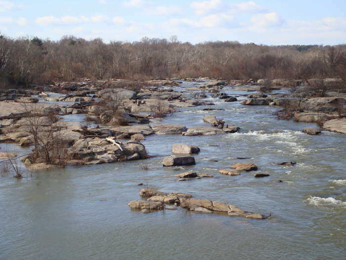
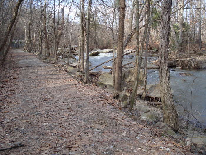
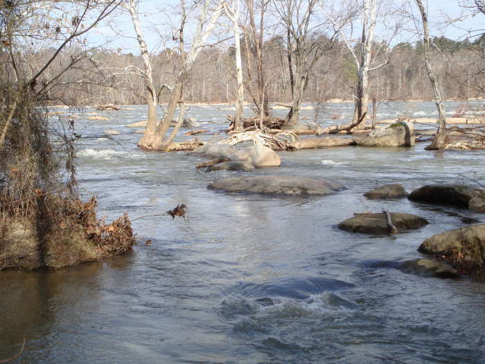
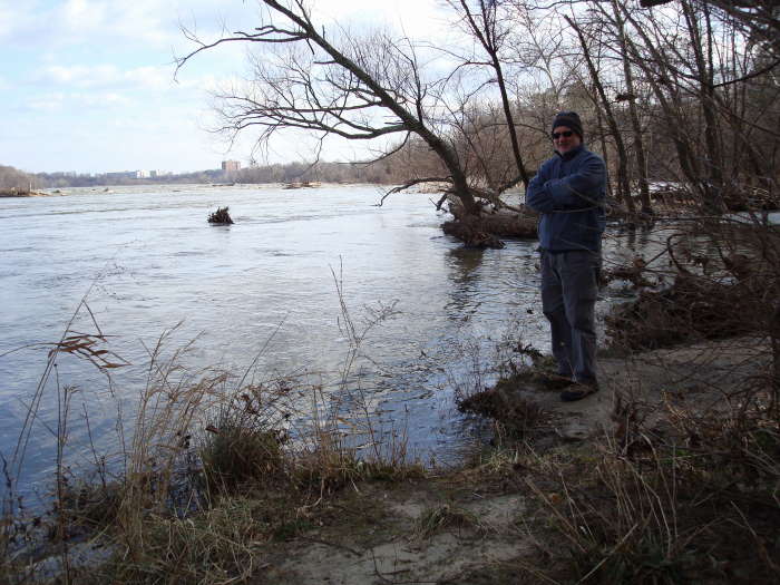
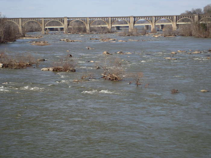
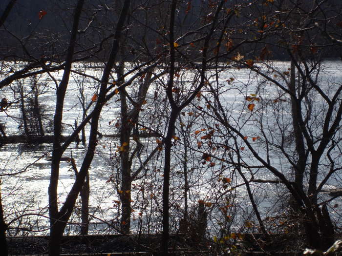
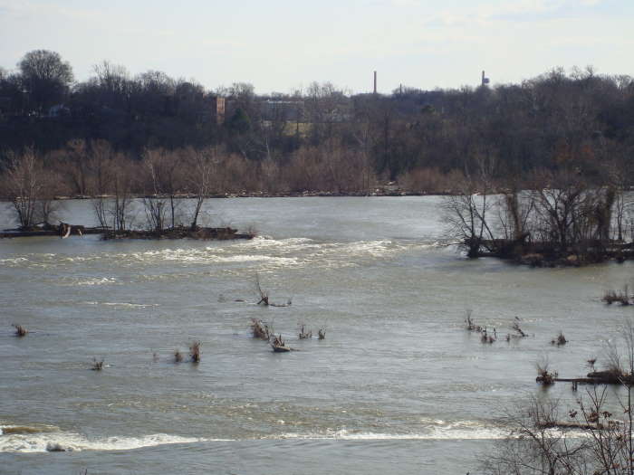
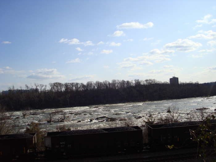
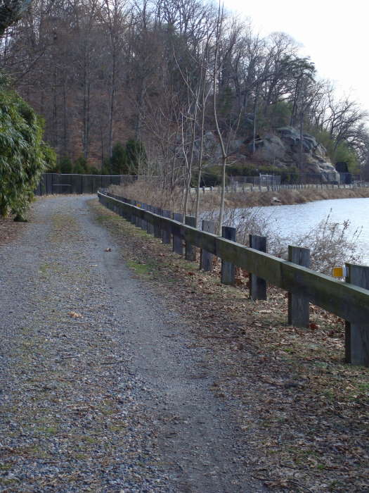
Once on the South side of the James River, bear right and take the Low Water trail. If the river is high you will have to take the High Water trail. You will soon come to a concrete path, bear left. Continue on the trail and in 1 mile you will come to the James River Park System Headquarters and Visitor Center. Keep your eyes open on this mile long section for multiple small spur trails to view the wildlife on the many creeks that are flowing into the James River. Continue past the Visitor Center and reach the Boulevard Bridge in 1.2 miles. You will start getting closer again to this section of the James River and can see the outline of Richmonddown river.
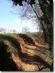
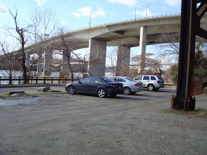
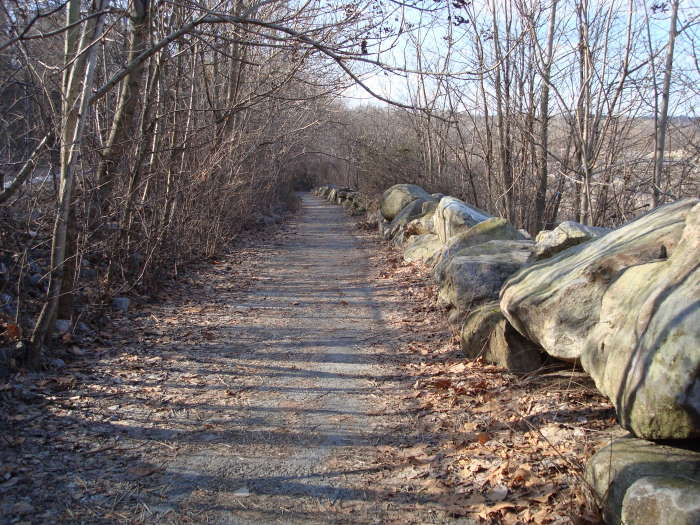
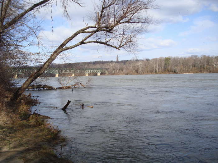
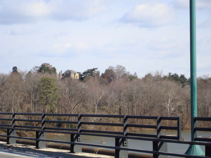
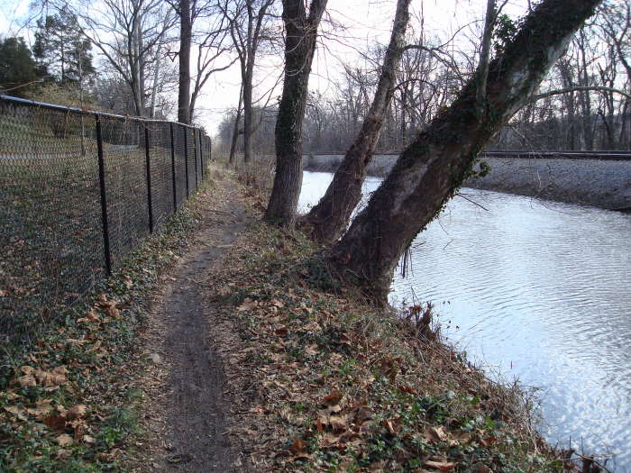
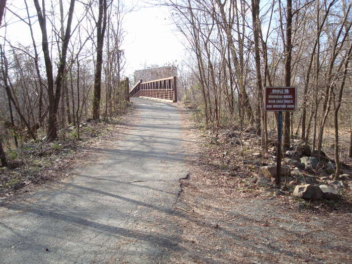
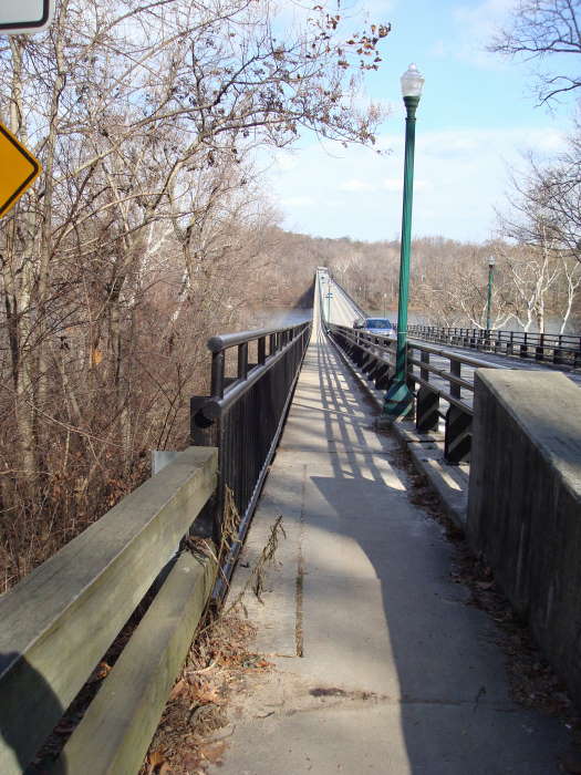
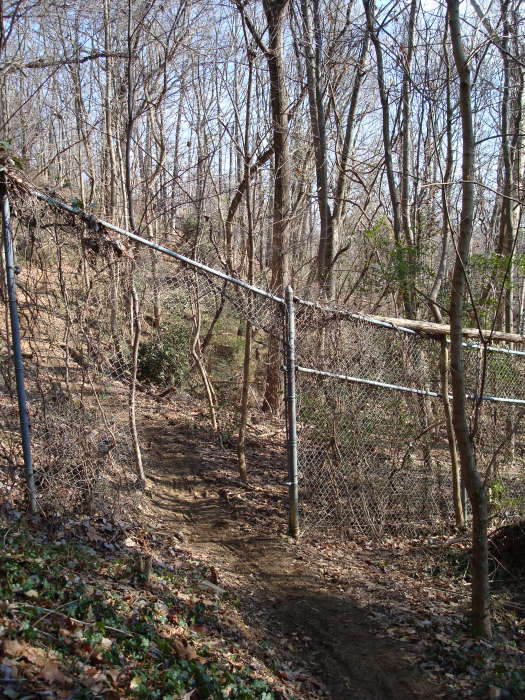
Go under the bridge and take a left over the railroad tracks, a not so obvious path will be in front of you, follow it up to the road and take a left towards the Boulevard Bridge walkway. Cross the bridge, up river is a beautiful railroad bridge, to the left and up on the hill is the Maymont House. Once across take a left towards the Northbank Trail, the trail begins near the kiosk. The next 0.6 miles of the trail will have the Maymont property on the left and the Kanawha Canal on the right. There will be a steep ramp and portion of the trail as you reach the intersection of Hampton Street and Kansas Ave. Follow Kansas Ave for 0.3 miles and take a right on Texas Ave towards the Northbank Trail parking area. Take a left into the parking area, the trail begins at the far end. At the first intersection bear to the left and the trail will go through a fence, it seems strange but that is where the trail goes. [Note: This part of the trail was a little confusing and with no blazes it made it even harder to follow. If you end up starting to go across a railroad pedestrian bridge, you have gone the wrong way, turnaround.]
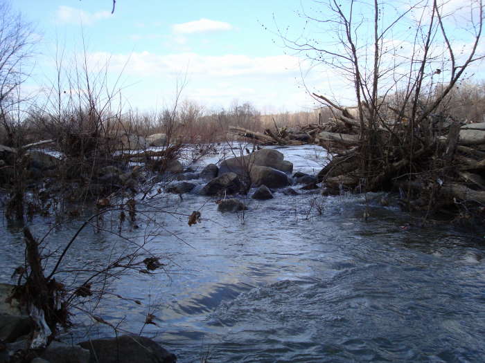
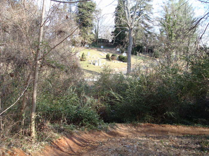
Once through the fence it is about 1.5 miles back to the parking area. You will pass 3 separate cemeteries: Calvary, Riverview and Hollywood. There are some great views of the James River on this stretch of the trail. Keep heading towards the Lee Bridge and you can’t miss the parking area.
Early January
James River Hike Comments
Archived Comments
By:A S
Rating:
Date of Hike: Tuesday, October 29, 2019
Have always enjoyed this hike, both the version outlined here and the slightly longer version with the Buttermilk trail included. Hiked it today and thought it would be helpful to share that the north bank trail is currently closed between the entrance at the Boulevard bridge and the intersection of Kansas and Hamilton streets before the Texas Beach parking lot portion. We realized this once we made it to the north bank trail entrance. There are yellow arrows however that will lead you on a detour around maymont park where you can connect at the Texas Beach parking lot.
By:Rebecca and Allen Mills
Rating:
Date of Hike: Thursday, January 3, 2019
Took this trail as a spur-of-the-moment adventure. we were very glad to have the written tips from this site, as we had not hiked much in this area. Even with the tips, there were one or two spots that we found tricky. For those used to hiking on well-marked/blazed trails in the state parks and similar, it would be helpful to have these tips, as the trail at intersections/cross-trails is not always as obvious.
After crossing to the South side, only a very small portion of the concrete walkway was overflowed by the river, which we could get around over the rocks, so we were able to take the Low Water Trail...it's really just a small portion. We did not see as much wildlife as I had hoped, but did see bird activity. Mostly we really enjoyed being close to the river and seeing it fairly high. When arriving under the Boulevard Bridge, you literally climb up to the railroad tracks and cross over. The tips are understated when it says, "a not so obvious path" will lead up to the bridge. When you cross the tracks, immediately under the bridge, just to the right, is the path leading up to the pedestrian walkway across the bridge, back to the north. This is probably the steepest upward climb and a bit of tricky footing because of the overnight rains. Over the bridge to the North Bank trail is easy. The views are great you just have to ignore the cars zooming by. Walking past Maymont was cool the ramp up to the street IS very steep, a bit slippery when wet. Then it actually takes you a few blocks through a residential area on the way to the North Bank Trail parking area. I would refine the trail notes here, when taking up the trail from the parking lot. at the first intersection, do take the Left trail, marked "Texas Beach". You will go down the steps built here. you will not follow the Texas Beach trail, but will find the opening in the fence that is referred to, slightly to the left, just before the railroad pedestrian bridge. After this it was smooth sailing. It seemed marshier here in some spots than on the South Bank. we have had so much rain, but never so bad that we couldn't avoid puddles, and we had light, water-proof hiking boots. Regarding hygiene facilities, for those who care porta-potties at Tredegar parking lot, parking lot just across the Boulevard Bridge, and the North Bank trail parking lot...strongly advise bring your own toilet paper these potties were very full, and had not been serviced for a while you can't be squeamish if you are going to be a hiker! Just be prepared. We really enjoyed this hike on a coolish January afternoon. It was a combination of urban, woodsy, river hiking. There is so much history in this area, this hike prompted us to want to learn a bit more about the places we went through. I have lived in Richmond my entire life but there is always more to learn, appreciate and remember. We don't do as much of this kind of thing as we would like, so in terms of difficulty I would call it mostly easy with a few spots of moderate thrown in. You must be in good enough shape to tackle just a couple of short climbs, and watch aging knees on a couple of downhills, maybe a little balance if exploring the rock field just over to the South Bank. This could be done in 2-21/2 hours by someone just out for the pure exercise of the walk. We took a very leisurely 3 1/2 hours, taking pictures, snacking, etc. Happy Hiking!
By:Diego
Rating:
Date of Hike: Wednesday, March 21, 2018
Can't believe I'm giving this a 5, but looking back on it, there was just so much to see throughout the hike. It was snowing the day of the hike which was beautiful. It also kept other people away from the trails. Both of these contribute to my high rating.
I started this from the Maymont Pump House lot (37.535162, -77.482964) and hiked clockwise. There is also parking at the Texas Beach lot (off Texas Ave) and the Reedy Creek trailhead (off Riverside Drive).
Instead of the hanging bridge under Route 301 I instead took the Tyler Potterfield Memorial Bridge. I would recommend both routes, but the Potterfield Bridge makes it a longer hike. After crossing the bridge you have to take a footbridge over the railroad tracks to get up to Railroad Ave. The Buttermilk trail peels off of this road, going under the Route 301 Bridge, then parallels Riverside Drive for a ways. There's a 4-way intersection (near 21st st) with a bridge/stairs to the right. Go right to cross over the railroad tracks to the Reedy Creek Trail. I did not take this route on my hike but wish I did. Continuing to follow the Buttermilk trail will result in you staring at trains and not much else.
The Reedy Creek Trail will eventually lead to the Park HQ building. Go right. You can either cross the train tracks or continue on the river side of the tracks. The trails meet up a little farther down. From there you get back to Westover Hills Blvd which goes back over the river.
I liked the portion on the north side of the river the most. There are so many places to branch off and explore if you have the time - Texas Beach, Maymont, cemetaries, Brown's Island, Tredegar. It's also worth noting there are trails all over Belle Isle to explore as well.
By:Local
Rating:
Date of Hike: Friday, February 17, 2017
Just wanted to update with the December 2016 opening of the fantastic new T. Tyler Potterfield Pedestrian Bridge, which adds a new foot crossing over the James. The bridge is built on the piers of the old VEPCO levee which crosses from Brown's Island south to the Manchester wall. A short section has been open for many years but now you can walk all the way across. You get beautiful views of the city and the falls of the James. This is a very cool structure and well worth the drive to Richmond to see it. The bridge is 100% accessible from both sides. There is a warning sign for dog owners, longer nails can be caught in the bridge decking so beware.
Instead of taking the Belle Isle hanging bridge from the parking lot, go left down Tredegar Street and turn right onto Brown's Island. Follow the Potterfield footbridge across the river and continue on the path to the view from the top of the Manchester wall. Continue on the shorter footbridge over the train tracks and turn right behind the Suntrust parking lot. Follow the sidewalk and then a marked trail under the Lee Bridge. In about a quarter mile you will come to the 21st Street park entrance. Go down the spiral stairs to reach either the High Water or Low Water trails and rejoin the route in the main description.
By:Midlo Day Hiker
Rating:
Date of Hike: Sunday, November 15, 2015
We have lived in in the suburbs of Richmond since 1997 and never hiked this trail. It is fantastic and can't wait to hike it again. It has everything a hike in the mountains has, except the elevation. We parked in the lot off Westover Hills Blvd/Pump Rd. and went clockwise up Northbank trail. The Northbank trail is very busy with walkers, runners, mountain bikers, but once you cross over to Belle Isle and are on the Low Water trail it becomes much quieter. I think the trail changes to Buttermilk Trail at some point. We enjoyed the trail, cemetaries, rock hopping, creek crossings. The whole trail is very dog friendly and my dogs particularly liked the Reedy Creek area. Highly recommend this trail.
By:Hiker mom
Rating:
Date of Hike: Wednesday, November 11, 2015
This was a very nice hike right in the middle of Richmond. It gives you some nice views of the river as well as lots of history along the way. Recommend taking the excellent hiking summary along as the trail is obscure in several places. It was a fun way to spend a morning. Get there early to find a place to park. By the time we finished the hike around noon, the lot was full.
By:Long Beard
Rating:
Date of Hike: Saturday, January 31, 2015
My wife and I started this hike at the Pump House parking lot near Maymont along the North Bank trail, The weather was nice for a winter hike ,42 degrees and sunny. The views along the river were nice and there were lots of birds to view. Keep an eye out for bicyclists along the trail , as it is used quite a bit by mountain bikers and the trail is narrow in spots. Once you cross to the south side of the River be sure to follow the Buttermilk Trail, use the metal tower stairs to access the trail. We did not do this ,as I had printed the map from this site and followed its instructions . I suppose this sites map and instructions were done before the addition of the Buttermilk Trail. Since we missed this part of the trail and hiked the low water and high water trail instead ! I guess it just means we will have an excuse to go back ! Overall this is a great urban hike.
By:Master Hiker
Rating:
Date of Hike: Tuesday, March 11, 2014
Great evening hike when you have enough daylight. Started from Legends Restaurant/Brewery then continued to Buttermilk trail, crossed Boulevard Bridge, then to North Bank trail, then to Brown Island, normally would go Pipeline Trail, but opted to follow Canal to Dock Street and cross Mayo Bridge continued to 7th Street and back to Legends. This route is about 8.5 miles and hiking time is about 2 1/2 to 3 hours. Legends patio is a great place to view Richmond's cityscape in the evening. Trails were dry and daffodils blooming. 1st warm day in Richmond, so Legend's was crowded and there was a 90 minute wait for food, so skipped dinner. Note: Parking lot at Tredegar was pretty crowded the past two times I was there, and don't park under the railroad bridges (heavy greases from railcars can damage your cars paint). If you do the hiking upwards route, check out "Dead Rock" on north side of Belle Island.
By:MJG & BMW
Rating:
Date of Hike: Saturday, December 28, 2013
Overall great hike parking lot was full before noon. Some great views lot of people and bikers for most of the hike. It took us 3 hours to walk the trail stopping for pictures and sight seeing.
By:Adam Peat
Rating:
Date of Hike: Saturday, July 30, 2011
We were in town visiting, so we did this hike one morning and thoroughly enjoyed it. Although this was right in the middle of the city, it often felt otherwise. There is a little bit of everything history, river view, forest, city scape. The scenery along the south side of the low water trail was spectacular. We did this hike on a hot day and followed the hike scenario posted on this site. On the north side, there are long periods walking along the bluffs where you are exposed to the sun. This part of the trail, while not difficult, requires some exertion, so we were very hot when we got to the end. I would recommended doing the hike in reverse to minimize this issue. Also, the trail markings aren't that good, so its easy to get off course. Generally, the most traveled path is really the best one to follow, but you might easily find yourself off course. Definitely, take along the hike summary as it will help.


