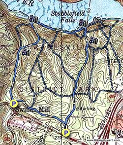
You won't find a closer waterfall hike to the Metro DC area. One mile from the beltway on Georgetown Pike, the Scott's Run Nature Preserve is a little piece of wilderness saved from urban sprawl. Originally the Burling Tract, it avoided development in the 1970's and was renamed the Dranesville District Park. Today it is known as the Scott's Run Nature Preserve.
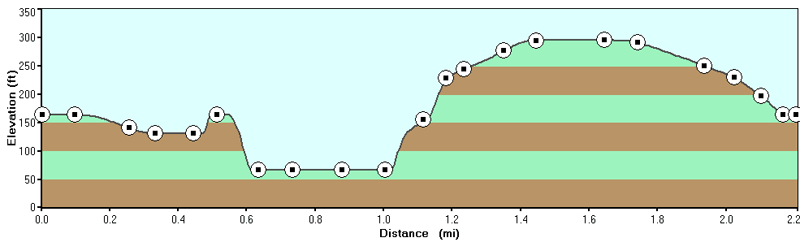
We have outlined a loop of 2.2 miles here, however the preserve has many interconnecting trails on its 384 acres. The Fairfax County Park Authority doesn't blaze or name any of the trails, but there is little chance of getting lost. You can't go any further north than the Potomac, and Georgetown Pike borders the property to the south. This hike has trails that range from the very easy to quite difficult.
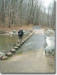
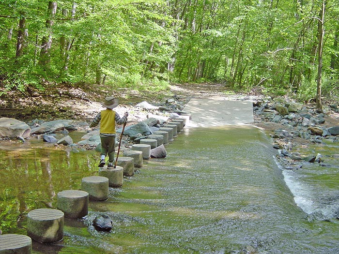
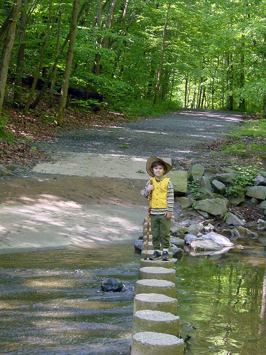
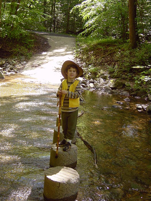
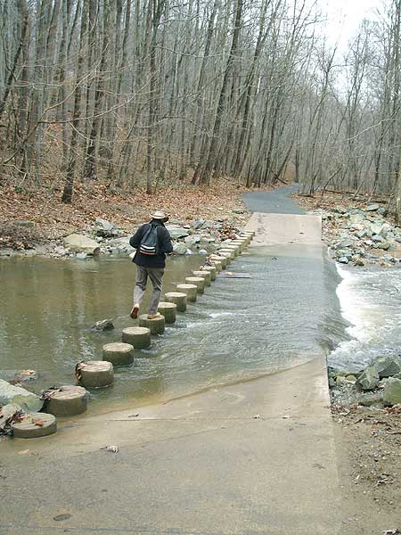
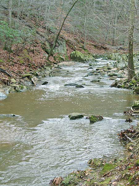
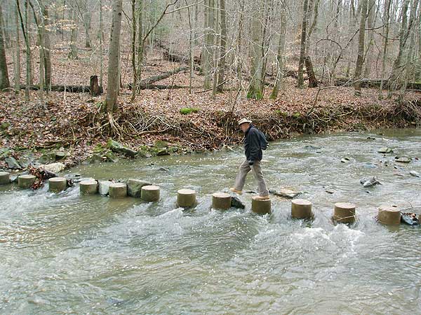
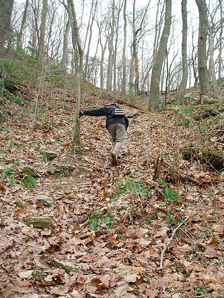
Start down the path, and shortly cross a ford over Scott's Run then in 0.3 miles turn right crossing Scott's Run over the concrete posts. The path that leads straight, and didn't cross the run, takes the direct route down to the falls and becomes very difficult requiring boulder hopping. DO NOT take this route with children or when the trail is wet.
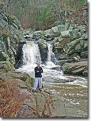
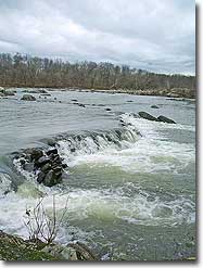
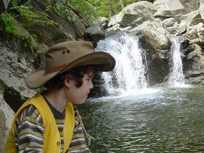
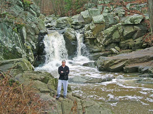
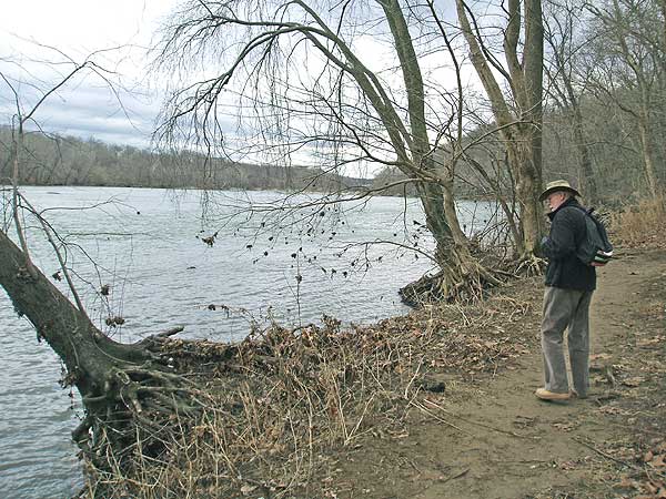
After crossing Scott's Run head uphill for 0.1 miles and junction of the wooden stairs that lead up to the Burling House Ruins. Turn left downhill for 0.1 miles to the Potomac River bank and falls where Scott's Run meets the river.
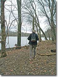
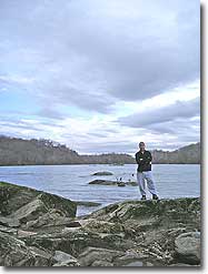
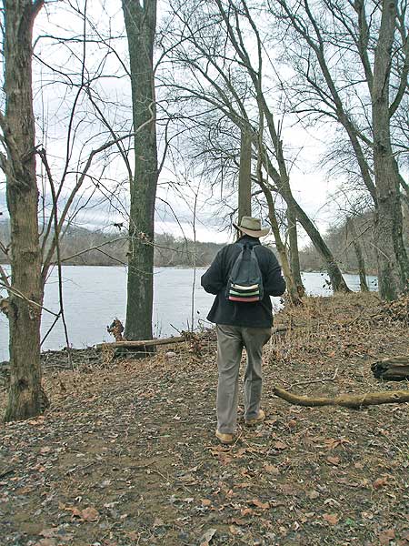
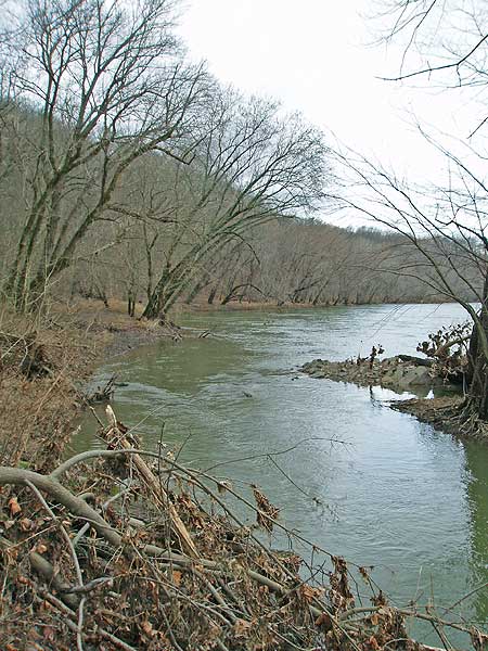
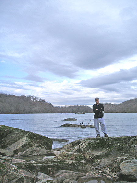
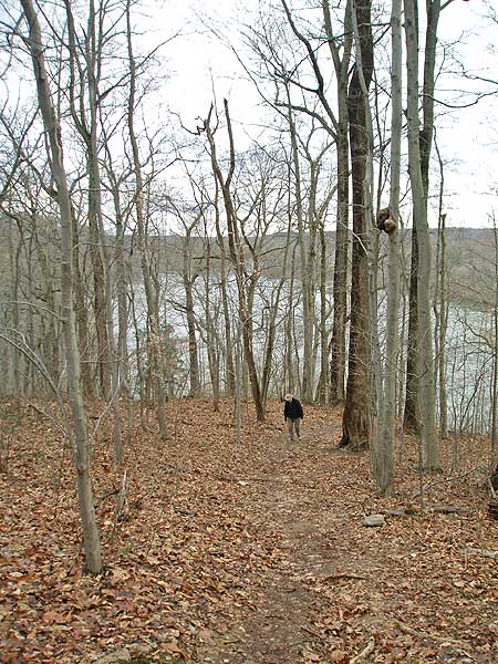
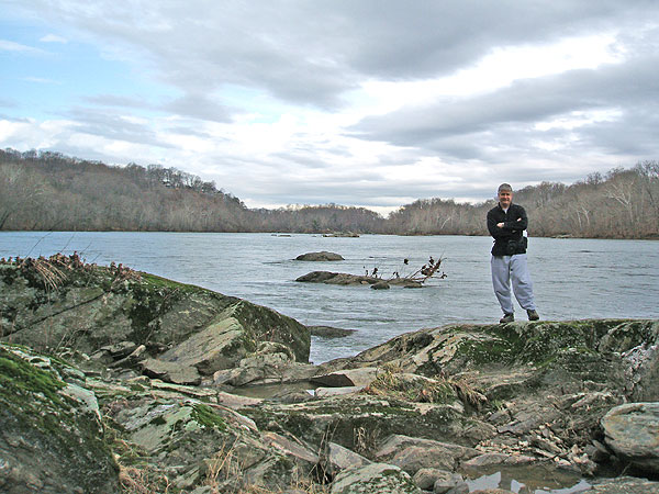
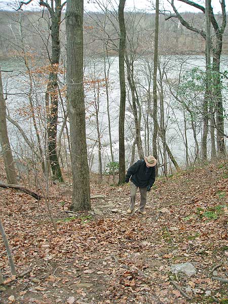
Turn right following the trail along the river bank and in 0.2 miles pass a small trail that leads uphill to the Burling House Ruins. In another 0.1 miles pass another trail that leads uphill. Continue along the riverbank where the trail goes around a small point. The point jetties out into the river here for about sixty feet and is a great spot for lunch. Twenty feet past the point take the trail as it heads directly uphill between two small ridges. As you pass the steepest section come to a minor trail junction.
Turn right, then immediately left along the top of the ridge spur and in 0.1 miles pass an old flag pole. Continue straight for another 0.2 miles an arrive at the next major trail junction (the trail to the right passes the Burling House Ruins then descends the wooden stairs and goes down to Scott's Run falls in the earlier part of this loop). Turn left and pass a four way junction in 0.1 miles.
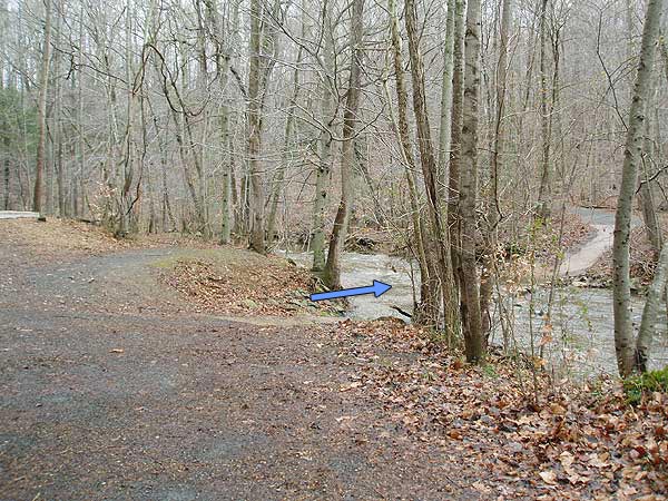
In another 0.2 miles turn right at the next trail junction (if you arrive at the upper parking area and Georgetown Pike you've gone too far). Continue down the trail passing a trail on your right in 0.3 miles, then arriving back at the main parking area in another 0.2 miles.
Late May
Mid January
Scott's Run Hike Comments
Archived Comments
By:Justin V
Rating:
Date of Hike: Thursday, January 26, 2017
Great DC area hike! If you are in DC definitely check it out, but I wouldnt travel to DC to do it. Lots of trails to choose from so took about 3 hours to check them all out. Few things: (1) people have mentioned a sewage smell, but other than maybe at the parking lot I didnt smell it at all. (2) Great place to hike with kids, dogs, but a few trails are more difficult than others (Order from easiest to hardest: Light blue/light green, purple, blue, red, yellow, orange). (3) pretty empty, but I did go on a work day.
Here is a link to the trail map: http://i.imgur.com/ZrUFUbk.png . Top left is the trail map, top right (red) is what I walked, bottom left (yellow) is what this website recommends), bottom right (green) is what I think is a better hike.
By:Adam R.
Rating:
Date of Hike: Saturday, September 5, 2015
My wife and I took our four girls (ages 11 through 6) for a wonderful hike at Scott's Run this morning. The "sewage" smell was only faintly noticeable in the upper parking lot. We followed the route outlined here, working our way down to the falls. We'll need to remember swim gear next time so we can take a dip in the water! Instead of getting wet, we opted to climb the rocks far above the falls. The rocks were sheer at times, so thankfully no one slid down! We had lunch on the point and caught an osprey and heron having lunch out on the Potomac. The rest of the trail was uneventful, but pleasant. For a Saturday morning, the trails were populated, but not crowded. We'll definitely be going back to explore some of the other trails, especially the ruins which we weren't able to get to.
By:northern va resident
Rating:
Date of Hike: Sunday, May 3, 2015
The waterfall was pretty, but the entire hike all you smell is sewage. I would skip this hike in favor of great falls national park, just down the road. Believe me, of you want a jaw dropping hike, great falls is where it's at! For a Mediocre hike, come to scotts run. It's not how it used to be.
By:Whitey
Rating:
Date of Hike: Sunday, April 12, 2015
Warning: parking lot smash and grab today in the crowded parking lot. The hike was busy but most people opted just to quickly hop down to the river. Take the circuit!
By:Nate Flames
Rating:
Date of Hike: Saturday, December 27, 2014
I have been hiking in this preserve for more than forty years. Needless-to-say, it has special meaning to me and my family. Thus I was horrified to see signs posted throughout the area warning hikers that deer are being bow hunted in this PRESERVE. Preservationists united to save this land back when it was the Burling Tract, but why aren't people rallying to protect deer from being stalked by bow hunters in this supposed haven? If deer numbers are that high, why weren't/aren't alternatives being considered/used?
By:AsiaFan
Rating:
Date of Hike: Saturday, December 20, 2014
Went on this hike with my school aged kids and another family with the same. It was a mild easy hike with some elevation and a decent (though not breath-taking) vista. It was a warm winter day with runners and adults with dogs on the trail. Kids had a great time playing in the brooks and streams. Definitely recommend it with family!
By:Rook
Rating:
Date of Hike: Sunday, September 22, 2013
we did an out and back because we went to the other side of scotts run. the rock scramble was really fun and the falls was amazing. and only 40 mins from home!
By:Fireg8tr
Rating:
Date of Hike: Saturday, June 1, 2013
We went as a family hike. The park was easy to find. Despite its' close proximity to major roads, the sound of running water and the occasional plane were all you could hear. The western parking lot had plenty of room, but be careful getting back out. Most of the trails were crushed rock or compressed ground. My 4 and 6 year old had a great time. The kids liked the rough trail in the NW corner of the park. It ends at the waterfall with some rock climbing. You will either have to back track or climb across (getting wet) to get to the other trails. The internal trails themselves were not well marked. A compass and a pic of the park map taken as we entered helped. The kids loved the river crossings.
Warning - The park is monitored by the US Park Police. They will ticket you for swimming.
By:Ubikwity
Rating:
Date of Hike: Monday, May 6, 2013
This was a nice hike, although not my favorite. The directions and map are accurate until you get to the waterfall at the Potomac but then things get murky as you go along the river. The area of the "little point" is not obvious. I'm actually not sure if the "little point" is supposed to be further east along the river - on the map you see the dotted trail and a more prominent point with three small islands in the river, but that doesn't seem to be part of the hike that's highlighted on the topo map. There are an awful lot of trees down in that area as well. Makeshift trails that go around them lead back up the hill. The trails are not well marked for the most part so if you're a map freak like I am it can be confusing and a little frustating. But you won't get lost - you're essentially just making a big square between the river and Georgetown Pike.
By:Bill D
Rating:
Date of Hike: Sunday, September 30, 2012
This hike won't test the limits of human endurance or draw on your survival skills, but it is a great family outing, especially if you live in the DC/NoVA area. I did this hike with my wife, three sons (ages 3, 7, and 9), and my dog, and everyone had a great time.
We parked in the west parking lot and hiked toward the river. The first part of the loop follows a stream through the forest, and you have to cross the streams twice using a series of round concrete steps. As they were making these crossings, the boys informed me that it was very treacherous. I wholeheartedly agreed with them that they were indeed brave explorers, as I stood in a quarter-inch-deep section of the stream taking photos of them. The trail follows the stream until it reaches the Potomac, at which there is a nice waterfall there as it empties into the river. There are plenty of places to reach the waterfall for a good view.
There trail then follows the Potomac river east and then rises slowly until you reach a very nice overlook with a great view of the river. The trail then loops back through the forest with enough of a vertical climb to break a sweat, but not enough to prevent a high-energy three-year-old (are there any low-energy three year olds?) from completing it.
Overall, this was a great way to spend a beautiful fall Sunday morning with your family. Many people seem to agree, as the trail was busy with other families enjoying the trail and walking their dog, so you won't get much solitude on a nice day.


