|
 By Trail Contributor: Jeff Monroe (Email Jeff) By Trail Contributor: Jeff Monroe (Email Jeff)
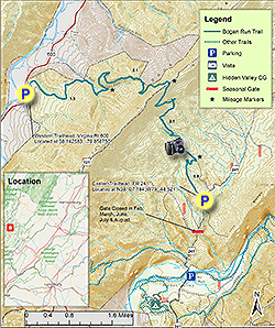
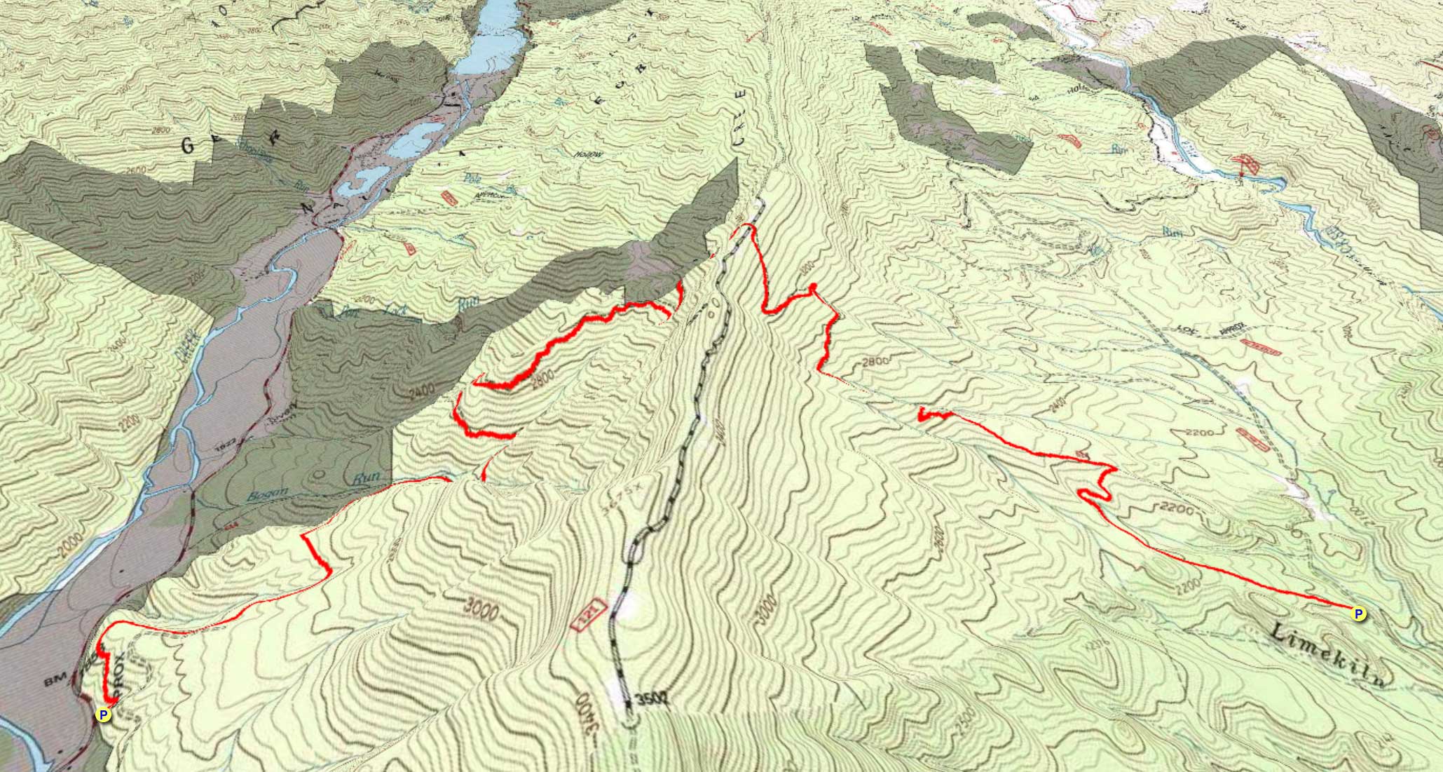
The Bogan Run Trail #614 climbs over Back Creek Mountain connecting, from east to west, Hidden Valley with the Back Creek Valley in the Allegheny Mountains of western Virginia. The mileage shown represents an out-and-back hike, however with parking lots at either end of the trail, it makes a great shuttle hike. This trail is also part of the long distance Great Eastern Trail, however hiking further north and south on the GET from this trail’s ends involve long road walks – 7 to 8 miles before the next trail in either direction.
Although there were no established campsites observed on this hike, its eastern end is not far from the Forest Service’s Hidden Valley Campground, which is open from April to early December. There is also a bed and breakfast in Hidden Valley, at a historic home that was the set for a Richard Gere movie years ago. (Less expensive: there are roadside campsites on the road to the eastern trailhead.) Stay nearby, and make this hike part of a great weekend!
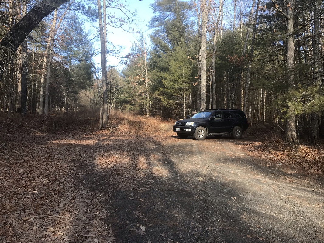
There are two possible trailheads for this hike. The description assumes you park at the eastern end, at a parking lot up the road from Hidden Valley. The Forest Service gates this road for nearly half of the year: the road is open in April and May, and September 1 through the end of January. If the gate is closed, it is a 0.6 mile walk to the trailhead from the gate. Both lots hold about six cars – there should be plenty of parking space when it isn’t hunting season – and if you are hiking in November or December, be sure to wear blaze orange.
-
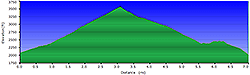
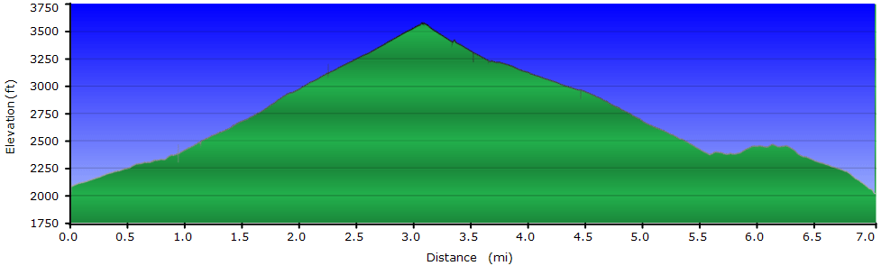
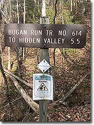
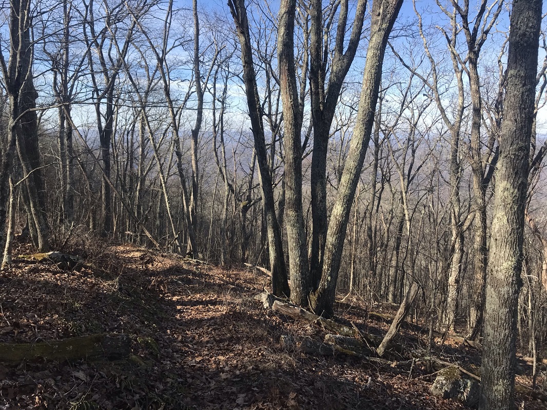
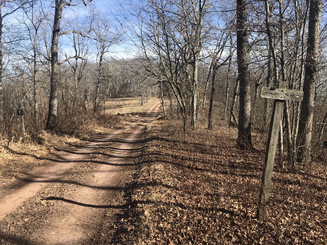
Mile 0.0 – Start the hike in the eastern trailhead, just off FS 241. The trailhead is marked by a brown hiker sign, about 100 yards up the road. When you begin the hike, pass over a tank trap next to a mileage sign that you should ignore. The mileage listed on this trail sign is wrong, as the trail is 7 miles, not 5.5 miles – a big difference! The trail heads west on an old woods road that passes a timber harvest area on the left and a relatively young forest on the right.
-
Mile 0.7 – The trail makes a u-turn as it crosses a stream.
-
Mile 0.9 – Come to an intersection that can be confusing. The trail takes a left on the intersecting road. This road was the original trail route in both directions and several area maps have not been updated. Now, you take a sharp left, following the blue blazes.
-
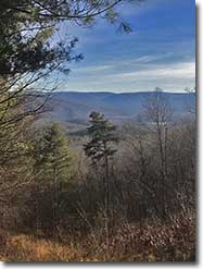
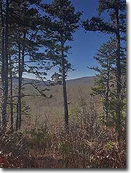
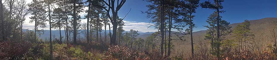
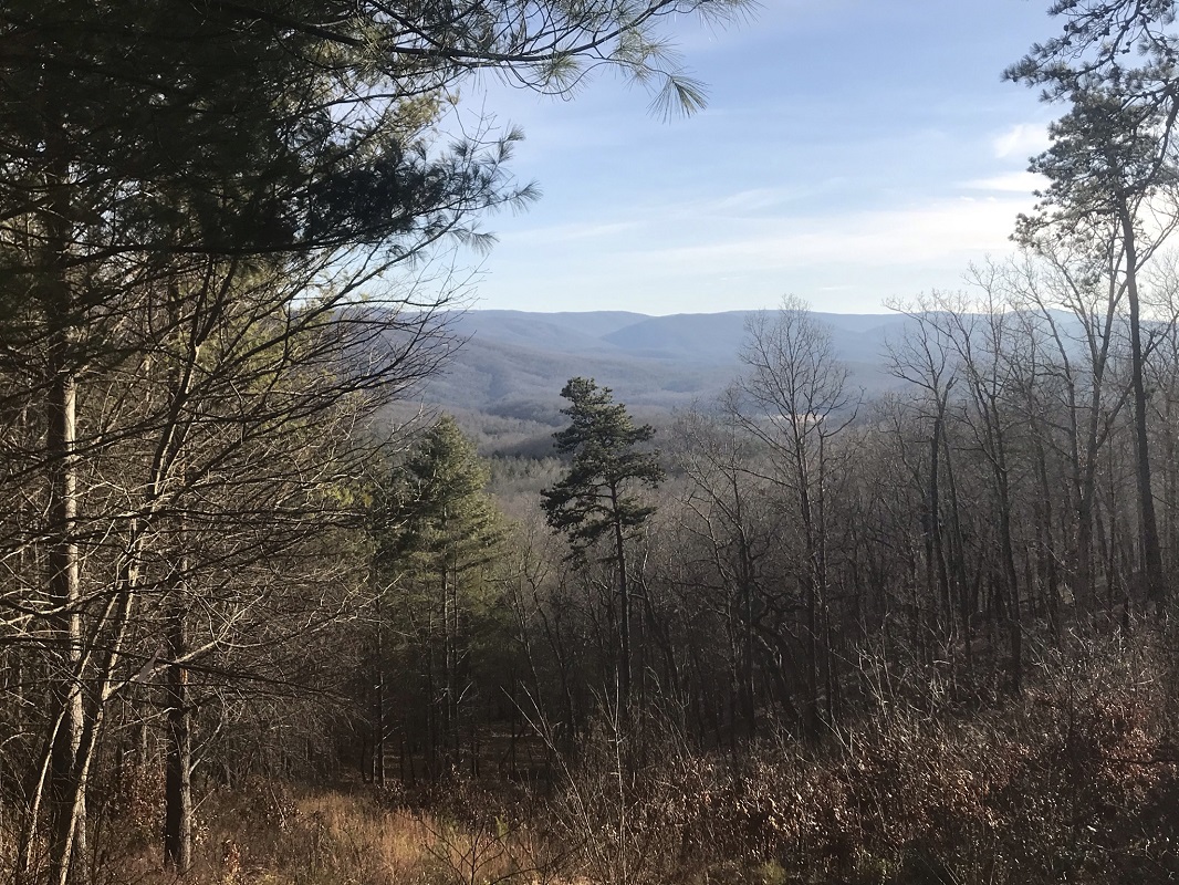
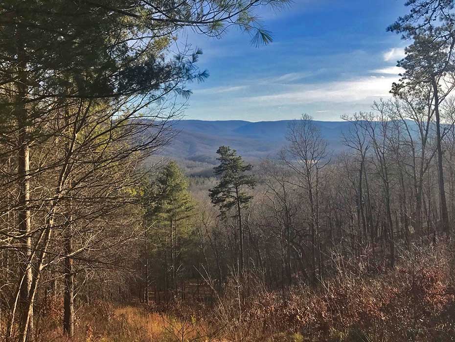
Mile 1.3 – Hike through a timber harvest area, with some of the best views of the entire hike – to the south and the east.
-
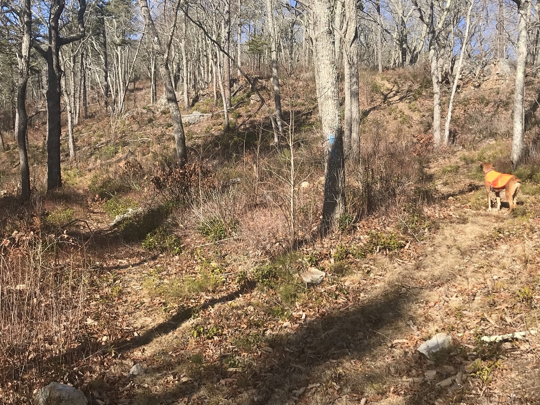
Mile 1.5 – The trail appears to split with a blazed tree between the forks. Take the left route, which climbs the mountain more gradually, via a switchback. After this, the trail curves around a ridge and eventually ascends via a series of long switchbacks. During much of this part of the hike, you will push through some Mountain Laurel branches – it appears that a fire may have cut back these bushes, as they are dead above about a 6 inch height and easy to push through.
-
Mile 3.0 – Reach a road on the ridgetop of Back Creek Mountain. Just before summiting, the trail seems to disappear – a strangely common phenomenon on trails in the Warm Springs Ranger District near mountain summits. If your trail disappears, know that you push uphill only a few feet to the summit. Signs on either side of the road indicate where the trail should meet the road. A short distance to the north on the road – off trail – is an open area managed as a wildlife attractant, which could provide a good campsite. Note that the Forest Service gates this road at the same times of year as the road to the eastern trailhead. So, if you drove all the way to the eastern trailhead, past an open gate, this road may see traffic. On the west side of the ridge, the trail is easier to locate, but you have to push through about six feet of thorny wild raspberry that adjoins the road. Fortunately, it is not very thick.
-
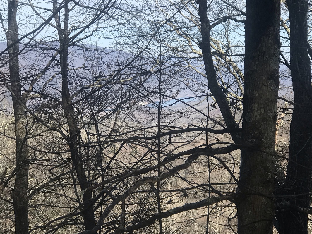
Mile 3.7 – The trail descends slowly, riding the side of a ridge. There are some good winter views of a reservoir to the northwest, where Back Creek is dammed (called “Lower Reservoir”). At the point the trail reaches a finger ridge, it switches back sharply. The switchback is so sharp that I lost the trail completely – thinking at first it would follow the finger ridge - and then thought I was retracing my steps when I was continuing down the trail. Fortunately, the trail is blazed here and is well blazed (blue) throughout its length.
-
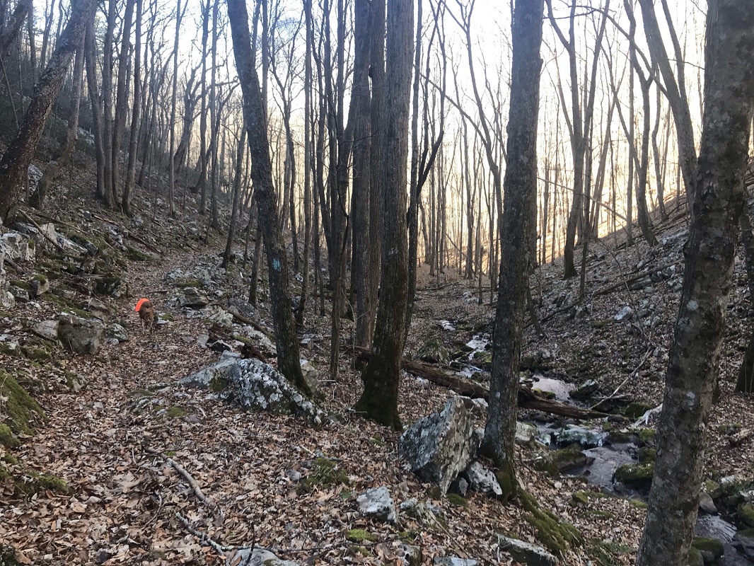
Mile 5.1 – The trail crosses the first of two streams.
-
Mile 5.3 – After crossing the second stream, the trail descends on an old woods road through a beautiful section of woods.
-
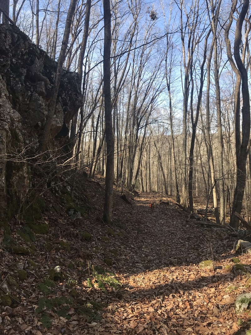
Mile 5.5 – Shortly after passing close to a small cliff on the left side of the trail, look carefully for the trail on the left – it leaves the road and the road enters private property. This change in trail direction is easy to miss. The trail climbs up via steps, away from the road. The trail also leaves public land for a short time before re-entering the National Forest. For about the next 0.7 mile, the trail is fairly level, before beginning its final descent.
-
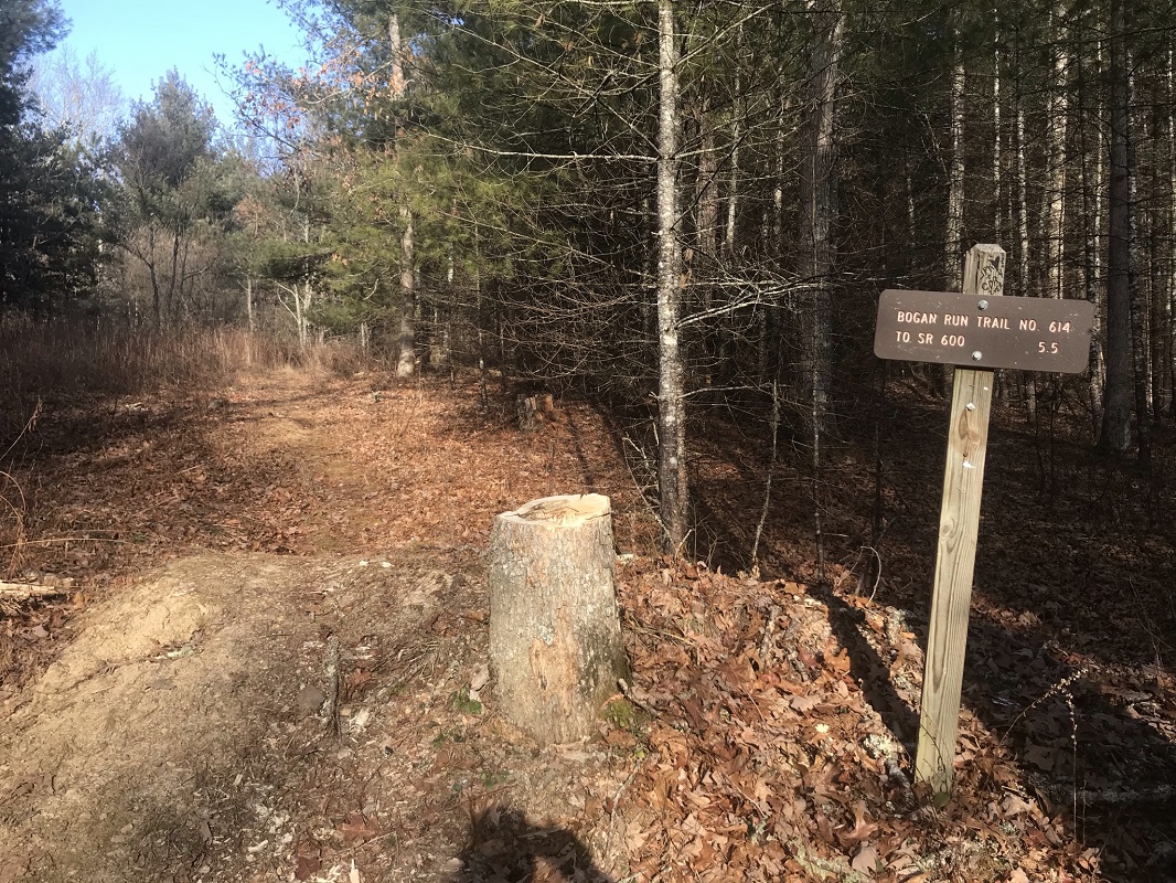
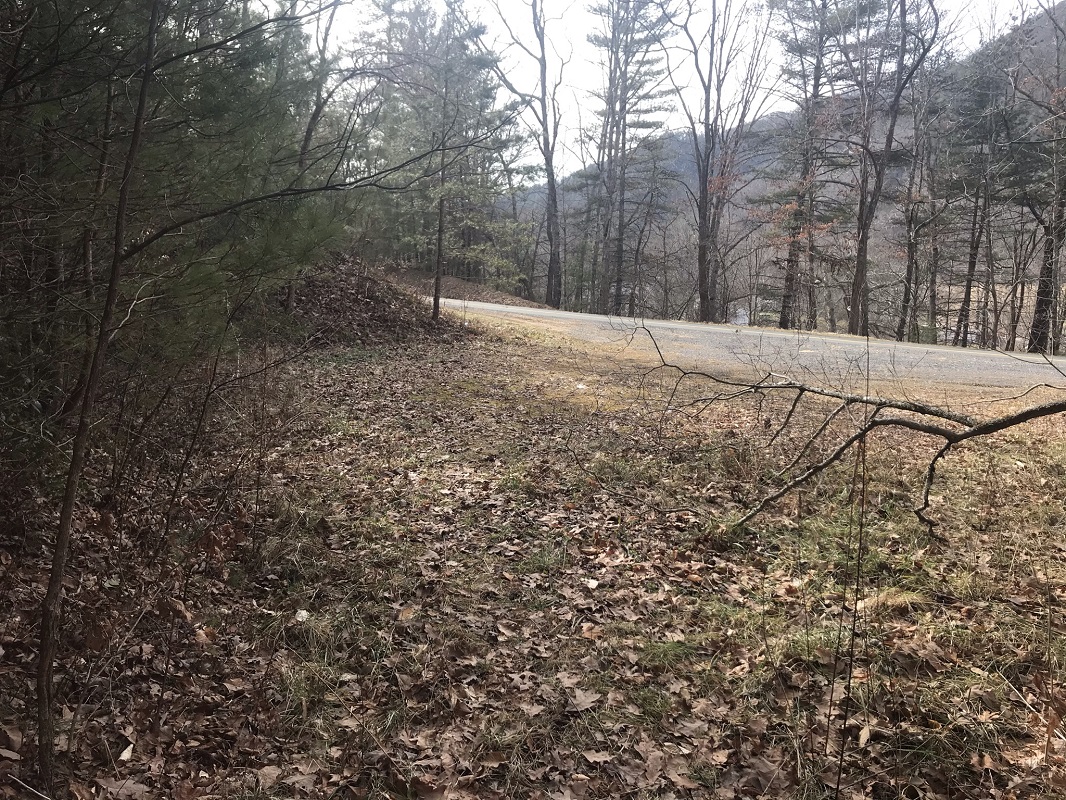
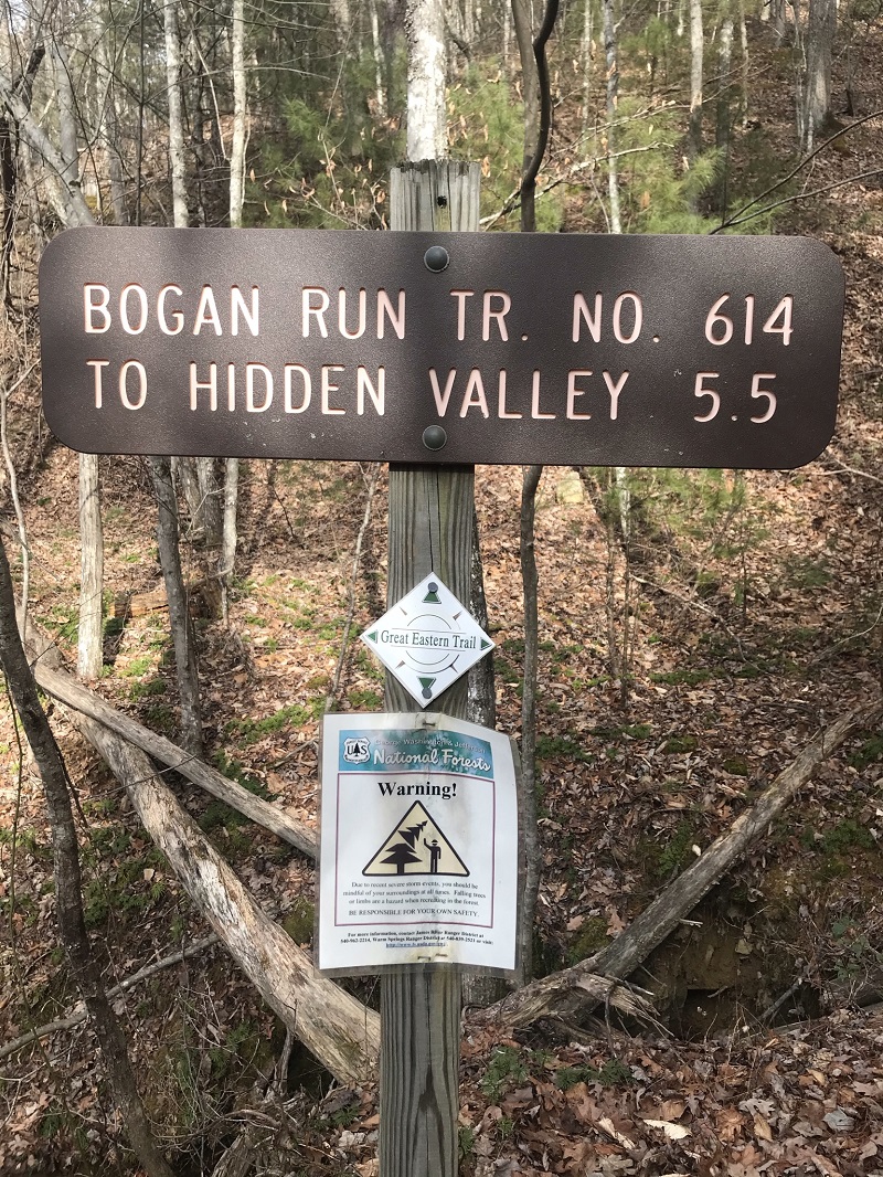
Mile 7.0 – After crossing a small stream, the trail reaches the western trailhead, which is a pulloff on Virginia Rt. 600. There is a trail sign here that also lists the wrong trail length. It looks nice and new. It will probably be here for a long time! If you dropped a car here, your hike is over. Otherwise, turn around and experience this hike again.
-
Mile 14.0 – Return to the eastern trailhead.
|
