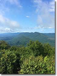
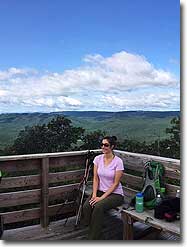
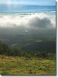
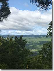
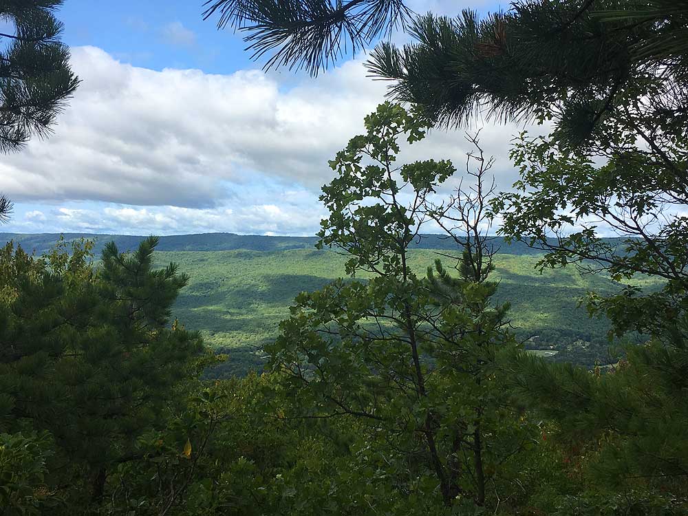
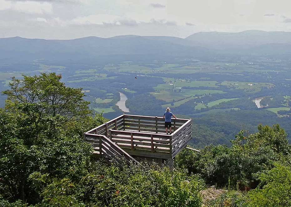
Kennedy Peak has some of the best vistas in the region. The out and back hike ends with a spectacular 360° view from the fire tower viewing platform at the summit of Kennedy Peak. The hike itself is reasonably easy. It starts with a gentle incline along the ridge, then climbs more steeply around the western flank of the peak. If you're looking for more of a challenge, add the Stephens Trail to create a 9.2 mile 1,590 ft gain loop hike. Also before starting out take a moment to check out the paragliding launch area with easterly views of the Shenandoah River and Luray Valley.
Important Parking Note: As of 2020 parking is no longer permitted on the VA 675 ridge. If you park there you may be towed or ticketed.
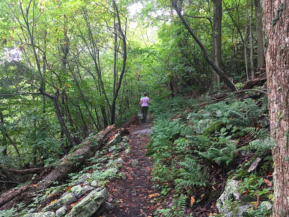
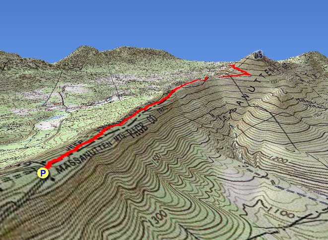
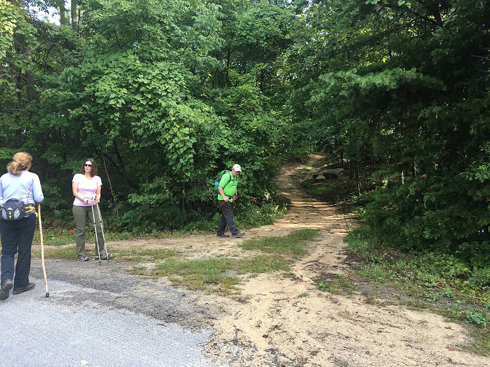
Mile 0.0 - Near the entrance to the Stephens trailhead parking area the orange blazed Massanutten Trail will start uphill towards the ridge. The trail will make several switchbacks as it climbs towards the ridge.
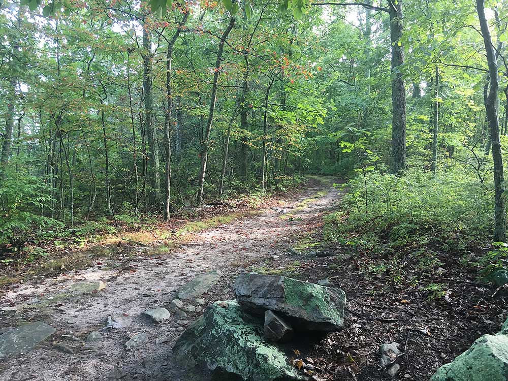
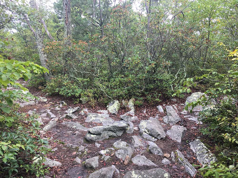
Mile 2.2 - Descend through a saddle where the trail then climbs around the eastern side of Kennedy Peak before making a hairpin turn back towards the western side of the mountain.
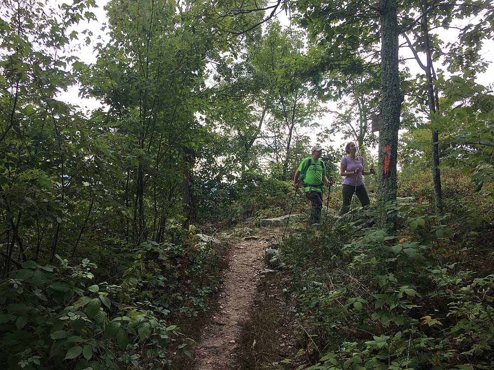
Mile 3.3 - Turn right and follow the Kennedy Peak trail as it climbs for the remaining 0.2 miles to the Kennedy Peak fire tower.
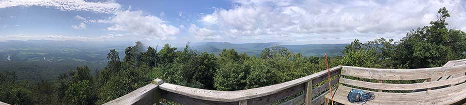
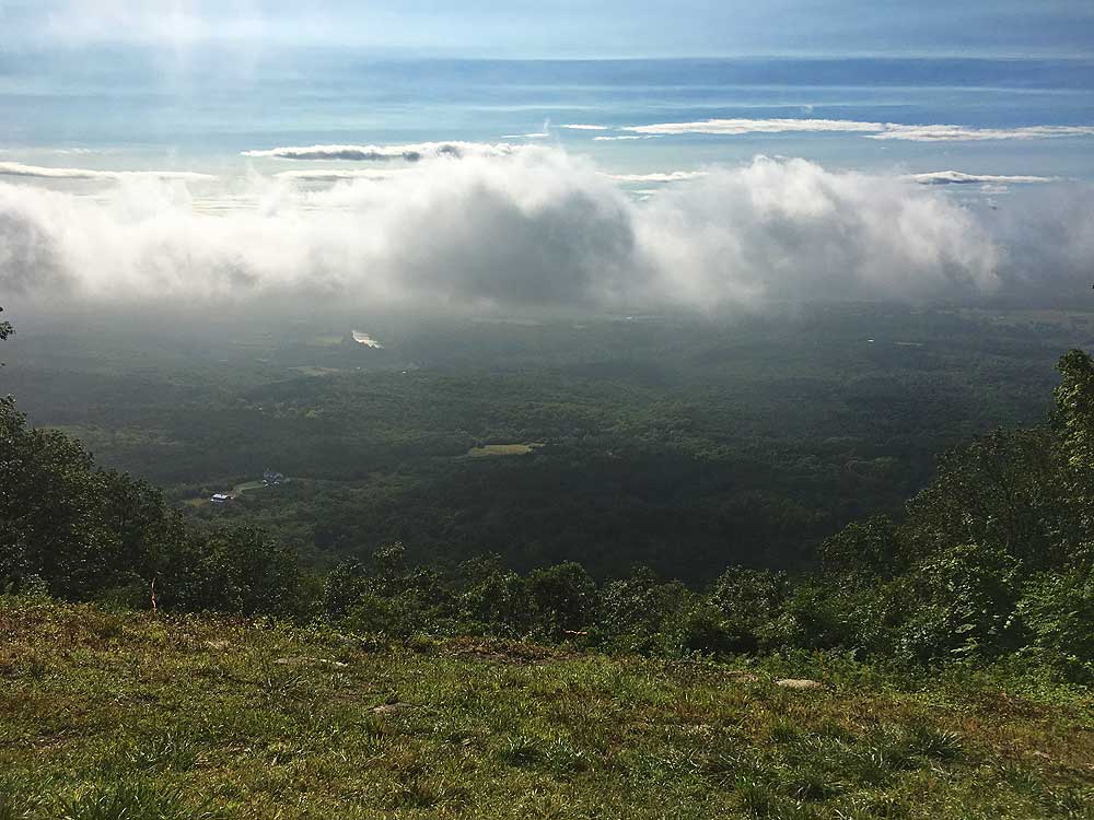
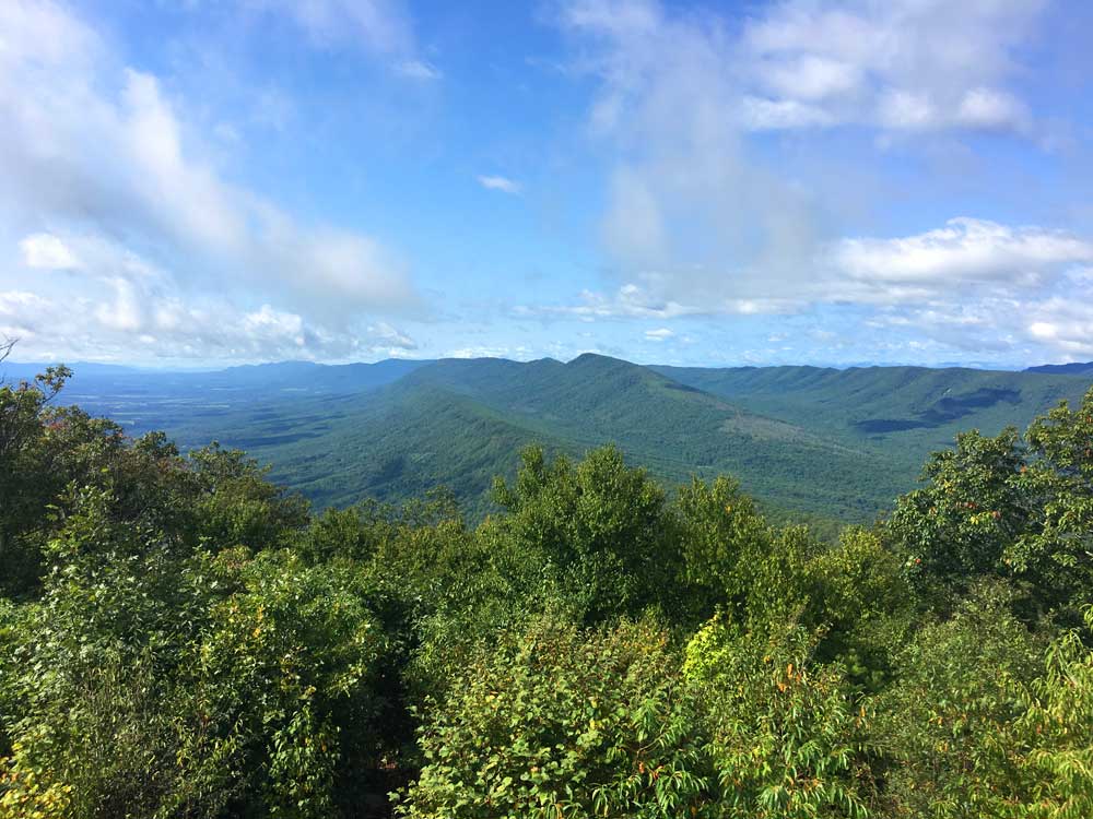
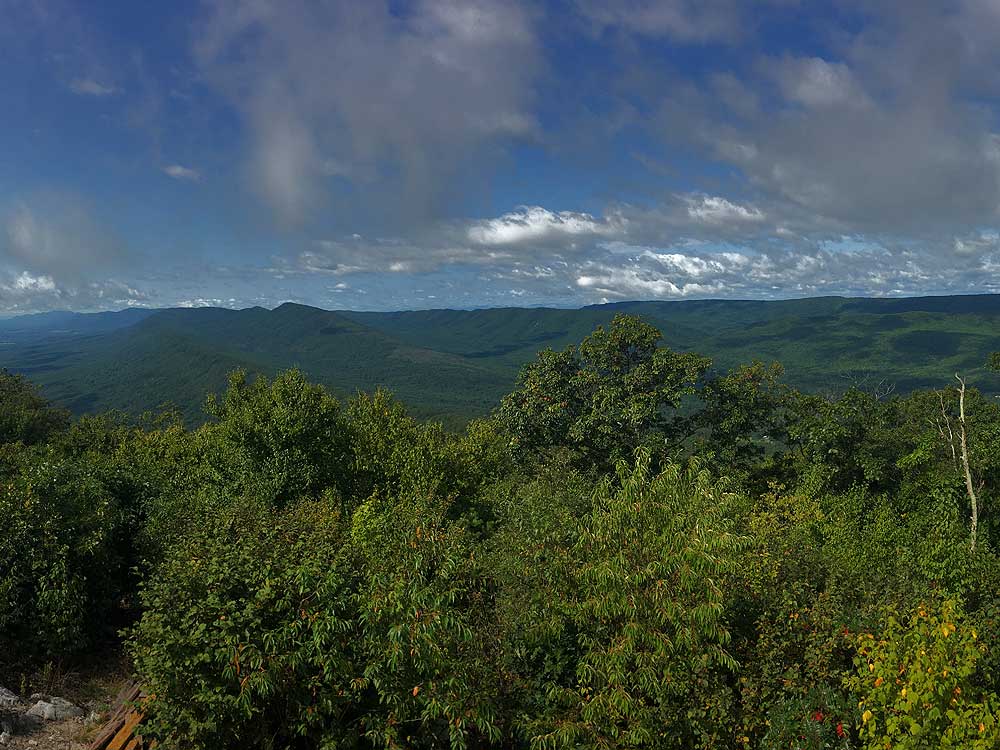
Mile 3.5 - From the fire tower lookout platform there are expansive 360° views of the Luray Valley and South Fork of the Shenandoah River to the east, and the Massanutten Range including Duncan Knob and Kerns Mountain to the southwest.
7.0 Mile Out/Back Hike: From the fire tower retrace your route back to VA675, then down the orange blazed trail back to the Stephens trailhead to complete the 7.0 mile out and back hike.
9.2 Mile Loop Hike: From the fire tower continue north on the orange blazed Massanutten Trail then descend and follow the yellow blazed Stephens Trail south to the lower parking area.
Early September
Video
Kennedy Peak
Kennedy Peak Hike Comments
Archived Comments
By:Heathen VSOP
Rating:
Date of Hike: Tuesday, October 1, 2019
Nice short hike for a stretch and with a great view from the tower on Kennedy Peak. There is no water source(s) on the trail out or at Kennedy, so take along a couple of liters. Trail was in good condition but with some erosion at the trailhead. No litter in the back country or parking area, but some horse manure in spots and some almost to the tower. Trail blazes were in good condition and about what i'd expect from any trail in VA. Intersections had signs that were in good condition and even showed the obvious intersection between the Massanutten Trail (orange blaze) and Kennedy Peak trail (white blaze) The hairpin turn in the trail after the saddle is pretty obvious with a line of boulders and a tree trunk on top. Still, some people didn't seem to get the hint from the directions on this site or that this was obvious trail maintenance. Taking the time to understand trail markings makes for a better experience and less outrage that it's not Central Park. I was surprised at how many other hikers I encountered mid-week. It wasn't a crowd, but more that I'd expected for a weekday. Leaves are starting to change but are muted because of the drought conditions. Great views from the tower and worth the time.
By:Kevin
Rating:
Date of Hike: Sunday, June 23, 2019
Relatively easy hike early half (logging road), 2nd half up is full of rocky trail terrain. Not difficult if you have good ankles. I rate the difficulty between a 2 and 3 mostly due to rocky travel.
Fantastic view of the Shenandoah valley and Luray VA looking east.
Nice day hike
By:Tale of two hikes
Rating:
Date of Hike: Wednesday, May 1, 2019
Kennedy Peak is a tale of two hikes. The section of Massanutten Trail up to the old fire tower, and the view from the fire tower are great - a definite 5. The continuation of the loop on the Stephens Trail, on the other hand, is rate "poor" in my opinion. It's a long boring slog through muddy lowland trail, full of horse manure, with nothing to show for it. Do an out-and-back and forget the loop (hence the rating)
By:Suzanne M.
Rating:
Date of Hike: Saturday, November 17, 2018
Today was perfect hiking weather, not a cloud in the sky and a high of 50 degrees or so. We had not considered the last few days weather out west when leaving Richmond. This trail was covered ( the whole way) in a combination of slushy snow, ice and a some mud / bog areas. The white ground cover made for a beautiful landscape, but tricky hiking conditions, especially on the steep down hill parts. The views from the top observation tower did not disappoint. We managed not to slip and fall, but I would not have been surprised if that had happened. We did enjoy seeing a bald eagle, deer, hawk and a bear ( from the car off route 33 on the way home) on this trail. Would definitely like to go back with no snow.
By:Abigail Putnam
Rating:
Date of Hike: Thursday, October 25, 2018
My boyfriend and I decided to check out the Kennedy Peak Trail because of the high reviews, and really, it is a lovely hike. Great views on either side of the path, lovely foliage this time of year, and great weather. Would have given it 5 stars, but I had to drop it back 4 stars because THERE ARE NO DAMN SIGNS. We spent about an hour trying to find the trail, and another half hour second guessing if this was actually the trail or someones driveway where we were gonna meet an untimely death by shotgun for being on someones property. Also, the parking for this place IS NOT parking. Its a little pull-off at the top of the mountain. Once again, no signs until youre on the trail itself. Also, we went the wrong way from the lookout tower. We were promised a lookout tower, but it was more of a lookout for disappointment because we spent so much time trying to find the trail that we had to turn around before getting there. My advice is dont go on this hike until youve studied a topographical map, have hired a folksy guide that knows the area, and are open to communing with the gods to make sure youre going the right way. Otherwise, great hike. #getsomesigns #itsnothard #goodluckfindingthisplace
By:Bobby B.
Rating:
Date of Hike: Saturday, June 2, 2018
Don't let Abigail fool you. She seems to be used to tour-guided, GPS tracked hikes with street signs all over the trail. If you've ever been on an unpaved nature trail such as the AT or Massanutten, you'll be fine. (Theres not supposed to be signs, theres supposed to be trees.)
By:Hobo Hiker
Rating:
Date of Hike: Sunday, May 21, 2017
Great hike. Added treat was talking to and watching paragliders as they took off from the Kennedy Peak parking area. Added this hike to my favorites even with the full green coverage. I said "Google directions to Kennedy Peak VA" and my Galaxy phone navigated me right to the trail parking. There is a brown sign with white lettering that says "Trail Parking." No actually sign at the road parking entrance saying "Stephens Trail Parking." You turn off the main road and go through a white gate that looks almost like a one lane private dirt road. That leads to an open grass and gravel area at the trail head parking. Only two cars in Stephen Trail parking.
The Stephens trail teases you for the first 3.8 miles as it is flat and rolling a little. Some small brooks with rippling water sounds. Horses use the trail so you I had to watch my step in places, but didn't bother me. I didn't encounter anybody on the 6 miles of the Stephens Trail. I started to wonder if there was going to be any climb. At the 4th mile you start up the real climb. Not bad but you'll feel it in your legs as the trail climbs to the peak. Nice laurel flowers dot the trail side as you ascend. One to two glances of mountains but no real views on the orange trail. When you get to the white Kennedy Peak trail toward the peak you'll be rewarded with "Oh wow!" type views as the trail climbs once again to the overlook station. Kennedy Peak trail is where all the other hikers pop up. They are hiking from the other parking lots.
On the way back when I hit the road bend in the orange trail I noticed a mass of people near the edge. Very friendly group. They were all watching paragliders take off. I found it so much to watch the paraglider I spent two hours sitting watching. The paragliders would also fly by and make jokes as they flew by. They land in the valley in a green open field. I'm diffidently going back.
By:Giker (Girl Hiker)
Rating:
Date of Hike: Sunday, October 16, 2016
This hike just went to the top of my list of favorite hikes! It has everything I like- amazing views, superb track (both through the forest as well as on the ridge line), just enough solitude (didn't see anyone else until I reached the tower, and then a handful of hikers coming up as I started my descent, as well as a pack of horse riders), the perfect mix of sun and shade, and a great terrain- a mix of rocky as well as smooth trail. I started my hike at 8:45 am and was back at the parking lot at 1 pm, which also included a 30 minutes lunch break at the tower. The view is simply breathtaking! The trail is pretty clear and well marked, but I was slightly confused about parking- as you approach the coordinates, the parking lot is located to the left of the road through the white gate.
I am definitely coming back to experience the fall and winters!
By:Ed Matthews
Rating:
Date of Hike: Sunday, October 2, 2016
I really enjoyed this easy-to-moderate, medium distance trail. We started from route 675 and walked north up the Massanutten trail to the parking lot and then took the yellow-blazed Stephens Trail out the back of the parking lot and followed it 5 miles until it rejoined the Massanutten, then walked the Massanutten back to the car for a round trip on the GPS of 9.75 miles.
Finding the parking lot and trailhead could have been tricky (it is not very well signed and the parking lot is not visible from the road) except that I really studied the aerial view on Google Maps and got my landmarks down. From the west, the parking lot is at 10.0 miles on the left on route 675 after leaving route 11, up a short driveway beyond a gate. As soon as you pass Camp Roosevelt, you will see a little pull-out loop on the right. Continuing beyond this loop, you will cross the Page-Shenandoah border and maybe 50 yards further, the driveway to the trailhead goes off to the left. Coming over the mountain from the east, if you get to Camp Roosevelt, you've gone a bit too far.
The Stephens trail is fairly straight and fairly flat with a gradual climb as it skirts along the mountainside through largely open woods. I enjoyed how the flora changed from minute to minute along this trail. The last half mile as the trail turns east and climbs the mountain is a good climb up to the intersection of the orange-blazed ridge trail.
The Massanutten trail follows the ridgeline with the land sloping off on either side of you. I love this kind of walking. As you near the Kennedy Peak tower, the trail becomes rockier. Be careful of your footing especially if there are wet fallen leaves obscuring the trail. The 360-degree view is worth the hike. While we were there, scores and scores of hawks, mainly Broad-winged, were migrating by.
After visiting the tower, the trail heads downhill and becomes a jeep trail, continuing until it meets route 675 again at Edith Gap, up the mountain from where you parked. This is the only place on the trail that could be confusing. There is no signage to indicate that you should turn right on 675 and then pick up the orange-blazed trail again about 30 yards on the right. Forewarned, you won't have any trouble finding the trail. While you are there and before heading back down the hill, turn left on 675 and walk over to the hang-glider launch pad at Edith Gap for a wonderful view of the Page Valley and the Shenandoah River. You'll want to have your camera at the ready.
Except for a large and very vocal group at the tower, we had the trail to ourselves. The trail itself was torn up in places from horses and the trail was often littered with horse apples. You should expect to share the trail with equestrians. If you are unsure about hiker-equestrian etiquette, now would be a good time to Google it.
By:Virginia Traveler
Rating:
Date of Hike: Sunday, September 4, 2016
We had trouble finding the parking lot to start. It is up Rt 675 from Luray (Rt 340 south past Rt 211 to Mechanics street and over the river left and then right on 675 and up the mountain. You come to a scenic overlook and can park there and start the wide path next to that overlook (marked with orange marks) or continue a little over a mile down the hill and start from the parking area (mentioned by a sign but not visible from the road), then following the orange marks. If you get to Roosevelt camp, you have gone too far. I was surprised there were no signs to Stephens trail or Kennedy Peak until just before Kennedy peak and no information on it at Roosevelt Camp or on road maps. We found out how to get there from the tourist office in Luray - open 7 days.
It took us 45 minutes to get up the first part of the path to the road and then about 90 minutes for the second part to get to Kennedy peak. The first part goes through the woods along a horse path and is fairly pleasant but has rocks easy to trip on. The second part starts out very easy but make sure to make a u turn following the orange marks when you reach a low barrier of rocks. The path is not very difficult, but is a bit steep and rocky prior to the peak. The peak looks out over the Shenadoah river and Luray - a pretty view and there is a little structure including a lower part in the shade and an upper platform.
The whole trip took us a little over 4 hours plus half an hour break at the peak. Two of our party of three almost fell on the lower path tripping on the rocks. It was an invigorating walk.
If we hadn't done Mary's Rock in Shenandoah Park earlier, I probably would have preferred that but this was quite a nice walk with a very nice view from Kennedy Peak and a good workout and less traveled than Shenandoah paths. We saw some people who carried their toddlers up the second part of the path - quite challenging.


