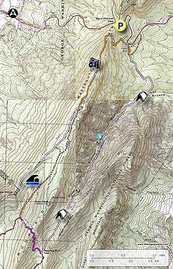
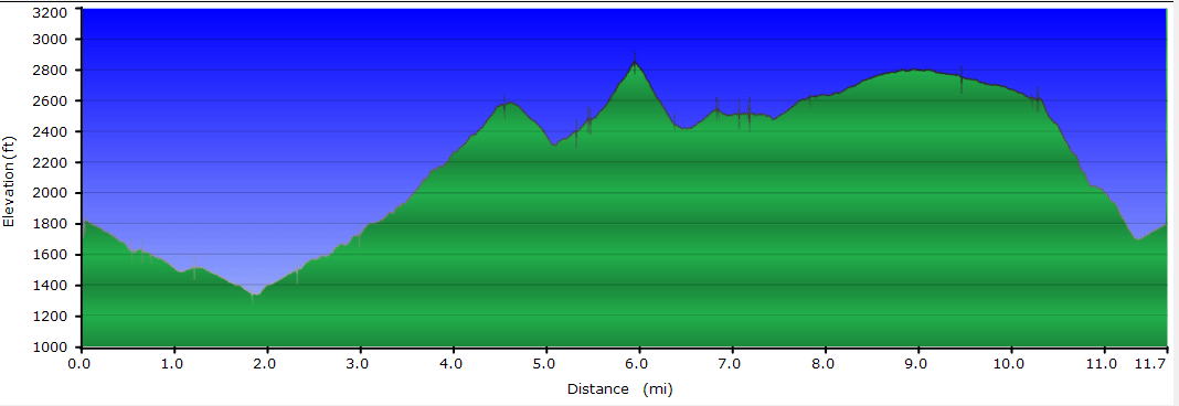
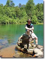
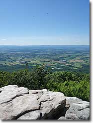
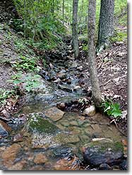
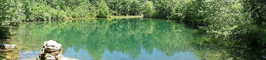
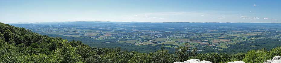
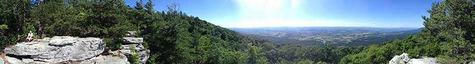
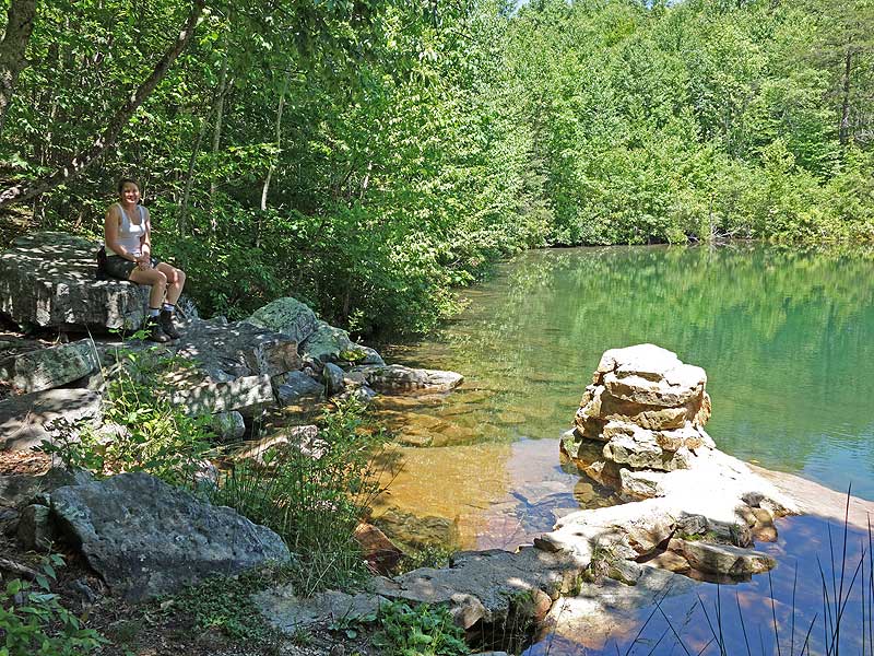
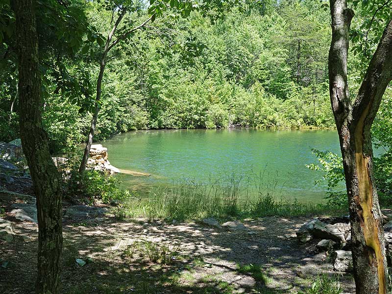
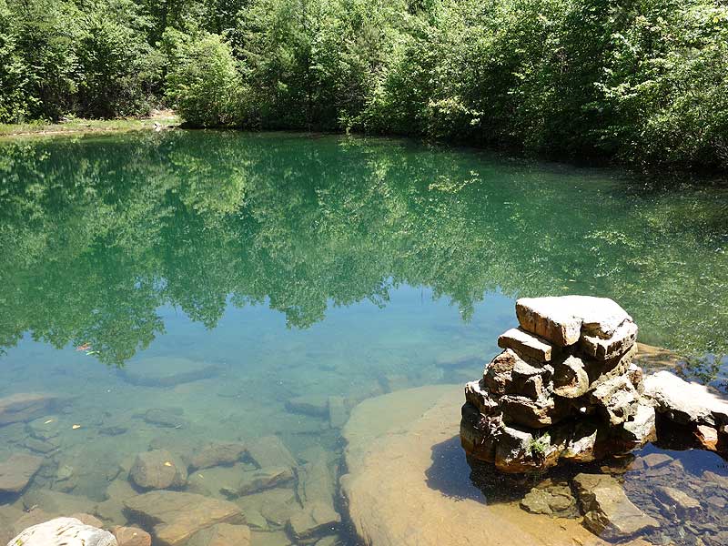
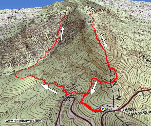
The Browns Hollow hike is the big brother to the Emerald Pond circuit, adding 3.5 miles with the addition of the Browns Hollow and Roaring Run Trails. This 11.7 mile hike has 3 great features: 1. The climb through the gorge on Browns Run, with small pools and waterfalls. 2. Emerald Pond, with its spring fed swimming hole nestled in a small hollow off the Bird Knob Trail. The water has exceptional clarity, and in the summer months is surprisingly warm for a mountain pond. And 3. A spectacular vista to the west of New Market from the Massanutten South Trail.
There are several secluded campsites along Browns Run, including one just above a set of falls halfway up the gorge. On the west side of Big Mountain the best camping is right on the banks of Emerald Pond. Also, if you travel west homeward, make sure to stop at Pack's Custard Stand on US211 in New Market for some of the best frozen custard around!
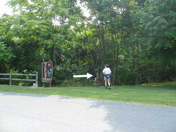
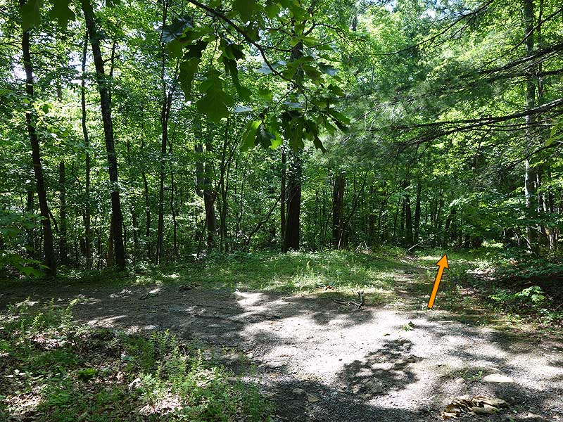
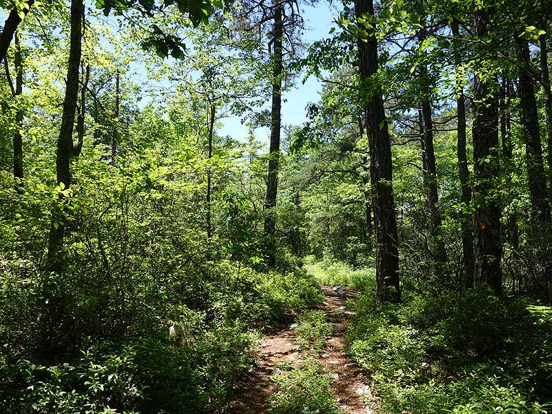
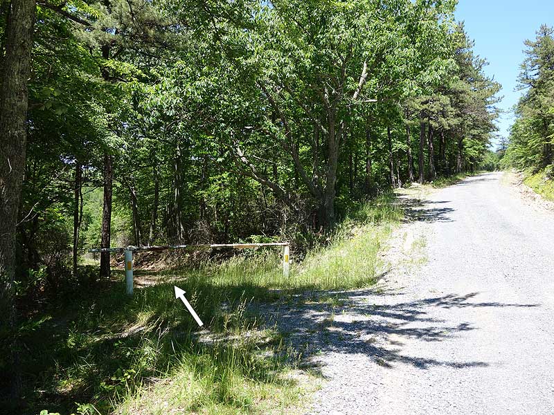
Mile 0.0 - Start the hike near the front of the parking area on the white blazed Wildflower Trail, DO NOT go down the paved Nature Trail at the end of the parking area. Follow the white blazed Wildflower Trail downhill for 0.3 miles to the intersection of the orange blazed Massanutten South Trail.
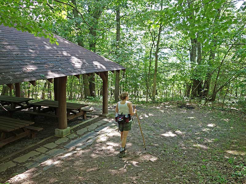
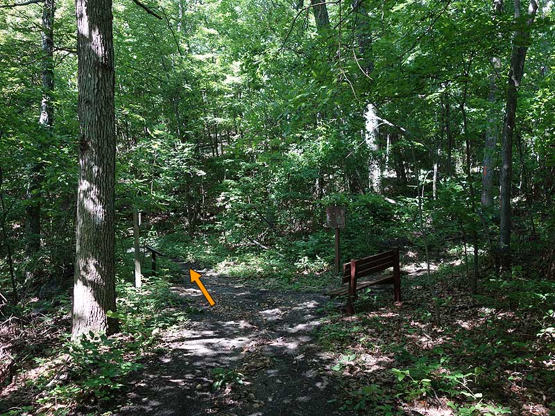
Mile 0.3 - Stay straight continuing downhill on the now white and orange blazed Wildflower/Massanutten South Trail for 0.2 miles to a four way intersection at the old picnic ground. On the opposite side of the intersection is a shelter with multiple picnic tables.
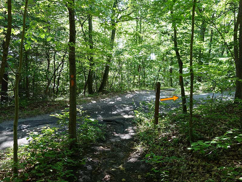
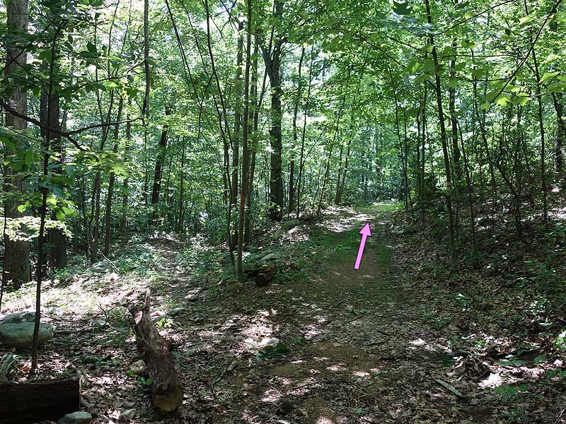
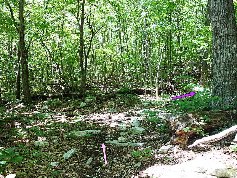
Mile 0.6 - At the four way intersection turn right on the orange blazed Massanutten South Trail that now uses a section of the picnic ground loop road. In 375 feet stay on the orange blazed Massanutten South Trail by turning right off the loop road onto an old logging road. Follow the trail for 400 feet to an intersection where the orange blazed Massanutten South Trail turns left, and the pink blazed Browns Hollow Trail stays straight on the old logging road.
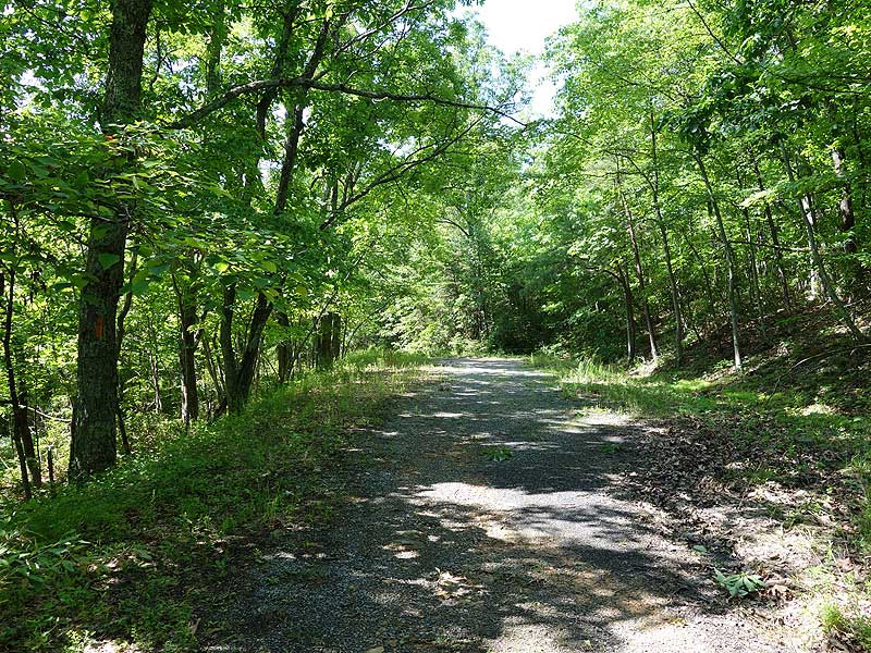
Mile 0.8 - Stay straight on the pink blazed Browns Hollow Trail to the next intersection in 0.5 miles
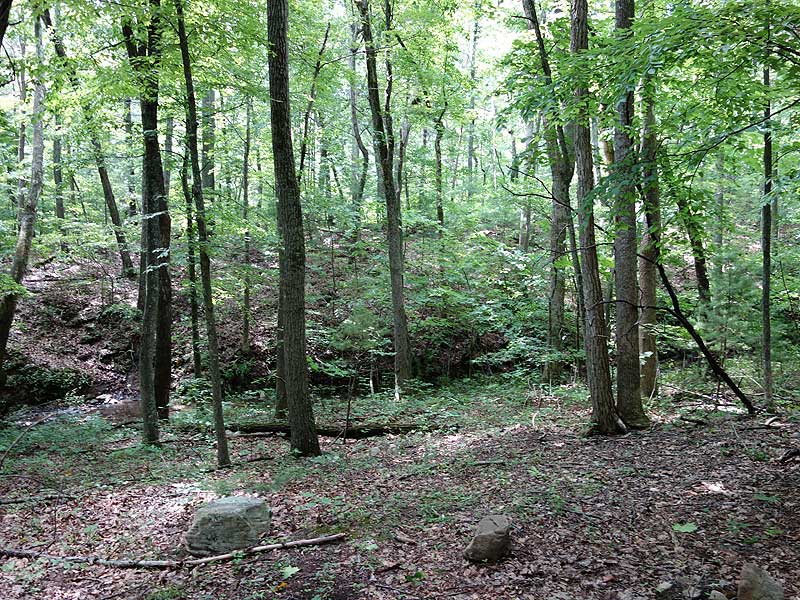
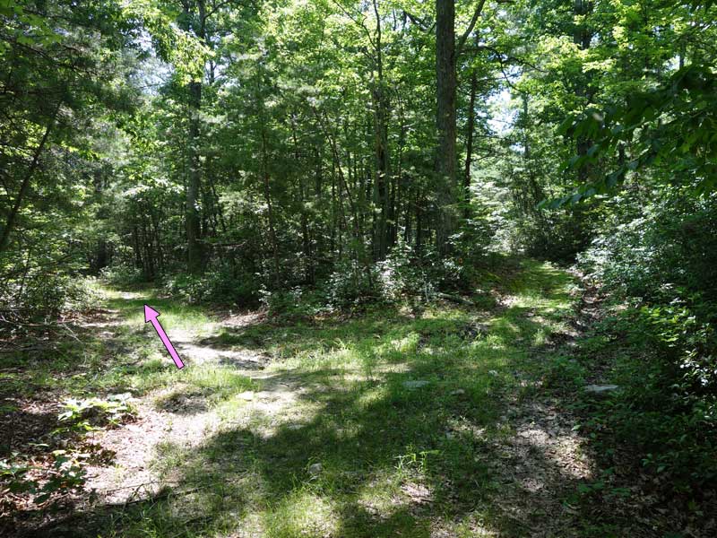
Mile 1.3 - Stay left on the now narrower pink blazed Browns Hollow Trail as the old logging road continues straight. Follow the trail as it winds around the ridge, then descends to Browns Run. Just before crossing Browns Run there is a campsite and small steam that falls of Big Mountain.
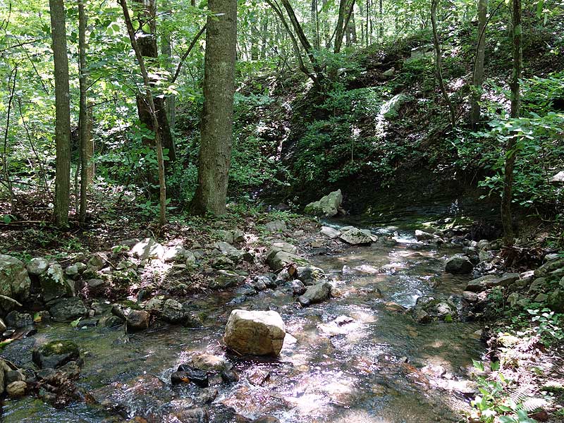
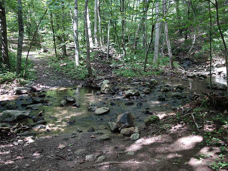
Mile 1.8 - Cross Browns Run and now start the ascent of the gorge. The trail gradually increases in incline and passes a small waterfall and several campsites. The last 1.2 miles to the saddle between Short Horse Mountain and Big Mountain becomes quite steep.
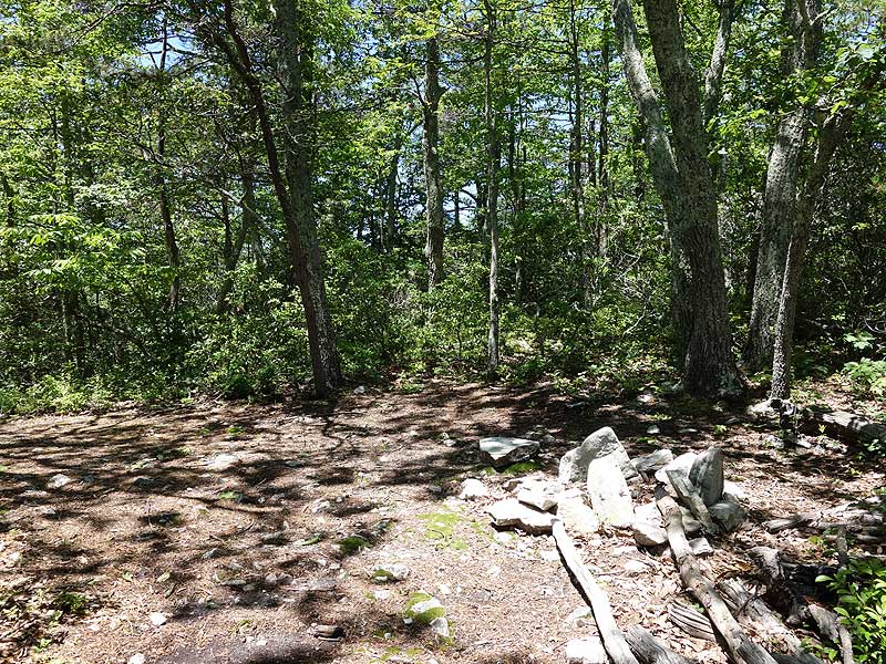
Mile 4.5 - At the saddle there is a campsite suitable for two tents on the right. The pink blazed Browns Hollow Trail now descends for 0.7 miles into Roaring Run Gap, then ends at the intersection of the Roaring Run Trail.
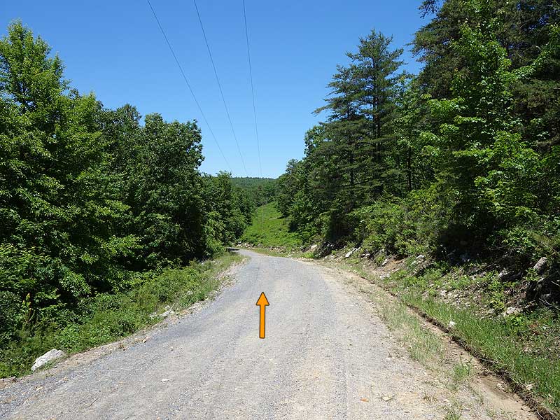
Mile 5.2 - Turn right uphill on the purple blazed Roaring Run Gap Trail. The trail steeply ascends to the ridge on Big Mountain with several switchbacks. At the ridge is a small campsite on the right. Descend Big Mountain for 0.4 miles where the Roaring Run trail ends at the Massanutten South Trail and Forestry Road.
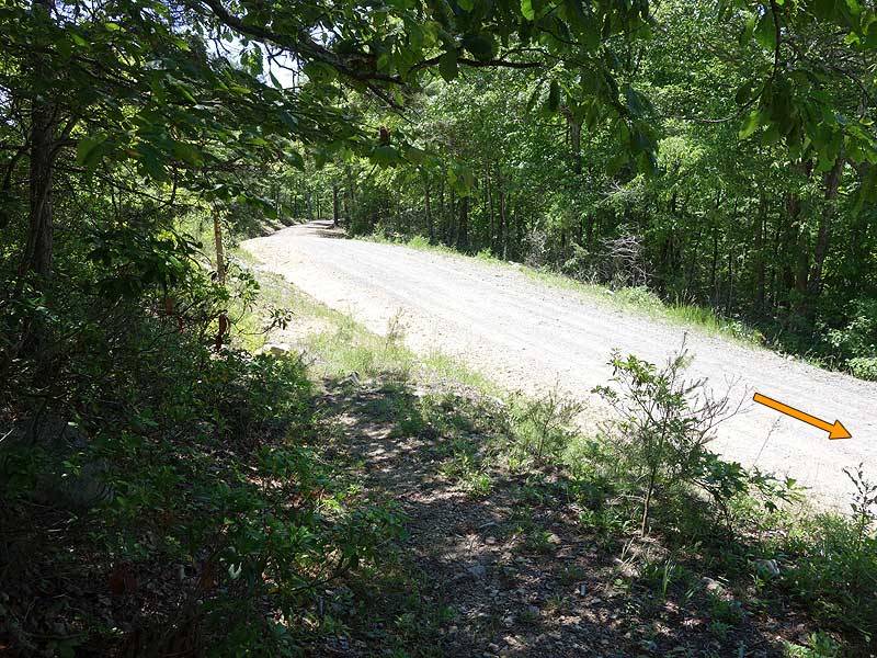
Mile 6.2 - Turn right uphill on the orange blazed Forestry Road for 0.4 miles to a closed gate and the white blazed Bird Knob Trail.
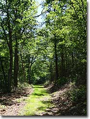
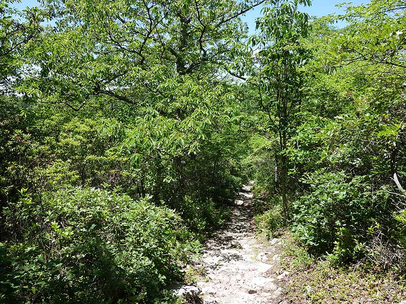
Mile 6.8 - Return to the white blazed Bird Knob Trail, turn right, and climb to a clearing near Bird Knob. Pass along the right side of the clearing where the Bird Knob Trail reenters the forest on the ridge of Massanutten Mountain. The Bird Knob Trail will gently climb, then descend past two unmaintained trails before ending at the intersection of the orange blazed Massanutten South Trail 1.8 miles from the clearing.
Mile 10.0 - From the vista descend steeply for 0.4 miles where the trail passes through a rocky area on the west side of the mountain. From this point the trail is less steep, and turns back the east side of the mountain descending back to the intersection to the Wildflower Trail.
Mile 11.4 - Turn left upward on the white blazed Wildflower Trail for the reaming 0.3 miles back to the parking area.
Mile 11.7 - Arrive back at the old Visitor Center and parking area.
Emerald Pond Panorama
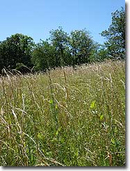
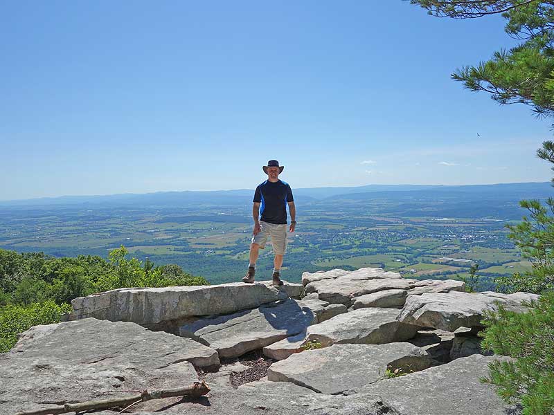
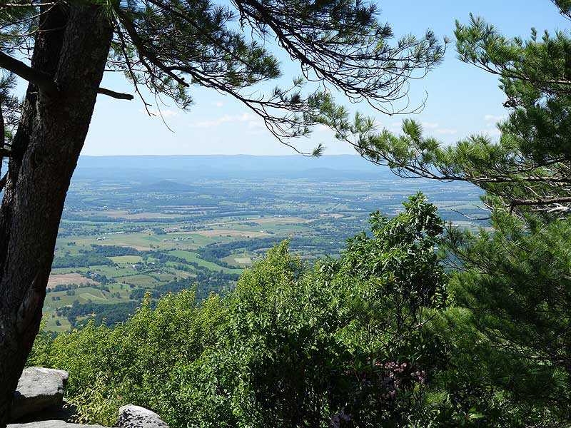
Vista on Massanutten South Trail
360° Vista on Massanutten South Trail
Mid June
Yellow Rock Cliff Video
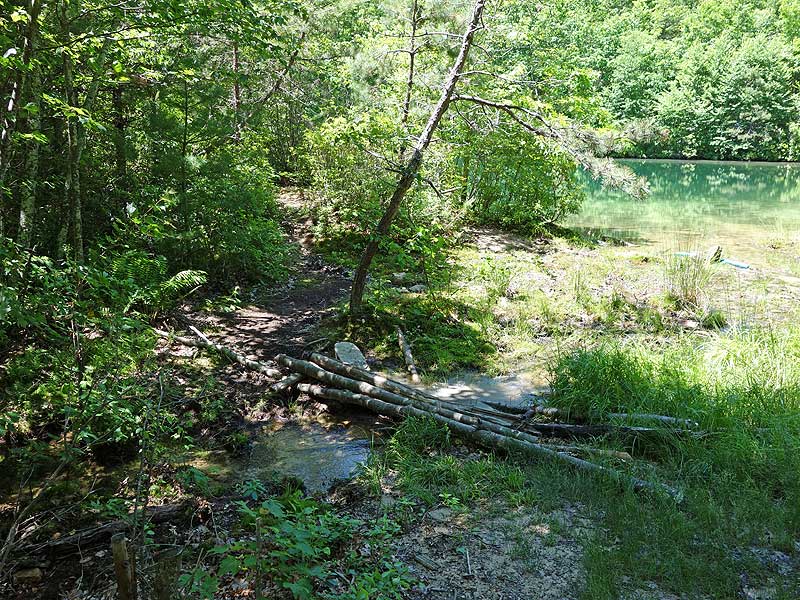
Emerald Pond
Browns Hollow Hike Comments
Archived Comments
By:Glenn
Rating:
Date of Hike: Saturday, July 27, 2019
Great hike and you will cross a lot of day hikers. We ran across a 50K that was occurring and had to step to the side to give way to a few runners, no biggie.
NOTE* The pond is a favorite local water hole for the locals. We arrived with multiple families enjoying the pond on rafts etc. However, at 130am, a few drunk locals found their way to our campsite (on the opposite bank) and disregarding us (three tents) and continued to be obnoxious and loud. We did let them know we were trying to sleep. They finally left and once they hit the dirt road, they fired numerous 9mm shots in the middle of the night. *its the main reason why I carry when I hike.
By:Patrick
Rating:
Date of Hike: Sunday, April 21, 2019
I did this hike on Easter Sunday with some friends. It was a great hike and there are still some winter time views. The waterfalls and pools on the Browns Hollow Trail were incredible. I am giving this hike four stars due to the motorcyclist, we encountered on the Roaring Run Trail as we were making the climb to the ridge line. He tore up the trail pretty badly. I have let the forest rangers and PATC know about this individual.
By:Monkshood
Rating:
Date of Hike: Sunday, November 25, 2018
Great Hike, especially in the first half (clockwise) for the waters you hike along and in the second half for the views in the last stretch before you head back down to the parking lots.
Regarding the Browns Hollow Trail: the maps I first reach for do not mark this trail. I was prepared for some bushwacking, but the trail is there and is well maintained. Like the preceding reviewer, I found it well marked and missed no turns.
An alternate starting point is on the Massanutten Trail (416), where it crosses US-211, slightly to the east of the Wildflower Trail TH. There's an ample parking lot on the south side of US-211 at that point that can't be missed (neither can the access to 416). From this starting point, I clocked 13.1 miles, so slightly longer than the route described above.
By:PGHTOM
Rating:
Date of Hike: Saturday, November 10, 2018
Great hike overall. We did this counterclockwise (opposite of write up) with a late start Saturday. Trail was in good shape all around, blazes were also in good shape. Trail description was plenty accurate and I can't recall any issues with missing turns, etc. The pond is pretty cool. I would not ever plan to go here in the summer months. I am certain it gets crowded and rowdy like others have mentioned below. We overnighted at one the spots and were frankly surprised to see 2 other groups (temp at night was 19°).
Some words of advice for young college aged hikers. PLEASE learn about the outdoors and specifically winter hiking. Tight cotton jeans, small backpacks, loose blankets, etc have no business in the backcountry. You all really put yourselves in a precarious situation that could have turned into a rescue situation had the weather turned bad. Never have I seen people hike 5 miles with firewood tied around their necks. Never have I seen a group so inept at building a fire or collecting additional firewood (because 2 cut up 2x4s burn for 15 min like you all learned). The girl crying in the middle of the night about how cold she was is evidence enough that you all were ill prepared. I admire your desire to backpack and even more to do it in the winter months. But seriously, there are lots of ways to learn the skills, please take the time to do so.
By:Jeff Monroe
Rating:
Date of Hike: Sunday, November 4, 2018
This hike was a last minute decision, and as a result I was armed only with a PATC map and without first finding Hiking Upward's hike description. As a result, I hiked it in a clockwise direction and started using the paved trail that the HU description specifically discourages. Fortunately, there was an unmarked trail that split off to the right and headed uphill, and then merged into the Massanutten South Trail. I guess I was lucky, because my map did not have sufficient detail to send me in the right direction from among several choices.
The highlight of this loop is the overlook that looks west towards New Market, and it comes early in the clockwise loop. Dropping into Browns Hollow was also beautiful.
Even hiking on an October Sunday, when there was a long line of cars at the entrance to Shenandoah National Park, this hike was virtually empty. Amazing!
By:Mike s
Rating:
Date of Hike: Sunday, October 21, 2018
Not a whole lot to add drove four hours to hit this trail with my pup lil cold and windy today but definitely quite and challenging couple more signs threw out the trail would be amazing but all and all clean good real world hiking and this site and maps where spot on no information located near the trails and definitely finally didnt run into a bunch of newbie about to keel over with all the wrong gear and no water wtf anyway highly recommend if a good five hours hiking is in ur plans with about 3 hours of it a great rewarding challenge
By:Adam R.
Rating:
Date of Hike: Saturday, August 25, 2018
A buddy and I did the clockwise route as our first overnight backpacking trip and, while it was a challenge (especially the first day), it was a great experience. We decided to make Emerald Pond our halfway point for camping, which was a great spot and we had it all to ourselves once the daytrip swimmers left. First day started out with an easy downhill through the Hollow, but about halfway through it turned uphill drastically and really tested our cardio endurance. Second day was an easy hike along the ridge and ended with a beautiful overlook. If I did it again as a first-timer, I would probably do the route counterclockwise because it put the steepest parts at the beginning of each day to get them out of the way.
By:Weavey Bee
Rating:
Date of Hike: Wednesday, August 15, 2018
I was looking for a solo overnight hike that had a little of everything and the Browns Hollow/Bird Knob delivered. First of all, thank you to whomever did the writeup of this hike because they got me where I was going unambiguously (though there is one trail intersection on the descent from the vista that was unnoted... turn right at the survey marker and stay on the orange blazed trail). But I digress...
I arrived to find one other car in the parking lot but no one else around. Someone had been on the trail ahead of me since the last time it rained, as evidenced by the big footprints straight through every mud hole on the trail, but the spider webs indicated that it hadn't been but so recently. One thing to note: this is overall a pretty rocky hike, punctuated by patches of mud. You get a sense of this right away for the first few miles are just that, with some little creek crossings and water seeping out of the ground. As you climb out of the gorge, it gets increasingly steeper and rockier and it may have you questioning whether or not you actually needed all 21 pounds of the stuff that's strapped to your back. Then you reach the trail intersection and there is even more, steeper climbing through rocky switchbacks until you reach the saddle, at which time you begin a rocky descent. An interesting note: right past the saddle when you begin the downhill portion hanging over the trail is a live American Chestnut tree producing chestnuts, which is a rare thing, indeed. When I finally reached the fire road, I was grateful to give my knees a rest and ponder the purchase of some hiking poles. It's pretty easy going the rest of the way to Emerald Pond, which I arrived to find deserted. I set up camp right by the pond on the far side and collected firewood sawing off logs from fallen trees in the forest to find that they, too, were chestnut but had been claimed by the blight. You will have to work for your firewood here, as it is pretty well picked over for the easy pickings.
I had the pond all to myself all day and night and it is hard to overstate how beautiful the pond is (despite the broken glass and human feces/TP... come the F on, people). The spring comes out of the ground and goes directly into the pond. I went through the trouble of going to the headwaters of the stream to get the freshest water but after sampling that and the water from the pond I found the water from the pond to be just as good (after filtering, of course). Since I had the whole hollow and surrounding mountains to myself, I enjoyed a swim in the clear, green water as nature intended and kept my clothes dry. Night time brought with it clear skies, stars, and nothing but the sound of whipoorwills to lull me to sleep in my hammock. I didn't even have to use my bug net as there were surprisingly few of them given the time of year, most notably zero mosquitoes.
After cleaning up camp, the next day started with some brief uphill to the meadow before reaching the ridge and some welcome level-ish ground. Again, lots of rocks but now encompassed by a lush mountaintop forest with vistas poking through the trees. The cliffs overlooking New Market are a great place to stretch for a bit while taking in the view in preparation for some serious downhill. The rock scramble down the first half mile requires strong ankles and balance and while it does get easier after a bit, the entirety of the descent to the terminus of the trail is tough, especially when it has recently rained.
TL/DR: Rocky, somewhat challenging trail, best done on a weekday to avoid people as I saw not another soul, camp at emerald pond, consider investing in hiking poles if you're carrying a pack.
By:Brian Alexander
Rating:
Date of Hike: Saturday, August 11, 2018
I tackled this hike on a steamy August Saturday with a group of 13 from Central Virginia Trailblazers (www.cvatrailblazers.org). We had done the shorter Emerald Pond circuit two years ago and returned to do this longer version. Not many other hikers on the trail, except for a few friendly hillbillies with hunting dogs near the pond. Disappointed to see there is still broken glass near the stacked stone "diving board". The downhill portion on Massanutten South following the overlook was indeed steep and downright treacherous at times, as a brief rain shower and made the rocks wet and slippery. One note to future hikers: Somewhere between mile 10.0 and mile 11.4 there was an unexpected fork in the trail that was not mentioned in the description. Both appeared to be orange blazed. We debated for a while an ultimately went to the right, which fortunately was the correct choice. It took us about six hours to complete the hike including a break at the pond and overlook. Then we headed into town for dinner at Southern Kitchen Restaurant followed by frozen custard at Pack's. It was truly a step back in time! All in all a great day to be on the trail.
By:Yerboy
Rating:
Date of Hike: Saturday, August 4, 2018
We took the fire road short cut to the pond due to a late start.
The views are great. The ant hills were cool.
Dont stop too long to take a picture. Youll see why!!
Unfortunately a great time walking in the woods with friends and a nice night by the pond were all ruined.
The weather was fantastic. The water was cool and clean and great to swim in.
However, the ponds proximity to road access allows for this to be a more popular spot.
In our case, an awesome group of generator and cooler toting 20somethings with a sharing problem.
After assisting them (before sundown) with a severely burned hand we were rewarded with skinny dipping to horrible music, inter-crowd fighting settled with gun fire.
No one was hurt, but after the police left at 3:30am most did not get to enjoy any of their hammocks or the sounds of the GWNF.
Getting up the fire road to cell signal to call the police was an adventure in and of itself. VERY IMPORTANT: If you need assistance and call 911 to help you there. The local police know this as PITTSVILLE SPRINGS POND. it is in Page county.
The police were awesome. However our pond guests were not.


