|
| Length |
Difficulty |
Streams |
Views |
Solitude |
Camping |
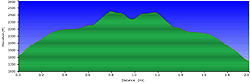
| 2.1 mls |
 |
N/A |
 |
 |
N/A |
Hiking
Time:
Elev. Gain:
Links:
Resources: |
1 hour, including viewing time from the rocks
800 ft
 George
Washington National Forest George
Washington National Forest
Topo Hike Trails Map (PDF)
Bath Alum, VA Weather Forecast
Garmin (GDB), Gaia/Trails App (GPX) (What's
this?)
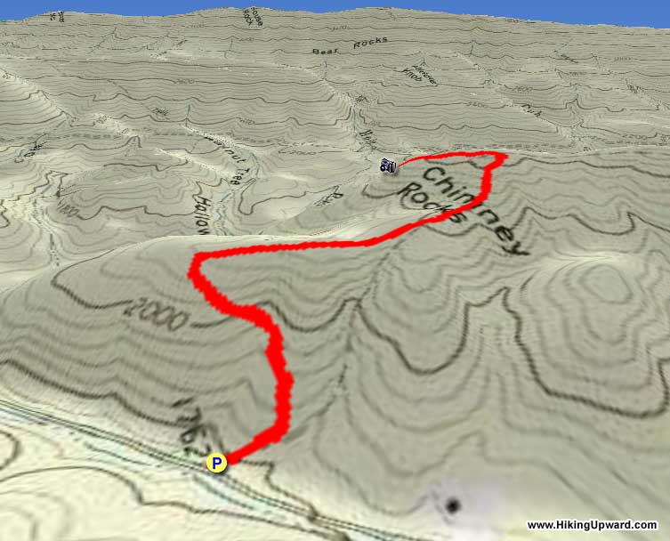
3D
View of Route |
 By Trail Contributor: Jeff Monroe (Email Jeff) (Email Jeff) By Trail Contributor: Jeff Monroe (Email Jeff) (Email Jeff)
The Tower Hill Mountain Trail climbs its eponymous mountain and ends at private property. It used to continue for over 10 miles across the long ridge of Tower Hill Mountain, but the forest service now recognizes only the southernmost 1.2 miles as public trail. The first time you experience this trail, you might ask, as we did, ‘Is this all there is? Why does this trail still exist?’
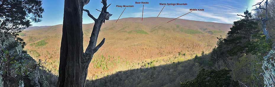
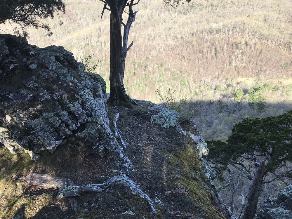
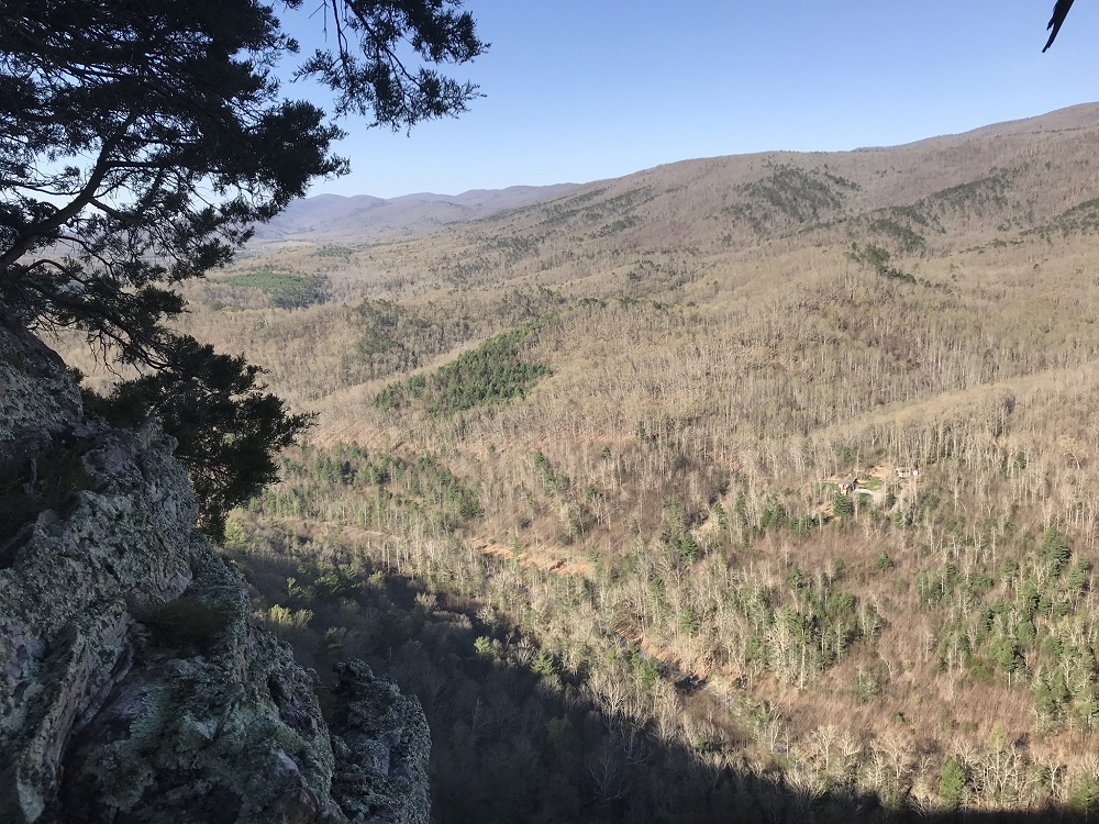
Bath County locals know why. A little off of the established trail is an overlook on top of a cliff known as Cathedral Rocks. The view is what makes this trail worthwhile, even though the trail doesn’t exactly take you to the overlook. With the instructions in this description, you can find your way to the view, though we also recommend that you download HU’s GPX track, if you have a GPS receiver. We do not recommend this hike to families hiking with young children because of the cliff overlook, and we do recommend using a GPS receiver.
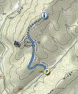
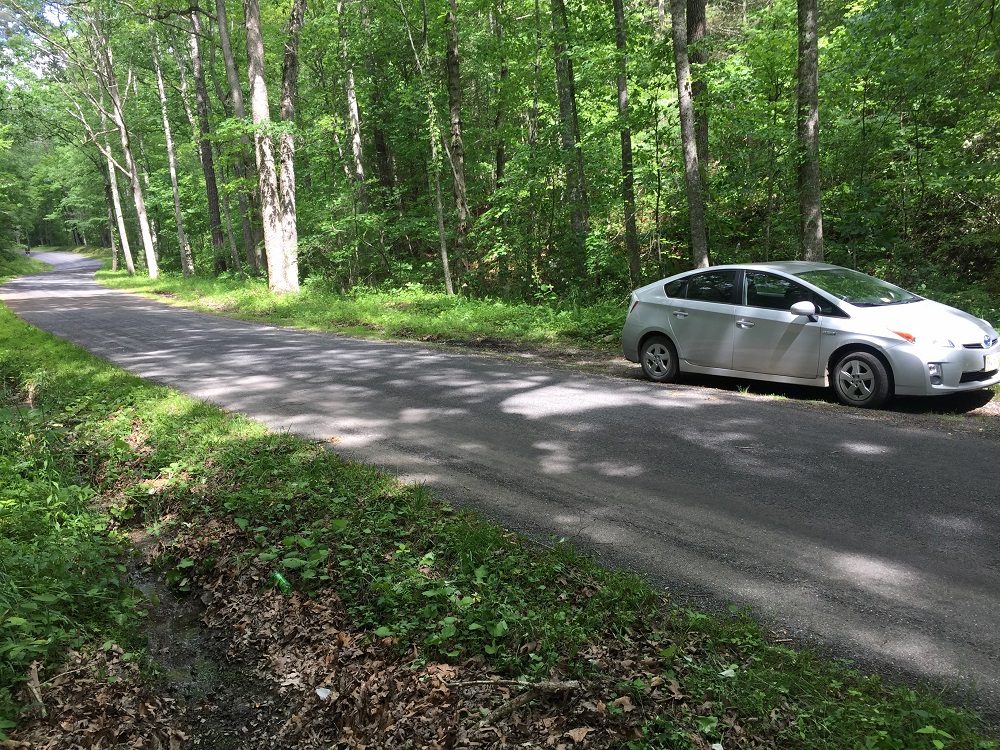
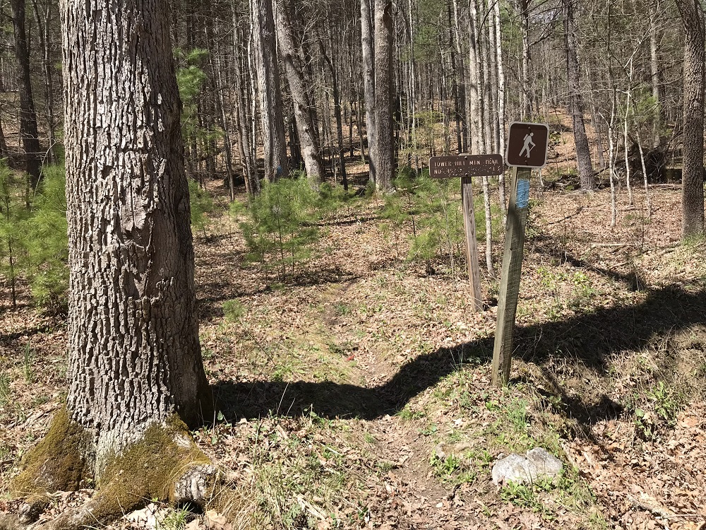
- Mile 0.0 – Parking is on a wide spot on the southbound side of Westminster Road. Both road approaches have a sign warning you that the trailhead is just ahead, which makes it much easier to find the trail. There is a trail sign just off the road where the trail starts.
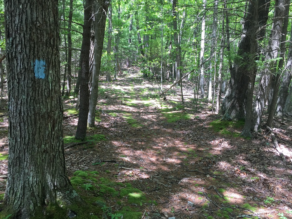
- Mile 0.3 – The blue blazed trail climbs steeply right at the start, then crosses several old roadbeds before making a wide switchback. Although the trail levels out here, don’t mistake this for the top of the mountain. Continue after the switchback on a wide trail.
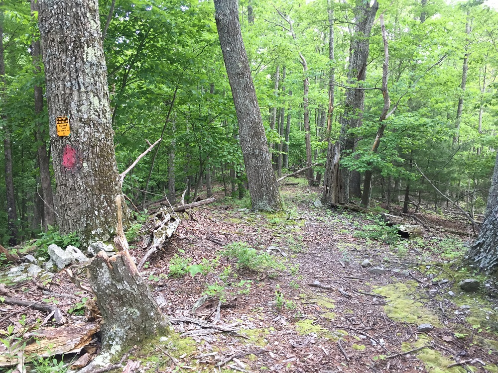
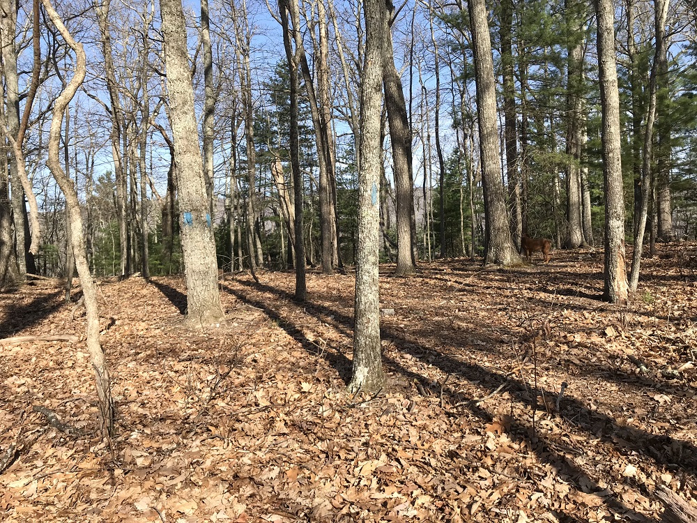
- Mile 0.8 – Near the mountain summit, the trail may get a little harder to follow, depending on the time of year. The trees are frequently blazed, however, so keep an eye for another blue blaze if you lose the exact trail location. At the top, the trail curves to the right and virtually every tree sports at least one blaze. The trail at the top goes in a northeast/southwest direction. When the climb has leveled off, instead of following the established trail north, take an unblazed social trail south towards the view. (If you wish to continue north on the blazed trail, you will continue another half mile before reaching the forest boundary.)
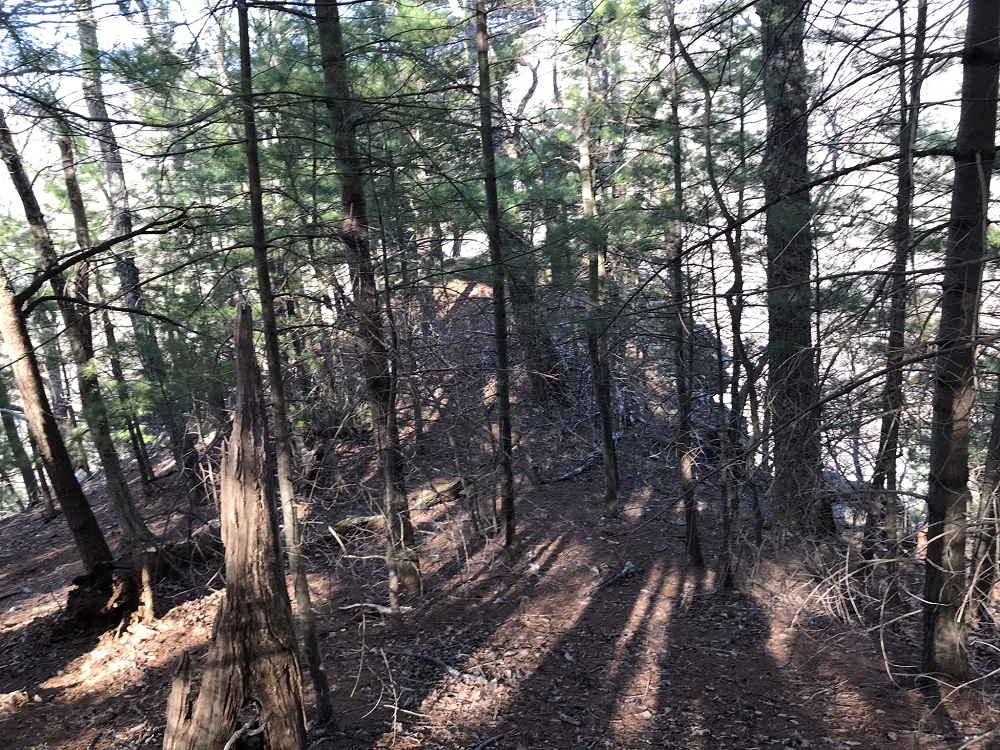
- Mile 1.0 – The unmarked trail weaves among the trees for approximately 0.2 mile. You should stay generally to the left side of the ridge top, dropping slightly in elevation. Keep an eye out for a grove of pine trees ahead and to your left. If you use a GPS receiver, the coordinates for the viewpoint are N38° 05.430' W79° 41.747'. Out on the rocks, the view is generally to the southwest, towards Warm Spring Mountain. The sound of water in Dry Run may be heard from directly below, as well as the sound of an occasional vehicle on Rt. 609.
- Mile 1.2 – Return to the trail, taking care to look for the part of the trail with many trees sporting blue blazes. (At worst, you will overshoot it slightly and find yourself on the trail a little northeast of where it ascends to the summit – it is hard to get lost on a ridge top.)
- Mile 2.1 – Follow the trail back down the mountain to your vehicle.
Note: this hike is given a “2” in difficulty because it is so short, but there are a couple of steep climbs early in the hike. |


