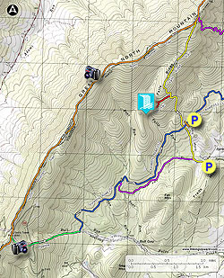
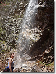
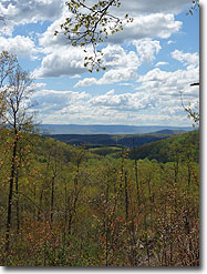
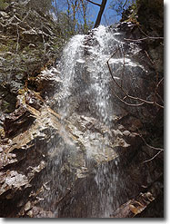
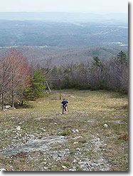
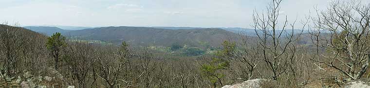
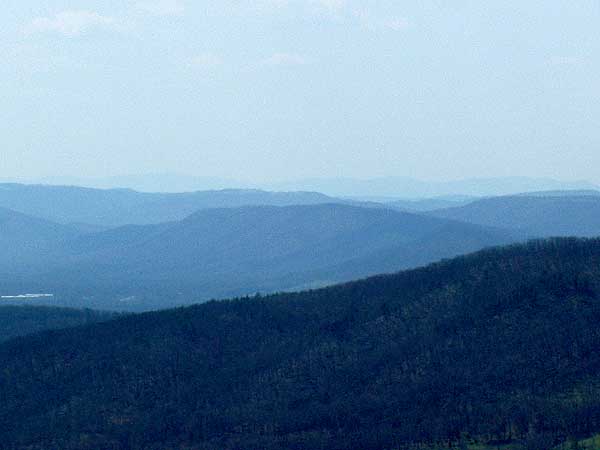
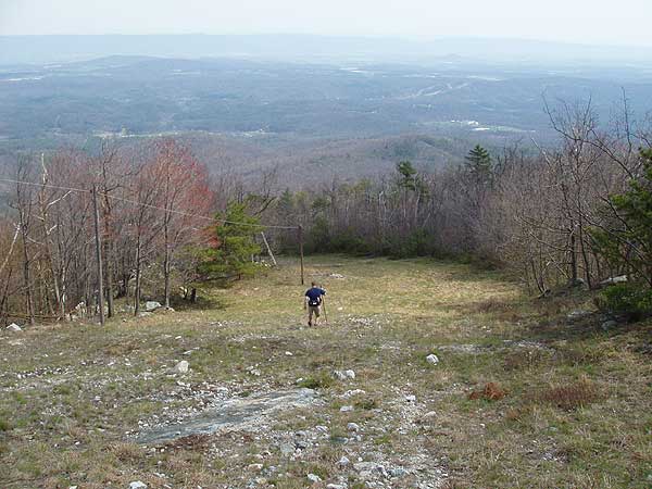
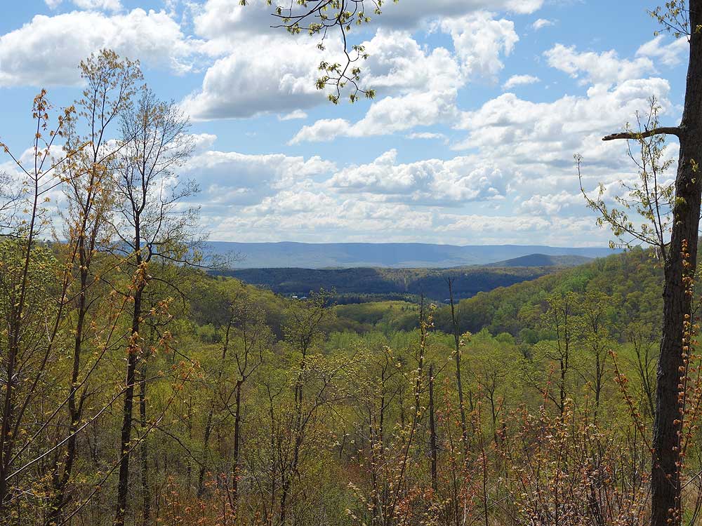
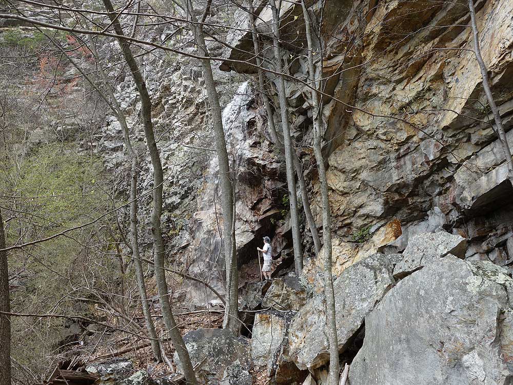
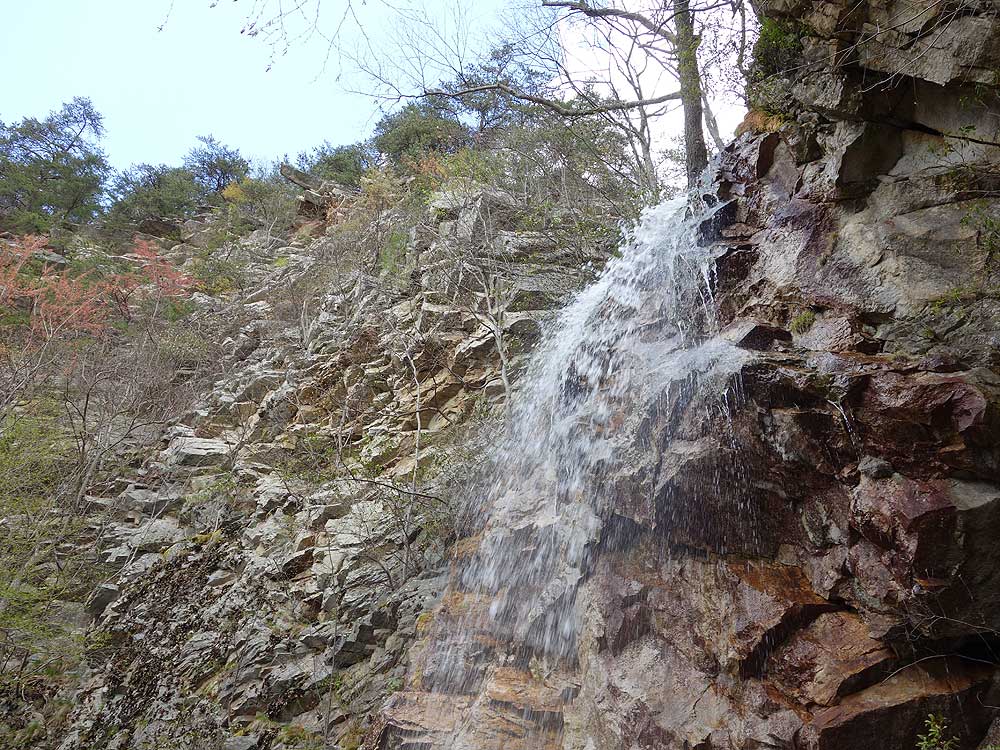
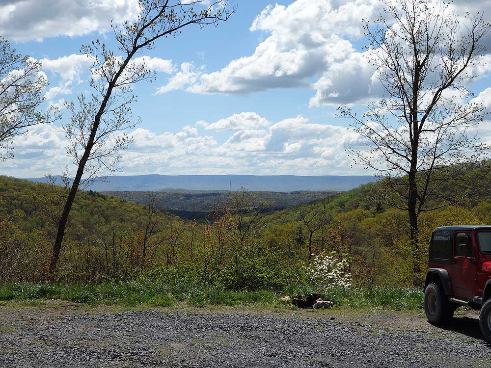
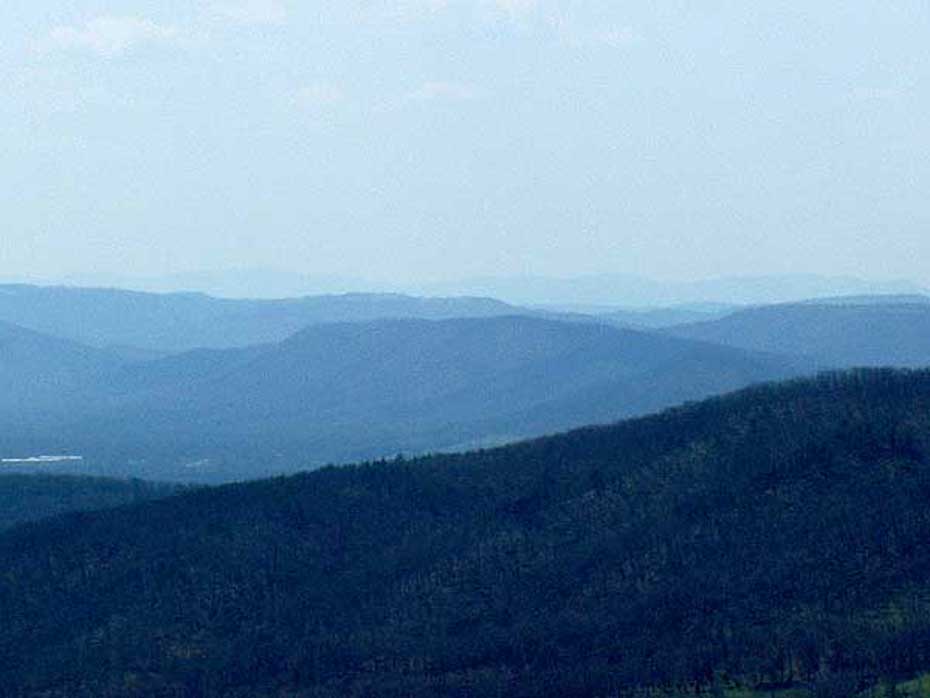
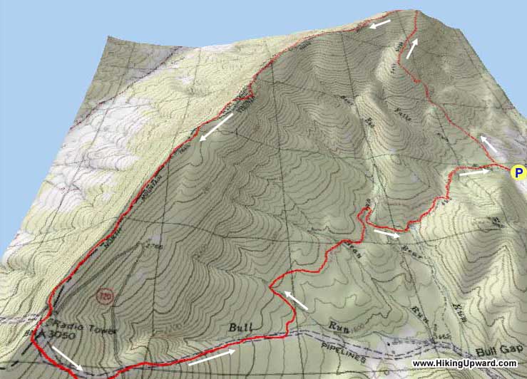
A long day hike at almost 12 miles, this hike has a couple of outstanding features. The hidden 30ft Falls Run waterfall is the prettiest waterfall on Great North Mountain, and the vistas from the Great North Mountain ridge west into West Virginia are panoramic. The second section of the hike down the steep pipeline clear cut is very rocky, and there is no shade. An alternate shorter hike that still passes the falls is the 6.9 mile Falls Ridge hike that descends Stack Rock Trail.
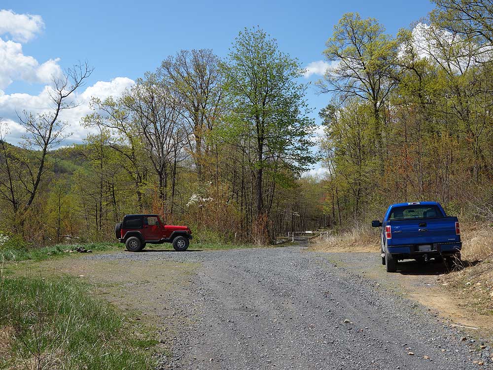
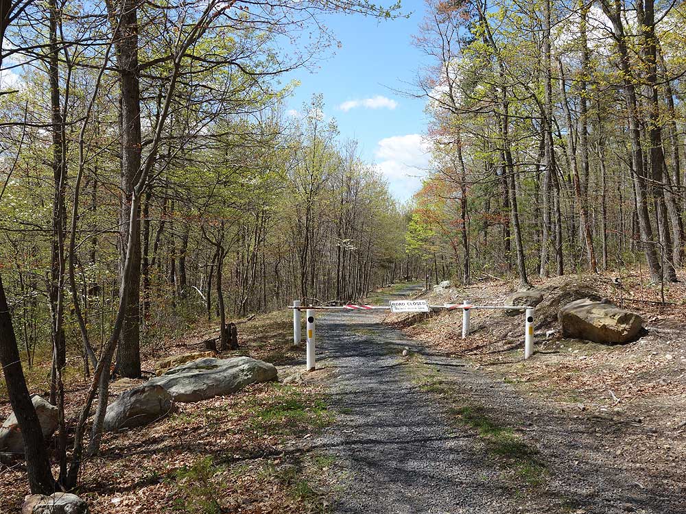
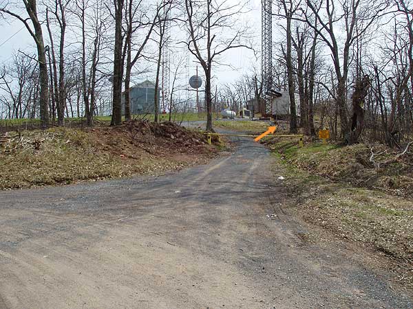
To access the hike, follow FR252 all the way to the permanently closed gate 0.1 miles from the Falls Ridge Trail intersection. FR252 is only open from April 1 - May 21 and Aug 1 - Dec 31. The hike can still be done when FR252 is closed by parking at the end of VA701/Dellinger Gap Rd. at the lower terminus of the yellow blazed Falls Ridge Trail. This will add 0.5 miles for a total hike length of 12.2 miles.
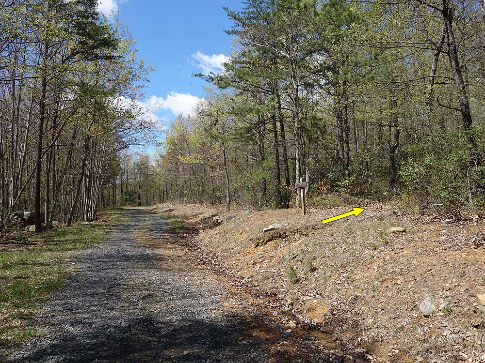
Mile 0.0 - Pass around the closed gate and continue along FR252 on the blue blazed trail for 0.1 miles to the intersection where the yellow blazed Falls Ridge Trail crosses the road.
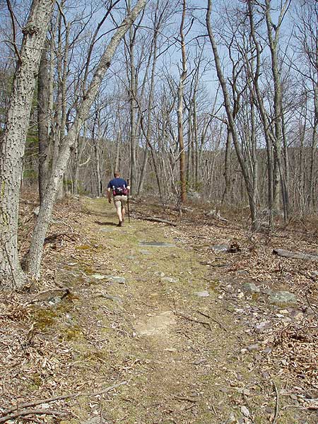
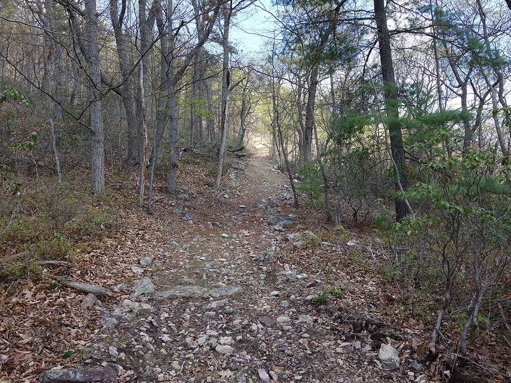
Mile 0.1- Turn right uphill on the yellow blazed Falls Ridge Trail. The trail becomes increasingly more steep for the first 0.6 miles to the intersection of the unofficial side trail to the Falls Run waterfall.
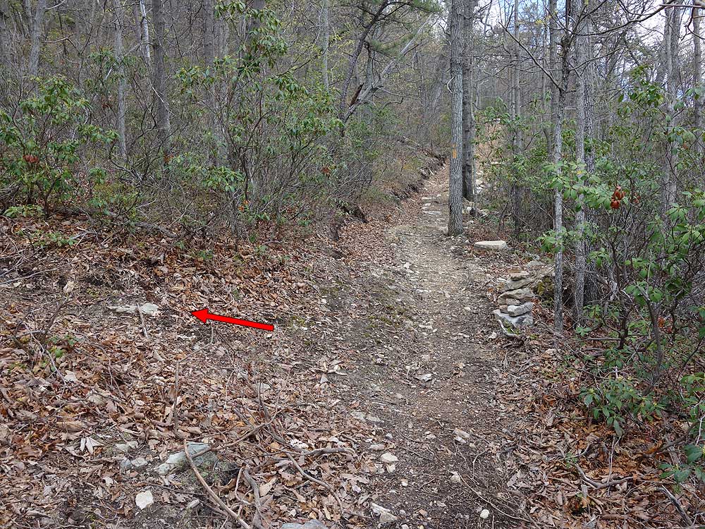
Mile 0.7- Look for a small rock cairn marking the side trail, however it is well worn and hard to miss. Turn left on the side trail that passes through Mountain Laurel. At this point the trail is intermittently marked with faint colored blazes. In 0.16 miles the trail will split.
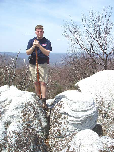
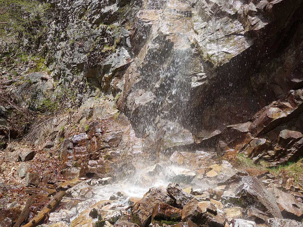
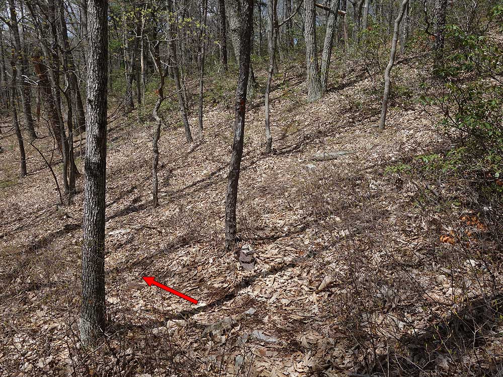
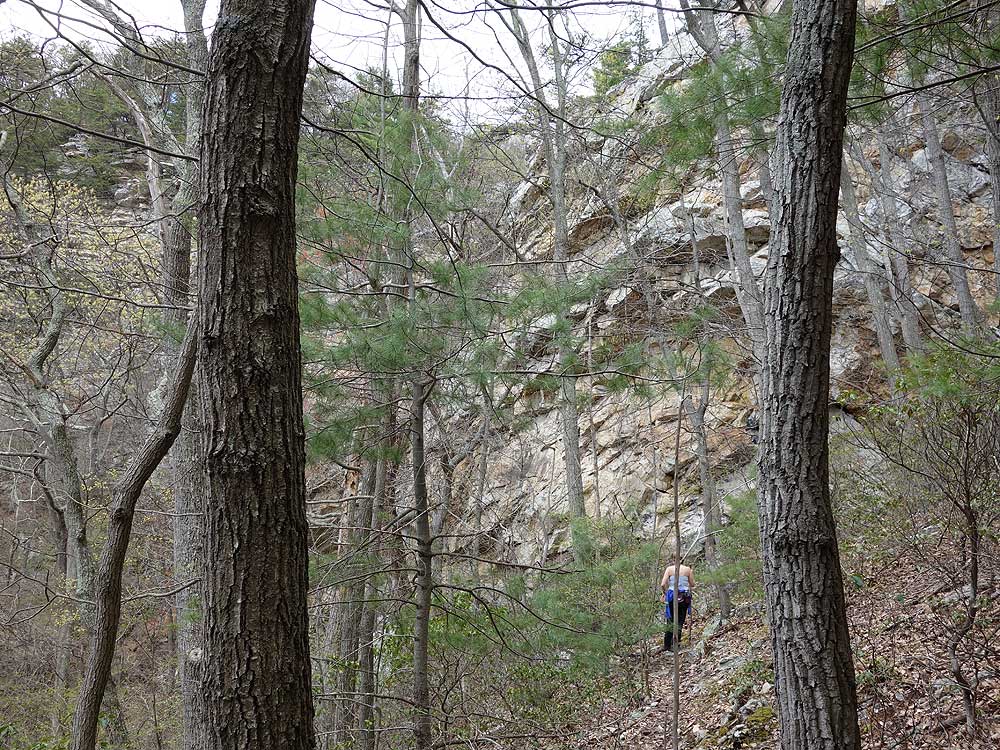
Mile 1.0 - Turn left downhill (continuing straight will take you to the upper section of Falls Run). This section of the side trail is intermittently red blazed, but is harder to follow than the previous section. As you get closer to the run, the trail falls pass through a section of rhododendron then arrives at the waterfall and 60ft cliff. Pass carefully over the boulders down to the foot of the waterfall.
Mile 1.3 - Return back to the yellow blazed Falls Ridge Trail. Be cautious on the return after passing back through the rhoterdendrum. The trail is very faint and hard to follow.
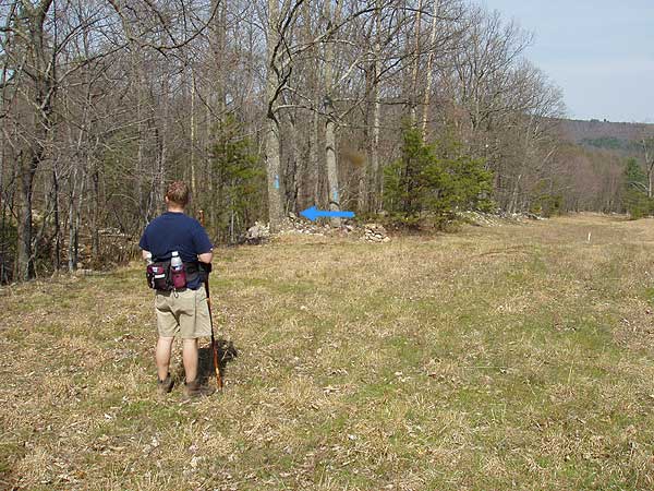
Mile 2.1 - Turn left uphill on the yellow blazed Falls Ridge Trail. The Falls Ridge Trail will pass through another stand of Mountain Laurel before ending at the ridge and intersection of the North Mountain Trail.
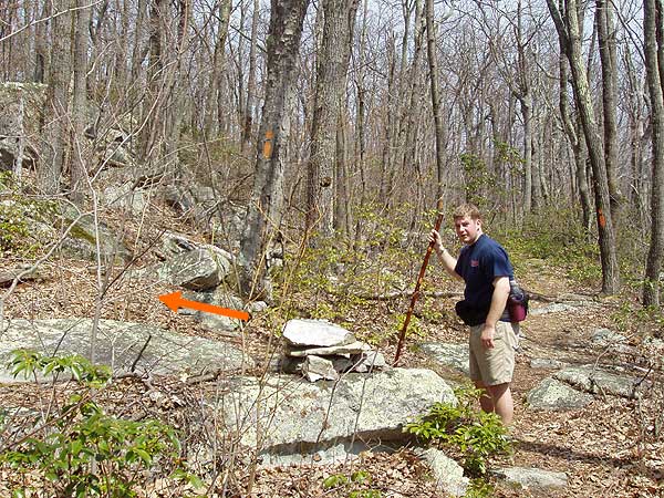
Mile 7.8 - Cross the FS road and pass the closed gate
staying to the right of the installation following
the orange blazes as you turn left slightly uphill to the ridge in another
100 yards.
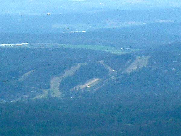
Mile 7.9 - Steeply descend either of the two (they parallel each
other) underground
gas pipeline clear cuts as they go steeply downhill, then cross
a FS
road in 0.4
miles. Continue steeply downhill for another 0.5 miles before
the clear cut flattens out. In 0.3 miles
after the clear cut flattens out look for the blue
blazes and small
rock
pile on the left where you will cross the stream and take the blue
blazed trail.
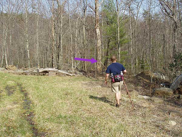
Mile 9.1 - After crossing the stream follow the blue blazed trail as it
turns uphill for a short distance before turning right and traversing
the mountain for 1.2 miles where the purple
blazed trail will enter from the right. Continue on the blue blazed trail for another 1.4 miles back to the closed gate and parking area on FR252
This trail is outright dangerous! Ive been hiking for many years and have seen many good and bad trails. If you are thinking about doing the loop thats laid out in the description, be prepared for the potential of danger. If you want an adventure, and feel the need to do the entire loop, think about completing this hike in late fall, before it snows and the clear cut is less dense. Do not, under any circumstances, attempt the loop when the ground is wet.
The hike to the falls along the Falls Ridge Trail is simple, enjoyable and worth the time. The North Mountain Trail is well marked, yet poorly maintained, with limited views of the Shenandoah Valley. Long sections of this trail are overgrown, with dense foliage, tickets, and briars in many sections, it felt like a bushwhack. Its a good idea to wear long pants. I wore shorts and came out of the hike with many scratches.
Once I reached the radio tower, saw the gas pipeline clear cut, I returned the way I came. During the summer, the clear cut is dense. After exploring the clear cut, I discovered a steep slope, with tall grass, at least 3ft 4ft high, dense, and thick. There are many briars and thickets. The ground is littered with large and small rocks, and stumpy. In wet conditions, the large rocks are an accident waiting to happen. One slip, who knows when youre going to stop tumbling. In addition to the dangerous conditions of the descent, I was concerned about snakes. This environment is a wonderful habitat for timber rattlers and copper heads. If I had snake proof gaiters, I would have carefully considered completing the descent.
If you are intent on doing the loop, there are other options. Several miles down the forest service road, it intersects with the blue trail, near a road side memorial. While I didnt explore this option myself, it looks like a possible alternate to descending the clear cut.
I hope this helps. :)
By:aldikuma
Rating:
Date of Hike: Sunday, April 26, 2015
I really enjoyed this hike, but I think it depends on what kind of hiker you are. I prefer a lot of change in scenery and challenges. I definitely got these!
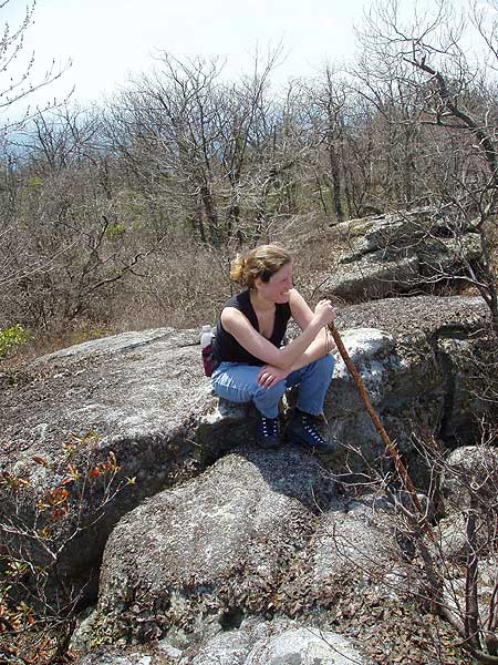
I didn't read all the way through the previous posters or I would've seen the description for what's off the red blazed trail halfway up the ascent on the yellow trail (waterfall and rock scramble). I'll know for next time! It's very obvious, off to your left, with a large cairn and small red blazes.
The hike is the standard GWNF hike till you get to the towers, with a few nice views along the way. There are two campsites on the right within a half mile of the towers. The descent down the pipeline clearings is VERY steep, and watch for the thorny vines and countless small stumps that can trip you up - best to really take your time (took me 45 minutes to get down with my weak knee). And there were SO MANY gnats out today, especially on the descent. It was definitely interesting and challenging, though. As the previous hiker states, stay to the left so you can see the blue trail, which is very clearly marked (though no rock pile anymore).
Finding the purple trail wasn't too difficult if you keep track of your distance on the blue. Though you will not see a purple blaze till you walk into the trail, the wide trailhead is marked by a pink ribbon and small cairn resting on a large cut tree. After about 10-15 minutes on the purple trail, you will come to a clear cutting on your right as you go uphill, then to a small clearing with a fire pit. On your right you will see a wooden post with what looks like a white blaze. It's not - it's light purple (and where you continue on). To your left is the blue blazed FS road (also marked with a light blue blaze on a post). Both take you back. If you continue on the purple, you will not see a blaze for a while, don't worry - they become more frequent as you move into older forest. The trail is very obvious.
I really liked this hike and it was a great workout. I didn't see anyone all day, it was recently used by horseback riders. If you really want to get a workout, do it clockwise! I probably wouldn't do this in summer, though, as the foliage and trail growth will be very thick, lowering the views and increasing the risk of ticks. It was fairly overgrown in spots already.
By:LMHHIKE
Rating:
Date of Hike: Thursday, July 4, 2013
Did this hike on a fairly hot, humid day. I have done North Mountain before but don't remember so much high grass as was encountered today on the ridgeline. And the pipeline descent was horrendous. Unlike the photo, the "trail" is covered in scree, small and fairly large trees, and rocks of assorted sizes. Not pleasant.
Falls Ridge Trail was fine, as I have found it in the past. I would give this hike a pass as written up here. Maybe take a right on North Mtn. once you ascend on the Falls Ridge Trail in order to avoid the pipeline which adds nothing to this hike.
By:Mountain Girl
Rating:
Date of Hike: Sunday, January 13, 2013
My husband and I did this as a birthday hike, and we loved the 65+ degree weather (in January!!!) and the fact that we had the entire trail to ourselves all day long. There were a couple of okay views, and we definitely got our heart rates up in a few places. However, that's really all the good that we can say about this hike. Due to the logging, a lot of the latter part of the hike looked terrible--fallen trees, open, eroded land, and blazes on tons of trees. The worst part of all was, we looked REALLY carefully for the purple blazes. I mean, REALLY carefully. We amazingly found some purple blazes and were so excited! We veered to the right and crossed two streams, just like the directions said. But something felt wrong about it. Sure enough, about a mile later, we came back out on the blue-blazed trail...back before we had ever gotten off on the purple trail. By this time, it was dark and the bats were out. We felt like we were in the Twilight Zone. We just followed the blue-blazed trail back to the yellow, but it wasn't much fun at all. I don't really recommend this hike unless you're just looking for a day of solitude and don't really care too much about the scenery.
By:Navin
Rating:
Date of Hike: Sunday, June 17, 2012
As other reviewers have noted, the trail is rather long but without any discernible reward or benefit. The hike has a steep section in the beginning, leading up to the orange section, but besides that is not physically challenging. The long walk on the ridge is dominated by tall grass and the trail is frequently akin to bushwhacking at parts. The oddest of all section is the descent (rather steep, along loose rocks and thick brush) along the "clearing" over natural gas pipelines: one must wonder why they routed a hiking path through this most useless section, for it is neither enjoyable nor rewarding. Challenging, yes, espcially if one has a heavy pack, which I did. All fine, the hike would have remained just unremarkable but for the badly marked and rather confusing second half of the hike. Calculating which slope to go down from the radio tower and finding the purple trail were very trying. The purple trail (evidently) joins up with the blue trail at an angle that one must look behind as they are walking forward, or might miss it. This indeed did happen to me- but luckily the blue trail joins up with the yellow trail eventually, and turning right on that leads back to the start, albeit a bit longer than if the purple had been found.
Overall, lots of small to moderate difficulties for neither good views, nor good physical challenge. Poorly marked trailheads. I wouldn't do this trail again because it seems a haphazard patchmark of sections of forest but for those who do try it, some pointers:
-Wear pants, because (at least in the summer) a significant majority of the trail is amongst high grasses, and the descent along the gas pipeline clearings is fraught with thorny stalks and high grasses that can scratch up one's legs.
-Continue up the hill past the radio tower installation, on its right side, and at the very top, the orange trail will continue to your right. To the left of the orange trail, there two parallel pipeline paths are present. Take the path to the left (farthest from the continuing orange trail), since the blue trail head will be on the left side of this path after it flattens out.
-Keep a close watch out for the purple trailhead from the blue trail. I couldn't find it but perhaps it was because I did not look hard enough as the purple trail joins up more or less facing away from the direction one is walking. If you miss the purple trail, not to worry, just continue on the blue till you gradually climb on and off along the wide and sometimes gravel-laden path, and you will intersect the yellow train eventually, and take a right on that to return to the bus and back to parking lot.
By:Moonshine
Rating:
Date of Hike: Sunday, September 4, 2011
About a mile from the radio tower I saw a large male bear on the trail. It was in the area of several anthills. It walked toward me, stood on its hind legs and did not display any aggression. I banged rocks and yelled, and the bear got off the trail. I decided not to continue to the pipeline, which was a good idea anyway as a thunderstorm was approaching. It will be interesting to revisit this area in a few years to see how the forest recovers from logging.
By:Z-Money
Rating:
Date of Hike: Saturday, July 16, 2011
I have gone on several strenuous hikes in around GWNF and this was by far the most difficult hike I've been on. I added a few side excursions and lost my directions and had to backtrack up the steepest part of the hike which increased the hike distance to about 16-18 miles. The toughest part was the terrain, almost the entire hike was uneven and rocky making it very difficult to keep a fast pace (Prefer to average 3-4miles/hour, but with the terrain it was down around 2miles/hr).
Hike started off nicely, but the trail quickly became a steep accent. At the bus, go right and follow the yellow blaze. About 1/3 of the way up the yellow blaze, there is a red blazed trail to the left that will take you down to a small waterfall and a great rock scrabble. I highly recommend adding this into your hike. The decent and following accent were very steep, but was well worth the time spent down near the waterfall.
On the orange blaze there is a ton of tall grass, so please beware of ticks. I also passed three massive 3-4 feet red ant mounts, so be careful not to get attacked. It was quite the scene if you disturbed the ants causing them to fly into a frenzy. There aren't many views due to tree cover, but there is a nice one about half way down the orange blaze. Once you reach the radio tower continue until you see two large clearings (they are parallel, so you can go down either one). They called this the green blaze, but there is no blaze or trail. It is a very difficult decent and of course I didn't realize I left my trail itinerary at the top until I reached the bottom, so had to backtrack up the mountain to find my directions. Of course, it's the one day I didn't have my back up and this hike was too far west for my PATC maps.
Once the decent levels out, make sure you're on the left so you can see the blue blaze trail. There are tons of blackberries and raspberries that were delicious and safe to eat. Note: There is logging operations in the area which made the hike very confusing from this point. The loggers would spray paint trees the same color as the blue blaze, making it confusing. In addition, they have cut down so many trees that the environment has completely changed. Where there used to be trees is now just open land, so I found what I thought was the purple blaze and went down the trail for a mile until it just didn't feel right. There was no purple blaze down this path. It was getting dark at this point, so instead of risking getting lost in the dark I back tracked back to the blue blazed trail which I knew led me back to the yellow blaze and back to my car.
I was out there for about 10 hours and literally did not see one person the entire time. There aren't many views, but if you truly want a challenging forest hike this is a great one to try. The small waterfall side excursion was a great addition to the hike (about 1.5 additional miles). I would recommend this hike again, but just be very careful not to get lost.
By:Evan McCarthy
Rating:
Date of Hike: Saturday, July 9, 2011
We actually combined this hike and the Laurel Run hike by skipping the Falls Ridge trail and completing the entire 6.2 North Mountain segment, returning via the Laurel Run trail (skipping the Stack Rocks segment as well). I estimate this made the trail about 15 total miles. Since we started in the evening, we hiked the hike in reverse order, going up the gas pipeline and the over the ridge, camping at a fantastic campsite not far from the observation tower on the ridge. We were able to return to the parking lot area by 11:00 a.m. the next morning.
Really great views. I could have done without some of the road walking, but we beat the heat with some nice elevation and we look forward to returning in the winter when the views will really open up. Nice addition to the repertoire if you are looking for another hike in the area and have done Halfmoon, Big Schloss, White Rocks, etc.
By:Elena
Rating:
Date of Hike: Sunday, May 15, 2011
Yes, Virginia there is a waterfall for Fall Ridge Trail! About halfway up the yellow trail there will be a smaller trail to the left marked with red as well as red stone markers. Just follow the red trail down to the waterfall bottom. Soon the rest of the trail will be marked for the upper part of the falls as well as a back trail that leads to the purple train that ends the Falls Ridge Trail.
By:Lubos
Rating:
Date of Hike: Sunday, April 24, 2011
Awesome hike indeed. Did it in the opposite, clockwise direction (went up the gas line) which I think worked out much better. It's steep going up, but then the rest of the hike is gradually downhill. Plus my knees prefer steep ascent over a steep descent. The purple trail was really muddy - basically a creek bed - so bring waterproof shoes. Highly recommended, I'll definitely be coming back, possible extending the hike by walking along the ridge North Mountain trail longer. Amazing views from the ridge.


