Hidden Valley in Bath County VA is one more hidden gem in the crown of mid-Atlantic hiking. There are many interconnecting trails in the valley itself, as well as a campground at the Forest Service Hidden Valley Recreation Area. The post-Civil War love story Sommersby was also filmed at Hidden Valley with Richard Gere and Jodi Foster in 1993. Once a year we'll hike this area and spend the weekend in our favorite B&B Gristmill Square just a few miles away. The food and staff are fantastic.
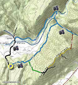
The Topo Hike Trails Map has green, yellow, and red trails that are no longer maintained and now pass through private property. They are listed for reference only and are no longer part of the trail system.
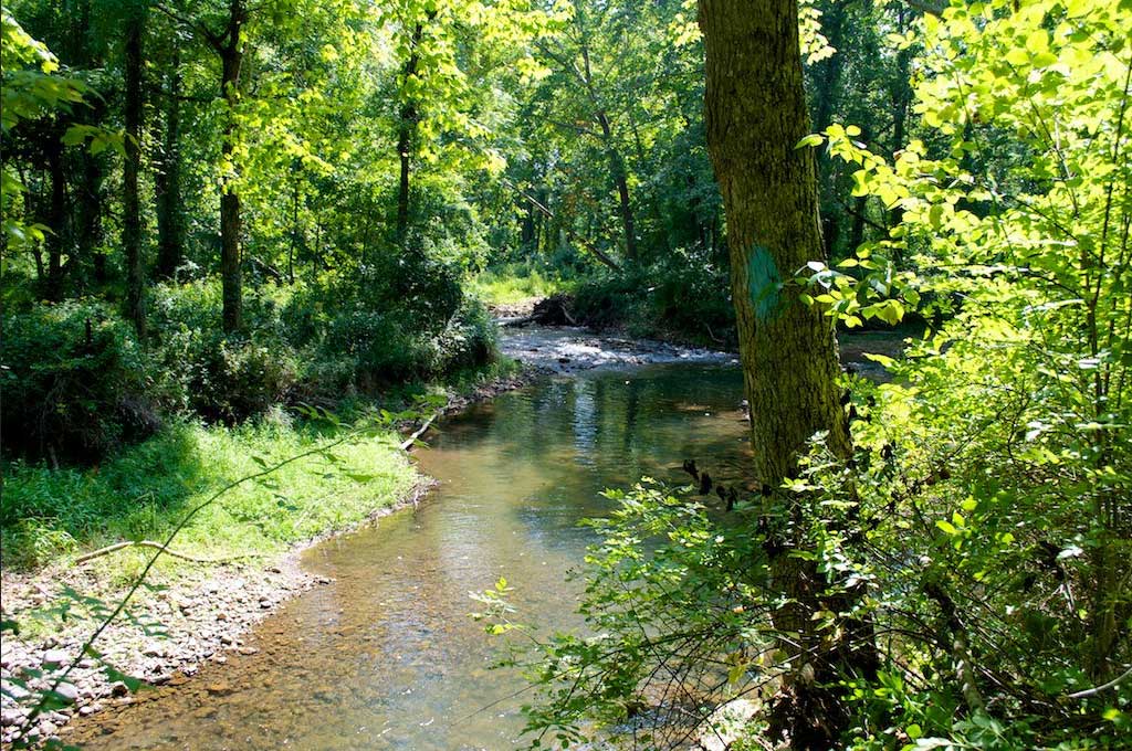
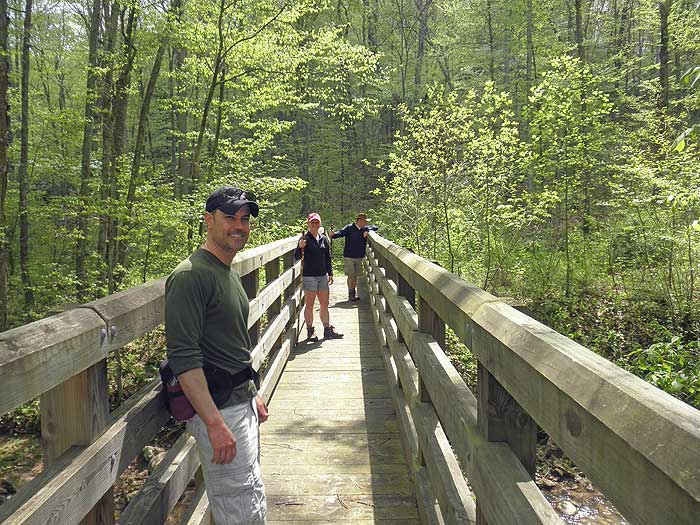
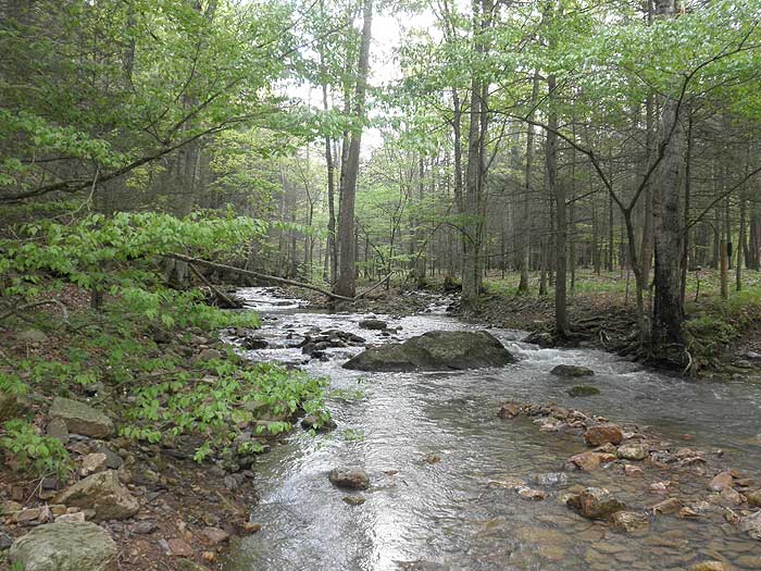
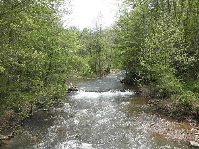
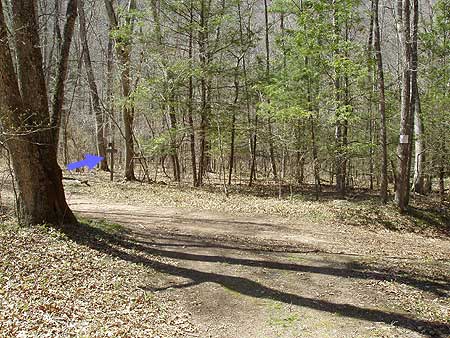
Start out on the blue blazed Cobbler Mountain Trail as it ascends then descends the spur before arriving at a wooden footbridge that crosses Chimney Run in 0.7 miles. Cross the run and continue left on the blue blazed trail as it follows Chimney Run downstream. The trail to the right dead-ends on private property within 0.2 miles.
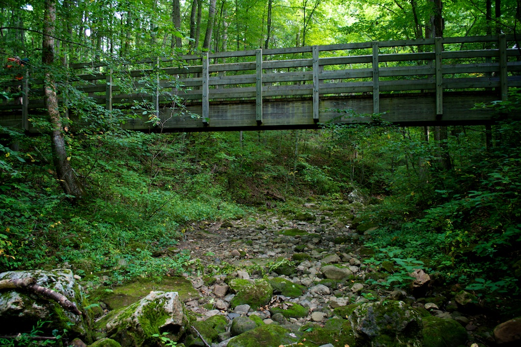
Follow the blue blazed Cobbler Mountain Trail for 2.0 miles as it winds along the bottom of Cobbler Mountain with Chimney Run to the left before passing through a wetland area and descending to the intersection of the blue blazed Muddy Run Trail. Turn left on the Muddy Run Trail for 0.1 miles where the trail ends at the Hidden Valley Trail and where a small wooded footbridge crosses Muddy Run.
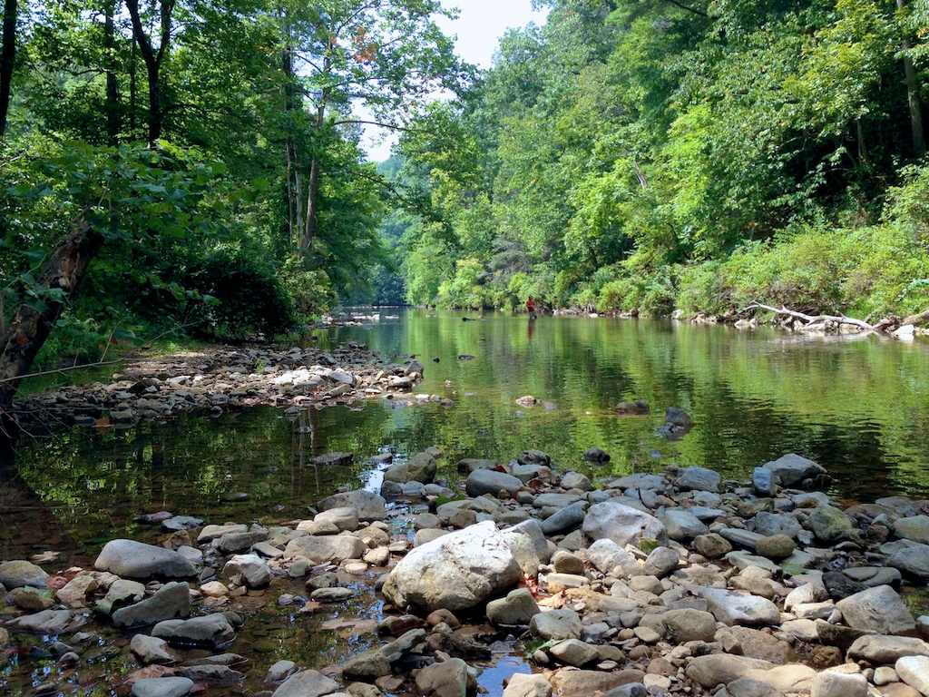
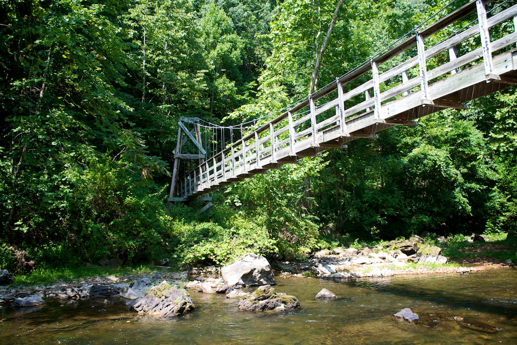
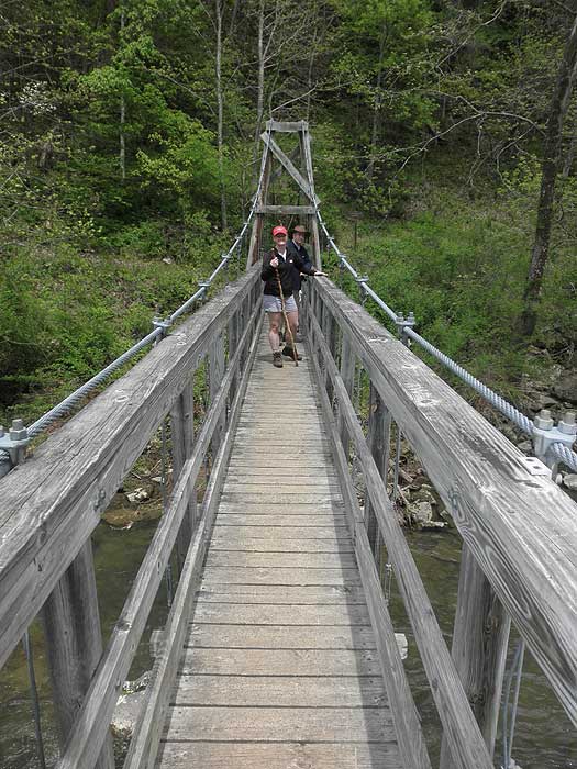
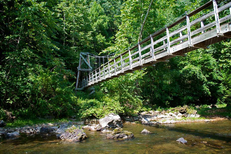
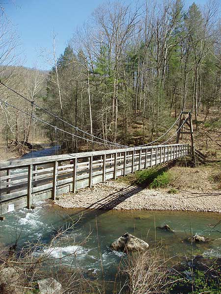
At this point you can take one of two trails back downstream on either side of the Jackson River. For the Jackson River Gorge Trail on the opposite back of Jackson river cross Muddy Run on the footbridge and in another 0.2 miles arrive at a large suspension bridge that crosses Jackson River.
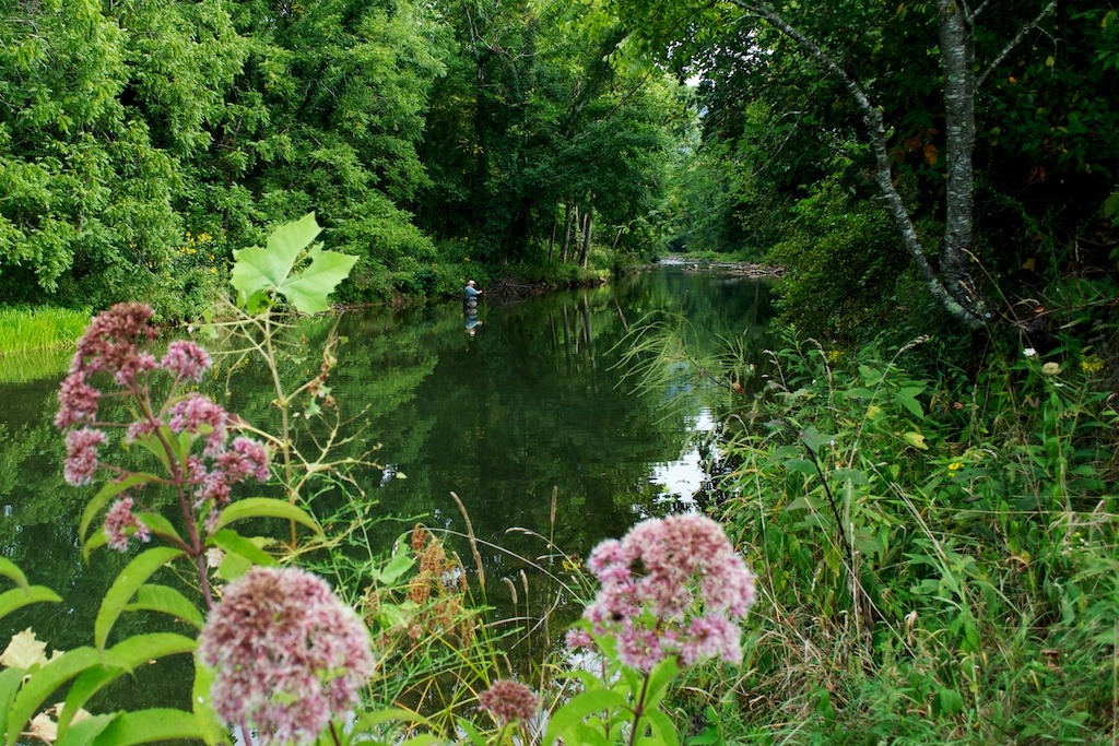
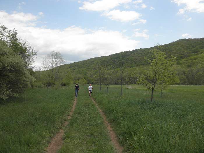
Cross Jackson River on the suspension bridge and turn left on the Jackson River Gorge Trail as it follows Jackson River downstream and arrives at a closed gate in 1.8 miles. Pass the closed gate and turn left on the gravel road and shortly cross Jackson River over a concrete ford. Continue to follow Hidden Valley Road for 1.2 miles. The road will become paved then pass the Hidden Valley GWNF campground on your right before you arrive back at the Cobbler Mountain Trail parking area.
Late
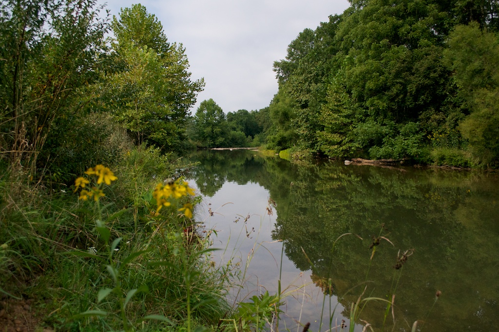
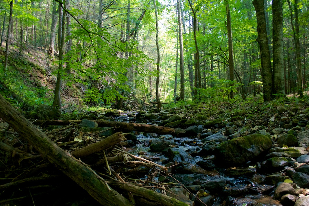
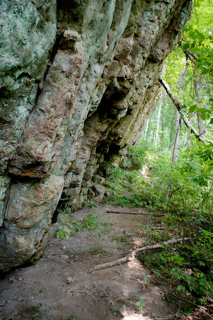
August - Photos Courtesy of Tripp Fenderson
Early May
Hidden Valley
Hidden Valley Hike Comments
Archived Comments
By:Will H
Rating:
Date of Hike: Saturday, November 9, 2019
Seconding the previous review that the trails are in much better shape than they apparently used to be. We only hiked some of the trails along the river but they were serene, peaceful, and easy to follow. This area is a pleasant oasis and I'm glad to see it is getting some much-needed maintenance to remain a good hidden away hiking spot.
By:Tom Richardson
Rating:
Date of Hike: Tuesday, July 30, 2019
Most of the very 'negative' reviews in this thread are over 2 years old, and are (were) pretty valid for their time frame.....the trails have not been in great shape.
But I can happily report that many (if not MOST) of the trails in the Hidden Valley area (near Warm Springs, Va) have been recently 'brushed' and are in much better condition NOW than what these earlier reports would indicate.
The USFS guys have been out there this Spring/Summer (2019) and have cleared off the River Loop Trail, the Upper & Lower Lost Woman trails, the Cobbler Mountain trail, and the Jackson River Gorge Trail from the Warwick Mansion (the B&B) upstream to the swinging bridge, and will probably get the 'rest' of the River Gorge Trail (from the swinging bridge up to Poor Farm area) later this summer, along with Neal's Run (later this summer).
Like earlier reviews mentioned, the signage could be better but if you are in the area, please give these trails another try!
By:WoolfPack
Rating:
Date of Hike: Tuesday, July 11, 2017
I should have read the reviews before I went, because the one by HikingJustForFun was spot on:
The trail is NOT MAINTAINED. Terribly overgrown, not well marked, and serious danger for poison ivy and snakes. I love hiking, but I felt claustrophobic and desperate at having to push through long stretches of shoulder-high growth.
I'll never do this hike again and do not recommend it.
By:HikingJustForFun
Rating:
Date of Hike: Friday, June 30, 2017
Never again! The trail needs serious up-keep. It looked like we were the only ones to visit this trail in 2 years since it was so overgrown. We are seasoned hikers (hiking for 15 years) but had to back track twice to find the trail again since it's so poorly marked. This trail had all of my worst fears in one hike:
1) Bears - Fresh BIG bear poop on the trail
2) Snakes - Overgrown, 5 feet tall vegetation in several stretches, I feared I would step on a snake since I could not see in front of me or below me
3) Lost - we had to double back (TWICE) to find a blue blaze because it's so poorly marked, at one point we truly thought we might not make it back
4) Poison Oak/Ivy - the vegetation was clinging to my arms and legs and there was no way to avoid it.
Do not go on this hike unless you enjoy the feeling of impending death for the duration of the hike.
By:Trailguy
Rating:
Date of Hike: Saturday, January 9, 2016
For the area, it's a good hike. Unfortunately, it's true though. Views are lackluster. River is pretty but there's no real wow factor. If you're in the area, it's worth the visit though. For me, looking at the beauty of the surroundings, thinking about the history is what really sets it apart. Plus you can turn it into a nice loop hike (hard to find in this area).
Trail condition: Signage isn't all that great. Blazes need to be redone. Trail (which is mainly a road walk) is wet and swampy it you've had a recent rain.
Views: There are some decent views of the mansion, fields, river (on in certain areas) and mountains. Halfway to 3/4 of the way from Cobbler Mtn trailhead, there are some neat hillsides (which you're walking near the whole way).
Would I go out of my way to hike this, probably not. If you're looking for something new and different, yes I would. It's worth the trip.
By:Jim S.
Rating:
Date of Hike: Wednesday, August 26, 2015
I gave this a one-star rating largely to counteract the very misleading ratings given to this hike. As of the time of writing this, it is rated 5 stars for streams and 4 stars for views. These need to be seriously downgraded! Based on the ratings, I thought I had hit the jackpot of trails since it's very rare to have high ratings for both streams and views. I should have known better!
Regarding the streams rating, perhaps only a quarter of the hike actually has a view of the river, and even then the river is nothing particularly special to look at - no falls, rapids, or anything noteworthy. By comparison, the White Oak Canyon hike - which has a series of lovely falls - is also rated a 5. I would be generous to give Hidden Valley 3 stars for streams.
For me, "views" means open spaces where you can see something other than your immediate surroundings. These trails were almost completely enclosed for the entire hike. A significant stretch even had overgrowth of ivy walls lining the trail on both sides. By far the best view was from the portion of the hike where you are walking on the road to return to the parking lot. I would rate this no higher than a 2 for views. Perhaps the view rating is there in case you choose to follow the green, yellow, and red trail portions named that pass through private property. There are NO views if you only follow the blue trails and the given instructions.
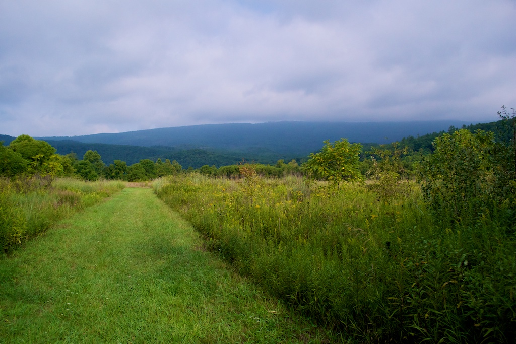
I would not recommend making any special trip to do this hike. If you happen to be staying at the B&B or campgrounds nearby, it would be fine just for the sake of getting out and going for a few-mile walk. Even then, I would just follow the two trails that run alongside the river (the blue dotted line and blue-blazed return route on the map). There is a parking lot and restroom at the very bottom of Hidden Valley Road where you can pick up that trail. There is also a short meadow trail in that area that is rather lovely when wildflowers are blooming.
Finally, the trail was very buggy when we went in August. A spring or fall hike when bugs aren't out would be advisable! We also had to be on the lookout for the MANY large spider webs across the path.
By:Tripp Fenderson
Rating:
Date of Hike: Saturday, August 30, 2014
We started our Labor Day weekend hike around 9am on Saturday, Aug. 30 and camped on the Jackson River for 2 nights.
The trail conditions in the area varied from slightly overgrown to excellent depending on how close to the Warwickton Bed and Breakfast you are (where Hidden Valley Road crosses the Jackson River on the Hiking Upward map). There is also a public parking area and horse trailer parking next to the B&B.
For our 3 days, we saw a total of maybe 20 people, only two of whom were backcountry camping like we were. A number of groups were on horseback exploring the other trails in the area. You'll definitely need to watch where you step when you're on the main trail.
The only confusing part for us was when we left the Chimney Run area. As you come down a forest service road after you've crossed the footbridge, the trail that runs northeast along the base of Cobbler Mountain isn't well marked. We ended up missing the turn but were dropped into a pasture area, which was well maintained and had trails cutting to the river with a bushhog so it was easy walking. On our return trip out 3 days later, we looked for and found the blaze on the tree.
I rated this as 5 stars but not because of the loop trail described here on HikingUpward. We loved the solitude of our camp along the Jackson River, the amazing trout fishing, and the side trails in the area that we explored. I highly recommend a camping trip to this spot. If you're just going up for a hike, it's nice enough but I wouldn't make a 3 hour drive from Richmond just to come here for a 5 mile, easy walk through the woods.
I'll try to upload some photos from our trip in a bit.
By:John
Rating:
Date of Hike: Saturday, October 5, 2013
Pretty easy hike. Leaves were starting to turn but waters levels were very low at this point of the year. Probably a better hike earlier in the year when the creeks aren't all dry. Many of the trials are also shared by horses, so watch out for large piles of poo on the trial (which also lead to a lot of bugs). High recommend taking the Jackson Gorge trail on the way back. Makes it worth it.
By:Lightfoot
Rating:
Date of Hike: Saturday, March 3, 2012
This was a very enjoyable hike. The views of the river are amazing. The trails are marked clearly, but I would suggest taking the map posted on this site. The location of the swinging bridge wasn't marked on any signs that we could find.
By:K.O.Tic
Rating:
Date of Hike: Tuesday, August 16, 2011
An easy hike for the entire family, easy climbs, good quality trails, and some very nice vistas. The trail description was very accurate, and we had never any doubts as where to go. The swinging bridge is a highlight for kids, of course, yet no too high for anyone to cross. For those who have eyes to see, some wildlife (deer, rabbits) can be spotted.
I would suggest to leave the car in the parking near the concrete ford, it is easier to climb the road at the beginning of your hike than at the end.-)
For those interested in geocaching, a cache is right on the trail (GC1H8D4 Kids Hidden Valley Cache (http://coord.info/http://coord.info/GC1H8D4))


