
|
 By Trail Contributor: Jeff Monroe (Email Jeff) By Trail Contributor: Jeff Monroe (Email Jeff)
Volunteers who are members of the Potomac Appalachian Trail Club (“PATC”) maintain 240 miles of the A.T. and trails in Shenandoah National Park and the George Washington National Forest. The PATC originally developed the 250 mile-long Tuscarora Trail (“TT”) as an alternate route to the Appalachian Trail between Shenandoah National Park and central Pennsylvania, in case development shut down the original A.T. route in that region. In 2022, the PATC celebrates the 60th anniversary of the TT’s conception. Even after all these years, the TT remains a trail in flux as portions of the trail cross private lands and others use road walks that could change, subject to landowner permissions. If you are looking for a long distance trail that is wilder and more rugged than the AT (with fewer thru-hikers), then this trail is for you! (The PATC publishes guidebooks and trail maps covering the entire TT that are available for purchase by the public.)
The portion of the Tuscarora Trail described here straddles the Virginia/West Virginia border. Most of this route is very recent, having opened in May 2015 after years of negotiations between the PATC and multiple landowners, and after multiple land purchases by the trail club. Landowners include property owned by the nearby Capon Springs and Farms Resort and land purchased by the Potomac Appalachian Trail Club to protect and enhance the Tuscarora Trail. Please respect private property, remain on the trail, and practice Leave No Trace hiking etiquette so that future hikers can also enjoy this hiking route. This respect includes not camping on private property, and restricting campsites to the locations described in this writeup.
The beginning portion of this hike is the same route described in Hiking Upward’s Eagle Rock Hike. The Eagle Rock portion of this hike is likely fairly crowded – our hikes here have seen other hikers and their young families nearly every day of the week. After the TT passes north of the Eagle Rock vista however, the trail becomes more rugged and remote, and your likelihood of encountering other hikers drops dramatically. This section makes an excellent overnight backpack if established campsites or the shelter at the north end of the description are used, however we cannot vouch for whether the trail gets overgrown in Summer.
Note: This hike is dry. Be sure to bring enough water!
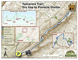
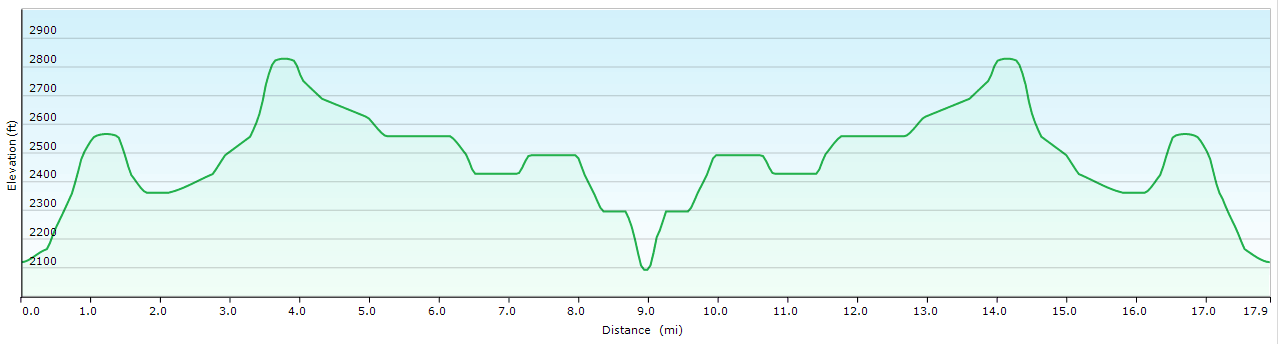
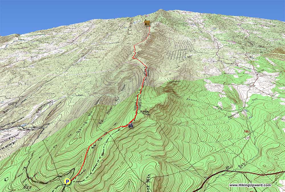
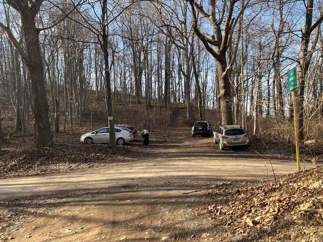
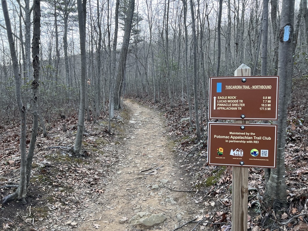
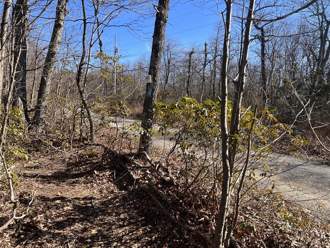
- Mile 0.0 – The trailhead for this hike is the parking area at Dry Gap and VA690/Capon Springs Grade Road. (You could add 2.6 miles to both ends of this hike by parking on the side of the road where the TT crosses U.S. 48/VA 55 to the south, described in the Eagle Rock hike description.) There are spaces for about eight vehicles in lots on either side of Capon Springs Grade Road as it crests Dry Gap, and this area is often crowded with cars in the afternoons of nice hiking days. Although it is unpaved, this road was in good shape when we completed this hike accommodating regular vehicles. Heading north on the blue blazed trail from Dry Gap, you will find a mileage sign stating that the Pinnacle Shelter is 10.5 miles distant. We found the actual distance to be about a mile less than that.
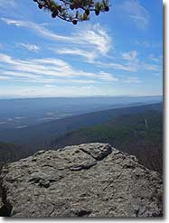
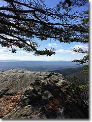
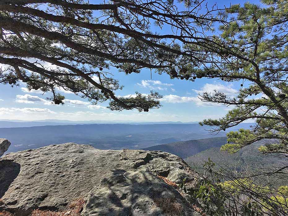
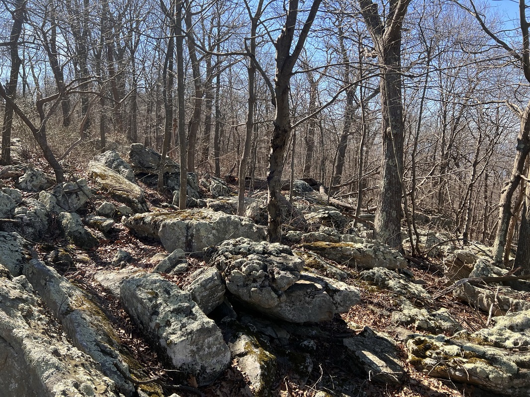
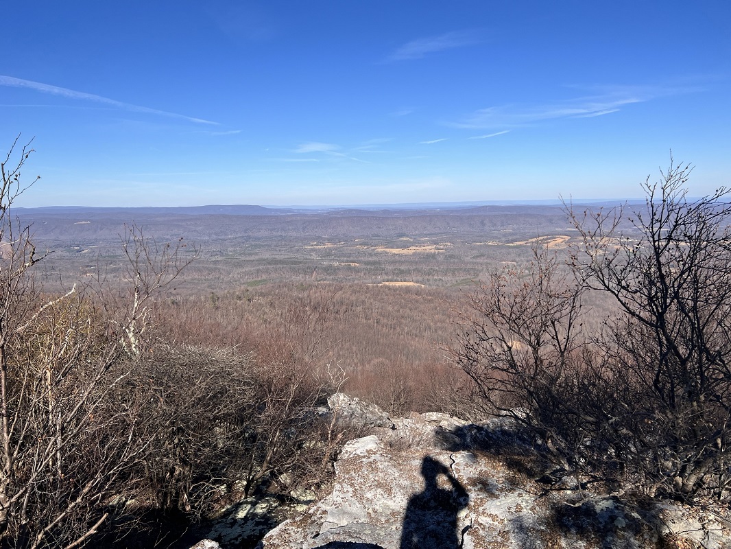
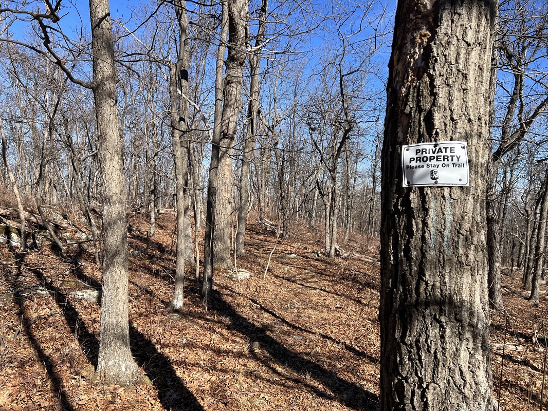
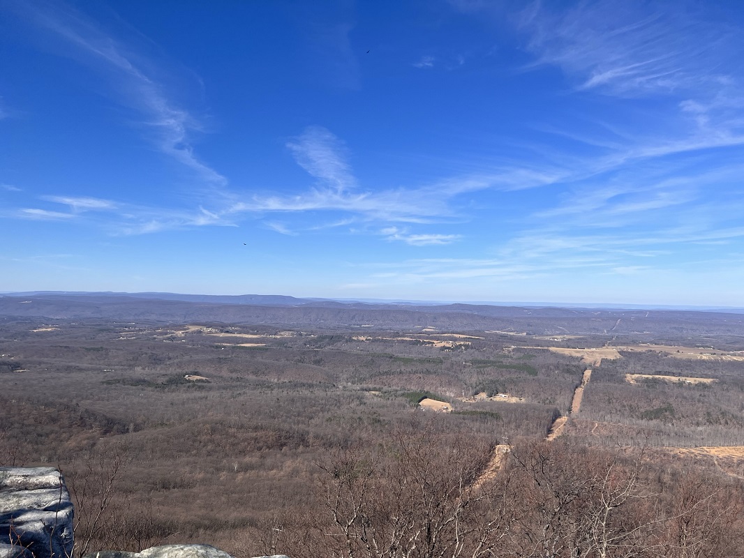
- Mile 1.0 – After ascending about 450 feet over the first mile, the trail route reaches the Eagle Rock overlook. This is the only open overlook facing east on this hike and is arguably the best vista of the entire route. It is justifiably popular! After this vista, the trail goes through woods on tread that starts out very rocky, but that rocky nature diminishes as you head north. You will pass multiple signs on the west side of the trail stating that the landowner is the Capon Springs Hunt Club. Stay on the trail.
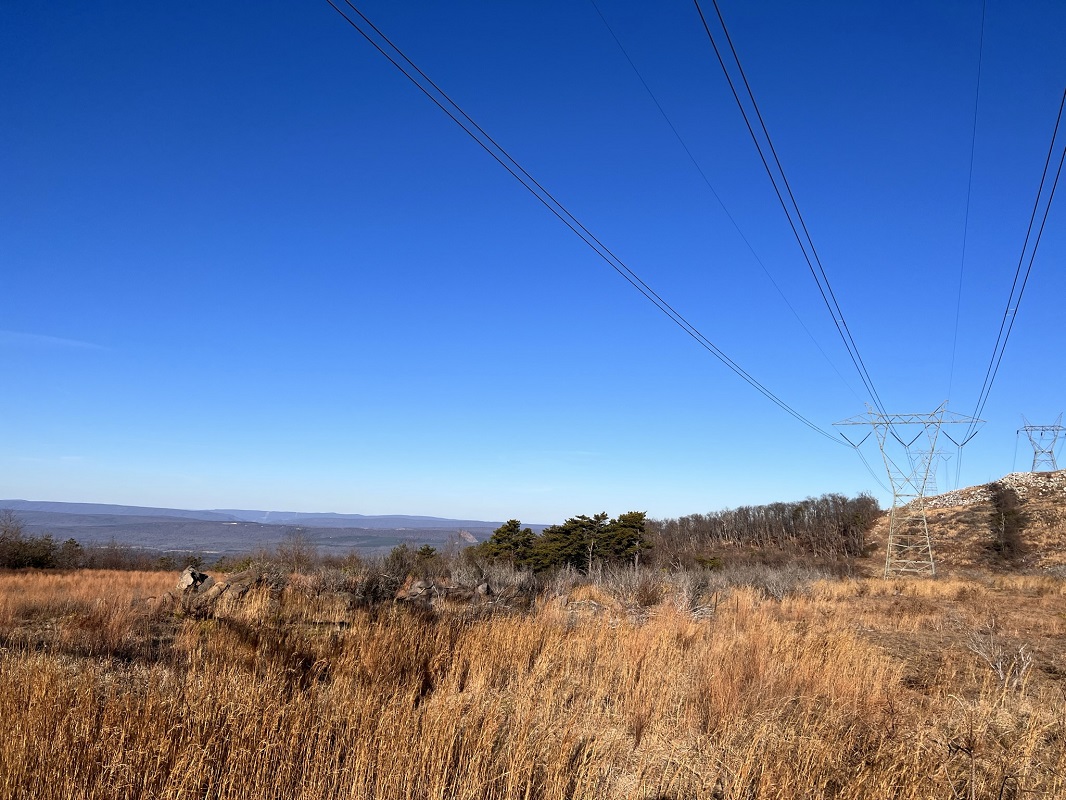
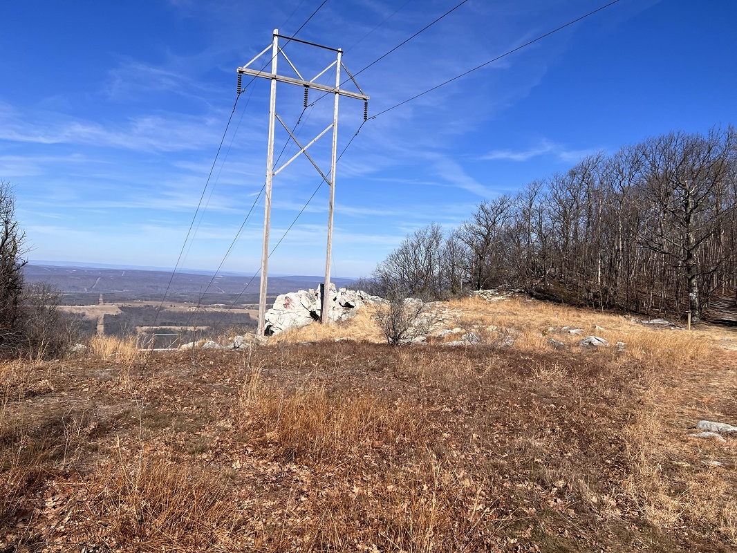
- Mile 3.2 – Exit the forest and come out into an open area which is cut for power lines crossing the mountain, giving nice views to the west.
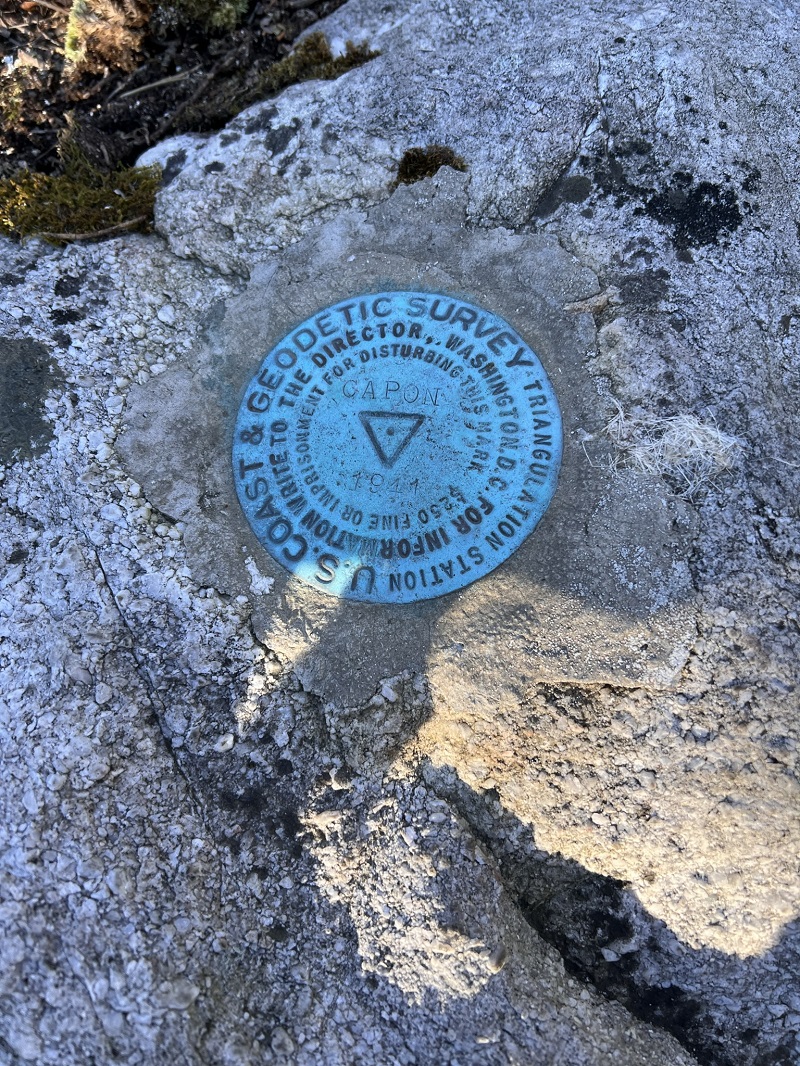
- Mile 3.9 – After re-entering the forest, climb sometimes steeply via a single switchback to the wooded summit of Pinnacle Mountain, elevation 2844 feet. The summit is marked by a Geodetic Survey medallion. This is the high point of the hike and the trail going northbound trends generally downhill for the next 3.5 miles.
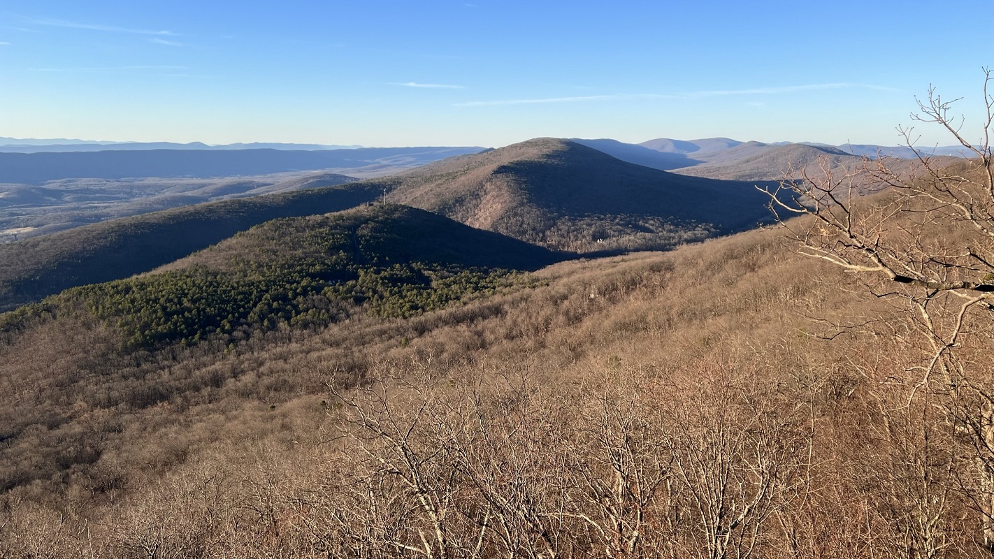
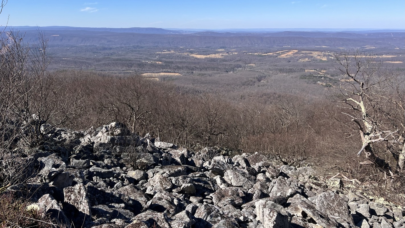
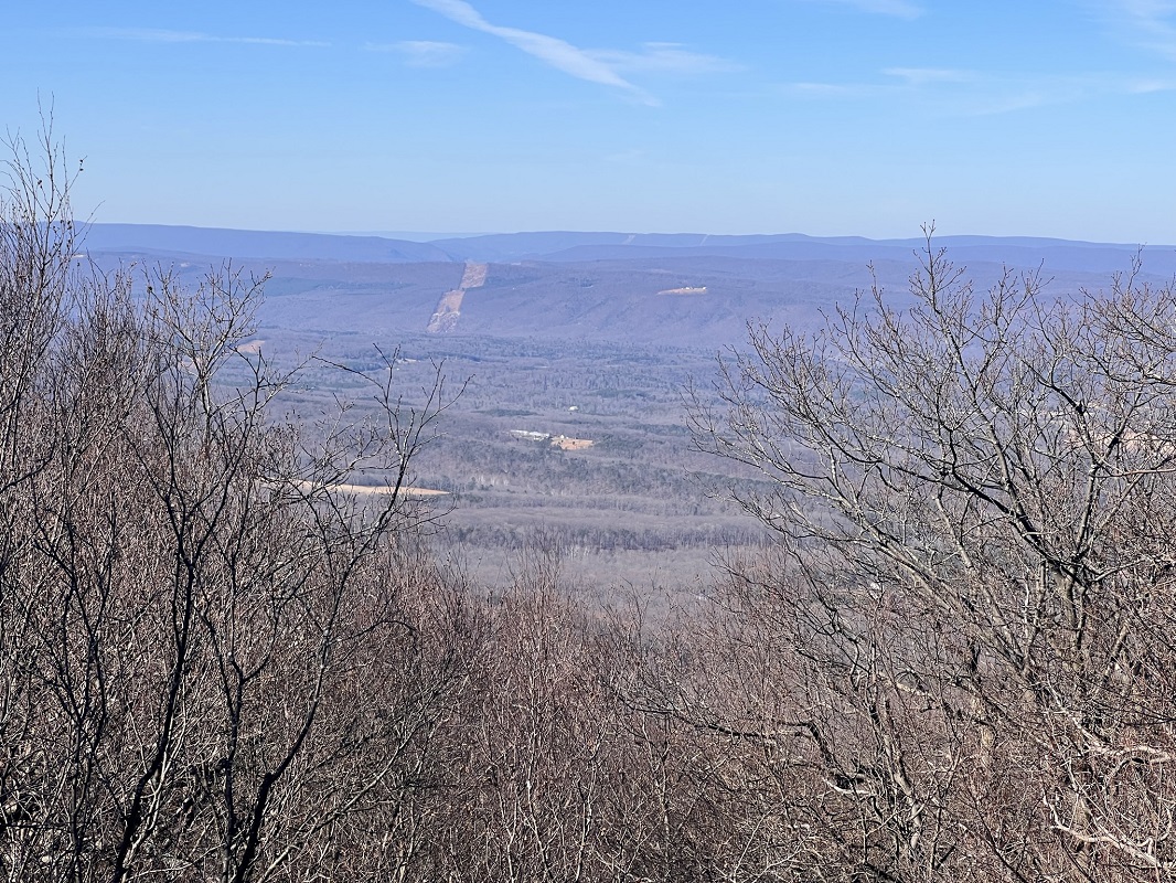
- Mile 5.7 – The trail crosses a series of rocks on the western end of the ridge. These rocks offer great views to the west.
- Mile 6.2 – Pass another overlook with views to the west, and then cross a short talus scree with additional views.
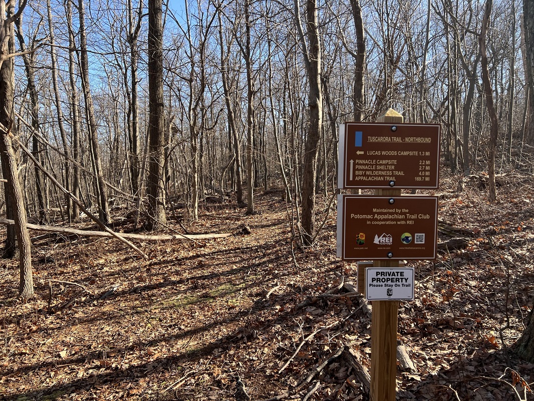
- Mile 6.6 – Reach a Tuscorora Trail sign, which designates a side trail to the left. This drops to a campsite called the Lucas Woods Campsite, 1.3 miles away. The trail to the left is the previous route of the Tuscarora Trail; the new portion of the trail that you have been traveling since the beginning of this hike ends. The rest of the hike is on an older trail alignment.
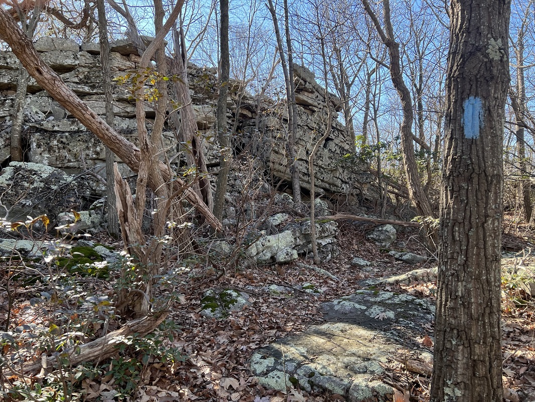
- Mile 7.4 – The trail passes along some interesting rock formations and shortly after passing the rocks comes within sight of a private road with a sign instructing hikers to stay on the trail.
- Mile 7.8 – Pass a partial view to the west.
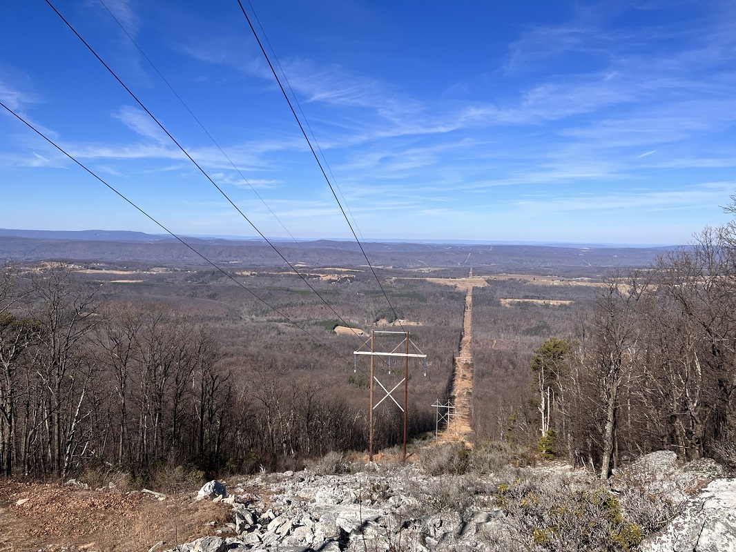
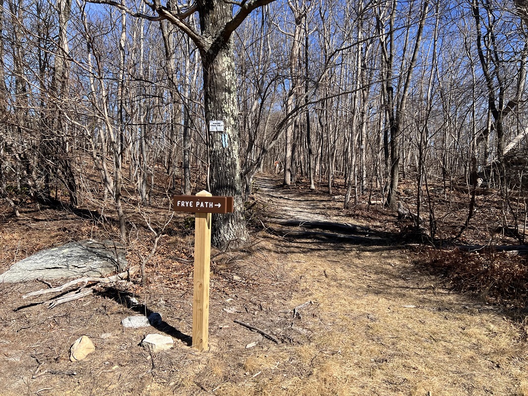
- Mile 8.6 – The trail passes through a second power line cut. There are some white rocks to the left that have graffiti and provide a view to the west. There is also a sign here indicating that the Frye Path heads east from the trail. (The Fry Path connects again with the Tuscarora Trail just north of where this hike description turns around.) Cross a power line service road that ascends from the west.
- Mile 8.7 – A trail to the right goes 100 yards to Pinnacle Campsite. This is a large campsite with room for multiple tents and a nice fire pit. An older wood sign indicates that the next campsite is six miles further north. This is really your only campsite option near the portion of trail described here, unless you count using the upcoming shelter as “camping.” Immediately after passing the campsite, the trail ascends through some rocks and reaches another nice vista to the west. This vista is somewhat popular, and is accessed from a housing development a little to the north off of the TT. Follow the blue blazes to stay on the TT.
- Mile 9.1 – The trail descends, sometimes steeply, before crossing a dirt woods road.
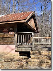
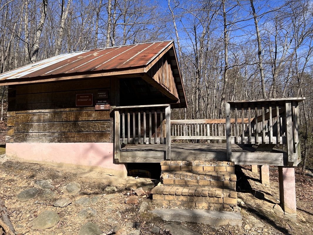
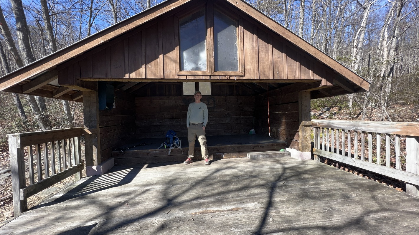
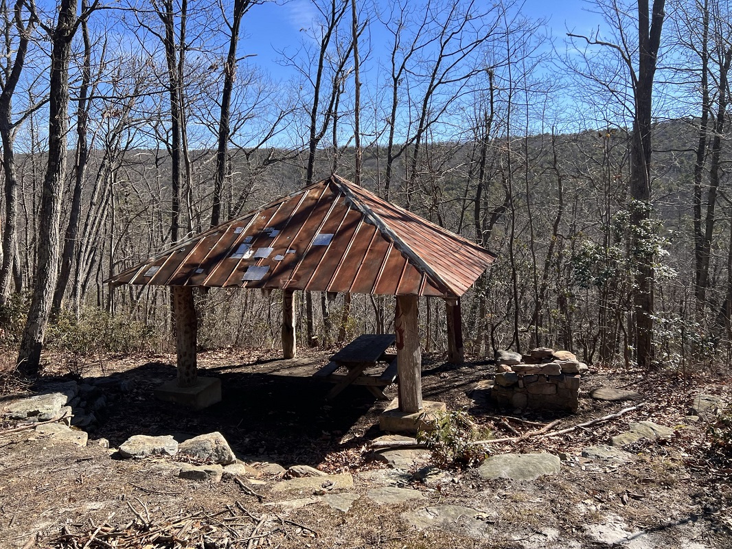
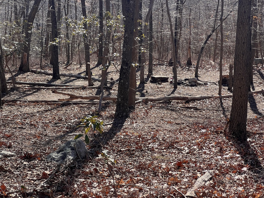
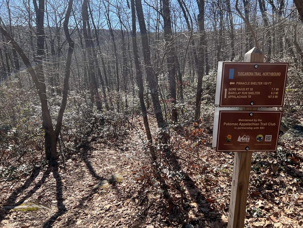
- Mile 9.2 – Take a side trail left 150 feet to the Pinnacle Shelter, built in 1990 by the PATC. The shelter is located on land owned by the PATC. The shelter is nice and big, though there are no campsites here. There is also a picnic table with a roof overhead, along with a privy, fire pit and bear pole. A sign indicates a spring is nearby, as well – the first indication of water since the hike started! This is a very impressive setup! Instead of being just impressed, however, you should join the Hiking Upward staff in becoming a member of the PATC. Give back to the trails through a trail club membership, in appreciation for what the local trail club has done in providing this recreational opportunity. The Tuscarora Trail continues north for another 167 miles before ending at an intersection with the Appalachian Trail, according to the sign at the shelter trail. Reports indicate the next few miles to the north are not nearly as enjoyable as the section described here, with multiple ATV trails intersecting the TT. Instead, retrace your steps back to your vehicle.
- Mile 18.4 – Return to the Dry Gap parking lot.
|

