|
 By Trail Contributor: Jeff Monroe (Email Jeff) By Trail Contributor: Jeff Monroe (Email Jeff)
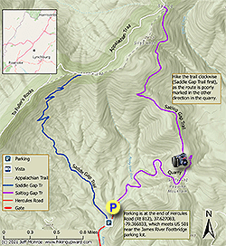
The Saltlog Gap loop is a hike that provides a nice workout for hikers familiar with other trails in the James River’s Balcony Falls area. It should not be your first hike in this region, as HikingUpward’s Big Rocky Row hike and several hikes in the nearby James River Face Wilderness, also described on this site, provide superior hiking experiences. In addition, parts of this hike may be overgrown in summer and dangerously icy during the winter. This loop should provide considerable solitude, as - other than on a short portion on the Appalachian Trail - it is doubtful you will encounter other hikers (in part because the Saltlog Gap Trail is not found on the Trails Illustrated map for this area). Note that the Saltlog Gap described here has no connection to an identically named gap further north on the Appalachian Trail in Virginia near Cole Mountain.
-
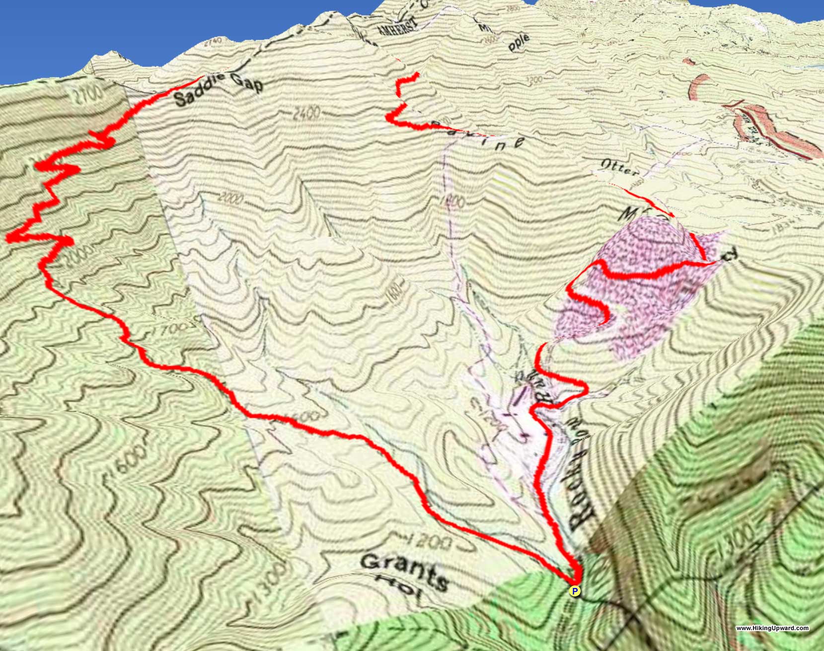
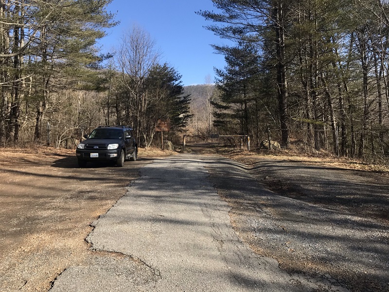
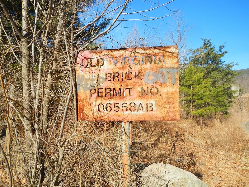
Mile 0.0 - The optimal place to park for this hike is at the very end of Hercules Road, which exits U.S. 501 across from parking for the James River Footbridge. There is a wide spot for multiple vehicles, next to an old metal sign for a quarry that you will walk through at the end of this loop. There is a gate here that is always locked, but don’t block it. You can also park at the very start of the Saddle Gap Trail, but that parking isn't as obvious from the Hercules Road, and it has a small parking area - maybe 3 cars max.
-
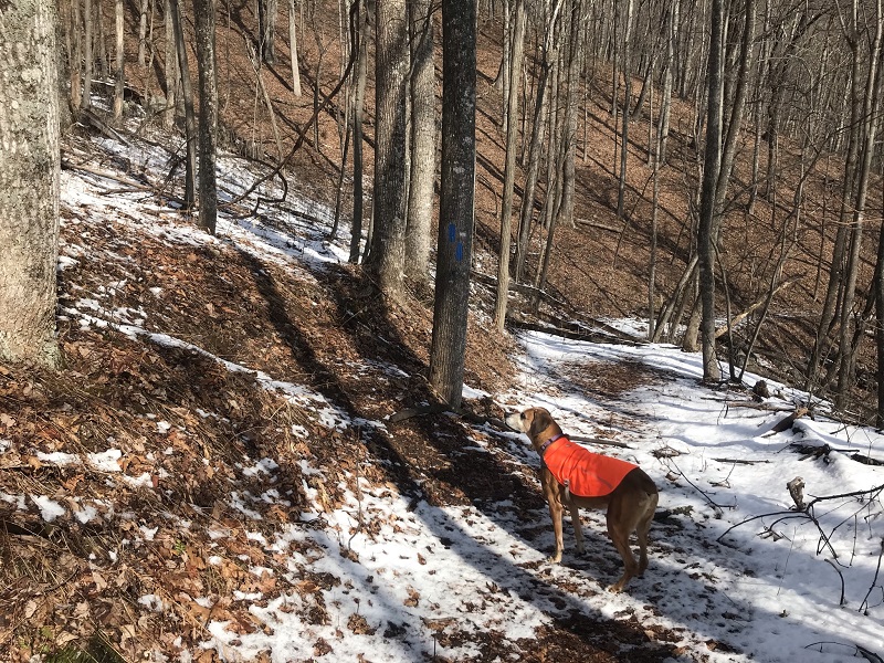
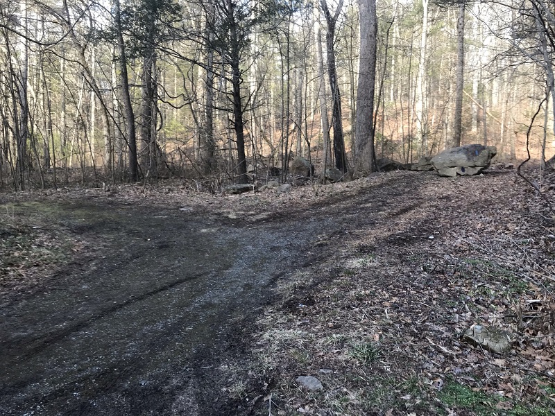
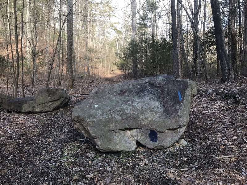
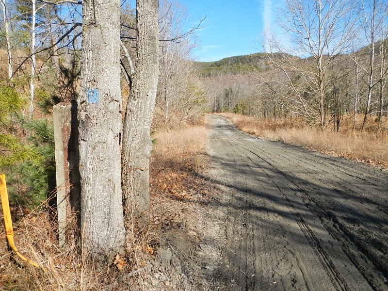
Mile 0.2 - From the gate, hike back down Hercules Road, cross a small stream, and look for a large boulder blocking an old road on your right. The boulder has a navy blue blaze painted near its base. This is the start of the blue blazed Saddle Gap Trail.
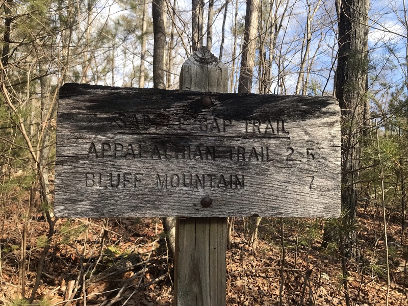
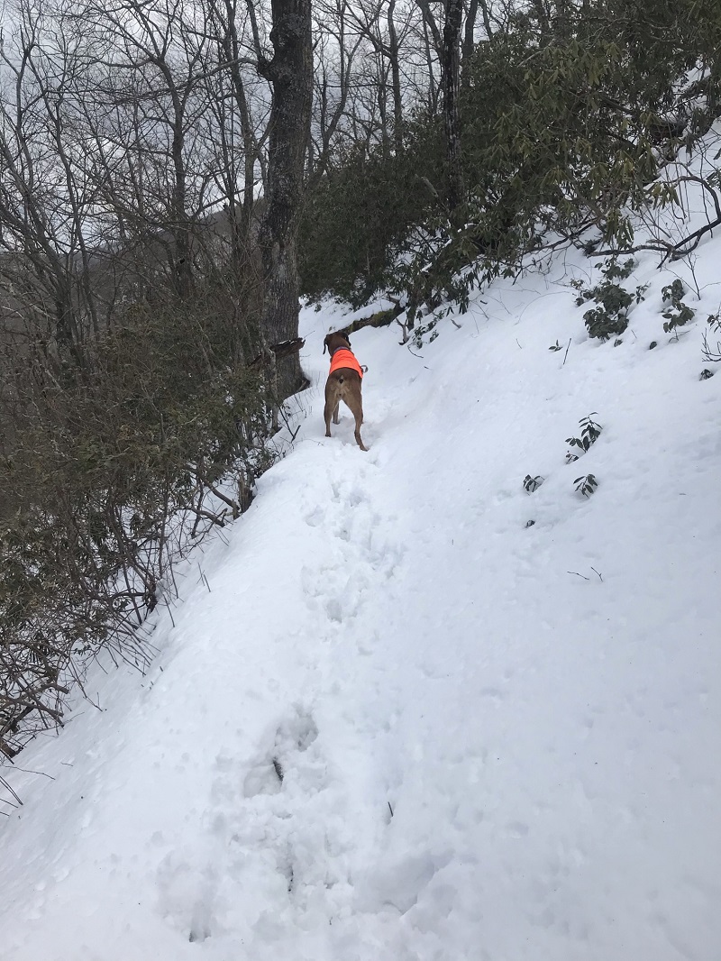
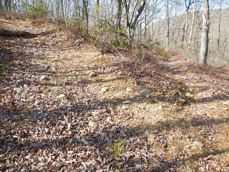
Shortly after starting up the trail, but out of sight from the trailhead, is a sign confirming that you are on the blue blazed Saddle Gap Trail. There are several small stream crossings before the trail turns into an old woods road and starts to climb. Short sections on the old road are really steep, with grades approaching 25 percent, and reportedly overgrown in summer.
-
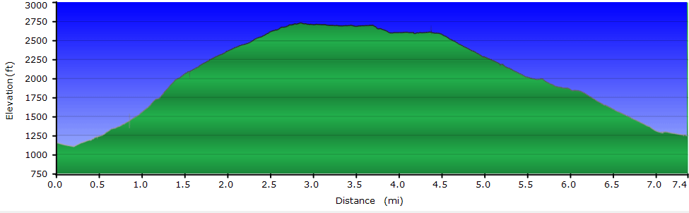
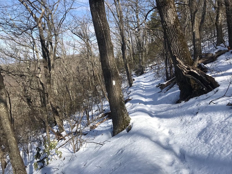
Mile 1.5 – Keep an eye out for where the trail leaves the woods road at a sharp angle to the left. After this, the climb becomes more gradual and consistent, averaging about a 10 percent climb over five switchbacks.
-
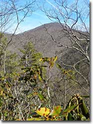
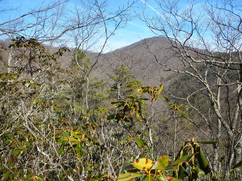
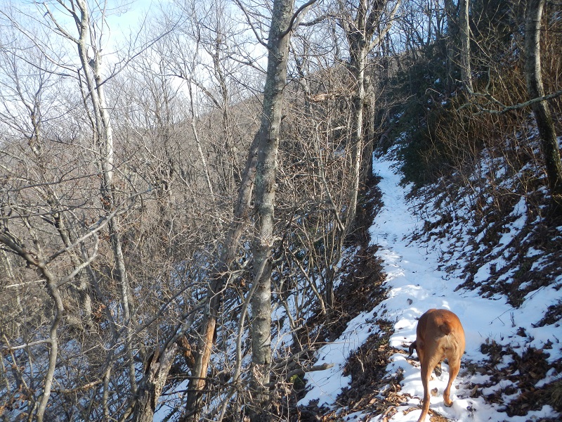
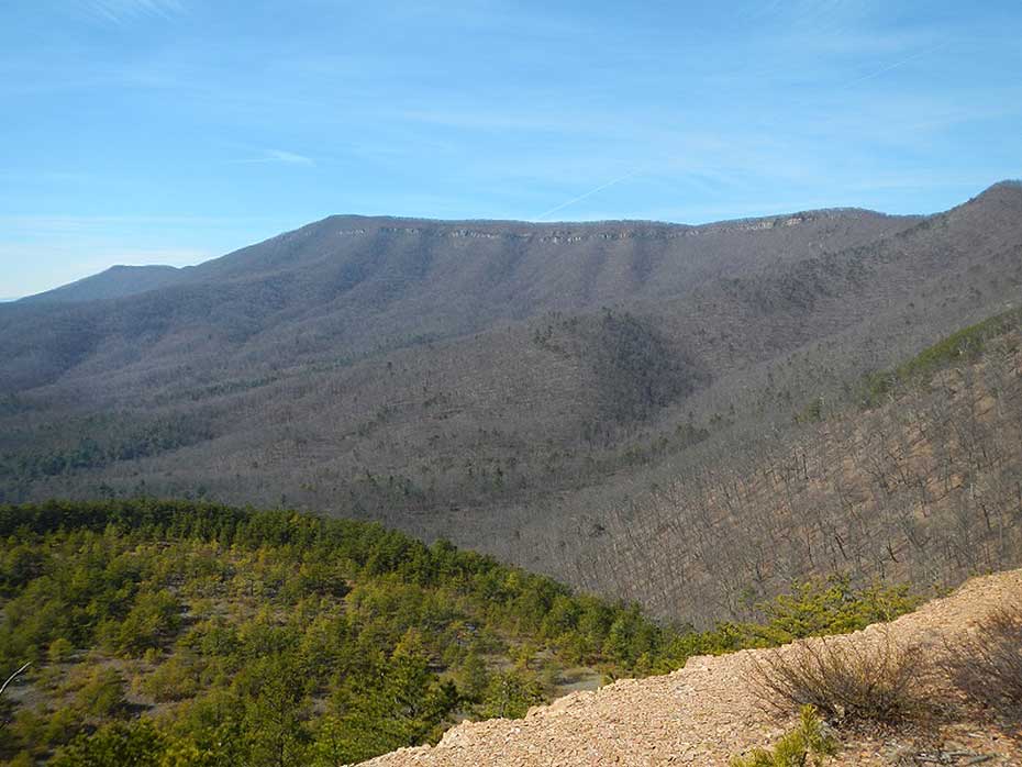
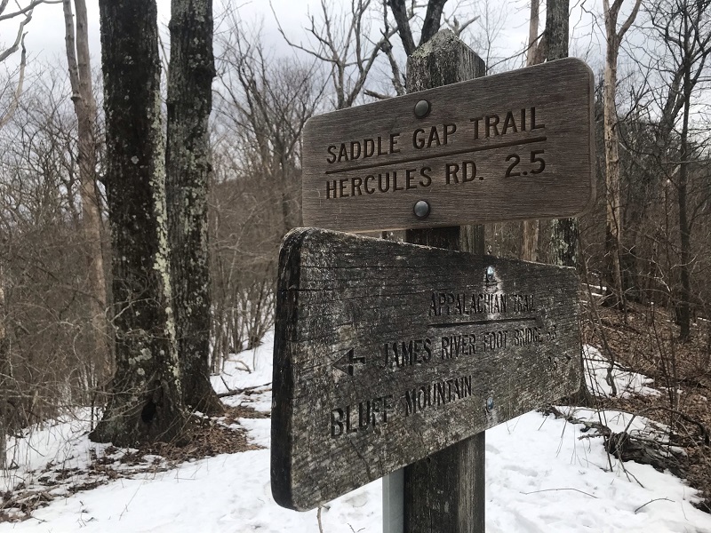
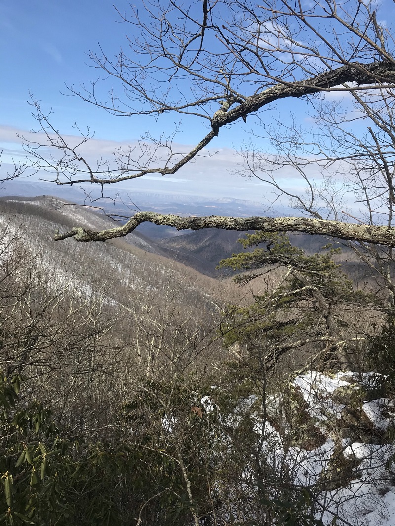
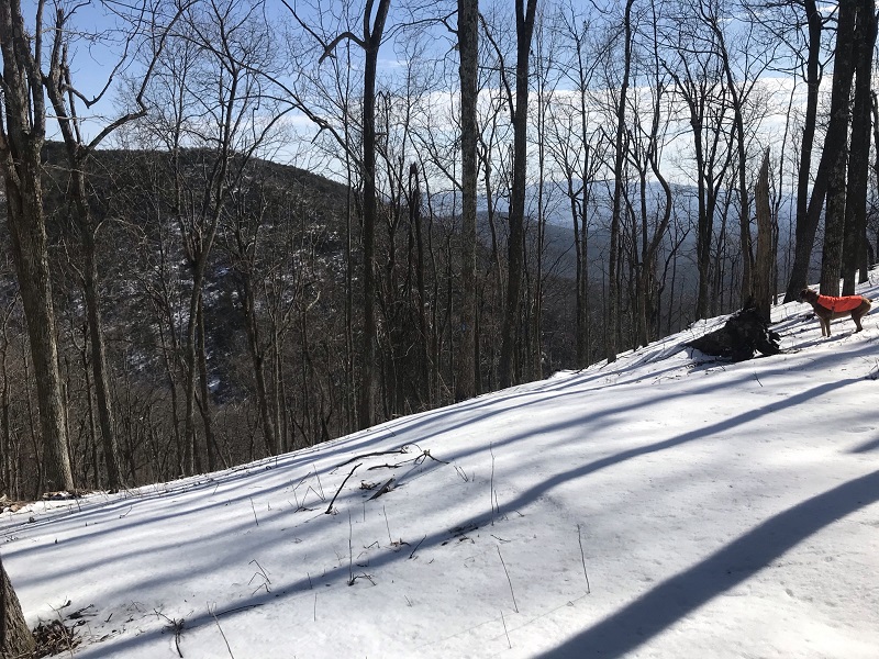
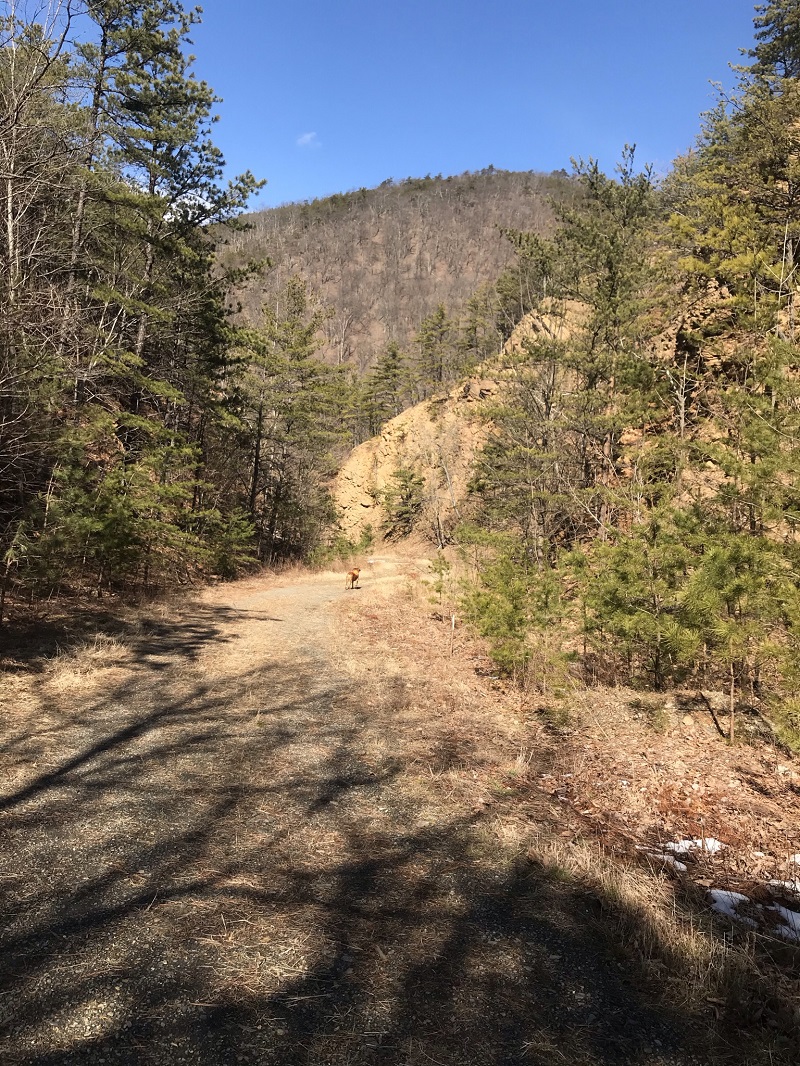
Mile 2.4 - The Saddle Gap Trail ends at the Appalachian Trail. Take a right here, following the A.T. northbound. (Going left takes you to Fullers Rocks 2.7 miles to the south and is described in HikingUpward’s Big Rocky Row hike description.) Northbound, the A.T. skirts the summit of Silas Knob on its western edge, reaching the high point of this loop between 3 and 4 tenths of a mile past the end of the Saddle Gap Trail. Extreme caution should be taken hiking this trail section in the winter. Traversing the western facing slope means shade, so ice is possible on this part of the trail even when the rest of the loop is dry. In March, 2021 a hiker had to be rescued from this trail section after slipping and tumbling down the slope. The A.T. here is likely to have snow and ice long past when snow on other trails have melted. There are some nice winter views to the west along this section.
-
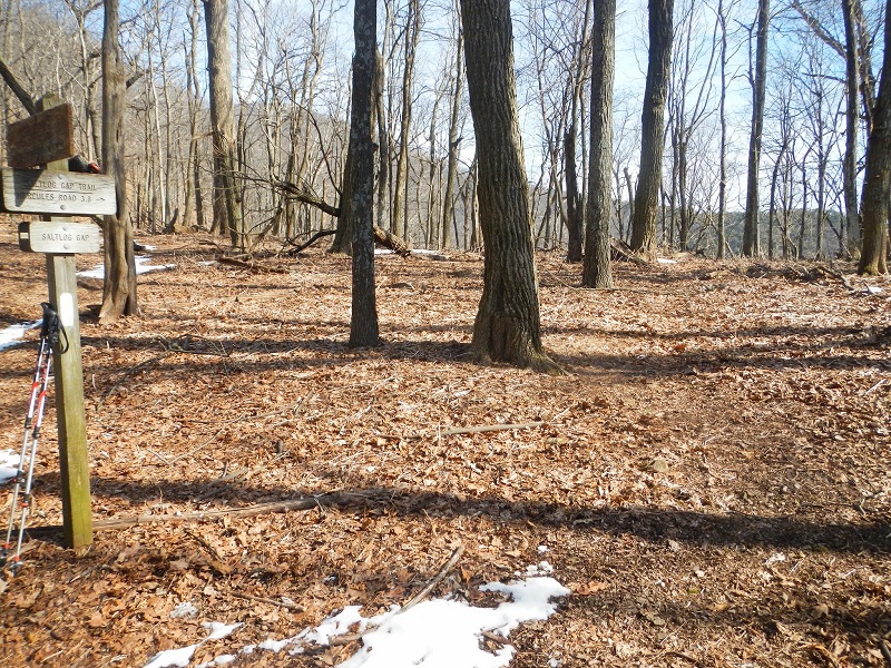
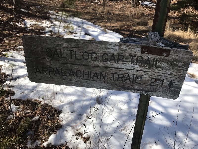
Mile 3.5 - Reach Saltlog Gap and a sign for the intersection with the Saltlog Gap Trail. This area has a flat section that is the single best camping option on this loop.
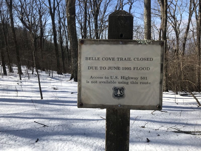
Nearby remains a sign stating that the Belle Cove Trail to the west is closed following a flood in June of 1995. I always find it interesting that such a sign would remain in place a generation after the trail was closed and de-commissioned. I asked Forest Service representatives about this several years ago, and they said they planned to take it down, but they never have.
From the sign for the Saltlog Gap Trail, take a right and expect to have trouble finding the blue blazed trail for the first hundred feet, especially if leaves are down or snow covers the area. Blazing is lacking in this area! This will be the single hardest part of the hike from a directional standpoint; note that the trail does not follow the ridge as you might expect, but drops into a small cut in the mountains slightly north of the ridge. Head at about a 2 o’clock direction after reaching the sign. After about 200 feet, the trail is obvious as it cuts a path across the slope that drops from south to north. For the next 2/10ths of a mile, the trail drops in elevation before levelling off for about 6/10ths of a mile. From here, you will be descending for the rest of this hike. There are several nice winter views along the trail.
-
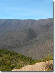
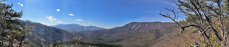
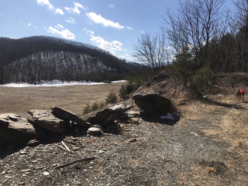
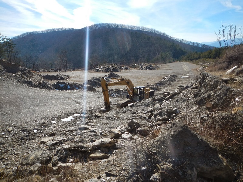
Mile 5.0 - About 1.5 miles after its start, the Saltlog Gap Trail merges into an old woods road, which is marked on some maps. This road intersects near the summit of Peavine Mountain. Shortly after that, you will come to the single outstanding year-round vista of this hike, at the edge of an old, unused quarry. (Don't look down!) From here you can see the rocks that form Rocky Row, and which cut down to the James River to form Balcony Falls. On the other side of the James River - which is unseen from this vantage - are the more distant mountains of the James River Face Wilderness and Apple Orchard Mountain.
The trail then descends to a sharp right turn, marked in the other direction by a sign at belt height and comes out on the edge of the old quarry you saw from above. This quarry was still occasionally active as recently as 2014, but has not appeared to have any use for the past several years.
-
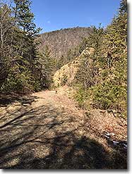
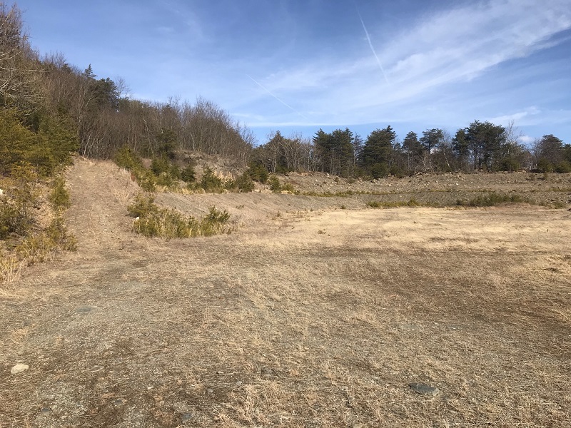
Mile 5.9 - After descending into the quarry in a spot marked on maps as "Slaty Gap," the rest of the hike followed the access road, which is a continuation of the road where you left your vehicle, Hercules Road. The quarry is the reason for a strong recommendation to hike this loop in the direction described, as first timers here would have a tough time finding the trail through the quarry in the opposite direction. When you reach the quarry, you follow the roadbed to the right as it descends into the main open area, and stay to the right on the road that exits the quarry. The rest of the hike back to the car is via the quarry access road, which is blazed blue but not terribly scenic. At one point the road was cut through some hills, giving you the feeling of walking through a canyon.
-
Mile 7.2 - Reach the gate and your vehicle.
|

