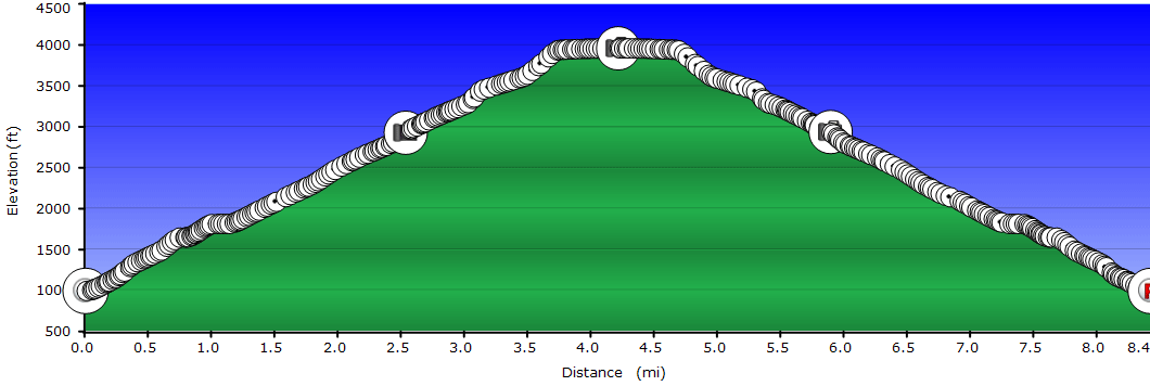
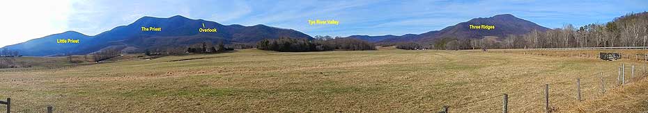
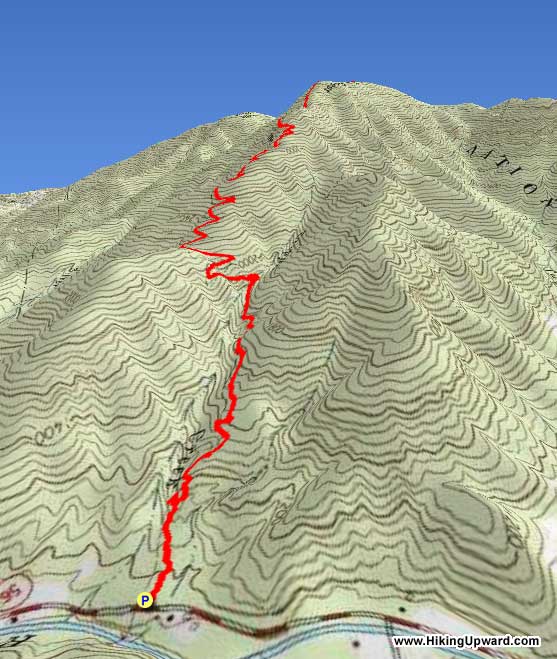
Many folks express great fear when thinking about hiking The Priest from VA 56. Although The Priest isn’t found on the list of the 50 highest mountains in Virginia, it rises straight up from the valley floor and forms part of an impressive skyline when driving in from the Tye River Valley. This hike involves a 3000 foot elevation gain (higher than any trail in West Virginia), however the trail is seldom steep along the way, and can be better characterized as “unrelenting” rather than difficult. Once the trail starts climbing, it maintains a remarkably constant 13% grade for 3.6 miles before steepening slightly for the last 0.3 mile to the summit.
Coordinating with a second vehicle as a shuttle, you can combine this hike with a descent along the Crabtree Falls Trail to check off two great hiking destinations in less than 10 miles with less downhill stress on the knees (and more company) than hiking back down The Priest.
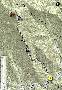
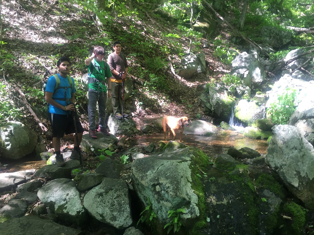
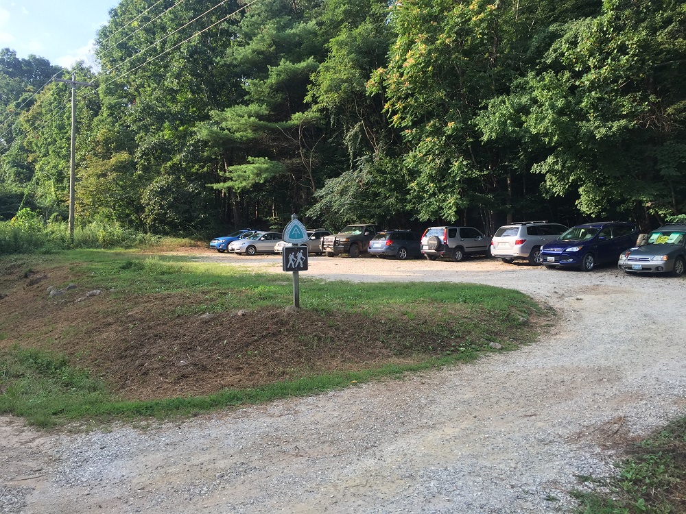
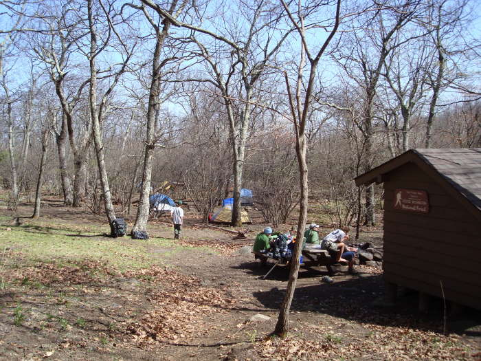
Mile 0.0 – The hike starts at an A.T. parking area on Virginia Route 56. The lot holds about 20 vehicles, and can be crowded on nice weekends. From this spot, southbound hikers climb The Priest and northbound hikers climb Three Ridges. Be sure to lock your vehicle and keep anything of value out of sight – stories abound of occasional break-ins here through the years. And, if climbing The Priest, go the correct way - don’t cross the highway! Enter the woods to the left of the information kiosk.
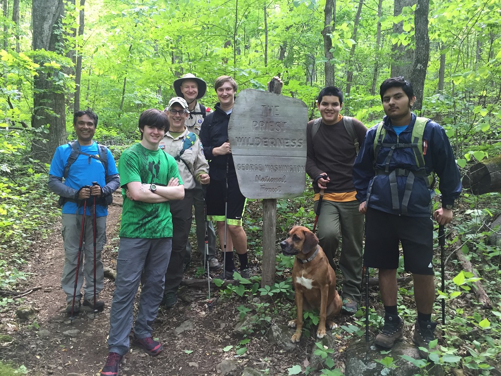
Mile 0.1 – Enter into The Priest Wilderness after passing the wilderness boundary sign and begin climbing. Remember, federal wilderness regulations prohibit parties of more than 10 people within wilderness areas. Leave no trace!
Mile 0.6 – After ascending via several switchbacks, the A.T. cuts left on an old woods road.
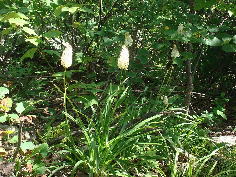
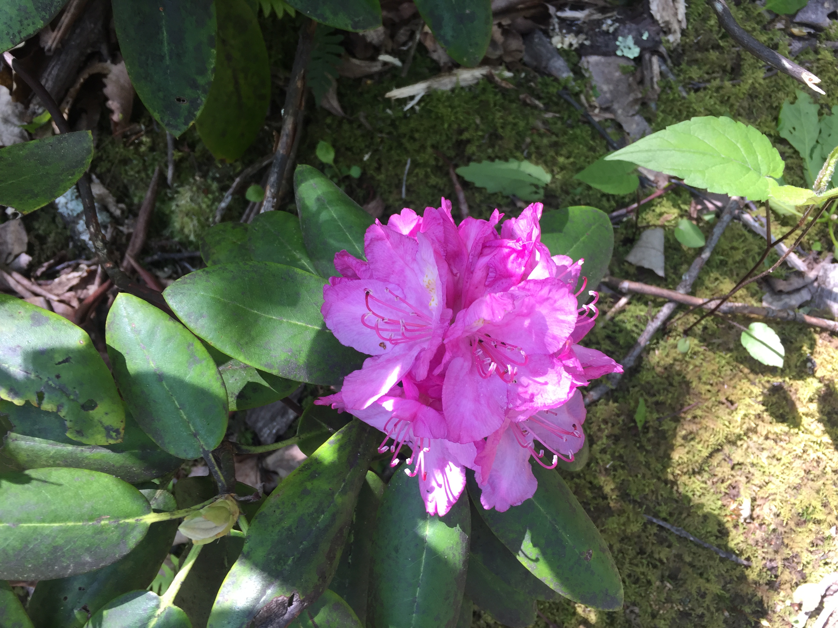
Mile 3.9 – Reach the summit after numerous false summits and switchbacks. If you hiked here in late May or early June, you may have seen the Eastern Turkeybeard flower, which grows above 3500 feet elevation along the trail, along with a few thru-hikers. Continue on the A.T. for approximately 0.4 mile, over level ground.
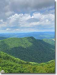
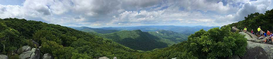
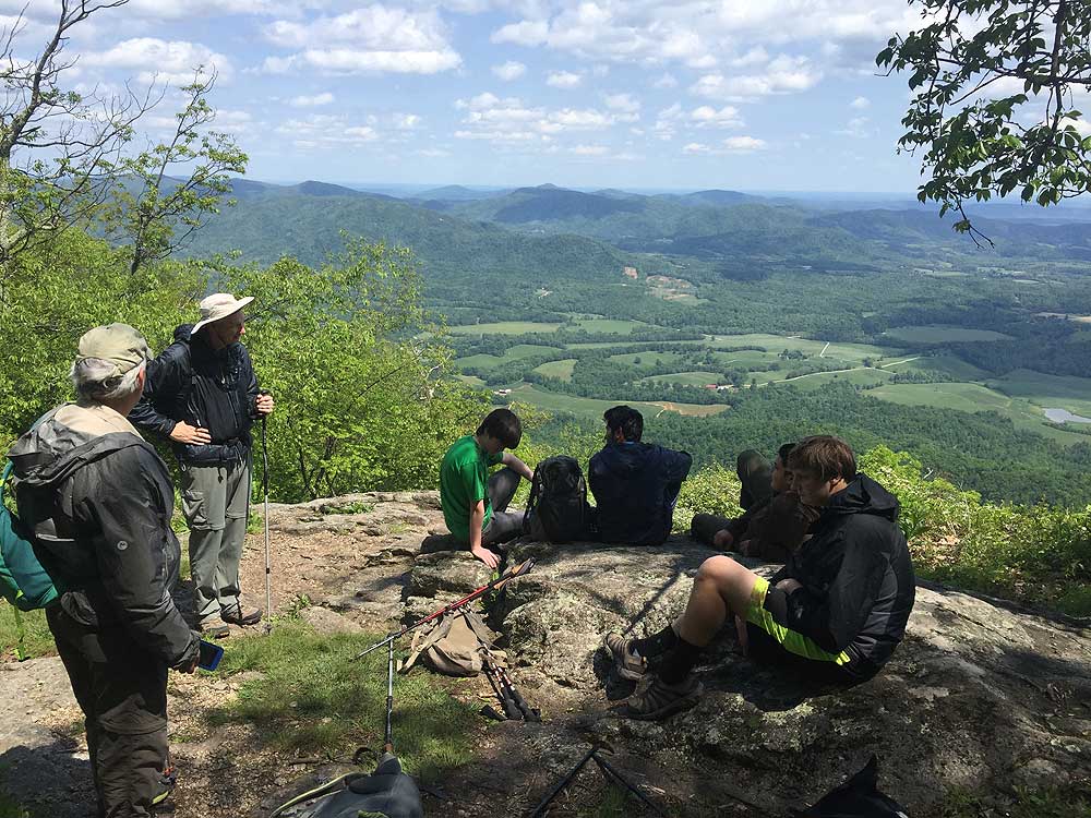
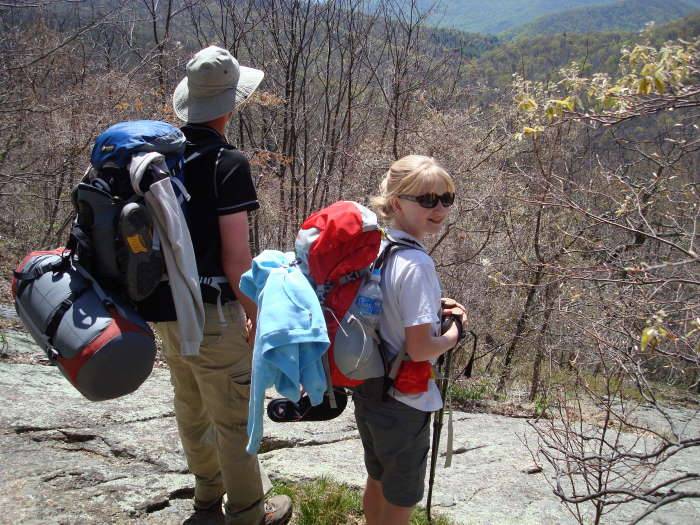
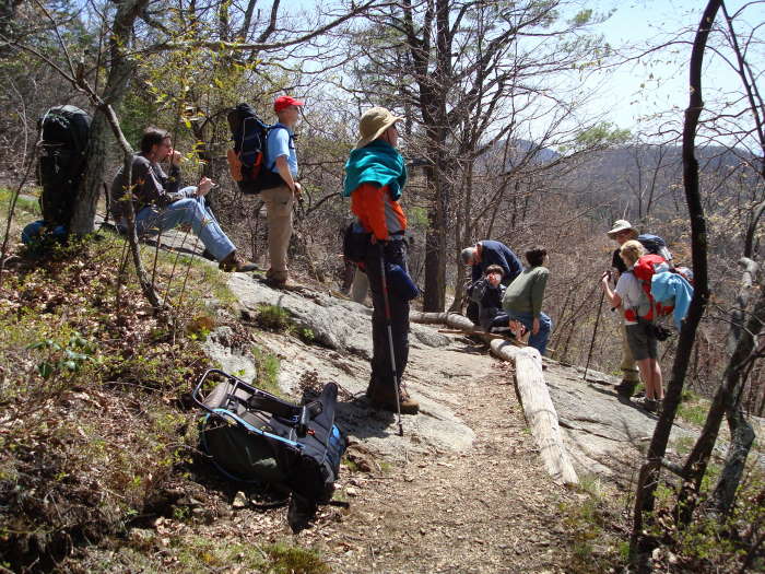
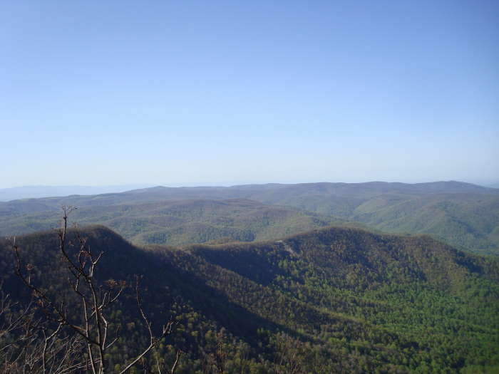
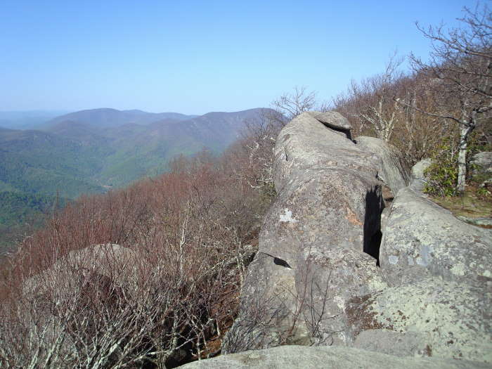
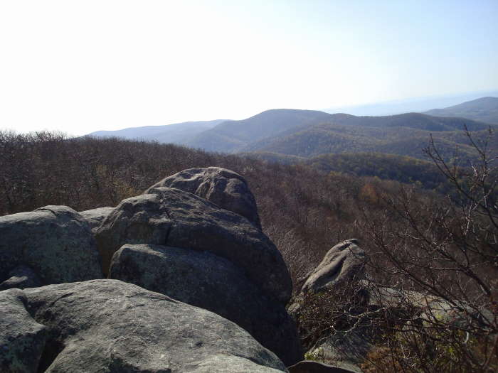
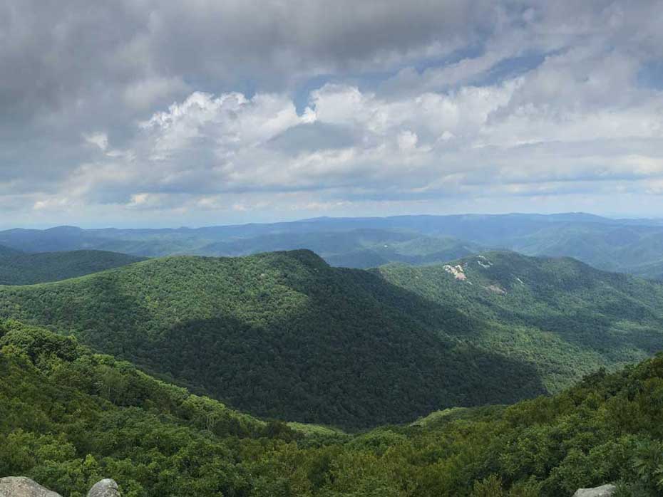
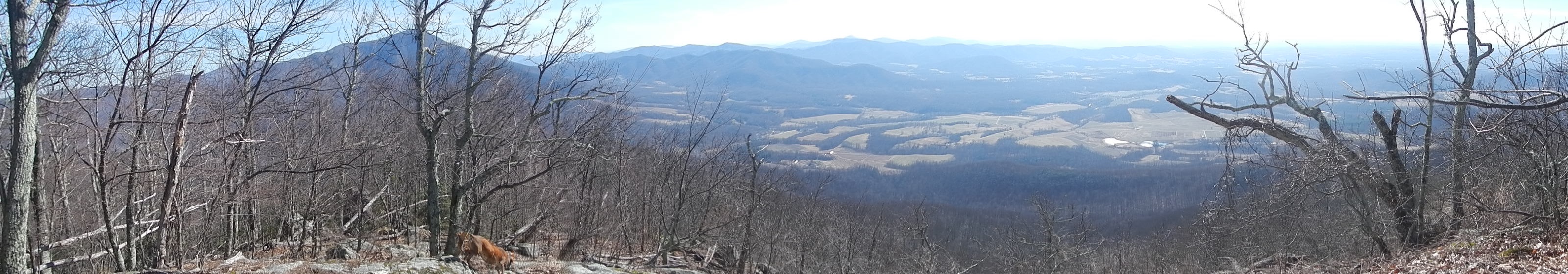
Mile 4.3– After passing numerous smaller trails that lead to potential campsites and dead ends, follow a well worn trail right to a large set of rocks on the western edge of the summit. These rocks give an overview to the west and north, including Three Ridges and mountains in Shenandoah National Park. By looking carefully, you can see the Blue Ridge Parkway knifing through the mountains several miles away. Return the way you came if you have a single vehicle.
Mile 8.6 – Return to your vehicle after following the same route back down the mountain.
Late August
Early May
Video
The Priest Overlook
The Priest Hike Comments
Archived Comments
By:MarkHikes
Rating:
Date of Hike: Saturday, November 9, 2019
The Priest is a good name for this hike because you may need one as you die on the way up. The difficultly of this hike is what makes it rewarding there's something nostalgic, alpine, and supremely satisfying about literally climbing a mountain and coming back down in an afternoon. This is an ideal challenging day trip get-out-of-the-city hike. I highly suggest doing this in mid fall as the leaves are coming down you got a nice blush of color at the bottom and at the top most leaves were down allowing for sweeping views. There are many azaleas as well so I'm sure when they're in bloom would be an ideal time as well. Took me 2 hours 45 min up, 1 hour 30 min down.
What's great about this hike:
-Two five star views, one East at Mile 2.6 and the other at the finish looking West
-Cripple Creek on the first mile is very beautiful
-During mid fall there's always something to look at, you get mountain views throughout
-Immense feeling of accomplishment
-Even though it's a 8.6 mile hike, only the first 3.9 miles are difficult. It's really a 3.9 mile brutal stair climb followed by a leisurely stroll and descent.
-The directions on Hiking Upwards are perfect. Print them out and bring them.
What's not great
-3.9 miles of leg burning
-Leaves down in fall made for a sometimes slippery descent
-Sun to shade and wind to no wind make for massive temperature differences quickly. Wear layers accordingly.
By:Andrew
Rating:
Date of Hike: Saturday, August 31, 2019
Started this hike at 7:30am, about 65 degrees. It quickly got hot. Took about 3 hours to get to the summit with 2-3 water breaks. It is just a steady climb the entire way with only a few "steep" sections. Had it in my head the top was at 3 miles or so became a little frustrated when 3.25, 3.5, 3.75 all passed and I was still going up! Only took about 1.5 hours to get back down to route 56. Passed 13 other hikers on my way down and just told all of them "good luck".
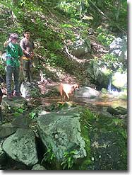
Passed a couple with dogs- NOTE: there was only one stream that had some water in it at about a mile into the hike. There is no other water for dogs further up the mountain as the other two streams were dry. Make sure if you bring a dog with you, bring sufficient water for them as well, especially on hot days. Those two dogs were panting up a storm.
By:Arnold Sullivan
Rating:
Date of Hike: Saturday, April 20, 2019
This is an excellent little hike. The grade is indeed unrelenting, but my only slightly fit but and my occasional hiker friends were able to complete it without (too much) difficulty, although that didn't stop us from getting passed by an older Meetup group with a comment of "whippersnappers" thrown our way haha. You pass several beautiful waterfalls on the way up, and a few of them offer pools where the brave hiker can take a chilly, bracing dip. I highly recommend it on a sunny day. The first overlook makes a beautiful place to stop and catch your breath, which is good because the last mile or so is quite a beast on the way up. The second overlook just past the peak of the mountain is very worth going to, and will be obvious when you see it on your right. On the way down you'll feel like you're stepping down a staircase from the spine of the world.
We had excellent visibility thanks to all the rain on Friday, and the view was verdantly green in all directions. Pollen was low, there were enough sleeping brown trees to see through the forest but enough green to give everything at lower altitudes a beautiful color, and all in all it was a beautiful day for a walk in the woods.
By:C Lewis
Rating:
Date of Hike: Saturday, April 6, 2019
I've heard about The Priest for years and always thought the hike was beyond my ability. I'm 57 and in reasonably good shape, but I would say this is long and arduous but do-able for sure. So maybe it's reputation precedes itself?
Several of the reviews here are NOT for the NorthBound hike from Rt. 56 but are from the AT coming southbound from Crabtree Falls or SpyRock. That trek is difficult (I did it a few weeks ago), but it does not compare to this NOBO hike straight uphill for 4.5 miles and 3,100 feet.
I don't understand the reviews that say that this hike is boring. There are not any views going up until the 2.6 mile overlook, but the woods, rock formations, forest undergrowth, and creeks are stunning. (Must be triathletes who never take time to smell the flowers.)
I was concerned about the Cripple Creek stream crossing, as other on hikes this Spring (White Oak Canyon, Sugar Hollow) have been tough or impossible. It's been a wet Spring and we had rain yesterday, but it was easy as the rocks are huge.
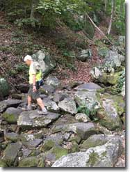
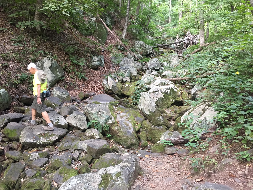
This hike consists of 2/3 of the mountain with earth or scree trail for the most part, with the described 13% average grade. But the last 1.5 miles or 1/3 at the top consists of rocky underfoot, requiring placement of feet going up and coming down. And it's a much tougher grade, so that's where The Priest's reputation is earned. The view at 2.6 is amazing, as is the view at the rocks past the summit.
As other reviews stated, the summit is unmarked but when the trail flattens out and you are at the highest point, and sort of near a campfire area, you are there. The rocks with the view are .3 or so beyond and off to the right. You can't really miss it.
For older or injured knees, the downhill retracing the trail is tough. Treking poles are helpful. The suggestion to park a car over at Crabtree and exit by hiking through is a good one.
Can't wait to do this again.
By:Nate Dolan
Rating:
Date of Hike: Saturday, April 6, 2019
I and a friend hiked this trail, couple notes:
- Yes the trail does climb consistently, but with the switchbacks and relative short length of the overall trail it is very doable
- Well worth continuing on the last 0.4 miles to the large rocky overlook to the right of the trail
- Leaves were still off the trees so it was very pleasant to have great views of the surrounding area hiking up and down the mountain, I had thought retracing our steps would be a little dull but with the changing views, going back didn't seem redundant
- Parking lot was less than half full at 9 AM on a Saturday
- I will likely do this again but include Spy Rock
- Trail was very easy to follow, we saw a few people on the way up, and several people on the way down
By:VA_hiker
Rating:
Date of Hike: Saturday, November 3, 2018
Lots of hikers, lots of campers at the top, loud music, cigarette butts. Such a shame.
Difficult hike (did the over 8 mile route) but beautiful, well-maintained trail. I would give this one not very much solitude at all.
By:David
Rating:
Date of Hike: Saturday, October 20, 2018
We did a single overnight backpack up to the top of Priest, stayed over, and back the next day. Parking overnight at the trailhead (Priest Wilderness parking area on Rt. 56) was fine - space permitting, at your own risk of course. Looked like several groups were doing it. Be warned this time of year: camping at the top was cold and VERY windy. Be prepared. Otherwise, fairly straightforward, there are good sites around the Priest shelter and several other spots around the peak. The hike itself is, on the whole, moderately difficult. The distance isn't bad and trail quality is good, but 3000' is just a lot of work. I'm not in especially good shape, and my legs sure were glad I wasn't trying to go up and down the same day. The ridgeline is special and beautiful, though, worth the effort.
By:Living the dream
Rating:
Date of Hike: Saturday, June 16, 2018
This hike is no joke. There is no "warm up" before the climb. My husband said it perfectly, "It's like climbing stairs all the way up". There are very very few spots that kind of "levels out", but not enough to really count. Over all a challenging but pleasant hike in the trees. You pass a few streams along the first mile and a half. You are pretty much shaded by trees the entire time so it makes for a nice temperature even when the sun is out. The pay off would be much better if there wasn't people up there. But it is a well known spot so there was 6 other people that arrived after us and we saw a dozen more going up on our way back down. Also, if your are tracking this hike with GPS, and going NOBO on the trail, the turn off to the view is at about 4.75 miles from the sign saying "The Priest Wilderness, George Washington National Forest". Making this hike just over 9.5 miles. And we didn't really go off trail till the side trail to the view.
By:Karen K
Rating:
Date of Hike: Sunday, January 15, 2017
Parked at the lot on Rt 56 and did an out-and-back (about 9 miles total) to the Priest shelter. FANTASTIC view at the summit IF you head off the trail when if flattens out (through an obvious camping site just off the trail, about a half mile before the sign pointing to the shelter) to the right. Don't miss that 20 yd detour! It took us 5 hours round trip which included stopping for lunch and photos. I think we hike at a moderate pace.
By:JT
Rating:
Date of Hike: Sunday, January 1, 2017
From a trail runner perspective, this is one of my favorite challenging runs in the area. The SOBO AT from route 56 is shy of 9 miles out & back. The trail starts with about 700' of elevation per mile and then continues to increase to about 850' of elevation per mile. It is nearly continuous uphill with very few areas of relief. The trail gets rocky in some areas as you get about 3 miles from the trailhead. There are a couple of creek crossings early which are easy to avoid getting shoes wet. Overall the hike/run is a great indication of your physical state.


