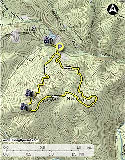
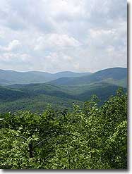
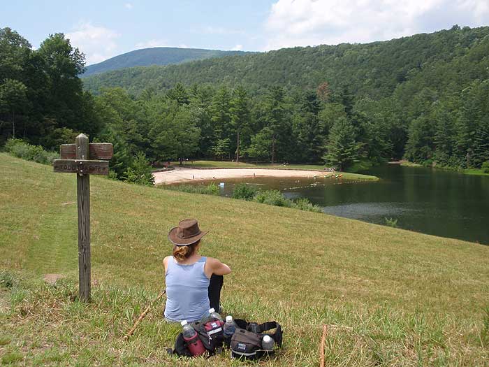
The Trimble Mountain loop is an easy to moderate loop situated just opposite the Todd Lake Recreation Area on FDR95. There are several views of Big Bald Knob and Little Bald Knob on the western section of the loop. At the end of the circuit, the short climb up to the Todd Lake dam embankment offers a beautiful lunch spot, and view of the lake.
The Trimble Mountain Hike is just one of many hikes that are located in the Todd Lake area. A great weekend plan is to come in on a Saturday and hike Trimble Mountain, take a dip in Todd Lake, camp at the Todd Lake campground, then hike the North River Gorge circuit early Sunday before leaving.
The Todd Lake Campground has clean shower and restroom facilities, as well as a sandy beach and picnic area at the lake. The campsites are $16 per/night, and are on a first come first served basis. Reservations are not accepted. If the campsite is full, there are numerous free camping spots available along the North River off FDR95. Todd Lake Recreation Area is open from Memorial Day through Labor Day.
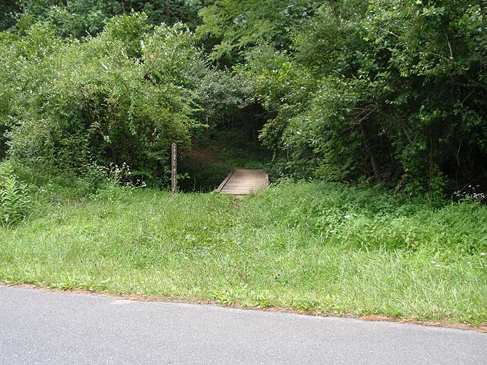
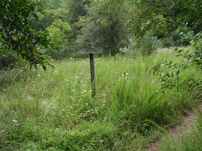
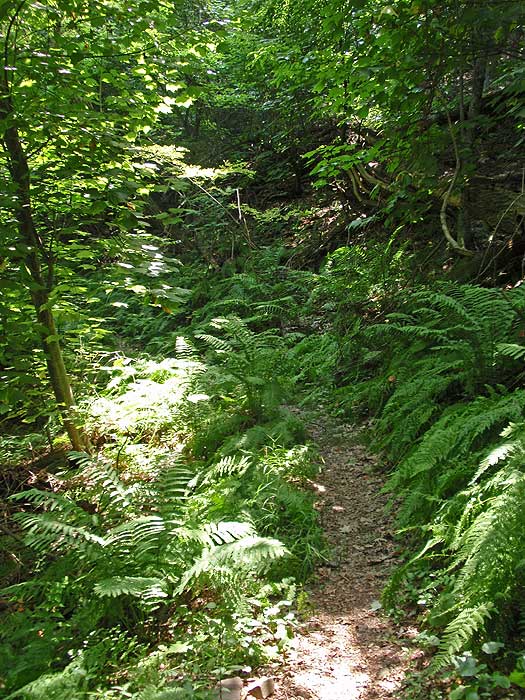
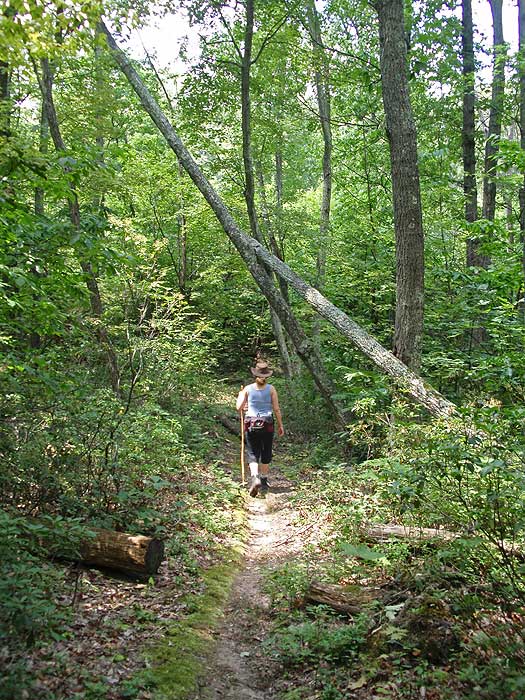
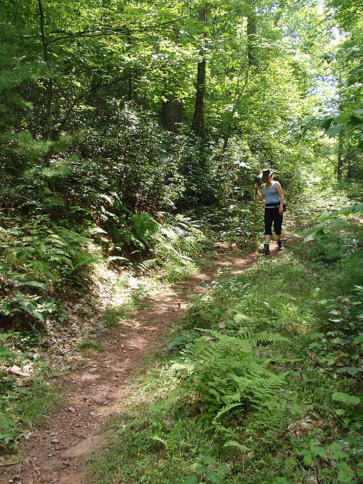
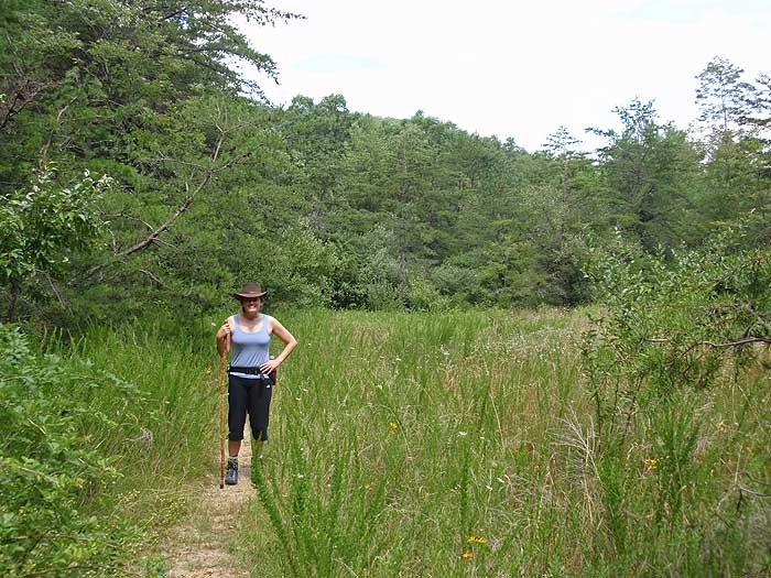
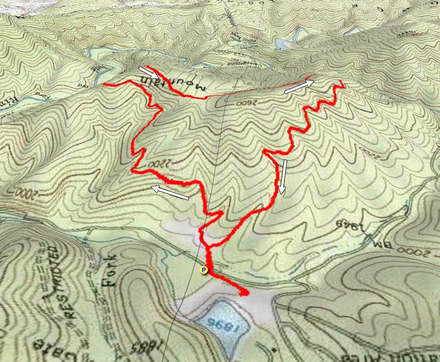
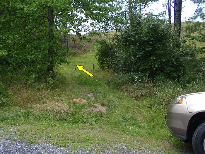
From the parking area walk up to the turnout, cross FDR95 and start up the yellow blazed Trimble Mountain Trail. In 400ft the Trimble Mountain Trail will split at a clearing. We recommend going to the left, or clockwise, as it's less steep on the ascent, and the best views are on the westerly descent of the mountain.
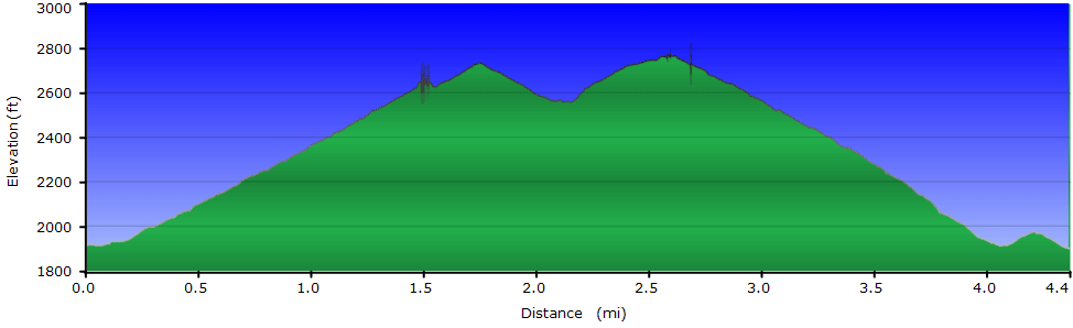
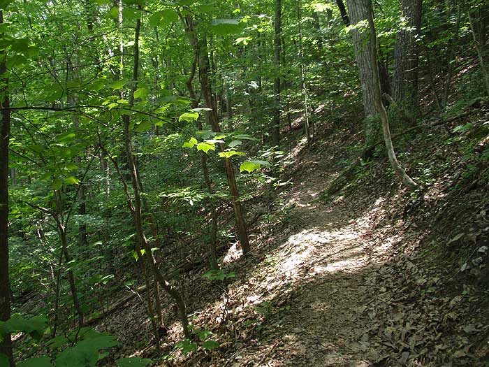
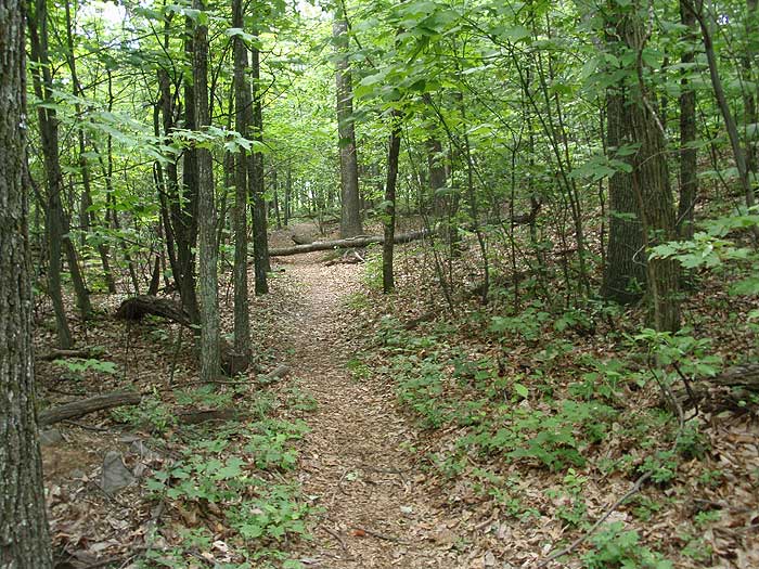
After turning left, the trail will gradually climb Trimble Mountain becoming steeper before arriving at the ridge in 1.2 miles. The trail will follow the ridge climbing the northern summit, before passing through a saddle and climbing over the southerly summit.
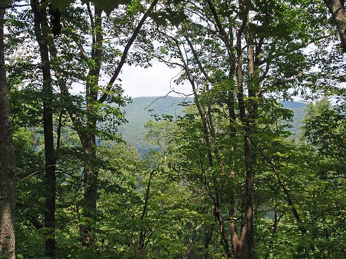
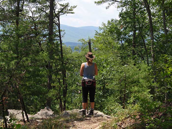
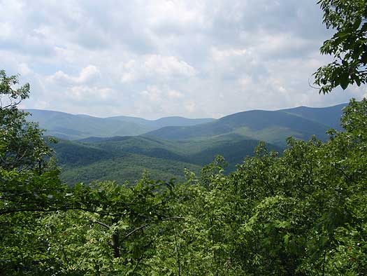
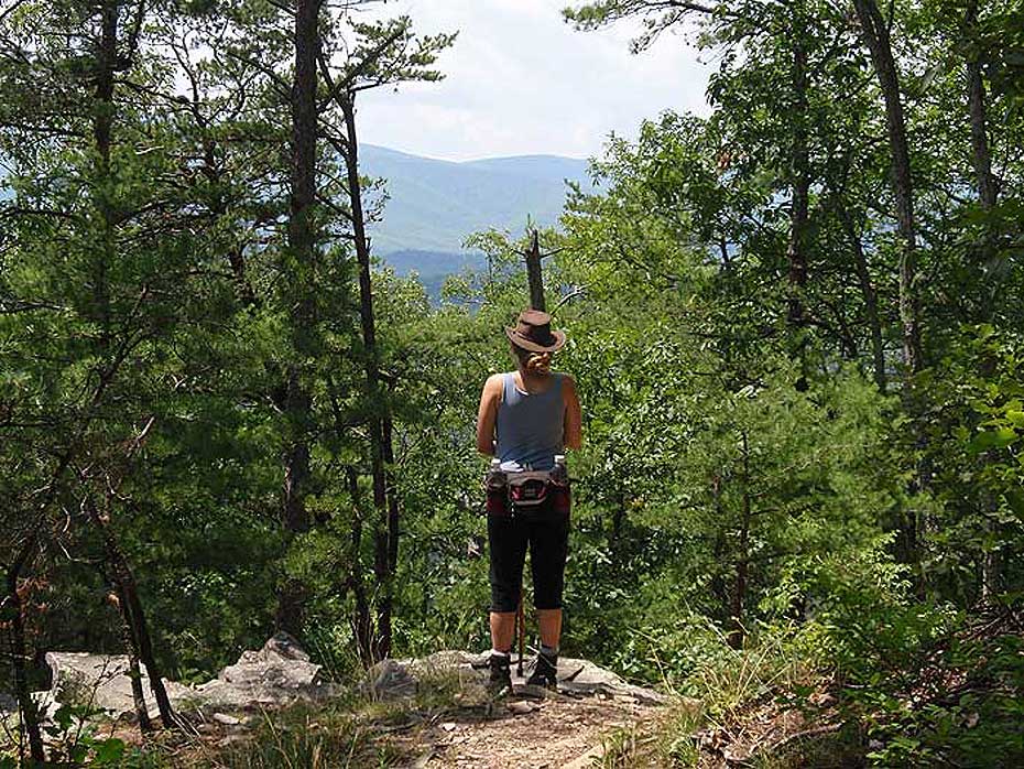
As the trail begins to descend the westerly section of Trimble Mountain, there are two good vistas of Big Bald and Little Bald Mountains to the west. The trail will then descend more steeply before arriving back at the clearing, and beginning of the loop 1.0 miles from the last vista. Stay left returning to the parking area in another 400ft.
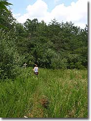
Lake View Out/Back: After returning to the parking area make sure to continue following the yellow blazed trail up to the crest of the dam for a beautiful view of Todd Lake and lunch spot.
Late July
Trimble Mountain
Trimble Mountain Hike Comments
Archived Comments
By:Kylena
Rating:
Date of Hike: Friday, March 23, 2018
This was a lovely hike in the aftermath of our recent snowstorm! Views of surrounding mountains are incredible since there is no foliage on trees yet. Directions were great and even though we were the first boots to break the trail, the route was an easy follow! A few down trees, but nothing too difficult to crawl over!
By:Rainchell
Rating:
Date of Hike: Sunday, November 12, 2017
Hiked this with a large group of adult and children (5-12). Great family hike! Not much in the way of views, but still enjoyable. Sheltered from wind and fairly easy (all children made it out). I would do this hike again.
By:Jess B
Rating:
Date of Hike: Thursday, March 24, 2016
I really like this hike. It's not much for stunning views, but it curves around Trimble Mountain and is nice and quiet. Took me a little over two hours, including a 15 min break. I too went right where left was recommended, and would also recommend that - the climb is steep and would have been a bit precarious on the way down.
By:John
Rating:
Date of Hike: Wednesday, March 23, 2016
We also liked this hike very much.
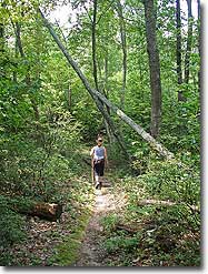
We parked directly across FR95 from the trailhead in the grassy shoulder on the north side of the road. We followed the clockwise path (turned left at the "t") and found the climb to be consistently gradual. A "3-star" difficulty seems reasonable - perhaps a tad high. We took several breaks but just because we are all retired and are frankly not in too much in a hurry. The trail was fairly well-maintained (could use a chainsaw to clear some trees that now block the path). There also were very long stretches with no yellow blazes. It really didn't matter as the trail was clearly evident - might be different in the late fall with leaf debris potentially hiding the trail.
Lots of interesting plants, a few birds on the back side of the hike and, overall, a very pleasant hike. Passed a pond on the way down with a nursery of frog eggs 6-8' in diameter. Interesting place.
This website rates the views as "3-star", which is about right. We are actually not quite sure when we passed the "lookouts" denoted on the map. The lookouts were certainly less evident as on other trails we have hiked. That said, we had nice views when we could sneak a peek through the trees. Might be more difficult after the trees leaf out.
Our party of six has the mountain to ourselves - could have brought our retrievers in hindsight but we prefer to scout out new hikes first before including them. They would have been fine on this hike...and will join us next time.
Saw a small bear grazing on the east slope of the Todd Lake embankment while we were relaxing afterwards. 1st one of the year.
All in all, a good day in the GWNP.
By:TimL
Rating:
Date of Hike: Friday, April 18, 2014
The marked parking space on the trail head now is with the "No Parking" sign. We have to walk up half a mile near the Todd Lake recreation area (also closed) to park car outside the gate. The trail is fairly easy to walk through, our four children aged from 5 to 8 all completed on their own in 3 hours. The starting point elevation is 1,935 ft. (by our Garmin eTrex 30), the highest point is 2,600 ft., so the gain is about 700 ft., vs. the 1050 ft. gain claimed on intro page. It is a fun family trip.
By:DeeJ
Rating:
Date of Hike: Sunday, August 25, 2013
Overall a nice hike. Was put off a little at first by the NO PARKING signs at the dump station. I had passed a ranger on the way in, so I backtracked and asked him where I should park. HE SAID just don't park BEHIND the NO PARKING signs. He said parking on the grass along the street or in front of the sign is 100% acceptable. The main thing they have issue with is blocking the dump station. As long as there is room for a trailer to go through you won't be ticketed.
The hike itself was pretty good. We're in the middle of summer at the moment and there were essentially no views, but we saw a decent amount of wildlife. The right side path is much, much steeper and feels a little sketchy when you're tired from the hike up. All-in-all a great morning hike!
By:Garry
Rating:
Date of Hike: Thursday, February 23, 2012
DO NOT PARK AT THE TRAILER DUMP STATION. You are risking a ticket if you do. I just got home from hiking this and had my truck parked at the dump station but off the gravel out of the way not blocking anything. Was walking up just as a ranger was getting out to my truck. Luckily she didn't give me a ticket but said no parking there at all. There is a pull off a couple hundred yards before the dump station where you can park.
By:Rachel
Rating:
Date of Hike: Saturday, July 30, 2011
Nice easy hike that took less than 2 hours. You can see the lake if you cross the road as instructed and walk up the dam. The lake is not on the trail but across the road from the trail head. Would recommend this one for the fall after the leaves are off, better views.
By:Matt Sargent
Rating:
Date of Hike: Saturday, June 18, 2011
Three novice hikers did this trial starting about 2PM. The trail is well marked and easy to follow. We went right when the recommendation said left and so we up the steeper path. In the end, we felt like that was the better way for us as we would have been nervous coming down the steeper path at the end when we were tired.
Word of warning, there is no place on this hike that opens up to a lake, so beware that the photo you see on this hikes page of a nice place to sit and overlook the lake is not on this hike.
By:Woods
Rating:
Date of Hike: Sunday, February 6, 2011
Hiking Trimble Mountain was kind of a spur of the moment thing and I was not disappointed. Over all the hike took around three hours (counting a half an hour break for lunch) and was generally not that difficult of a hike. The trail head was not hard to find and the hike was kept interesting because one there was still snow at the high elevations and two just when you think you've made it to the top you dip into a valley and begin up another summit. On both these summits there really is no clear of the other mountains but if you're willing to give it a little effort the view is beautiful.
I would defiantly recommend this trail to novice hikers as it is a good way to slowly build up mountain hiking skill without to much strain.


