|

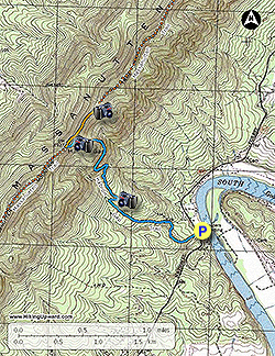
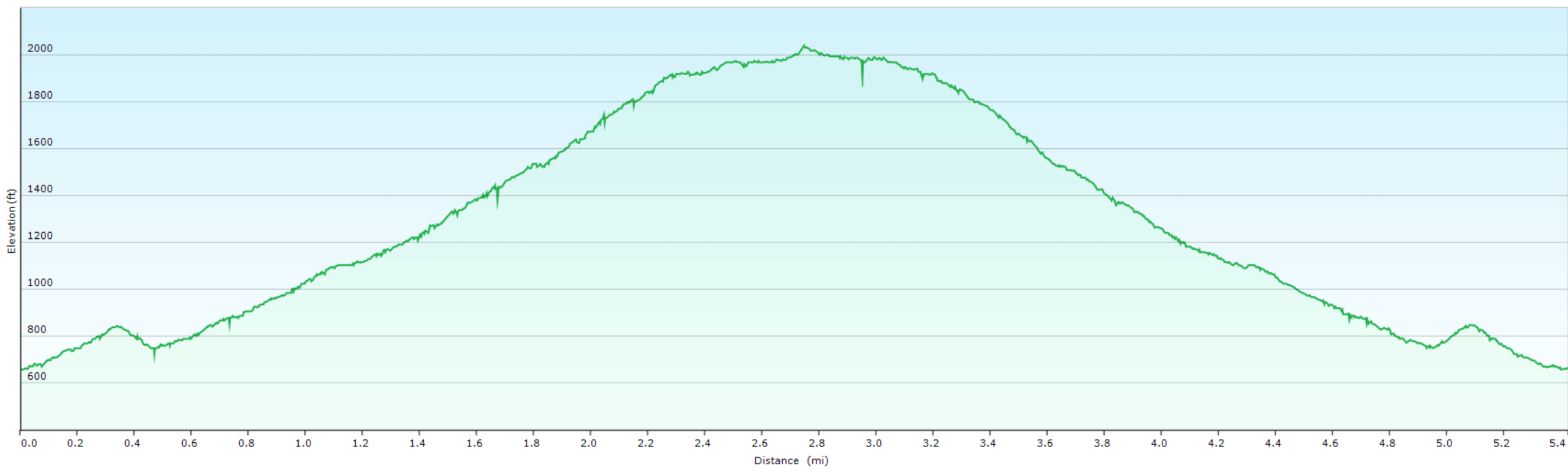
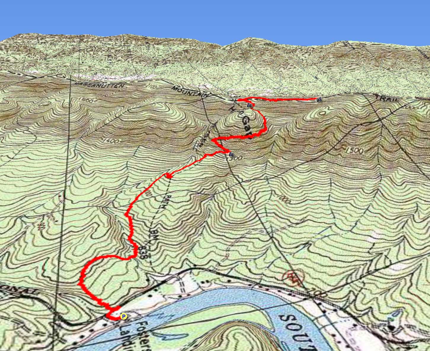
One of the least utilized trails in the Massanutten Range. The Habron Gap Trail starts next to the south fork of the Shenandoah River climbing over 1,300 feet to the ridge where it ends at the Massanutten Trail. The Habron Gap Trail is steep and challenging in places, but rewards you with several beautiful views. The Yoda Overlook, just 0.4 miles north of the Massanutten Trail intersection, has another panoramic view of the river and Shenandoah National Park beyond.
-
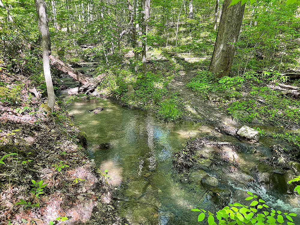
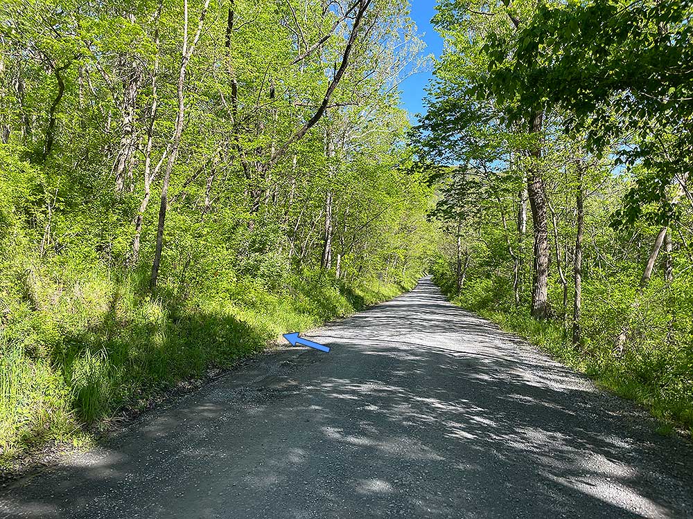
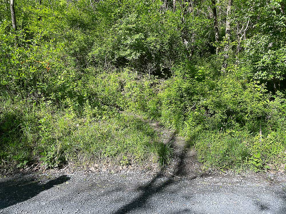
Mile 0.0 - From the Fosters Boat Ramp parking area continue north on VA684 for 50 yards to the blue blazed Habron Gap trailhead. The trail starts out climbing gradually through the lower woodland before descending slightly to a small stream.
-
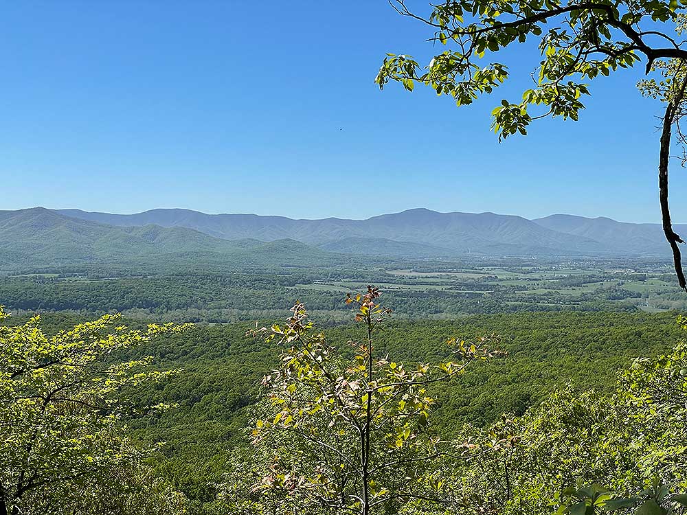
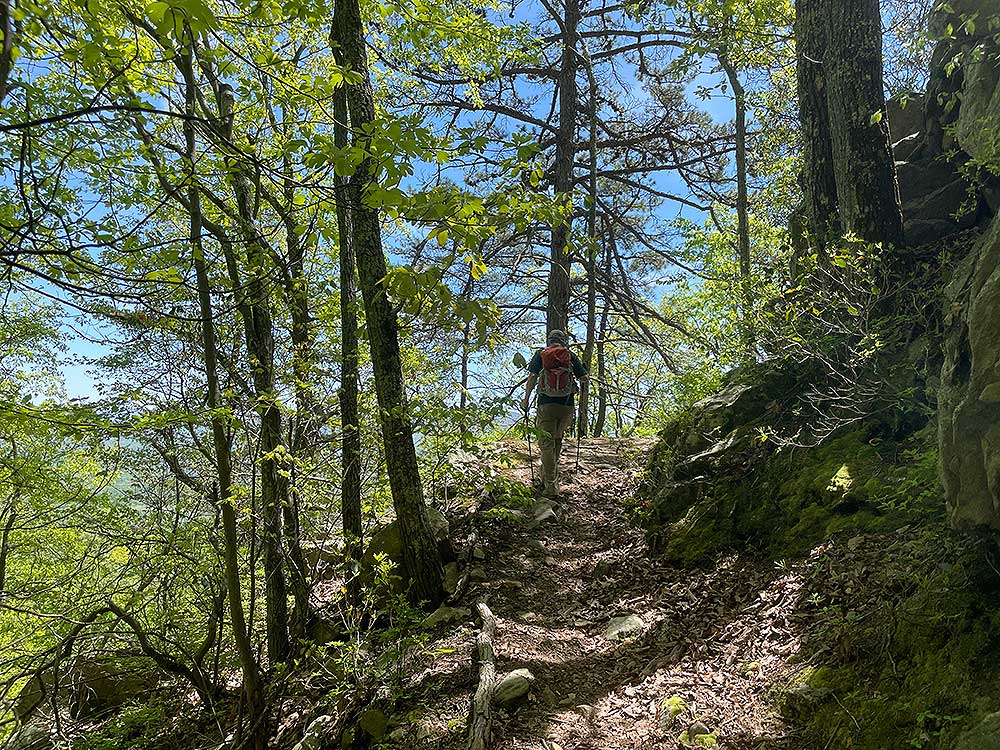
Mile 0.4 - Cross the stream and start the main ascent to the ridge. The trail passes through a hollow than makes a switchback and continues to climb steeply. The trail makes another large switchback after which there is a good view to the east. Continue around the north side of a knoll with views of the Shenandoah River. After passing around the back of the knoll the trail becomes steep again for the last climb to the ridge and intersection with the Massanutten Trail. On that final incline also pass several great views towards Luray VA.
-
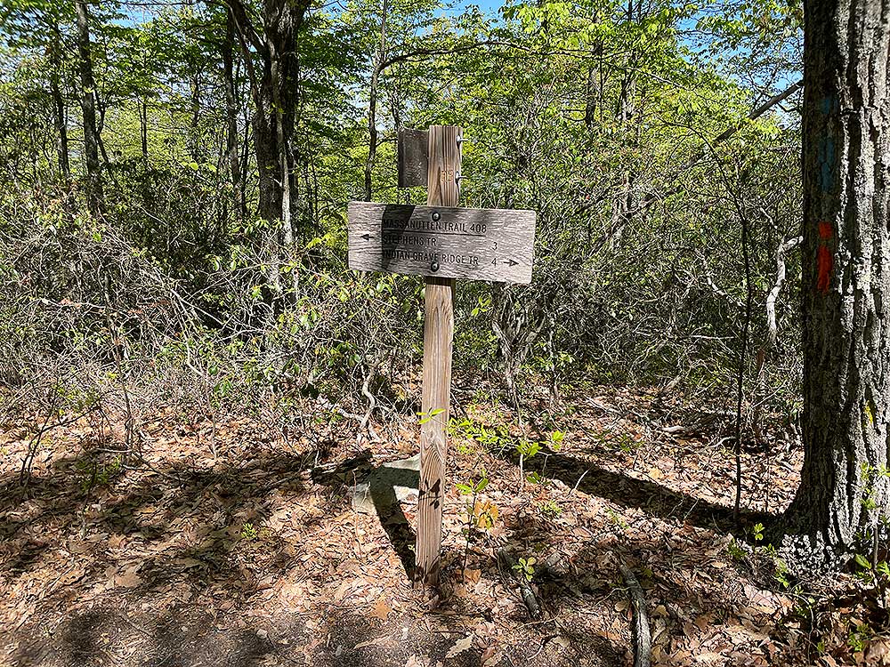
Mile 2.1 - Arrive at the intersection of the Massanutten Trail and turn right/north. Follow the orange blazed Massanutten Trail as it gradually climbs along the ridge.
-
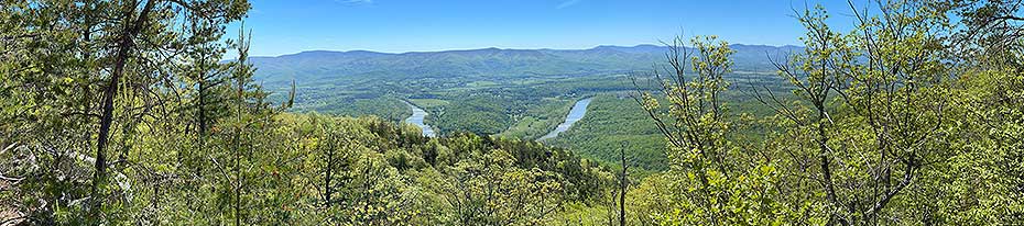
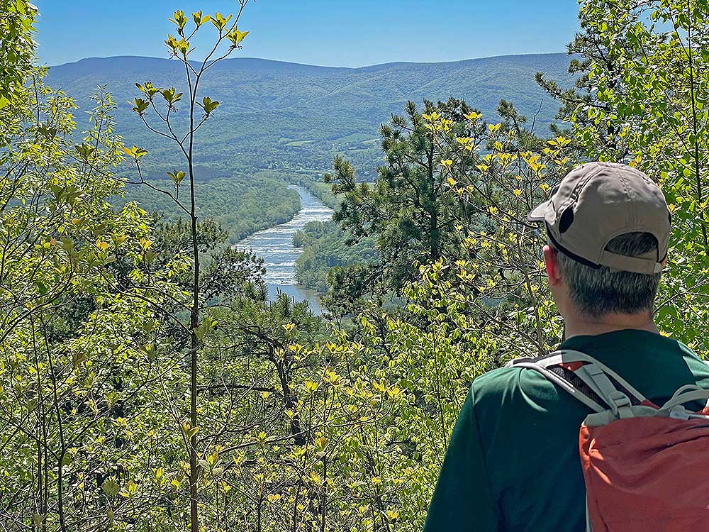
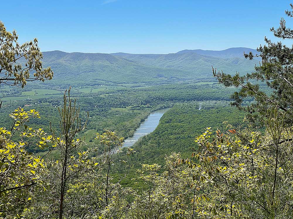
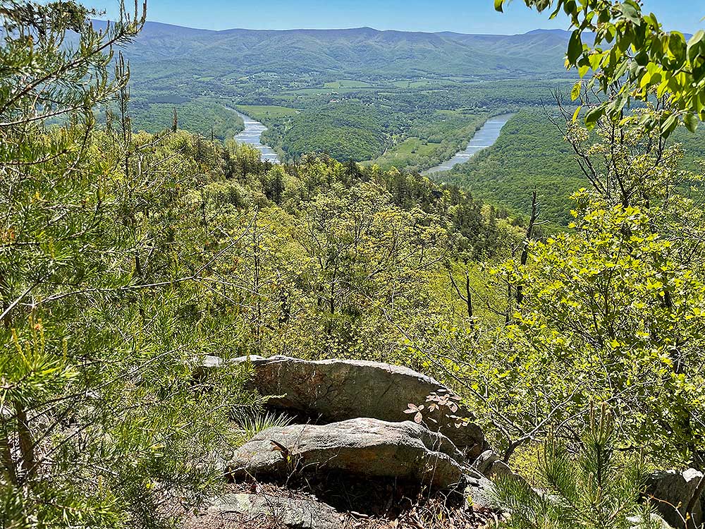
Mile 2.5 - Arrive at the Yoda Overlook in 0.4 miles. Why is it called the Yoda Overlook? We've heard from several people that the rock outcrop 3/4 mile towards the river looks like the Star Wars character Yoda. We couldn't see it, but if you do drop a note in the comments below! From here you get a spectacular view of the south fork of the Shenandoah River and the Shenandoah National Park beyond. This is the turn around so retrace your route back.
- Mile 5.0 - Arrive back at the Fosters Boat Ramp parking.
|

