|
| Length |
Difficulty |
Streams |
Views |
Solitude |
Camping |
| 5.5 mls |
 |
|
 |
|
|
Hiking
Time:
Elev. Gain:
Resources: |
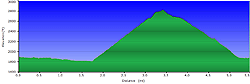
3 hours with breaks
1,503 ft
 Topo Hike Trails Map (PDF) Topo Hike Trails Map (PDF)
Blue Bend WV Weather Forecast
Garmin (GDB), Gaia/Trails App (GPX) (What's
this?)
3D View of Route |
 By Trail Contributor: Jeff Monroe (Email Jeff) By Trail Contributor: Jeff Monroe (Email Jeff)
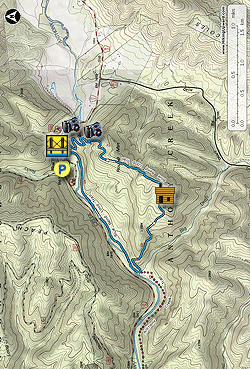
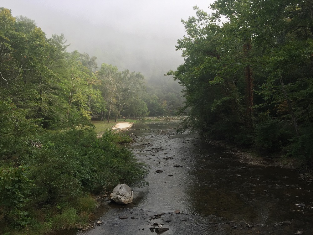
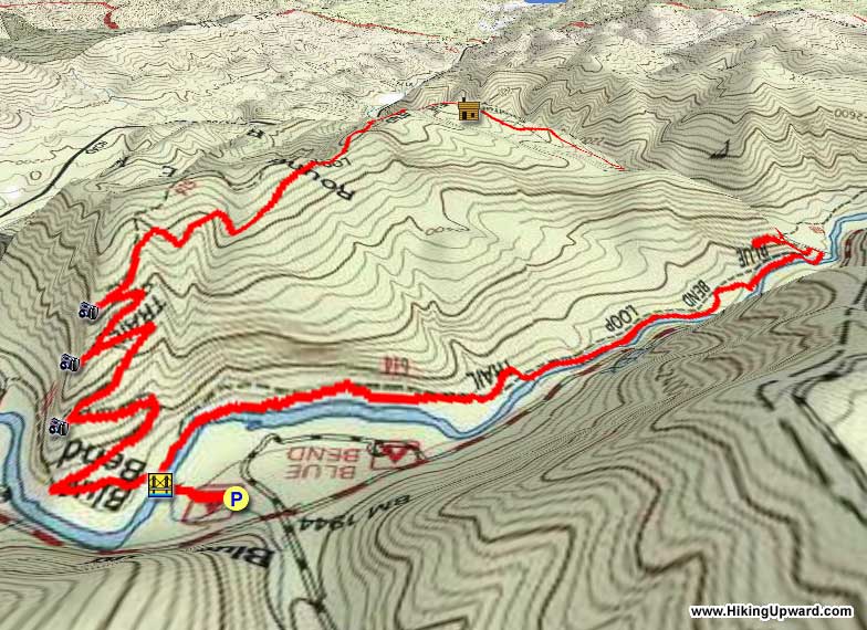
The Blue Bend Loop Trail starts and ends in the picnic area at the Monongahela National Forest’s Blue Bend Recreation Area. In 1994, the National Park Service listed the Blue Bend Recreation Area on the National Register of Historic Places as “an outstanding regional example of the work of the Civilian Conservation Corps.” Constructed from 1936-1938, the NPS determined that Blue Bend retains a “designed rustic” character to this day, with many of the original structures still intact. Blue Bend is a wonderful place to consider a summer family camping adventure, even though there are no real campsites on the trail described here. The 21 site campground includes showers and flush toilets, and a locally popular river swimming and fishing hole (known as Blue Hole) on Anthony Creek within walking distance of the campsites. The Greenbrier River Trail, one of the country’s best rail-trails, is quite close by for biking.
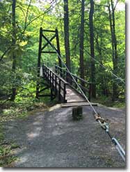
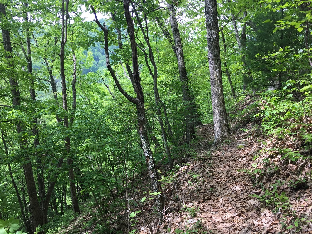
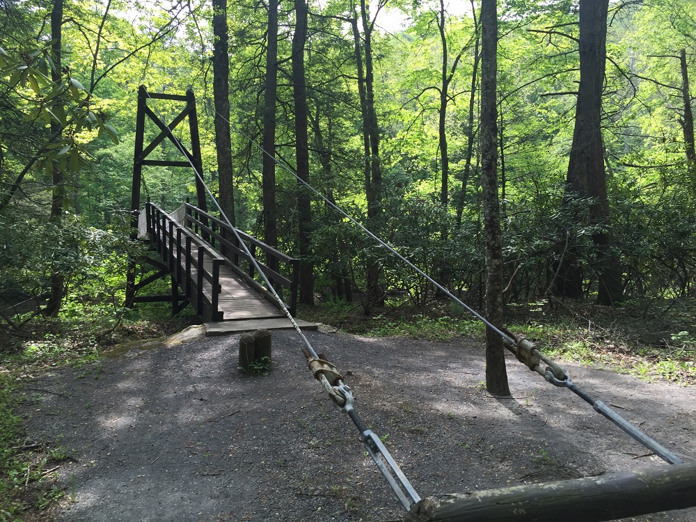
The Blue Bend Trail is located at the southern end of the Monongahela National Forest. It is within the 5,144 acre Big Draft Wilderness, the smallest of West Virginia’s seven federally designated wilderness areas. The loop starts and ends just across Anthony Creek from the Blue Bend Recreation Area, accessible by an historic steel cable suspension footbridge. Because the trail lies primarily within wilderness, there are no blazes on the trees, but the trail is easy to follow.
-
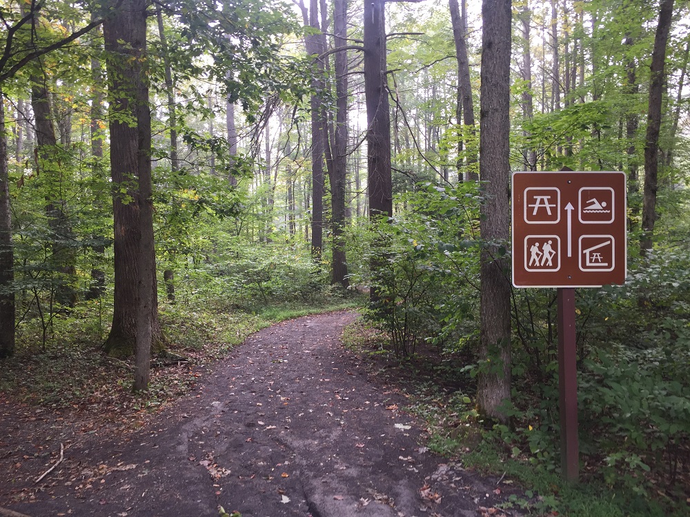
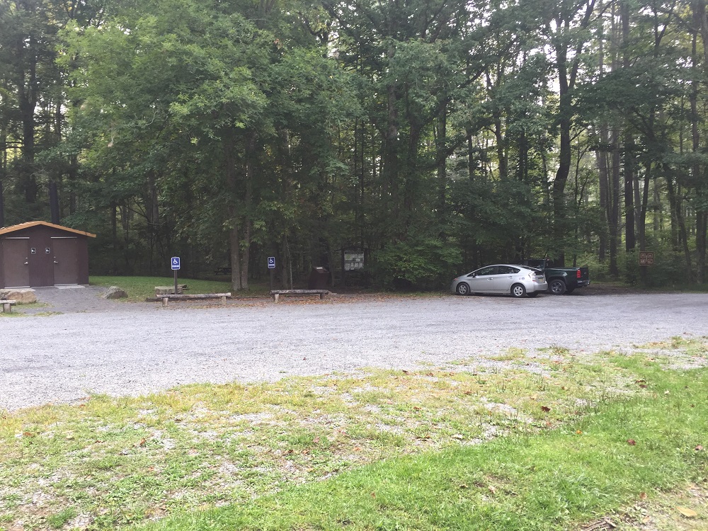
Mile 0.0 – The hike starts at the large Day Use Parking Lot. There are privies and trash cans here, along with picnic tables and a large, rustic picnic shelter with stone fireplace. Enter the trail at the sign on the right (southern) edge of the parking area.
-
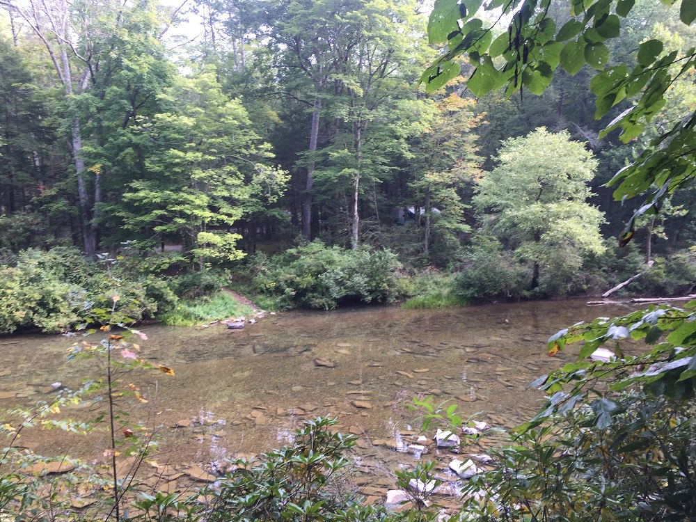
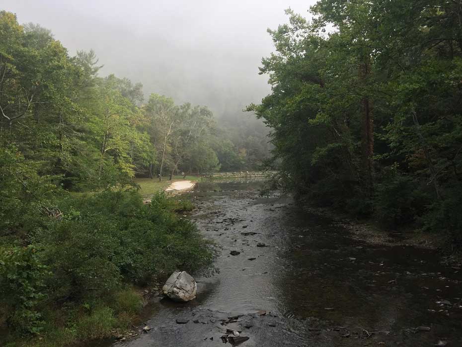
Mile 0.1 – Cross Anthony Creek on a suspension bridge. The swimming area is visible from the bridge. On the opposite bank is a kiosk with a map, trail descriptions, and wilderness information. Like other wilderness areas, groups are limited to ten hikers or fewer. Leave no trace! Take a right at the kiosk and follow the trail along Anthony Creek for the first part of the hike.
-
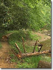
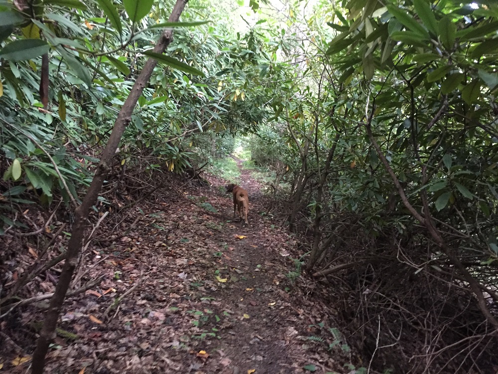
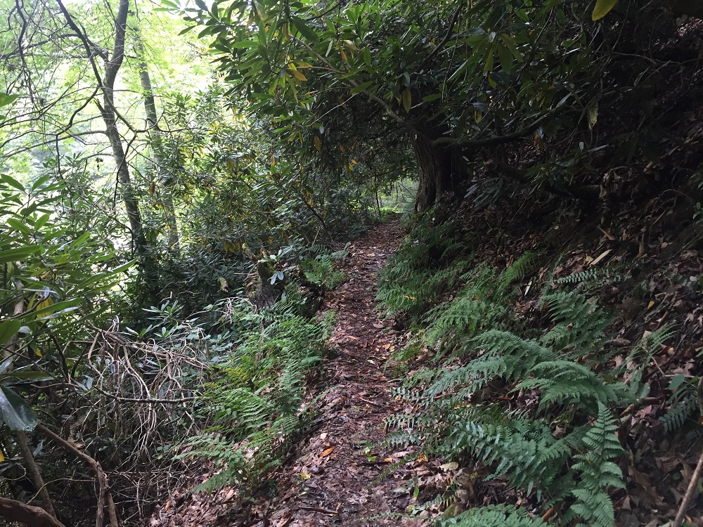
Mile 0.4 – Although the trail does not climb the mountain yet, it is sometimes a little tricky due to erosion along the creek. Looking across the creek, you can see some of the campsites in the Blue Bend Campground. At other points, the trail continues under a wave of Rhododendrons.
-
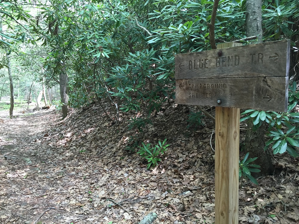
Mile 1.7 – The trail intersects with the end of the Anthony Creek Trail. Continue straight, following the sign signaling towards the shelter.
-
Mile 2.2 – Ascend via a couple of tightly packed switchbacks through rhododendron.
-
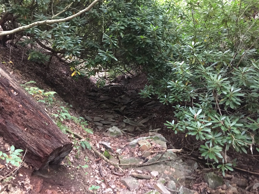
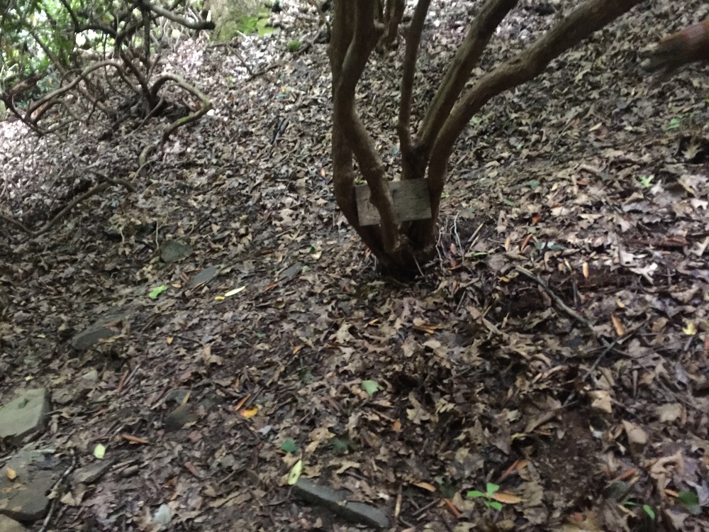
Mile 2.6 – The trail appears to drop into a dry creek bed and into a thick grove of rhododendron. Use care here, as the trail stays in the creek bed only briefly and it is easy to miss the trail sign near the ground indicating that the trail cuts sharply right.
-
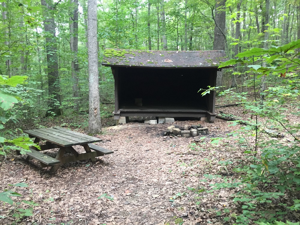
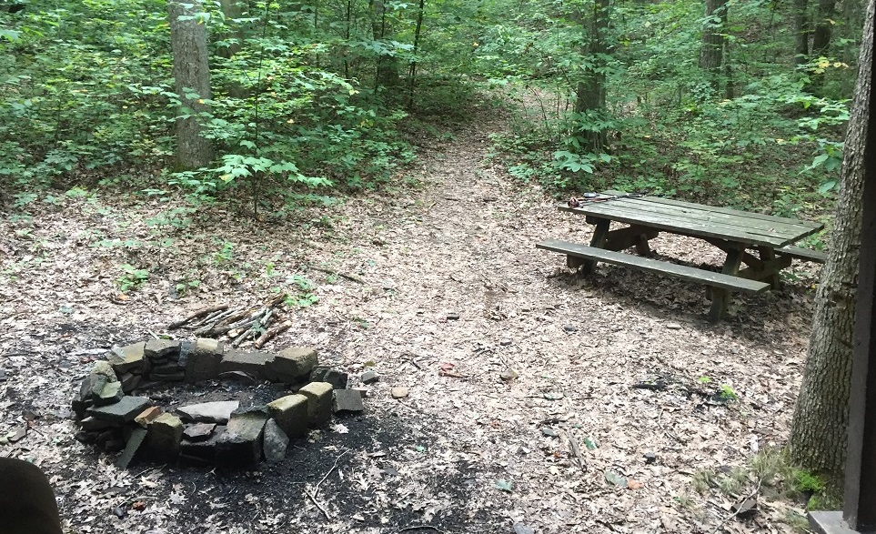
Mile 3.1 – On your left is an Appalachian Trail-style trail shelter, with fire pit and picnic table. There is no privy. There are no good areas to pitch a tent here, though the shelter looks like it could handle up to six hikers.
-
Mile 3.4 – Climb steeply for a brief period after leaving the shelter, then crest the high point on the hike. The rest of the route follows a ridge before skirting around the summit of Round Mountain.
-
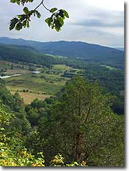
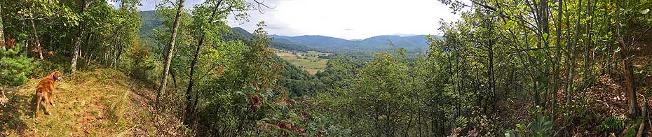
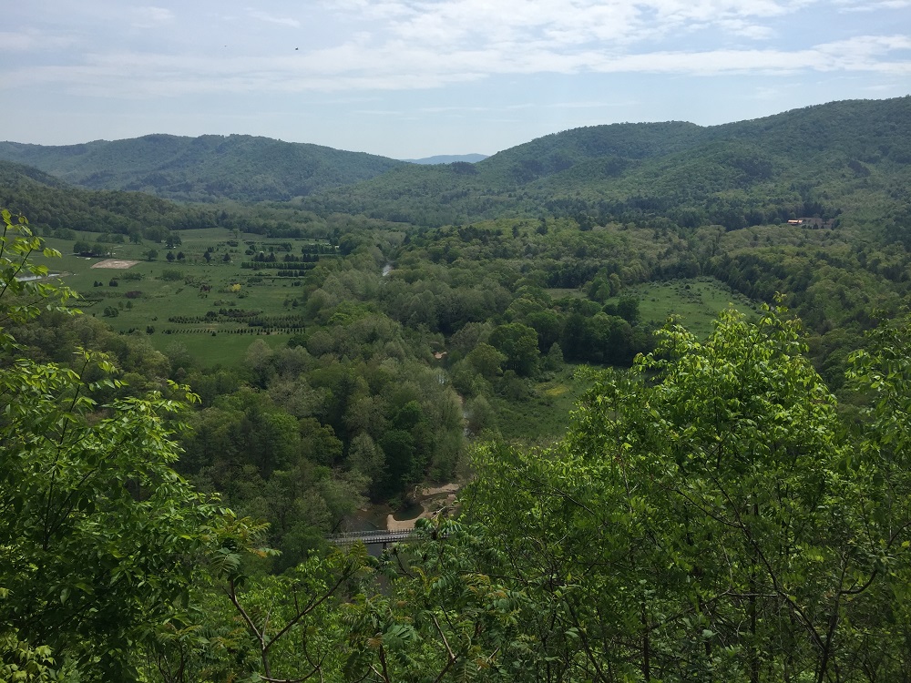
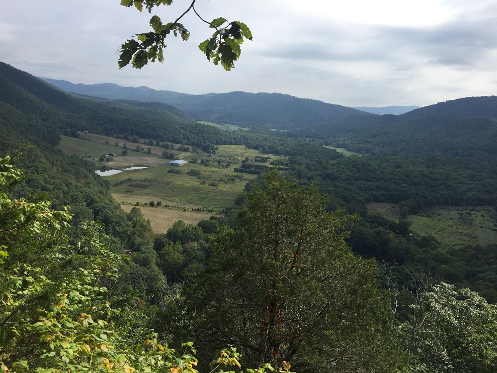
Mile 4.4 – The trail switchbacks at a beautiful overlook, the first of three overlooks that oversee the same valley.
-
Mile 4.6 – After another couple of switchbacks, the trail presents a similar overlook.
-
Mile 4.9 – The trail switchbacks again to a third overlook before completing its descent as it exits the wilderness area.
-
Mile 5.5 – Make your way back to the suspension bridge before returning to the trailhead parking.
|


