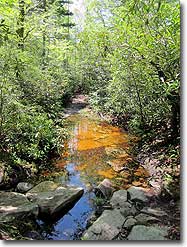
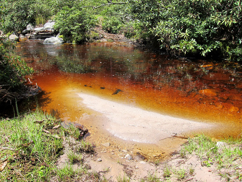
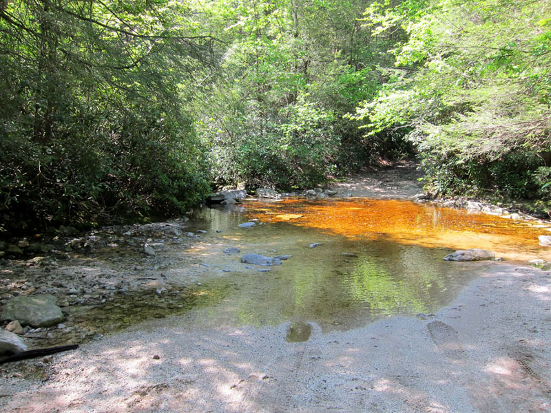
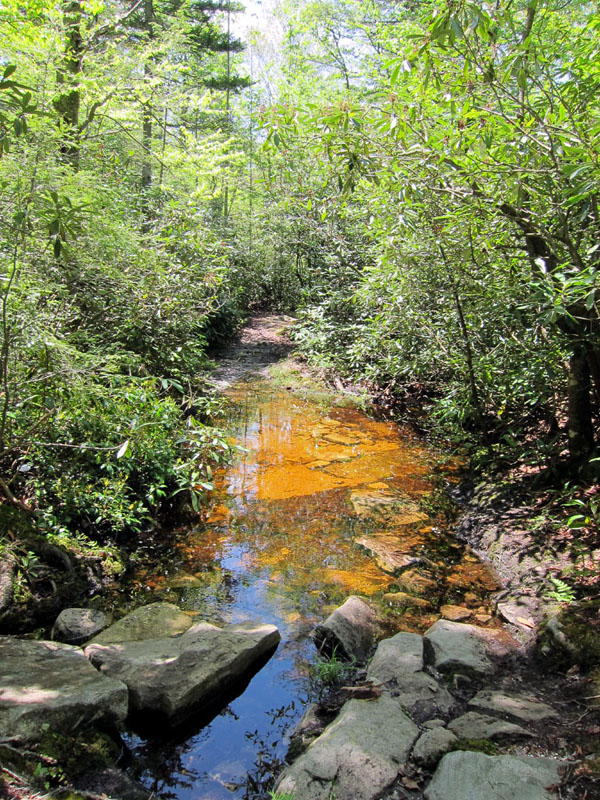
The Canaan Mountain Backcountry sits on a similar high plateau as the Dolly Sods, sharing the same cool, moist climate and northern ecosystem of wetlands and conifers. Numerous trails crisscross the highlands with a wide range of back country campsites and shelters, providing a variety of options for overnight and multiday hikes. The adjacent Blackwater Falls State Park provides additional lodging choices with rental cabins, RV lots, and campgrounds available. The distinctive tea- or cola-colored ‘black water’ of the local streams and falls are due to tannins leached from years of fallen spruce and hemlock needles that cover the plateau’s slopes.
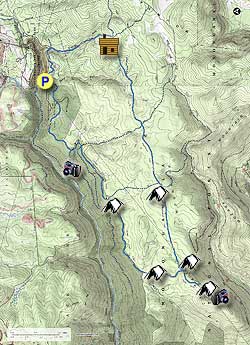
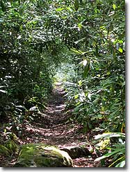
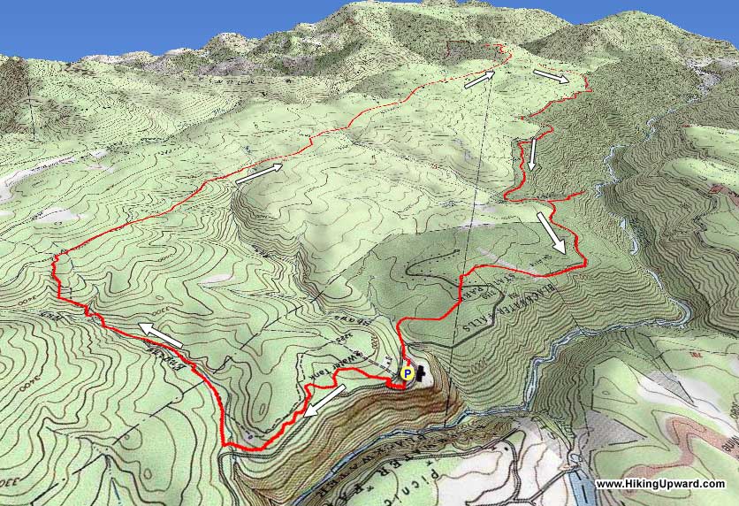
This overnight loop visits two of the most scenic views in the backcountry – Table Rock and Lindy Point Overlook – and passes through beautiful peat bogs, stands of conifers, fern-filled glades, and rhododendron tunnels. Plenty of campsites are available to choose from, with several cross-trails and side loops providing the opportunity to shorten or extend the hike if desired. Trail traffic falls off considerably once over the State Park boundary, with only the occasional fellow hiker or mountain biker sharing the trail. The return leg uses an unmaintained section of the Canaan Loop forest road which no longer sees regular vehicle use.
Note: Like Dolly Sods, much of the Canaan Mountain Backcountry trails feature boggy or waterlogged sections that must be traversed. Plan ahead and bring gaiters and/or waterproof footwear to keep dry.
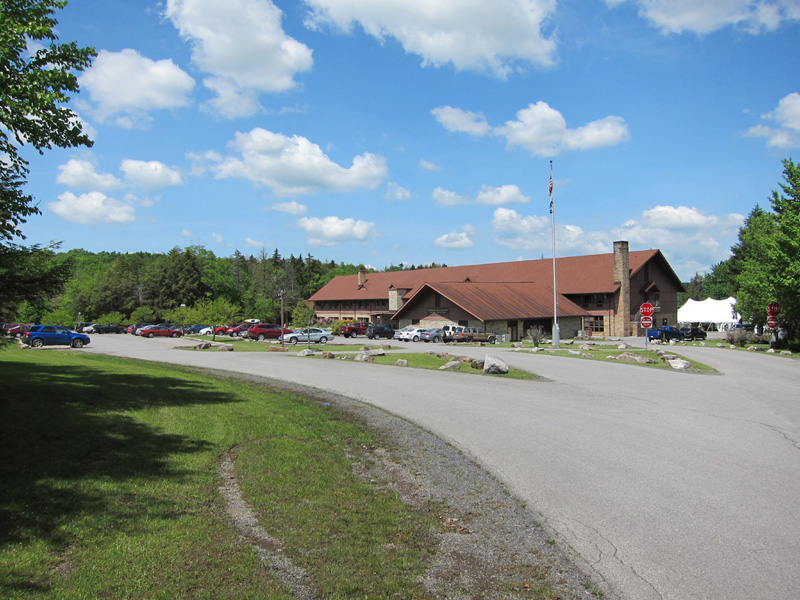
There are no fees for overnight parking at Blackwater Falls Lodge, but be sure to visit the Lodge reception desk to let them know your vehicle details, hike itinerary, and emergency contact info. Alternatively, there is limited parking space at a primitive camping site on the Canaan Loop Road just past Lindy Overlook. Reaching this spot requires fording Lindy Run and is only recommended for high clearance and/or 4-wheel drive vehicles. No overnight parking is allowed at the Lindy Overlook parking lot.
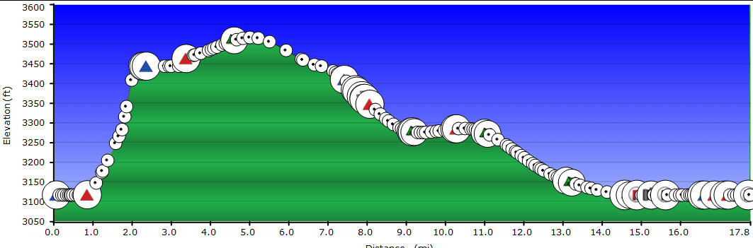
Day One – 9.4 miles
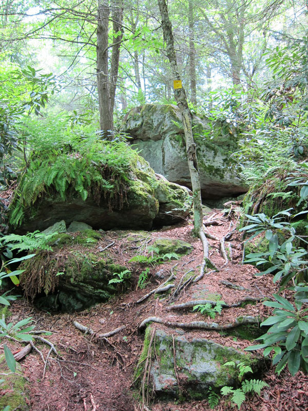
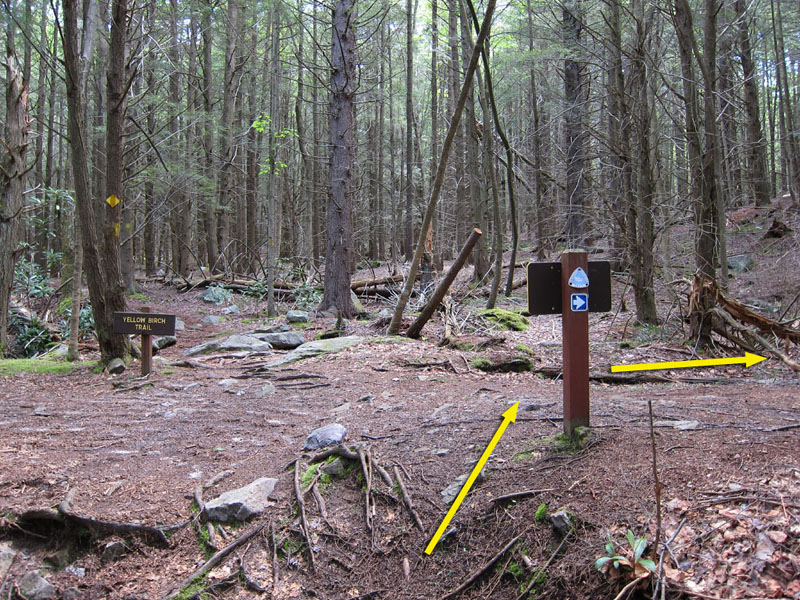
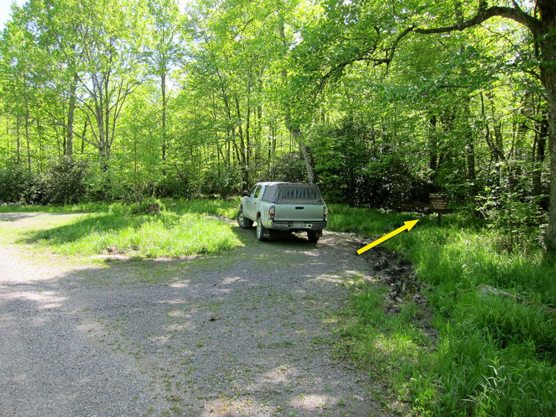
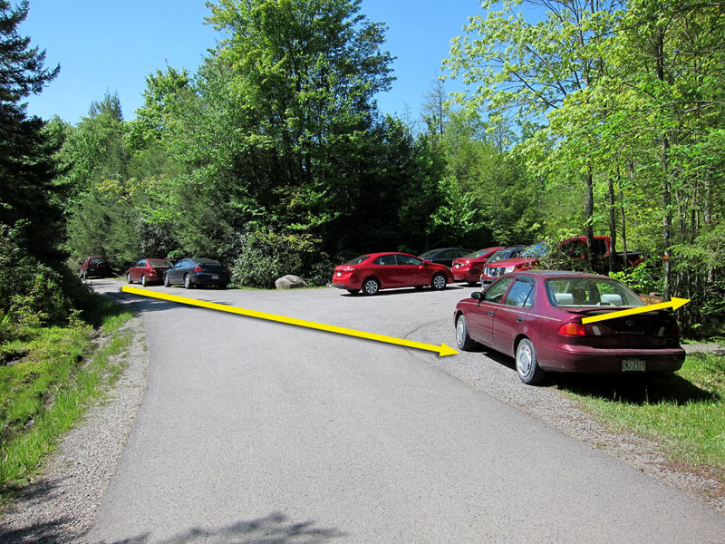
Mile 0.0 – From the Blackwater Falls Lodge parking lot, leave by the eastern lot entrance and cross Blackwater Lodge Road to join Yellow Birch Trail. Yellow blazes mark the trail as it turns south-eastward, at one point passing through a small boulder pile.
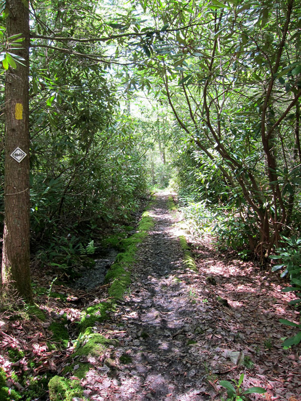
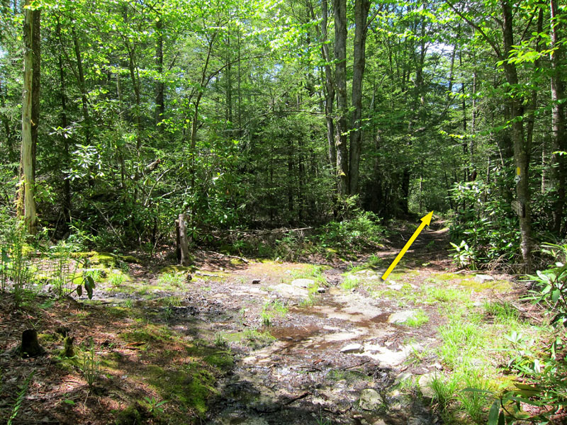
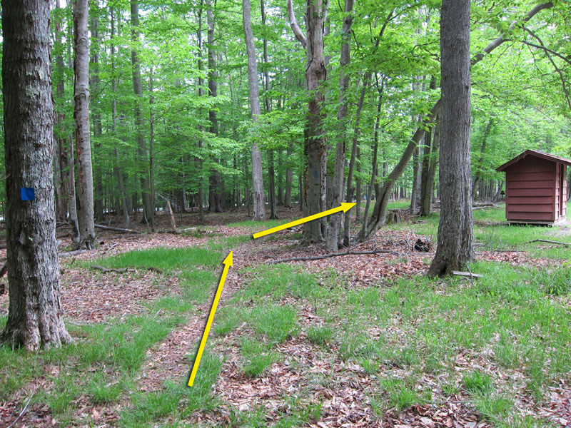
Mile 0.9 – The trail descends as it crosses a driveway and joins with the Allegheny Trail. Cross a small wooden footbridge over Engine Run and come to a signed intersection. Turn right onto the Allegheny/Davis Trail as it runs south along Engine Run. Yellow blazes, blue placards, and reflective “Heart of the Highlands Trail System” signs are used interchangeably to mark the route.
Mile 1.2 – The trail merges with a former disused section of the Davis Trail before crossing the State Park boundary into the Monongahela National Forest and Canaan Mountain Backcountry area. Another wooden footbridge crosses over Engine Run, and after half a mile the trail turns southwest and begins to move away from the stream.
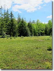
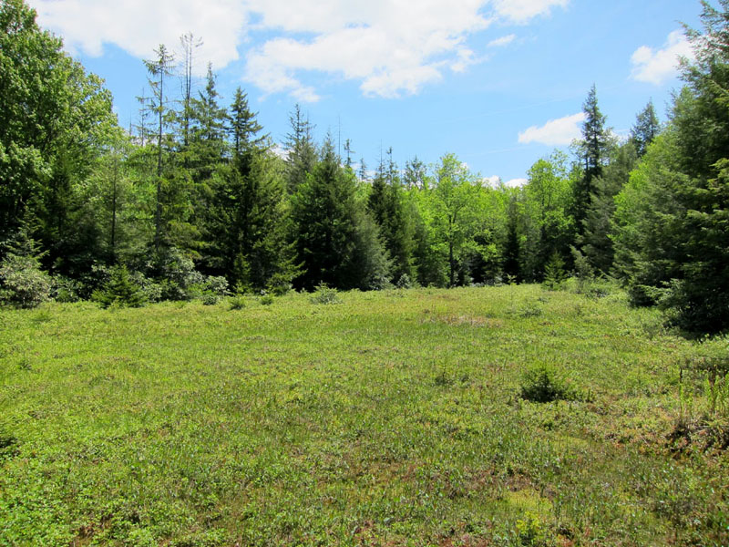
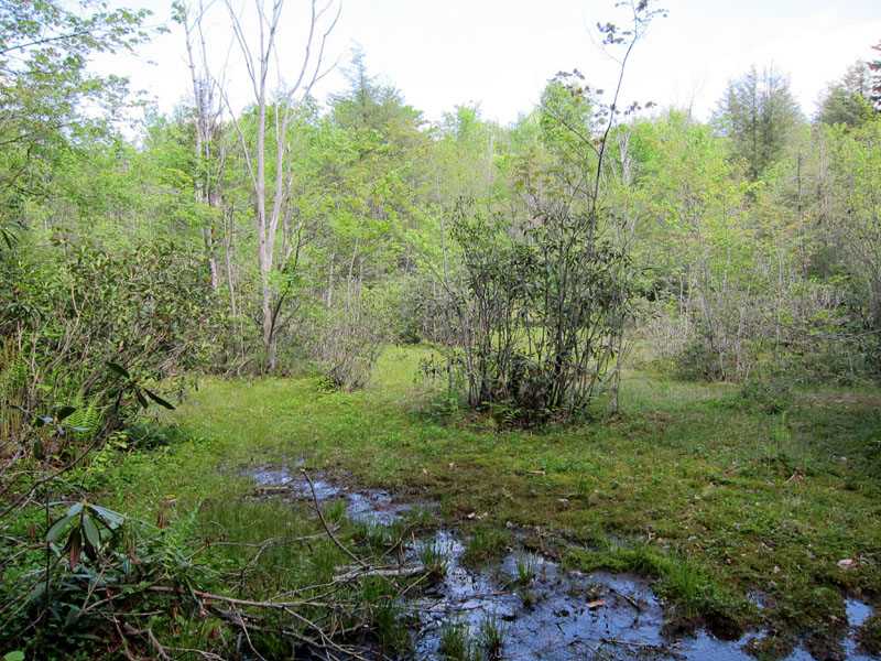
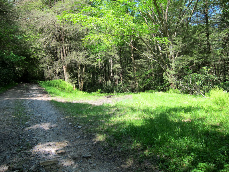
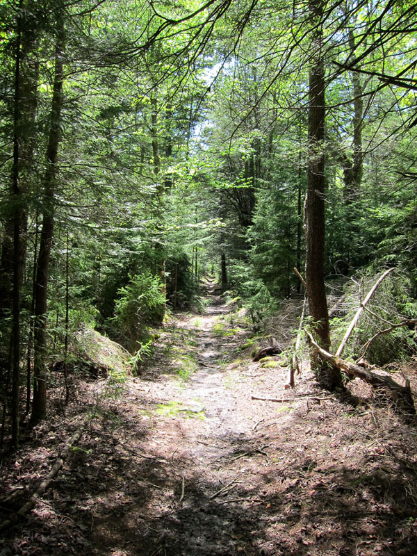
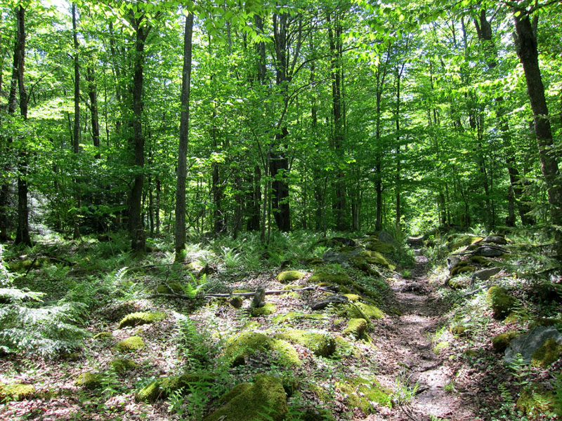
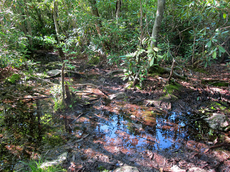
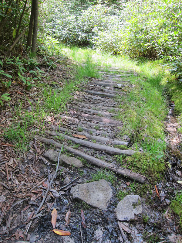
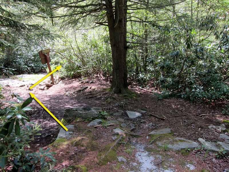
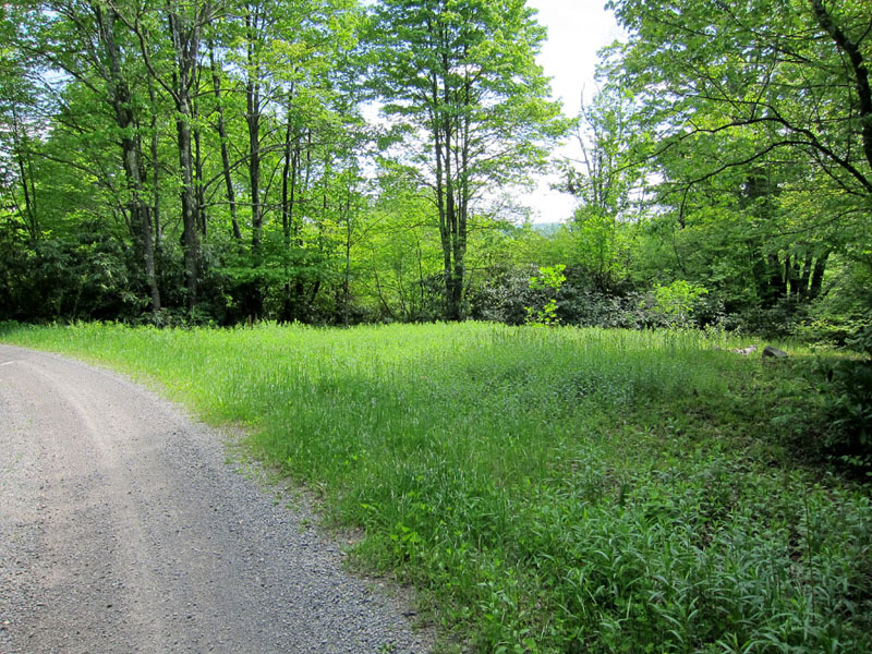
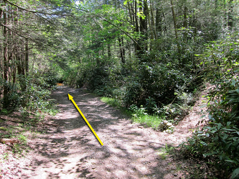
Mile 2.4 – Pass a shelter and campsite set back from the trail on the right before reaching an intersection with Plantation Trail. The straight and left trails (south and east) both continue for approximately one mile before reaching the gravel Canaan Loop Road which rings the plateau. Turn right to follow the yellow-blazed Plantation Trail as it runs westward along the plateau’s crest, bisecting the Backcountry area. Soon after joining Plantation Trail, pass a small open peat bog to the left. The plateau’s rolling terrain is poorly drained, resulting in numerous boggy, washed out, and partially flooded sections of trail. In some places this has been partially alleviated by logs, stones, or other drainage measures.
Mile 3.5 – Pass through an intersection with Pointy Knob Trail/Fire Trail No. 6 to the left. This trail makes a 7.8 mile loop to the south through higher elevations and past several falls on the south fork of Red Run, before returning to Plantation Trail via the Railroad Grade Trail.
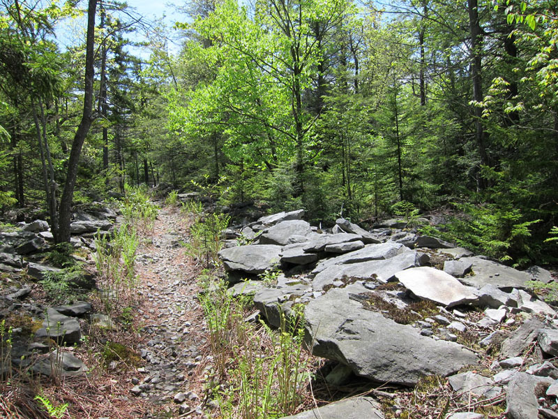
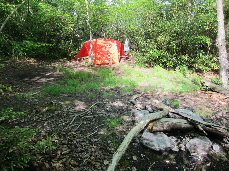
Mile 4.6 – The trail travels through rocky terrain shortly before passing through an intersection with Lindy Run Trail. To the right, Lindy Run Trail runs north 1.5 miles before meeting with Canaan Loop Road near Lindy Point Overlook. This northern section of trail is no longer maintained by the Forest Service but has been kept clear by volunteer hikers and mountain bikers. To the left, Lindy Run Trail runs southwest approximately one mile before reaching the southern portion of Canaan Loop Road. Past this point the trail is no longer blazed but the route is easily visible. Continue straight along Plantation Trail. Just past the intersection there is a small campsite with fire pit, located in a fern-filled clearing close to two nearby streams.
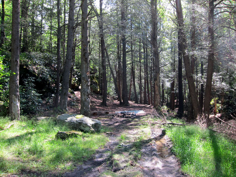
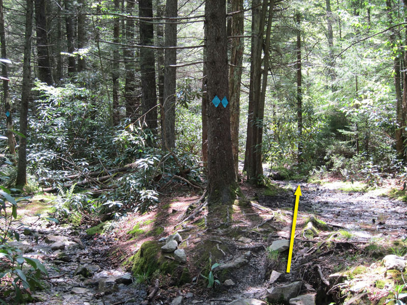
Mile 6.0 – The Railroad Grade Trail diagonally crosses Plantation Trail at a partially marked intersection. Blue placards and streamers have been placed by bikers to mark the RR Trail turnoff, which follows an old logging railroad grade. The northern section to the right is decommissioned but still used unofficially by mountain bikers to connect with the northern Canaan Loop Road. A shelter and campsite are located a half mile down the southern section to the left. Keep right to stay on the Plantation Trail.
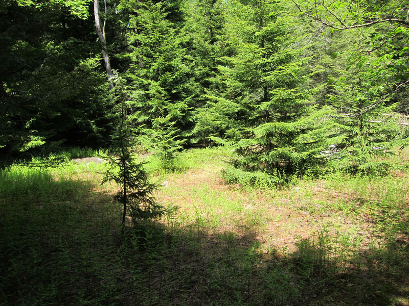
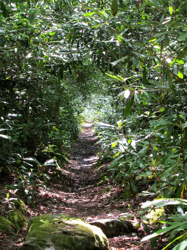
Mile 7.9 – Pass between another peat bog and sandstone outcropping shortly before Plantation Trail exits onto the Canaan Loop Road. Turn left and follow the road 75 yards to reach a small parking area and the Table Rock trailhead. There is a stream and roadside campsite another 250 yards further down the road – this is the closest water source to the dry Table Rock campsite, so if you plan to overnight there fill your canteens here before going further.
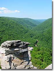
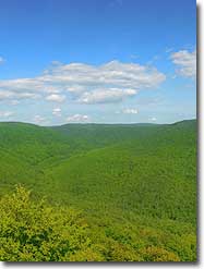
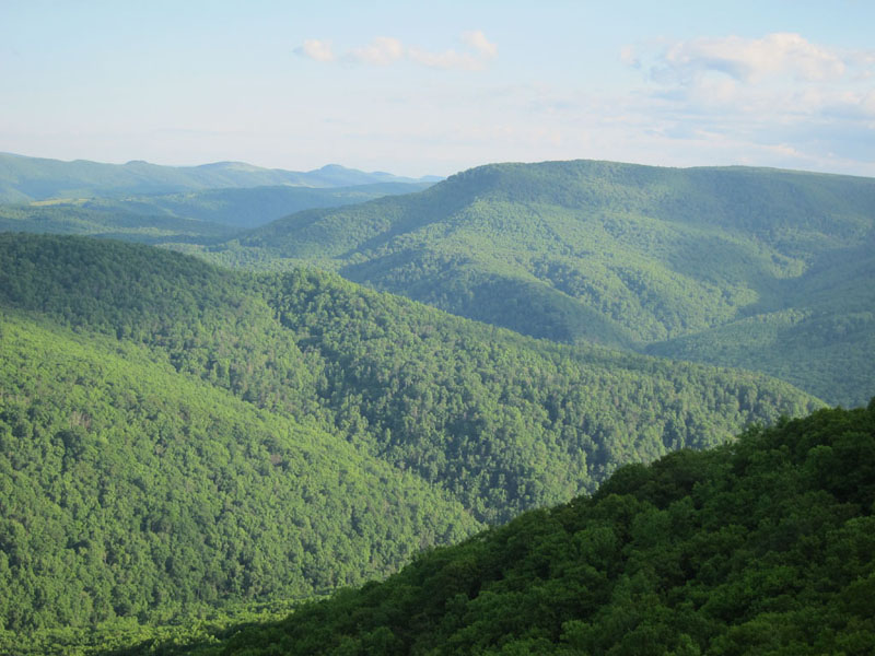
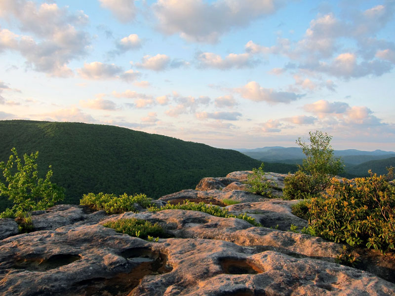
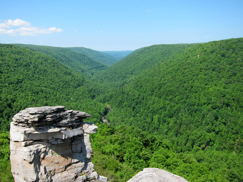
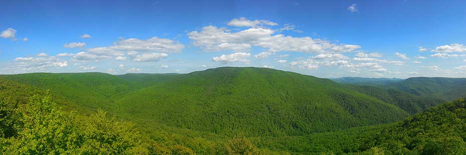
Mile 9.4 – Proceed up Table Rock Trail as it climbs towards the southwestern tip of the plateau. A dry campsite is located 80 yards from the Table Rock overlook. The overlook itself provides an incredible view of Mozark Mountain to the south and Red Run as it descends from the plateau towards the Otter Creek Wilderness to the southwest. Stick around for a dramatic sunset before settling in for the night or hiking back to the alternate campsite on Canaan Loop Road.
Day Two – 8.6 miles
Mile 0.0 – Wake up and enjoy the sunrise over breakfast before breaking camp.
Mile 1.0 – Return to Canaan Loop Road via Table Rock Trail and turn left to follow the road clockwise around the edge of the plateau.
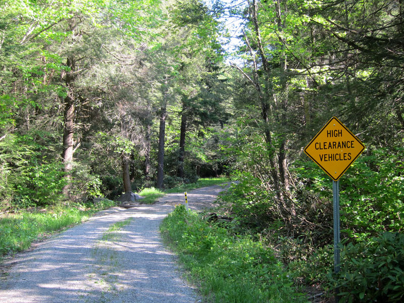
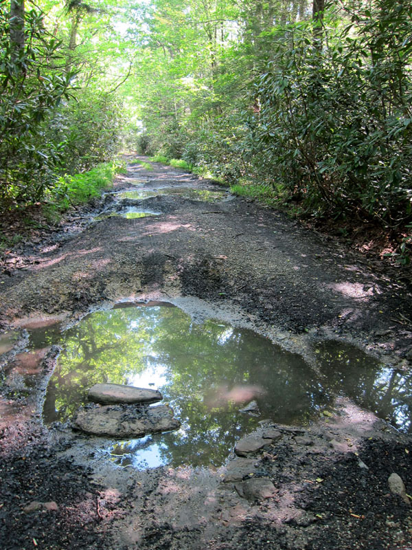
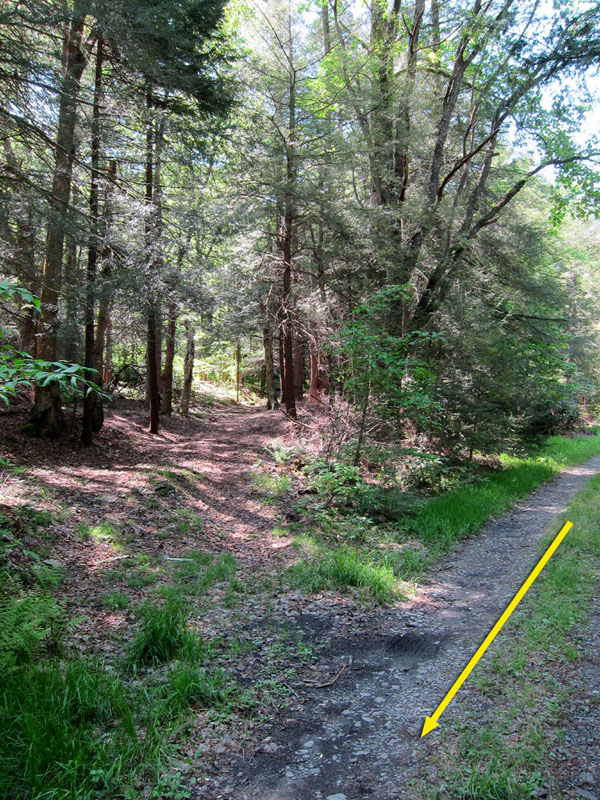
Mile 1.8 – Pass a peat bog on the right and Mountain View Trail on the left before coming across two campsites on either side of a stream crossing. From this point forward the Canaan Loop Road is no longer maintained. Traffic is rare and limited to high-clearance 4-wheel drive vehicles due to numerous potholes and occasional washouts. The road steadily descends as the land to the left falls away into Blackwater River Gorge.
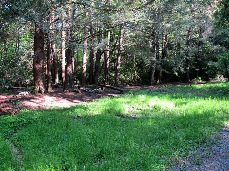
Mile 4.0 – The road passes through several stands of red spruce along the southern lip of the gorge, including an excellent large campsite, before intersecting with the northern exit of the Railroad Grade Trail. The intersection is only partially marked with streamers tied to branches and a few faded blue blazes, but the elevated railroad grade is readily distinguishable as it meets the road diagonally from the right. A small campsite is located opposite the intersection in a grassy clearing.
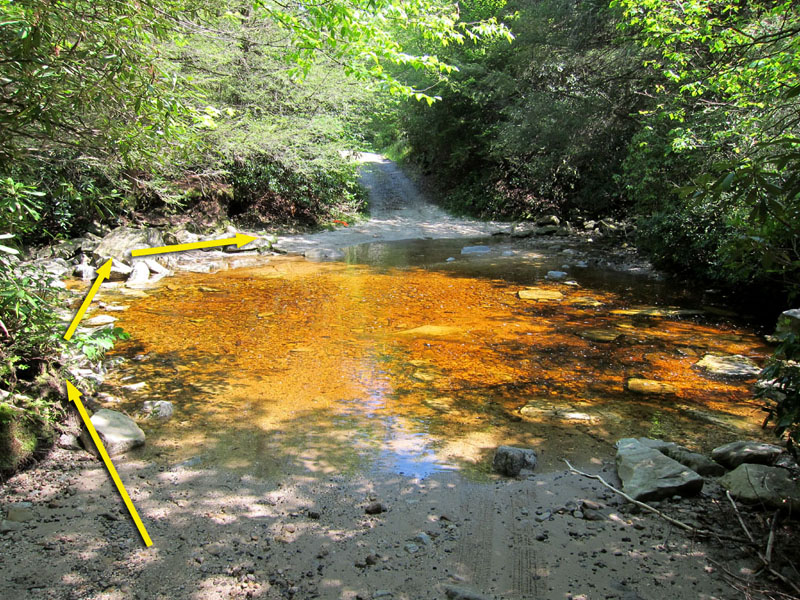
Mile 5.5 – The unmarked Lindy Run Trail emerges from the right near the alternate primitive parking spot before the road dips to ford Lindy Run. Another small campsite is located just across the ford where the road makes an immediate right-hand turn.
Mile 5.7 – The road becomes paved at the Lindy Point Overlook parking lot. Turn left to follow the red blazed Lindy Point Trail.
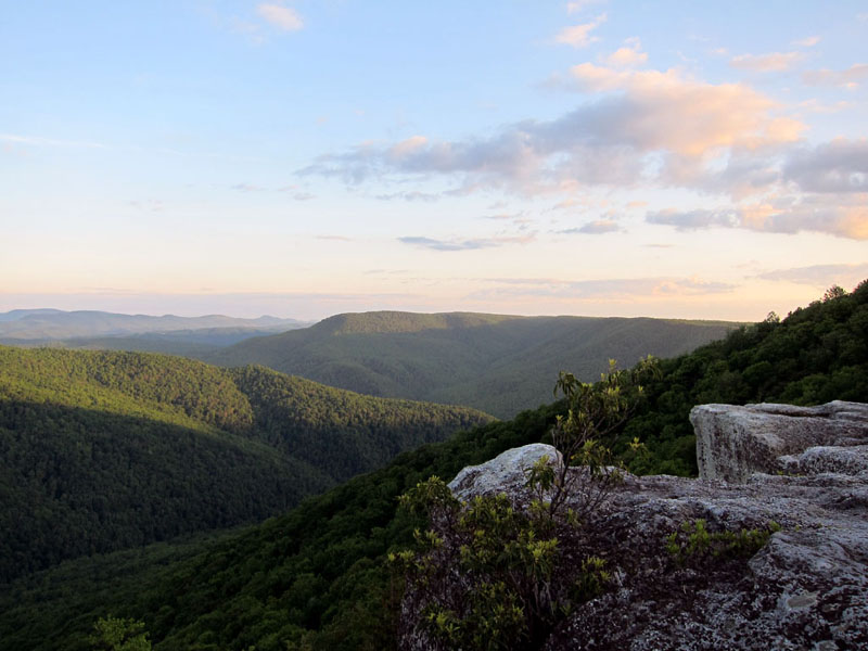
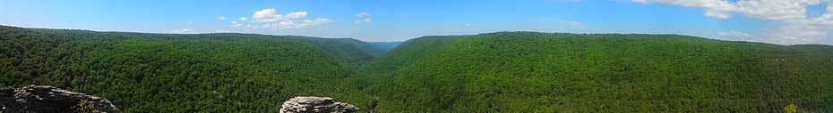
Mile 6.1 – Reach the rock outcropping of Lindy Point, which hangs 900 feet over the valley floor below with dramatic views up and down Blackwater River Gorge. Be careful if leaving the wooden platform to walk on the rocks themselves, as the outcropping is split by numerous deep clefts and chasms.
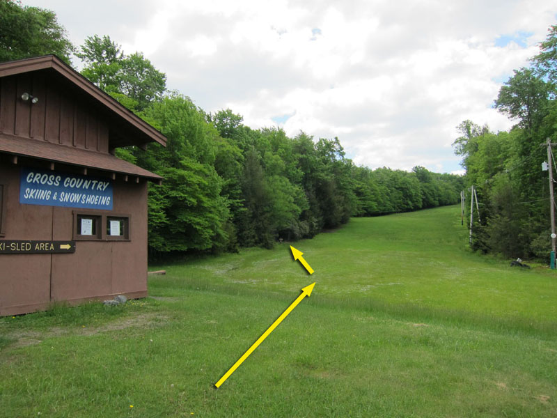
Mile 7.4 – After enjoying the view, return along Lindy Point Trail to the parking lot and turn left to continue following the now paved Canaan Loop Road as it enters Blackwater Falls State Park. Eventually come to the Sled Run / Ski Touring Center on the right. Circle around back of the building to find the entrance to Shay Trace Trail to the left at the base of the sledding slope.
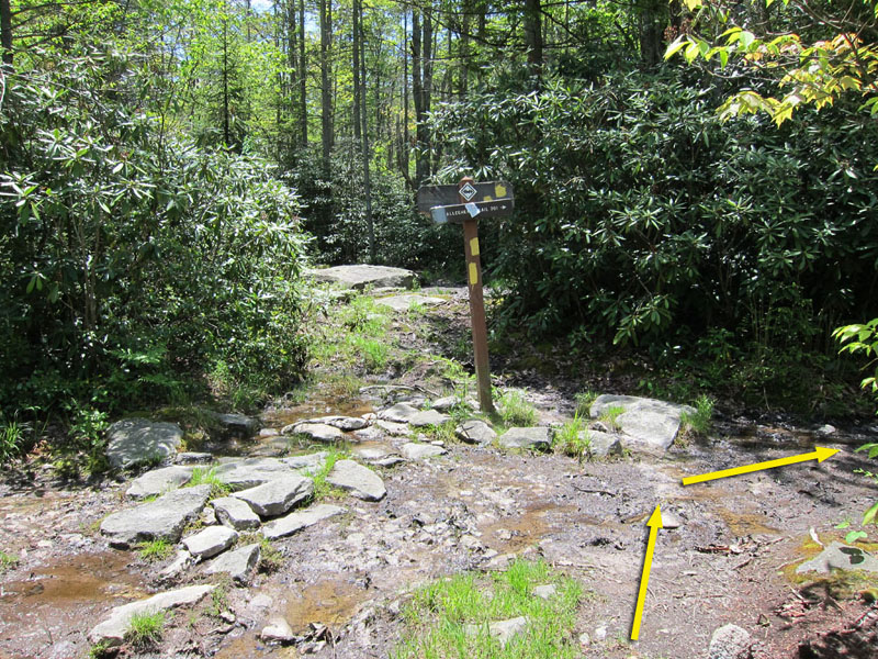
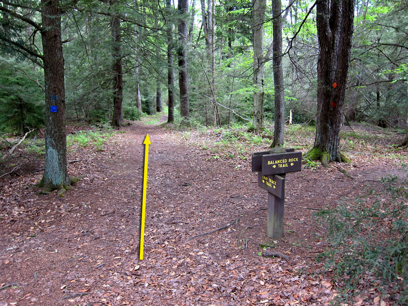
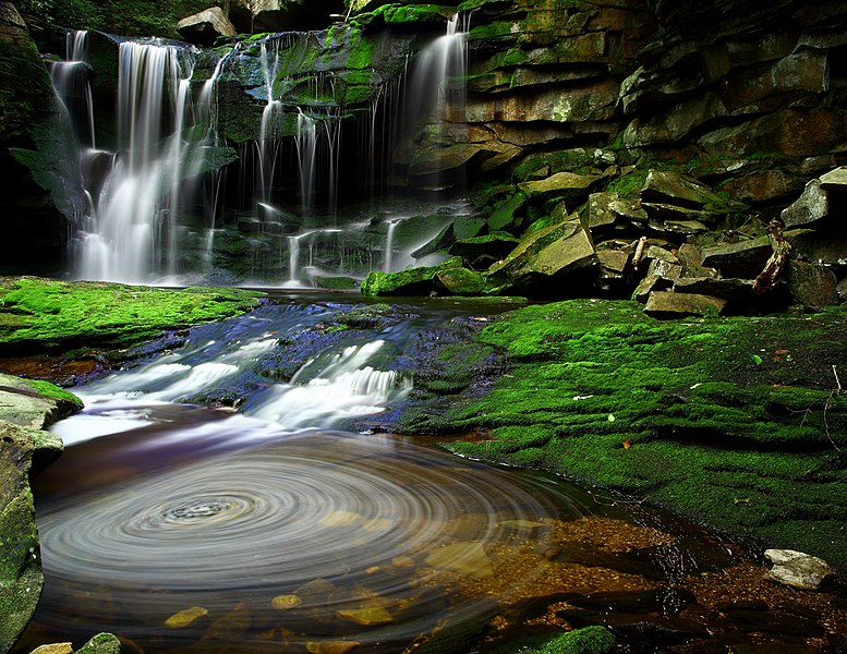
Mile 7.9 – Follow the blue-blazed Shay Trace Trail uphill, crossing an intersection with the yellow-blazed Cherry Lane Trail before passing through a set of rental cabins. Past the cabins the trail descends through a storm-battered hemlock grove, crossing two further intersections with red-blazed Red Spruce Trail and orange-blazed Balanced Rock Trail. There is a choice to take a half mile detour to the left along Balanced Rock Trail, which passes by another scenic overlook of the Gorge and the picturesque Elakala Falls before ending at Blackwater Falls Lodge.
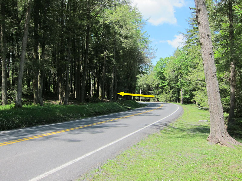
Mile 8.6 – Shay Trace Trail crosses a wooden footbridge over Shay Run before exiting onto Blackwater Lodge Road. Turn right and follow the road 125 yards to reach the Blackwater Falls Lodge parking lot where you started from. On your way out of the State Park feel free to stop and see the namesake Blackwater Falls from one of the roadside overlooks.
Late May
Table Rock
Lindy Point
Canaan Mountain/Table Rock Hike Comments
Archived Comments
By:D.L.L.
Rating:
Date of Hike: Friday, September 27, 2019
Hiked this with our dog on a late summer/early fall weekend just as some of the leaves were starting to turn. It was much less muddy than we feared it would be, even after a thunderstorm the day before we began our hike. (We've done Dolly Sods in the spring and are no strangers to mud!) - from previous reviews, sounds like the trail is much boggier in the spring than fall, so something to keep in mind.
Perhaps related, some of the streams noted as water sources, especially the one by Canaan Loop Rd before you head up to the Table Rock Campsite, were running low and/or hard to find. We did manage to find the stream and gather enough water for our night, but would recommend folks maybe gather water earlier in the day (as there were lots of stream crossings and good options) if you're hiking during a particularly dry period.
The hiking on Day One is lovely, mostly flat with some rolling hills and no really tough terrain. There isn't much by way of scenic vistas at any point in the walk, although the forest and meadows are beautiful in their own way.
Note we had some difficulty staying on Plantation Trail, and as others have said, the directions were a bit confusing. We ended up making an accidental detour down Lindy Run trail at Mile 4.6 when we were supposed to stay on Plantation, because the trails are close to each other and the signage isn't completely clear. So just a word of caution - read the signs very closely there, and check your compass!
Day Two was fine, and Lindy Point is breathtaking, but was really crowded on a Saturday. Almost your entire Day Two hike is on the road, which is still nice / feels like a trail in the sections where it's unmaintained, but was a lot less fun in the paved / maintained sections, and the walk along the paved section was just a little too long to be pleasant (but not long enough to ruin the hike!).
We didn't see a single human all day on Day One, until we met a friendly group of hunters and their dogs packing up for the day on Canaan Loop Rd right before the Table Rock trailhead. The serenity of the first day made the crowds and traffic we met at Lindy Point and afterward on Day Two all the more jarring, although the hike until then was also mostly enjoyed in pleasant solitude.
All that said, Table Rock is stunning beyond belief, and enjoying sunset, starlight, and sunrise in solitude there felt almost sacred. The campsite is pleasant, sheltered, has a great fire ring, and plenty of trees tall enough for hanging a bear bag. It was a magical place and we lingered for a long while over breakfast before finally admitting we needed to leave. I'd live there if I could.
tldr I would *maybe* do this itinerary again, but would *definitely* go back and camp at Table Rock. Next time, I might try to see if there's a route there that avoids the paved road, but not sure how that would be possible. Hmm!
By:A2
Rating:
Date of Hike: Friday, June 7, 2019
Hiked this on a cloudy misty weekend. Converted it into an easy two night three day hike. My plan was to stay at the Davis shelter the first night but it was occupied I camped around mile 4.6 at a small campsite near a stream. It suited me.
On day two the sun tried to poke its head out but never quite made itself seen. The wind was something fierce. As i got to Table Rock Overlook the wind was whipping throughly the valley and the overlook was impossible to stand on without being pushed back. I ate lunch huddled around a bolder refusing to be intimated by the wind. I camped around mile 4 on day 2. It was a reasonable site and I saw two cars come through for the day.
On day three i woke up before the sun and got an early start to get to the car. I walked with the misty rain and the early morning calm saw Lindy point overlook and the Eskala falls before heading home with a sense of inner comfort.
-I hiked this without waterproof boots or gaiters. Yes it is muddy, yes you will have to walk through mud. But its just a change of socks and tolerating putting on a wet boot in the morning.
- The eskala falls detour should be the main route. Take the left.
Trail Updates
Day 1
Mile 4.6: The trail is now blazed.
Day 2
Mile 4.0: There are now 4 or 5 campsites.
By:David
Rating:
Date of Hike: Saturday, February 23, 2019
Was down in the area to try and cross country ski, only we were missing the key element of snow, so had to audible and find something else to do. Found this hike, and decided to do the upper half portion of it, cutting up the Lindy's Run trail. This upper section is about 9 miles, and very much enjoyable.
Trail was wet and muddy due to melting snow and recent rains, but the trail is still in good condition. Not too much climbing and amazing foliage throughout the hike. Once we turned on Lindy's run, I'd say this is the best section of the entire hike and there were some amazing rock walls and the river was beautiful. Once we got back on Cannon Road, the ford wasn't to difficult of Lindy's Run, and the outlook is well worth it.
Even the walk along the road isn't too bad, not too long, and Shay's trail is pretty. Wish we had time to visit other sections.
By:Justin B.
Rating:
Date of Hike: Saturday, January 12, 2019
Did an overnight winter hike on Canaan Mountain, following the trail guide to a T. Left the Blackwater Lodge around 10:00 AM and made it to Table Rock Trail via Plantation Trail around 4:00 PM. We camped on Table Rock Trail about a tenth of a mile in, making our own campsite under a large hemlock tree, which helped shield us from the snow. In the morning we left camp and ventured out to Table Rock around 9:00 AM. After taking in the awesome views we returned and broke down camp, then completed the second leg of the hike, with a stop at Lindy Point (definitely worth the detour for the views), returning to the Lodge around 4:00 PM. The biggest negative has to be the peat bogs on Plantation Trail. Note that even in winter you may run into situations where your boots break through ice into mud or water. This resulted in some cold, wet feet for us when we got to camp. But after building a good fire to huddle around the discomfort faded. Make sure to pack extra socks, as there are sections where there's just no avoiding getting your boots wet. Some folks might find this to be pretty miserable. The beauty of the winter woods and the great views from the two overlooks kept us in high spirits. Overall a very nice hike. I would rate it a solid 3.5, deducting some points for the bogs and the mileage that you have to hike on the forest road.
By:BrianJB
Rating:
Date of Hike: Friday, July 27, 2018
Did a modified version - started at the far end of the loop road, Fire Road 3 trail, and did about 2 miles to the Davis shelter on the Plantation Trail. Day two took Plantation Trail to Lindy Run trail, and then a quick out-and-back to the overlook (don't miss it!). Took the loop road all the way around to Table Rock trailhead, and camped at the site off the road just past, with another out-and-back to Table Rock (12 miles total, but only 9 with packs). Day 3 took the Plantation Trail all the way back to the start (about 8 miles). A few thoughts...one, don't miss the overlooks, really worth it. Two, not too boggy, could rock-hop/branch hop through most spots. Three, not as many campsites as I would have thought - very few established outside the few marked off the road and the shelters. One secret - there's a very nice site tucked back behind the Davis Shelter (beyond the slightly boggy valley). Dry site near Table Rock looked nice two sites off the road (just before the trailhead) were OK, not great. Site we stayed at on the road past the trailhead was decent - fire ring, not really a place to sit, had to trample down brush to pitch a tent. Overall, very good backpack, nothing too steep up or down.
By:Brian/Moses
Rating:
Date of Hike: Friday, March 24, 2017
Pretty good hike. Went out the first weekend of spring and temps were great, mid 60s for the high/50s for the low.
The first day is pretty rough. You start off making great time on the northern end of the hike, but moving south you get into the mud. I went presumably during the first big thaw. There was still snow on the ground in some places so there was serious mud. To the point toward the end of the first day I just stopped caring if my boots were wet, and made sure they were laced tight as to not lose them in the muck. The long, straight "fire road" was the hardest part. the clearing due to bush, wasn't much more than 12" wide at some points. I think this should seriously be considered during summer months when insects take hold for weary hikers. I can imagine that with the moister and the lack of clearance spiders might rule this section. the approach to table rock was doable, and the campsite was very acceptable. hammock hangs can be tricky but i certainly made do.
day two was much easier. you do walk a gravel road for a while, which is maintained, then it turns pretty rough. the scenery is better than day one, with a ridge on your left that provides from decent views, noting spectacular, and i imagine that summer time foliage may impede this slightly. i had to take my boots off for two river crossings, both doable but a little chilly. the rocks were not slippery and the river bed was able to be walked without much pain. after the second crossing you arrive at the overlook option, which i recommend as it has so pretty awesome views, but expect a crowd. when i arrived it was empty, and while taking in the moment i had about 15 people come in different groups, later learning that the "VA Off Road Jeep Club" was there. to be honest it would of put a damper on my hike if i had 20 off road jeeps driving past while making my way through the woods. luckily i passed them just in time. the remainder of the hike is pretty boring, with a decent amount of paved road walking which wasnt my favorite. I did not do the 1/2 detour as mentioned in the notes.
also, from previous reviews that mentioned the directions were tricky, i added the GPX data to my gaia app on my iphone and had no issues.
By:Sally L
Rating:
Date of Hike: Monday, August 29, 2016
We did this hike the past two days and there are some super confusing elements of the instructions that I thought Id clarify.
Firstly, please read the entire paragraph of each instruction point before agreeing you are on the right path. We probably did not read closely enough and so added 5 miles to our first day. Secondly, this is a lovely hike. Do make an effort to camp at Table Rocks. We had a puppy, probably a lost dog being trained for hunting, follow us for 5 miles the second day. Some folks with a car took her to the Lodge to help find her owners. She was VERY sweet. Stole our English muffins, though. Came right into our camp and before we could blink had swallowed an entire English muffin. Then proceeded to give us kisses.
Day 1:
Mile .9: Calls for you to turn right on the Davis trail. This is not marked as the Davis trail on your hike. There is a wooden marker with a blue arrow pointing right - this is where you turn. It is pretty much IMMEDIATELY after the footbridge.
Mile 6.0: Okay, obviously if we had paid attention to the entire paragraph, this would not have a been a problem, but when you reach that intersection with the Railroad Trail, just go right. The instructions have this giant paragraph telling you about how the trail to the left is marked and there is a shelter, and we were tired, and probably not paying enough attention, but just go right. I have no idea why this wasnt in the first sentence and left until the last, but go right.
Day 2:
The mileage was about a mile off - we ended up at around 7.6 miles, not 8.6.
Mile 1.8: We saw only one campsite just across the stream crossing. Also, the point where the forest road is no longer maintained is a bit past this 1.8 mile marker. There is a Forest Service sign that says this.
Mile 4.0: We did not see the Railroad trail coming down. Maybe we are blind? But either way, you just stay on this road for a while. There are definitely not streamers marking the intersection. Still, doesnt matter much as you will be staying on the road for a ways.
Mile 5.5: The instructions say that after crossing Lindy Run, the road makes a hard right hand turn. Unless we are entirely daft, the turn is actually left. To the right is a campsite that seems to be used by ATVs. The paved road pops up very quickly after this.
Also, by the time you hit the Lindy Pint overlook, the mileage is more like 4.9. Again, I feel like these instructions are off by about a mile.
Mile 7.9 (more like 6.9): As you walk past the cabins on Shay Trace, you will end up crossing a paved road. This is the cabin road. This was pretty clear, but I thought it would be nice for people to know they had to hike across a paved road that is not the Blackwater Lodge road.
Mile 7.6 (instructions say 8.6): Blackwater Falls Lodge!
Enjoy, but read carefully. While the instructions that mentioned what is down an alternate path are nice to know, when you are glancing to confirm your next move, seeing all the extra is confusing. Perhaps rewording to something like, "Turn right here. If you are tired and need to camp for the night, you can find a shelter a half mile down if you turn left. Otherwise, continue to the right."
By:JR M
Rating:
Date of Hike: Friday, July 22, 2016
We did a modified version of this hike, so we could do it in three days and an overall total of about 29 miles. After leaving the lodge we crossed Plantation trail and went south on the Pointy Knob trail, spending our first night at the 2nd shelter campsite on the Pointy Knob Trail. There is water close by but it is boggy and you'll probably get muddy. All the trails were well marked. From there we hiked up to Table Rock and spent our second night there. Saw only day hikers the entire trip. Table Rock was unbelievable! It is one of the best views we have seen. Got there about 2:30 or so. Shared the view with a couple mountain bikers rolling through and 1 fat rattlesnake sunning herself. Next day it was back on the Plantation Trail (quite overgrown with lots of blow downs to go around) to the Lindy Point trail and followed the directions as you have laid out to the Lodge.
By:DCbackpacker
Rating:
Date of Hike: Sunday, May 29, 2016
Overall, great hike, especially on a rainy day when there aren't many other hikers. The first day, the only rewarding view is at the Table Rock overview, but the wet boggy trail kept us very focused on not getting stuck in the mud during the boring part of the hike. If you're going after a lot of rain, make sure you have a good pair of water-resistant boots! The only tricky part was getting on the right trail at the 6.0 mile intersection. There's a blue-blazed trail that appears to continue straight forward from where you approach the intersection. It's very enticing, but don't go on that. Instead, take the trail just to the right of that that barely looks like a trail with no markings. No big deal though if you take the wrong turn, if you come to a shelter, just head back to the intersection. The dry campsite near the Table Rock overview was very nice, especially since we had the whole overlook area to ourselves, and brought up plenty of water from the stream. We enjoyed dinner and breakfast at the overlook, as suggested in the description. The second day offered another good view at the Lindy point overlook, but for the most part no other highlights. Someone said they saw a rattlesnake at the Table Rock overlook so watch out for that.
By:DCLightweight
Rating:
Date of Hike: Saturday, May 28, 2016
Overall, a mediocre hike. A bit boggy if it's been raining as others have noted, but that's no big deal. Soggy feet are a part of the game. The main disappointment is that about half the loop is a gravel road, which makes for lame hiking. Also, the campsites on the gravel road part are awful. They're basically on the road. There's standing, stagnant water where 4x4s left ruts--so, lots of bugs. If you go, definitely plan to camp at Table Rock or the shelter. The table rock campsite can get crowded as folks roll in up to sunset, but it's a pretty spectacular view. Best to arrive early if you want the good tent spots.


