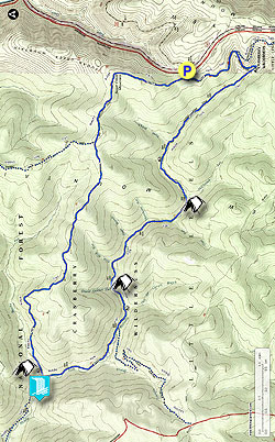
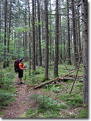
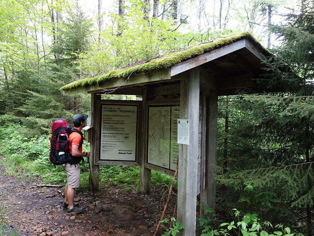
The 47,815 acre Cranberry Wilderness in the Monongahela National Forest has over 70 miles of hiking trails. The area is very rugged, with densely forested areas and steep mountains. The trails in the wilderness are not blazed, and depending on the time of year you decide to hike, a map, compass, and GPS are highly recommended as many of the trails can be harder to navigate. Your reward is one of the most beautiful areas on the East Coast, with moss covered mountains, streams with pools, and exceptional solitude.
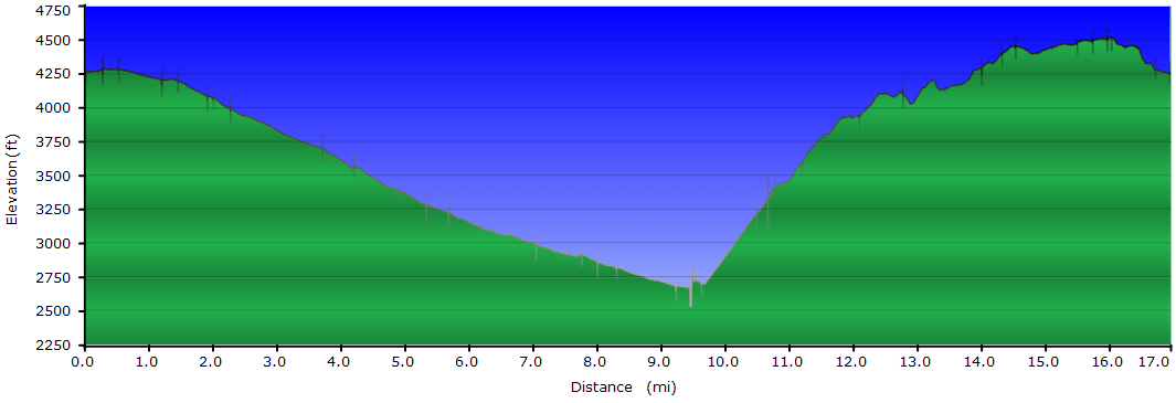
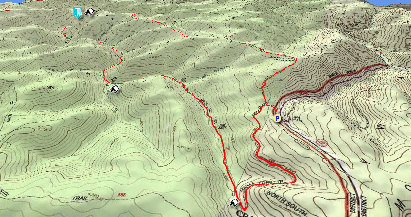
The 16.7 mile Middle Fork/Big Beechy loop hike we have mapped here is done clockwise descending the Middle Fork Trail on day 1, then ascending the Big Beechy Trail on day 2. The Big Beechy Trail is steep and rocky, and is safer to climb then descend in our opinion.
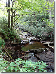
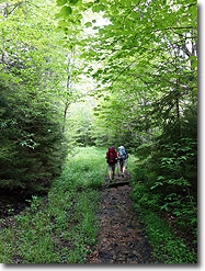
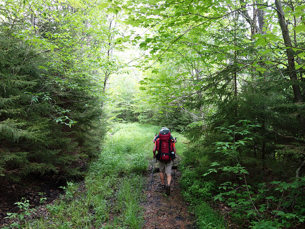
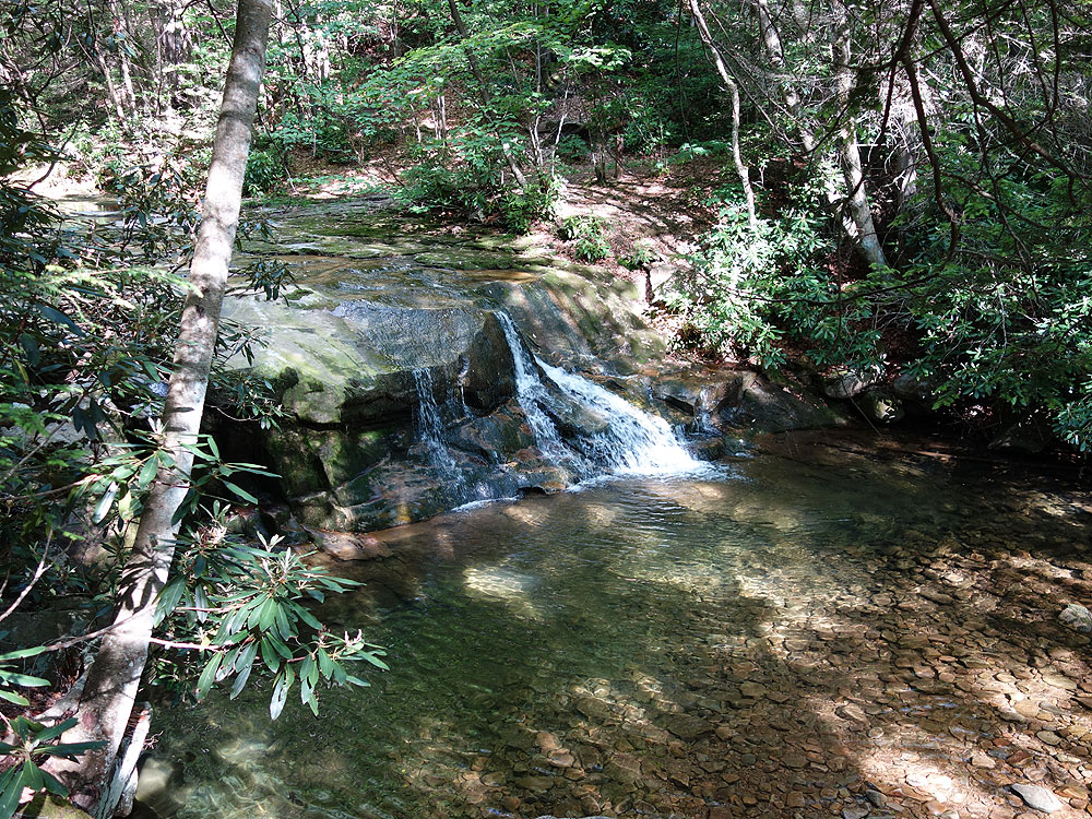
The first day hiking along Middle Fork is a pleasant stroll along countless pools. Spend the night camping next to the waterfall at the confluence of Middle Fork and Beechy Run at one of the 5 large campsites. On day 2 the first 2.4 miles is the most challenging as you climb to the ridge. You are then rewarded with old growth forest, as well as fields and stands of spruce.
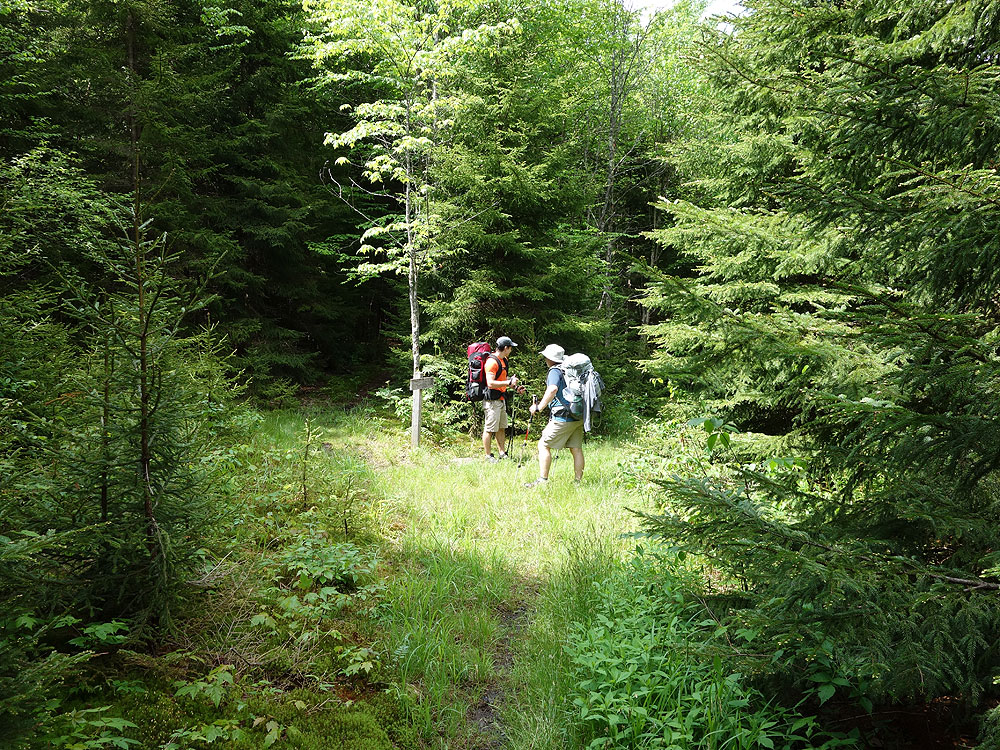
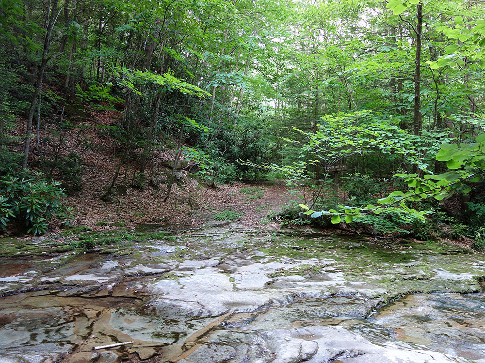
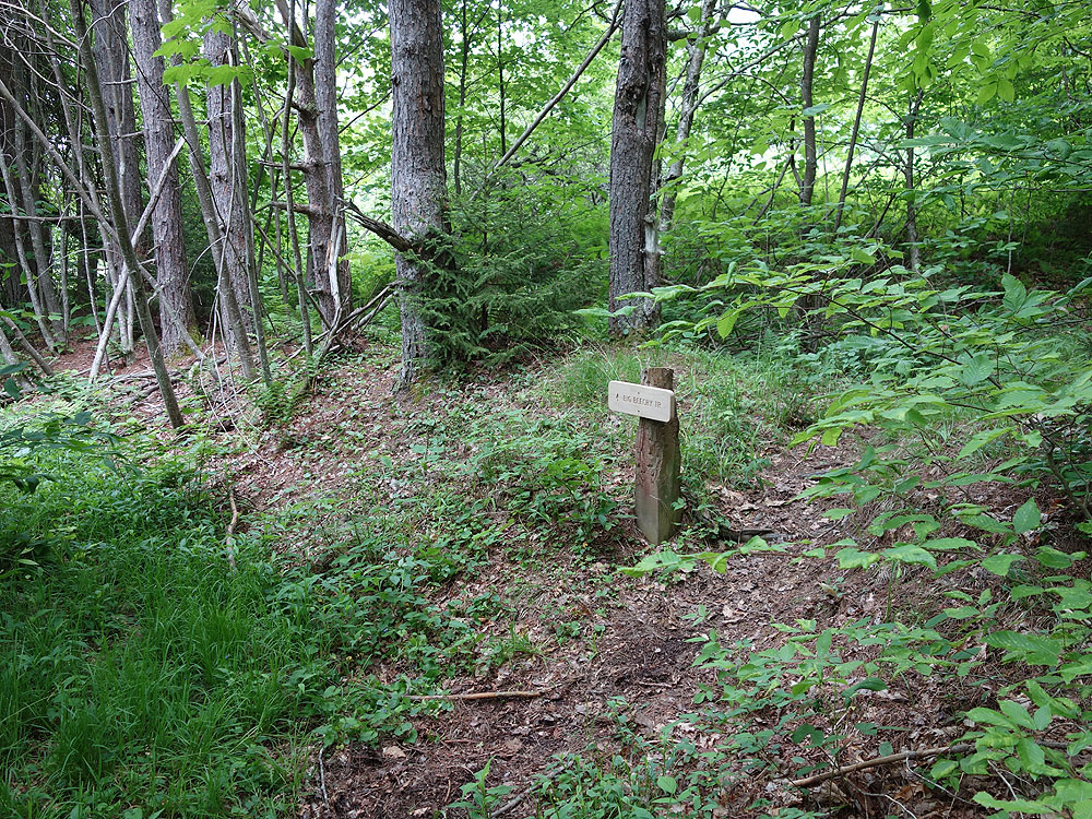
Mile 0.2 - Stay straight as the path you have been following becomes the North Fork Trail TR272. Follow the North Fork Trail as it gently begins to descend the mountain, then in 1.2 miles arrives at the intersection of the Middle Fork Trail.
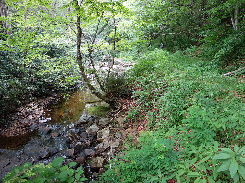
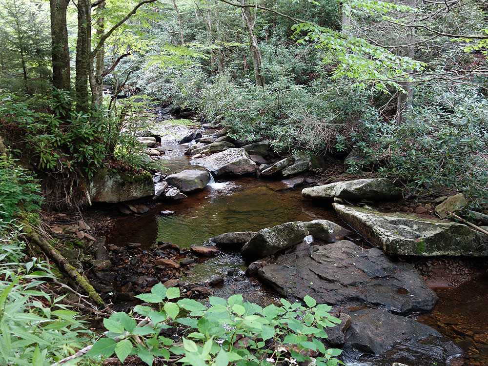
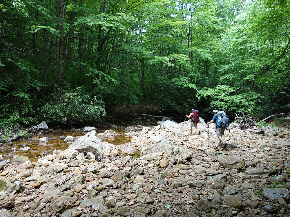
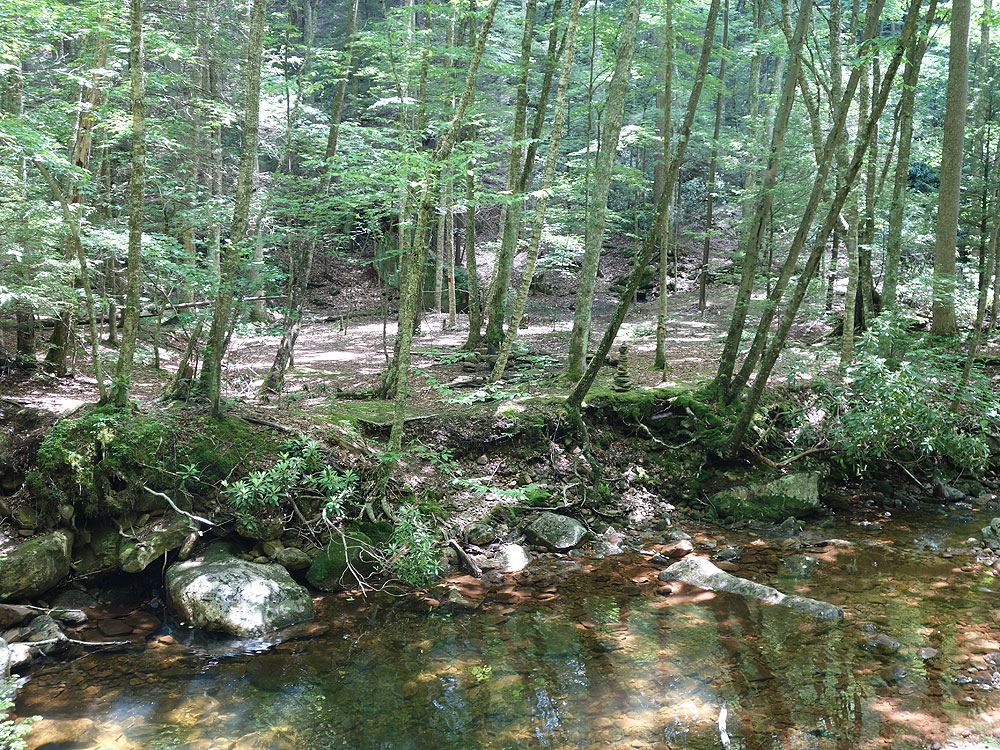
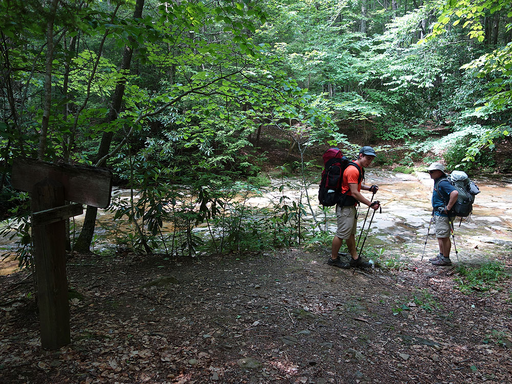
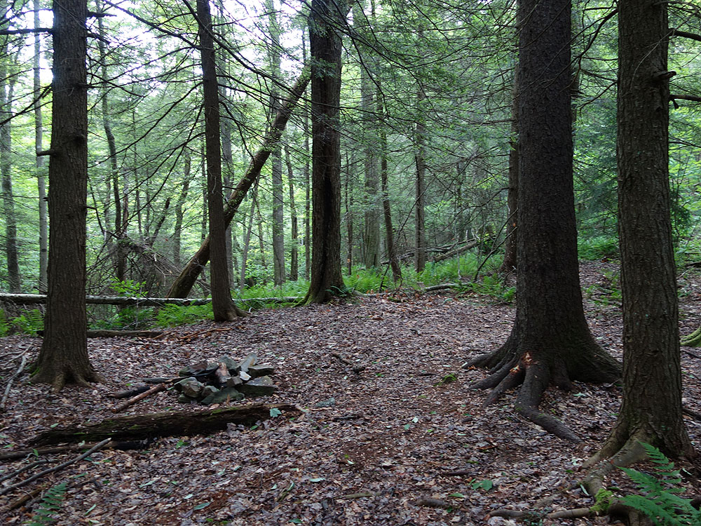
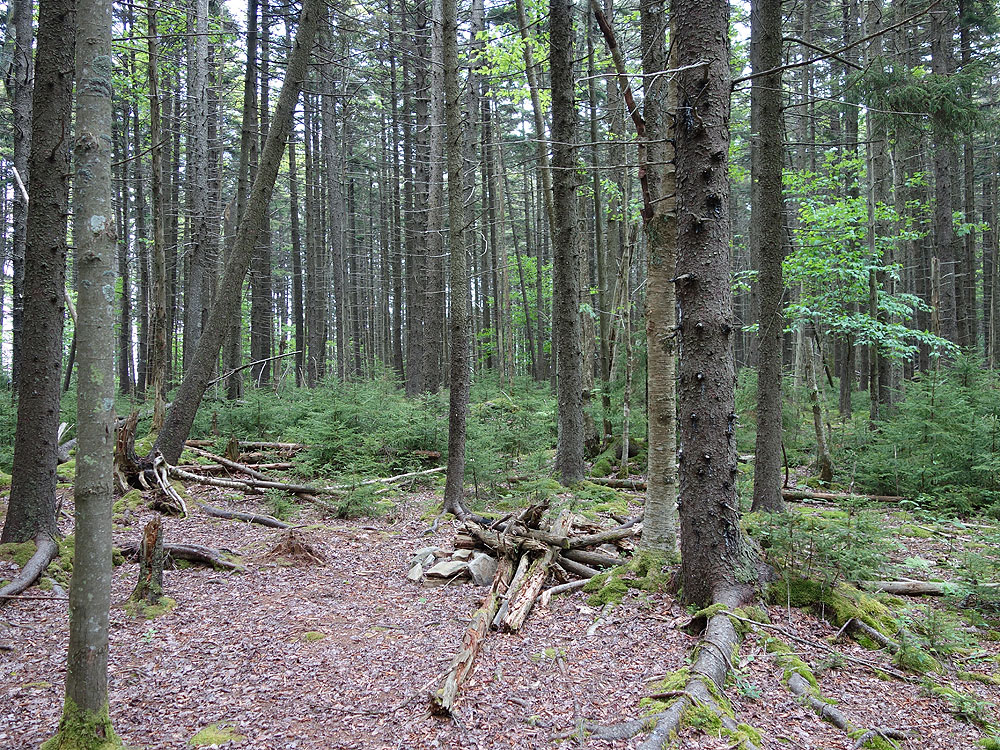
Mile 1.4 - Stay right on the Middle Fork Trail TR271. The trail will now follow the right bank of Middle Fork. The trail is heavily forested and passes many pools along the run. Also pass several good campsites as the trail meanders its way down the valley. There are also several small tributary creeks including the North Branch, Hammond Run, Slade Branch, Slick Rock Run, and Sheets Gordon Run. The Middle Fork Trail also crosses Middle Fork to the left bank, then crosses back over to the right bank.
Mile 7.8 - Pass the Laurelly Branch Trail TR267 on the left. This trail intersection did not have a marker as of June 2015, and also can be easy missed. Continue along the Middle Fork Trail for another 1.6 miles and arrive at the Big Beechy Trail intersection.
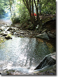
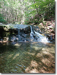
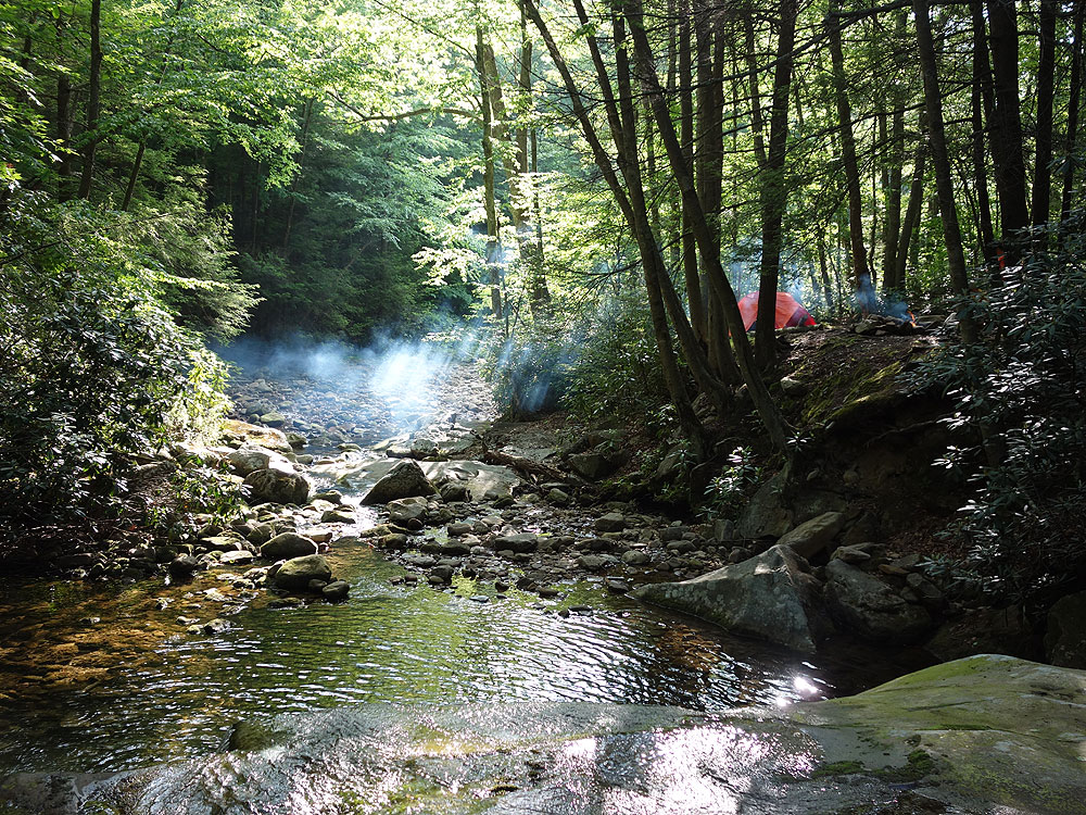
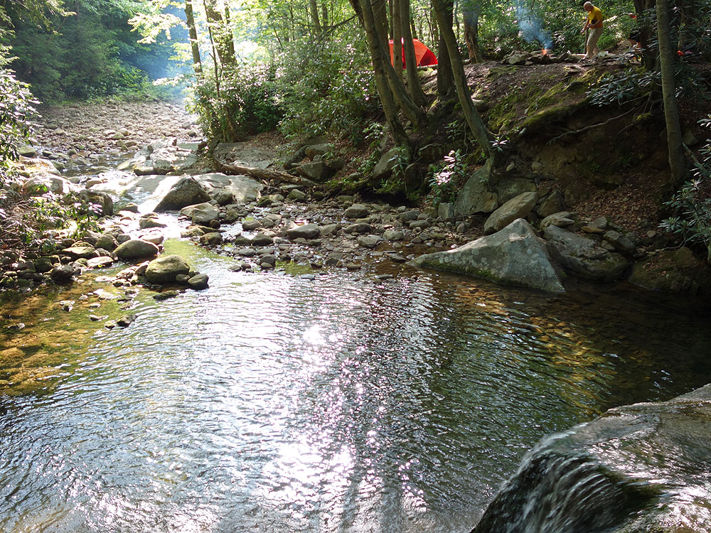
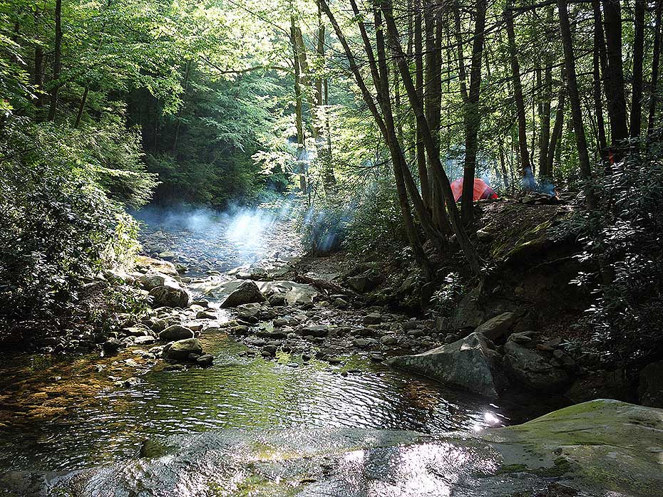
Mile 9.5 - Cross Beachy Run where the best campsite is next to the waterfall, however if that campsite is occupied there are 4 more large campsites in this area on the bank of Beachy Run. (The Middle Fork Trail continues another 2.6 miles to the Three Forks Trailhead parking on FR86)
Day 2
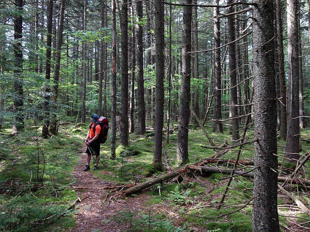
Mile 9.5 - Cross back over Beechy Run. Turn left on the narrow Big Beechy Trail as it steeply climbs the mountain. For the next 2.4 miles the Big Beechy Trail is rocky, narrow and has a steep drop off, watching your footing on the narrow trail is a must. There are also several sections of dense Stinging Nettle, so either were long pants, or be prepared to carefully navigate this as it intrudes on the trail in many places.
Mille 11.9 - Once reaching the ridge the Big Beechy Trail passes over several knobs, then in another 2.3 miles arrives at the District Line Trail intersection on the left. Again this trail junction is easy to miss. Look for a small rock cairn.
Mile 15.4 - At this point the Big Beechy Trail makes a hard right, with the overgrown and abandoned Northsouth Trail turning left. Stay right on the Big Beechy Trail as it shortly passes over the high point on Sugar Creek Mountain at 4,521ft. Now gradually descend towards the intersection of the North Fork Trail.
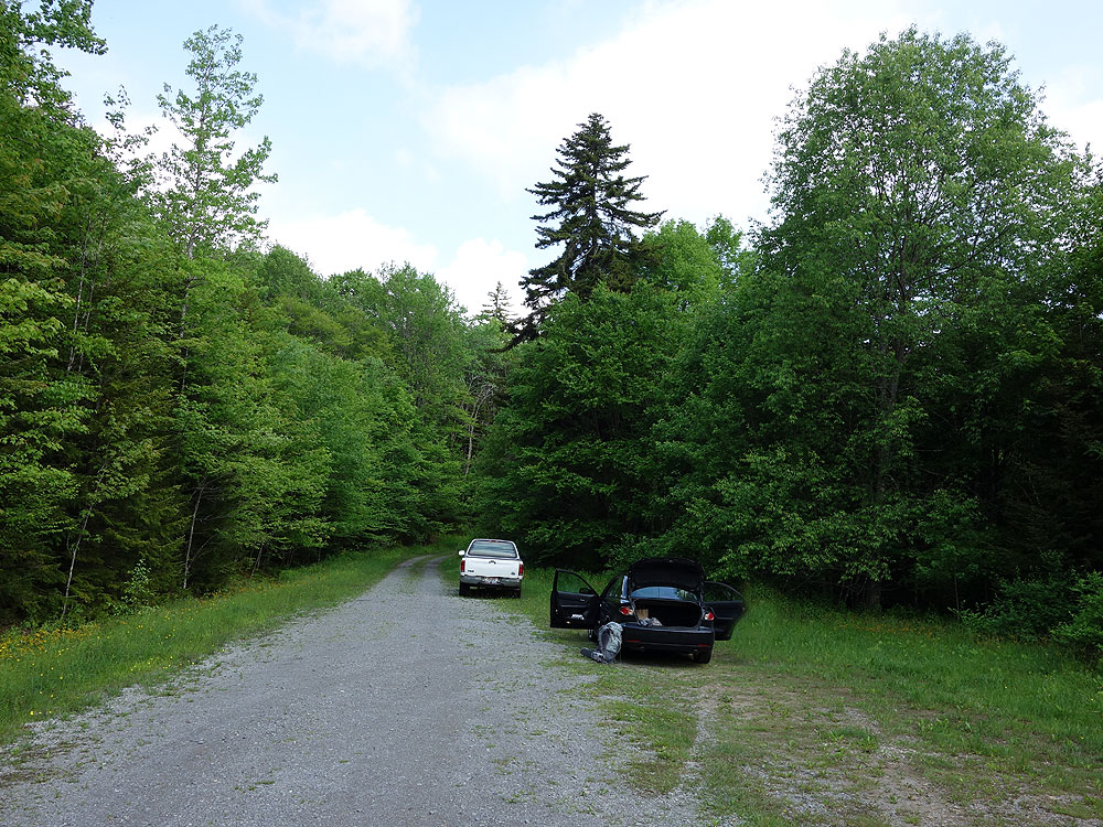
Mile 16.5 - Arrive back at the intersection with the North Fork Trail. Turn left for the remaining 0.2 miles to the parking area.
My son and I did a slightly longer version of this hike, starting on the North-South Trail (688), and then taking a right on Laurelly Branch Trail (267), and then taking Middle Fork (271 up to the Big Beechy (207). (About 24 miles give or take). We stayed at a campsite right at the Laurelly Branch/Middle Fork Intersection, and enjoyed solitude and the beautiful stream. The 2nd day we stopped to enjoy the Waterfall at the Middle Fork/Big Beechy intersection before pushing it home. We had planned for a 2 night hike, but got to Sugar Creek Mountain by 1 PM so we just finished off the last 3.5 miles to the car.
We saw only 1 other backpacker, coming in on the Big Beechy trail as we were heading out. No views, but Narnia like moss/red cedar forests, a beautiful brook and waterfall and isolation. Overall, a really nice wilderness backpacking trip.(It is kinda like the inverse of Dolly Sods...great in a very different way)
Couple of things to consider:
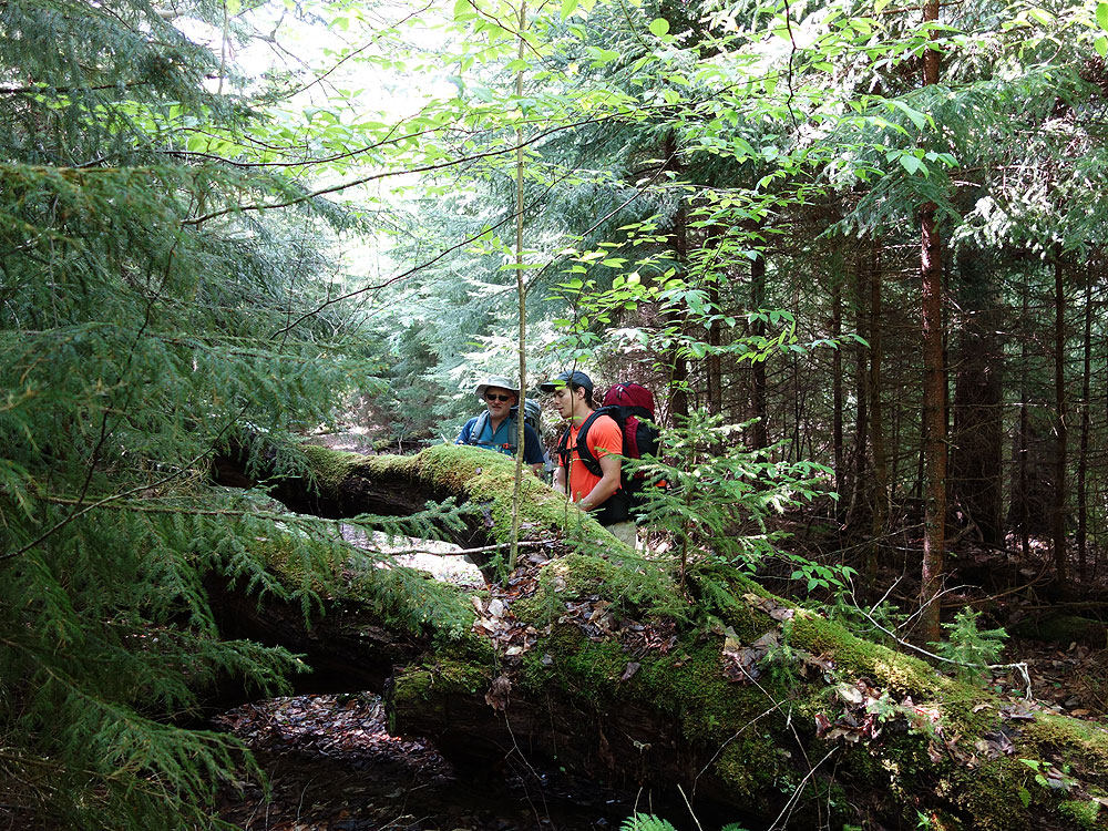
- Trails are not well maintained, and are NOT MARKED except at major intersections. There are times that the trail almost disappears with the overgrowth, and there are many trail obstacles (downed trees) to navigate over/under/around. I would not want to be trying to follow the trails after dark.
- Have a good topo map and a topo app ready to go. I used Topo Maps, and it came in handy when we lost the trail at the junction of 688/214 and had to bushwhack for 45 minutes to finally met up with the trail again. I also used it to confirm I was on the right trail a few times.
- Big Beechy trail deviates some from how it appeared on my topo map on the ridge, so don't panic as long as you are heading towards Sugar Creek Mountain.
- Wear long pants. Lots of nettles and other stuff along the trail, overgrown into the trail.
- Some mud but nothing too deep
- No water on Big Beechy so hydrate well before heading up and carry 2-4 liters per person, depending if you are pushing to the car or planning another night.
- Lots of trout in the stream if you bring a pole.
By:Michael G.
Rating:
Date of Hike: Monday, July 1, 2019
To be clear, this review only covers the first 1.5 miles, from the trailhead parking area to the campsite at the south-eastern tip of Middle Fork Trail.
I was looking for a relatively easy hike for my 10 year old's first true backpacking trip, and this was as perfect as you could hope for. All the way down to the campsite, it was either flat or a very gentle decline. That said, there were plenty of fallen trees we had to climb over. That first campsite is superb perfect for a 2 person tent + a second, smaller tent. Water is right there, just a few steps away. There is a second site about .2 miles further west on the trail, but it is only accessible by a STEEP descent from the trail to the creek. It isn't far, but it is VERY steep. Not for a novice.
Please be aware, this is a black bear sanctuary. From wilderness.net: "Cranberry Wilderness is contained within the Black Bear Sanctuary. Black bears are abundant and share the Wilderness with white-tailed deer, wild turkeys, grouse, rabbits, mink, bobcats, and foxes." I didn't see any traces of bear, but I was very alert for them.
By:Pam W
Rating:
Date of Hike: Saturday, May 12, 2018
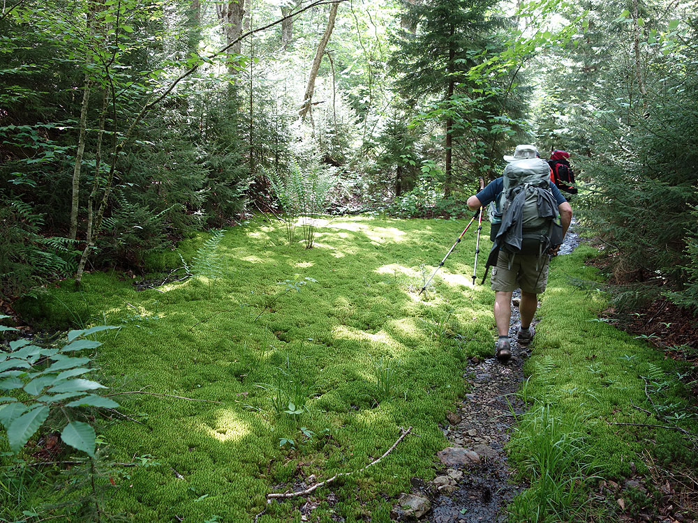
This was a really fun hike. There are no views so if that is what you are looking for, don't look here. Instead, this hike offers awesome forested terrain and a good dose of isolation. The hike starts through woods following the river. There is basically constant access to water. We saw a number of wildflowers, a snake, and tons of wild ramps! The first day as outlined here is an easy, gradual downhill through the woods. The trail is straight and easy to follow. None of the river crossings were particularly deep or difficult but I could see that being different if we had more rain or it was a different time of year. There are some really nice campsites along the river. Arriving to the campsites at the intersection of Middle Fork/Big Beechy, we saw the first other people we had seen all day. But, there was still plenty of space to camp. The "best spot" by the waterfall was still open, but we opted for a spot across the trail, where the waterfall was far less loud. The site across the trail was also a bit more protected. Crossing over Big Beechy to get to the campsites was the first time we had to take off our boots to cross. Even though there were other groups near our campsite, they were quiet and small, and we still felt pretty isolated which was nice. Finding a tree for a good bear hang took some time as most of the tree do not have branches at a good height, keep that in mind as we waited until night to hang our bag and it made it that much harder. Camping right next to the river/waterfall was perfect and beautiful. There is a nice swimming hole at the waterfall if you want to take a dip! We just soaked our feet and relaxed on the rocks. Day 2 is a much more challenging day hike despite being less distance. Leaving the campsites you are walking uphill for basically two miles on a seriously narrow (and sometimes slanted) trail with a steep drop on the left. There were occasional small streams along Big Beechy Trail that should not be relied on for water source - carry plenty of water for the hike. We saw a fair bit of stinging nettle but luckily it was still small/growing so not problematic for us. We had three dogs with us and this portion of the trail was the most challenging with them since it was steep with lots of trees down. Note that there were a lot of trees down across all portions of both trails but we never had an issue getting past and never lost the trail because of those trees. We did the route in the recommended direction. The moss covered forest was magical. We had a great time, great hike and descriptions. This hike is fairly isolated, we only saw other people when at the prime camping area. The only reason I am not rating this as five stars is the steep 2-ish mile straight uphill section with numerous downed trees. Would not have been a good choice for first time backpackers and was definitely moderate verging on difficult for that portion of the hike. Middle Fork was a gentle and easy hike which could have been done as an out/back to avoid the more challenging terrain, but then we would have missed the moss covered forest which was my favorite part! WV wilderness does not disappoint.
By:Nathaniel
Rating:
Date of Hike: Saturday, July 1, 2017
Middle Fork Trail was overrun with nettles and thorny plants. There were probably 100+ downed trees (July 1, 2017) on the loop which made it significantly harder to hike with a pack. We weren't hiking after a storm and there was moss on many of the trees so I don't think the trail is very well maintained.
The camping spot at the waterfall with the waterhole was really nice and worth the hike there. Lots of firewood around.
The forest was weirdly empty of animals and silent. We saw two watersnakes and heard birds but didn't even see a squirrel the whole time.
By:Shannon
Rating:
Date of Hike: Wednesday, May 31, 2017
Did this hike by myself during the weekday and didn't see a single other person the entire time, it was gorgeous. The trail is still a bit hard to follow at points with countless downed trees on the Middle Fork trail. I started with Big Beechy since I wanted to hike to a further campsite the first day and camped at McClintock Run which was a nice spot though the Hell for Certain and site at the junction of Beechy and Middle Fork looked like the best options. While I agree the incline off Beechy would be somewhat tricky to go down if slick, it was fine with the trail dry.
At the junction of the Laurelly Branch and Middle Fork it looks like you should cross the river and go on Laurelly due to downed trees obscuring the Middle Fork so just be aware that you won't cross the creek until after Hell for Certain since it's a bit confusing.
Beautiful trail, particularly Big Beechy, though definitely echo the need for pants and boots since fairly muddy and overgrown with nettle in places.
By:Catt
Rating:
Date of Hike: Friday, July 1, 2016
Major flood damage in this area from recent storms. At parts, the Middle Fork trail may be impassible due to blow-downs and trail collapse. The Hell for Certain campsite is now under 6 inches of sand. Definitely not for a beginner. Still, gorgeous area and very wild.
By:Mike
Rating:
Date of Hike: Saturday, October 24, 2015
We did this as a 2-night trip, arriving at the parking area about 4:30 Friday afternoon. We spent Friday night at the first campsite marked on the map (N38 16.939 W80 14.937). Nice little spot next to the creek - all the camp sites along the Middle fork looked very nice and are sheltered from the wind. The campsite at N38 18.123 W80 16.464 would be great in the Summer, with a small waterfall and private pool not visible from the main trail in the tributary trickle that entered the Middle Fork.
Our second night was spent at the confluence of the Middle for & Big Beechy Run - its a great spot with abundant well burning wood across the run from the sites. As you can imagine, the fire-wood is well-picked over and hard to find on the side of the creek next to the sites.
Clockwise is definitely the way to do this one. Hiking down to the Big Beechy trail is easy, a nice and steady downward slope on an old road with several stream crossings and a few spots where well-placed cairns make it possible to find the disappearing trail. It was neat to see evidence of the road construction, like the stone-work of periodic culverts on the side of the road away from the creek and the remnants of what looked like an old bridge that we stumbled upon while eating lunch near a small falls and interesting rock formations at N38 17.780 W80 17.036. We encountered several sections of ankle-deep mud as well.
It rained Saturday night, which made the steep ascent of the Big Beechy trail a slick challenge. The ground was covered with leaves, making it difficult to find the Big Beechy Trail at first and several times throughout the day.
There were still spots of beautiful color but it looked to me like we missed the peak time, lots of leaves were down and trees were bare. The Beeches that still had leaves were bright yellows to deep oranges and the some of the Maples had color as well.
By:Paul
Rating:
Date of Hike: Saturday, August 8, 2015
Have hiked this trail multiple times. We hike in 3 miles on the Middle Fork Trail until we get to Big Beechy (there is a great campsite there with a waterfall and pool). In the morning, we take off up Big Beechy and time ourselves to see how fast we can do Big Beechy/Middle Fork until we arrive back at the beginning of Big Beechy. Our best time is 5:43 (five hours and forty three minutes) (we lost the trail for about 15-20 minutes in there as well).


