|
| Length |
Difficulty |
Streams |
Views |
Solitude |
Camping |
| 4.5 mls |
 |
|
 |
 |
N/A |
Hiking
Time:
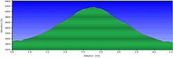
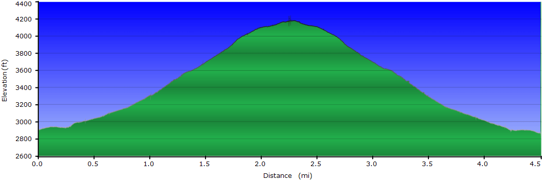
Elev. Gain:
Resources: |
3.0 hours with breaks
1,300ft ft
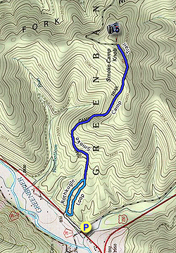
 Topo Hike Trails Map (PDF) Topo Hike Trails Map (PDF)
Thornwood WV Weather Forecast
Garmin (GDB), Gaia/Trails App (GPX) (What's
this?)
3D View of Route |
 By Trail Contributor: Jeff Monroe (Email Jeff) By Trail Contributor: Jeff Monroe (Email Jeff)
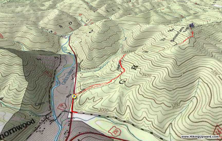
The Smoke Camp Trail climbs from West Virginia Route 28 to the site of an old fire tower via a loop interpretive trail called the Rothkugel Loop. Though parking is nonexistent on site requiring a short road walk, the hike’s lone vista makes this hike worth the trouble.
-
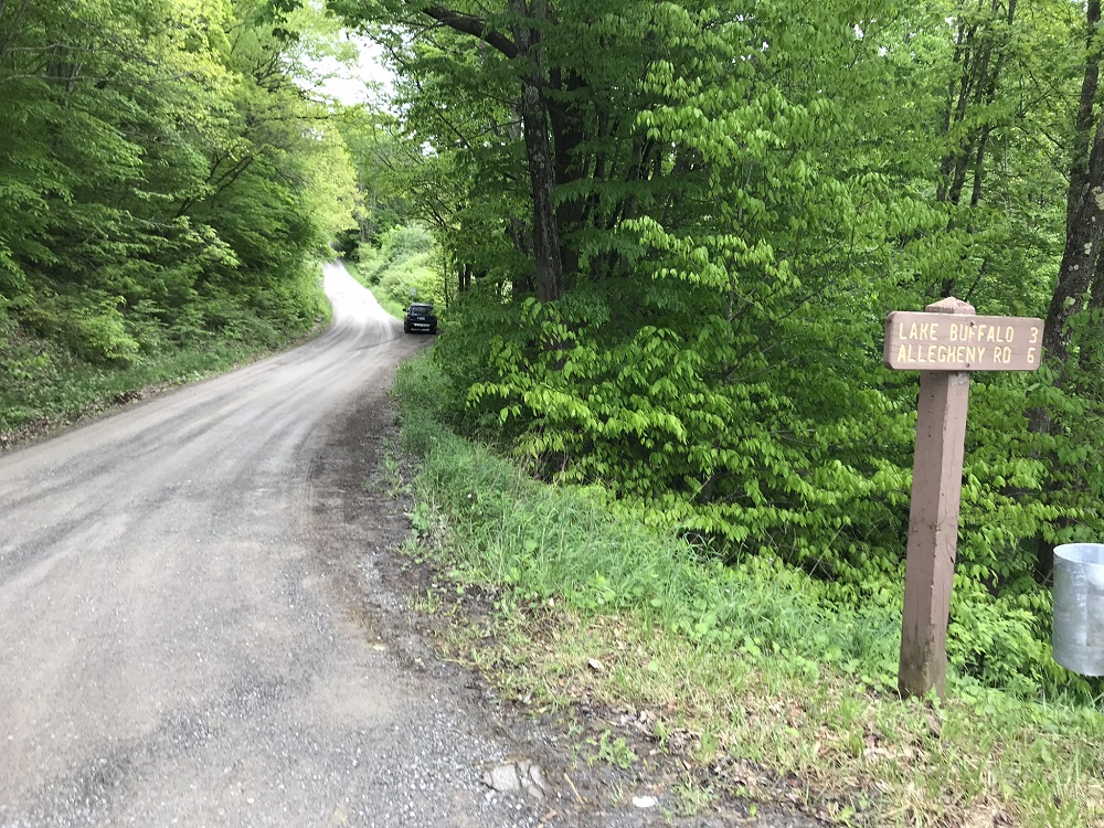
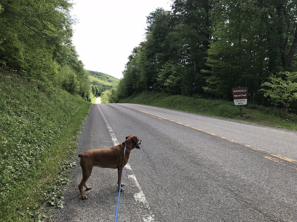
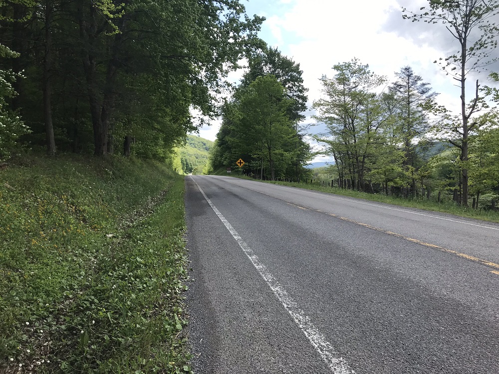
Mile 0.0 – Park at a wide spot on the road to Lake Buffalo (Forest Service Road 54), a little off of WV 28 just north of where it splits with US 250. There is parking for 2 or 3 cars here. Walk from here back to WV 28 and turn right (north), taking care to watch for traffic on the highway.
-
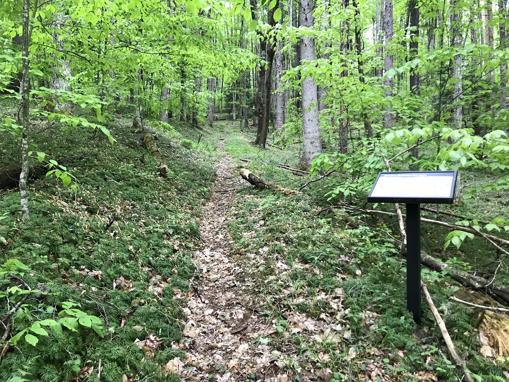
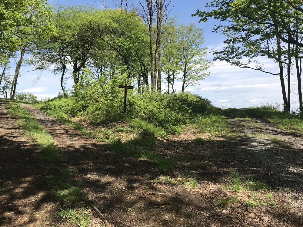
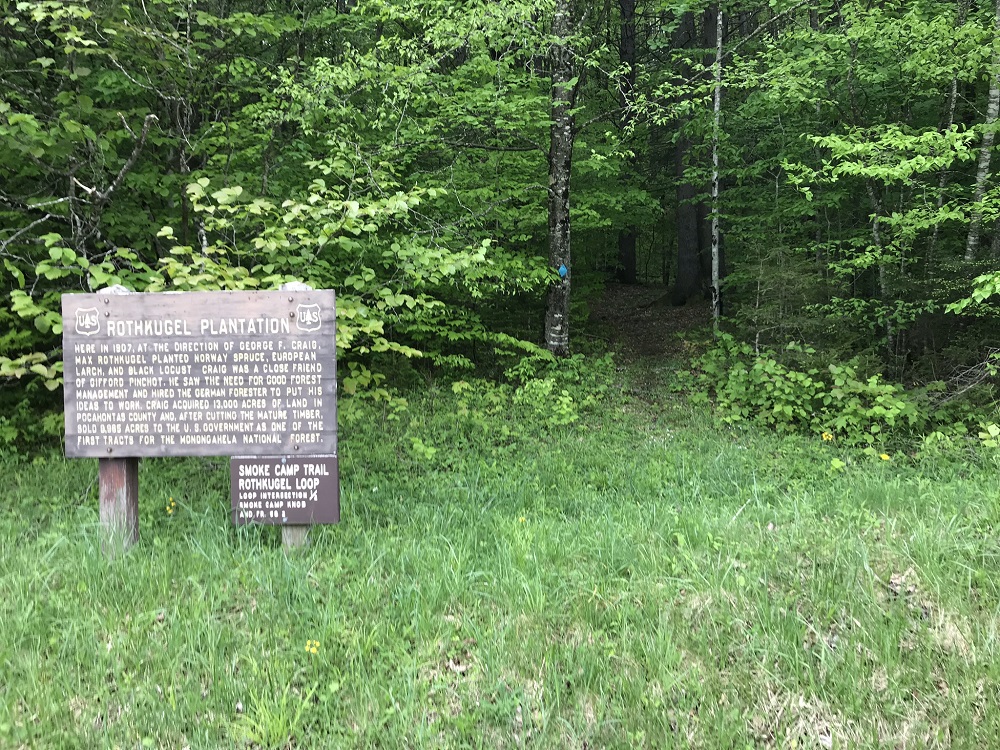
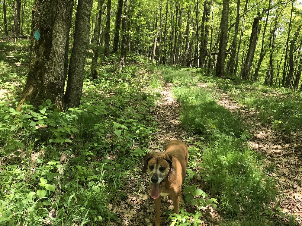
Mile 0.2 – This blue blazed trail starts 0.2 miles north on 28 from FS 54, behind a large sign and across from a yellow house. The sign discusses the history of the tract where the hike starts. Trees were planted here in 1907 on land that later became one of the first tracts of the Monongahela National Forest. Interpretive signs on the Rothkugel Loop, which is the start of the hike, discuss the history of the land, discuss forestry concepts, and illuminate the life of the man who planted the trees, Max Rothkugel. The signs are informative and interesting, and it is curious that the National Forest created such an interesting exhibit without including even a small parking lot off of the road in front. Stay to the left at the intersection just inside the forest; you will return via the trail on the right.
-
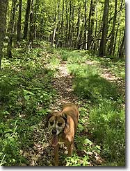
Mile 0.6 – After passing multiple exhibits about the forest, come to a trail intersection. Take a left onto the Smoke Camp Trail and leave the tract of planted trees for a forest of natives. The trail begins to climb here, and some claim that this trail is among the steepest in the Monongahela National Forest. It climbed at about a 15% grade, however, which is not unusual in the Appalachians.
-
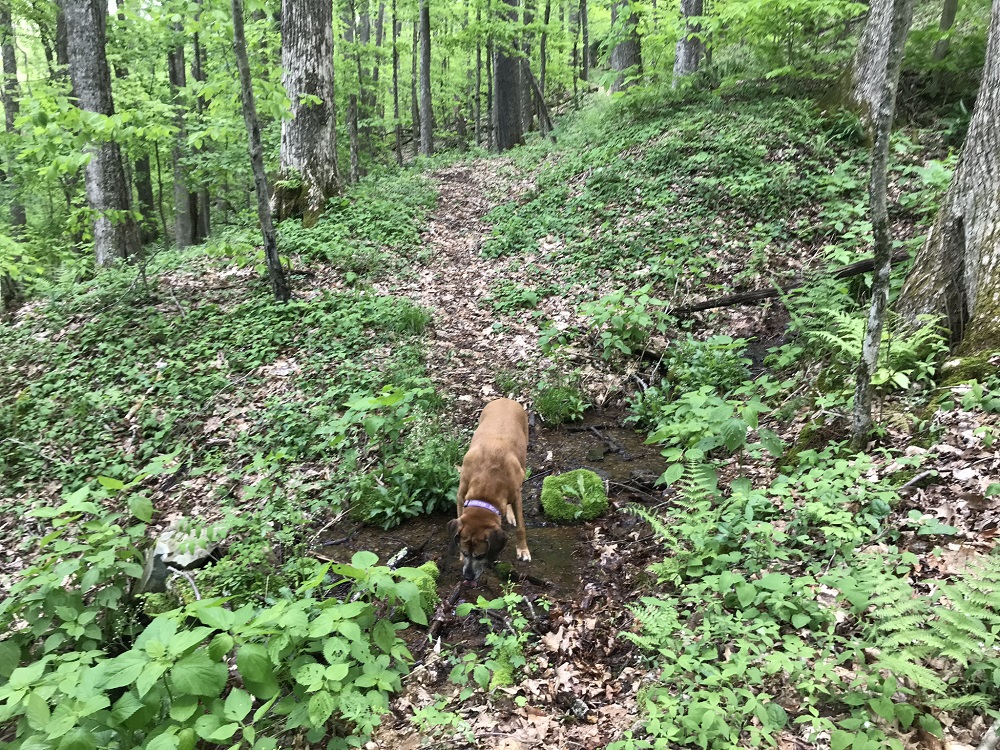
Mile 1.0 – Cross a small stream and continue to ascend. Stinging Nettle can be found among the forest undergrowth uphill from this point. The nettle does not grow in the trail, and its hollow stems means that a hiking pole can easily take it down, but any hiker who has experienced this plant can tell you that it is well named. Hiking this trail in mid-May presented no nettle issues, but later in the Summer may be different. Bring poles if you have them.
-
Mile 1.9 – Reach an old woods road and turn left, continuing uphill. Remember to be alert on your return, so you do not continue past this intersection on the woods road.
-
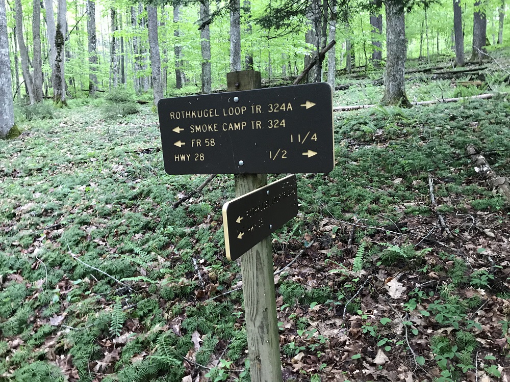
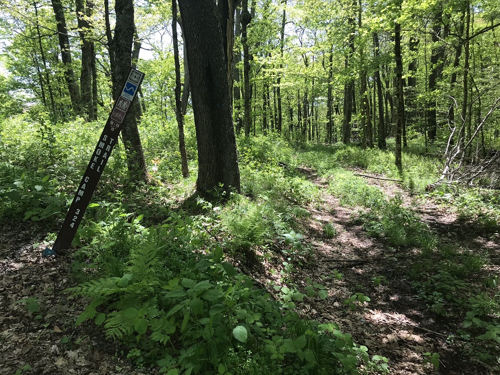
Mile 2.1 – The Smoke Camp Trail officially ends at an open, but lightly used forest road (FR 58). Take a right on this road and continue uphill.
-
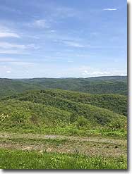
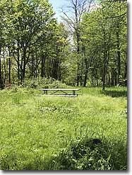
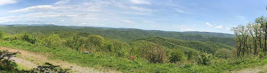
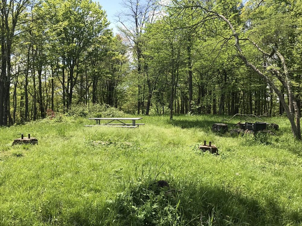
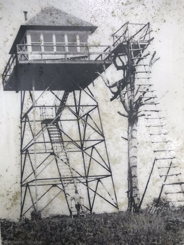
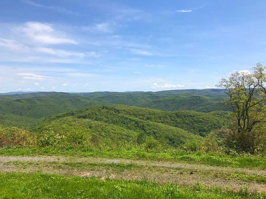
Mile 2.2 – The road ends at a circle, which encloses a small picnic area with grill and picnic table. The concrete posts that once supported the fire tower are still visible. One of the exhibits at the bottom of the mountain shows a photo of the first and second fire towers, and states that the larger tower was built in 1928 and lasted until the 1950s. There are wonderful views of nearby mountains in the Laurel Fork Roadless Area to the east. This is the Smoke Camp Overlook, which a worker at the National Forest’s nearby Greenbrier Ranger District said was only recently cleared – in 2018 – and few people know about. After soaking in the views, return via the road to the Smoke Camp Trail. Take care to follow the route you took up to the overlook.
-
Mile 3.8 – Return to the intersection you passed on the way up, and reenter the Rothkugle Plantation tract. Continue straight this time, to complete the Rothkugle Loop and read about what happened to forester Max Rothkugle.
-
Mile 4.3 – Arrive at the end of the Rothkugle Loop. Exit the forest and return to WV 28, taking care to watch for traffic on this road. Take a left (south) back toward your vehicle, taking another left when you return to the Lake Buffalo road.
-
Mile 4.5 – Return to your vehicle.
|
