|
 By Trail Contributor: Michael Gergely By Trail Contributor: Michael Gergely
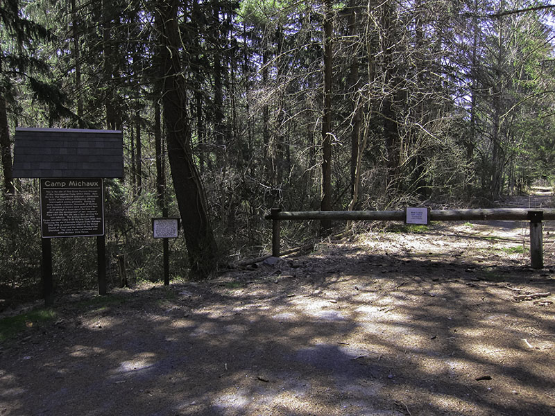
This hike explores the ruins of Camp Michaux, a former Civilian Conservation Corps (CCC) camp used as a US Army POW interrogation center during World War II and later as a church retreat camp from 1946 to 1972. The site also includes the remnants of a barn wall built in the late 18th century as part of the nearby Pine Grove Furnace settlement. The hike can be done on its own from the Bunkerhill Road parking lot or as a side-trail to the Sunset Rocks hike.
The site and trails are maintained by the Cumberland County Historical Society. Much of the site has been given over to nature but there are still many signs of the original camp structures. Numbered posts are installed throughout the site to mark where the old camp buildings once stood. A detailed historical walking guide is available online at the Cumberland County Historical Society website.
The site is still in the process of being cleared and many trails are only partially marked. This guide marks the location of historical markers and the clearest routes to reach them. During the summer months several areas of the trail can be overgrown, so be sure to take precautions against ticks. Be careful of snakes and poison ivy when leaving the trail.
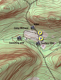
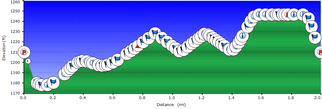
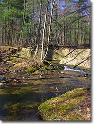
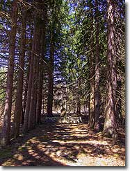
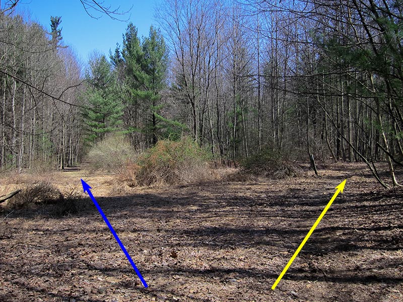
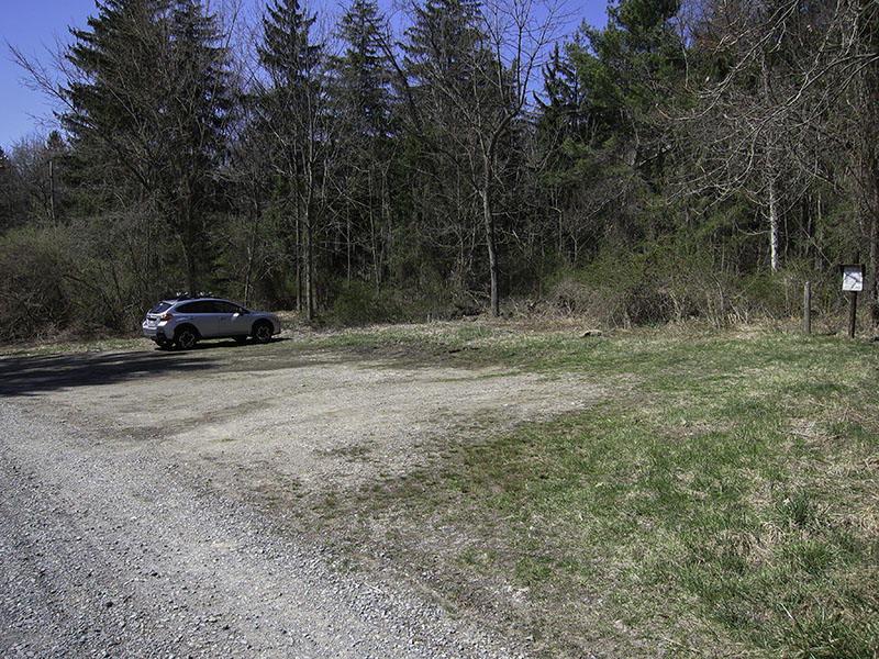
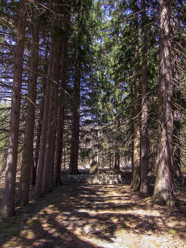
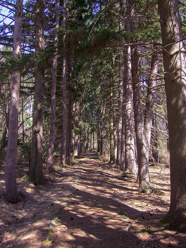
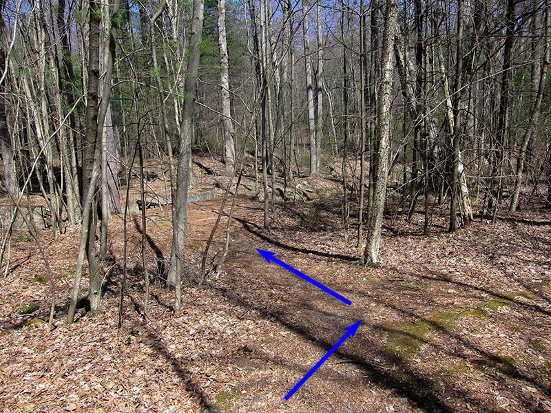
From Bunkerhill Road Parking – The Bunkerhill Road parking lot is located just off Michaux Road by  . From the parking lot cross Michaux Road to the Camp Michaux sign and gate. Continue past the gate and follow the trail down the old camp entry path. The trail goes past several stone and concrete memorial markers installed by the CCC workers and POW camp staff. There are several side trails to the left and right – the trails to the left lead down to ruins along Toms Run, including a small dam and the camp water reservoir. To the right is a spruce-lined connector trail through the center of camp. Continue following the main trail west. . From the parking lot cross Michaux Road to the Camp Michaux sign and gate. Continue past the gate and follow the trail down the old camp entry path. The trail goes past several stone and concrete memorial markers installed by the CCC workers and POW camp staff. There are several side trails to the left and right – the trails to the left lead down to ruins along Toms Run, including a small dam and the camp water reservoir. To the right is a spruce-lined connector trail through the center of camp. Continue following the main trail west.
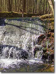
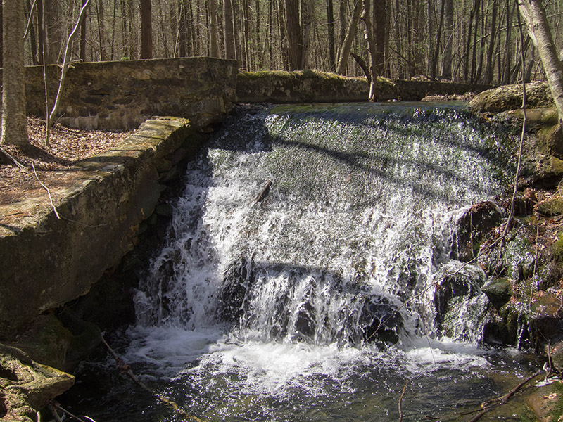
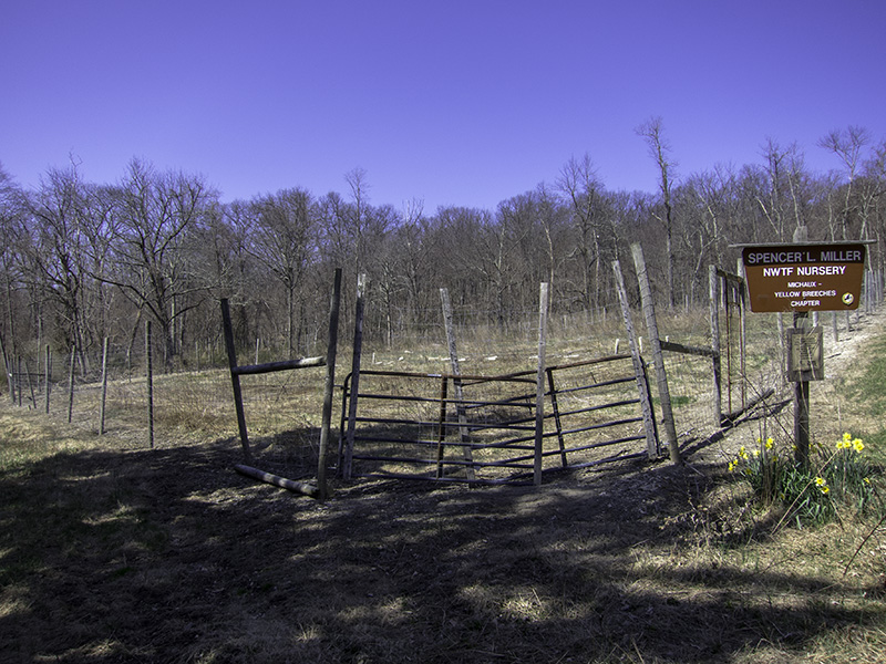
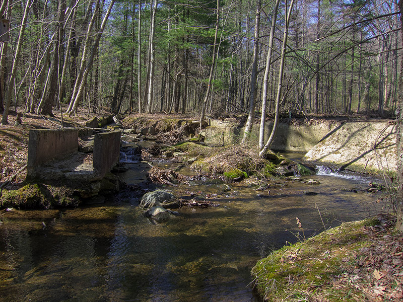
The trail eventually comes to an intersection at the southwest corner of the camp. Straight ahead the trail continues to a concrete dam and spillway  and eventually connects with Sunset Rocks Trail. After visiting the spillway, double back to the intersection and turn left to follow the trail northeast past the church camp swimming pool and eventually connects with Sunset Rocks Trail. After visiting the spillway, double back to the intersection and turn left to follow the trail northeast past the church camp swimming pool  . The trail eventually reaches the northwest corner of the camp, which is occupied by a National Wild Turkey Foundation (NWTF) nursery . The trail eventually reaches the northwest corner of the camp, which is occupied by a National Wild Turkey Foundation (NWTF) nursery  . .
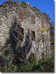
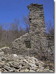
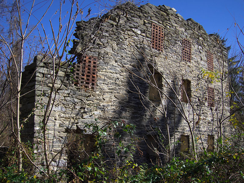
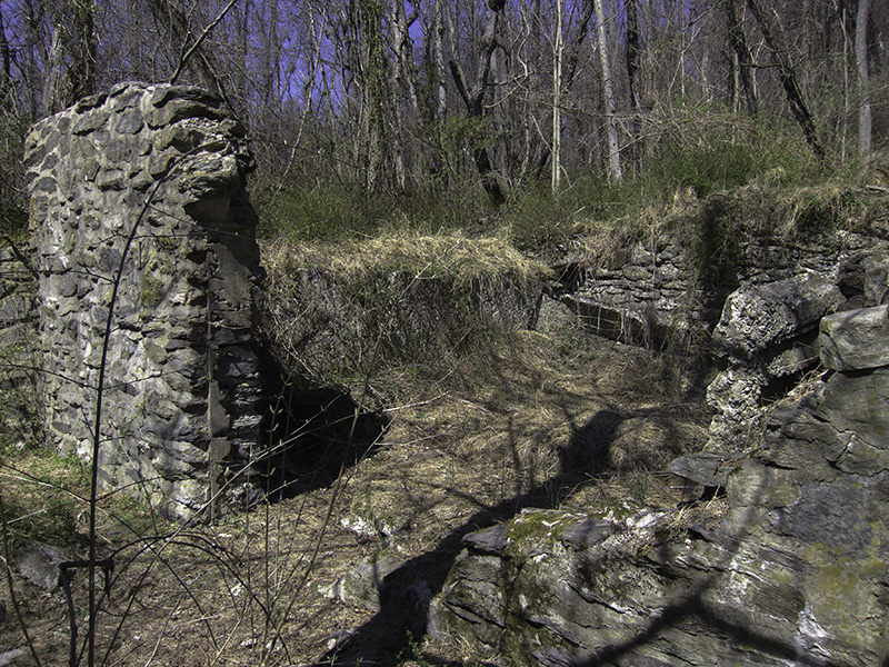
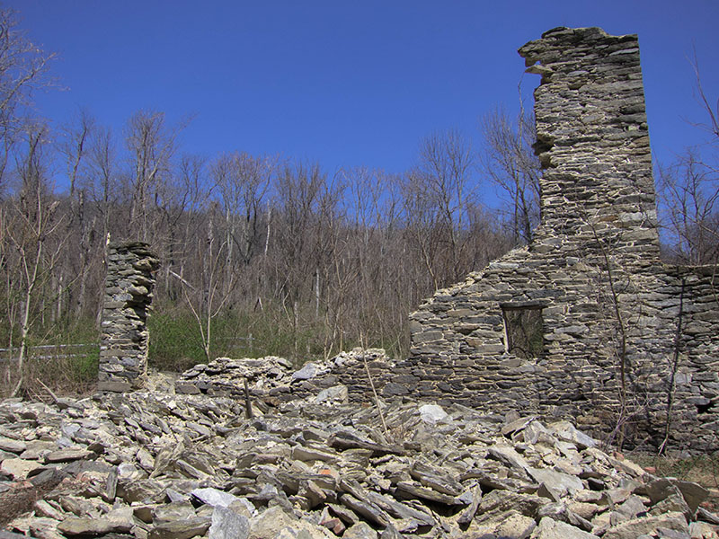
From the trail turns right and parallels a gravel drive out to Michaux Road. Near  a side trail crosses the gravel drive to the right and heads north to end at a ruined stone maintenance shed. The main trail crosses Michaux Road at a small parking area and the fenced-off remnants of an 18th century farm wall from before the camp’s construction (Marker #4). A large portion of the previously surviving wall collapsed during the night of 1 February 2016 due to instability and cold fatigue. a side trail crosses the gravel drive to the right and heads north to end at a ruined stone maintenance shed. The main trail crosses Michaux Road at a small parking area and the fenced-off remnants of an 18th century farm wall from before the camp’s construction (Marker #4). A large portion of the previously surviving wall collapsed during the night of 1 February 2016 due to instability and cold fatigue.
The trail continues around the wall to pass the old camp motor pool and staff housing areas before looping south to the gravel Bunkerhill Road and main parking lot . There are a few markers that can only be reached by walking along Michaux Road from the parking lot, such as the Michaux Road bridge built over Toms Run by CCC work crews  . .
From Sunset Rocks Trail – The Sunset Rocks Trail passes a small clearing at Mile 4.3 of the Sunset Rocks hike. Cross the clearing to an old gravel forest road on the far side. 200 yards down the forest road is a side trail to the left that crosses a concrete dam and spillway that marks the southwest corner of the camp ruins . From there, continue following the side trail to an intersection and turn left to reach the camp swimming pool at .
Follow the Bunkerhill Road Parking directions to make a clockwise circuit of the site. Once you return to the concrete dam and spillway at , recross to the old forest road and turn right to return to the small clearing and rejoin the Sunset Rocks Trail.
Marker Descriptions
More detailed marker descriptions can be found online in the Camp Michaux Self-guided Walking Tour Guide available on the Cumberland County Historical Society website.
– Bath/Shower House / CCC Garage
 – Latrine / Old Farmstead – Latrine / Old Farmstead
 – Barracks – Barracks
 – Barracks / Farm Wall – Barracks / Farm Wall
 – Barracks – Barracks
 – CCC Camp S-51-PA Marker / Barracks / POW Mess Hall / Rec Building – CCC Camp S-51-PA Marker / Barracks / POW Mess Hall / Rec Building
 – Supply Building / Historical Sign – Supply Building / Historical Sign
 – Guard House / Secretary’s Office / POW Marker – Guard House / Secretary’s Office / POW Marker
 – Pump House – Pump House
 – CCC Fountain – CCC Fountain
 – Mess Hall / CCC Star – Mess Hall / CCC Star
 – Headquarters / Camp Office / CCC Flag Pole – Headquarters / Camp Office / CCC Flag Pole
 – Shed – Shed
– Rec Building
 – Bath House – Bath House
 – Shed – Shed
– Barracks / NWTF Nursery
– South Gate House / Swimming Pool
– Barracks / Spillway
 – Generator House / Toms Run Resevoir – Generator House / Toms Run Resevoir
 – POW Marker – POW Marker
 – Hospital – Hospital
 – Commanding Officer’s Quarters – Commanding Officer’s Quarters
 – NCO Quarters – NCO Quarters
 – Forestry Office / Intelligence Building – Forestry Office / Intelligence Building
– Motor Pool Shed
 – Sewage Treatment – Sewage Treatment
 – Privy – Privy
 – Transport Office / Motor Pool – Transport Office / Motor Pool
 – Tool Shed / Water Tanks – Tool Shed / Water Tanks
|
