| By:
Hans und Heidei |
Rating: |
 |
Date of Hike: Saturday, March 30, 2019 |
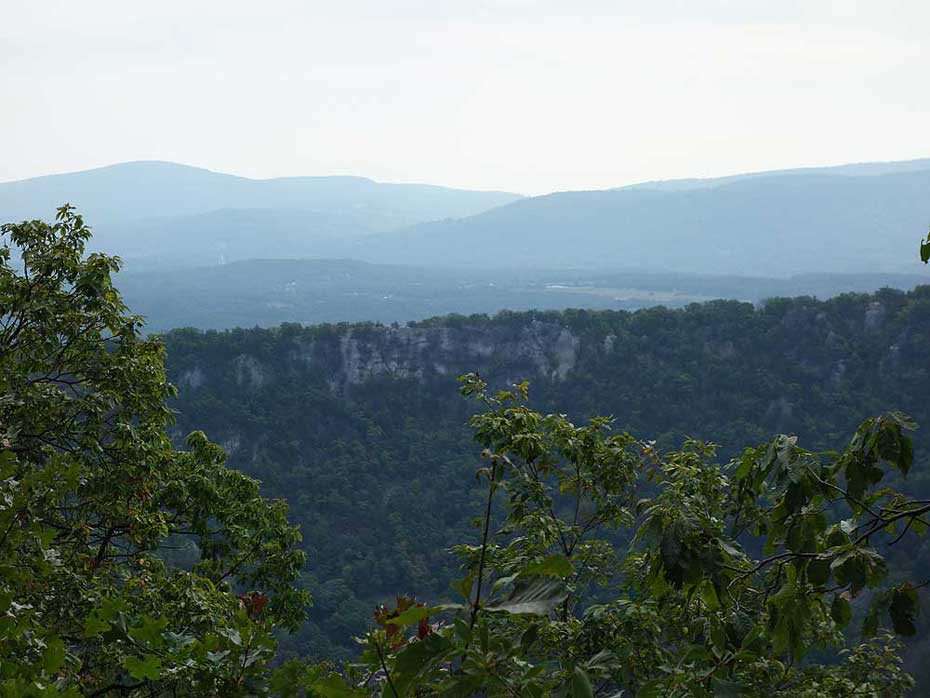
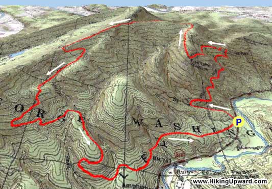
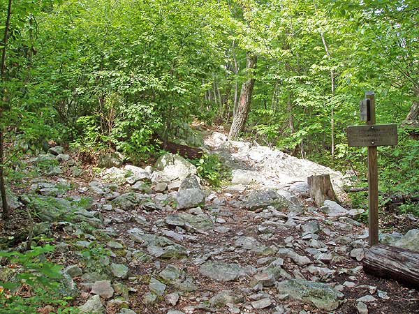
Three stars means "overall a nice hike". It was a very pleasant day for the end of March. The views are nice and consistent, but will be gone when the leaves emerge. There are some fine campsites up there. If you walk counter clockwise the trail varies from rocky, to very rocky crossing 3 scree slopes (which is about an hours time on the way up), to near no rocks most the way down . It never got very steep, we rate it a gradual incline. We encountered maybe 8 people all day. It was the first time out in 4 months and it took our 58 year old knees und ankles 5.5 hours walking time. It was our first time here and we will come back, when again there is no foliage.
|
|
| By:
David S |
Rating: |
 |
Date of Hike: Friday, June 15, 2018 |
I like this hike a lot. It's true that the first part of the trail (going counterclockwise) is rocky, but if you have sturdy boots you'll be fine. There are good views in places, to all directions even with leaves out, though you may have to peer between trees. Today was a Friday, and I ran into 0 hikers and 3 mountain bikers as I got closer to the finish. Mountain laurel was blooming at the upper elevations. It's unbelievable that you can find such beautiful mountain solitude an hour and a half from Washington.
|
|
| By:
CJ Staton |
Rating: |
|
Date of Hike: Sunday, November 12, 2017 |
Great hike and views but definitely an ankle killer. Sturdy boots are a must. Didn't see much wildlife except for a snake, which was strange as it was only 40 degrees out.
Trekking poles are very helpful, especially on the downward part of the trail.
|
|
| By:
Doug |
Rating: |
|
Date of Hike: Saturday, July 8, 2017 |
Great, hike I have to admit. Very rocky in spots that do take some time to cross, but some of the views were worth the work. We had to turn around half-way through the hike due to coming up on a mother black bear and two cubs (around the tv tower section). We were already in their "bubble" of comfort for the mom and she decided to bluff charge at my fiance, so we decided to get out why we could. This particular day, the trail was becoming crowded. Overall, we will be completing this hike in the fall. (Side note) Forrest Service had to shut down a camp ground / picnic area close to the parking area to the Signal Knob / Meneka Peak Trail Head.
|
|
| By:
Jimmy |
Rating: |
|
Date of Hike: Saturday, February 20, 2016 |
Had to take advantage of the beautiful weather on Saturday and get out for some hiking. I've been wanting to do Meneka Peak for a while now and finally got the chance.
I'd agree with the difficulty rating of a 3. The hike itself really isn't that challenging other than the first section up to Buzzard Rock overlook that is a little steep. Some sections are rocky but nothing too difficult. This is a great fall/winter hike since the leaves in spring and summer would likely obscure most of the views the hike offers. There are plenty of camping spots along the trail, although there are only two water sources, one at the very beginning and one at the very end, so bring plenty of water.
Finished in approximately 3.5 hours and there were several other groups/individuals on the trail that day.
|
|
| By:
Bex |
Rating: |
|
Date of Hike: Saturday, October 24, 2015 |
We hiked the trail and it was sunny when we started and it became partly cloudy. The hike was great and a steady up hike climb but nothing too crazy. The view of buzzard rock had a nice place to stop and have lunch. As we continued on, the train became rocky. We hiked this train in tennis shoes so hiking boots might help, but we didnt find it too hard. There were great views of fall foliage. We stopped for lunch at the first campsite. It was a bit breezy on the ridge, but no need for extra clothes. The only river is at the beginning and the end so bring plenty of water.
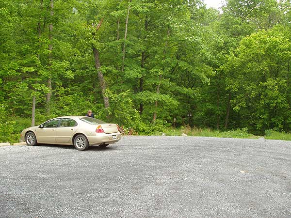
We started hiking around 12pm and finished by 4pm. The parking lot was quite full when we arrived.
|
|
| By:
DCEsq |
Rating: |
|
Date of Hike: Saturday, October 10, 2015 |
Good hike with some views between the trees. Some color change. It's a pretty rocky hike, so hiking boots would help. The trail is easy to follow. We had a bear sighting near the Signal Knob Trail split. It looked like a small adult bear who bounded around 20 feet away from us. After 5 seconds, it rushed away. This is a lower impact hike compared to Signal Knob. The fire road portion of Signal Knob is boring, but Meneka Peak also skips the steep ascent after the Signal Knob fire road.
|
|
| By:
ExFed |
Rating: |
|
Date of Hike: Monday, March 23, 2015 |
Started the hike at 7:00 AM from a vacant parking lot. Chilly but sunny. Had done this hike before and much prefer this hike before the leaves come out. Glad that I had my hiking sticks and some sturdy boots, as I had forgotten how rocky many parts of the trail are. My GPS measured the hike to be 8.6 miles, I completed it in 4:18, and I agree with the stated degree of difficulty as a "3". Saw no others on the trail. All in all, a very pleasant walk in the woods.
|
|
| By:
Sean |
Rating: |
|
Date of Hike: Wednesday, June 25, 2014 |
I had done this trail a couple of times ages ago so I kind of knew what to expect. Arrived at 7 a.m. and was surprised to see no other cars in the parking lot. Saw no one else on the trail, and no cars when I returned around 12:30 p.m. Have always seen several other people and cars before -- very strange.
One of the rockiest hikes I have experienced, more so than I recall from my first hikes there -- I'd say about 2/3 of the trail you are on irregular rock, and even on the smoother dirt portions -- there aren't many -- you are still dodging them. Since my early hikes there I had taken kids up to Buzzard Rock Overlook and back with them wearing sneakers. For the whole trail, I strongly recommend sturdy boots. It's still a nice hike.
Saw deer, lizards, frogs, signs of bears, unusual mushrooms. It was humid and warm but somewhat comfortable as the trail is mostly shaded. Should have taken more water -- I took 2 quarts and could have used 3. There are a few springs along the trail so you could filter your own, but I don't know how reliable the flows are in drier weather.
|
|
| By:
Mike C |
Rating: |
|
Date of Hike: Friday, December 20, 2013 |
Hiked this one today. There were still parts with snow along the side of the trail, but there was only a few crossings where there was snow in the path. Rocky as expected. We only saw one other person on the hike, a mountain biker coming down the Tuscarora side. We completed it in 5 hours, with only a few 5-10 minute breaks.
|
|
 View all 37 archived reviews for the Meneka Peak hike
|

