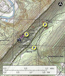
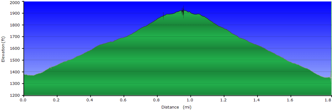
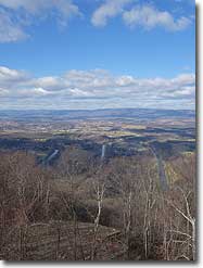
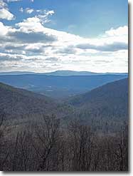
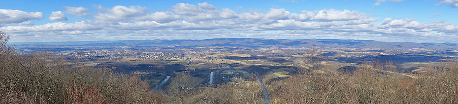
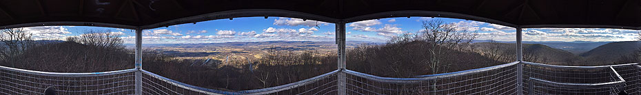
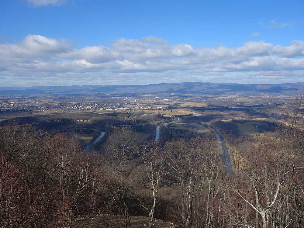
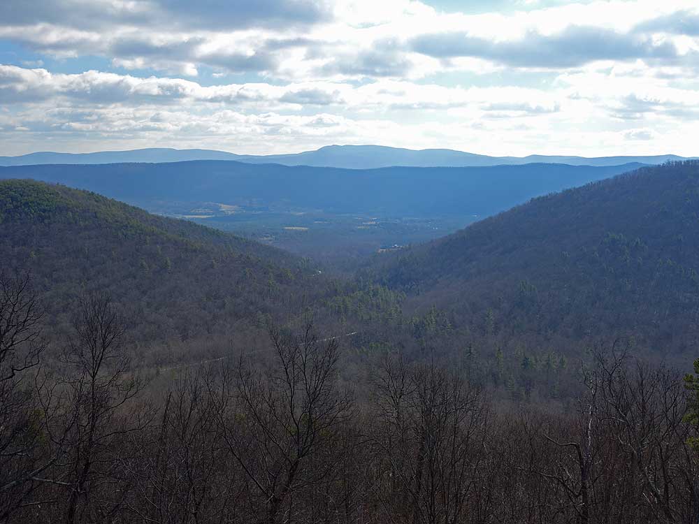
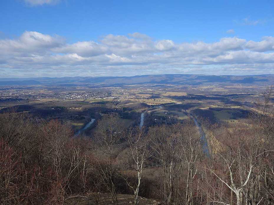
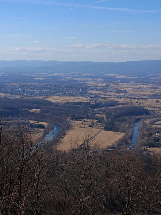
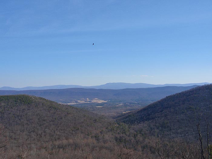
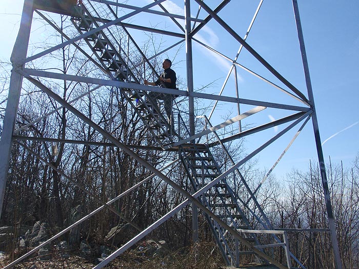
The hike up to Woodstock Tower is an easy 2.0 mile out/back walk suitable for most people, and the 360° panoramic view from the top of the tower is one of the best in the Massanutten range. On a clear day you can see south towards Harrisonburg and the town of Woodstock just across the other side of the south fork of the Shenandoah River. The views west are of the north fork of the Shenandoah River, and to the east you look back through Woodstock Gap to the Shenandoah National Park.
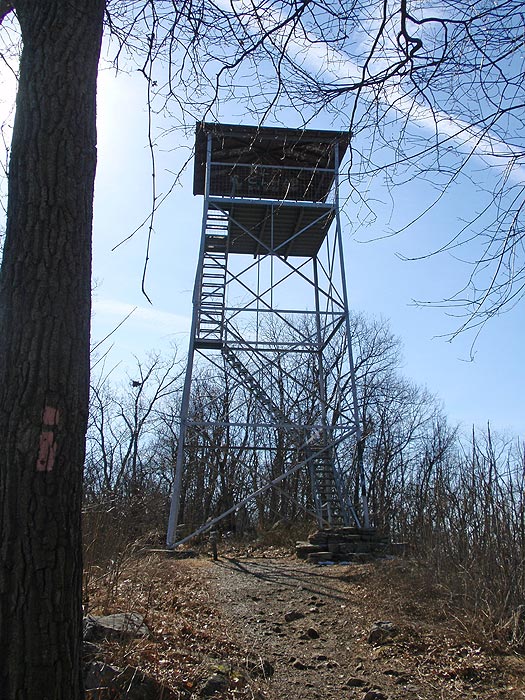
If you're hiking with very young children, or hikers who are just starting out and may not be in the best shape yet, you can also park on the ridge at the pink blazed Tower Trail, which makes for a very easy 10 minute walk to the tower with no elevation gain. Note: Tower Rd from VA758 is closed in the winter.
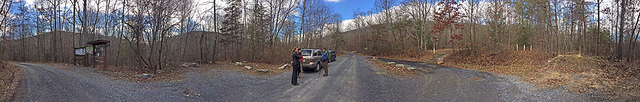
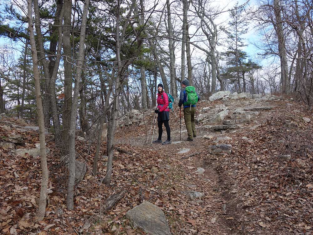
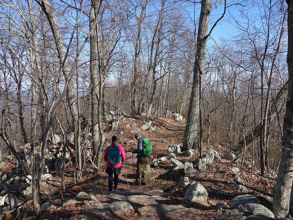
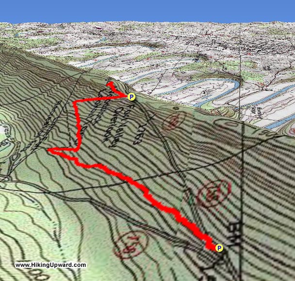
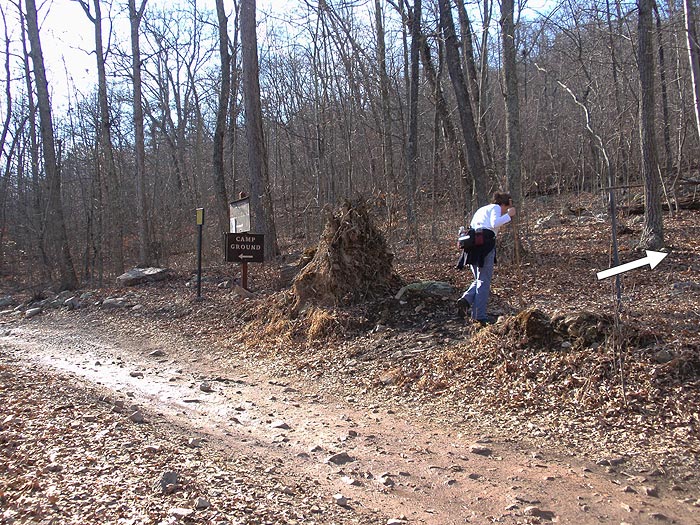
Mile 0.0 - From the parking area in the Little Fort Camping/Recreation area start up the white blazed Wagon Rd/Nature Trail and in 0.1 miles cross the wide yellow 'V' blazed Peters Mill Run Trail. Be cautious, as the Peters Mill Run Trail is open to ATV's. The white blazed Wagon Rd/Nature Trail is one of the few trails in the Woodstock Gap area that is closed to motorized vehicles.
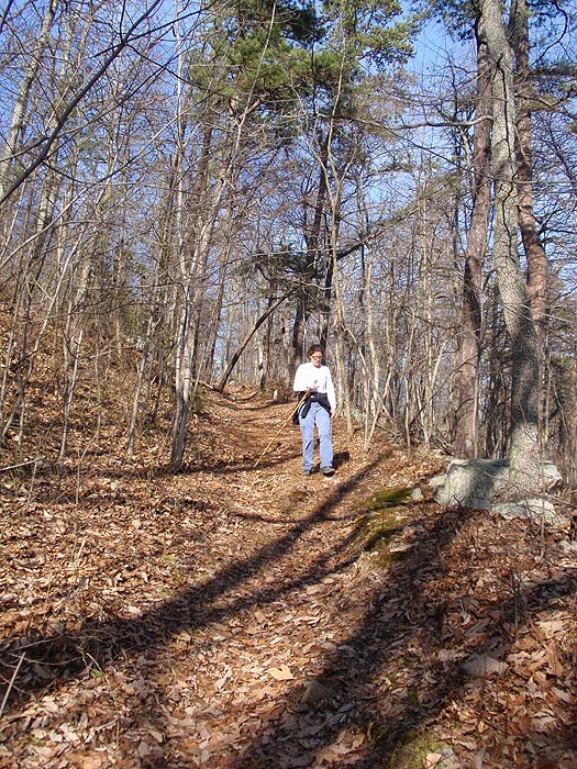
Mile 0.1 - After crossing the yellow 'V' blazed trail, continue on the white blazed trail as it becomes slightly steeper before making the first of two switchbacks in 0.1 miles. After the next switchback in another 0.3 miles, the trail is at it's steepest for the remaining 0.2 miles to the ridge and intersection of the pink blazed Tower Trail.
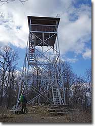
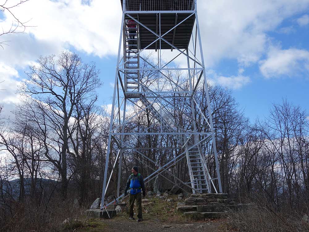
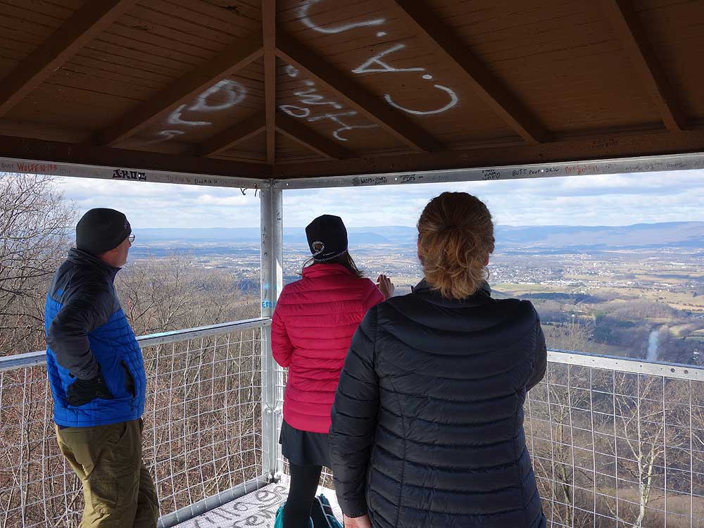
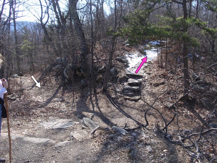
Mile 0.95 - Turn left on the pink blazed Tower Trail and follow it along the ridge for 150 yards to Woodstock Tower. Woodstock Tower is one of the few in GWNF where you are still permitted to climb to the observation deck.
Mile 1.0 - Retrace your route back to the Little Fort Camping/Recreation area.
Video
Late
January
View From Woodstock Tower
Woodstock Tower Hike Comments
Archived Comments
By:VaMtnLion
Rating:
Date of Hike: Sunday, November 10, 2019
Hiked this trail again after about a decade with my wife and 6-year old grandson. Weather was nice hovering close to 60 degrees and trail conditions very dry. Trailhead at Little Fort parking lot was easy to find with the two white poles clearly marking the start. A little harder to locate where the trail picked up after crossing the Peters Mill Run trail, particularly with the thick layer of leaves on the ground. Found the trail a little to the right of where the Tower trail intersects Peters Mill Run and enjoyed a rocky, moderately steep ascent for nearly a mile with two switchbacks. Tower was in good repair and open to climbing with fantastic view of the valley and fall foliage - well worth the hike and climb and hard to believe it is 84 years old. Trip back a little challenging due to thick carpet of dead leaves making traction going downhill tricky at times for a 6-year old. I would rate this hike as about at the limit for a child that age with no previous hiking experience. Highly recommended hike - do it while the tower remains open and serviceable!
By:Kent
Rating:
Date of Hike: Sunday, November 4, 2018
The GPS coordinates were spot-on for the entrance to the little fort campground and parking for the hike. We had a little confusion finding the trail head. There are a few different signs after we drove in. To find the start of the trail, just walk 50 ft futher along the road in the campground and look for the Wagon Rd trail sign. There were two white poles at the entrance with a yellow blaze on them altho the trail has a white blaze.
Once at the tower u can see a patch of grass below on the Shenandoah river side. I think its actually a paraglider launch site. We scrambled the rocks down there and it actually had a nicer view of the river and valley than from the tower. It made for a less crowded spot to sit and relax while we ate our sandwiches. We walked the gravel path back to the road, then a short distance up the road to the tower trail head and then back down our original trail. Great little hike with a beautiful reward.
We bought subs at the gas station on 678/Fort Valley Rd less than a 1/2 mile south of 758. My italian sub had a thick stack of meat that could have benefitted from extra cheese to obtain a euphoric meat to cheese ratio. Delicious!
By:Robert LaBella
Rating:
Date of Hike: Saturday, September 8, 2018
My boys and I decided to go see the Woodstock Tower and came up through Fort Valley Road. The drive directly to the tower (5 minutes from where you can park) was well marked coming from the valley. We ended up deciding instead to try the short hike from the Little Fort campground which was empty except for one tent camper. At the campground, a printed sign at the entrance indicates that the "white blazed trail to the Woodstock Tower starts at campsite 8" but we never found any blazings. There was a trail at campsite 8 that led through the woods to a fast-flowing stream that had both a rock crossing and a small footbridge. We followed that path for quite a while and never saw any blazings. It was a beautiful hike, clean trail and quiet but in the end we decided to turn around and head back to the car and simply take the road up to the Tower Trail. Once there, we did not see any trash at all. It was very clean. The tower itself was cool and we had a great time up there despite the clouds (that we looked down upon). We could see quite a way when the clouds cleared periodically and could definitely see the bends of the North Fork of the Shenandoah River. All-in-all, despite having no luck finding the trail out of the campground, we had a great time and I would recommend this. If you've never been in an observation or fire tower, it's a good time and the views are fantastic.
By:Kristine Villatoro
Rating:
Date of Hike: Sunday, March 18, 2018
It was a great short hike. Very busy for a Sunday March afternoon. Didn't see no trash along the trail. Saw a couple handgliders taking off. Want to come back up maybe during the week, when there isn't so much traffic. We came one way and left another. I want to go back the way we came as I saw some old ruins and was interested in figuring out what those ruins were.
By:Hobo Hiker
Rating:
Date of Hike: Saturday, August 5, 2017
I enjoyed the tower hike as a very quick simple hike with little elevation and a great view. I entered Woodstock Tower Rd from Fort Valley Rd. The road only had one turn and wasn't bad. It is a gravel road so it had a washboard type feel and plenty of road dust. The road does narrow to a single lane in spots but when two cars meet they figure it out. It was GREAT to be able to go up in the tower as I had never been up in one. The tower is very safe but I'm not use to that type of bare bones forestry tower. The tower itself is a little scary for someone afraid of heights.
As for the tons trash comment I didn't see any trash. I spoke with a very friendly park ranger who was checking the tower for graffiti and he said a Boy Scout Troop and some park rangers cleaned all the trash up. (Thank you Boy Scouts) They are going to paint the tower again to get rid of all the new graffiti. He said it is constantly being repainted due to vandals. I don't see the point of people putting graffiti on stuff. It just gets painted over and is annoying.
Below the tower is a hang gliding launch site. I did a small bushwhack down to the hang gliding site and spent an hour watching the hang gliders take off from the mountain. Interesting and fun to watch. The hang glider pilots were very friendly.
By:Teresa
Rating:
Date of Hike: Tuesday, July 19, 2016
Although two guys were painting the tower they still let us go up.
The view was awesome...just wish we could have stayed alittle longer.
We will go back in the fall after the leaves come off the trees!
By:mike
Rating:
Date of Hike: Saturday, February 4, 2012
The view is great, trash along the trail not so great, besides that the view from the tower is one has to see to believe
By:Zachary Taylor
Rating:
Date of Hike: Sunday, February 27, 2011
The Woodstock Tower provides the best view available (on foot) of the famous "Seven Bends" of the Shenandoah River available. And there's two ways to get there - one is a 3 minute walk on Tower Trail, the other is a 20-25 minute walk from Little Fort Recreation Area. I enjoyed getting to the hike, walking the trail, and the incredible views. One downside is that due to being able to park off 758 and walk 3 minutes to the tower, this can sometimes get a lot of traffic. So if you're into a great view of the river and Fort Valley, this is your hike. If you're looking for solitude, not so much.
Well we were short on time so we looked for a short hike and found this one. Figured the kids would like it. The trail head is actually in a camp ground and starts on an ATV trail. Walking on the ATV trail was a little difficult but it doesn't last for long. We did read that you can just park and go to the tower (about a 50 foot walk). The hike has a pretty decent ascent as you work the second leg of the cut backs, nothing to intense though. Well we made our way to the tower and thats the part we disliked. Trash was everywhere, lots of beer cans!! We encountered a lot of people at the tower that had just driven up there. The view was nice, but the people and the trash bothered me to much. We usually teach the kids if we encounter any trash on the trail we pick it up, we would of been up there for hours if we tried to clean that place up. If you want a great view and a short hike in this area go for buzzards's rock on of my families favorites!!


