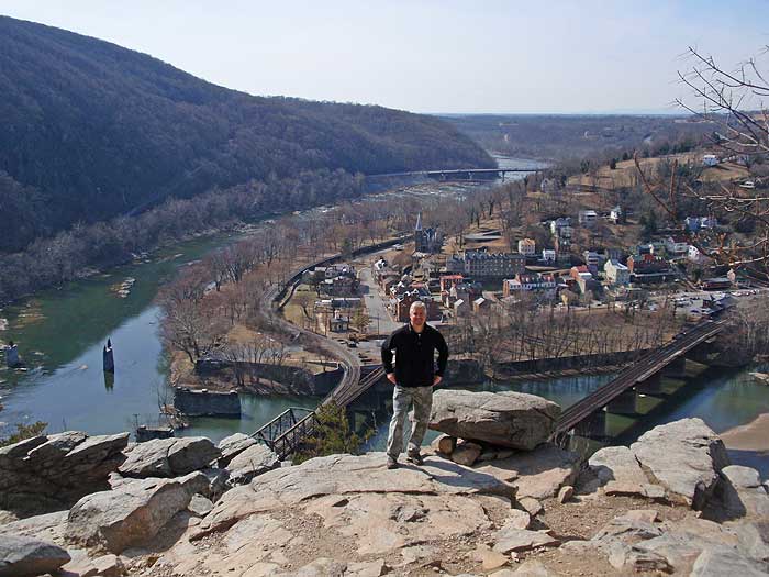
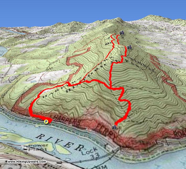
Maryland Heights is another of those must-do circuits for most hikers in the metro area. With a spectacular view of Harpers Ferry from the main overlook, and steeped in Civil War history, this shorter circuit is a favorite for many. But be prepared for the crowds, on nicer days this hike is very busy.
The main ridge at Maryland Heights has the ruins of Union Civil War forts, trenches, gunpowder magazines, and infantry encampments. With most of the circuit having informational signage describing the different ruins.
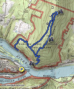
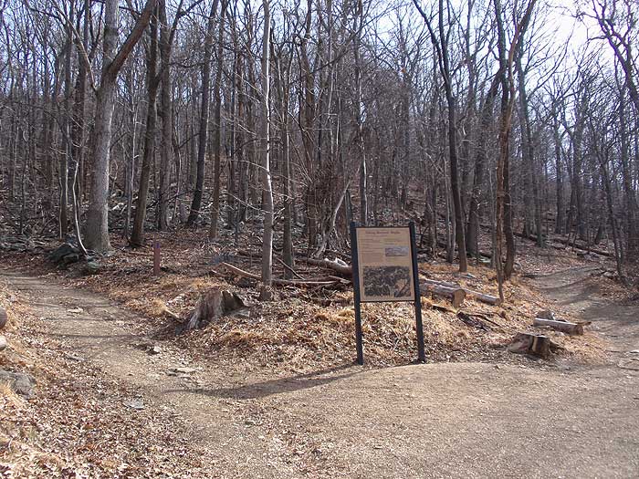
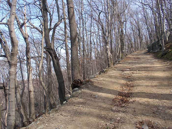
From the parking area at the train station cross the pedestrian bridge and stay left to the trailhead at the bottom of the steps. Start up the Combined Trail and pass the Naval Battery built in 1862, and first of the Union fortifications on Maryland Heights. At the next intersection, and informational sign, turn left uphill on the Stone Fort Trail as it very steeply ascends towards the ridge.
Once arriving at the ridge pass through the main fort area, then climb a set of log stairs to reach the main interior of the fort. This main section, and largest earthwork, was constructed in June of 1863. The main stone wall on the north of the fort was erected to protect it from northern attack.
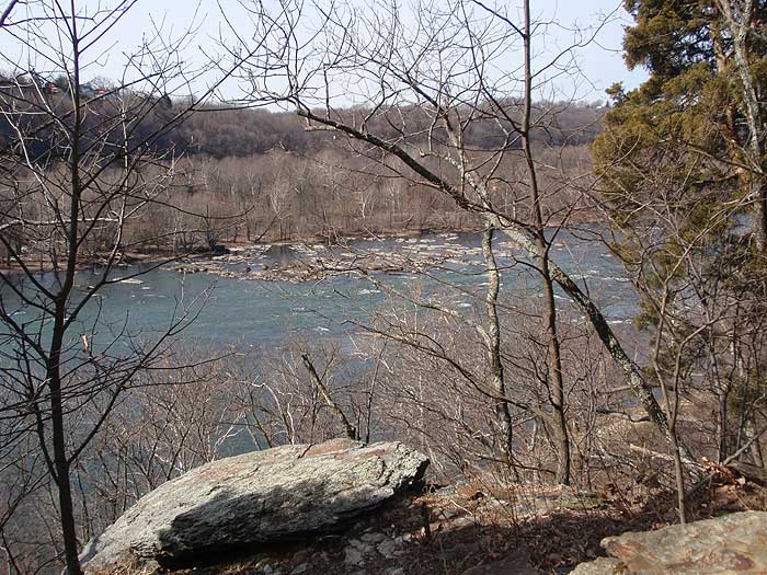
From here the Stone Fort Trail will pass back to the south, with views of the Potomac River to the east through the trees. The trail will descend more steeply before ending at the intersection of the top section of the Combined Trail.
Turn left towards the overlook and in 150 yards turn right down the Overlook Trail. The main overlook for Harpers Ferry is in 0.3 miles.
Return to the Combined Trail, then follow it past the two trailheads for the Stone Fort Trail as it descends back down to Sandyhook Rd.
Early February
Maryland Heights
Maryland Heights Hike Comments
Archived Comments
By:yishin
Rating:
Date of Hike: Saturday, August 24, 2019
Parking is very limited - you are better off to park in town and walk through the bridge to get to the trailhead. The view at stone fort trail sucks, but it provides a good work out as the trail is steep. The grass is overgrown on the way down stone fort trail (if you hike the loop clockwise). To reach the overlook, you have to hike downward on overlook trail. This part of the trail is very crowded, but the view is so worth it. To get back, you have to hike up again the same way. The overlook trail is tough on a dog, because of the rocks scrambling.
By:Rachel
Rating:
Date of Hike: Monday, May 27, 2019
Great hike. The trailhead parking was full, but we still got there early enough to get parking near the train station in town. It was a nice and easy walk to the trailhead. It was a bit wet, so some of the downhills from the Stone Fort were slow-going. It was a holiday weekend, but we passed many more people on our way down. Few people went out towards the stone fort so the solitude was nice.
By:Mark the Leki Pole Loser!
Rating:
Date of Hike: Saturday, January 26, 2019
Leki telescopic trekking poles left in 2nd parking lot of the MD Heights Trail on Saturday 1/26 at approx. 2:30pm. Silly me, leaning them up against my car, then driving off! If retrieved, please call me at 540-636-1640. Thank you in advance.
By:Nice winter hike!
Rating:
Date of Hike: Friday, January 11, 2019
I went on a cold Friday afternoon and it was a pretty busy trail. Very pretty views and lots of interesting historical sites. Parking lots and road are back to normal.
By:Be warned!
Rating:
Date of Hike: Saturday, October 6, 2018
The parking lot at the trail head is currently not open!!! The road is closed due to a recent rockslide and is currently being repaired. You will have to park in Harpers Ferry and walk across the pedestrian train bridge! I learned this too late today but I hope I can save the next person.
By:Rachel
Rating:
Date of Hike: Tuesday, October 2, 2018
Sad that I couldnt even do this hike....Sandy Hook Road (where the parking area is located) was closed off...
By:Steven
Rating:
Date of Hike: Wednesday, August 22, 2018
Ive wanted to do this hike for years and finally got around to it today. Took my son and 5 of his college friends. We parked at the parking lot by Rt 340 at the Shenandoah Bridge and started the hike at 10:30am. We hiked the AT to Jefferson Rock at Harpers Ferry. We then hiked down into town and crossed the bridge to get to the start of the Maryland Heights hike. We hiked the blue trail to the top with the stone fort. We then hiked down to the overlook. The hike is steep at times, but very rewarding. Great for Civil War history buffs. And the views from the cliffs are stunning. The we arrived at the cliffs at 1:30 and they were not crowded (the benefit of doing this hiking midweek). We ended the hike and got ice cream at Scoops. My sons friends thanked me for planning this hike. They really enjoyed it. We plan to do Loundon Heights next.
By:Dave
Rating:
Date of Hike: Sunday, June 10, 2018
Warning: I got what appears to be a Giant Hogweed burn on this hike on June 10, as my son and I did the Stone Fort loop twice that day. I suspect that the Giant Hogweed plant(s) are somewhere on the ridge traverse. I was lucky and just ended up with about a dozen small blisters across my arms and neck. Do some research on the Giant Hogweed so you can avoid it.
(Great hAP5688895ike, great overlooks on the Stone Fort Loop and the cliff)
By:Dave
Rating:
Date of Hike: Sunday, April 15, 2018
This is a great hike for the views and the exercise. The trail can be steep, but it is generally wide (except on the ridge) and not too rocky.
The overlook has excellent views of Harper's Ferry and the Potomac, but can be a bit crowded on nice weekends. The stone fort trail is much less congested, and offers great views of the Potomac east of Harper's Ferry, as well as loads of history.
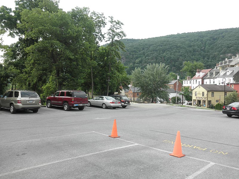
One parking option is at the base of Maryland Heights, but be aware there are only about 20 spots total (across 2 areas) and these fill up fast on weekends. You can also park across the river at various pay spots (street, train station) and walk across the bridge.
By:Adventures in Roamance
Rating:
Date of Hike: Saturday, March 31, 2018
This is an old favorite of mine. The trail is not long by any means but it is steep enough for you to make a real workout out of it if you get creative with the routes. The river adds to the serenity of the location and there is quite a bit of history sprinkled throughout the trail. Read more about this specific trail with stats and pictures, here: https://adventuresinroamance.com/maryland-heights-a-historic-day-hike/


