 |
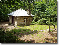
Potomac Appalachian Trail Club (PATC) Cabins
We receive many emails every year asking about the cabins in the GWNF and SNP. Maintained by PATC, the club has twelve public use cabins reasonably priced, as well as twenty PATC members only cabins. Reservations are generally taken up to two months in advance. Check out all the info below:
|
 |
Ticks and Lyme Disease
The ticks start coming out in the Spring, with the summer months of June and July prime ticks season. Help protect yourself from Lyme Disease and make sure to take the proper precautions. Apply a repellent with 30%+ deet, and consider using a clothing repellent like Permathrin that kills ticks.
|
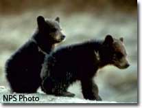 |
Black Bears and Hiking on the East Coast
Catching a sighting of a Black Bear can be the highlight of a hike. In the mid-Atlantic the most likely place to encounter a bear is in the National Parks where hunting is not permitted, however they are present in many of our forests or state parks.
|
|
 |
 |
High Lonesome Trails: Hiking Virginia's High Knob Region
Amazon - Far Southwest Virginia’s High Knob Region, centered around 4,200-foot High Knob in the George Washington and Jefferson National Forest’s Clinch Ranger District, has long flown under the radar as one of central Appalachia’s most underrated hiking destinations. Hikers looking to travel the area’s trails, which lead to backcountry swimming holes, waterfalls, sweeping vistas, and old-growth forests, have mostly relied on online and word-of-mouth information for trip planning in the past.
|
 |
AMC's Best Day Hikes in the Shenandoah Valley: Four-Season Guide to 50 of the Best Trails from Harpers Ferry to Jefferson National Forest
Amazon - One of the most iconic American regions, the Shenandoah Valley has served as a home to presidents, a cradle of colonial America, a battleground during the Civil War, and a crucible for the United States' recovery from the Great Depression. It's also a lush, dramatic, ruggedly beautiful area, with access for hikers of all skill levels to see the landscapes close up that shaped our nation's history.
|
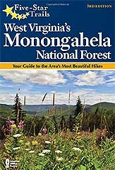 |
Five-Star Trails: West Virginia's Monongahela National Forest: Your Guide to the Area's Most Beautiful Hikes
Amazon m- A whopping 900,000 acres, the mighty Monongahela National Forest is the heart and soul of West Virginia and a natural getaway for hikers and weekend backpackers. Five-Star Trails: West Virginia's Monongahela National Forest leads hikers to classics, such as High Falls and Senaca Rocks, as well as such lesser-known but equally scenic hikes as Canyon Rim and Laurel Creek.
|
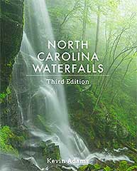 |
North Carolina Waterfalls
Amazon - In this third edition of his classic photography/hiking guide, Adams showcases his own beautiful color photographs. This complete compendium lists 1,000 waterfalls, and Adams specifically highlights more than 300 of the best waterfalls found in North Carolina with full descriptions, comprehensive directions, and four-color photographs.
|
| |
If you have a hiking book you think we should highlight at HikingUpward please
contact us
. |
|
|
So Who Are We?
We are a group of avid hikers who enjoy spending time in the magnificent forests and parks of the mid-Atlantic states. Over the years, we have hiked many beautiful mountains and valleys, and founded
HikingUpward.com to share what we've learned, create a meeting place for people who like to hike, and encourage anyone with an interest to enjoy the outdoors.
Since HikingUpward.com was founded in 2000 a team of dedicated volunteers have constantly worked to create the best hiking resource in the region. Many of our new features reflect suggestions from hikers like you. Just by visiting this page, you have become a member of the HU community, and we invite you to post a review and share your tales from the trail.
In addition to the tremendous contribution of volunteer programs managed by the USDA Forest Service and National Park Service, many of the trails in the mid-Atlantic are maintained by private groups. Please consider joining or donating to your local hiking non-profit. It is through their efforts that we are all able to hike these great mountains. HikingUpward.com is completely free to use, and it is maintained entirely on a volunteer basis. We hope that you find the information on our site useful. |
|
|
|
|
 |
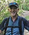
Tony Van Vugt
Founder
Originally from Australia, Tony began HikingUpward.com almost 20 years ago as a way to share his favorite trails with other hikers. In those years the site has grown to feature hundreds of day-hikes and backpacks across the mid-Atlantic region. After hiking for 40 years in the mid-Atlantic Tony can still be found out on the trails most days volunteering for the Potomac Appalachian Trail Club and United States Forestry Service supporting trail maintenance and sustainable usage of our natural resources.
Contact:
Tony Van Vugt
|
|
 |
Bryce Allison Chief Trails Officer
Bryce is based out of Goochland Virginia, near Richmond, and does most of his hiking in mid-state Virginia. Originally from Scotland, his love of hiking started after his 20th Wedding Anniversary trip to the Canadian Rockies. He prefers some of the longer hikes such as The Maryland Challenge, Mt Rogers/Grayson Highlands, North Fork Mountain and the Catoctin Trail.
Contact: Bryce Allison |
|
 |
Jeff Monroe
Senior Contributor
Charlottesville based Jeff Monroe has been hiking in Virginia for nearly 30 years, and writes about some of his outings in his blog at www.wanderingvirginia.com. Jeff volunteers extensively for the Potomac Appalachian Trail Club, is an Eagle Scout and the father of an Eagle Scout, and a former Scoutmaster. Jeff coordinated revisions of the most recent PATC trail maps covering Shenandoah National Park's Southern District and the National Forest's Pedlar/Glenwood District. When not working as an administrator at the University of Virginia, Jeff is often out on the trail with his constant hiking companion, Gracie the Ultimate Trail Dog.
Contact: Jeff Monroe
|
|
 |
Zachary Robbins
Senior Contributor
Zachary is based out of Chapel Hill, NC and author of Zach's Mild Adventures. Although far from the mountains he enjoys 3+ hour drives each way combined with difficult all-day hikes. Since college he has been on hundreds of hikes around North Carolina and southern Virginia, visiting the most popular and most obscure trails he could find. There's no hike hard or long enough that he wouldn't tackle. Some of his favorite areas in North Carolina include the Black Mountains, Grandfather Mountain, Old Fort region, and Linville Gorge.
Contact:
Zach Robbins
|
|
 |
Adam and Christine Anderson
Senior Contributors
Christine and Adam live in the heartland of Virginia's best hiking in the western part of the state. They are also the authors of Virginia Trail Guide an in-depth social media blog promoting the awareness of Virginia's hiking trails. Both are life long residents of Virginia and have hiked all over the Old Dominion, as well as many other trails along the east coast.
Contact: Adam Anderson
Contact: Christine Anderson
|
|
 |
Linda Shotwell
Advocacy and Community Outreach
Linda has hiked in the mid-Atlantic for more than 20 years, and enjoys spending most of her hiking time in the mountains of northwest Virginia and West Virginia. She is passionate about engaging the hiking community on all issues that affect the mountains and parks that we all love to hike.
Contact: Linda Shotwell
|
|
 |
The Rest Of The Crew
Many other HikingUpward volunteers contribute their time and talent to map routes and maintain trails. The HU community contributors also include everyone who has posted a review of a hike on this site. Thank you!
|
|
|