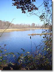
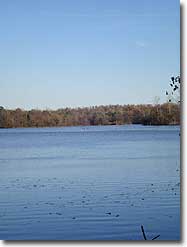
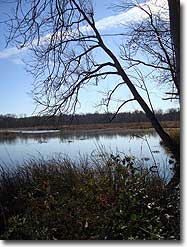
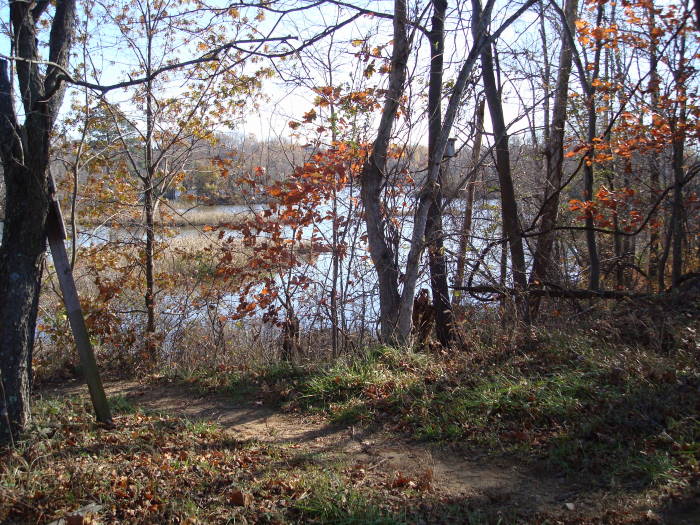
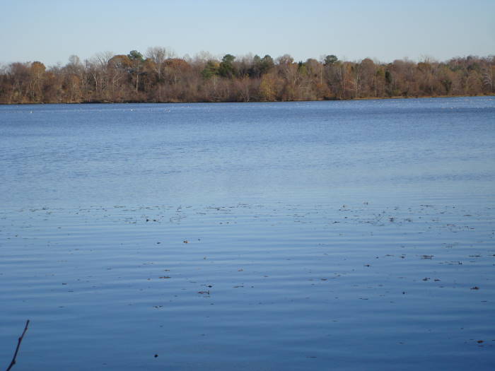
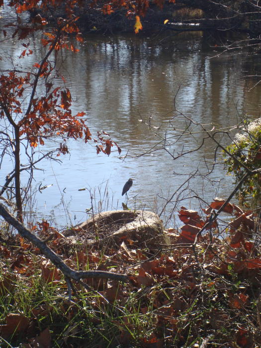
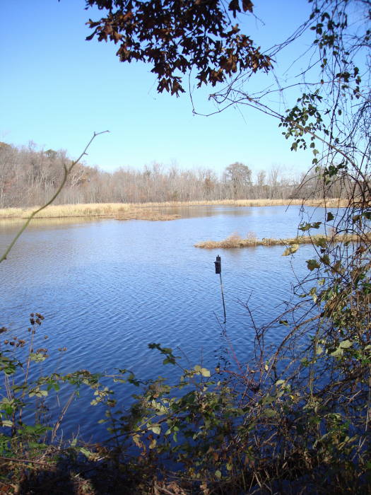
Do you live near Richmond but can’t make it to the Mountains for a quick hike? Then head to the Dutch Gap Conservation Area (DGCA) just south of Richmond for a unique hike around a James River Tidal Lagoon. There are constant views of marshes teaming with all sorts of birds. This hike is an ornithologists dream. We saw an eagle, herons, cormorants, Canada geese, ducks, red tailed hawk, etc. We also saw about 8 deer with a good size buck leading them.
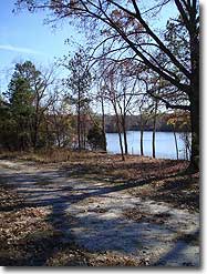
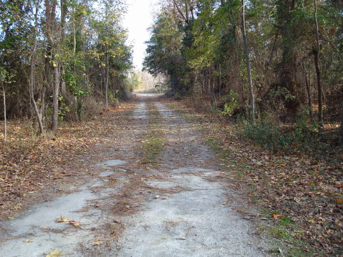
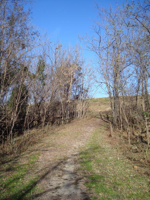
This is a great hike for families with young kids due to its relative lack of elevation change and would be easy to push a stroller on. There were also many people walking their dogs. This is probably the only hike on our site that we will list as wheelchair accessible with just a little help in 1 or 2 short areas.
Notes:
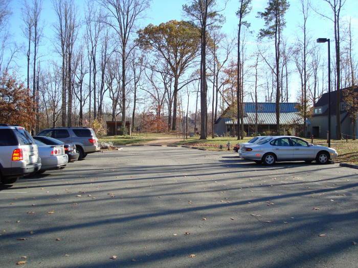
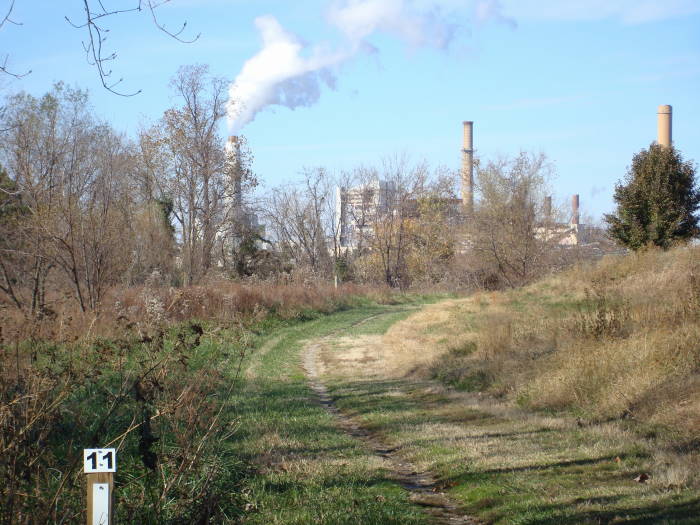
The drive to the Visitor Center parking area will lead you past a county sewage treatment plant and a large Dominion Virginia Power Plant. You will even see the Power Plant on some parts of the trail but do not let this Industrail “beast” deter you from visiting and seeing the “beauty” of this area.
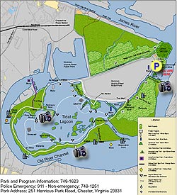
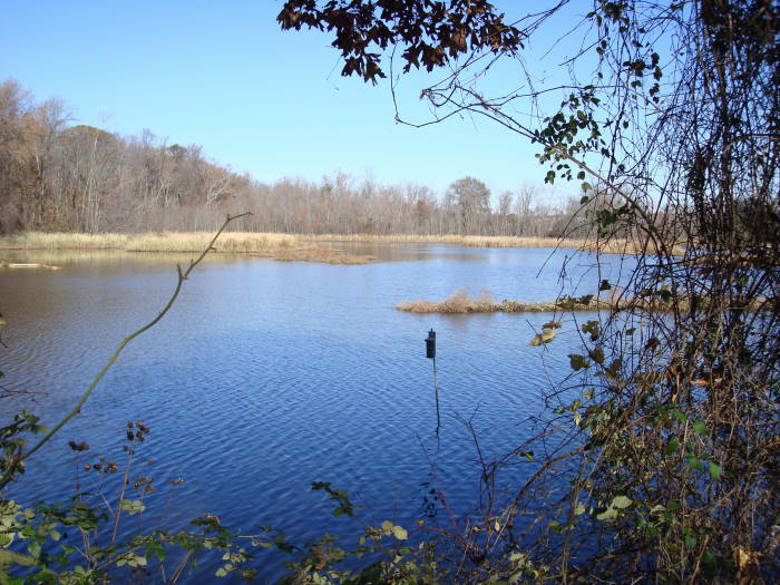
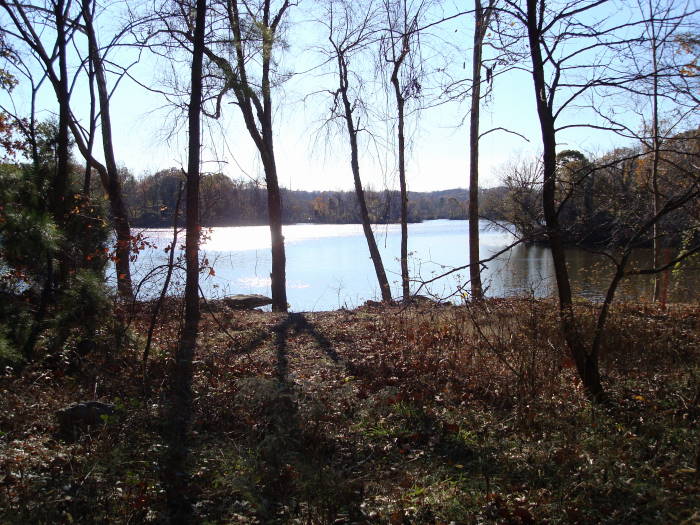
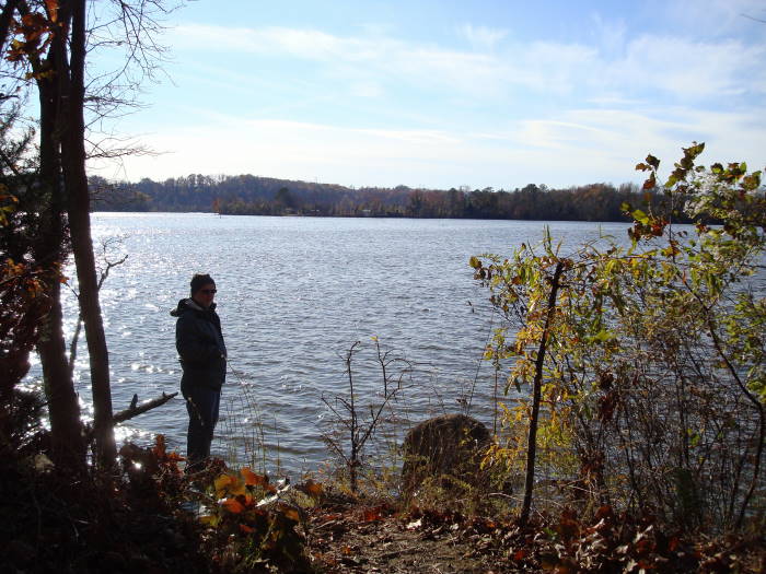
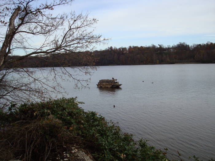
There are many spur trails (usually out and back) to observation points throughout this hike, we did many of them. The loop back to the Visitor Center is 4.4 miles, doing most of the spur trails will push the mileage close to 6 miles. It was on the very first one where we saw a bald-eagle. To your right on the blue blazed trail beyond the fence is the Dominion Power Flyash Pond. Be sure to keep your eyes open on this hike for all sorts of wildlife. In fact, don’t forget to pack binoculars.
There have been reports of Vultures at Dutch Gap landing on cars and causing damage. I checked on this at the Visitor Center and it is true but it is at the Dutch Gap Boat Landing about 1 mile from the Visitor Center and has not happened at the Visitor Center parking area.
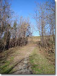
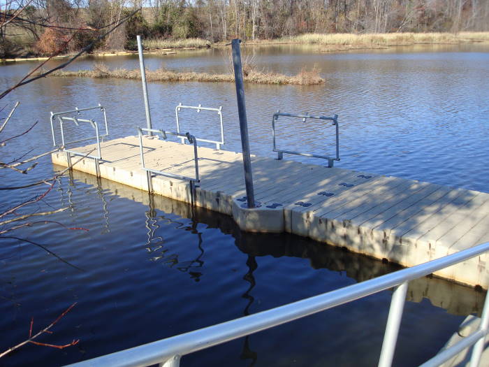
We started the hike behind the DGCA Visitor Center on the Blue-blazed trail. In 0.3 miles you will come to the Sycamore Spur trail on the left and is only 150 yards to an observation area and small floating fishing pier (there are quite a few of these piers throughout the trail) . Return to the Blue-blazed trail taking a left continuing for 0.3 miles until the Twin Rock Spur trail on the left with a short walk to an observation area/bench.
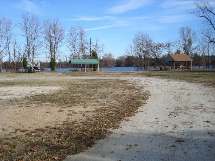
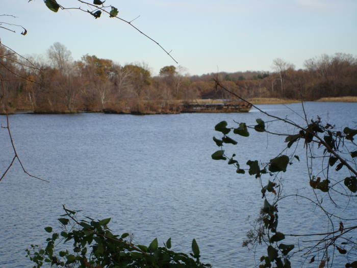
Continue on the Blue-blazed trail for 0.1 miles until the intersection of the White-blazed main loop. Stay straight at the intersection doing the main loop counter-clockwise. Ignore the next intersection which is just a shortcut to the other side of the main loop. The trail will bear hard to the left in 0.1 miles leading you to the intersection of the Horse Tail Loop in 0.2 miles. We only went to the observation point on this loop and returned back to the main white loop trail. (You could stay on the Teal-blazed Horse Tail Loop and it would meet up again with the main loop). Return to the main loop and in about 60 yards is one of the few sections that someone in a wheelchair might need a hand to go up a short hill. It is this portion of the trail where you will see the power plant straight ahead, but not for long. Just after the hill on the left you will see the Horse Tail Loop meet the trail and soon after that the trail will bear to the left. From this point to the next intersection, Peninsula Point, is 0.6 miles. Peninsula Point has picnic tables and boats for rent in season (check at visitor center prior to the hike). If bypassing Peninsula Point, bear to the right or if returning from Peninsula Point bear to the left and continue on the main loop.
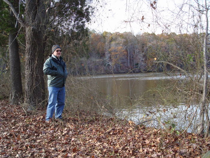
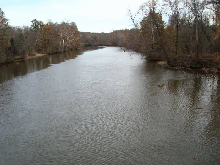
To the Oxbow Point Intersection is about 0.4 miles, there is a nice bench/observation area at the end of this spur trail. On the next portion of the trail we saw a couple of sunken barges inside the lagoon. This section of the trail seemed to be the longest as it is almost 1.3 miles until the Dog Leg Intersection. It was on this not very wide part of the trail that we saw a buck and 7 does. The Dog Leg trail is no longer a Dog Leg trail as it just ends as you come to the Old River Channel of the James. We surprised some duck hunters at this point. The trail that was supposed to be to the left and parallel to the Channel is overgrown and I could not find it.
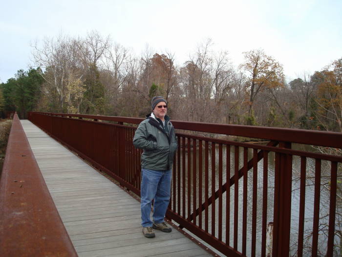
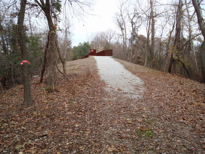
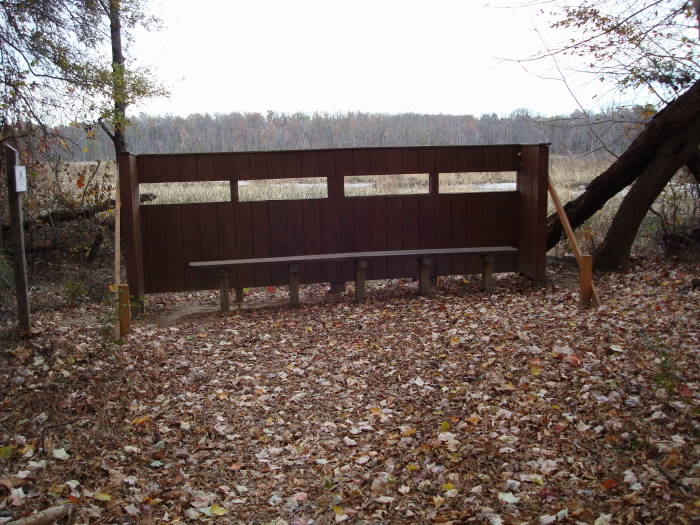
Back on the main loop it is only 0.1 miles to the bridge from the Dog Leg Intersection. This is the other section of the trail where someone in a wheelchair may need a hand as the ramp up to the bridge is a little steep. This channel is the main supply of water from the James River to the Lagoon. In another 0.2 miles you will come to an Intersection on the left and mentioned earlier as a shortcut, stay straight on the main loop and go 0.1 miles to an observation blind overlooking a marsh. This is to view nesting herons in the Spring time. In about 150 yards you will come to the end of the main loop trail, bear to the right and rejoin the blue blazed trail to return to the parking area in 0.6 miles.
Late November
Dutch Gap Hike Comments
Archived Comments
By:Lea Ann
Rating:
Date of Hike: Saturday, October 5, 2019
Pleasant place to get out for the walk if you're in the area or as an addition to a visit to the Henricus Historical Park, a replica of the follow-up English settlement to Jamestown ($9 to go through the settlement). Trail map and restrooms available at the start of the trail by the historical site visitor center. The trail was gravel most of the way which isn't my favorite and the water views are not as scenic as one would think from the map due to heavy vegetation, unless you go down every spur trail which would make it more than the 4.5 mile direct route we had time for. Since we didn't go through the museum, had to look on Wikipedia to learn that the original oxbow channel of the James River that surrounds the area was bypassed originally by Union troops in the Civil War due to the Confederates having a major outpost defending the river there. The bypass canal (known as Dutch Gap) was later completed and eventually it turned into the main channel. The exact location of Henricus is not known due to these topographical changes.
By:Steve
Rating:
Date of Hike: Thursday, October 18, 2018
My wife and I took our 9 year old boxer and 2 year old pitbull. It was a gorgeous day and the trails were wonderful. Clearly marked and maintained. This will become a weekly excursion for us.
By:CM3
Rating:
Date of Hike: Saturday, March 3, 2018
This was an excellent hike. Most weekends, I sponsor a hike for my company team. This particular weekend, I was asked to come up with something that co-workers could bring family and friends.
I do apologize that I hadn't realized the park doesn't open as early as I had expected. Plan your trip accordingly. It was a good adventure out with about 20 folks. The kids loved it. We came across deer, snakes, a variety of birds and a few stops dropped some food into the water to watch turtles and fish make an appearance.
While the beginning of the hike is a bit industrial, give it 20 minutes and you won't notice the power plant.
By:Diana
Rating:
Date of Hike: Tuesday, March 7, 2017
Ok hike. Nice and flat if you have kids. Unfortunately, there is a lot of metal and concrete debris among the undergrowth. The industrial stuff definitely took away from the beauty of the place. Lots of birds for birdwatchers.
By:Jason Viper
Rating:
Date of Hike: Saturday, March 4, 2017
So I've never actually "hiked" this hike, but have been back there plenty of times via boat. I think it's got some pretty scenery, lots of old rusted barges sticking out of the water, and you can glimpse a ton of wildlife - including bald eagles. If you are so inclined, bring a fishing pole as there is excellent fishing there, including MONSTER catfish. If they are running the sprayers at the plant, the water can get into the 70's in the dead of winter!
If you are parking at the boat ramp parking area, beware of vandals and buzzards (as they will eat any plastic on your car - trim, wipers, etc...)
By:Rick & Martha
Rating:
Date of Hike: Sunday, December 27, 2015
This was a very pretty hike around the water, on a flat-ish, wide trail. We weren't on the trail but five minutes when a group of 6 deer came charging out of the underbrush not 20 yards from us, and hurtled along the fencing for 100 yards. Then, two minutes later, another group of 3 deer did likewise, and much closer to us. The trail is very well marked. The only time we were a tad confused is when we arrived at the Observation Point, where the picnic tables and canoes are. It took us a minute to figure out how to get back on the trail to continue going around the lake. Fortunately, we had this web site available to refer to. We'll definitely return in the summer to check out the birds.
By:Jessica
Rating:
Date of Hike: Saturday, May 31, 2014
This hike is great for young children, There was a portion where cotton had grown as was blowing around everywhere. There is even some large sand dunes to climb and a small beach area which overlooks the river and factory!
By:KParks
Rating:
Date of Hike: Saturday, November 3, 2012
Overall, very nice hike, particularly since this was only my 7 y/o son's second hike. Another obvious benefit was the location, which is very accessible. A huge plus was the obvious markers every 1/10th mile throughout the hike. We explored every optional observation point, so the hike actually turned out to be 4.9 miles. Course was very level with nice views of Tidal Lagoon and some wetlands. Very nice family-friendly hike...
By:bunnys
Rating:
Date of Hike: Saturday, September 29, 2012
Great hike. I've done it a few times before. A little distracting looking up every now and then to see the coal fired power plant smokestack but usually it's not in view. I like a quiet hike and I need to remember for next time to come in the dead and cold of winter when there are no powerboats trolling around the lake all afternoon. Not a lot of traffic on this path. Very pretty.
By:Chris and Leslie
Rating:
Date of Hike: Friday, February 24, 2012
The weather was too beautiful to stay indoors. We were looking for something to show my guest from Atlanta and be outdoors. It was a very nice hike and good exercise. We saw Herons and numerous water fowl. I'll go back in the spring when the vegetation is green and share it with more people.


