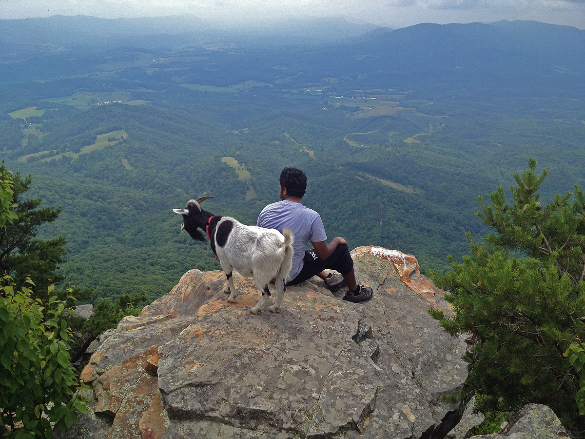
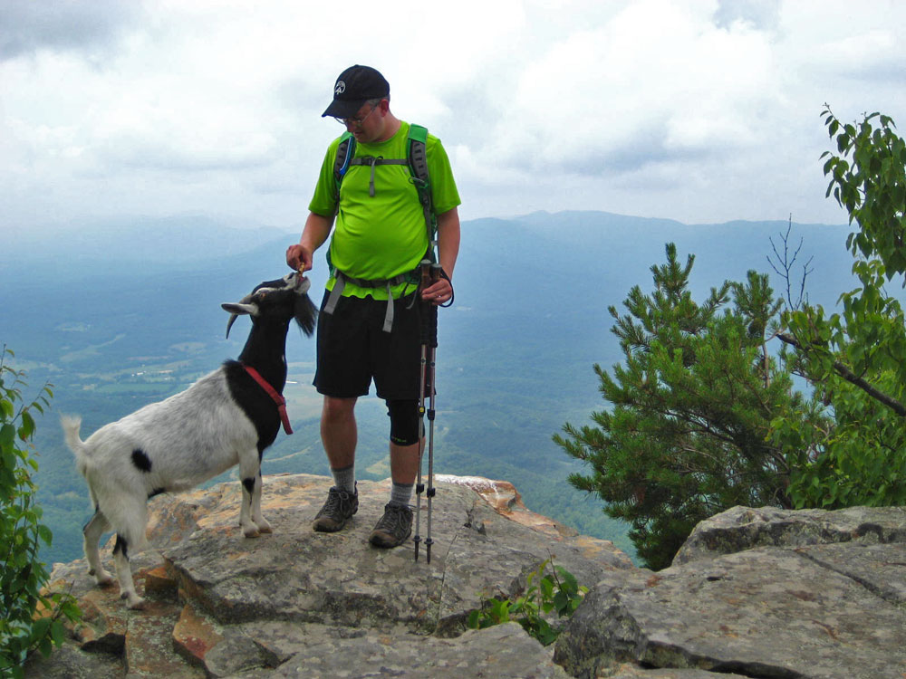
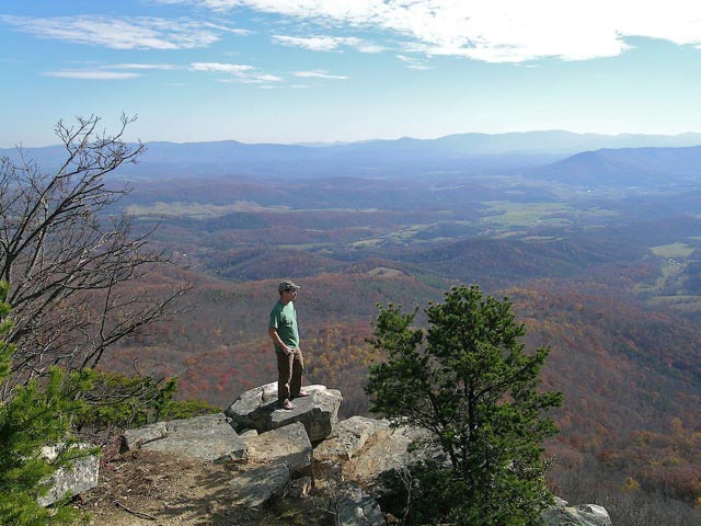
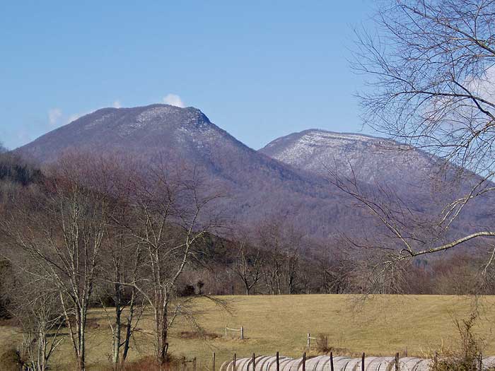
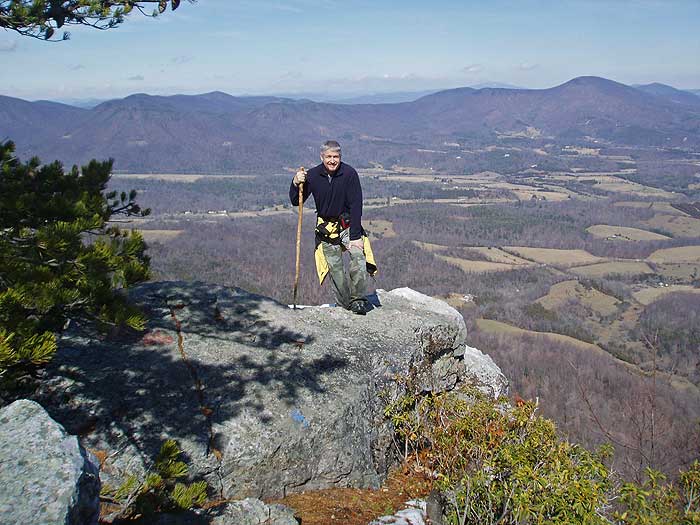
The House Mountain hike near Lexington Virginia is really two out-and-back hikes in one. Big House Mountain, with great views to the west from Goat Point Overlook, and Little House Mountain, with its spectacular views of the Shenandoah Valley to the northeast. Goat Point was named for a local goat that would look for handouts from hikers around 2011. Unfortunately the goat has not been seen in several years, but the climb to the overlook on Big House Mountain is definitely worth the effort.
Little House and Big House Mountains appear to tower out of the plains as they stand by themselves, separate from any other mountain range. The 950 acre House Mountain Preserve was purchased in 1989 through the efforts of the Rockbridge Area Conservation Council, the Virginia Outdoors Foundation, and many local residents, including Bill Stubbs a leader in conservation causes in the Rockbridge area for many years. The area is owned, and managed by the by the Virginia Outdoors Foundation. Volunteers contribute to the upkeep of the trails and parking area.
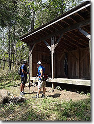
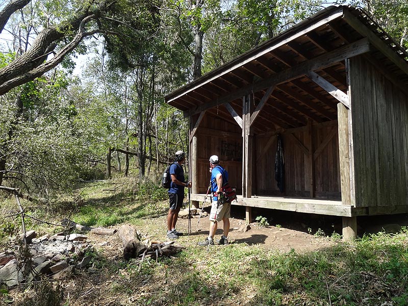
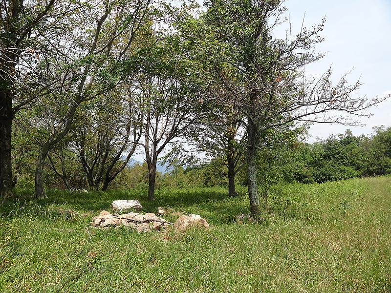
The saddle between Big House and Little House Mountains was originally a homestead, and more recently a orchard and pasture. With camping space for multiple tents, as well as a seasonal spring just past the shelter on Big House Mountain, this is a perfect place to take an overnight backpack.
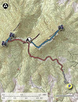
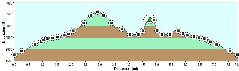
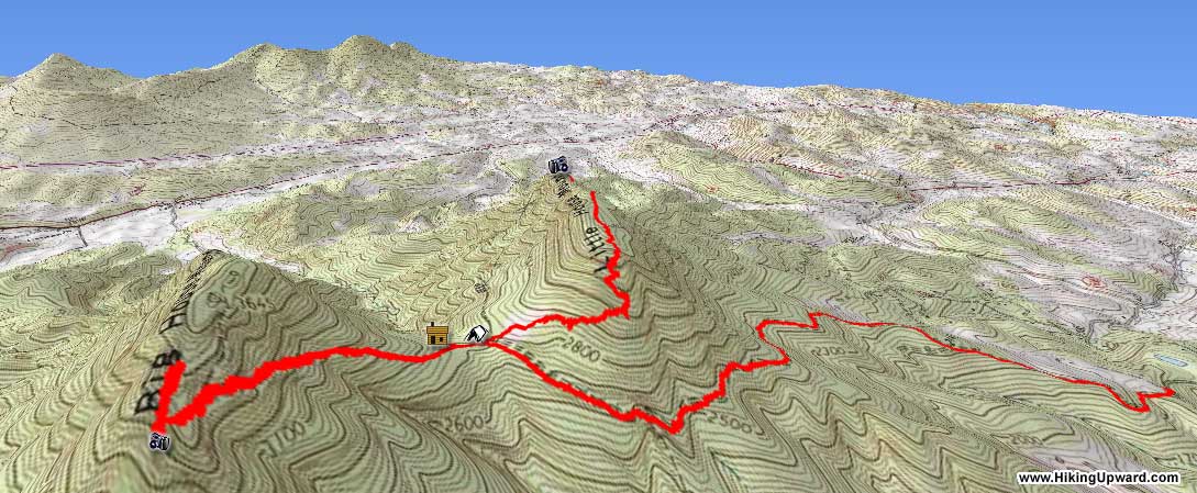
If you start at the parking area and hike both Big House and Little House mountains the total distance is 8.9 miles.
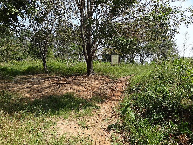
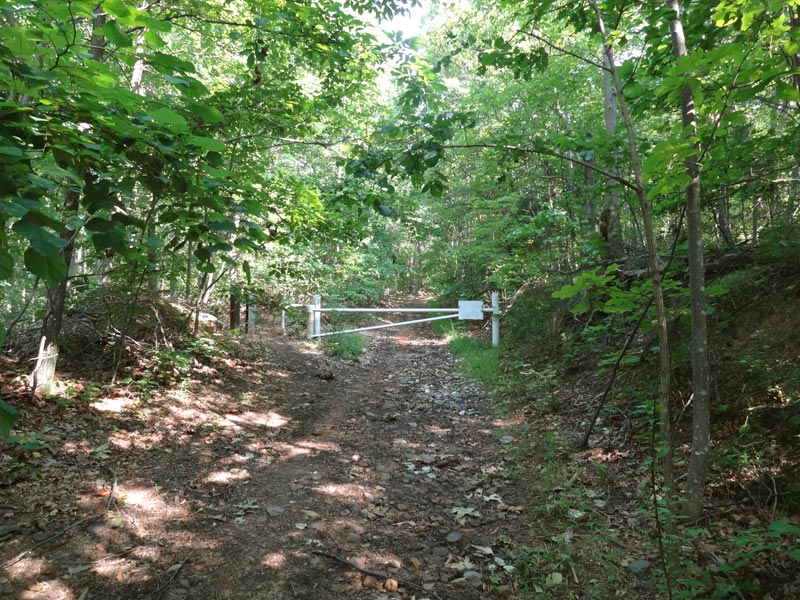
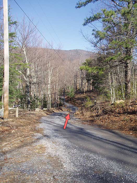
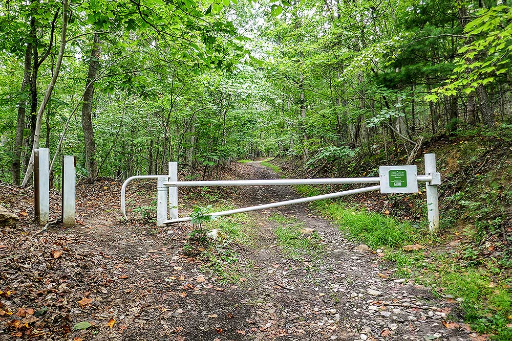
From the trailhead and closed gate, start up the unblazed House Mountain Trail. The trail passes private property on the left for the first 0.5 miles. The remaining hike to the saddle becomes steeper and more rutted.
Big House Mountain Trail Out/Back - 1.7mls - 740ft gain - Steep/Difficult
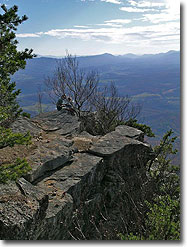
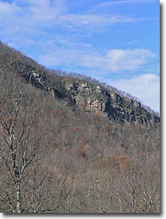
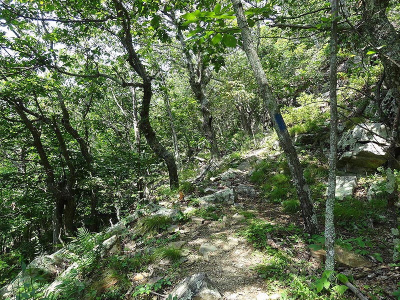
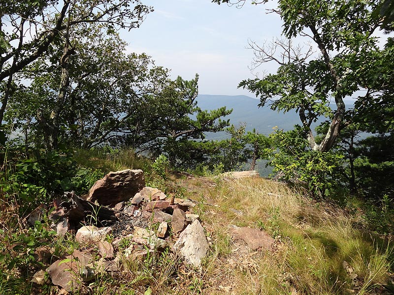
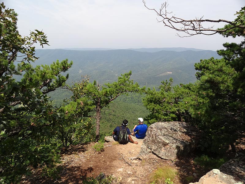
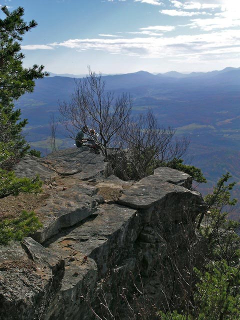
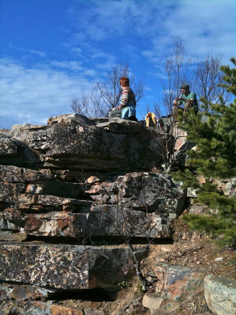
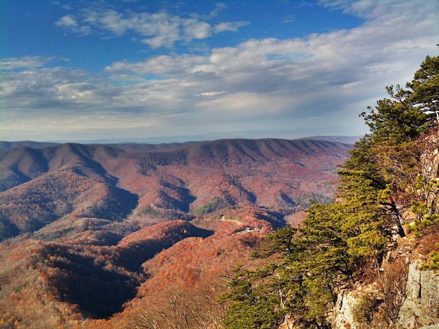
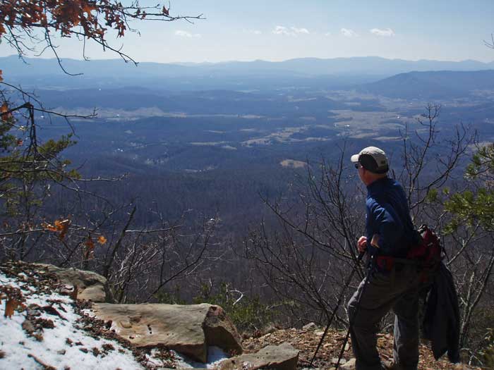
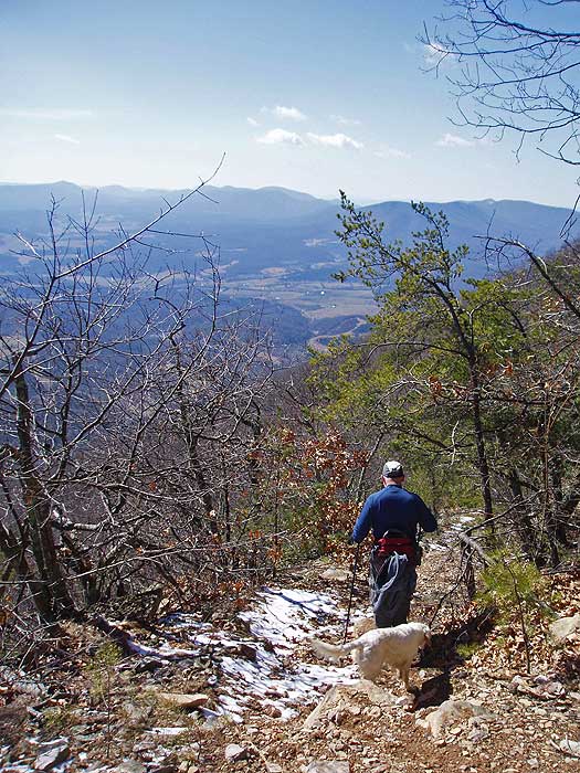
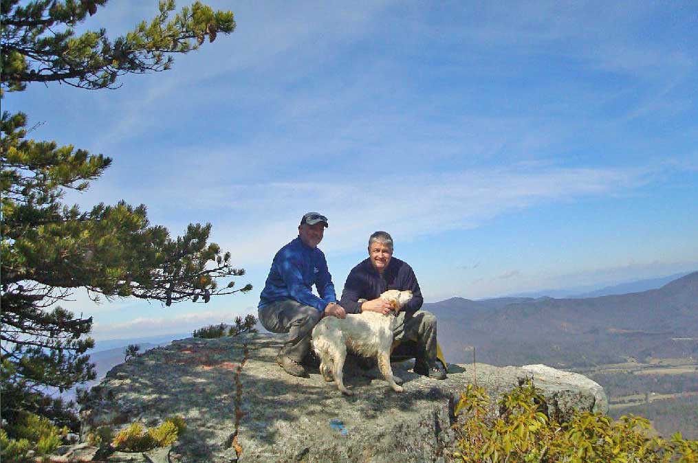
Continue to the west uphill on the unblazed Big House Mountain trail and in 100 yards pass a shelter and privy on the right. Just past the shelter the trail will split, remain right uphill as it becomes steeper then makes a hairpin turn to the right in 0.5 miles. At the hairpin turn, stay straight on the blue blazed trail where it becomes narrow, steep and rocky for the short 90 yard climb to the Big House Mountain ridgeline. Turn left at the ridge line following the faint trail for 30 yards to passing a small campsite, then arriving at the first vista to the west. Continue for another 25 yards to the main panoramic view at Goat Point Overlook on Big House Mountain.
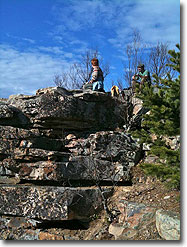
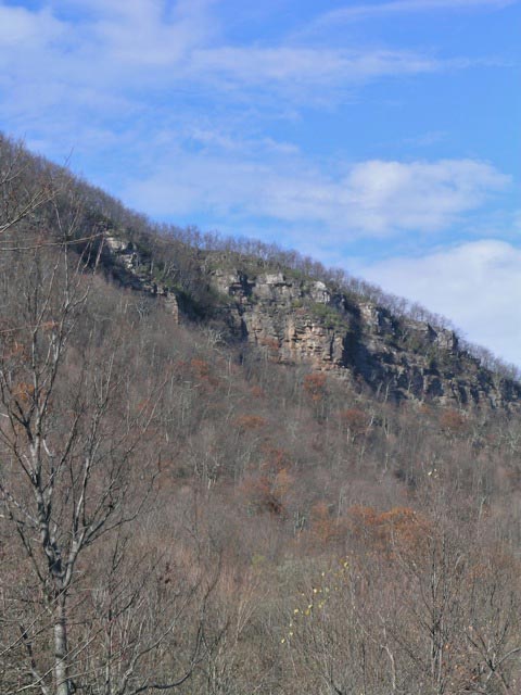
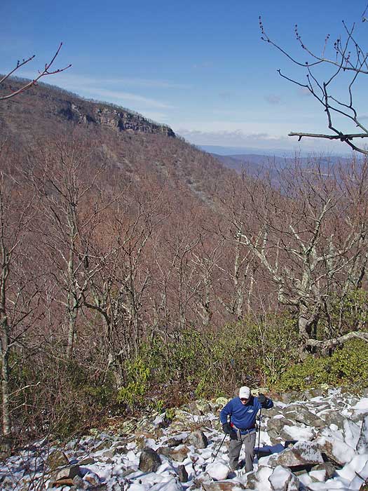
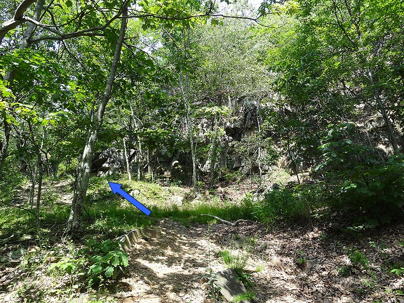
Return along the ridge to where the trail begins to descend, but continue to bushwack along the ridgeline for 100 yards where there is a boulder canyon. Just inside the boulders is Tabletop Rock. Return to the intersection down with the blue blazed trail and retrace your steps back to the saddle between Big House and Little House Mountains.
Return to the saddle by retracing your route.
Little House Mountain Trail
Out/Back - 2.6mls - 940ft gain - Moderate+
The new Little House Mountain trail is now fully marked with standard vertical blue blazes from the saddle (just behind the two signs) all the way to the incredible overlook. This new trail was the solution to the very strenuous, straight up trail before. This trail is not mountain bike/horse friendly.
From the saddle the Little House Mountain trail starts from behind the signs. Follow the blue blazes as it gradually ascends the south-west side of the ridge, before making several switchbacks and climbing the last half mile to the ridgeline.
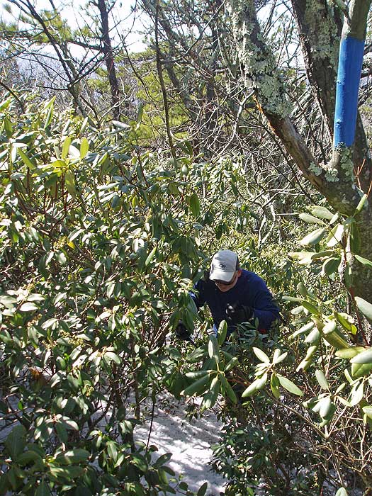
At the ridge follow the trail through a thick section of Mountain Laurel before turning left back to the north. In 0.2 miles the trail passes to the left of the main summit before beginning its descent to the overlook in another 0.7 miles.
Really good hike with two great overlooks. The hike was steeper than I anticipated, but I am out of hiking shape. My friend and I first went up to Big House Mountain, taking a break at Goat Point. After that we followed the red-blazed trail past Tabletop Rock to bag the true summit and explored further north passing an old building on an old forest road. I think if we continued we may have found the cliffs on the northeast side easily accessible from the forest road, I could see a long series of cliffs from Little House that we never stumbled upon. Instead of backtracking we followed the forest road back to the trail making a loop, bypassing the rockiest section of the trail near Goat Point and Tabletop Rock.
If the trail up Little House has been rerouted, the original trail must have been brutal because the new trail is very steep despite the presence of switchbacks. Luckily it does not last long, and the trail follows the ridgeline seemingly forever until it ends at the northern point. For me this series of cliffs was not only superior to Goat Point, but ranks amongst my favorite viewpoints in Virginia. The hike back was a long slog, especially the continual descent on the approach trail and the access road. In total my hike was 10.7 miles. Although I did add a little extra with the Big House high point, I believe the hike listed here is around 10 miles instead of 8.2 miles. My friend was also tracking the hike and got 10.8 miles.
By:DrG
Rating:
Date of Hike: Thursday, July 11, 2019
I had read and YouTube'd House Mtn and had it on my list of hikes. So on my way from DC to WV I stopped to hike it. It isn't far from I-64. The webpage says Big House is a 1.7 mile out/back. The Weather App said I had 90 minutes til storms approached. So from the parking lot I walked uphill 1.8 miles and was still deep in the woods with no Hump in site so I had to return to the car just beating a very heavy thunder storm by about 10 minutes. So I guess the 1.7 mile out/back is the distance from the Hump and not from the parking lot. I didn't reach the Hump.
So I'll have to return another day.
By:Jonny E
Rating:
Date of Hike: Sunday, April 21, 2019
Beautiful spring day - trees just starting to bloom so views were still really good going up the mountain. Nary a cloud in the sky - vistas were big and gorgeous with riot of spring colors--every shade of green in the valley. Best time of year to hike House Mtn. Big House is steep climb the last mile, but no tricky footing. Little House is a bit less grade, but does have a few tricky steps here and there no showstoppers. Big House overall has better vistas - more on top of a mountain looking toward valleys Little House is more being enveloped in the mountain, laurel everywhere. Have done this hike prob 10 times, still haven't gotten to see the goat!
By:PghTom
Rating:
Date of Hike: Saturday, March 9, 2019
Great hike. Great lean to. Nice hikes. But we spent the entire weekend in fog and had zero views. Oh well, nice night hike in Friday w headlamps. Had the entire lean to to ourselves and pretty much the mountain. Saw 2 day hikers, that's it. Guess the snow kept everyone away.
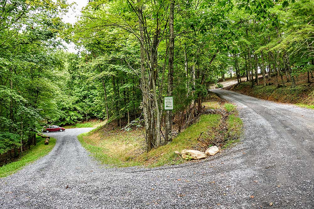
We met one of the care takers on the way out. He explained they changed the parking on Saturday. You can NO LONGER park on the road. The signs were removed. All parking is in the new lot. A little extra hump up the road. But a nice big lot to park in.
Will return on a clear weekend. Definitely a worthwhile hike.
By:Bryant
Rating:
Date of Hike: Wednesday, December 27, 2017
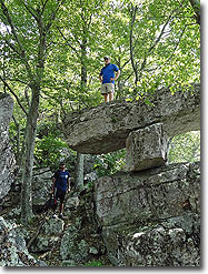
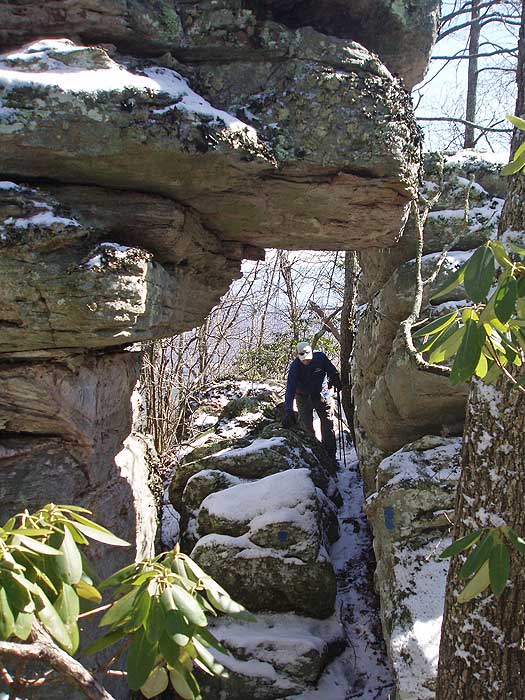
The only reason I give it four stars is for the long road walk you do from the parking to the trail head given the number of private landowners now on that section, it is understandable (and make sure you park where indicated or you WILL be towed). It was a great hike up Little House Mountain, and the "new" trail is well graded, scenic (speaking as someone who last hiked Little House in 2005). Beautiful stone arch at the top. Was accompanied most of the way by three hunters and their 12 dogs (very entertaining. The groups managing the area have done a wonderful job - kudos!
Excellent description of the hike - HikingUpward is my go-to source when looking for hikes in the South.
By:Brian & Brenda
Rating:
Date of Hike: Saturday, October 21, 2017
Less of a review and more of an updated trail status for the Little House side. Over last weekend and this one, I have trimmed the length of the Little House trail especially along the ridge where the growth was touching both sides of the hikers. Take advantage of the changing leaves coming into full color around the end of the month. If you have suggestions for the House Mountain trail, please contact me and well see what we can do to make a more enjoyable trail.
By:Brian
Rating:
Date of Hike: Saturday, October 21, 2017
House Mountain is a great overnight hike. This is my third year on House Mountain and we typically hike up to the saddle between Big House and Little House. We'll then drop our packs and set up camp before day hiking one or both peaks. Big House is a steeper climb, although shorter distance. It has a great view to the south with an unusual rock formation further up the mountain. Little House starts off steep but most of the hike is along the ridge line once you get past that first section. The end of Little House trail rewards you with great views on the opposite side of what Big House gives you. The caretaker of the trails here does a fantastic job. The trail on top of Little House was recently trimmed back. There's also a great fire pit on the saddle where people typically set up camp. Highly recommended for an easier backpack trip with options for more hiking once you get to the saddle.
By:Jessica
Rating:
Date of Hike: Saturday, February 18, 2017
We hiked in the middle of February and had an usually warm spring-like day to hike! We warmed up throughout the hike and only got chilly again when we got to the top. Seven women from our Her Hike Collective group hiked from the parking area to Little House Mountain peak. This was a challenging hike but I liked that the hike into the valley, about two and a half miles, was fairly easy. This allowed some of our newer hikers to get use to hiking before it got challenging. Which I think helped them get their confidence up before they got to the more difficult switch backs and rock scrambles. I love rock scrambles but they were a bit of a surprise because the description of the hike does not mention them on this site. Just be cautious of this and help each other, especially if you are shorter.
The views are extremely worth it on top of Little House Mountain. We ate lunch at the top and were the only ones there for a little while. It is a long hike so we did have to speed it up on our hike back to ensure we had enough sunlight left to get to our cars. I would have started a little earlier on this hike if I did it again in the winter. We started at about 11am. Hiking boots are definitely a good idea for this hike!
All in all our women's hiking group loved adding this hike to our list and it was a great day to hike together. You can find our womens hiking group on social media under #herhikecollective
By:John
Rating:
Date of Hike: Monday, February 6, 2017
Our hiking group tackled Little House Mountain today - we felt that doing both (rated here as 5-star difficulty) was probably a stretch for a group of 60-somethings.
We were right! Little House by itself was challenging enough for us - but well worth it. 7.8 miles RT on my GPS.
The GPS coordinates on the parking area were spot on. As was the route that I had downloaded from HU to my eTrex20...until we reached the meadow and discovered that I had downloaded the file a few years back which did not include the new trail. Fortunately, the trail was extremely well-blazed in blue. We found the ascent challenging enough (and wondered just how hard the old trail was to climb!). 4-star difficulty in our view.
The overlook was really something - reminded us of the views from nearby Jump Mountain (which we consider a slightly more difficult hike than Little House). 5-star views.
Unfortunately, we started the hike after lunch and couldn't hang around the overlook too long else we risk hiking down in the dark.
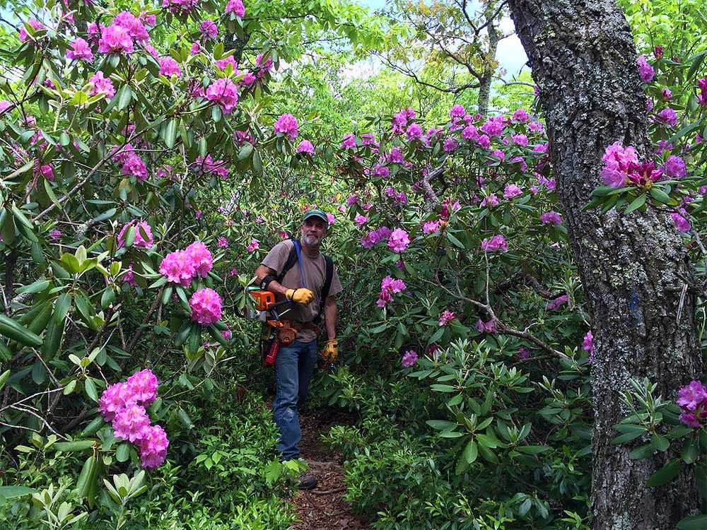
But we'll do this one again perhaps in May when the rhododendron is blooming.
By:Eric G
Rating:
Date of Hike: Monday, October 24, 2016
Hiked this on my first wedding anniversary with my wife. It was a Monday and we did not see one soul on the entire trail. First 2-ish miles are a bit hilly but the trail is nice and wide. We went up Big House first and though it's a short trip up, it's pretty steep (and no switchbacks!). We did not see the goat anywhere, perhaps he/she has left? The views at the top were spectacular! Hiked up Little House second, I personally thought this hike was easier with the switchbacks. The trail along the ridge can be pretty narrow at times between the mountain laurel (only one person wide through some sections). The views at the end are also fantastic, but they overlook I-66, so not at great at those on Big House IMO. Made it up and down both in 5 hours.


