| By:
Bob Siegel |
Rating: |
 |
Date of Hike: Sunday, November 24, 2019 |
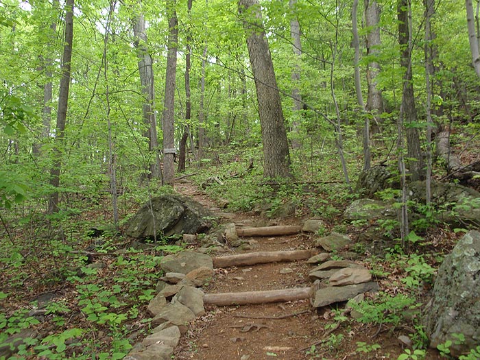
Nice easy hike. Plenty of parking in a fairly big parking area off of 605. 605 itself is all gravel and quite steep in a few places. A vehicle with good ground clearance is preferable to a sedan. The trail in good shape, no blow downs blocking it anywhere. Very nice view from the top.
|
|
| By:
Julie |
Rating: |
 |
Date of Hike: Saturday, August 24, 2019 |
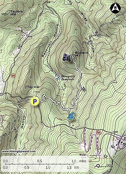
Ok so first, the parking for Hollow Brook IS on Morgan Mill Rd. They have NO PARKING signs for the actual road but they have an entrance that you can drive up and actually park near/ in front of the trail entrance. I wasn't sure what to expect after reading that you couldn't park on Morgan Mill Rd anymore but I figured I'd give it a shot and see... Anyways, Im glad I did because this is probably one of my favorite places now. My husband and I took our two boys (5 and 3) and they did great. It's a beautiful hike.. definitely recommend it!
|
|
| By:
Syd |
Rating: |
 |
Date of Hike: Monday, May 27, 2019 |
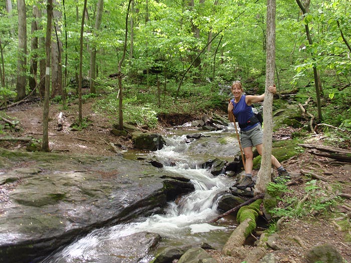
We really enjoyed this hike. It was a little muddy, we went after it had rained like a lot of people suggested so we weren't surprised by the mud. We went super early to get out of the heat. A lot of incline/decline but overall we had a fabulous time.
|
|
| By:
Heidi W |
Rating: |
|
Date of Hike: Sunday, February 24, 2019 |
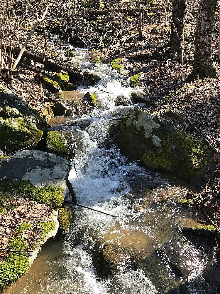
Fantastic hike for clearing out the winter cobwebs, so to speak. Took my 13 yo niece and I about 3 hours, but we spent quite a bit of time at the vista and the main waterfall. Area had quite a bit of rain the few days before, so trail was quite muddy in several spots...(we were prepared for muddy, so not a big deal.) The plus side of all the rain was that the waterfall had tons of water. Also looked like the winter/storm has been hard on this trail. A lot of fallen trees across several spots on the trail. Nothing spring clean up crews won't be able to take care of...also nothing you can't navigate around. I've already recommended this hike to several friends.
|
|
| By:
Christopher Boyce |
Rating: |
|
Date of Hike: Tuesday, December 25, 2018 |
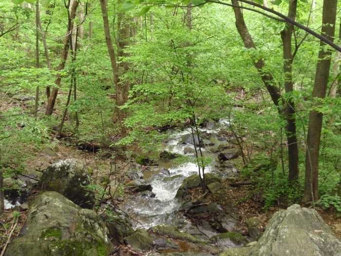
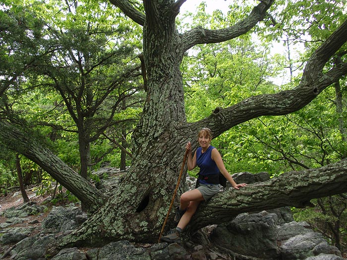
We hiked this trail on Christmas Day with only a few hours of light remaining. Took us 2.5 hours, which included an hour of stopping to snap photos and take in the views. Was an easy effort, and we got a mountain stream, rocks and boulders, and a vista at the turnaround!
|
|
| By:
Rob |
Rating: |
|
Date of Hike: Friday, November 23, 2018 |
The No Parking signs on Morgan Mill Road are intimidating but we found plenty of space to park when we arrived around 10:00am. When we were done around 1:30 there were still some spots and looked like others even parked on Morgan Mill a few hundred feet from the trailhead.
|
|
| By:
Kim |
Rating: |
|
Date of Hike: Saturday, November 10, 2018 |
Please be aware that there are now posted No Parking signs along Morgans Mill Road on both sides of the road on either side of the trailhead. We were parked fully off of the road and were hoping we were far enough away from the trailhead not to be impacted, but we came back to find a $30 ticket on the windshield. There were at least a dozen cars there when we started our hike if they were all ticketed, Clarke County has a nice little revenue generator on pretty weekend afternoons. Such a shame because it is a nice hike and there are a number of parking spots like the one we had that are fully off the road and not impeding traffic. Hope the local environmental groups and the PATC can work with Clarke County to find a reasonable parking solution for this trailhead.
|
|
| By:
Keith |
Rating: |
|
Date of Hike: Saturday, November 3, 2018 |
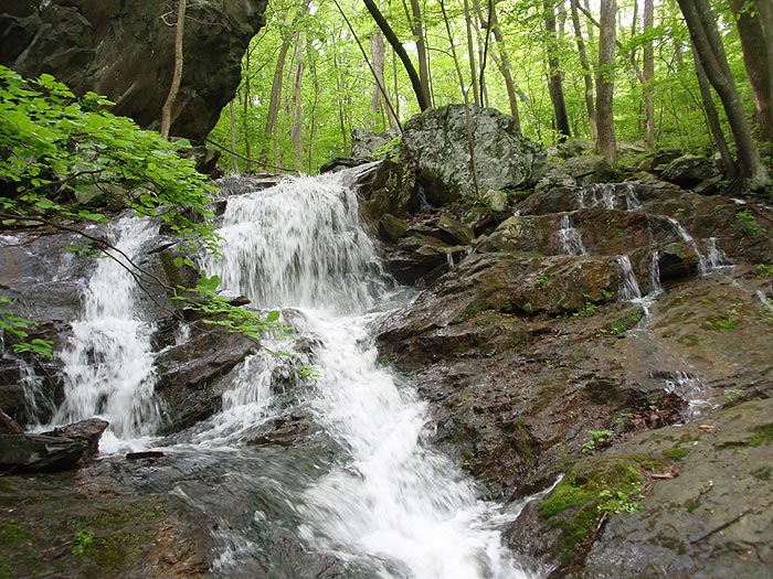
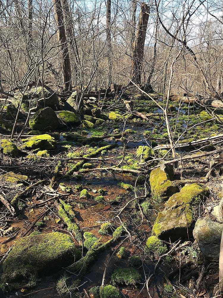
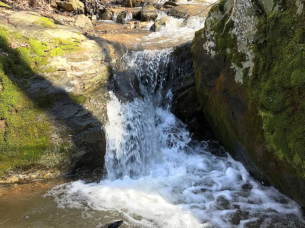
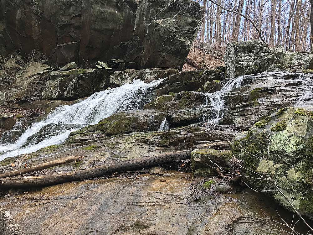
Very nice waterfall, but parking was a bit of confusion. Evidently, the week before the county placed no parking signs near the trail head with signs not to park between the No Parking signs. But there were 4-6 No Parking signs so it was confusing. We were told the county would give tickets. Also at the trail head, there are no indication of which way to begin. You can go up from the road or down from the road. The waterfall is on the upward trail of the AT if that is what you're there to see. When going up, you'll cross a stream and the waterfall is to the right. There is a smaller lower fall, but a larger fall by a huge bolder if you hike farther up, so don' stop at the lower falls.
|
|
| By:
Terri V |
Rating: |
|
Date of Hike: Sunday, July 29, 2018 |
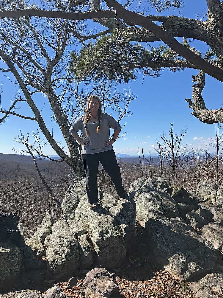
I have been battling some foot issues, so decided to try this one as my first hike out in several months. Thanks to the recent rains, the waterfall was flowing very nicely for late July. While the view from Buzzard Hill is not spectacular, it is a really pleasant spot to sit and relax and have a snack. The last climb up to Buzzard Hill was a bit more taxing than I had anticipated, but this was a great hike to get me back into the groove. I was surprised by the roughness and narrowness of Morgans Mill Road - and there were not many parking spots left when I got there at 8:30am.
|
|
| By:
Chris |
Rating: |
|
Date of Hike: Saturday, September 9, 2017 |
Nice and easy.The waterfall was little but never mind. Not too many people when I started around 9am but when on my way back at 11am I met a lot of noisy people.
|
|
 View all 53 archived reviews for the Hollow Brook hike
|


