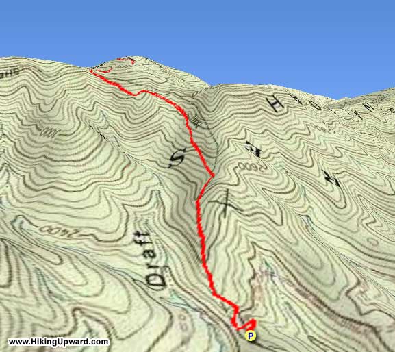
The Marshall Draft Trail is a very remote and steep trail in Virginia’s Bath County that accesses the Shenandoah Mountain Trail near the summit of Wallace Peak. The described hike continues past the end of the Marshall Draft Trail, using an old roadbed to climb to the summit of Wallace Peak, an open area that was once the site of a fire tower. There are also options to extend this hike in a big way, as the Marshall Draft Trail meets the Shenandoah Mountain Trail, which to the north connects with an extensive trail network that includes trails in Ramsey’s Draft Wilderness, the Wild Oak Trail, and even trails to Elliott Knob. The Shenandoah Mountain Trail is also part of the Great Eastern Trail, a long distance trail through the Appalachians that is under development and will extend from Alabama to New York state.
The Marshall Draft Trail is not widely used, and the Shenandoah Mountain Trail is primarily used by mountain bikers and hunters in season. There is a very low probability that you will encounter another hiker on this trip.
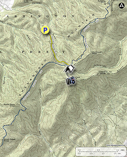
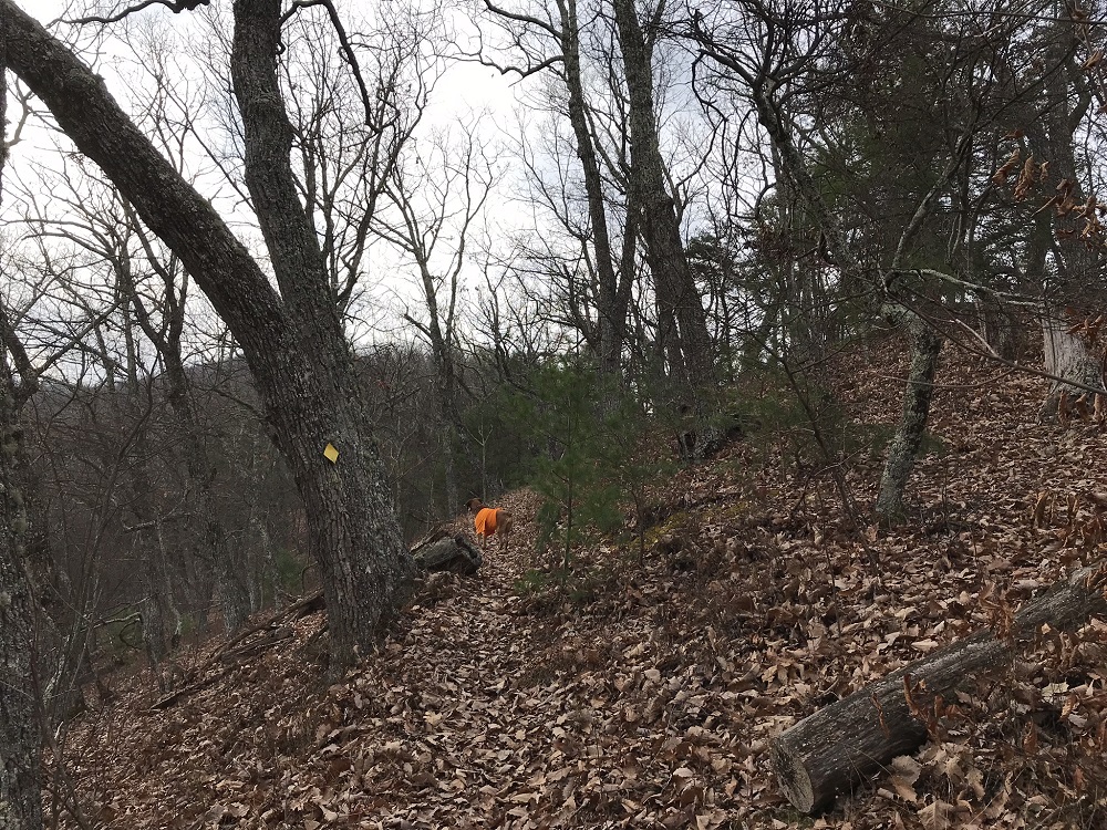
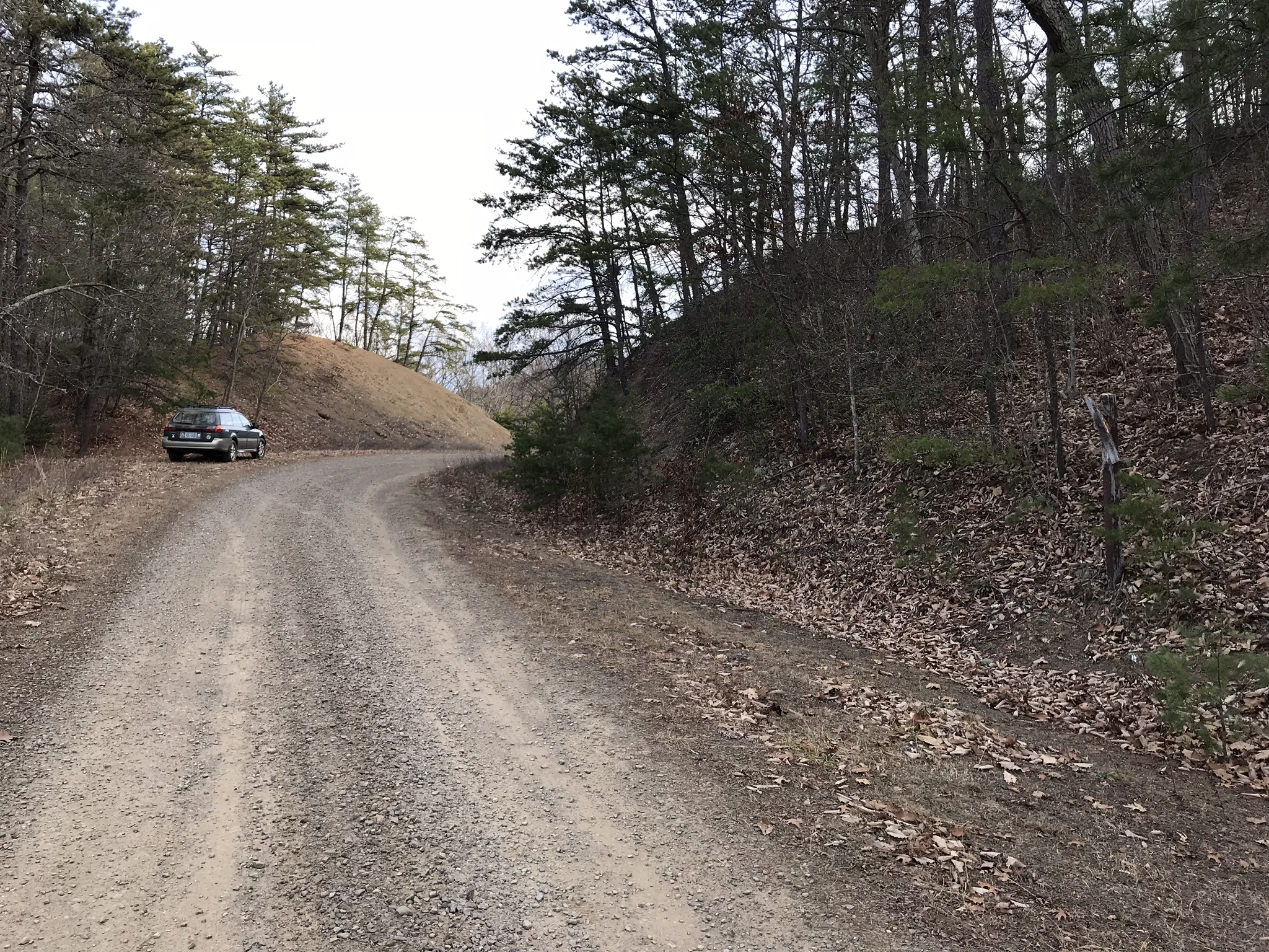
Mile 0.0 – Parking for this trail is on a wide spot of Forest Service Road 394, also known as Sugar Tree Road. Older USGS Topographic Maps show this trail continuing all the way to the Cowpasture River, but the Forest Service says the trail now officially ends here. The trail itself is marked by a deteriorating trail sign and is marked with yellow diamonds. The trail switches back about 20 feet into the hike, takes a right turn about 100 feet later, and then climbs straight up the mountain.
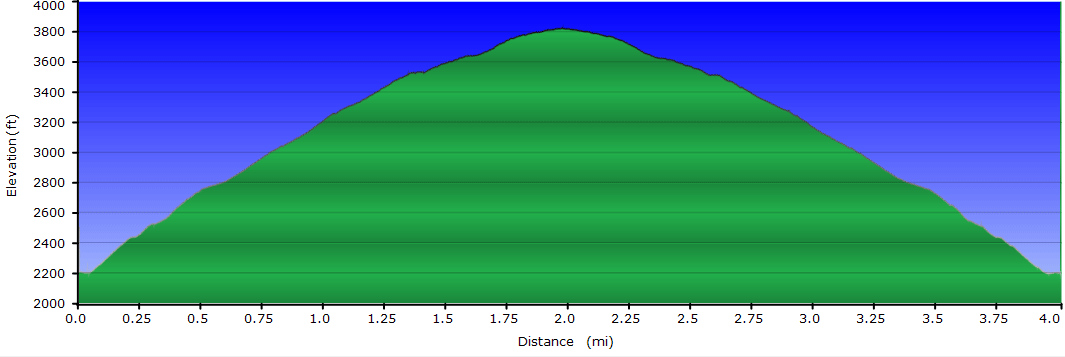
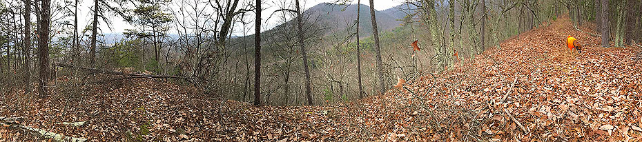
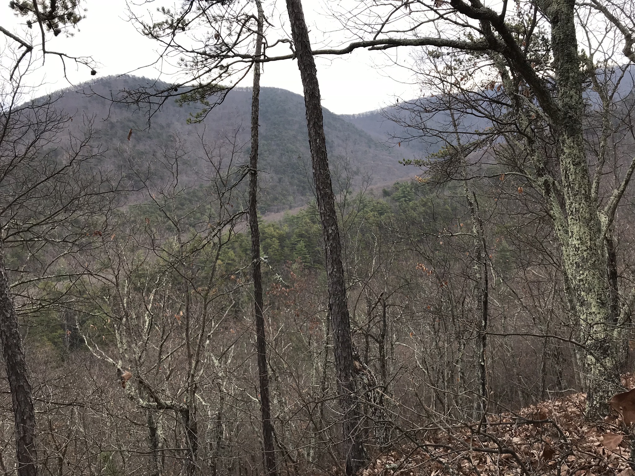
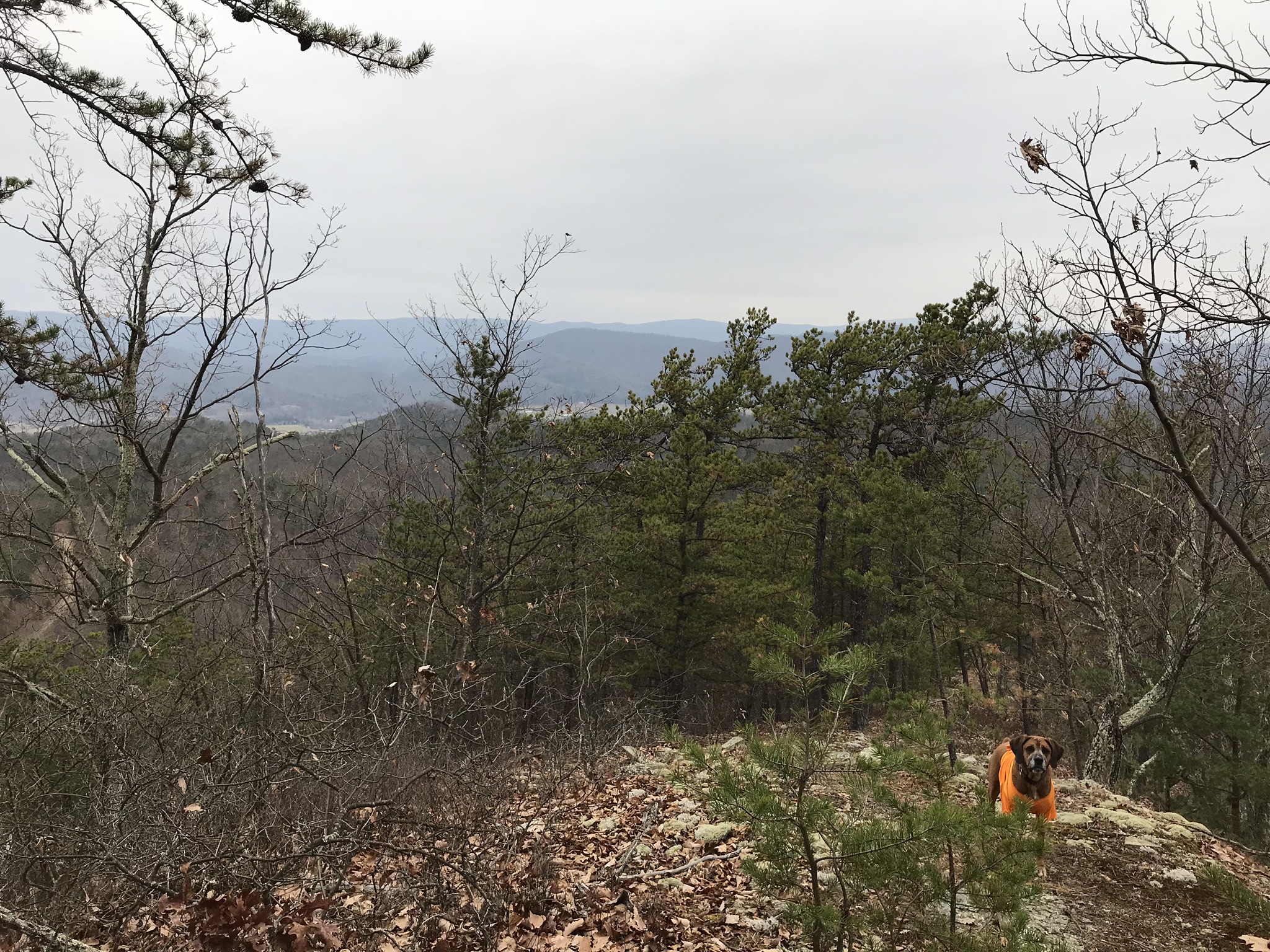
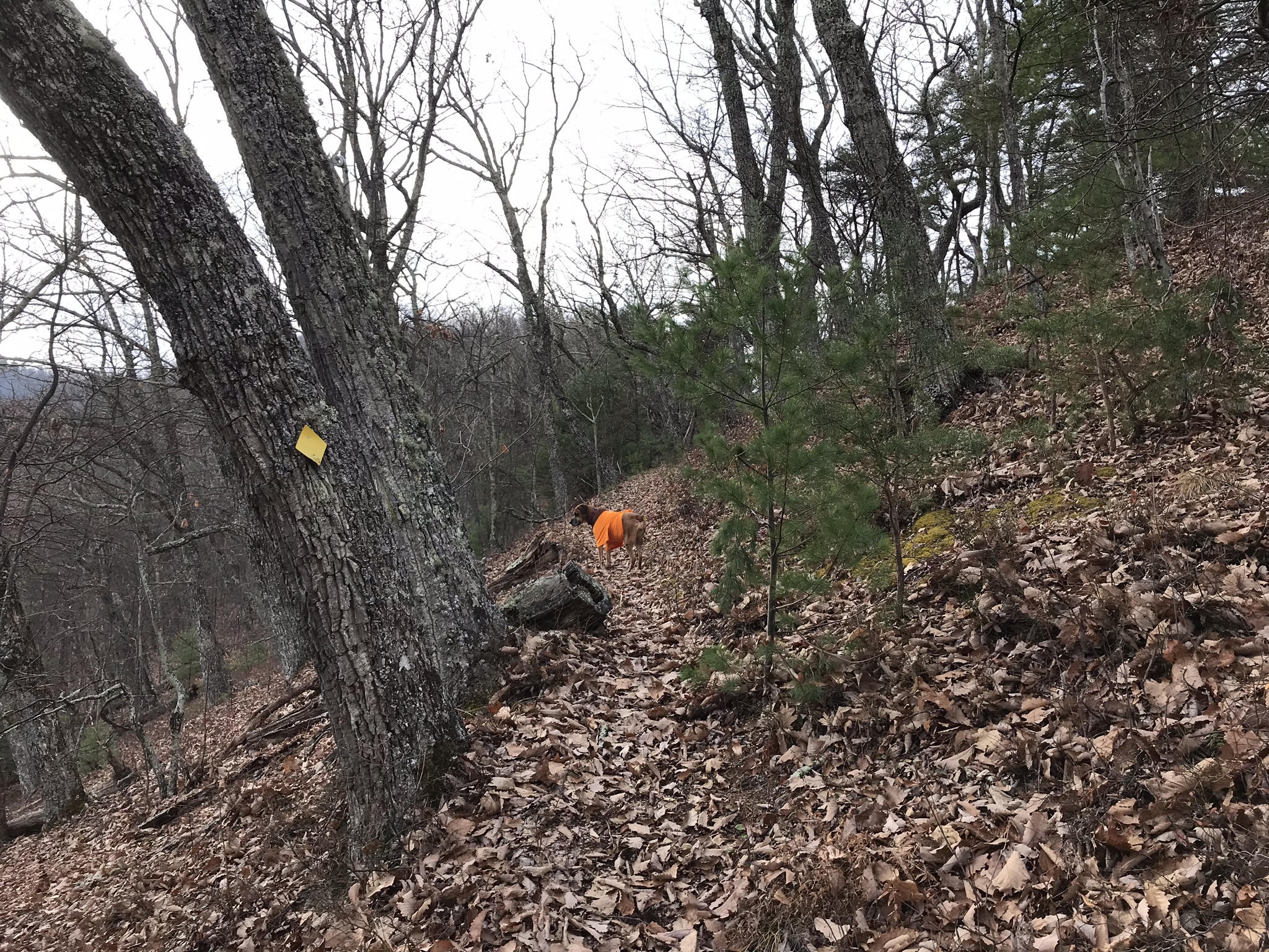
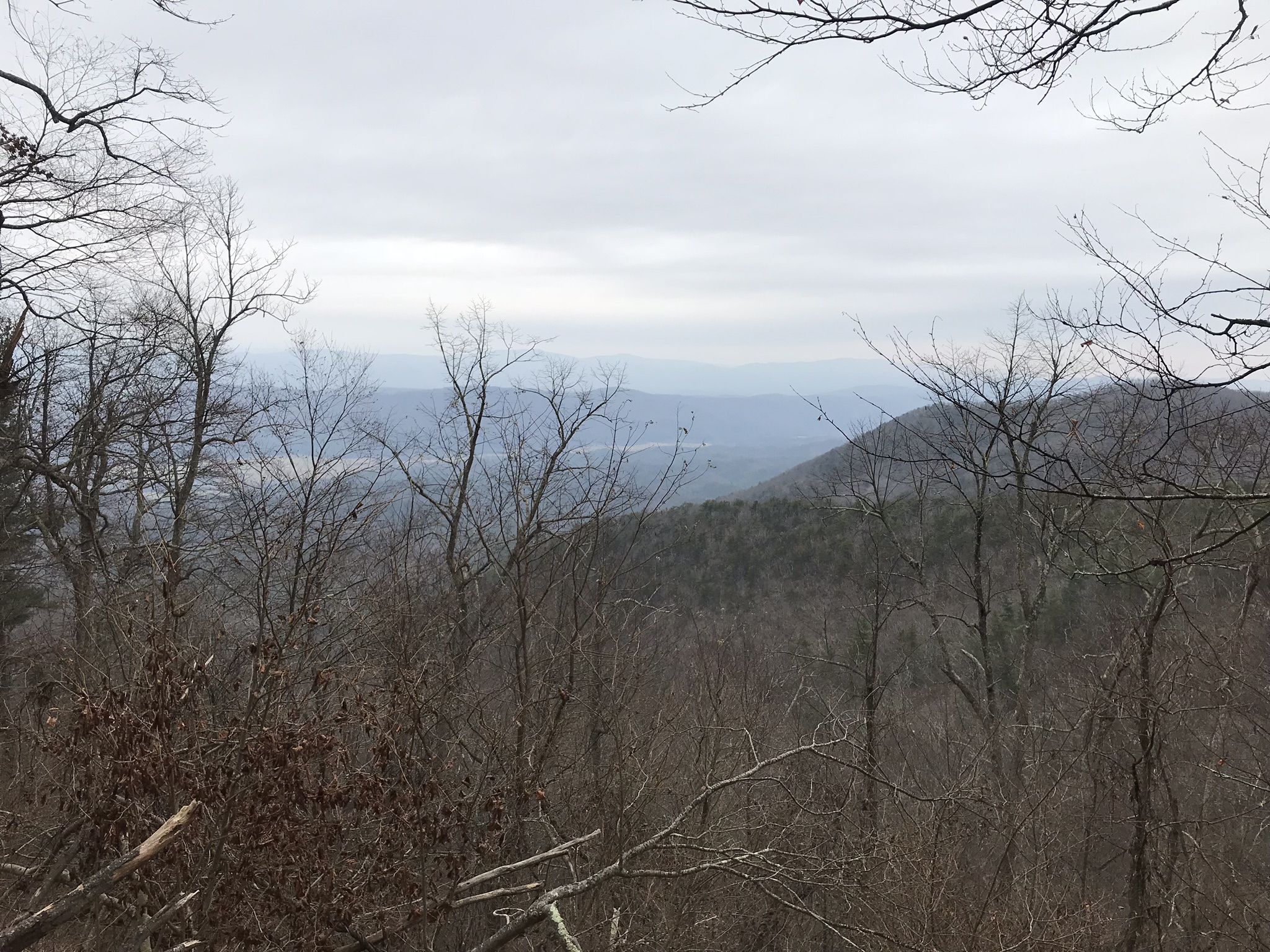
Mile 0.4 – After climbing steeply up the mountain, a view of the surrounding countryside is possible looking back towards the trailhead. The trail climbs at a lung busting 23% grade to this point, before moderating slightly. In its 1.4 mile total length, the Marshall Draft Trail climbs from 2200 to over 3500 feet elevation. As you climb, views of Shenandoah Mountain to the north are frequent.
Mile 0.9 – The trail washes out a little for a brief period, but remains easy to follow. After this, it climbs much less steeply.
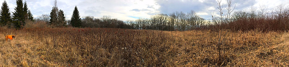
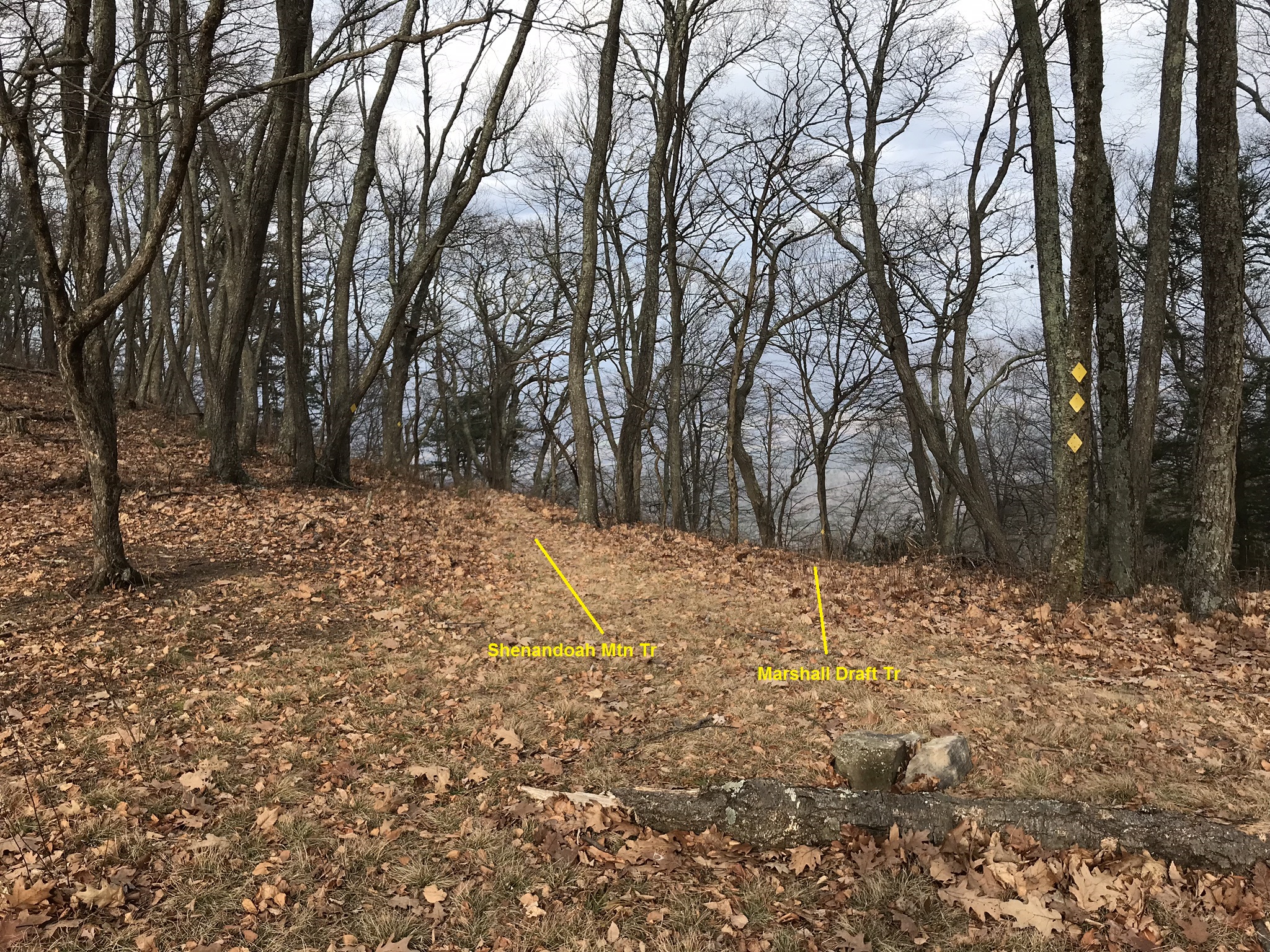
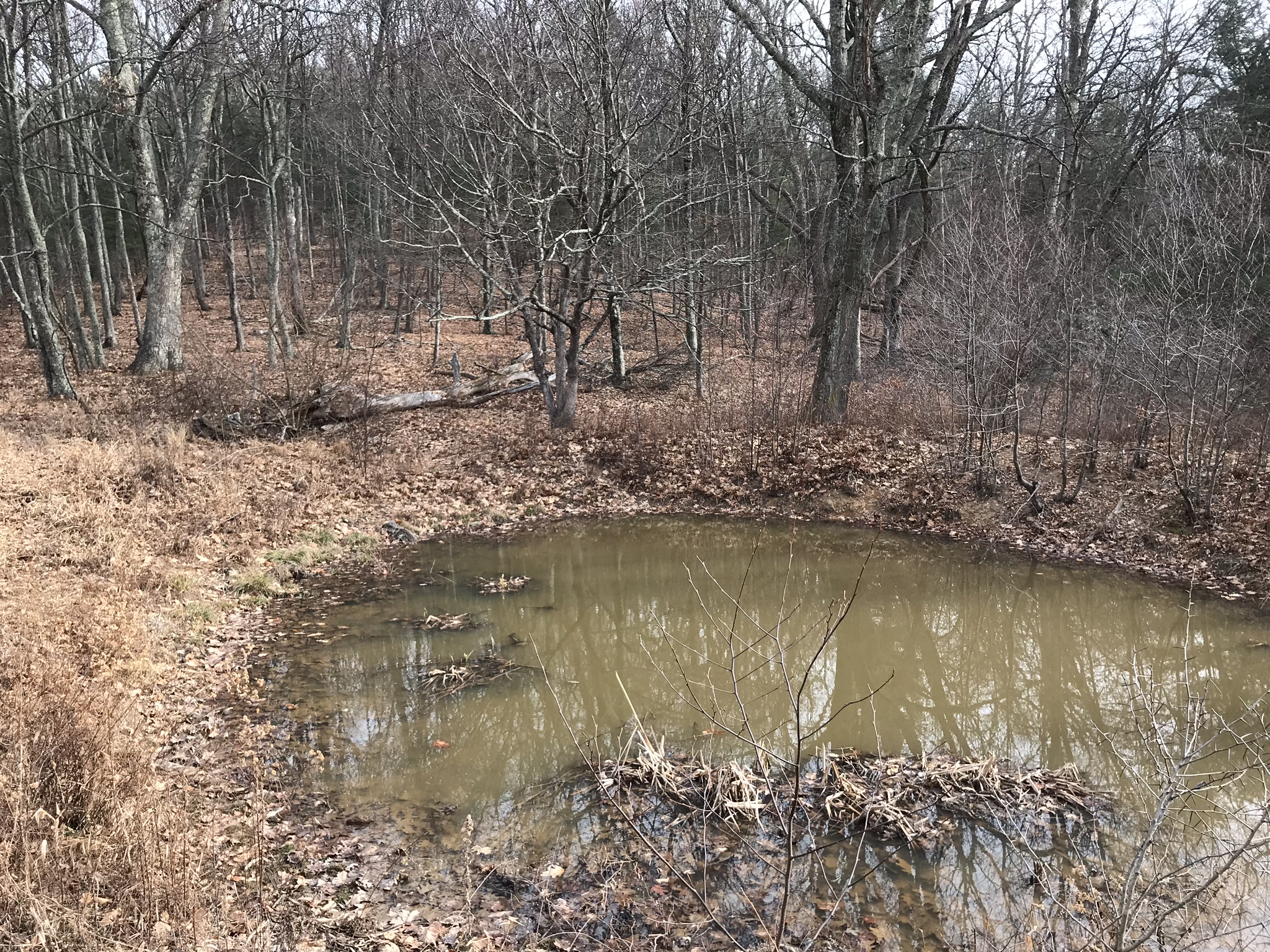
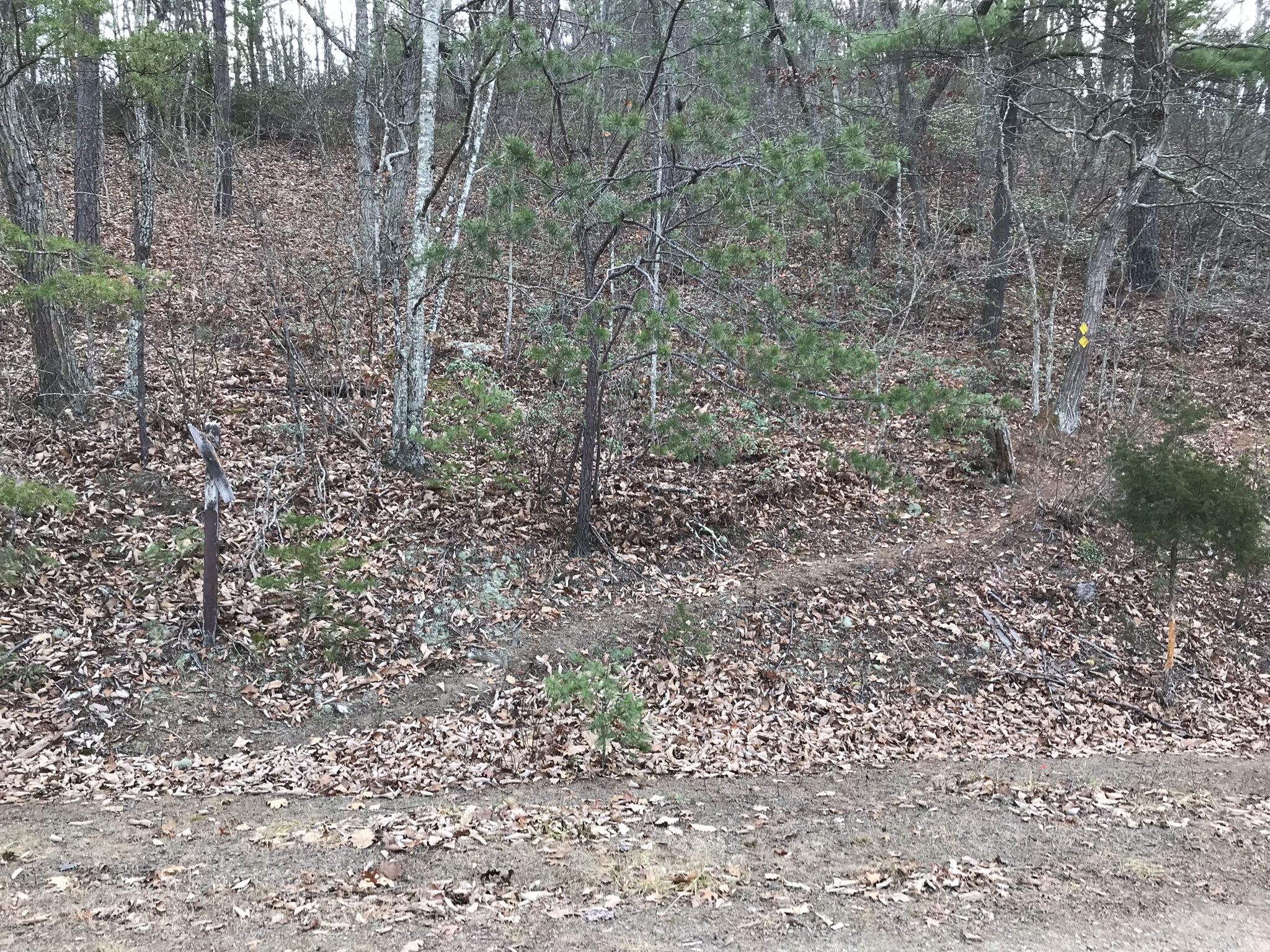
Mile 1.4 – The Marshall Draft Trail ends at an intersection with the Shenandoah Mountain Trail, in an open field suitable for camping. Keep a sharp eye looking at where you came from, as the Marshall Draft Trail is much less evident than the Shenandoah Mountain Trail, as the latter gets a lot more use, mainly by mountain bikers. Note in the photo of the intersection that both trails are marked by the same yellow diamonds. The diamond for the Marshall Draft Trail is much harder to pick out in this photo. The Shenandoah Mountain Trail heads north for 17.5 miles to U.S. 250 and then connects with trails in Ramsey’s Draft Wilderness. South, the Shenandoah Mountain Trail continues for 6.8 miles to a point near a bridge crossing of the Cowpasture River in Fort Lewis. At your present location, you have reached a sag between two peaks on the Shenandoah Mountain: to your right is Wallace Peak, and to your left – northeast of Wallace Peak – is Northeast Peak. Ahead of you is a wildlife pond. The summit of Wallace Peak was once the site of a fire lookout tower and remains a common local hiking destination, even though there is no trail shown on many trail maps. The key is to find the location of the old tower access road – no longer used, but still evident if you look in the right place. The access road came up from the east and appears to have turned uphill right where the wildlife pond sits now. Head to the right of the pond towards the only large pine tree in the area. Stay to the right of the pine tree heading uphill, and the old access road magically appears!
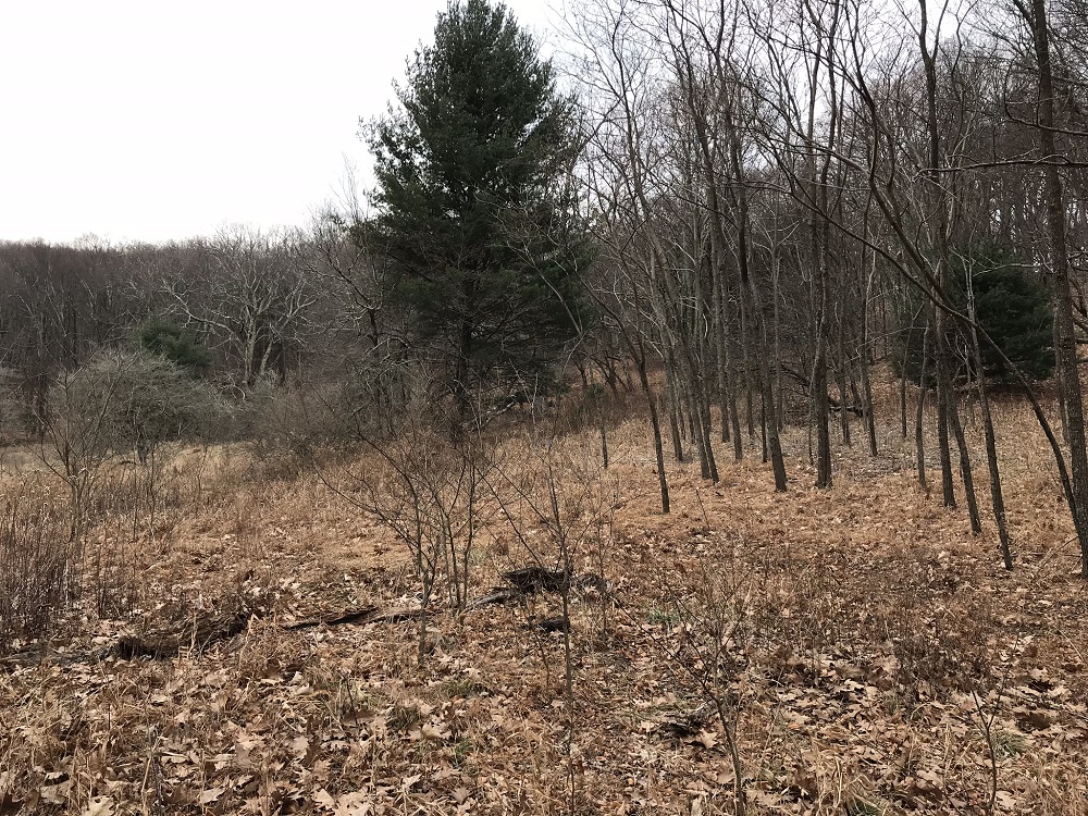
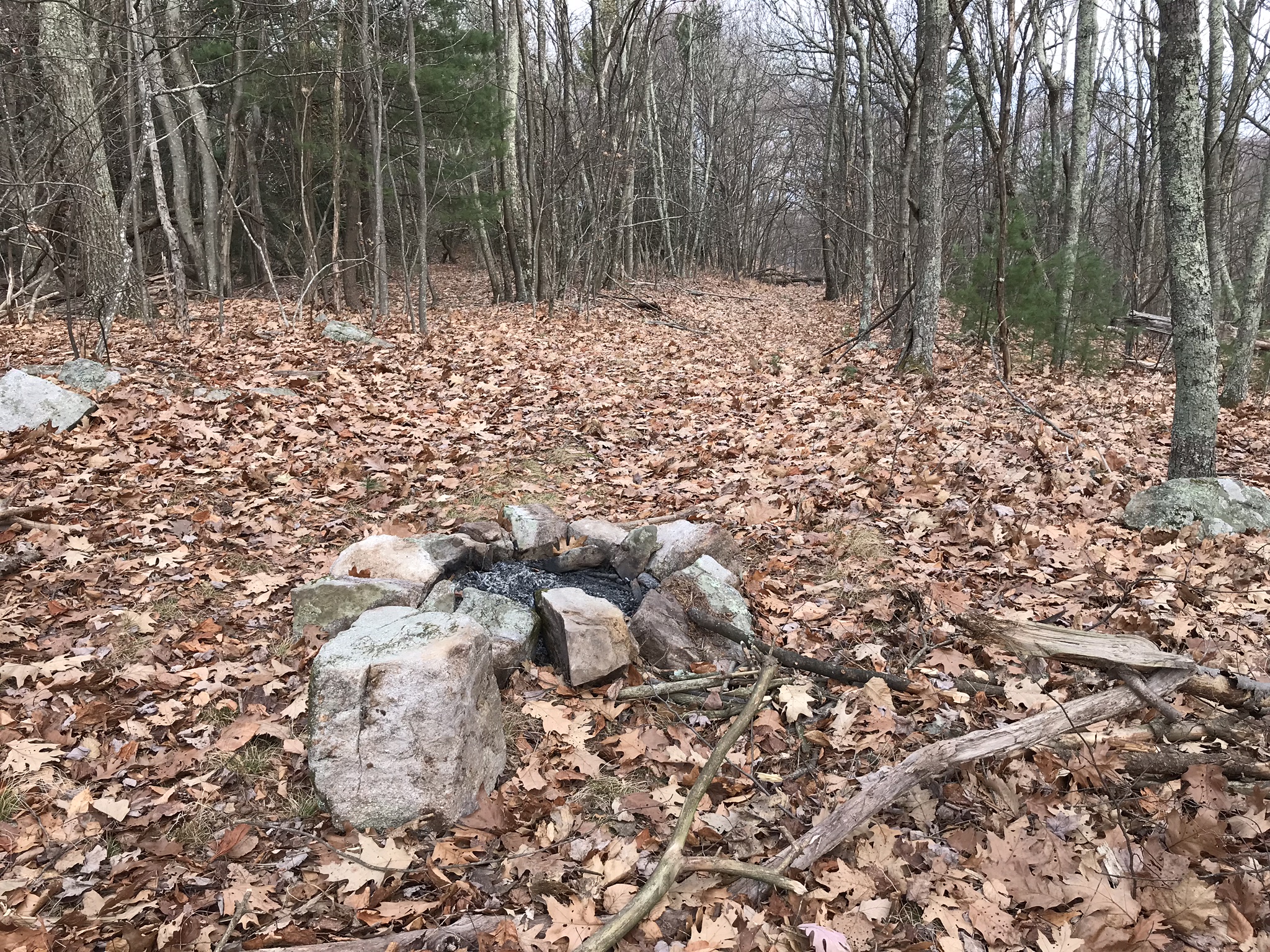
Mile 1.6 – The road takes a left turn shortly after the wildlife pond and climbs Wallace Peak. Right in the middle of the old roadbed is a campsite with a fire ring. Normally this would not be a viable spot to camp, but this is an inactive route. Continue past the fire ring on the old road.
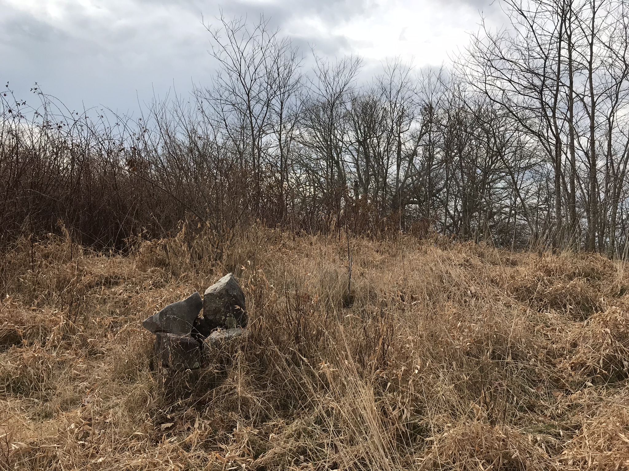
Mile 2.0 – Reach the summit of Wallace Peak. Although there are no views from the open summit due to nearby tree growth, the summit provides a very remote and peaceful place to stop for lunch. The concrete bases for the tower are still at the summit, but the rest of the tower is long gone.
Mile 4.0 – Return to your vehicle the way you came for a four-mile roundtrip, or take a side trip along the Shenandoah Mountain Trail. Northbound, there are multiple nice views from the ridgetop trail, looking west into remote Highland County.
Early December
Marshall Draft Hike Comments
Archived Comments
By:Paul
Rating:
Date of Hike: Sunday, May 26, 2019
Whether or not you'll enjoy this hike depends entirely on what you want. That's why I gave it a neutral rating. If you want solitude, you're in the right spot. We didn't see a soul. It's fairly pretty once you reach the ridge, but there are mature trees along the ridge, so views are minimal. To update the description: the trail-head sign is almost completely gone. If you don't have it marked on your GPS, you are highly likely to drive right past it. The trail itself is also not clear from the road. Once you find it, you're good to go for a while. The yellow diamond blazes are plastic and in place. The trail itself completely disappears for at least a 1/4 mile starting maybe around 0.6 or 0.7 miles from the trail-head. A tree blew down and a ton of thorns and vines appeared in its place. The blazes are still in place, but can get a little infrequent. There are smaller blow-downs all along the trail. No objection to the difficulty. I expected that and it was tough. The "wildlife pond" water source at the top is a challenge. I recommend packing some coffee filters or using something else to wrap around the head of your pump. Ours clogged very quickly.
By:Joseph G White
Rating:
Date of Hike: Sunday, October 28, 2018
Everything that it was billed in the description. It is most definitely the loneliest hike in Virginia. Really enjoyed it, although it was a bit challenging at times to follow the path it could use a little maintenance.
ONE IMPORTANT NOTE: I got lost on the immediate descent from Wallace Peak and spent 10-20 minutes trying to locate the trail. Because that part of the trail isn't marked, it's a good idea to be aware of exactly from which direction you came as you get to the top.
I would like to return with some friends and camp for the night. I bet the quiet would be amazing!


