|
 By Trail Contributor: Jeff Monroe (Email Jeff) By Trail Contributor: Jeff Monroe (Email Jeff)
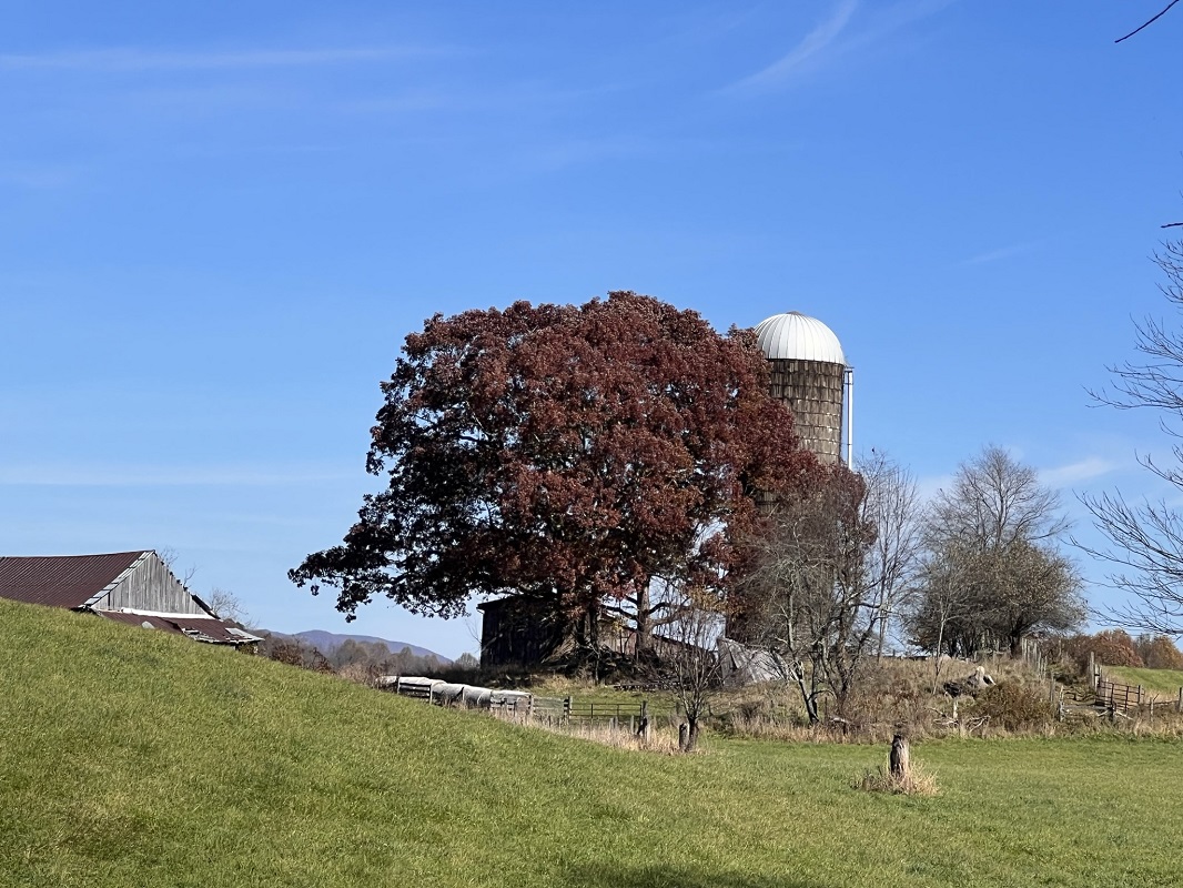
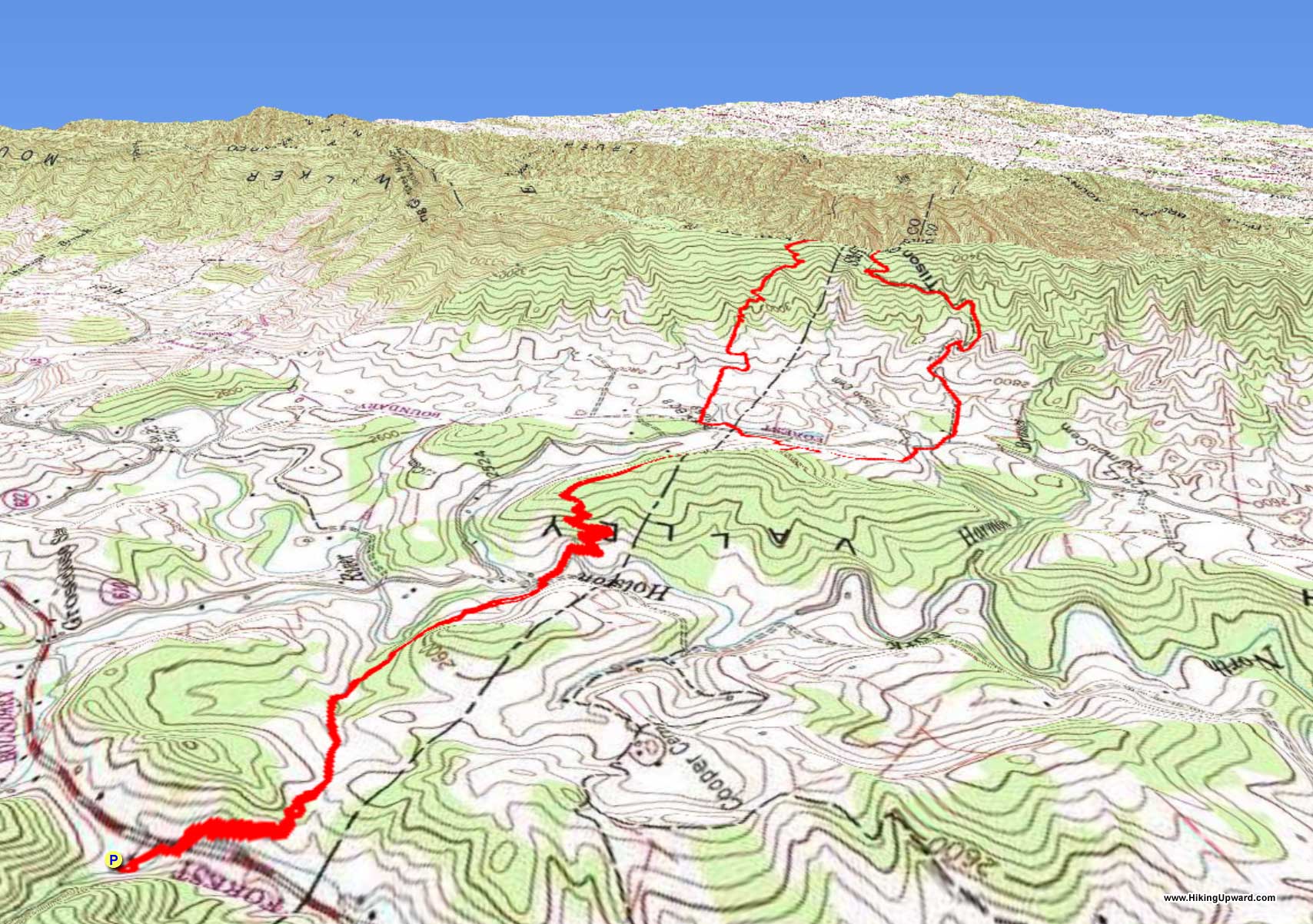
The Appalachian Trail south of Roanoke has changed location multiple times during its history. It was originally nearly entirely east of present day Interstate 81, as documented in a wonderful recent book entitled, “Virginia's Lost Appalachian Trail,” written by George Mason University History Professor Mills Kelly. It was later rerouted to Big Walker Mountain, before being rerouted further west to Burke’s Garden during the mid-1970’s. More recently, the trail on the northbound side of Big Walker Mountain has been again rerouted. This loop covers both the newest and the previous sections of the Appalachian Trail.
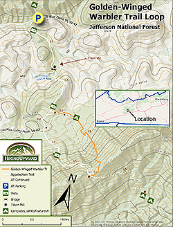
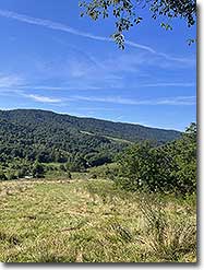
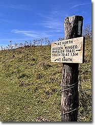
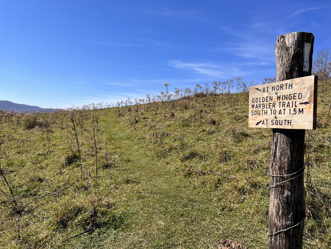
The Golden-Winged Warbler Trail (“GWWT”), located on the Bland County/Smith County line, is part of a small loop when combined with the Appalachian Trail (“AT”) at Tilson Gap on Big Walker Mountain. The trail’s namesake is a songbird whose population in the Appalachian Mountains has fallen by an estimated 98% in recent years. The area around the GWWT is considered prime habitat for this species. It also is exceptionally beautiful with wonderful vistas!
There are multiple locations to park for this hike. This hike description assumes a longer option that includes some additional Appalachian Trail miles before and after the loop, parking at a public parking lot where the Appalachian Trail crosses Virginia Route 42 next to the private O’Lystery Picnic Shelter. You may also park your car at the Quarter-Way-Inn, an AT Hostel just up VA 610/Old Rich Valley Rd from the loop, even in the off-season (this hostel is only open during the Spring rush). You would need to email the owners first, but this option is highly recommended if hiking after recent rains, as described below. There is also a small pull off right next to the Appalachian Trail on VA 610/Old Rich Valley Rd on the south side of the road to the west of the trail. Completing only the loop would give you a hike of 3.9 miles, and you would miss some of the spectacular scenery experienced on the AT when coming southbound from Route 42.
-
Mile 0.0 – Park at an AT lot where the AT crosses Virginia Rt. 42. The lot is on the northbound side of the road, and is next to a privately owned picnic shelter. In the woods behind the parking lot is the best campsite on this hike, with several flat areas for camping near Possum Creek. The AT crossing is a little hidden here, as it does not cross at the parking lot. Walk back out to Rt. 42 and take a right. The AT crosses about 50 yards down the road. Start the hike by crossing the road and hiking southbound on the AT, ascending through some woods.
-
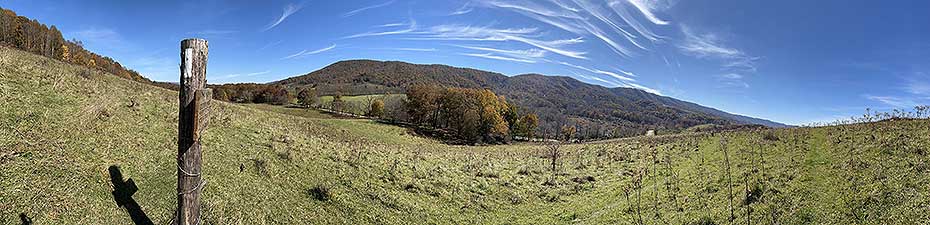
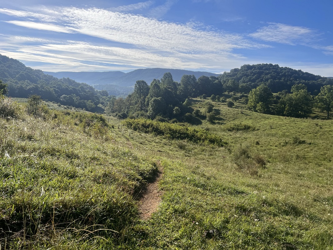
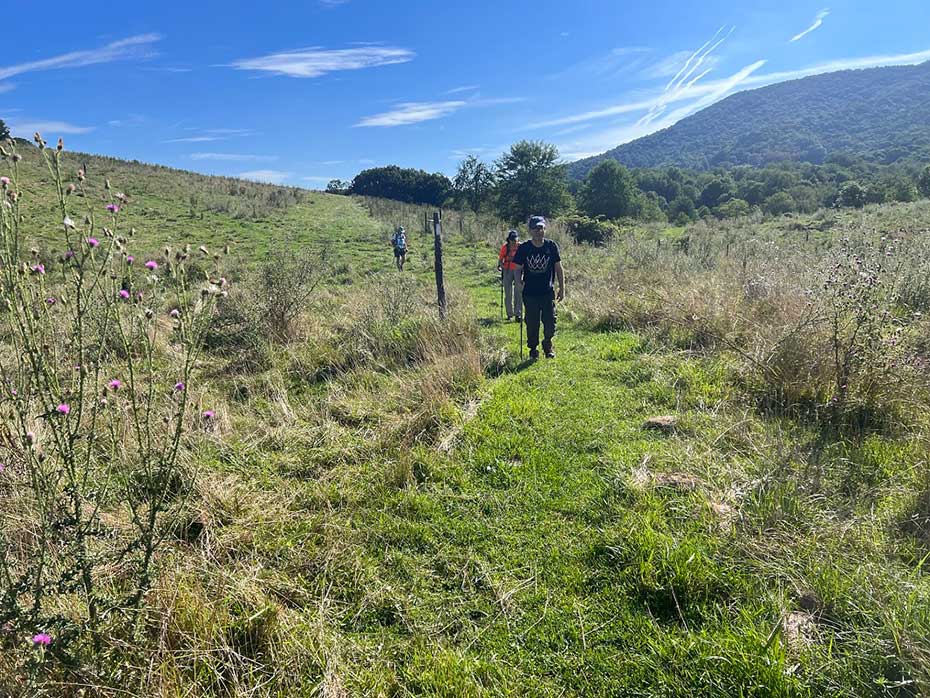
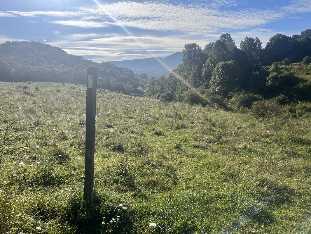
Mile 0.4 – Leave the woods and hike through pasture with wonderful views east to Big Walker Mountain. The trail is somewhat eroded and easy to follow here, and fence posts with white blazes also mark its track.
-
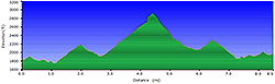
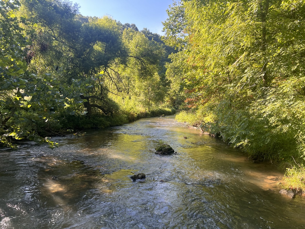
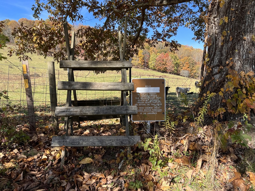
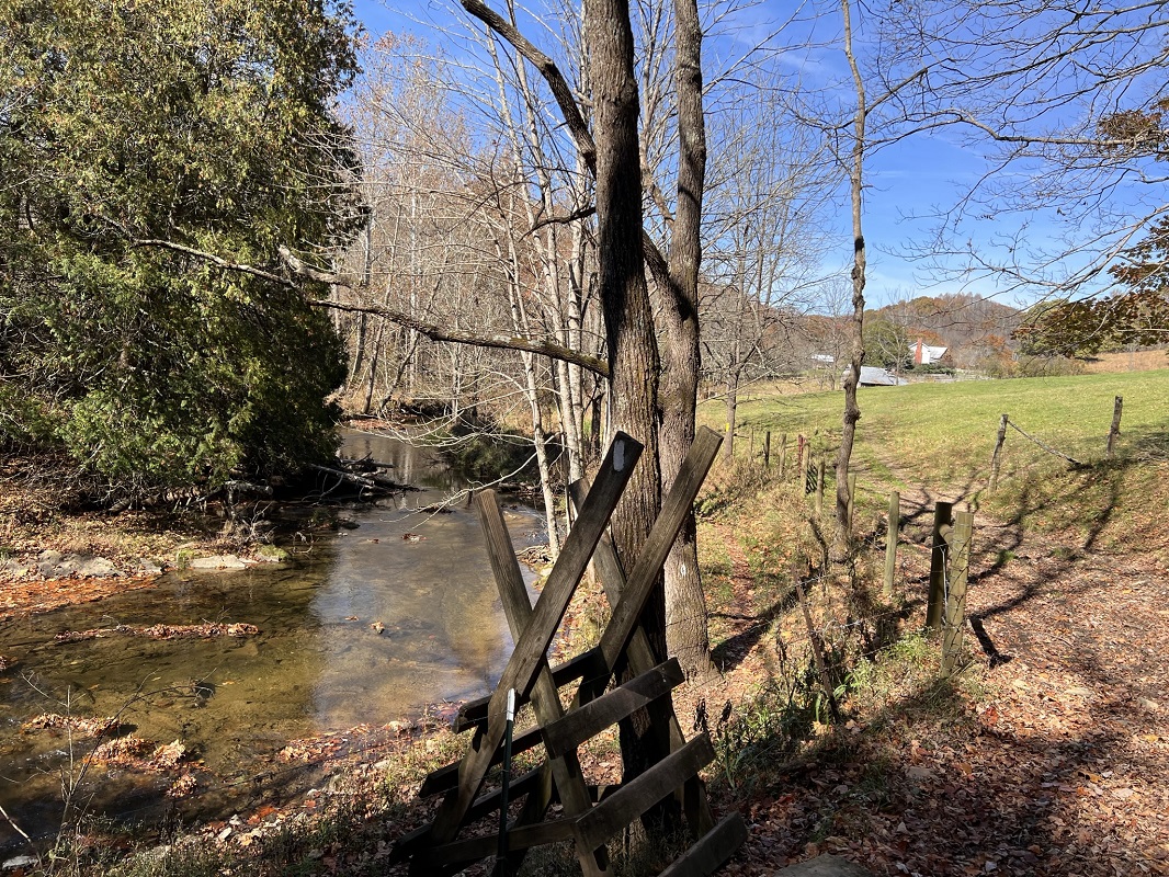
Mile 1.1 – After climbing a stile, come to the Shady Grove Road (Rt. 642). At this point is the lowest elevation on this hike. Cross the North Fork Holston River on the road bridge. It is important to note that the bridge here is a low water bridge. Although I have never had an issue here, the river regularly floods in the Spring (2018, 2020, 2021, 2022). If you have the FarOut app (formerly known as Guthook), you may be able to read about current conditions at this bridge. Do not attempt to cross if water is above the bridge. As stated earlier, consider parking options closer to the loop if water levels are high in the area.
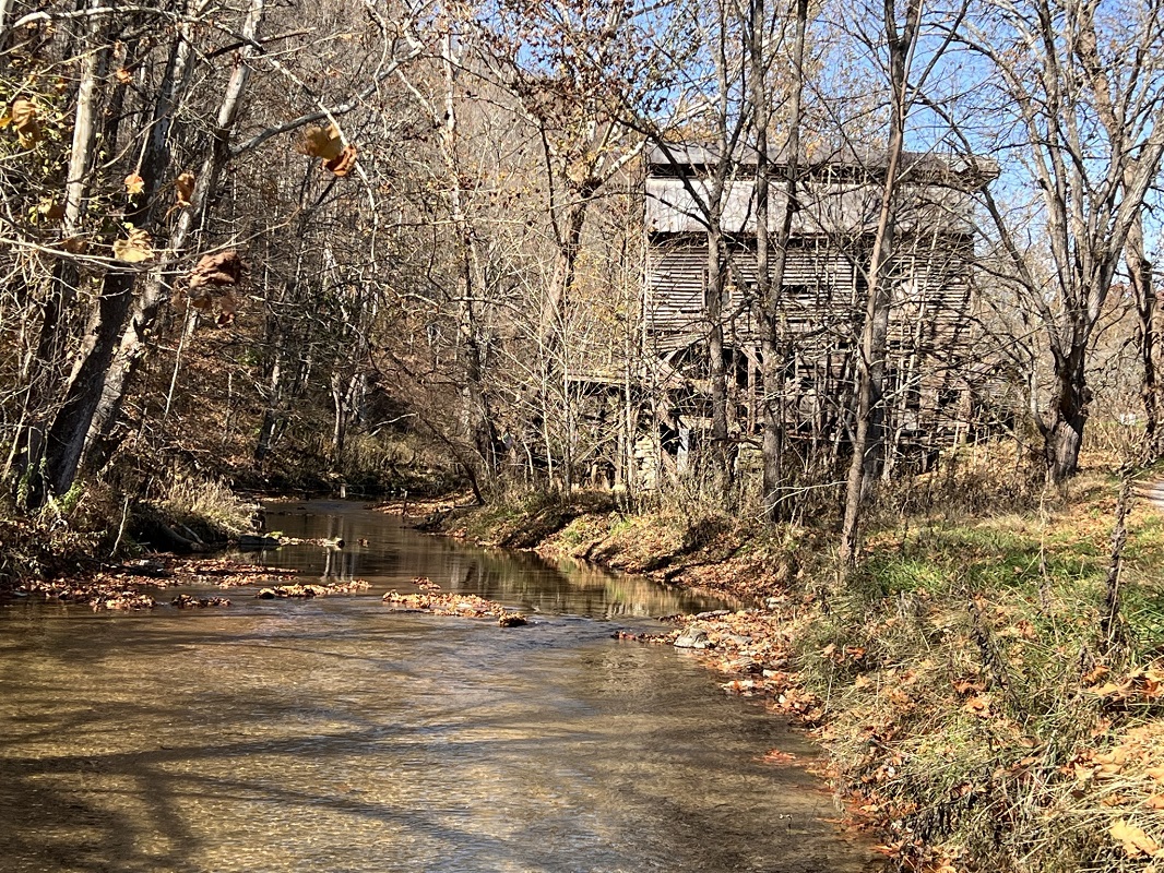
After crossing the bridge, take an immediate right onto the trail, marked by an AT sign and walk across a swampy, occasionally flooded, section of the AT on boards placed by the trail maintaining club. Be sure to check out the deteriorating old Tilson Mill upstream from the bridge.
-
Mile 1.2 – Come to another stile after paralleling the river for a short distance, Cross a farm road and ascend through woods about 425 feet over the next 0.9 miles.
-
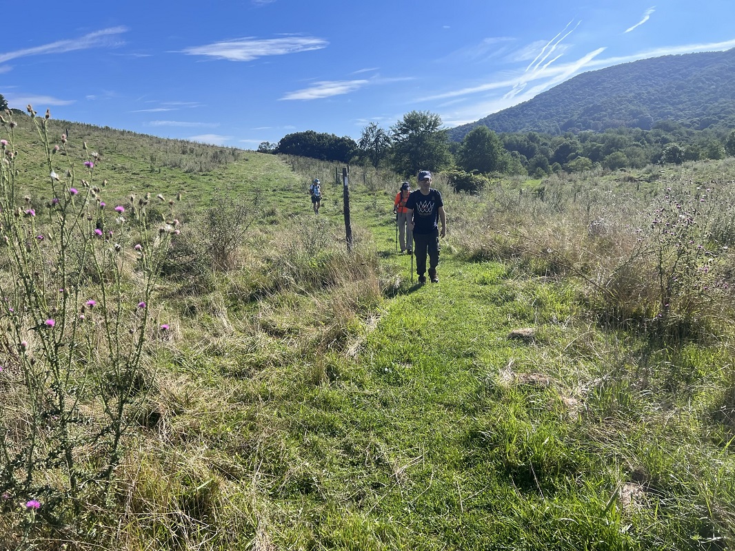
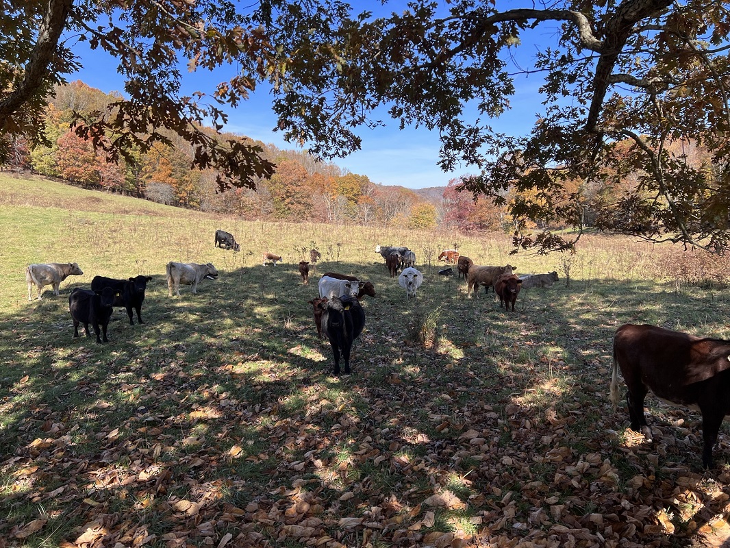
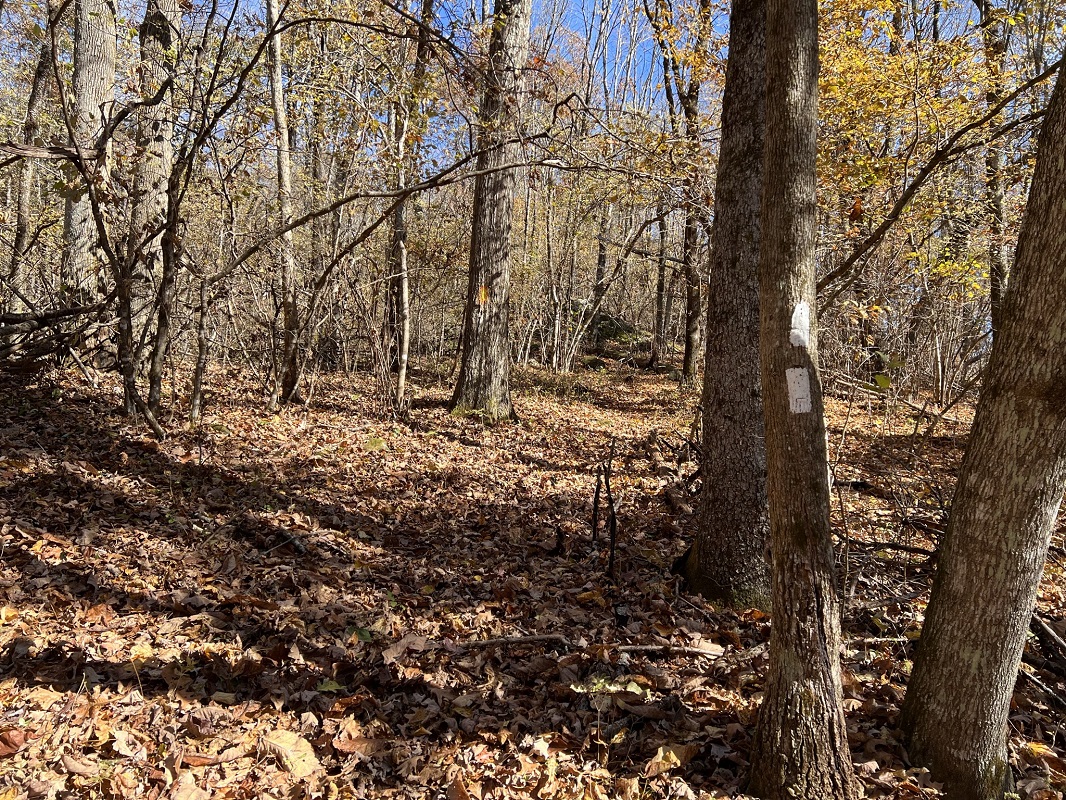
Mile 2.3 – At the upper end of a working cattle range, descend to a sign for the Golden-Winged Warbler Trail. Your return will take you back to this spot. To the left through the field is the GWWT, which follows the old AT alignment. Take a right and follow the white blazed Appalachian Trail. Straight ahead is a wonderful view of Big Walker Mountain. (Note that the next 2.2 miles of AT are not shown on maps produced by National Geographic/Trails Illustrated, as of the writing of this trail description. The new alignment opened in 2018, after the federal government bought the farm - known as the Tilson Farm - and added it to its National Forest holdings.) Following the AT, the trail drops in elevation as it approaches a road.
-
Mile 2.8 – Cross the Old Rich Valley Road (Rt 610) and begin an 800 foot elevation gain over the next 1.7 miles. Much of this ascent uses an old roadbed that was originally the “Black Lick and Plaster Bank Turnpike,” constructed during the Civil War to carry gypsum. You will start by traversing more fields before entering into the forest on the western slope of Big Walker Mountain. When my group hiked this portion of the AT, we wondered why the AT moved from its previous route. I asked a leader of the Piedmont Appalachian Trail Hikers (PATH), which maintains this section of the AT and the GWWT. He explained that the AT was relocated in this area because the previous alignment was right on the boundary of the property (or easement) and the trail corridor for several hundred yards was rather narrow (maybe 20 or 30 yards). The present location was relocated onto on an old commercial road (Plaster Bank Road) which makes for a better grade and easier maintenance.”
-
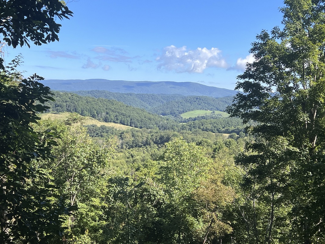
Mile 3.4 – About halfway into your climb up the north slope of Big Walker Mountain, come to a switchback with a nice vista looking west towards the Burkes Garden area.
-
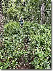
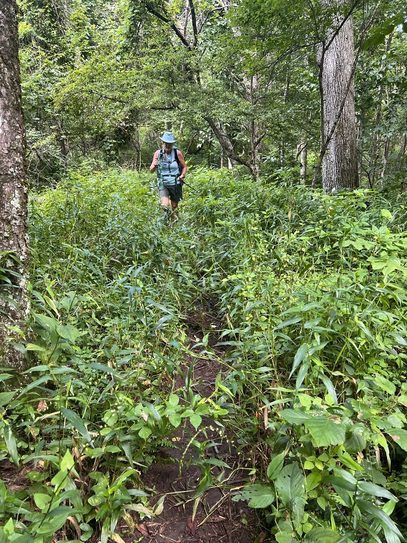
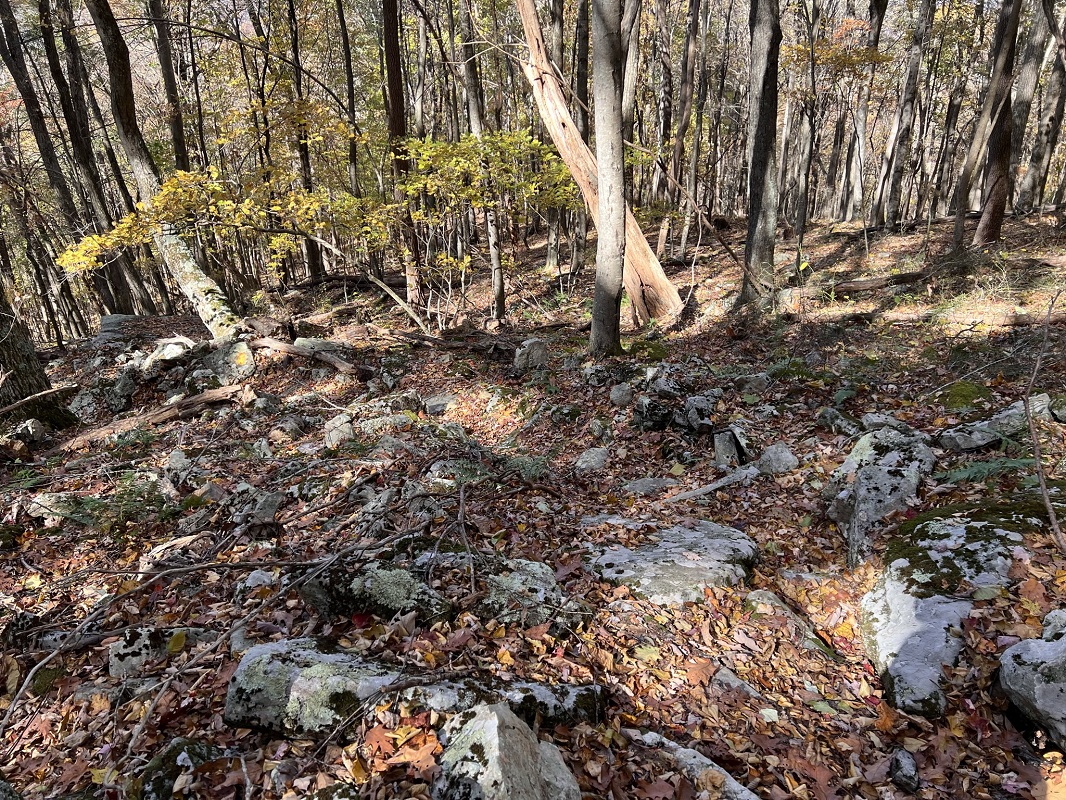
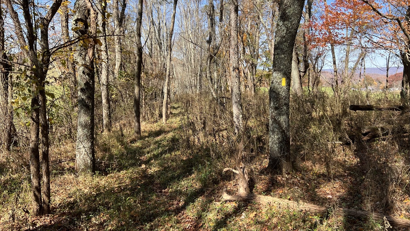
Mile 4.5 – Reach the highest point on this hike, about 3400 feet elevation, as you ascend to Tilson Gap on Big Walker Mountain. During the Summer months, you may go through some high growth just before reaching the crest. Look for a double white blaze signaling a change in AT direction, and a golden blazed tree to your left, signaling the start of the GWWT. As of this writing, there was no trail sign here, though it is likely PATH will install one in the near future. If you wish to hike further south on the AT to camp, there are multiple wonderful campsites at the base of the AT’s downslope, about 1.5 miles away, on the banks of Reed Creek in the wonderfully remote Crawfish Valley. (In my opinion, these are some of the finest campsites on the AT in Southern Virginia – and they are very secluded with reliable water.) If you are not camping, however, do not start heading downhill. Instead, take a left here onto the GWWT, looking for the golden yellow blazes to help you through areas where the old AT alignment is not clear. The trail descends over a rocky slope. Hiking sticks are very helpful here, as is a keen eye for upcoming golden blazes.
-
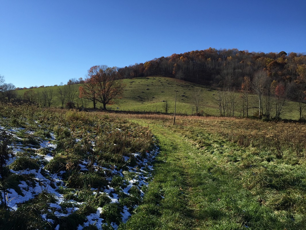
Mile 5.6 – The trail levels out somewhat and follows the original AT easement back towards the Old Rich Valley Road (Rt 610) – you can tell because it is a thin corridor of woods sandwiched between open grazing lands.
-
Mile 5.8 - A stream crosses this section of trail, providing a possible camping opportunity. Be on the lookout here for the trail to leave the wooded strip and angle left into a nearby field. I missed that because I was admiring an adjoining farm and its wonderful tree, then I found myself on an overgrown trail wondering what happened!
-
Mile 6.0 - After angling though a field towards a gate, following some posts with yellow blazes, come again to the Old Rich Valley Road (Rt 610). An old stile here is overgrown with plants. You do not need to use it to get out to the road. However, you will need to climb the stile on the other side of the road. I found myself climbing in front of a large, somewhat interested group of spectators! At this point, the trail is a little hard to follow. Head left along the fence line and look for blazes. There will be a small grove of trees ahead of you, and the trail cuts uphill away from the road in this small grove. If the trail is not well marked (it was not when I hiked this section), look for the GWWT sign that you passed at the beginning of this loop. It is visible on the hillside.
-
Mile 6.2 – Reach the sign signaling the GWWT split from the AT. Continue upslope, and be sure to turn around and enjoy the views of Big Walker Mountain, which you just climbed. Then retrace your steps to your vehicle.
-
Mile 8.6 – Cross Virginia Rt. 42 and head to the right back to the starting parking lot and your vehicle.
|


.JPEG)