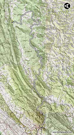
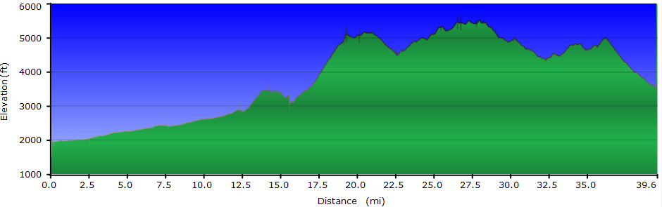
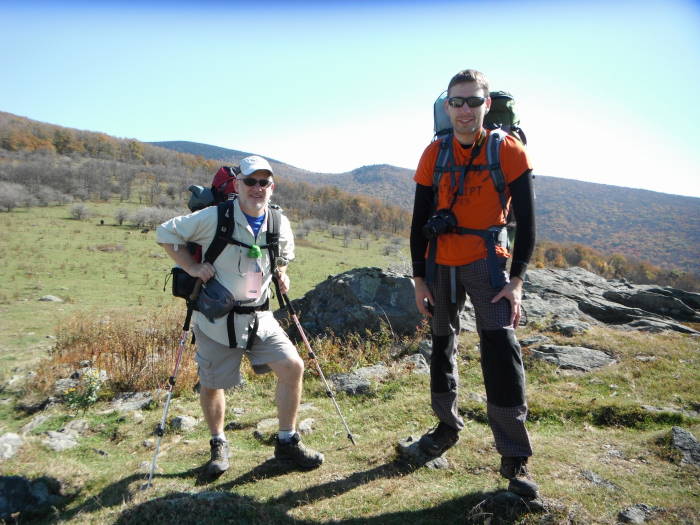
This has to be one of the best backpacks in Virginia. We did it as an aggressive 2.5 day backpack covering 39.6 miles. This backpack has everything, creeks, tough climbs, great vistas, wild ponies, tallest mountain in Virginia, tons of camp sites, open balds, and the list goes on. Double check the weather prior to your hike as it can change dramatically in this area and at these 5000+ elevations.
Our Hike Preliminary Notes:
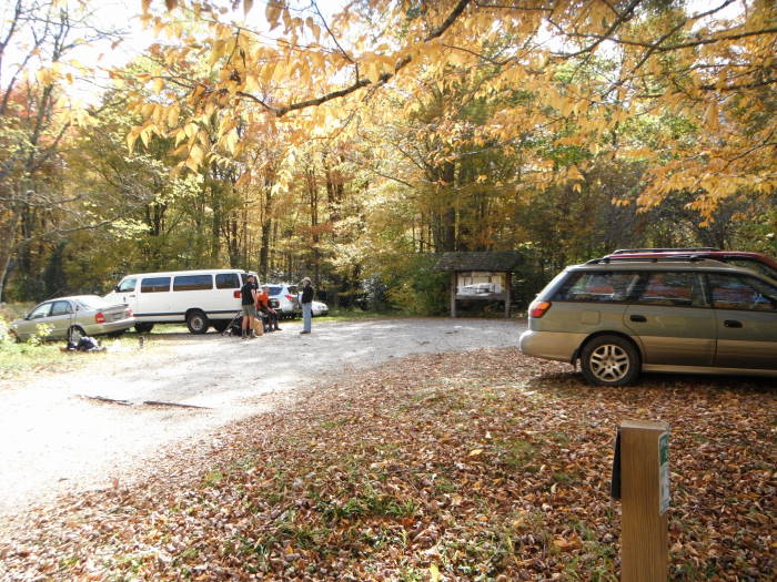
We spent our 1st night at the Mount Rogers Outfitters Hostel in Damascus VA, and also left our car here for a nominal fee. Prior to our trip we called them and setup a shuttle ride from Route 603, the hike end point, back to our car at the Hostel. See thier site for a list of rates.
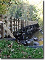
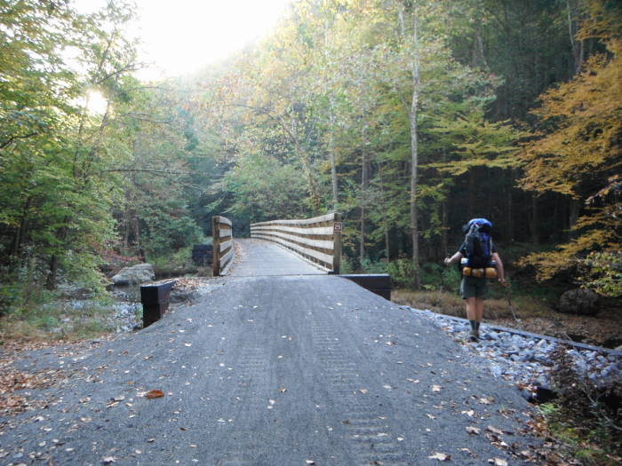
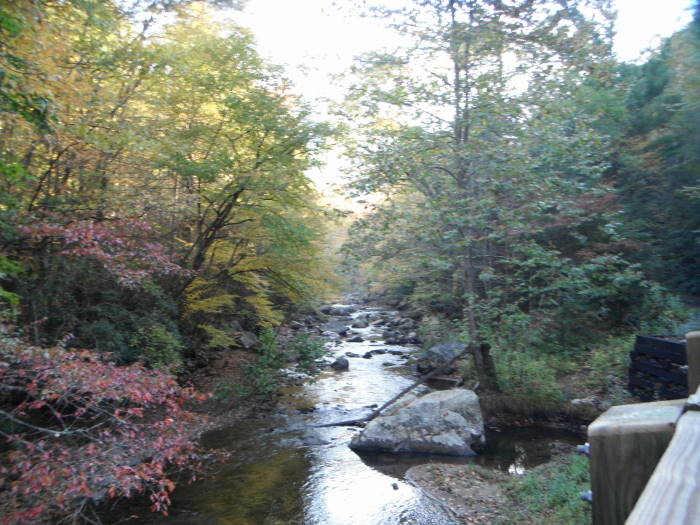
We hiked the Virginia Creeper Trail for the first 12.3 miles to ease in for our first day. The Appalachian Trail north on this section does not have many views. The mileage is not much different so decide if you want to do the A.T. or the Virginia Creeper Trail. The Virginia Creeper Trail is very picturesque and has multiple bridge crossings over Laurel Creek.
NOTE: The Topo Hike Trails Map.pdf">here does not contain a TOPO map. There are just way to may interconnectiong trails and and details to fit on one page. We highly reccomend that you purchase the National Geographic Mount Rogers 786 Map.
Also see the alternate 2 day version at the end of this write-up.
DAY 1 – 15.5 miles
Mile 0.0 – Start at the Mount Rogers Outfitters Hostel and followed the white blazed Appalacian Trail (A.T.) through Damascus. The A.T. will bear off to the left just outside of town after you have been on the Virginia Creeper Trail for a little while. Stay on the Virginia Creeper Trail for the next 7.4 miles enjoying the many beautiful views of the creek and fields.
Mile 7.4 – Taylor's Valley (Route 725). You will see the Creeper Trail Cafe on the right on the other side of the bridge. Continue 4.9 miles to the Creek Junction Trestle.
Mile 12.3 – Cross the Creek Junction Trestle, the tallest trestle on the Virginia Creeper Trail. Bear to the left onto the A.T. after crossing the trestle, continue for 1.9 miles to the Lost Mountain Shelter. Take a look at the trestle construction, really cool.
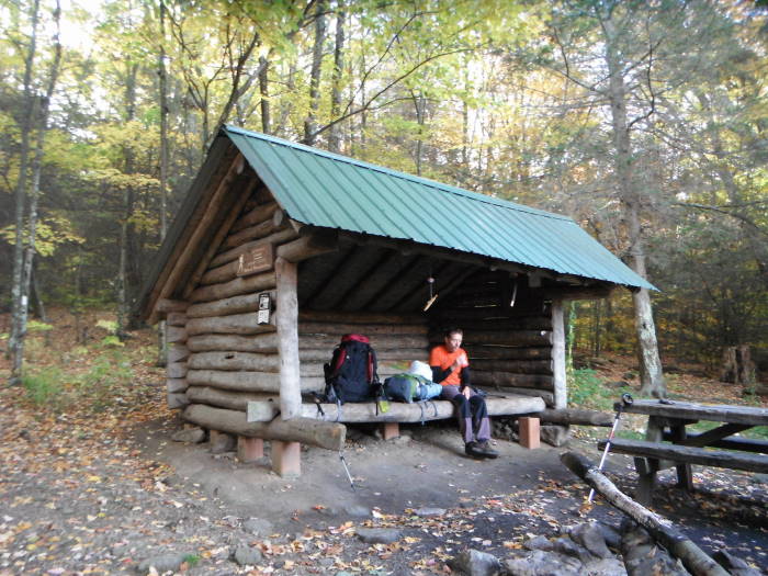
Mile 14.2 – Lost Mountain Shelter. Continue north to Route 58 crossing, Summit Cut, in 1.1 miles, this will be mostly down.
Mile 15.3 – Route 58, Summit Cut. Fill up on water just before crossing Route 58. Campsite is in 0.2 miles after Route 58
Mile 15.5 – Day 1 Campsite on left at pine grove, no water here. Walk in just a little ways for enough flat spots for 4-5 tents.
DAY 2 – 16.4 miles
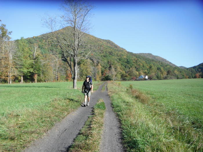
Continue north from the campsite, going through fields, and reach the Route 601 Parking in 1.2 miles.
Mile 16.7 – Route 601 Parking, room for 4-5 cars, gravel road. Coordinates: 36.6373 -81.6404. Be prepared for some exertion on the next 2.6 miles, gaining almost 1700' and not many switchbacks.
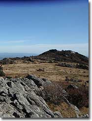
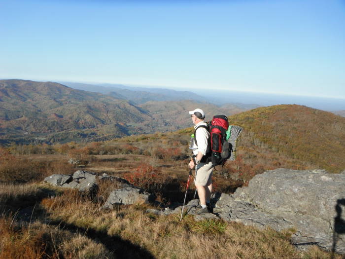
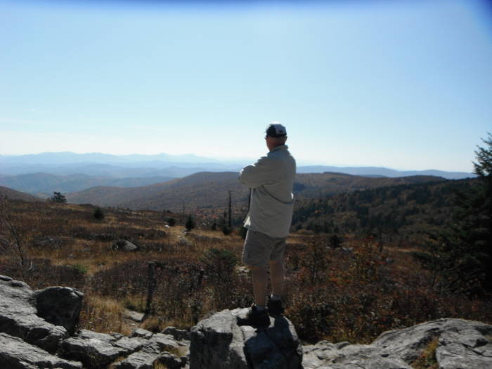
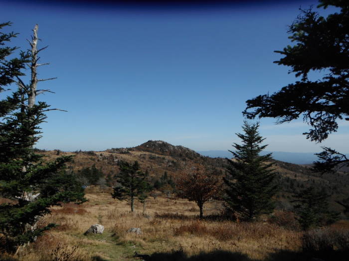
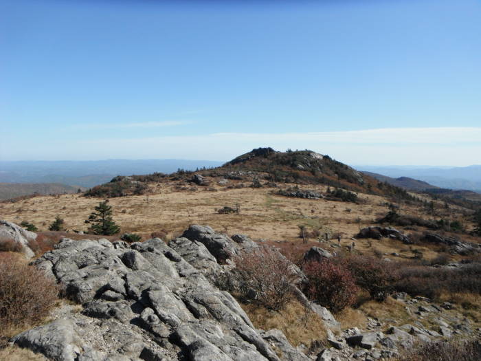
Mile 19.3 – Reach Buzzard Rock (5096') after a nice steady climb up the side of Beech Mountain. There are some awesome views here. Go through a section of woods and quickly come out into the open again reaching a spring in 0.8 miles below Whitetop Mtn.
Mile 20.1 – Spring. The next section is mostly in the woods and downhill to the Parking area on Route 600
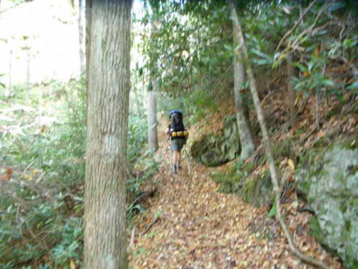
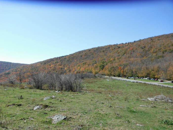
Mile 22.6 – Route 600 Parking, coordinates: 36.6465, -81.5832. Cross Route 600 and go through the gate into the open field, be sure to look back over your shoulder on occasion to view Whitetop Mtn. Continue the climb towards Mt Rogers Spur Trail, reaching it in 4 miles. This section is mostly in the woods until just before the spur trail. Some of these woods will make you think you are in Canada.
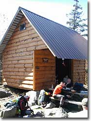
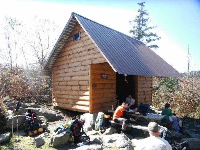
Mile 26.6 – Mt Rogers Spur Trail, tallest Mountain in VA, 5729'. You are there, go to the summit but don't expect any views, the summit is covered with trees. Continue 0.2 miles to the Thomas Knob Shelter.
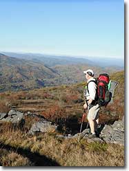
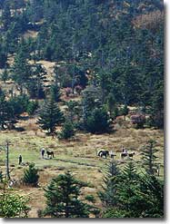
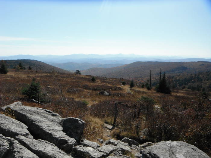
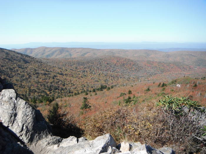
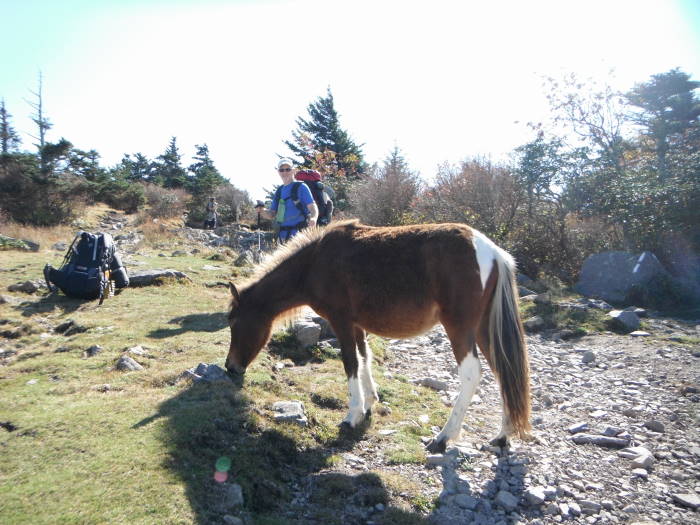
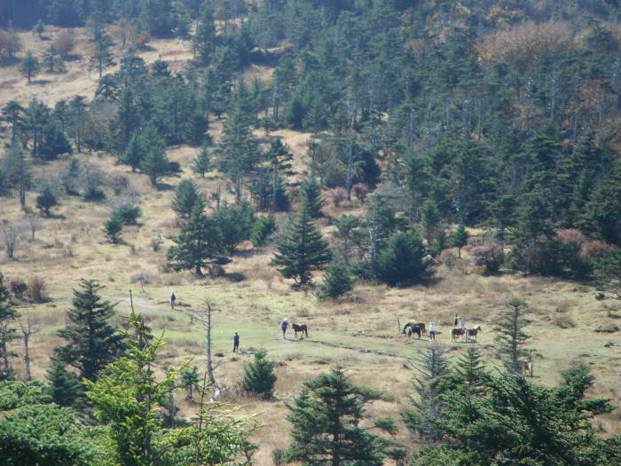
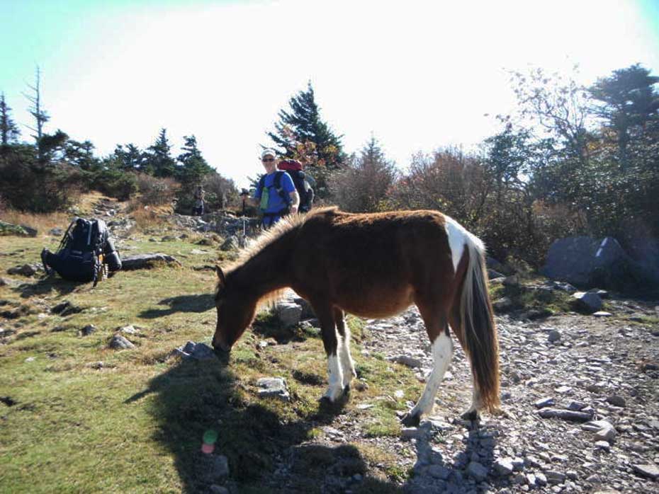
Mile 26.8 – Thomas Knob Shelter. Great place for lunch and to fill up with water about 150 yards behind the shelter where there are also great views. The next 5.1 miles through Grayson Highlands have some of the best views you will find in Virginia. You may also be fortunate enough to see some of the wild ponies.
Mile 31.0 – Quebec Branch creek crossing, could fill up here or at Big Wilson Creek near the shelter.
Mile 31.9 – Wise Shelter. Plentiful campsites near the shelter. Water source is Big Wilson Creek, about 0.1 miles north on the AT from the shelter.
DAY 3 – 7.7 miles
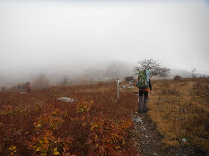
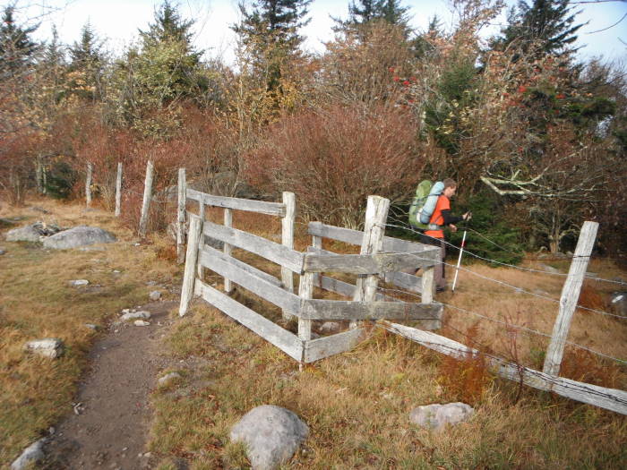
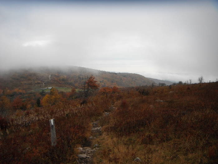
Continue north on the AT from the campsite, through the Little Wilson Creek Wilderness, reaching the Scales Campgound in 3 miles. We hiked this early in the morning, great views even with clouds blowing through .
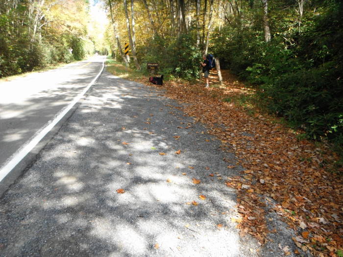
Mile 34.9 – Scales Campgound. Clean pit toilets located here. You will be pretty much in the woods for the hike down to Route 603 parking area.
Mile 39.6 – Route 603 parking area. Shuttle ride back to Damascus.
Alternate 2 Day Version – 24.3 miles
Day 1 – (11.5 miles) Skip the VA Creeper Trail and have the shuttle take you to Route 58 (Summit Cut). Hike to Thomas Knob Shelter and spend the night near there, tons of campsites just after the shelter.
Day 2 – (12.8 miles) Thomas Knob Shelter to Route 603 have shuttle pick you up around 3 or 4 depending on your pace
Mid October
Mt Rogers/Grayson Highlands
Mt Rogers/Grayson Highlands Hike Comments
Archived Comments
By:nort
Rating:
Date of Hike: Wednesday, August 1, 2018
Did this hike over four days with two kids including my 8 year old daughter. She had a very light pack, but 10 miles/day was about all she could do. We had the shuttle take us to fox creek/603 so that we could hike back to the car. We got a lot of rain over the four days, but the springs and streams were all flowing well. I was worried there would be stretches without water but it seemed there was a source often enough that you don't really have to worry about carrying a lot/extra. The shelters all have lots of campsites around them, and while there were definitely decent stretches without any sites, there were enough that you don't really have to worry about where you'll sleep each night if you are tenting and don't want to stay IN the shelters. Lastly, bears. They are having a serious bear problem up there with bears that are getting food and are not scared of people. Bear boxes were installed near Wise and Thomas Knob and they need them at Old Orchard. Even saw an electrified fence that had been setup near Thomas Knob. There were signs everywhere about the problem, but be very careful and take the utmost precautions when eating and storing your food.
Even in the first week of August, during the week, and with lots of rain in the forecast, there were still a bunch of hikers out there. I can't even imagine what it's like on weekends or during leaf season. But for good reason: this hike is amazing.
By:Richmond Hiker
Rating:
Date of Hike: Thursday, April 19, 2018
I did a modified version of this hike on the A.T. the whole way instead of the Creeper Trail in early Spring 2018. This is truly an epic section of trail, I can't overstate how beautiful it is. The first day out of Damascus is not too exciting but has some killer switchbacks before Saunders Shelter. I camped the first night at the junction of Creeper Trail and A.T. next to a roaring Laurel Creek. In mid-April every spring and stream was full so I never carried much more than 1L of water. (Even at 5000' on Whitetop and Pine mtns there were springs flowing.) Day 2 is when the trail comes out of the woods and you have more open sections in high meadows. The climb to Buzzard Rock was really tough, and then the trail around Whitetop toward Mount Rogers was more rocky and difficult than I expected. Views were insane. I camped near Thomas Knob on Night 2- there was a small herd of ponies walking around. Day 3 is just view after view, it will make your eyes pop out of your face. Plan extra time for taking pics and video. It was a beautiful Saturday when I came through Grayson Highlands so there were hundreds of people there. Night 3 I camped at Old Orchard shelter which was less crowded than Wise Shelter. I had MRO shuttle pick me up at Fox Creek at 10AM on Day 4 and drive me back to Damascus. Then I hiked south to the state line to check off that A.T. section. My mileage was roughly 15/15/11/9, all on the A.T.
This one is a superlative, bucket-list level of backpack trip. If you can't make it to the Grand Canyon this might be a good substitute.
By:forrestinthe4est
Rating:
Date of Hike: Friday, November 27, 2015
This is a hike unlike any other. This was one of my favorites and I look forward to getting back out there again. If you get the chance, you definitely need to check this one out. I recommend doing it in the late fall or winter because the majority of the hike lacks shade - the trail is mostly out in the open with breathtaking views the entire way up. If you are into photography, this is an excellent place to capture some incredible shots with a wide variety of scenery. With the wide open rolling hills, this hike feels less like something in Virginia and more like something out in Colorado. Prepare to be in for a surprise when you make it to the top - I was not expecting what we encountered! There were some cool rock formations along the way, as well as an amusing number of friendly wild ponies roaming around the hillsides. If you're not local, it can be a long drive to the state park, but it is worth every minute of the drive.
By:DJ-WEMT
Rating:
Date of Hike: Saturday, October 17, 2015
Ive done this hike 2x. Once in 2010 from Grindstone (hike was fogged in, 65F @ night in Sept w/ 20mph winds), and just got in from the Grayson Highlands access. Hike just under 9mi shouldnt take more than 5hrs ea way. Weather was 55F w/ constant icy 30mph winds and temp dropping fast. Spent night up near Thomas Knob shelter in tent. Temp ended up being 28-30F and those winds were constant.
Ive seen many hikers up there to include day hikers who should just be out for the day, however stuff happens, and the people I saw were clearly unprepared for anything other than a good day as a point, on our descent today I ended up treating a fellow hiker who likely fractured the base of her thumb, SAM splinted and compress wrapped and rigged sling for support- SO THINGS HAPPEN- BE PREPARED.
The weather and terrain are a s close to the Whites as you can get w/ out being in the Whites. Even for day hikers you should be prepared for an emergency bivvy. A full set of breathable rain gear, and All Weather Blanket or 2, and some form of insulation as a fleece or techwich and maybe a small piece of foam pad. If you use a space blanket, tarp, or bivvy bag in an emergency you will get wet from condensation inside, hence the need for breathable rain gear in that situation.
Have fun and hike safe all
By:Turtle
Rating:
Date of Hike: Saturday, November 22, 2014
We (me plus one 1st time hiker and one experienced hiker) stayed at the Hikers Inn in Damascus ($25 for a bunk bed and a shared bathroom) on Friday night. We parked our vehicle at Mt. Rodgers outfitters and coordinated for a pick up on Monday at noon at Route 603 parking area. We followed the Creeper Trail out of town and picked up the AT as the directions state the walk was very nice following the river. We made it to Lost Mountain Shelter early afternoon with no problem. We started out on day 2 with the intention of making it to Wise Shelter however a very cold, wet and windy day slowed us down so we stopped at Thomas Knob Shelter which was very crowded. This left us a long day 3 in order to make it to the pick up location by noon. I recommend planning this as a 4 day or at least coordinating for a later pick up. Highly recommend breakfast at Hey Joe's (great food and great people) and dinner at the Old Mill (again great food and great people).
By:Paul
Rating:
Date of Hike: Saturday, October 4, 2014
Simply the Best in Virginia!
This was epic!
First of all...plug to Crazy Larry!
The hostel at Mt. Rogers Outfitters was closed to renovation and Larry was a gracious host...Decent room and bed...great breakfast...nice company...hit him up on facebook at https://www.facebook.com/CrazyLarrysHostel
Damascus to Buzzard Rock
Virginia Creeper Trail is definitely the way out of Damascus...unless its on a Saturday in Fall Foliage season...at least 200 bikes coming at you downhill speeds...
Very nice trail with little difficulty...the AT at this point is not easy and not as picturesque...but no bikes...
Had lunch at Taylor Valley at the Va Creeper Cafe...very clean and very basic...with wifi and could charge everything up...
Hit the Lost Mountain Shelter and ran across two wise men and a couple...
Found a lone fire ring just past the open pine grove...almost flat...a little ways N on the trail is a fine campsite...on the right...best of all in the area...
Next morning up Beech Mountain was always gonna be painful...we made it to Buzzard Rocks by 11:30...
Whitetop to Mt. Rogers
A word to the wise...For those of you planning a 16 miler on Day Two...Good Luck!
It may as well be in the summer when maximum sunlight...and be ready for some serious exertion at many levels of the Mount Rogers Highlands...
We did not do 16 miles on Day Two...We did 12...actually 13...saw an opening just off the trail...when we reached the opening an A.T. angel tried to stop us...he said skirt the fence and reach the trail again off in the forest beyond...so we did...and picked up the trail going...South...WRONG! Ran into the Wise Men about .5 mile and then retraced...
The rest was a tough gradual ascent...finally making it to Thomas Knob an hour before sunset...
Thomas Knob Shelter
Plenty of company here...two floor shelter...joined by two Polish women...the Wise Men...and a pleasant young couple tenting but hangin' out...
Just after sunset...a southbound thru hiker joined us..
Howling winds and cold temperatures that night...
Up at sunrise to climb to the highest point in Virginia...beautiful sunrise looking back on the Summit Trail...absolutely nothing ot see at the top but the forest smelled very sweet...and spruce...
On to Rhododendron Gap and the Grayson Highlands
Open balds...plateaus...peaks and ridges...blue skies...views everywhere...AND...Ponies!
Ponies and more ponies!
Ominous skies near Scales...and up Pine Mountain into the forest and the final descent to 603...in the pouring rain...
Cleared up...of course...as soon as we get to the 603 parking area...
Unbelievable experience on the VA Creeper Trail and the AT...great views...and great company...even most of the bikers said hello...
Would have preferred to do this in four days...
By:Mary Beth
Rating:
Date of Hike: Saturday, November 2, 2013
We did the 2-day version of this trip this weekend. Great time! The hiking was beautiful. The pace was more intense than we are used to, and it was *very* cold in the morning when we woke up! But highly recommended.
By:SMELL N ROSES
Rating:
Date of Hike: Saturday, August 17, 2013
Perhaps my favorite place in Virginia! Please watch my video review here:
http://www.youtube.com/watch?v=E6aTcFahY1Q
By:CHUPACABRA
Rating:
Date of Hike: Friday, February 8, 2013
Six of us from (Meetup) Obsessive Compulsive Backpackers returned to do the exact same hike reviewed below, but this time as a Winter Hike and hopefully with snow. We weren't disappointed. The trails had about a foot of snow but thankfully up high the snow was either blown off the trail into drifts or hard packed. Unfortunately, on 90% of the trail the sun and warming weather softened the snow and we had to keep "breaking trail" which was hard work, but the views were worth it. Up on the Pine Mountain Trail one could pretend to be in Colorado with the snow capped mountains visible in North Carolina. Friday night temps, 17F (not bad), major wind advisory was in effect and we had the roar of wind freight trains all night! Saturday highs upper 30's, wind chills around zero warmer Saturday night, upper twenty's, not much wind. Sunday's hike out 30's or 40's, got sunburned. Plenty of water. Spring at campsite was flowing (about 1 mile east of Rhododendron Gap).
By:CHUPACABRA
Rating:
Date of Hike: Friday, October 12, 2012
This was our 2nd trip, first since May 2012 (Review below). This time our intent was to catch the Fall Folieage and make the trip into a 3 night loop. Day 1, Friday 12 October Departed Newport News around 7AM, arrived around 3 PM. Parked in the Overnight Backpackers Parking lot at Grayson Highlands State Park ($10). Hiked to the Wise Shelter on the Appalachian Trail, about 1.8 miles. (actually hike just past the shelter to a small meadow on left after crossing Wilson Creek to camp). Beautiful Meadow, right on the creek as you break out of the trees. Weather perfect. Lows about 41F.
Day 2, Saturday 13 October Hiked the A.T. to the Old Orchard Shelter, approximately 6 miles. Leaving the Wilson Creek meadow you are in the trees for a while then break out into the open. This is why this area is SPECTACULAR! The AT goes through the corral at "Scales", yes that's right, right through the corral. There was a round up going on of the Texas Longhorn cattle herd, as well as the ponies, so we weren't sure if it was ok to follow the AT thru the gates directly into the corral, but that's what we did. Then hiked up to the AT intersection with the Pine Mountain Trail and dropped over the backside and descended 900' to the Old Orchard Shelter where we tent camped. The water at the spring was flowing fine. Night time temps @50F. Weather was perfect.
.Day 3, Sunday 14 October Sunshine, low 60's. We hiked back up the A.T. to the Pine Mountain Trail intersection, then turned southwest on the PMT, then re-joined the A.T. at Rhododendron Gap for lunch. Our original plan was to then head for the beautiful campsite (same as in May) just before reaching the Thomas Knob Shelter, but since we reached Rhododendron Gap around 1pm, that would have meant a lot of dead time at camp, so we decided to go ahead and walk the 3 miles on the AT South, over the prominent Ridge and back to the parking lot.
Note. There is an AWESOME campsite, on the right, just in the trees on the PMT just past the spring which is marked on the Natgeo trails map. It is about half way between the PMT/AT intersection and Rhodo Gap. From this campsite you get a gigantic 180 degree view looking down across the mountains. Going to this campsite means you can pass of the Orchard Shelter and avoid the tree screen and hump back up the mountain. The spring is fenced to keep out the ponies. Just beyond this campsite is a sign pointing to another spring, if you follow the path it lead into the trees to yet another fantastic campsite, but we couldn't find the spring. This would make a great winter hike, but I would beware of the wind.
Note: Unfortunately it looked like we missed peak fall foliage, above 5000' the 'reds' had already dropped and most of the 'yellows'. Driving back to I81 on hwy 58, the trees were starting to peak.


