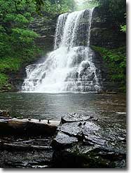
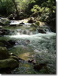
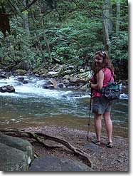
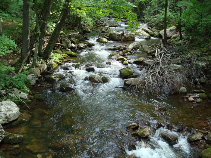
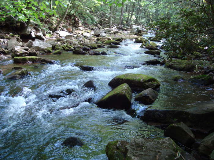
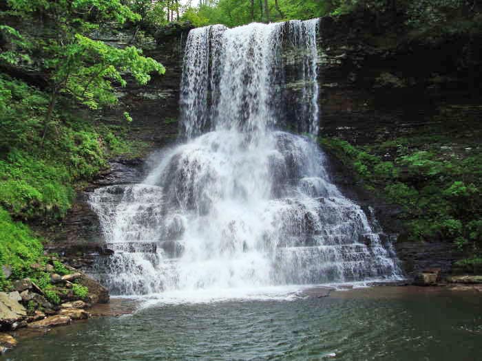
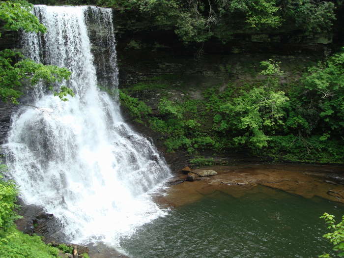
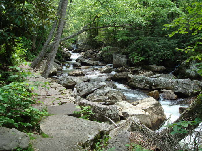
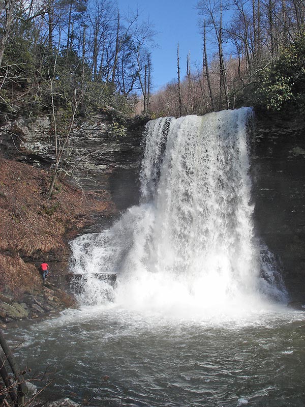
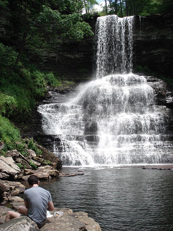
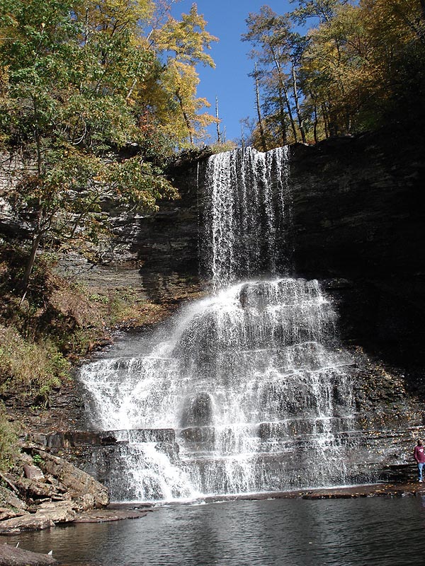
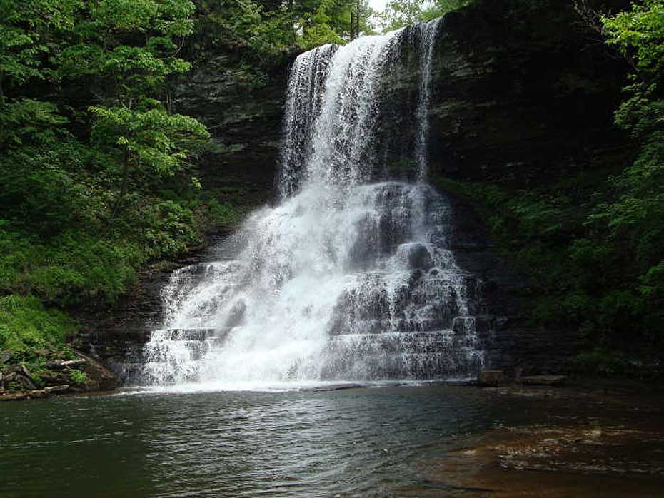
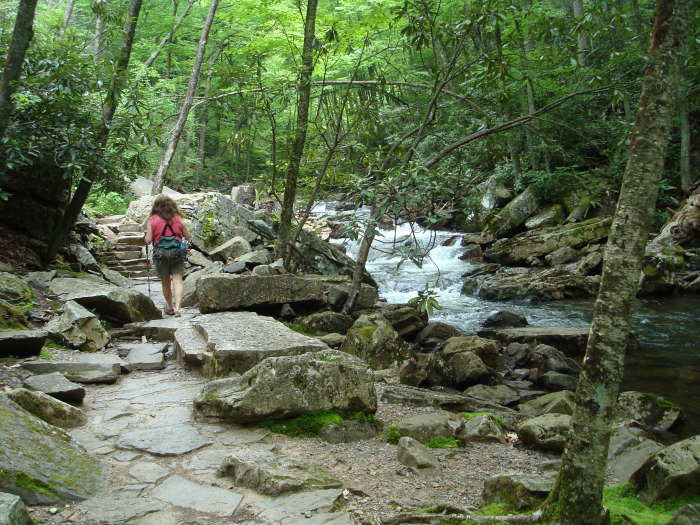
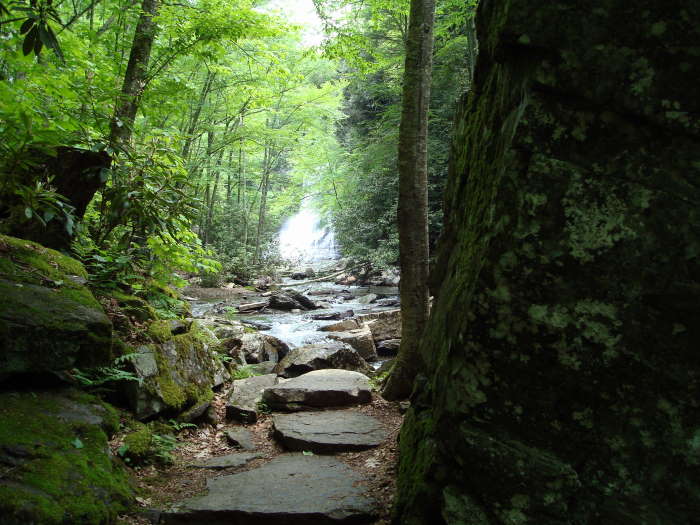
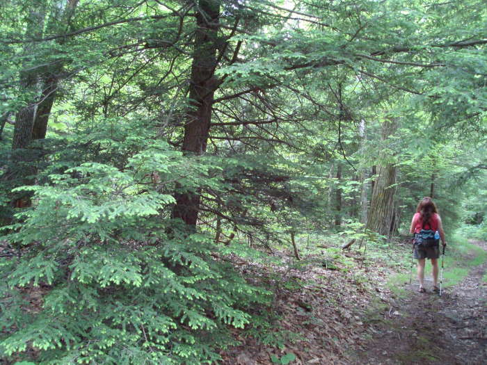
Near Pembroke, in Southwest VA, is one of the most beautiful waterfall and creek trails in Virginia in our opinion. The hike up the lower trail is one photo opportunity after the other with the trail never going further than 30 yards from Little Stony Creek before finally reaching the amazing lower falls.
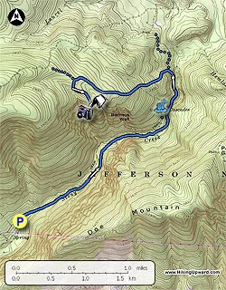
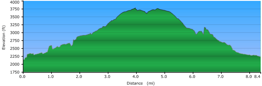
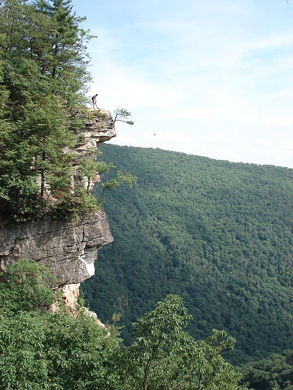
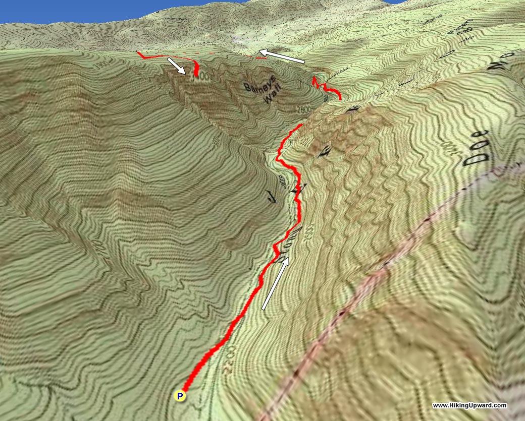
See HU Note below about directions to the Upper Falls sent to us by one of our hikers. This hike can be done as a 4 mile round trip to the 69’ foot lower falls (800’ Elev gain) or as an 8 mile round trip (1600’ Elev gain) taking in the lower falls and Barney’s Wall to see 700’ foot sheer cliffs with great views of the New River Valley. This is a very popular hike on the weekends so come early, do the falls, and then proceed to Barney’s Wall for a little more solitude.
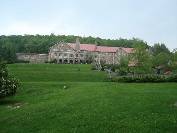
HU Note: For our hikers who are movie buffs, this hike is minutes away from Mountain Lake Conservancy & Hotel where much of “Dirty Dancing” was filmed. We stopped here for dinner on the way home, great food and service!
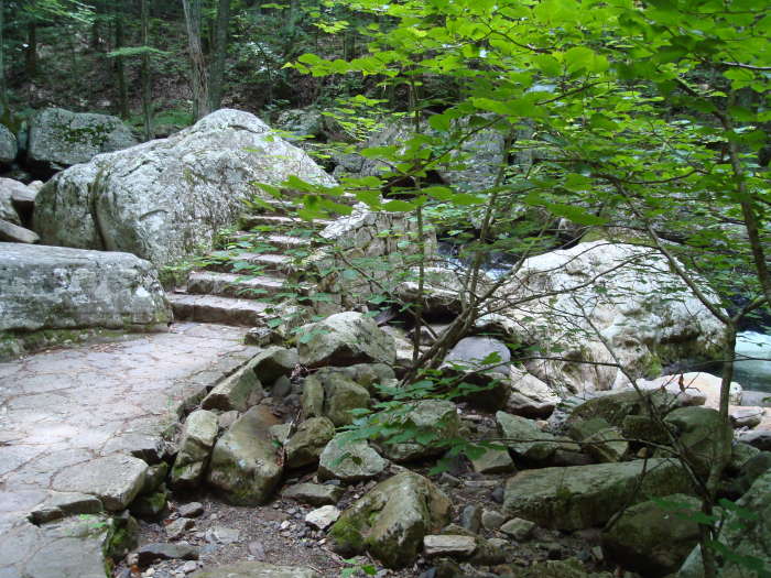
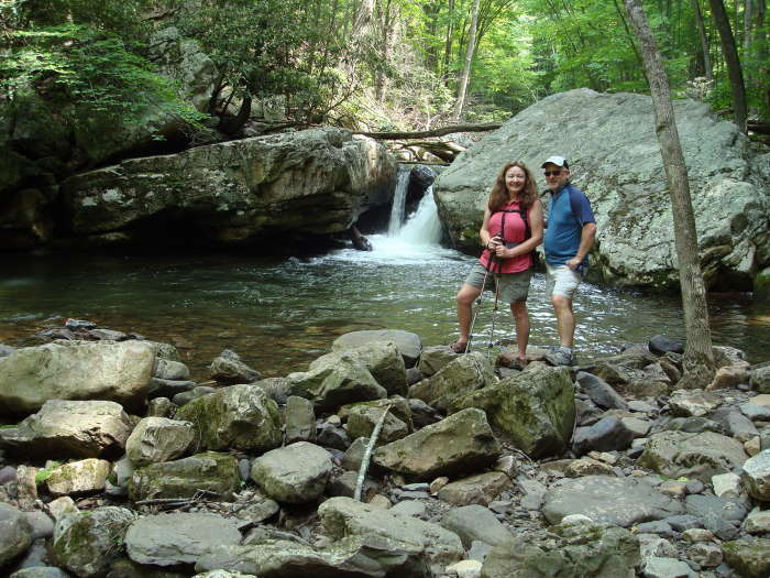
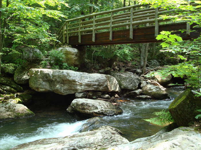
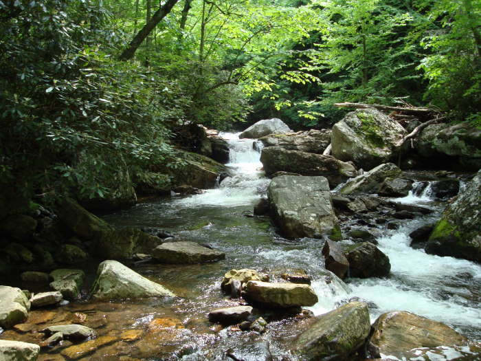
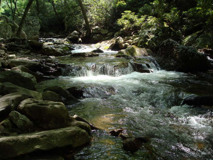
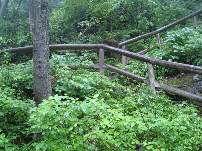
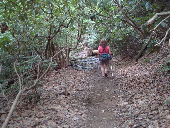
The un-blazed trail begins to the right of the bathroom and Information Center at the far end of the parking lot. Very quickly you will arrive at the first bridge. We chose to go across the bridge and take the lower trail as we heard it was the more picturesqueof the 2 trails. You could return on the upper trail if desired to get a different perspective of the creek. The lower trail weaves its way alongside the creek for a mile before reaching the second bridge and rejoining the upper trail. Keep your eyes open for remnants (stairs to no where) of the trail that were destroyed in the 1996 flood. From the 2nd bridge to the lower falls is about 1 mile with many more places to stop and take photos. The lower falls will come into viewas you pass a large boulder. Your time to do this trail will depend largely on how often you stop and how much time you spend “soaking” in the views and possibly taking in a dip in the large pool below the falls. This is the turn-around point if you decide not to continue to Barney’s Wall. Retrace your steps down either the Lower Trail or take the Upper Trail when you get to that intersection at the 2nd large bridge you crossed earlier.
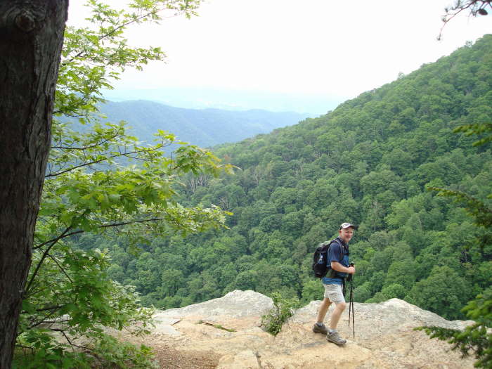
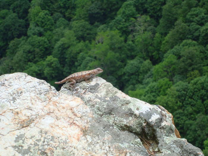
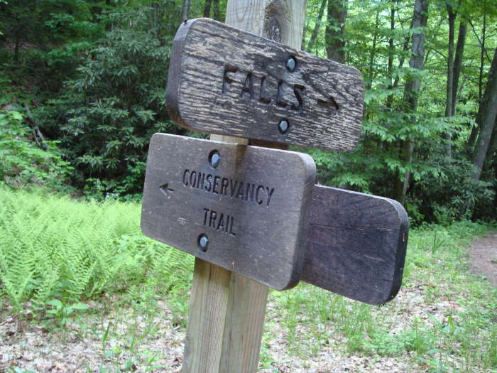
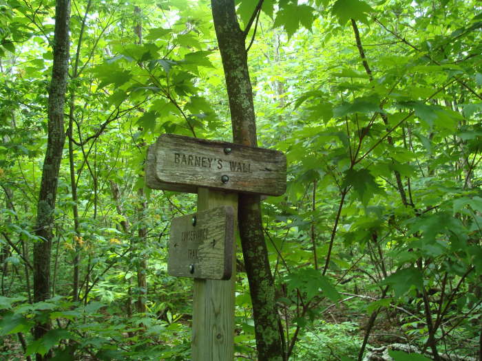
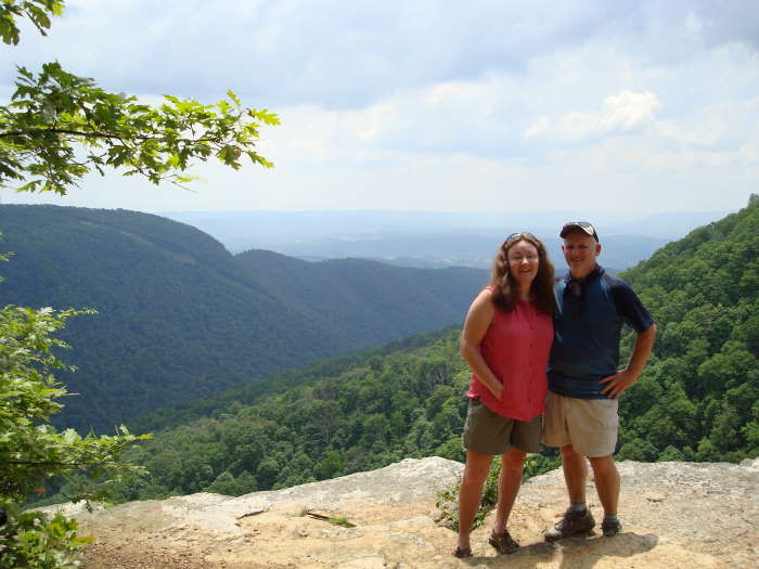
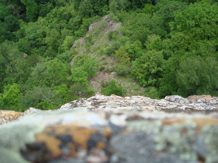
To continue to Barney’s Wall, head up the wooden stairs taking a left onto the trail instead of a right to the falls observation deck. In about 200 yards you will reach an open area with a sign post directing you to the Conservancy Trail. It is a fire road for 0.4 miles. At the fork in the road bear left and take another left in about 50 yards at the Conservancy Trail sign post. It is more of a trail from this point on and is Yellow-blazed. This is a pleasant uphill walk in the woods, crossing a small creekand finally reaching the Barney’s Wall intersection on the left in 1.1 miles. The sign was leaning against a tree so keep alert as it could be easy to miss. The spur trail to Barney’s Wall (0.4 miles) is also yellow-blazed and passes through a few seemingly healthy stands of Hemlocks, a rare treat in VA these days! Just before the cliffs you will see a campsite (not sure of the camping rules since this land is conservancy property), the trail bears to the right of the campsite. You will have a great view of the New River Valley looking over towards Blacksburg. If you have no fear of heights, lie on your stomach and look over the edge to get an idea of how tall the cliffsare. As always, be careful near cliffs, especially when wet. This is a great place for lunch, you may even have company (Eastern Fence Lizard) and if you listen carefully towards the south-east, you will hear the roar of Little Stony Creek.
From this point turn around and retrace your route back past the lower falls and to The Cascades parking area.
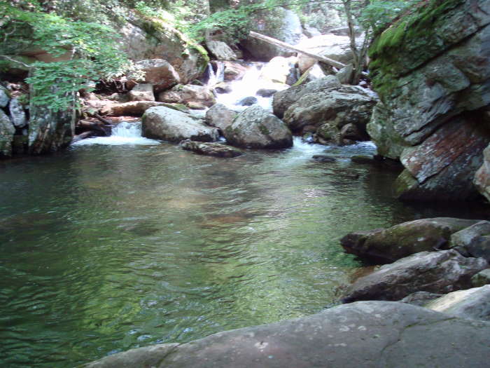
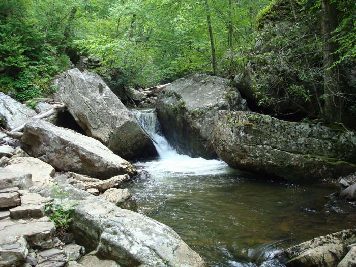
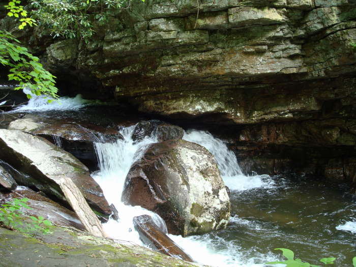
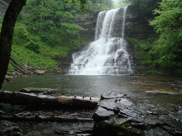
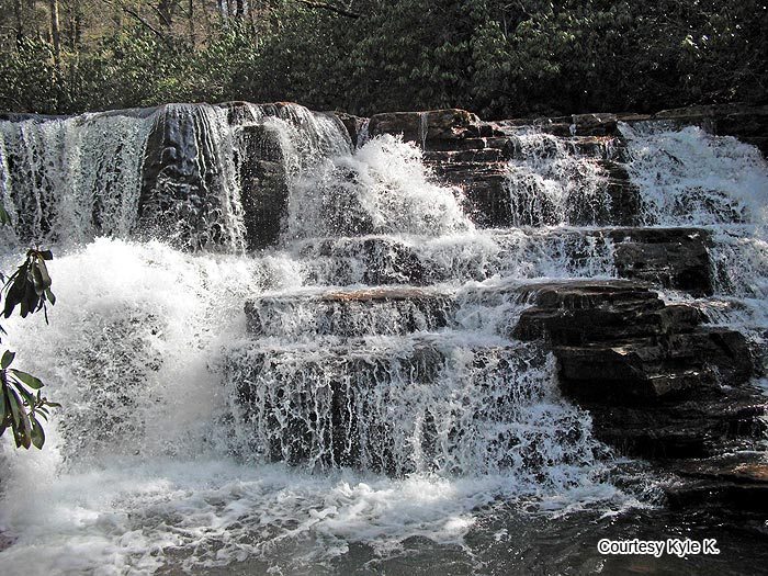
HU Note: There is a second set of falls about 0.5 miles beyond the lower falls. The upper falls can be reached by continuing along the trail that runs to the left of the lower falls (the same one you used to reach Barney's Wall). Exactly one half mile above the lower falls there is an unmarked but well established path on the right that leads downhill. You should be able to hear the falls from the turn and they are located about a tenth of a mile down the hill. (Photo and directions courtesy of Kyle K.)
Late May
Three Seasons (Courtesy of Laura U)
Video
Cascades/Barney's Wall
The Cascades/Barney's Wall Hike Comments
Archived Comments
By:John
Rating:
Date of Hike: Saturday, October 26, 2019
The high point of the hike is the 66 foot waterfall, but I find the entire trail next to Little Stony Creek is an important aspect that makes the hike great. The way the creek winds through the valley creates many open looks with the forest providing an arching tunnel. The lower trail has been fixed and is reopened for hiking. Barneys Wall and the Upper Cascades by themselves are good view points though the trail to get to them may just be in a tunnel of trees, but they can provide additional solitude to juxtapose against the typically busy Cascades trails. The forest walk was nice on a peak foliage day and I hit it right on this time around.
For full report, see: https://travel2walk.com/2019/10/27/virginia-hikes-cascades-trail-barneys-wall-october-26-2019/
By:Ray
Rating:
Date of Hike: Saturday, August 4, 2018
I hiked this back in college and thought it would be fun to take the family. When we arrived the lower trail was closed due to washout (after reading reviews, apparently this was a couple years ago). We took the high trail to the second bridge, and then took the low trail. Only once there was an area where we had to climb over a fallen tree's roots where the path was gone, but the rest of the trail was in fine condition.
We left the parking lot about 10am, and there were about three other people we saw on the trail. When we go to the falls, the water is cold. We had just received 5 days worth of storms, so the falls were roaring. No one got in the water except us, which was nice. However, when we got done with swimming and taking pictures (about 30 minutes), it went from 6 people at the falls to 20 with more coming in.
We had a 7 year old with us, and tried to make the trip to Barney's Wall. The trail was easy enough to follow and all the signs where there. (Thanks HikingUpward for the directions - I had been to the Cascades about 10 times and never knew this was there). While the hike is only 4 miles there, it is a decent uphill climb and ultimately proved too much for our daughter after the trip to the falls, swimming in the cold water, and then continuing onward. We turned back about a half mile away from the cliff (just on the other side of the stream you walk through) so never made it the entire way.
We're heading back in a month with just the adults to camp on the rock ledge, so I'll update.
In summation:
Trip to the lower falls - Definitely family friendly, but go early to avoid the crowds. Be prepared for cooler water than the beach or New River.
Trip to Barney's Wall - Decently marked trails, but a bit more strenuous of a hike than to the lower falls. Wouldn't suggest for the younger kids.
By:D
Rating:
Date of Hike: Saturday, August 13, 2016
The description mentions that above the Cascades there is "conservancy land" so camping rules are unclear. That is all still Jefferson National Forest, Eastern Divide Ranger District. Dispersed camping is allowed.
By:Medic G
Rating:
Date of Hike: Monday, August 1, 2016
I would agree with the ratings of this hike. The lower falls are pretty crowded and this is a VERY popular hike.
The upper falls are worth the "side trip". As stated, to get to the upper falls, you take the unmarked side trail to the right. The side trail to the upper falls looks like a Y in the trail when you are hiking up the fire service road towards Barney's wall. If you reach the trail marker indicating a left turn off of the fire service road, you have just missed the unmarked side trail.
Like I said, the hike to the lower falls was pretty crowded and the lower falls were crowded. We went a little earlier in the morning and avoided the larger afternoon crowd we saw on our return. Once we were past the lower falls, the crowd did thin out and we didn't see too many people. We saw a group of about 6 overnight hikers at the upper falls who were in the process of leaving and passed about 8 people along the trail to Barney's wall. We did have Barney's Wall to ourselves when we were there.
The "lower trail" from the parking area to the lower falls was pretty damp/wet. Watch you footing on the slick rocks! I took a slip and fall on the return trip landing pretty hard on one of the rocks.
By:Medic G
Rating:
Date of Hike: Monday, August 1, 2016
Sorry, one additional comment. The trail signage to Barney's Wall was all in place. The description stated a sign for the side trail to Barney's Wall was leaning on a tree. This was not the case when we went. All trails, with the exception of the side trail to the upper falls, were well marked.
By:Harry
Rating:
Date of Hike: Saturday, July 16, 2016
This hike is not very difficult and a popular spot for VT students. The main falls get rather crowded, however, I have never seen anyone at the upper falls. You can actually climb down the upper falls. Across the river at the top of the upper falls there is a good area to hang a hammock. I have friends who have gotten to an additional waterfall further upstream by walking up the river/bushwhacking but I have yet to explore further up.
By:Allen Leibrand
Rating:
Date of Hike: Sunday, December 20, 2015
There was a very light dusting of snow today. The hike was great.
By:Zachary Robbins
Rating:
Date of Hike: Sunday, August 9, 2015
I hiked the Lower Trail to The Cascades, then went to Upper Cascades before climbing to Barney's Wall and continuing onto Butt Mountain fire tower. Even though there were 50+ cars by 11:30 AM, I saw hardly any people on the Lower Trail. I highly recommend the Lower Trail, it stays by the creek the entire way and passes by numerous small waterfalls and a slot gorge. The Upper Trail people miss everything. Even with drought-like conditions The Cascades were spectacular. I've seen pictures with a lot more water, it looks better with less water because the slanted lower section is more distinguishable. Upper Cascades is easy to find, and there is a scramble path to the base that is easy. Only 2 other people were there. The climb to Barney's Wall was much steeper than expected, but the vertical cliff is quite stunning. I only passed 2 groups of people here. I continued on the Conservancy Trail and picked up the forest road to Butt Mountain. At the summit is an old fire tower, you cannot safely get to the top because most stairs have been removed. There are cliffs on the southwest side with views of Pearisburg and the New River, this might be called Lookoff Rock. I went searching for the actual topo summit Lookoff Rock, I highly advise even thinking about this unless you have a GPS and full bushwhacking gear. Otherwise it was a great hike!
By:Gabe Anaya
Rating:
Date of Hike: Sunday, June 21, 2015
I arrived at 7:00 AM and the park was almost completely empty all the way to the falls (barring the fisherman at the end and 1 or two people all the way up). The lower trail in the morning light of summer has almost a mythical feel, especially when there is no one around.
The hike to Barney's Wall is pretty much a straight uphill climb, though you get to enter a considerably different ecozone on the way up. The view from the cliff is spectacular and well worth the climb though.
I took the trip to the upper falls after Barney's Wall and it was well worth it - it was nearly deserted and was the perfect spot to jump in the water after such a grueling hike.
Once I returned to the lower falls around noon, the scene was completely different. There were probably 30-40 people swimming around the falls, and dozens more were coming up the trail. Thanks everyone for the suggestions to get there early...it is definitely worth it. The parking lot was a similar story - it was full at about 2:00 when I left and there was a line of about 20 cars waiting to get in.
All-in-all this was one of the most beautiful and peaceful hikes I've taken on the East Coast, though getting there very early is the key to making this such a wonderful experience.
By:Master Hikers Meetup Group
Rating:
Date of Hike: Saturday, April 18, 2015
Led a group of 7 hikers and English Lab to Cascades and then Barneys Wall. Note: Parking lot was full when we arrived at 1130 and was 30 minute wait to get both vehicles parked, but well organized by the Cascade parking attendants. Took a dip to cool off in a pool just below the 2nd bridge and water was very refreshing.


