
|
| Length |
Difficulty |
Streams |
Views |
Solitude |
Camping |
| 4.2 mls |
 |
N/A |
 |
|
 |
Hiking
Time:
Elev. Gain:
Resources: |
2.5 hours with half hour for lunch
850 ft
 Topo Hike Trails Map (PDF) Topo Hike Trails Map (PDF)
Crimson Springs, WV Weather Forecast
Garmin (GDB), Gaia/Trails App (GPX) (What's
this?)
3D
View of Route |
 By Trail Contributor: Jeff Monroe (Email Jeff) By Trail Contributor: Jeff Monroe (Email Jeff)
This is actually the tale of two hikes. The first, between the trailhead and the Hanging Rock Raptor Observatory, is locally very popular – the trailhead parking lot frequently fills up early on autumn weekends. The second, on the Allegheny Trail past the Observatory to a second overlook, sees much less activity. The entire hike is pretty easy, as the parking lot is located on the crest of the ridge of Peters Mountain. Be sure to wear blaze orange during the hunting season so hunters can see you from a long way away!
-
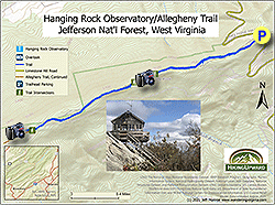
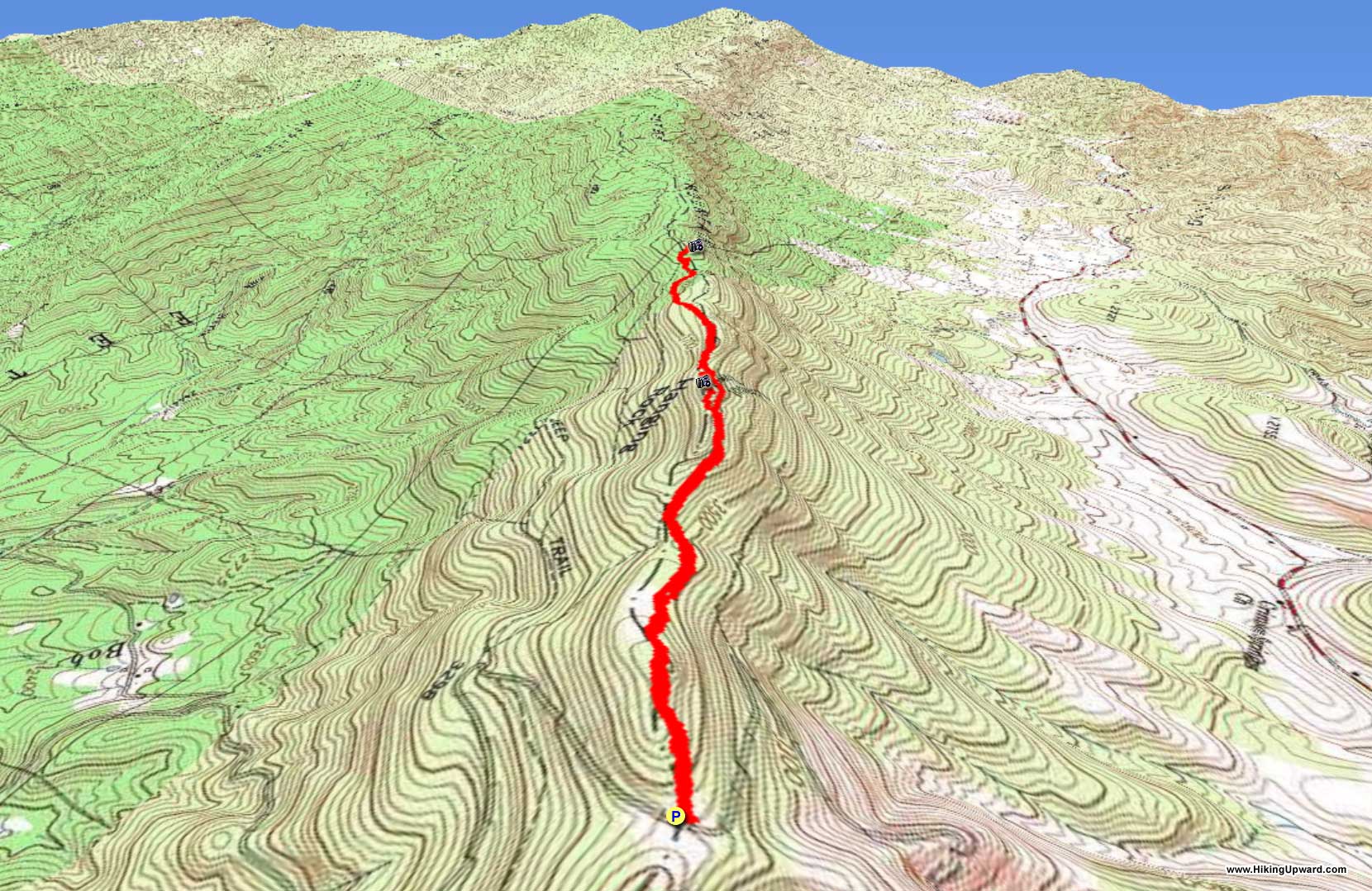
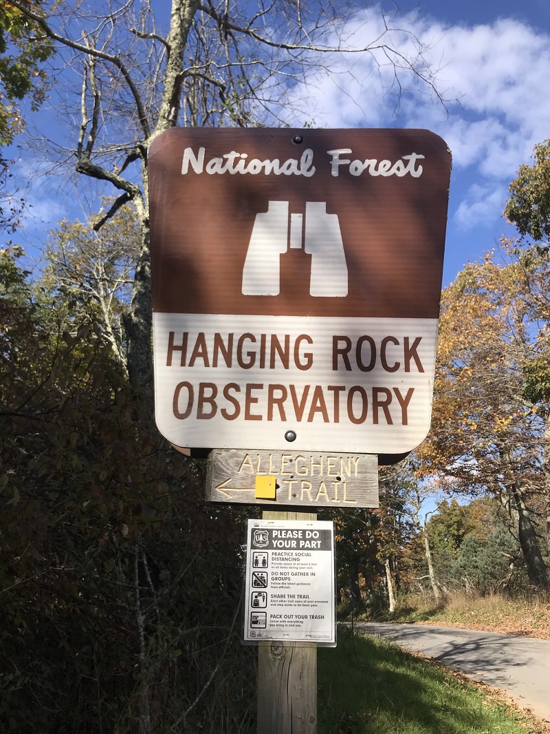
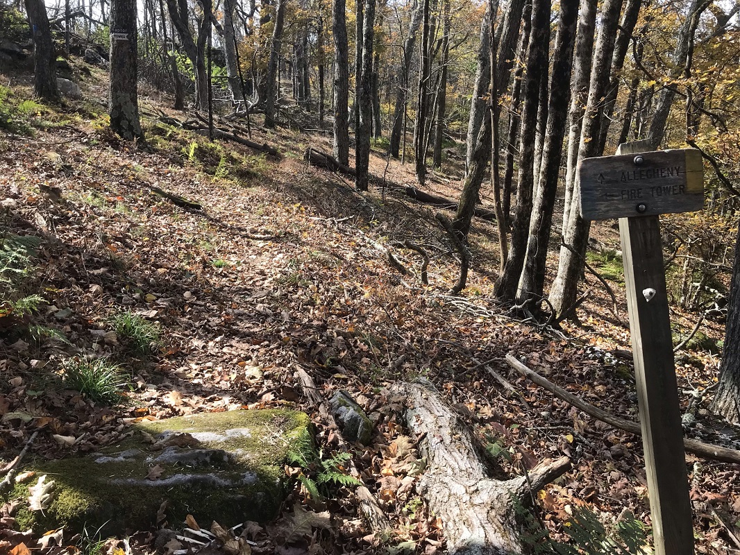
Mile 0.0 – Start the hike at the Hanging Rock Observatory Parking Lot, with space for about 15 vehicles. Finding the trailhead parking lot may be the hardest thing about this hike! Fortunately, you can find the trailhead in Google Maps labeled as “Hanging Rock Observatory Trailhead/Allegheny Trail,” but do not let your GPS take you on Fire Tower Road – stay on Limestone Hill Road until you reach a sign for the parking lot. The trail follows the yellow blazed Allegheny Trail, starting in the back end of the parking lot, heading uphill.
-
Mile 0.2 – After an initial ascent of 130 feet, the trail starts a descent.
-
Mile 0.5 – Begin the big climb of this hike, a relatively mild 280 feet over nearly a half mile.
-
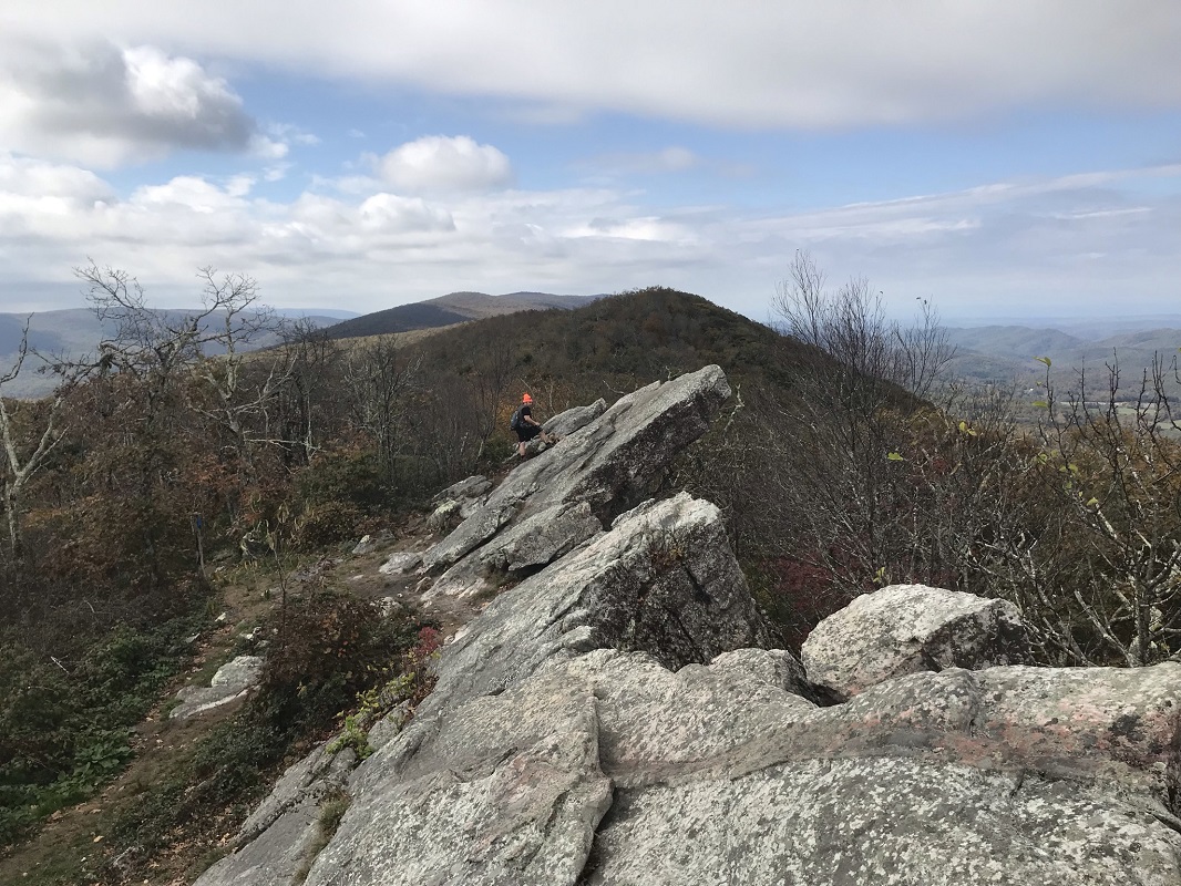
Mile 0.9 – A trail sign signals a blue blazed trail on the left. A nearby sign states, “You can either turn left here and take the short very steep rocky climb up to the Observatory or continue along the Allegheny Trail another 200 yards or so passing below the Observatory then turning left on the opposite end of the blue blazed loop trail, taking a much less steep and rocky route to the Observatory.” Of course, this description is taking the “short very steep rocky” option. Turn left.
-
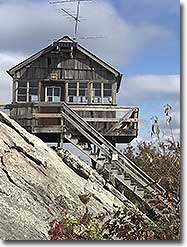
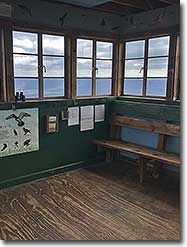
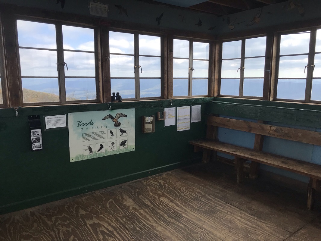
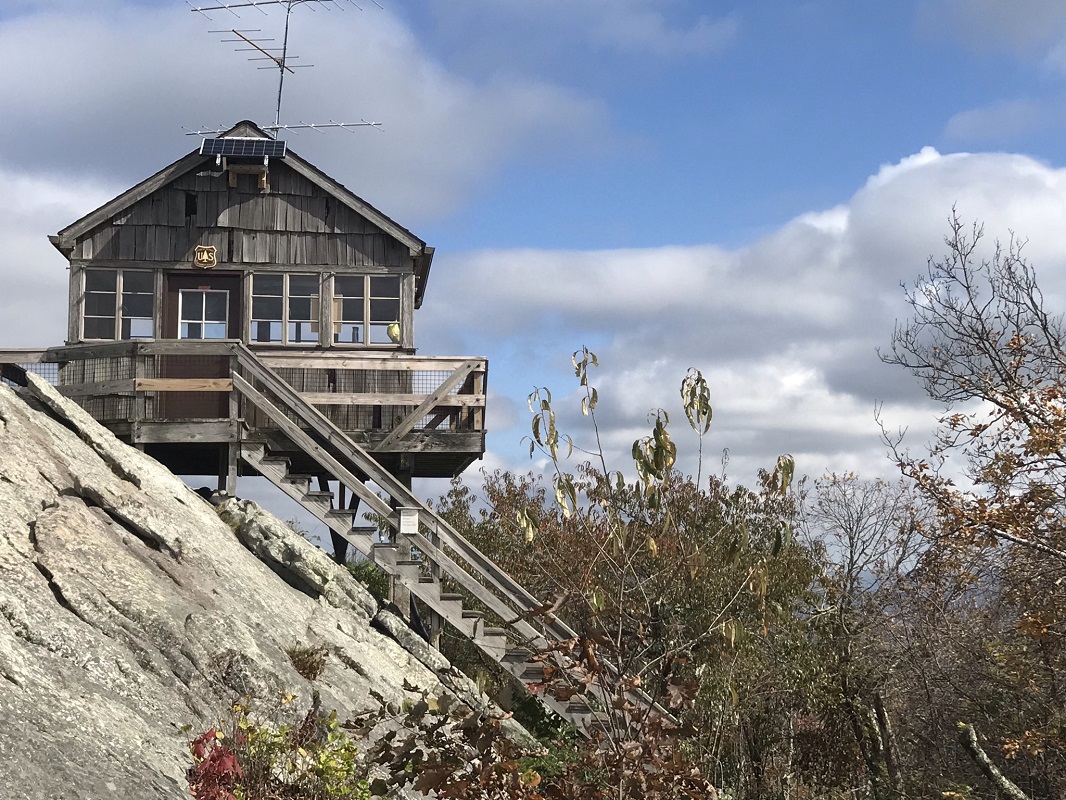
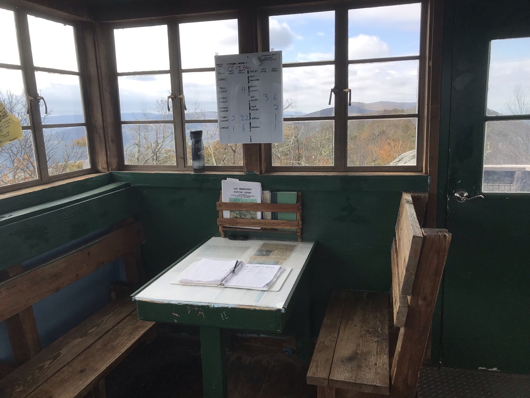
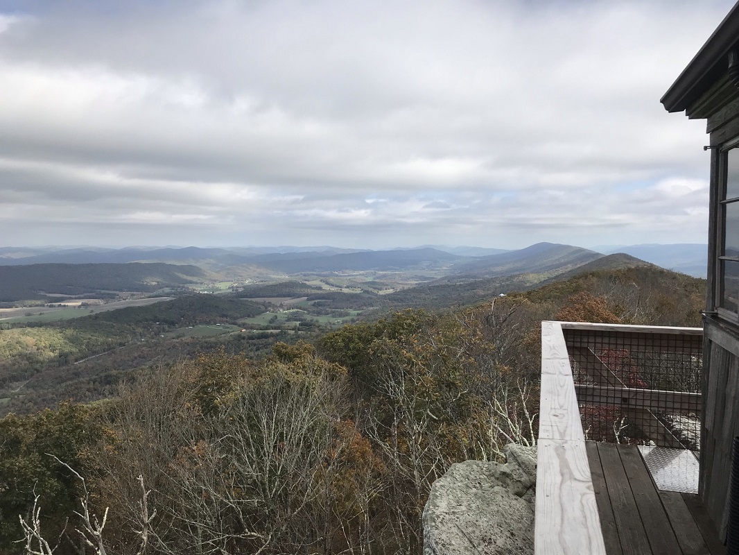
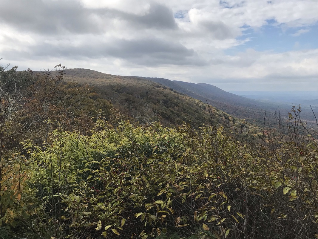
Mile 1.0 – Reach the Hanging Rock Raptor Observatory, elevation 3812. The views – wow! This tower was originally built in 1956 as a fire tower, but was closed in 1972 and the land on which the tower sits was purchased by the United States Forest Service in 1983. The tower was restored by birders, as this has been a popular raptor count location dating back to at least the early 1950’s. The tower was rebuilt after vandals set fire to it in 1996. Inside the building, recent raptor counts are logged on a white board. There is a log book for human visitors to leave a record of their visit. You can also check out information on the types of birds observed from this viewpoint. Views to the south include Peters Mountain, where the Allegheny Trail ends at an intersection with the Appalachian Trail just outside of the Peters Mountain Wilderness and Wind Rock along the Appalachian Trail. Views to the east are of Potts Mountain and the West Virginia/Virginia border. When you have finished these views, head back down the observatory steps and take a right on the blue blazed trail. You will pass a porta-potty.
-
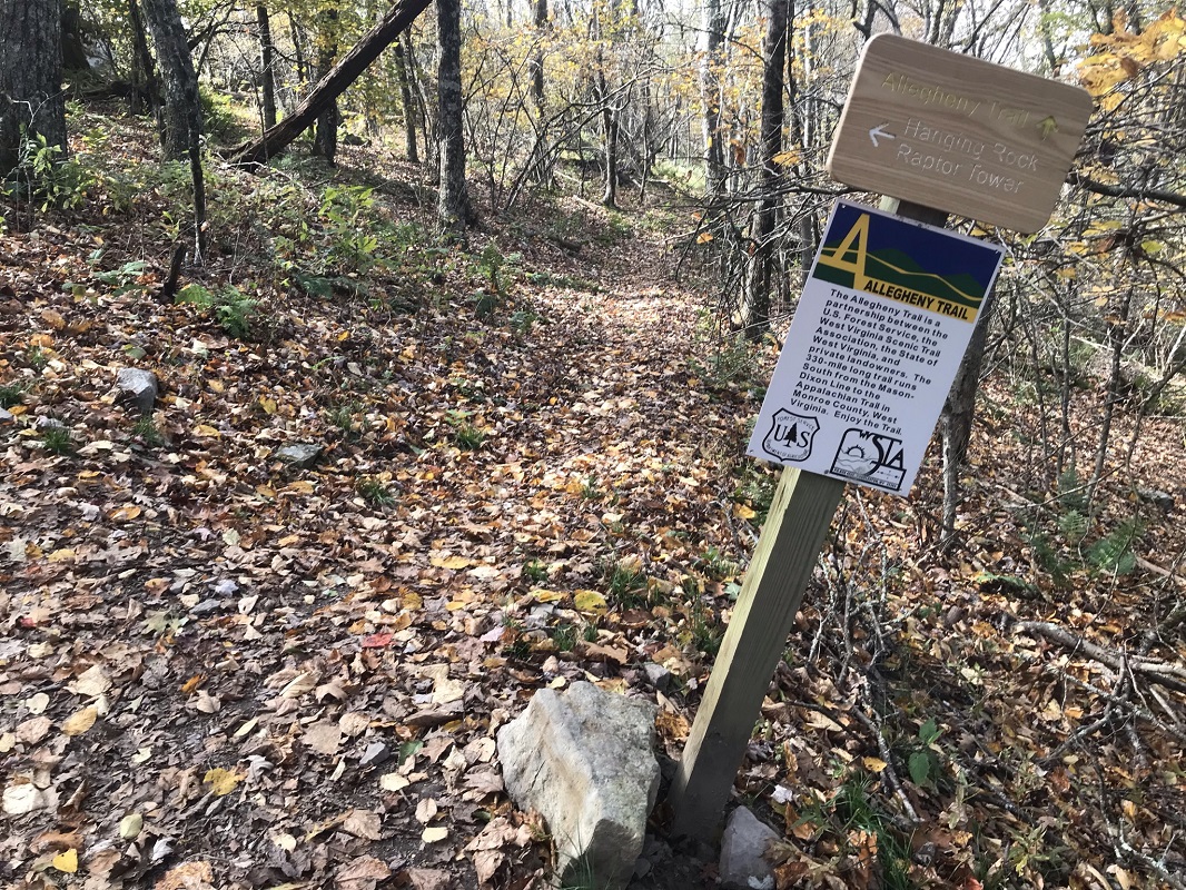
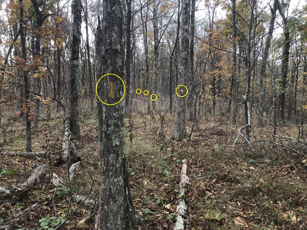
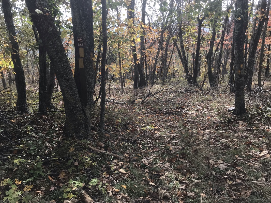
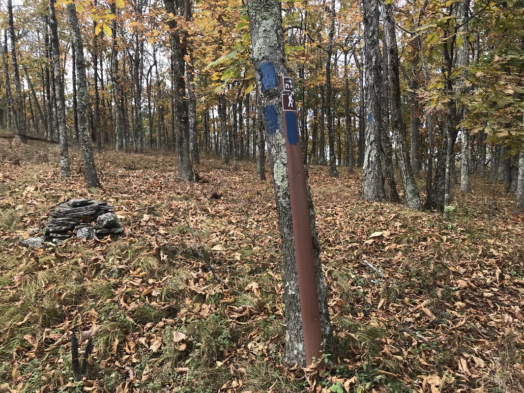
Mile 1.1 – Reach the Allegheny Trail. There is a small sign on a signpost indicating the side trail, and another sign on a nearby tree. Harder to see is the Allegheny Trail, which receives considerably less use after the second turnoff to the Observatory. There is a yellow marker on a tree to your left as you reach the trail signs – look for it and head left if you wish to extend your hike beyond the Observatory. Keep an eye out for yellow signs keeping you on the Allegheny Trail as you progress – the trail itself is sometimes faint, but the route is marked much more frequently than you will find on the Appalachian Trail. I made a game of how many yellow blazes I could see at the same time when hiking this section.
-
Mile 1.7 – Encounter a grassy roadbed and follow trail markings. You cut left on this roadbed for about 20 feet then right onto trail again. You do not hike as far as the nearby woods road to the east.
-
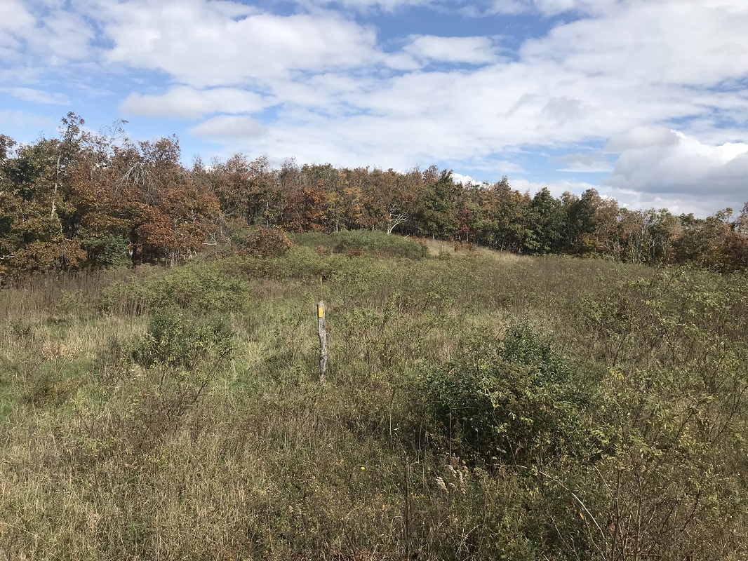
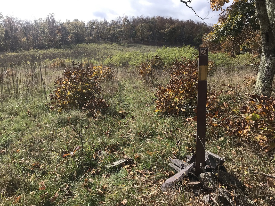
Mile 1.9 – The Allegheny Trail exits woods and crosses an open field, following trail signs on carsonite posts. Keep an eye for these posts leading directly across the field, as the trail briefly merges into and then leaves a roadbed. Do not follow the roadbed past a short distance, as it leaves the trail route quickly.
-
Mile 2.0 – Just after reentering the woods, look for another carsonite post signaling a blue blazed side trail to a vista. Leave the Allegheny Trail and follow the blue blazed trail.
-
Mile 2.1 – Make your way through some trees to a rock vista looking west into West Virginia. There are also views to the south along the crest of Peters Mountain. This view is not as expansive as the one experienced back at the Observatory, but chances are you will have this view to yourself. When you are ready, retrace your steps back to the Allegheny Trail, again cutting through the meadow to return on your northbound return. (The Allegheny Trail continues south for another 10 miles to its terminus at the Appalachian Trail, but this description does not follow that part of the trail.)
-
Mile 3.1 – Reach the southern end of the blue blazed Observatory trail. You can either experience the Observatory views a second time, or continue straight on the Allegheny Trail directly back to your vehicle, with views up to the Observatory as you hike.
-
Mile 4.2 – Arrive back at the trailhead parking lot.
|


