|
 By Trail Contributor: Jeff Monroe (Email Jeff) By Trail Contributor: Jeff Monroe (Email Jeff)
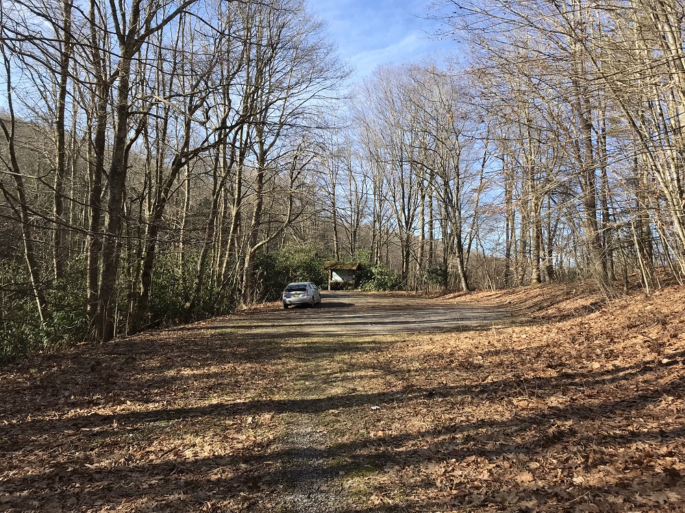
This loop hike, with an option to summit Virginia’s highest mountain, is a shorter loop than the multi-day Wilburn Ridge loop described on this site covering some of the same ground. Because it climbs into the Mt. Rogers high country on an unusually steep trail, it is better utilized as an intense day hike rather than a backpack, though campsites abound along this route. Take this hike while camping at one of the nearby National Forest campgrounds – Grindstone Campground is next to this loop and accessible by trail.
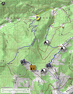
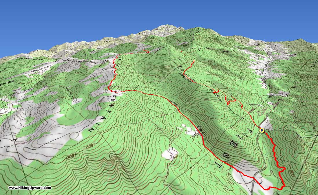
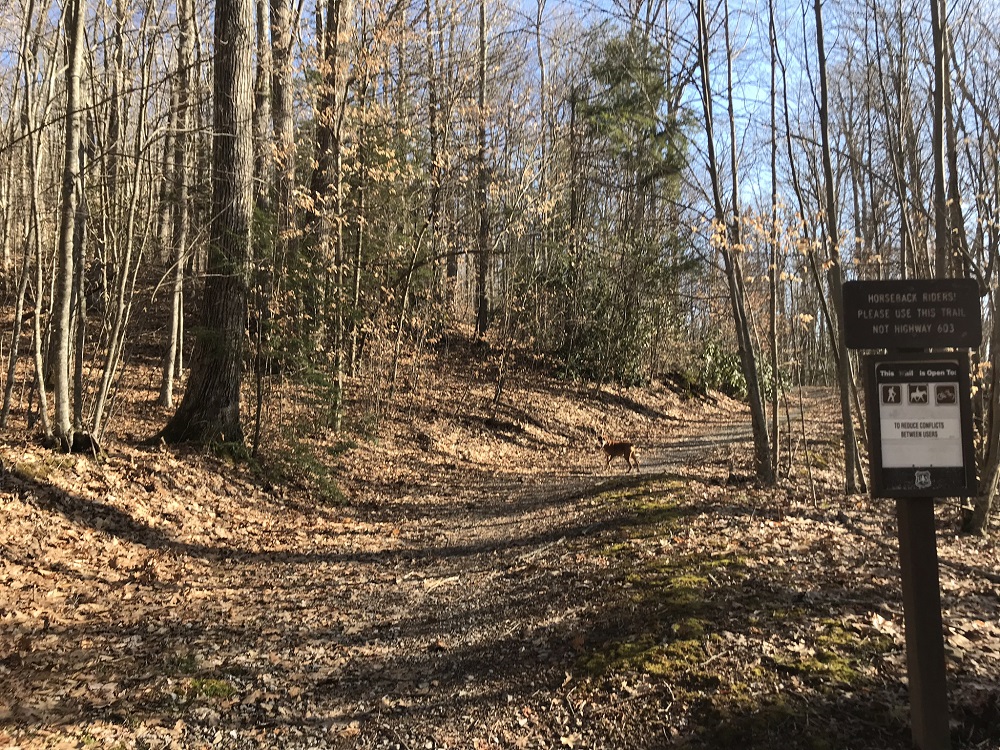
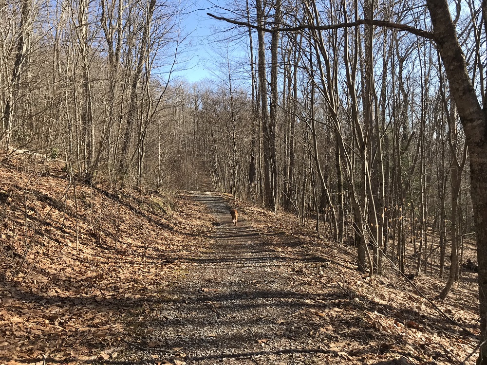
- Mile 0.0 – Park a large lot located just east of the entrance to Grindstone Campground on the north side of Virginia Route 603. The lot is somewhat hidden from the road, and is not connected to the campground. The more intense version of this hike is to complete the loop in a clockwise route, and that is how the hike description reads. There is a kiosk with a map here – take a photo of the map with your smartphone if you forgot to bring a map. At the back end of the parking lot is a trail sign and an old woods road. Start your hike here. This is the unblazed Fairwood Valley Trail and it is primarily a level horse trail, but connects to the other trails on this hike without using the main road.
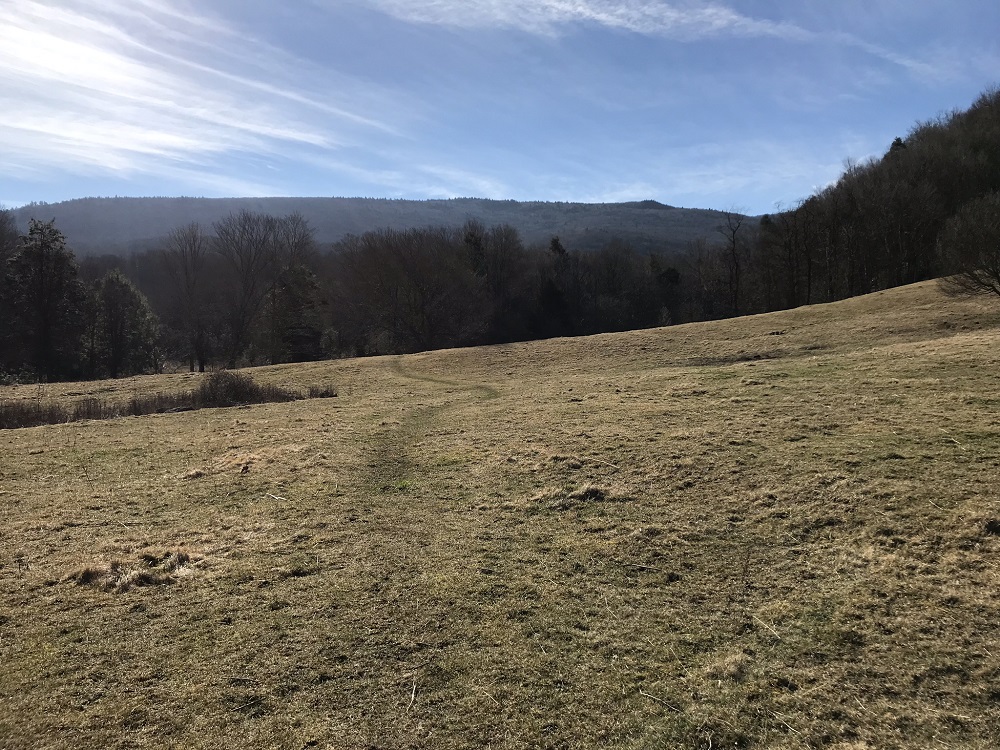
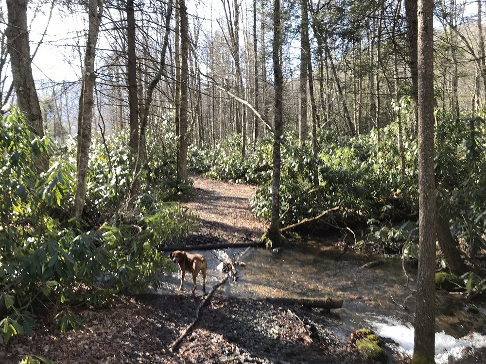
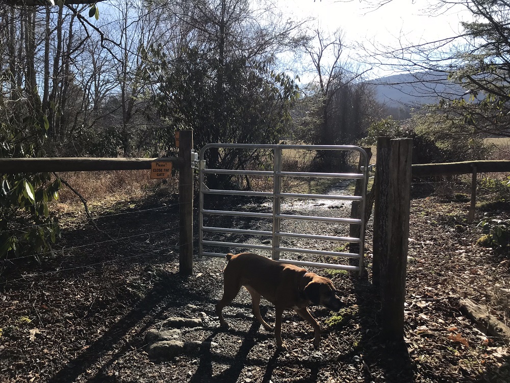
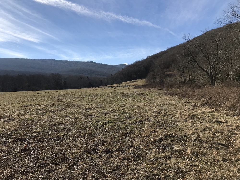
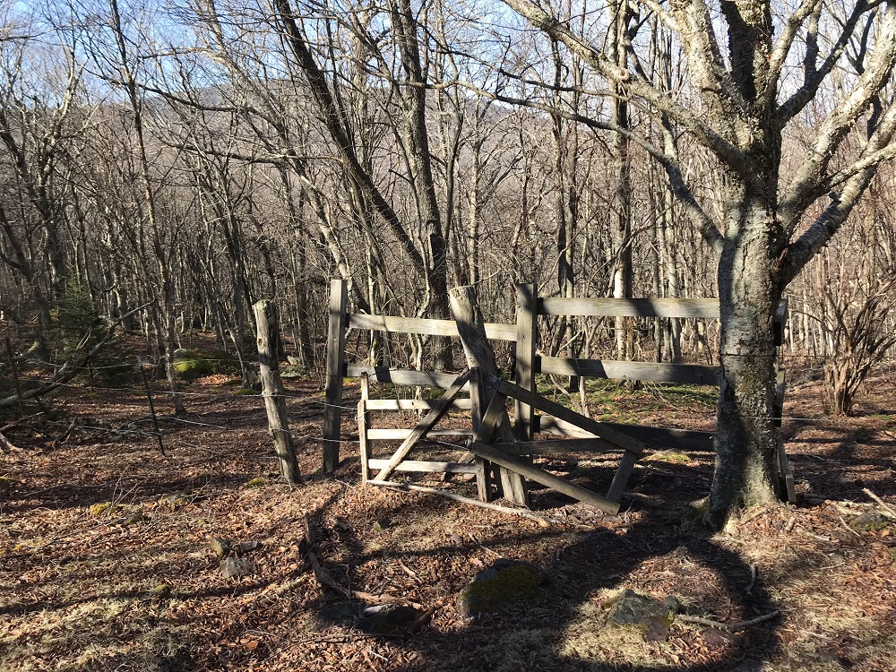
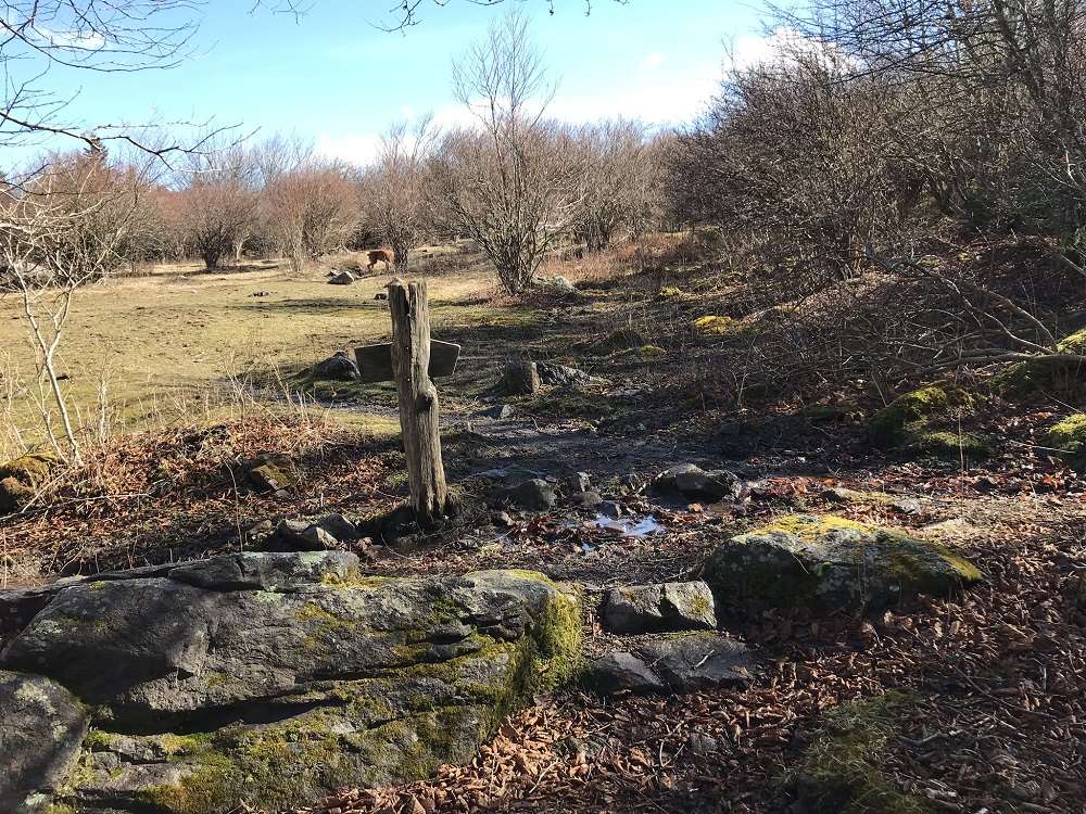
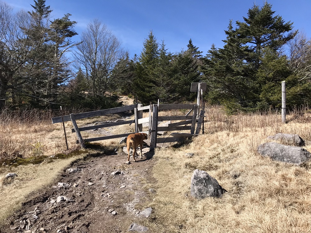
- Mile 0.9 – The trail crosses Fox Creek and then shortly after reaches a closed gate. Head through the gate, and after closing it again come out into a field used for grazing cattle. As you come out into the field, look to your right and in the distance you will see Route 603 and a fence with another gate. Although there may not be a defined path in the field, head towards that gate.
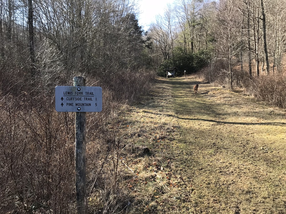
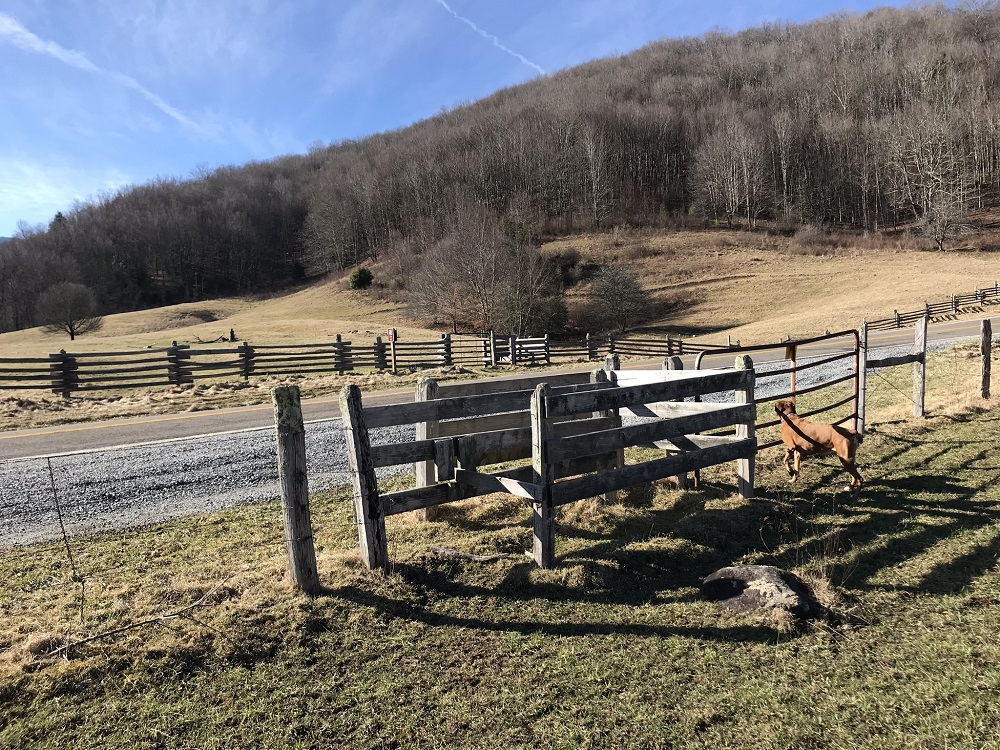
- Mile 1.1 – When you reach the road, you will see gates for hiker access on either side of the road. On the other side of Route 603 will be a sign for the Lewis Fork Trail. There is no parking here. Cross through both gates and start on the unblazed Lewis Fork Trail. This trail also starts in a grazing field, but the trail is a little more visible than over the first field.
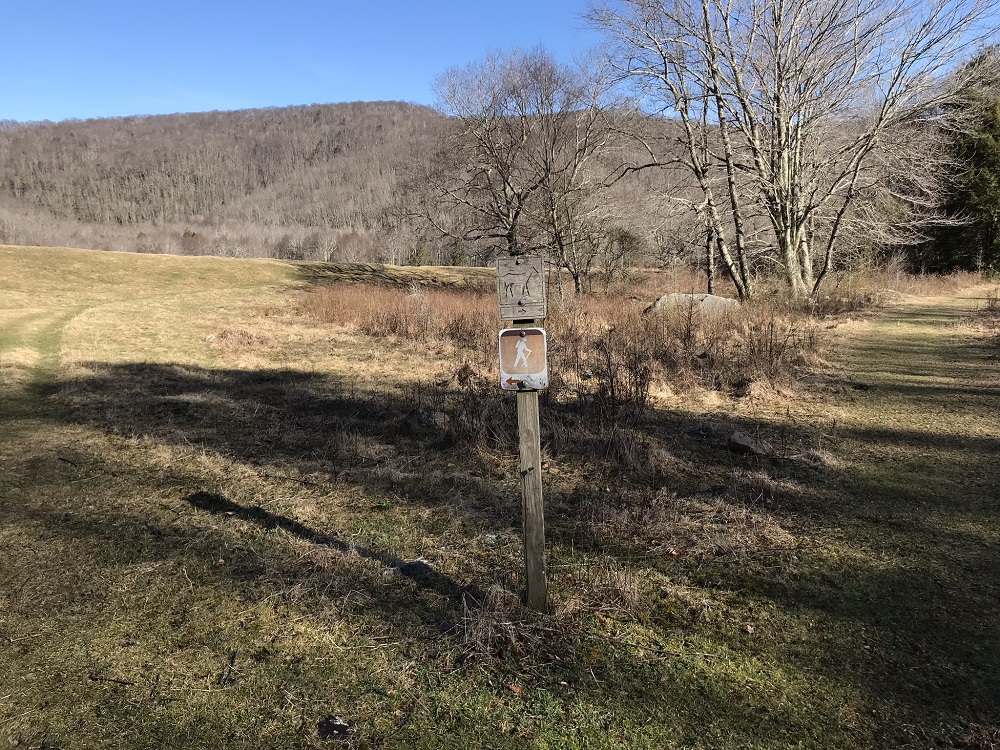
- Mile 1.2 – After walking through the field, come upon another trail with a trail sign. Looking back, you will see that you have taken the hiker only trail. The trail merges into another version of the same Lewis Fork Trail, but the other fork is for equestrian use. Horses are permitted on the Lewis Fork Trail from here on out. The trail heads into the woods towards a trail kiosk.
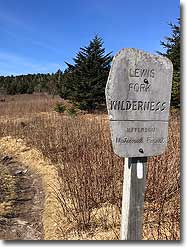
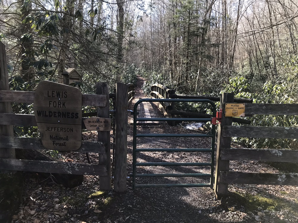
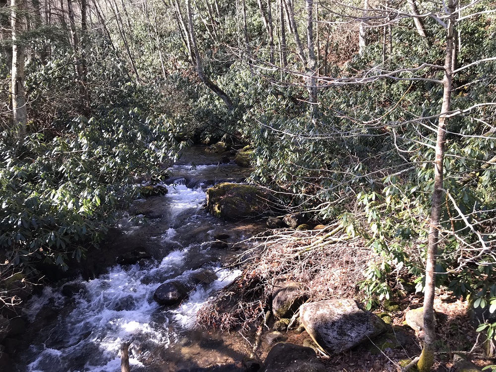
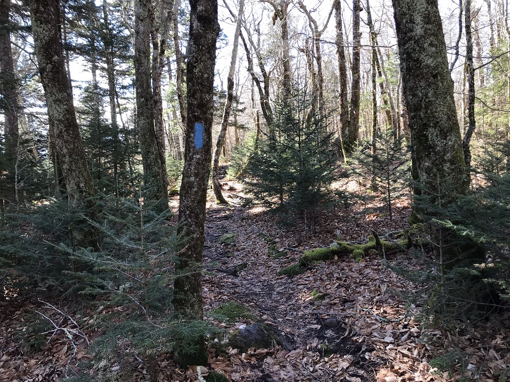
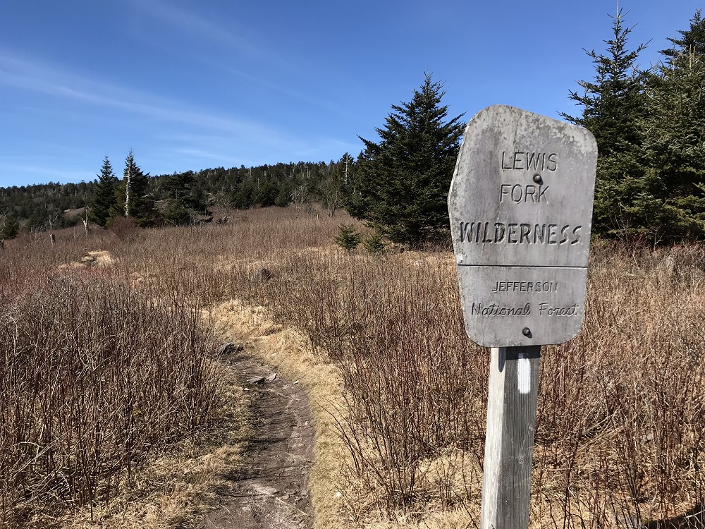
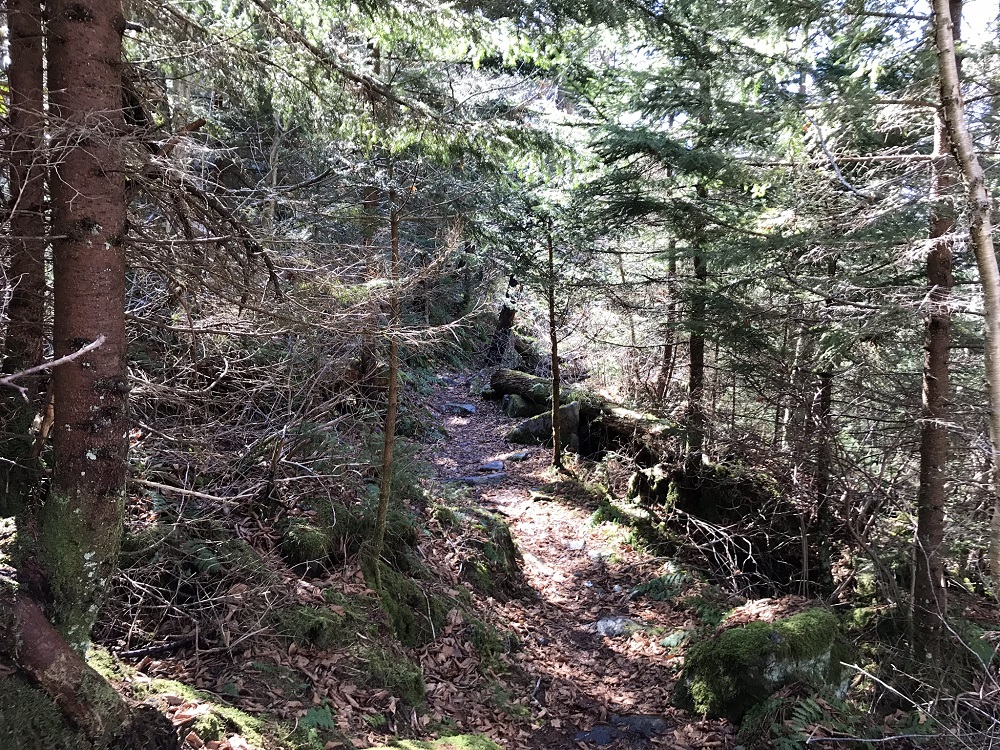
- Mile 1.3 – Behind the kiosk is another gate and signs indicating entry into the Lewis Fork Wilderness, with its maximum group size of 10 hikers. Behind the gate is a trail register and a bridge crossing Lewis Fork. Much of the next mile of trail is wet most of the year, and the vegetation along the trail includes several water loving tree types. This is a very scenic portion of the loop.
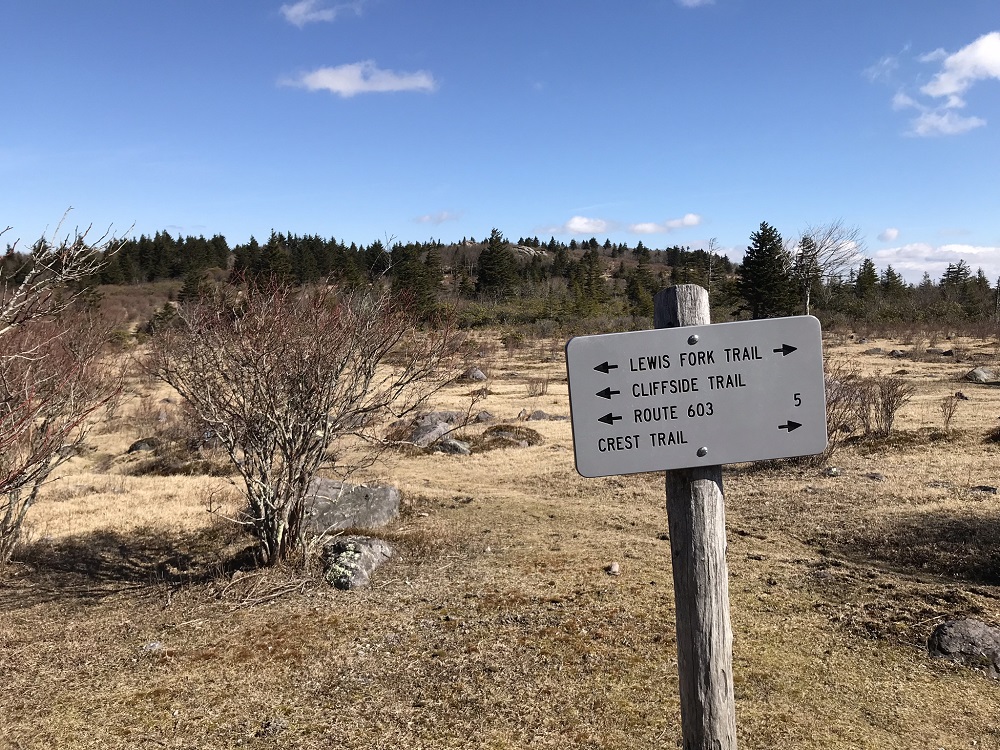
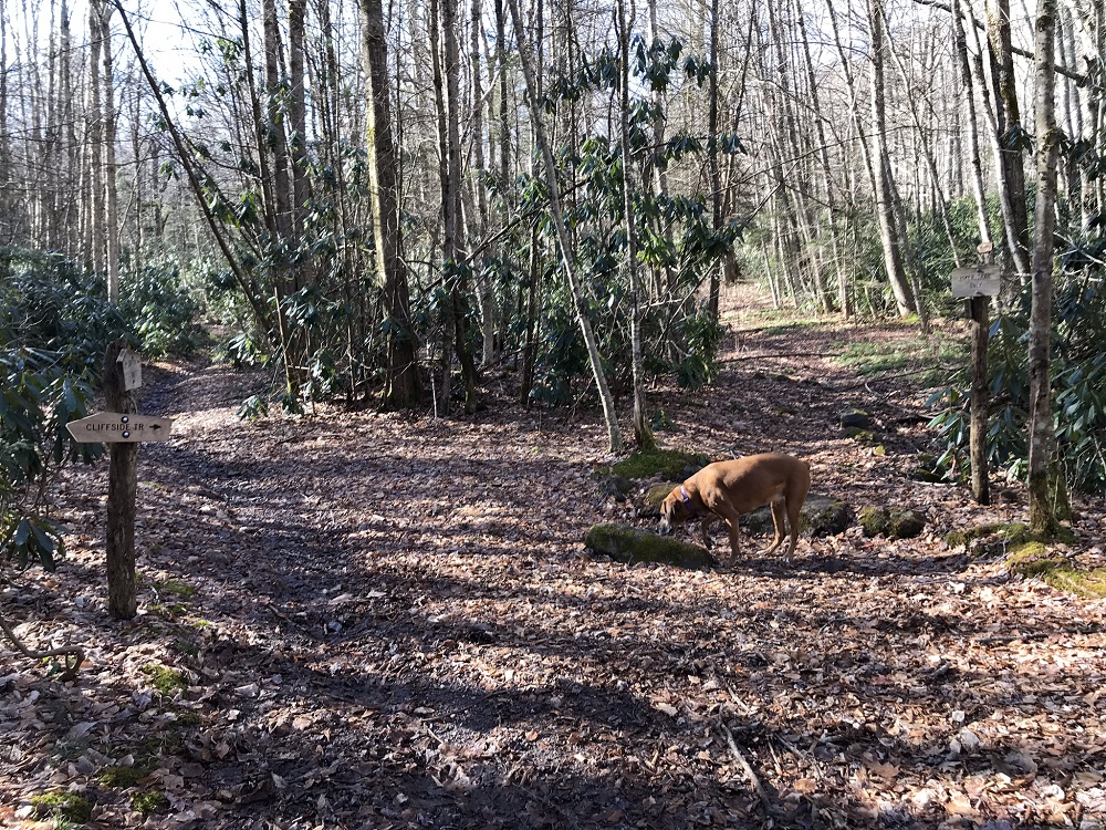
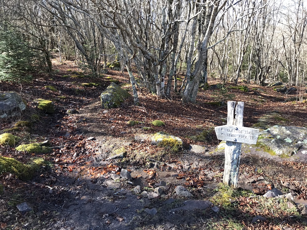
- Mile 2.0 – The Cliffside Trail starts at the Lewis Fork Trail, forking off to the right. Either trail will get you to the same place! The Lewis Fork Trail takes considerably longer and is not as steep. The Cliffside Trail is for hikers only and goes straight up the mountain. Use the Cliffside Trail to the right. The Cliffside Trail is a lower use trail than many of the area trails, so enjoy the relative solitude – not an easy thing to find in this region!
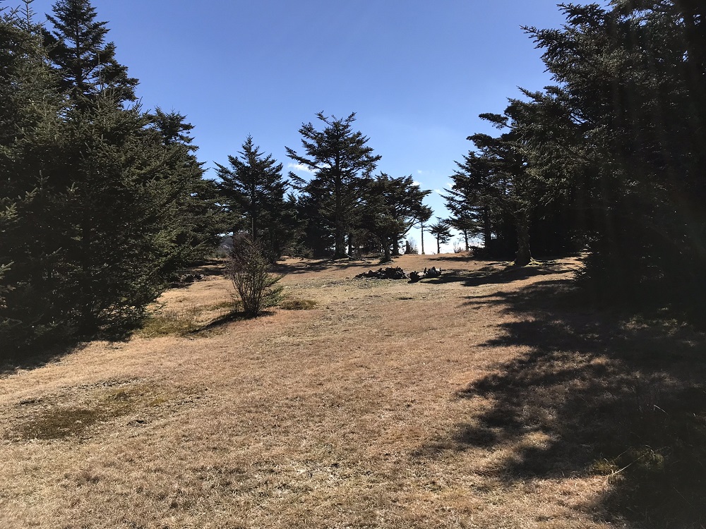
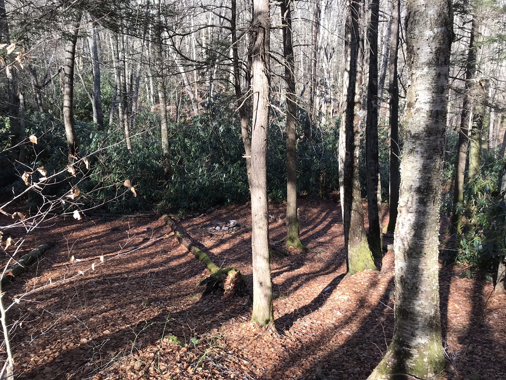
- Mile 2.7 – Pass a small campsite on the right, between the trail and Lewis Fork. After this point, the trail curves away from Lewis Fork.
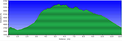
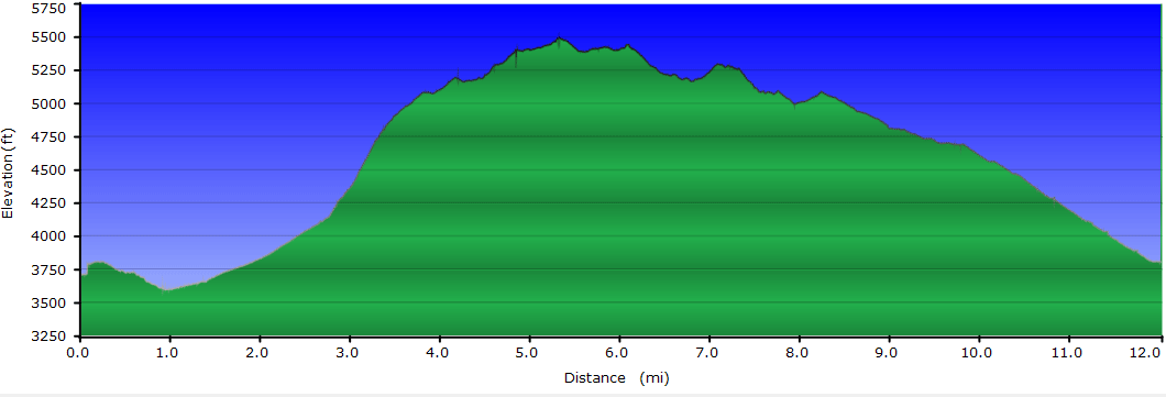
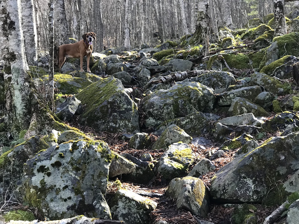
- Mile 2.9 – Cross an old woods road that constitutes the Lewis Fork Trail, which has been slowly switchbacking its way up the same mountain you have been climbing more quickly. Since crossing into the wilderness, your climb has averaged a consistent 7% grade, but it gets much steeper after this point. Look for the continuation of the Cliffside Trail directly opposite where you cross the Lewis Fork Trail.
- Mile 3.2 – The trail begins climbing more steeply, occasionally over rocks, at an average 23% grade – the toughest part of this hike.
- Mile 3.4 – Pass through another fence stile.
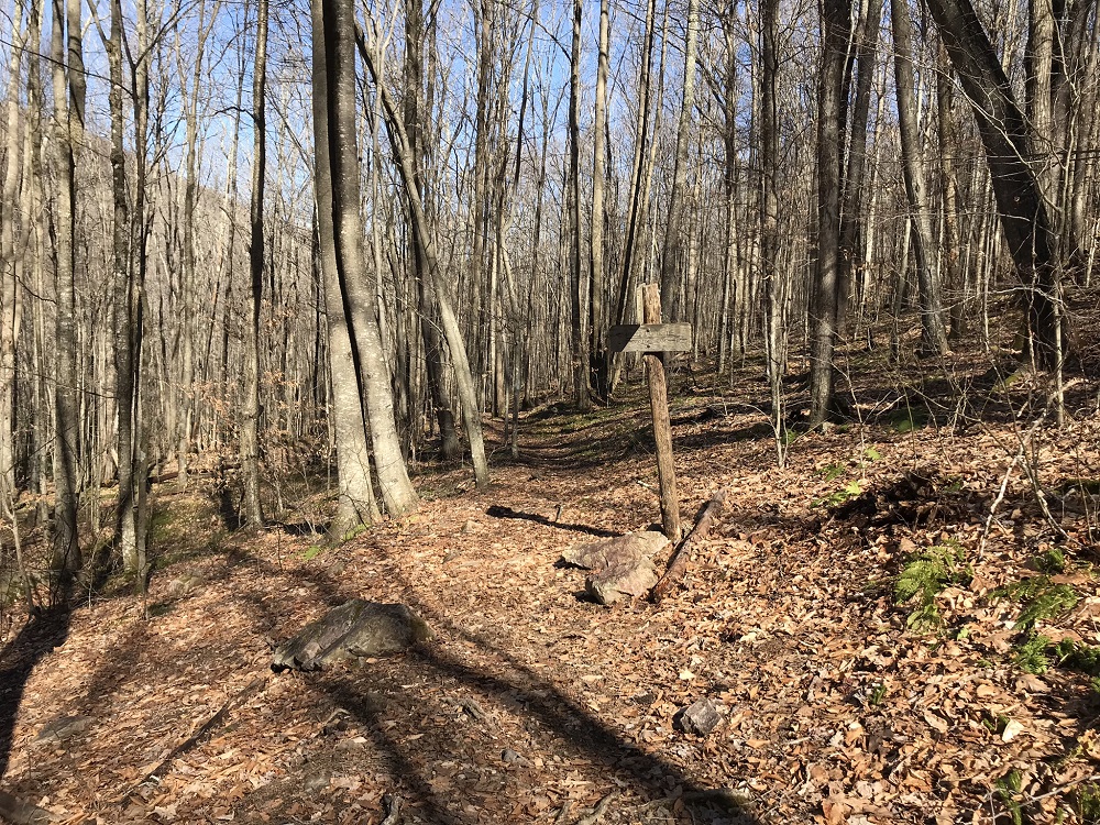
- Mile 3.5 – Exit the woods into a more open area, where there is another sign for a trail intersection – again it is the Lewis Fork Trail. The Cliffside Trail ends here. Take the Lewis Fork Trail to the left, into the open area.
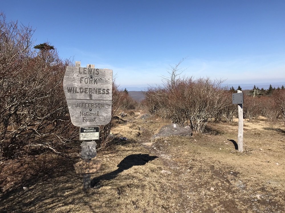
- Mile 3.6 – Exit the Lewis Fork Wilderness temporarily at the intersection with the Pine Mountain Trail in the Mt. Rogers High Country. You will pass a sign stating that Route 603 is five miles away, but that mileage is for the Lewis Fork Trail. The Cliffside Trail option took only half that distance. Follow the sign for the blue blazed Pine Mountain Trail to your right. The Pine Mountain Trail is an old alignment for the Appalachian Trail and is confusing almost right away. The trail takes you back into the woods and appears to head straight through a campsite on the edge of the open area. It actually turns right just before the campsite, and following through the campsite will land you on the less scenic Crest Trail. The Crest Trail, however, closely parallels the Pine Mountain Trail, goes to the same destination, and is more likely to route you near wild horses. The described route remains on the blue blazed Pine Mountain Trail, figuring that there are plenty of opportunities to see the horses later in the hike.
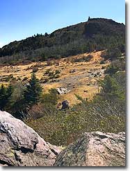
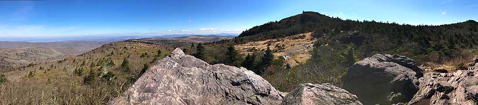
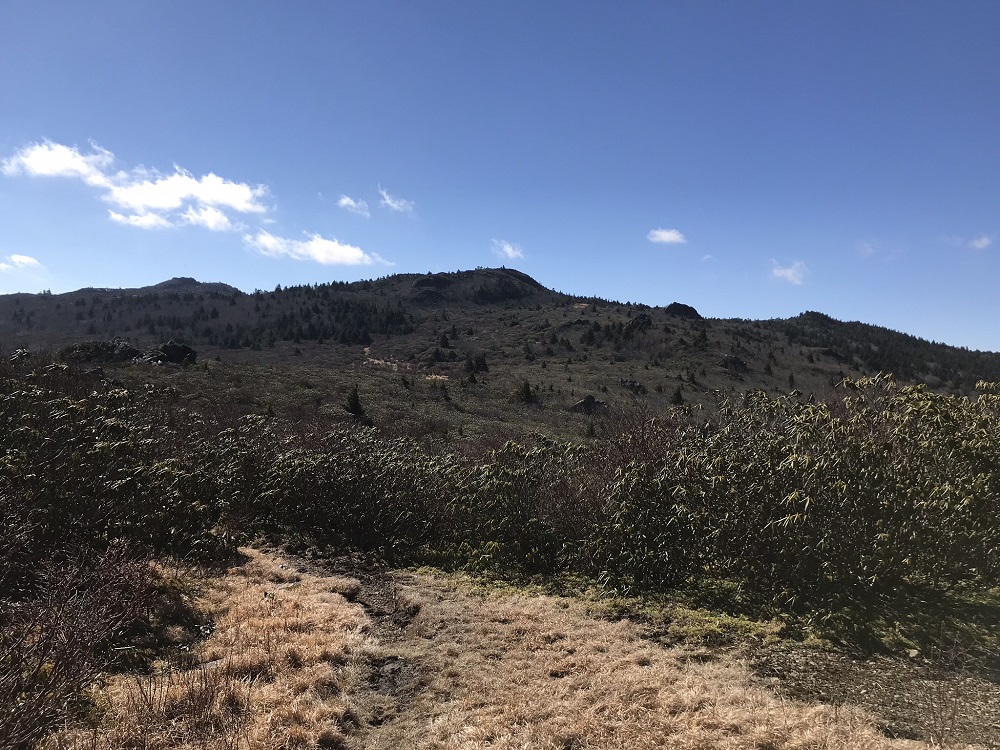
- Mile 4.2 – Come out of the woods to views of Wilburn Ridge.
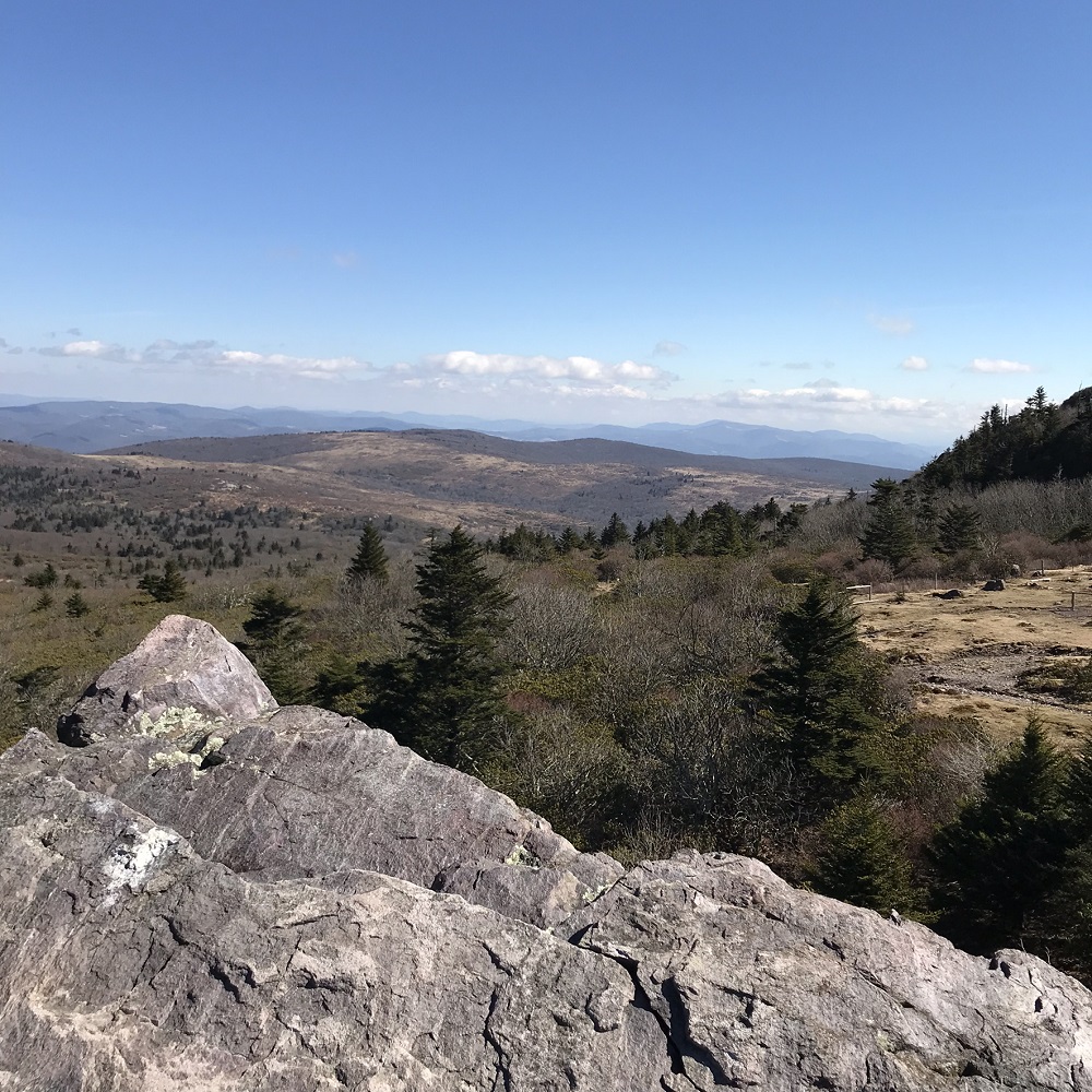
- Mile 4.6 – Pass by a large rock with views to the north.
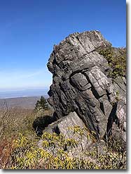
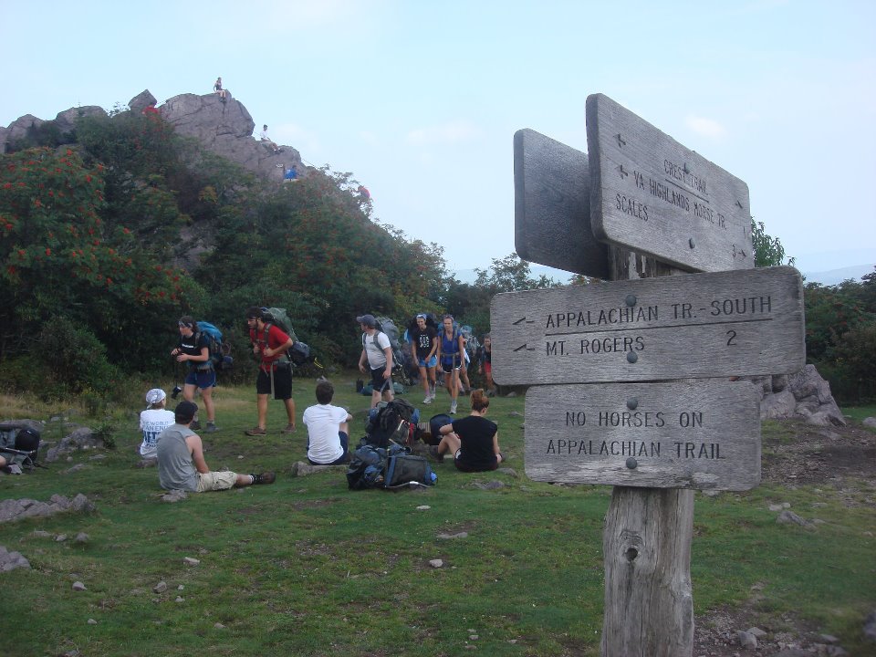
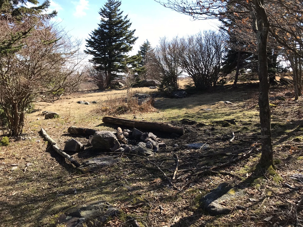
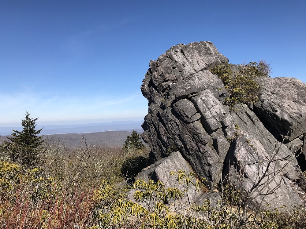
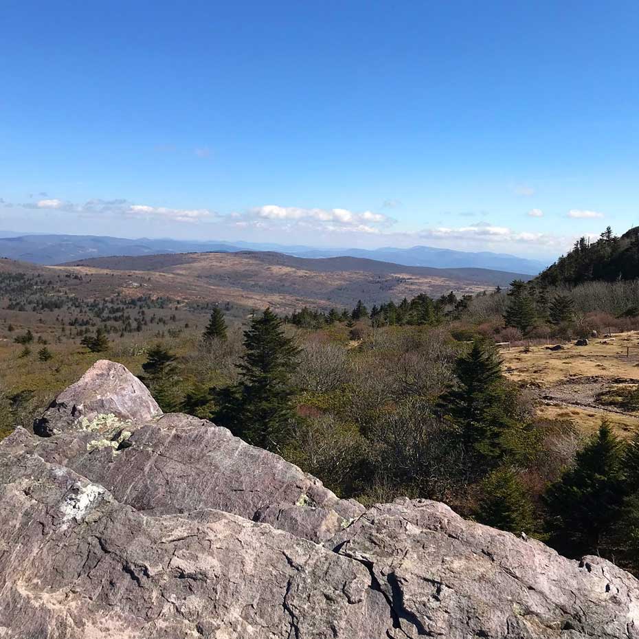
- Mile 4.9 – The Pine Mountain Trail ends at Rhododendron Gap, where it meets the Appalachian Trail. There is a large rock to the right here. Wind around to the back of the rock and it is an easy trip to the top, even though it looks like a technical climb from the front. This is the best view of the hike, and a highly recommended spot to take a lunch break! There are 360 degree views from this rock, including the Fairwood Valley where the hike started and Mt. Rogers, the highest peak in Virginia. After descending from the rock, take the white blazed Appalachian Trail right (southbound) past multiple nice campsites.
- Mile 5.3 – Pass through another horse gate.
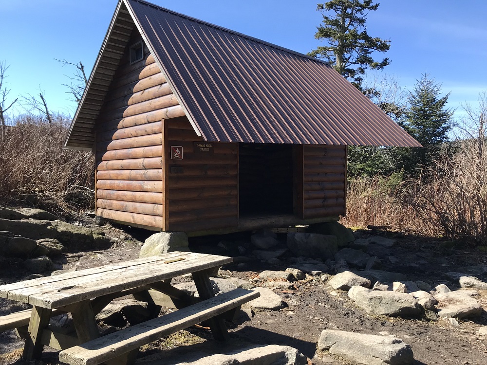
- Mile 5.6 – Reach the Thomas Knob Shelter, for long distance hikers on the Appalachian Trail. There is a somewhat reliable spring near this shelter, and a privy.
- Mile 6.0 – Return into the Lewis Fork Wilderness, passing a wilderness sign. Just after this sign is a side trail to the summit of Mt. Rogers, known as the Mt. Rogers Spur Trail. If you have never summited Mt. Rogers, now is your chance! It adds a little over a mile to your hike but (spoiler alert!) there are no views from the summit. It is worth summiting, though, if only to take an “I’ve Been Here!” selfie. The summit is an out and back hike, so either way you pass by this intersection and then continue southbound on the Appalachian Trail.
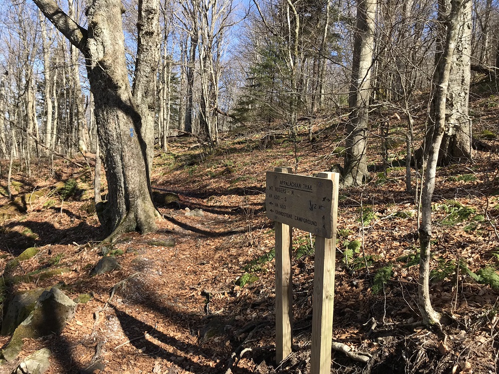
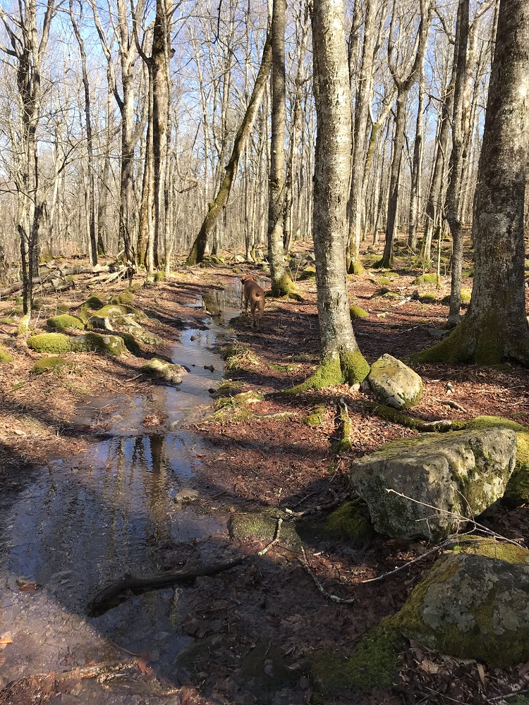
- Mile 8.0 – Near Deep Gap, the Appalachian Trail intersects with the Mount Rogers Trail. Leave the AT and take the blue blazed Mount Rogers Trail towards Grindstone Campground. For the first mile of its route, the Mount Rogers Trail is often dark and rocky! Parts of it can also be pretty swampy, depending on the time of year.
- Mile 9.8 – A trail sign marks the intersection with the Lewis Fork Spur Trail, which you could take to extend your loop, as it returns to the Lewis Fork Trail and the Cliffside Trail. Continue straight ahead on the Mount Rogers Trail.
- Mile 11.4 – After four long switchbacks, the trail exits the Lewis Fork Wilderness at a point marked by a wilderness sign.
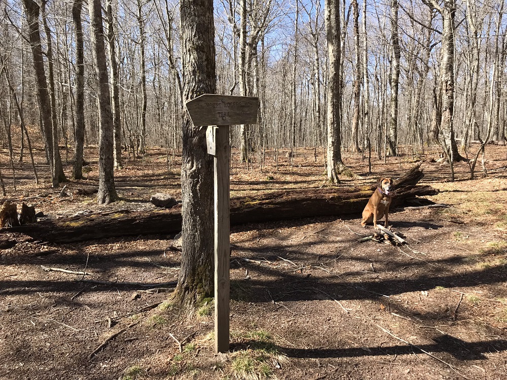
- Mile 11.8 – A side trail to the Forest Service’s Grindstone Campground meets the Mt. Rogers Trail at a point marked by a trail sign. This is the best option for accessing the campground if you are staying there.
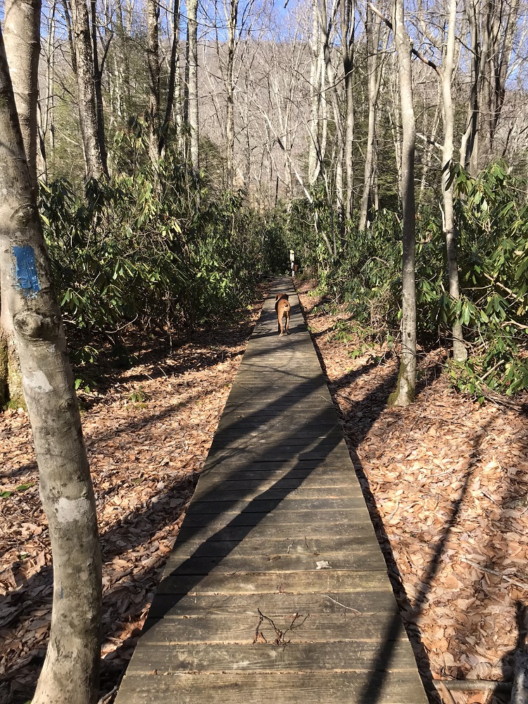
- Mile 12.0 – After crossing a raised boardwalk, the Mount Rogers Trail exits the woods onto Route 603. Your car is in the hidden parking lot, so cross the road, take a right, and walk 100 yards to the lot entrance.
|


