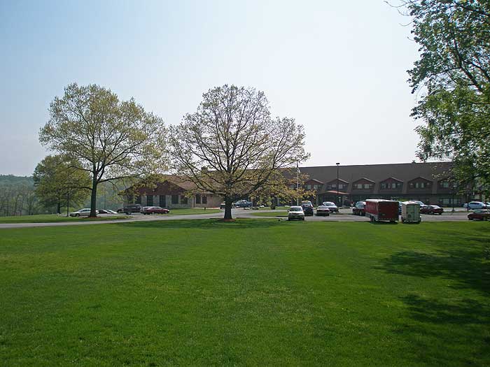
Cacapon Resort State Park is a beautiful area of over 6,000 acres. There is something for everyone here. A virtual labyrinth of over 20 miles of hiking trails, a trap shooting range, horseback riding, swimming and boating, as well as fishing in the large lake and reservoir. The park also has accommodations of 24 cabins and a main inn for weekend getaways.
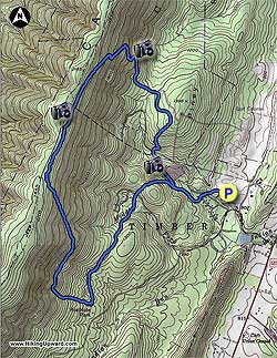
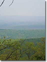
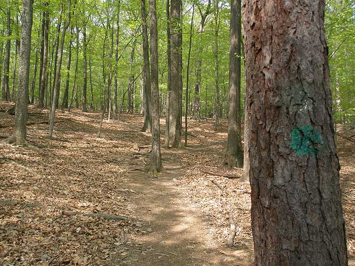
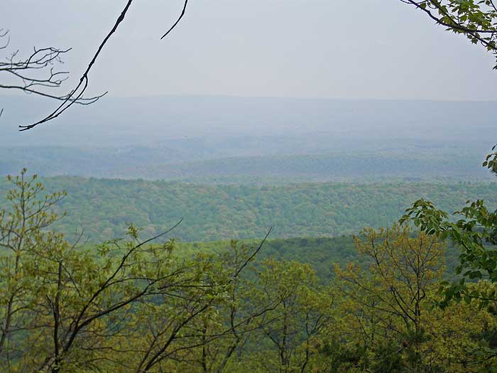
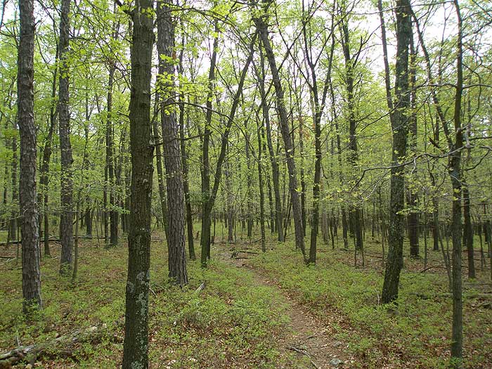
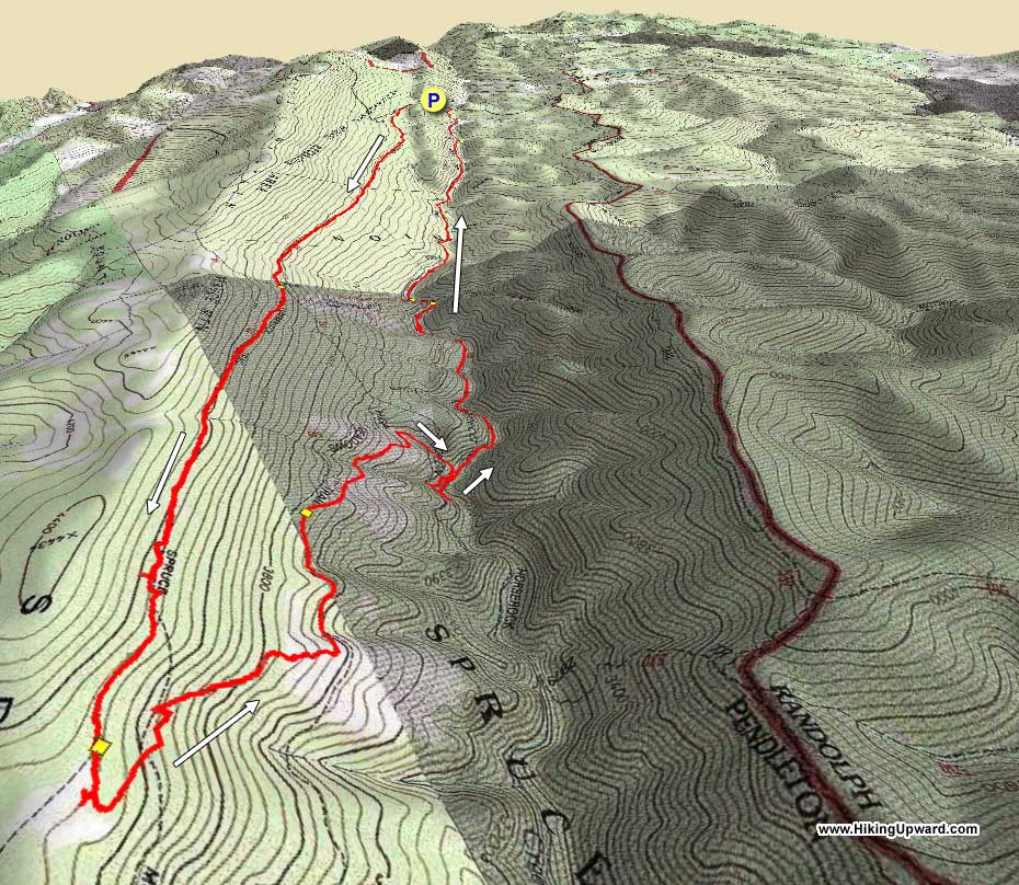
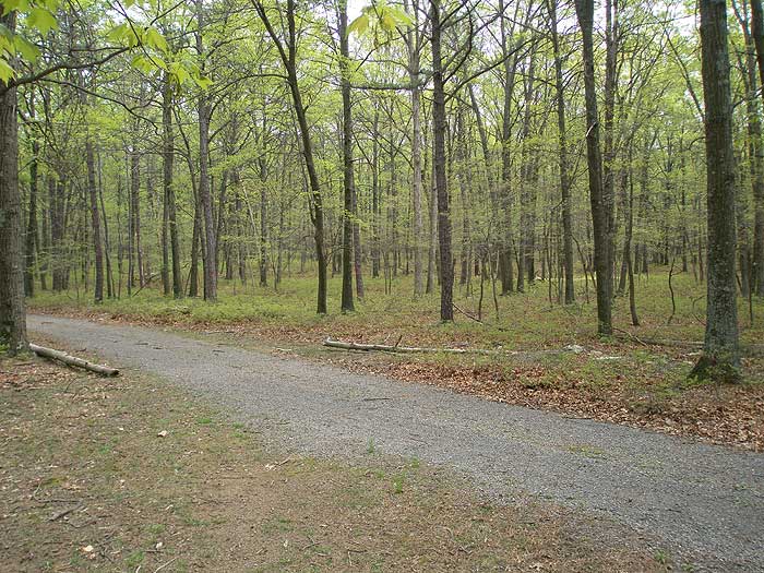
With 20 miles of interconnecting trails, from the easy nature walks, to the longer circuits that climb to the ridge on Cacapon Mountain, there are trails for every level of hiker. The circuit we describe makes use of the longer perimeter trails, and passes several good views of the valley.
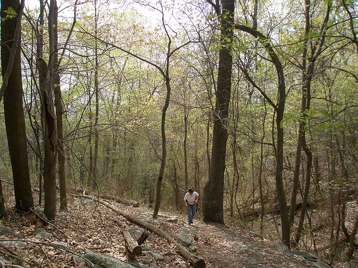
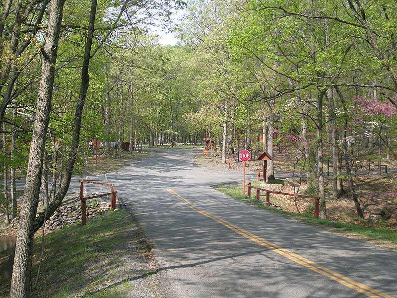
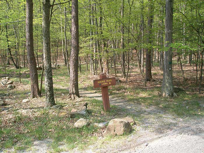
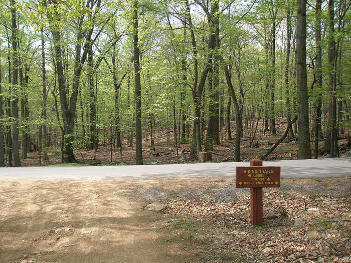
From the lodge, walk back to the stop sign crossing the main road towards the cabins. The trailhead is located between cabins 21 and 22. Shortly after starting up the trail come to the first trail junction with the white blazed Cabin Loop Trail directly ahead. Turn right on the green blazed Laurel Trail, then in 150 yards pass the opposite end of the white blazed Cabin Loop Trail.
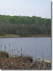
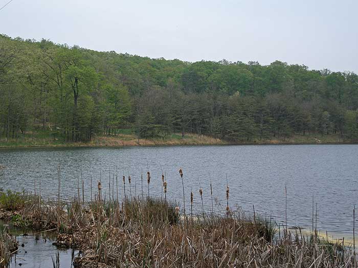
Continue straight on the green blazed Laurel Trail where it becomes steeper, before passing the red blazed central trail, and view of the reservoir on the right in 0.2 miles. Continue on the Laurel Trail for another 0.2 miles to the junction of the red blazed Central Trail at a small saddle.
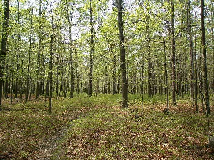
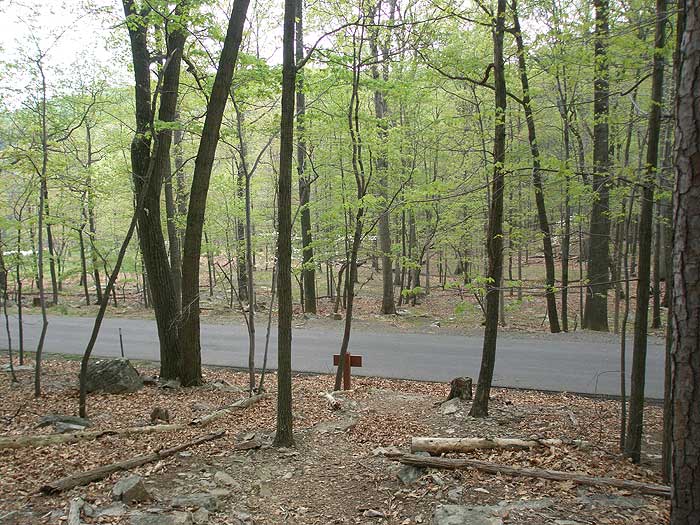
Turn left downhill on the Central Trail then cross a park road in 0.1 miles. The red blazed trail continues on the opposite side of the road where it passes behind a group of cabins. After passing the cabins the trail climbs a small ridge before passing through an immature forest, then slightly descends and arrives at the Ziler Loop Trail intersection in 1.0 miles.
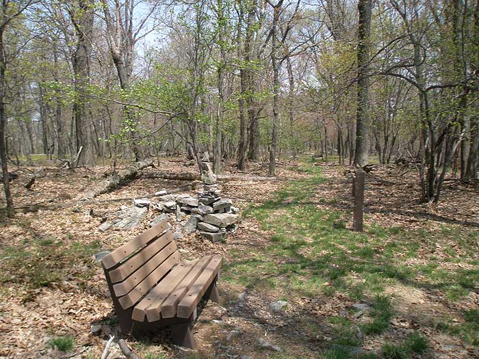
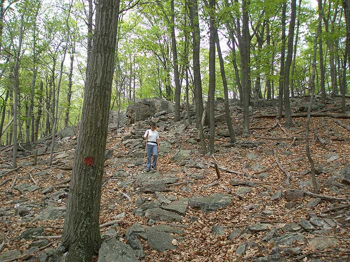
Turn right uphill on the red/blue blazed Ziler Loop Central Trail and come to the next intersection in 0.1 miles. At this intersection the combined Ziler Loop Central Trail turns right. Stay straight uphill on the blue blazed Ziler Loop Trail. The blue blazed trail has a steep grade with no switchbacks, leveling off only two times before arriving at the ridge and intersection of the Ziler Trail in 1.5 miles.
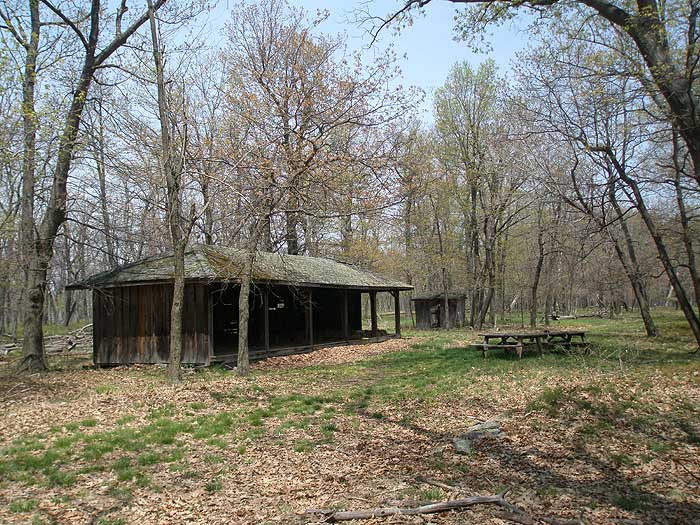
There is also a bench at the ridge and trail junction. Continue along the ridge on the Ziler Loop Trail passing an old shelter on the left before the Ziler Loop Trail begins to descend the mountain. The trail will make several switchbacks then pass through a hollow in 1.0 miles. Just after the hollow, the Ziler Loop Central Trail turns right. Continue straight on the now red blazed Central Trail and shortly cross a gravel park road.
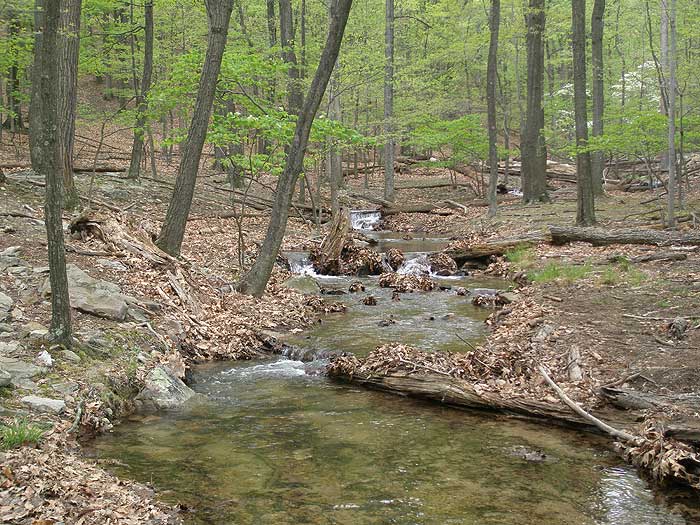
The Central Trail continues on the other side of the road passing through an immature forest, then descends before crossing the next park road in another 0.5 miles. Follow the red blazed trail as it passes along the left of North Fork Run, just before crossing at the reservoir. The red blazed Central Trail will climb and reach the Laurel Trail in 0.2 miles. Turn left down the Laurel Trail passing the Cabin Loop Trail, and arriving back to the trailhead between cabins 21 and 22.
Early May
Cacapon Resort State Park
Cacapon Resort State Park Hike Comments
Archived Comments
By:BeckyfromVA
Rating:
Date of Hike: Sunday, December 30, 2018
We went out on a perfect late December day. The streams and low waterfalls were beautiful, with all the rain we have had. On the ascent we saw a little bird sanctuary of sorts, with several different types of birds, including a titmouse and a couple of woodpeckers. They were beautiful and that was a highlight.
It's not too difficult of a hike, but the climbs were nice and challenging.
There is plenty of parking at the Lodge and the staff there is helpful.
It would not be a destination hike, but if I were in the area again, I'd do the hike again.
If you're interested in trail running, they have a fairly new 5k running trail that we did the day before. Lots of climbing there, but a great time. We saw 10+ doe and fawn gathered together watching us on the run. Very cool!
By:marc ROBLES
Rating:
Date of Hike: Monday, November 19, 2018
This hike was great. The weather was great, there was still snow on the ground from the last snow before. The higher I went the more snow. My Dog and I were the only ones out there, we had the whole trail to ourselves. It was both challenging and rewarding.
I went during Hunting season, so I could hear gun shots in the from nearby, but there was no hunting going on in the state park. At no time did I feel in danger.
By:Steve
Rating:
Date of Hike: Tuesday, September 19, 2017
A nice hike with diverse flora and a route that is not, overall, as rocky as others in the area. It is quite steep on the ascent and I stopped to catch my breath several times. The descent is also steep but not as much (I think) -- one might reverse it for an easier ascent but then you would have a steeper, more annoying descent to deal with.
Unlike most other hikes on this site this one is missing a map with trail directions in arrows. The park map given here was not too helpful to me. It turns out the hike, as described (which I did) goes clockwise -- knowing that at the beginning would have saved me a little time. You can see a fork in the hike -- there is recent construction at the fork, a new cross-country running path, apparently, near the trail that caused me some confusion (you want to stay left at the fork, to the extent you can discern it). And now I think the trial shares a portion with that newer graded, smooth path. The description says when you're on the right path you should see the reservoir -- problem is, go right or left at the fork and you still see the reservoir. Follow the blazes -- there are not many, but there are enough that you should see one before too long if you are on the right path. After the fork I was fine. Coming back, I was confused again at the fork and ended up off the path, but got back on with the help of my GPS device -- it would have helped if I didn't end the hike in the dim light of dusk.
For the first time on dozens of hikes annoying flies buzzed around my ears during the entire hike. Next time I would bring a hat with a net head cover or apply insect repellent to my head.
I checked out the lodge. It looks nice but they could get rid of the blaring TV in the common room. I didn't eat there but I see reviews on other sites are mixed. On the plus side, as the description says, there are a lot of activities available depending on the season.
By:Gary D
Rating:
Date of Hike: Sunday, September 22, 2013
This is my second hike of Cacapon. I really liked it on my first hike. How would I feel about it on my second hike. This time, I took along four other hikers. None have ever visit the park or hiked on the trails.
The trail selected was the Laurel Trail to the Central, Then Left to the Ziler Loop Trail and back again on the Central/Ziler Loop Trail to continue North and back to the Lodge on the Central Trail.
I missed the little section from the Laurel Trail to the Ziler Trail which I hiked on the 8/12/12 Hike. It's a nice workout.
Ziler has two spellings 1 is Ziler, the most common. Some signs say "Ziller".
Not as much wildlife on this hike as I saw in 2012. It might be the month, August vs September, or the relatively dry conditions due to low rainfall. We saw squirrels, chipmonks, deer, and a low number of bird songs were heard.
All of the hikers agreed this was a nice hike.
We missed the great buffet lunch at the lodge, served from 12-2. We finished at 2 pm. The Ranger directed us to the Pro shop where we enjoyed a really great sandwich which we ate as we sat on the deck and observed the cart path trails on the Cacapon Resort Golf Course. The hospitality shown us was superb. We'll go back there again. It was a great place to end the day's hike!
We look forward to hiking more of the trails next time to increase the level of difficulty and a higher level of intensity of the workout.
It takes a while to appreciate the young forest as compared to the more established forests where we usually hike. It's really very nice.
Solitude: we encountered about 6 people and 1 dog. That was a little bit of a surprise because on my last visit, I saw no one until the very end of the hike. Most seemed to be people who were staying in the few cabins on the park and taking a short stroll in the woods, not long distance hikers.
We learned that within the past week or so, there was a lost solo hiker who used the last of the cell phone's battery to call for assistance which consisted of more than one helicopter circling the park to locate the lost hiker.
By:Chase
Rating:
Date of Hike: Saturday, July 28, 2012
Like the first reviewer I didn't follow the hike as laid out. I started in the parking lot by the lodge and took the trail head as guided. However, when I made it to the intersection along the lake (Central trail), instead of going right I went straight and took the Ziler trail up to the top of Cacapon to increase the difficulty. I then followed the rest of the route as laid out. The hike was nice and I saw a good amount of wildlife on the second leg. The woods were beautiful and I had a great time.
By:Seamus
Rating:
Date of Hike: Saturday, July 11, 2009
Without a doubt, these are the MOST beautiful woods I have ever hiked. We (my dog and I) hiked a variation of the hike mentioned here. We were dropped off at the top of Cacapon mountain (the overlook). We hiked down the fire road to the bench mentioned in this hike and then down the mountain to the lake. The decent was steep in places, but always manageable. The path around the far side of the lake actually proved to be the most difficut on the day we hiked. The flat part right near the lake was under water at the beginning. The dog swam while I walked in the mud/muck. We were about half way when we met up with a timber rattlesnake. I had to coak my golden retreiever up on the steep bank and around the snake, over several large downed trees (they were almost too tall for him and I did a lot of encourageing) and finally to the dam and back to our ride on the other side of the lake.
By:Gary D
Rating:
Date of Hike: Monday, August 12, 1912
I plan to follow the trail as it laid out on my next visit (soon). I really like this resort's hiking trails. On this visit, I wanted to get a feel for what the trails were all about.
I was intrigued by the Laurel Trail and so I explored it first. It was fairly easy trail but very nice. At one of the park benches, I measured the sound using the Smart Tools App on my Motorola cell phone. It was 37 dbls. A couple of weeks ago, I recorded 38 dbls at the top of the Old George Washington Monument on the Appalachian Trail. The lowest I have ever measured on the instrument is 37 dbls and that was wrapping the instrument in all kinds of sound insulating material. In other words this spot on the Laurel Trail is very quiet. It was about 10:00 AM.
Afterwards, I retraced Laurel Trail to the intersection of the Laurel Trail and the Ziler Loop and Central Trail and followed it back to the Lodge parking area.
Solitiude: I hiked from 0908 hrs to 1135 hrs before seeing the first person on the trail .It was a couple headed up the Central Trail to Piney Ridge. I've not encountered so much solitude before.
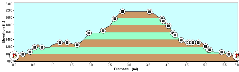
Stats: 5.5 miles, 1,434 ft gain, 2.83 hrs. Good Exercise.
Maps: Get a good copy of the map at the lodge before heading up the trail. It's the same map that you print out from this web site, but the topo lines don't come through very well.
Map comment 2: It would be nice if they could color code the trails on the maps to match the signs along the trails.
Signs on the trails: good
Don't forget lunch at the Lodge. It was $ 12.99, including coffee for a great lunch buffet. Great way to end a nice hike!
Personal Hike experience so far in 2012, about 80 miles


